Monday, September 25, 2017

2017-07-06: Driving Back to West Texas Day 3: Geocaching Through Texas History and Cemeteries

Welcome back to my drive from Florida to West Texas on Day 3 and final leg of my journey. Today's ride should be about 450 miles, probably much more depending upon my Geocaching stops. On the agenda are some cemeteries, a ghost town, an old church, and some historical buildings. And some new caching counties of course!

This morning started out in Centerville, TX at Hwy 7 and I-45. Driving westbound on Hwy 7, it wasn't long before I made it to the next county and my first cache (GC3WT26) at the Wesley Chapel Cemetery. Here is where you'll find Tennessee native Isaac Phillip Stem who enlisted in Western Frontier service in that state in 1836. In October 1836, he moved to Texas and joined the Republic of Texas Army at Houston. Continuing to serve in the military, Stem was a participant in the Battle of Plum Creek on 8-12-1840, in present Caldwell County. The battle was fought between Texas soldiers and Comanche Indians, who had raided the coastal towns of Linnville and Victoria. Stem served in the Somervell Campaign of 1841 and was a member of a cavalry of mounted volunteers during the Mexican War.

After his discharge from the Texas troops in 1846, Stem joined the US Infantry at Corpus Christi, Texas and continued in the war with Mexico. Discharged at Monterey due to illness, he later returned to Tennessee and joined the Tennessee Volunteers at Memphis. He later transferred into the US Infantry once again. Isaac Phillip Stem and his wife, Lucy Ann Weaks, were the parents of eight children. The family moved to Robertson County in 1869 and Stem became a farmer and rancher. He died in 1893 and was buried here beside his wife.

While Isaac played a part in the history of Texas, the interesting headstone was that of his son Washington Taylor (W.T.) Stem. The marker reads: "W. T. Stem and Wives." Doing some research all I could find was one website (werelate.org) that listed two wives. An Eliza Jane Henderson which he married in December 1873 and Catherine Johnson in February 1884. But the odd part is that there are no headstones around for either of them.

Here are a few more photos of Wesley Chapel Cemetery. There are 58 known interments here dating back to 1831.


After a couple of miles through Robertson County, I then entered into a corner of Limestone County. It was an already found county so it wasn't on my list of geocaching counties. However passing by small cemetery with a historical marker, I just had to stop. And guess what there's also a cache here too! (GC112J1)

Bardin King (1819-1891) and Elizabeth Susan Salter (1822-1879) married in Lowndes County, Alabama in 1842. The following year, they traveled west by wagon with their young son William and Susan's parents and siblings, settling in Louisiana. Bardin was successful growing cotton, but in the late 1850s the extended family moved to Texas, settling first in Navarro and Washington counties before arriving in Limestone County in 1870.

The Kings bought 189 acres here from John and Lucinda Wilson, and the family raised cotton and grains, and were active in the Headsville community. Bardin King was a lay minister at Ebenezer Baptist Church (1 mi. S), and sons John, Cullen and Moses also served later in the same capacity, while youngest son Finley became an ordained Baptist minister. Bardin was a charter member of the local Masonic lodge and active in the Patrons of Husbandry, or Grange.

Susan King died in March 1879 and the family buried her here on the farm. The surrounding land became a dedicated cemetery in 1881, when Bardin divided his holdings among his nine living children and set aside one acre for a graveyard. Daughter Susan Leuticia married Robert Holden Williams, and they and their children later continued cotton and corn farming on the family land. Ten members of the King and Williams families were buried in what became known as King Williams Memorial Cemetery and then King-Williams Cemetery. Robert H. Williams died in 1944 and was the last to be buried in the graveyard, which features historic limestone headstones shaded by pine and cedar trees. Family tradition holds an African American freedman named Speight is also buried here in an unmarked grave. The families also added more modern headstones that are easier to read.

After skipping through the next two counties due to previous finds (remember my goal is to finally get home to see my beautiful wife, otherwise it would take weeks because I'd be stopping at every cache), I entered Coryell County. The Eagle Springs Baptist Church (GC2DM1W) congregation grew from an early Coryell County fellowship known as the Church of Onion Creek. Worshipers met in a log building until it burned in 1954. In 1958 this site was acquired for a new church building. In the same year, the Rev John McLain, a Baptist Missionary, organized the Eagle Springs Baptist Church from the earlier congregation.

By 1880 Eagle Springs was a thriving community with two grocery stores, two blacksmith shops, a cotton gin, two churches, two doctors offices, a post office, and a school. The congregation grew also, with many baptisms being held in the Leon River.

During the first decades of the of the twentieth century, families began moving away from Eagle Springs. The community school was closed in 1935, and in 1948 members of the Eagle Springs Baptist Church voted to disband. The church building was retained, however, for reunions and occasional services. It is one of the few remaining structures in the Eagle Springs community.

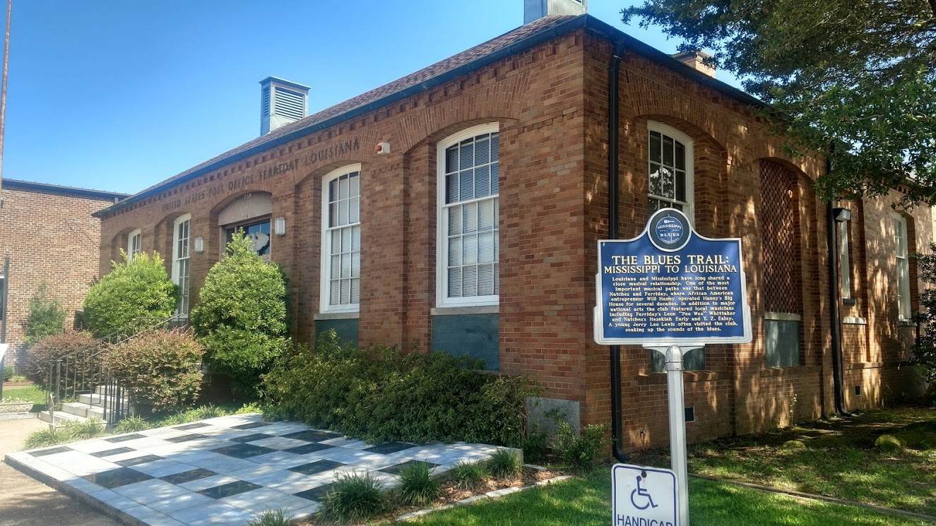
My next stop was a Virtual Geocache (GCB1BA). I can't say much as to give away the answers to claim a find. Currently used by the Chamber of Commerce, it once housed a cotton depot until the mid-1970's.

Upon reaching the town of Evant, I turned south on US-281 for a few miles in order to drop down into Lampasas County and grab a quick cache in the Pilgrims Rest Cemetery (GCVTQT). There are nearly 200 burials here dating back to the 1880's. Hard to pass up another cache and another cemetery, I continued a few more miles south to the Hines Chapel Cemetery (GCW0ZK) which also dates back to the 1880's. Making a u-turn back to the northside of US-84 into Hamilton County and two more caches at the Murphree Cemetery (GC22Z0YGC22Z10).

Finally back on US-84 heading westbound and crossing over into Mills County, I came to Star, TX and my next Geocache (GC17GNE). It was laid out by Alec Street in the mid-1880s and named for nearby Star Mountain. Calvin Skinner was the first postmaster when Star was granted a post office in 1886, and Alec Street ran a store and a gin. The town continued to grow until a tornado swept through in 1904. The storm leveled several houses and killed a couple of residents. Star had a school in its early days but did not build a permanent church until 1905, when the town reached the zenith of its prosperity. A bank, established in 1910, closed after a robbery in the 1920s. In 1944 Star had eight businesses and a population of 171. For years the cotton gin was the town's economic engine, but the gin shut down in 1950. The population in 1980 through 2000 was eighty-five. The cache was located next to this 1938 stone building converted to a history museum.

After a quick cache in Brown County (GC6XDMM), I entered into Coleman County. The Atchison, Topika, and Santa Fe Railroad established a railway line about eight miles southwest of Coleman in 1904. The town of Valera (GC17TC6) developed in the area around the train depot. It's business district, established parallel to the railroad, reflected the needs of its citizens. Businesses included a post office, a hotel, a bank, a flour mill, a cotton gin, an opera house, grocery stores, a blacksmith shop, a cafe, and a water well in the middle of the street.


Recognizing the need for a community cemetery (GC15315), Mrs Minnie K. Harris deeded more than 5 acres of land in 1922. One of two cemeteries serving the community, it contains more than 400 marked graves, and at least 5 unmarked graves. The first recorded burial was that of Mrs N. C. Kidwell in 1922.

Next up was a virtual cache (GCD061) located in the next county over. In the town of Ballinger in Runnels County is the Carnegie Library Building. This native limestone library was built in 1909-11 with funds from New York industrialist and philanthropist Andrew Carnegie. Local banker Jo Wilmeth donated the land and the Rev J D Leslie, pastor of the First Presbyterian Church, served as the supervising architect. The buildings auditorium and club rooms were used for a variety of civic cultural events, school social activities, and temporary worship services of several local churches.


After one last and quick cemetery cache (GC6QTTJ) at the Fairfield Cemetery in Coke County, and it was non-stop all the way through to Monahans. It was so good to be back. I parked the U-Haul truck and went inside to see my beautiful wife. The truck can wait to be unloaded in the morning. That completes my long 3-day 1598 mile drive from Florida to West Texas.

See ya next time.

Sunday, September 3, 2017

2017-07-05: Driving Back to West Texas Day 2: Alabama, Mississippi, Louisiana, and Texas

Welcome back to Day 2 of my road trip from Florida back to West Texas. Today begins in Evergreen, Alabama. After a good nights rest at the hotel and a quick hotel breakfast, it was time to hit the road again. I'm still following the backroads of US-84, trying to stay off the interstates as much as possible. At the same time Geocaching and sightseeing along the way.

My first stop was to get gas and a Geocache (GC2APKW) at the Love's Travel Stop for Conecuh County, Alabama. A quick fuel up and find and I was on my way.

The next county over was Monroe County and also the next cache. The Geocache was by a historical marker for Fort Claiborne (GC178A3). Built by General Ferdinand L. Claiborne during the Creek Indian War of 1813-1814 as a base for his invasion of the Alibamo country with the U. S. Regulators, Lower Tombigbee Militia, and friendly Choctaws. Claiborne's campaign culminated in the American victory over the Creeks at the Holy Ground. I was hoping to see something other than the sign, but nothing of the fort remains.

Moving on to Clarke County and a quick roadside cache stop (GC2MYZ7) to claim a find and to continue making good time.

Choctaw County was the last along US-84 in Alabama and a county needed. I stopped at the Bladon Springs State Park for an Earthcache (GC3JAB8). The springs here, named after the original property owner, James Bladon, were first opened to the public as a therapeutic spa in 1838. Seven years later, state geologist and University of Alabama professor Richard T. Brumby and two colleagues from the University of Louisiana traveled to the springs to conduct a comprehensive analysis. Brumby reported his findings in a 27-page book, "An Analysis of the Bladon Springs," published in 1845. Following the report, the tourist trade increased so much that a resort was built, including a bowling alley, cabins, skating rink, and last but not least, a Georgian Revival hotel that could house 200. The resort is gone, but four springs remain, one of which is still covered by the gazebo from the resort days.

I gathered the information I needed for the earthcache and took a few pictures. There were two more caches in the park and I was tempted to take the short hike after them. But the road ahead was calling and I wanted to get some miles put behind me. So across the state line into Mississippi I went.

Wayne County was up first with a quick roadside cache (GC38PV9). After that was a quick Virtual Cache (GCE7A7) in Jones County. Continuing westbound on US-84, I skipped right through Covington County having already found a cache there. Then quick park and grab roadside caches in the remaining Mississippi counties of Jefferson Davis (GC388J0), Lawrence (GC1RNA2), Lincoln (GC35WGT), Franklin (GC35WGT), and Adams County (GCTV6P).

Crossing the state line into Louisiana, they have Parishes instead of counties. My first stop in Concordia Parish is the Delta Music Museum (GC1D5VZ) along the Blues Trail. Louisiana and Mississippi have long shared a close musical relationship. One of the most important musical paths was that between Natchez, MS and Ferriday, LA, where African American entrepreneur Will Haney operated Haney's Big House for several decades. In addition to major national acts the club featured local musicians including Ferriday's Leon "Pee Wee" Whittaker and Natchez's Hezekiah Early and Y. Z. Ealey. A young Jerry Lee Lewis often visited the club, soaking up the sounds of the blues.

I had arrived to the museum just as it was closing up. She watched and we chatted as I searched for and found the Geocache. After signing the log, we went inside and she gave me a quick tour of the museum.

Two more quick caches in LaSalle Parish (GC23AXN) and Natchitoches Parish (GC4XHMC) before arriving in Sabine Parish and a cemetery cache (GC2D9MA). Fender Cemetery has over 300 interments dating back to 1851. One of the spookier graves is of this red brick tomb that seems to have been elevated a few inches. Kinda makes you think that the undead comes crawling out at night searching for innocent victims to carry back to the underworld.


I crossed the Sabine River into Texas at sunset and got a spectacular view. Driving nearly 600 miles today, I've got around 450 miles to go. Can't wait to get home to see my Beautiful Sweet Wife!

2017-07-04: Driving Back to West Texas Day 1: Florida, Georgia, and Alabama

So today's the day to hit the road and drive back to West Texas. And of course this won't be a boring I-10 forever non-stop westbound trip. No way. I just can't take a road trip without Geocaching and sightseeing. Plus there's another opportunity to pickup some new Geo-Counties! So I'll be taking the scenic byways of US-84.

I woke up just after 5 AM, gathered my things and quickly hit the road. From Umatilla, Florida heading north on SR-19 through the Ocala National Forest, west on SR-40 and over to I-75 northbound to Georgia. First on my Geocaching county list was Echols County, Georgia.

Non-stop express driving all the way up to US-129 in Jasper, FL, taking that exit to head directly north into Echols County. Now when most people travel they book a flight because it's all about the destination. I prefer to drive because it's more about the journey. The destination will be there all the same, but on a journey there's much more to discover. While passing through Jasper, I spotted this old forgotten rusty Jeep sitting out behind this business among other piles of scrap metal objects. Something about the sadness in the way it looked caused me to slow and make a u-turn for a photo capturing that moment and emotion.

Crossing the border into Georgia and Echols County, there were three caches along the route and I needed to find at least one to achieve the "Found County" status.  The first cache (GC4CJNF) on my list was located at the Echold County Museum and Statenville's oldest house. A combination of No Trespassing signs, fenced in property, and the neighbors outside getting ready for a July 4th BBQ, and I decided to skip this one and move on. It has since been archived.

Second on the list was "Down by the Riverside." (GC5Q27T) Just out on the west side of Statenville along the Alapaha River is a boat ramp and my next cache location. After spending about 10 minutes looking without any luck, I gave in and walked down by the riverside for some photos of the calm muddy waters. Two down, one to go.


The last cache along the way and my last hope for a find in the county was a Country Cache (GC5DBXA). Stopping along the road side, I quickly saw the spot that looked like it might have had a cache placed there but without a container. I continued looking around just in case, swatting away mosquitoes on this humid day, hoping that maybe I just overlooked it. But in the end I had to drive away without a smiley, leaving Echols County still unfound. Strike three, I'm outta there.

The next county was Lowndes County where I-75 runs through Valdosta. Having already cached here, I drove through to save some time. It was there in Valdosta where I picked up highway US-84 for my long journey westbound.

Brooks County was next in line where a quick stop at Quitman's Hangout cache (GC39155) gave me my first caching find and first new caching county for the day. Hopefully this would be the beginning of a caching streak!

Continuing west on US-84, I skipped through Thomas County having found a cache there on a previous road trip, I arrived into Grady County. Before I arrived at my next Geocache, I passed by this old small roadside cemetery and just had to pull over to explore. It was the Lester Poulk Braswell Pearce Cemetery. There are 60 interments there with many unknown graves that no longer have any readable markings on them. The oldest known grave is that of a Rev Mann Dutton who died in 1857 at the age of 61. I found an article that said as recent as 2001, this cemetery was so overground with weeds and vines that it took two hours just to walk through and find all the graves. Glad someone has cleaned it up.

A few miles down the road was another cemetery and my next county cache (GC26MCP). Dr. Joseph Griffin was a black physician. In 1935 he began practicing medicine in Bainbridge, Georgia. He built a 50 bed hospital and established the Southwestern Medical Society. In honor of south Georgia's first black physician, the Dr. Joseph H. Griffin Memorial Gardens was created in Grady County.


Another quick cache find in Decatur County (GC152M9) and I was off to the next one. A short detour to the north up into Miller County and a bridge cache (GC5RNRN). Just down from the bridge was this old church and another cemetery. The cemetery is still in use today. I did see this one dead tree that inspired a photo.


After the short detour, I made my way back south to US-84 and into Seminole County to find my next quick cache (GC5Y3A8).

For the last county in Georgia, it was off to picturesque Howard's Mill in Early County (GC27247). I couldn't find anything on the history of the mill. Though it appears to be used as a private home or for special events now.


Arriving in Alabama, the first two counties were Houston and Dale Counties. I had already found caches there so it was another chance to make up some time breezing through. Next on the list was Coffee County and the town of Enterprise, AL. By this time it was getting late in the afternoon and surprisingly this was the only town that was having a 4th of July celebration around the town square. There was a carnival setup in the square and it appeared that the whole town may have been in attendance.


I had three caches on my radar there. The first being a virtual cache (GCAC2D) located at a statue on Main Street as you enter the downtown area. I can't say much more about it because I'd be giving away some answers you need to claim the cache.


The second cache on my list was at the old train depot (GCT3MX) built in 1903. The first freight shipments and passengers came here on the Alabama Midland railroad in 1898 immediately after construction of the roadbed. That was also the year when most of the brick business buildings downtown were completed.

The one that caught my eye was the Rawls Hotel. This original two-story brick structure also built in 1903 by Japeth Rawls, developer of some of the earliest turpentine plants in Coffee County. This building was remodeled in 1928 and three-story wings added by Jesse P. Rawls, founder of the first electric power system in Enterprise. The Rawls Hotel was the center for business and social gatherings until its closing in the early 1970's.


My last cache to see in Enterprise was at the old jail (GC2FKAY). Unfortunately it was closer to the town square and busy with people coming and going for the festivities. And me being in a large U-Haul, I figured it be best to just pass on this one until next time in the area.

Covington County was the next to enter and my last cache of the day. It was just a quick and easy WalMart cache (GC24TFV).

I ended the day in Evergreen, AL after 431 miles of driving. Claiming some new counties for my Geocaching list, seeing some sights, and learning some history. Tomorrow is a new day. I hope to make it across and into Texas, but there's still 1300 miles to get all the way back. At least halfway would be good.

See you then.

Sunday, August 6, 2017

2017-07-01: Back in Florida for Two Weeks

Welcome back! So on Monday June 12, I finished my last day at work on Phase 1 of a solar power construction project. Spending another week hanging out in Texas, the plan was to fly to Orlando, Florida on Monday the 19th and stay there for a week seeing family and taking care of some doctors appointments. Then driving back to Texas in a U-Haul, bringing back a lot of our stuff since our stay is going on almost two years instead of the planned few months.

Well since when do things go as planned! First thing the plane was delayed a day due to weather. The flight was scheduled to leave Midland at 4:30 PM, a short stop in Dallas, then land in Orlando at 10:30 PM. Well correct that. It was first delayed a couple hours, so I still arrived at the airport, but then cancelled a day. I could have boarded a flight from Midland at 6:00 PM, to Dallas, to Los Angeles, to Charlotte, to Miami, then to Orlando at 2:30 PM the next day. If they'd have bumped me up to first class on every leg, sure. But no, so no I didn't.

So I called the hotel and the car rental and postponed my check-in. I flew out instead on Tuesday the 20th. By the time I touched down in Orlando, checked in with Enterprise Rent-A-Car, and got settled into the hotel, it was nearly midnight. And boy was I tired!

One last call to my lovely wife who had to stay behind in Texas
 and then time for sleep!

So my first day in Orlando and I'm already a day behind and I have to hit the ground running! I think I checked out of the hotel before 7AM. I've got the cardiologist at 1:00 and my sons for dinner after that. It wasn't long before I realized I was back in Orlando when I hit that traffic. I'm still down in southeast Orlando near the airport heading westbound when I spot a Walmart. That was my first stop to pickup deodorant, shampoo, toothpaste and all those essentials that I didn't want to hassle with in my carry-on luggage. Again, I hate flying.

As usual before leaving a Walmart, I check for Geocaches. There's one on the side of the parking lot. After a short search, I found the tiny cache container. However, I got nothing with me to help get the log sheet out of the container. So not being able to sign the log, I can't claim the find. Oh well, gotta move on.

Working my way west across south Orlando, I stopped by where I used to work before moving to Texas. Many of the faces have changed except for the two there working at that moment. There was a driver still around, but all the drivers had already taken off on their routes. It was good to catch up with my former coworkers. There's some customers I wouldn't mind seeing also, but I'm not going to go driving all over the state to do so.

Continuing west and heading into Ocoee, Winter Garden, and then Clermont, I spot a Jeep dealership. I still had to burn some time before my doctors appointment, so I pulled in for a quick look around. They didn't have any new ones in stock of interest, but a 2015 Wrangler Unlimited Artic Edition that was loaded with all the options. But it was this frost blue color and my preference is white. I talked to the salesman and got his card. I'd have to think about that one.

Turning north on US27, I start heading up towards the doctors in Mt Dora along the scenic route. After making the turn on Hwy 19 north and driving this country road for a few miles, I spotted this sign and got a chuckle. I just had to stop turn around and get a picture of it. Now being from Florida, I know it is the second home to a lot of snowbirds. As well as the permanent home to a lot of retirees! Well I didn't realize just how popular it REALLY was. I found the home of Dr Von Frankenstein! Florida truly is the retirement capital of the world!

A few miles further and I entered the small town of Howey-in-the-Hills, FL. Yes, there really is a town with that name in Florida. Checking my geocaching app, I noticed a couple of caches hidden since we were last here. They were on this nice boardwalk and trail leading down to Little Lake Harris. I took the short stroll, probably two miles round trip, and found both caches GC7785X & GC5QKH1.


Just around the corner from that park, I noticed a point of interest on the maps. It was the Howey Mansion and former home of the founder of this town. I'm just going to tell you of the very short version here, but I encourage you to follow this link (Howey Mansion) and read the full history and see the amazing photos of this historic mansion.

William John Howey was born on January 19, 1876 in Odin, Illinois. It was in 1908 when Howey found himself in Winter Haven, Florida where he perfected his citrus farming and sales program techniques. He believed that if he took raw land and controlled its development into mature citrus groves, he could guarantee investors a successful enterprise while making a profit on each step of citrus cultivation. In 1914, he began buying land for $8 to $10 per acre and later sold them at $800 to $2000 per acre, cleared and planted with 48 citrus trees per acre.
The Florida Land Boom tripled Howey’s enterprises and the “Town of Howey” was incorporated on May 8, 1925. In 1927, the name was officially changed to Howey-in-the-Hills to reflect the location of the town in an area of rolling hills which he dubbed “The Florida Alps”. In 1927, construction of his mansion was completed; a 20-room, 7,200 square foot mansion at the cost of $250,000, around $3.2 million after inflation. To celebrate, he hosted the entire New York Civic Opera Company of 100 artists, drawing a crowd of 15,000 arriving in 4,000 automobiles to the free outdoor performance.

Howey died of a heart attack on June 7, 1938 at the age of 62. His wife, Mary Grace Hastings, lived in the Howey mansion until her death on December 18, 1981 and was laid to rest in the family mausoleum on the mansion grounds along with William and their daughter Lois.

Arriving now in Mt Dora, I still had about an hour until the doctors appointment. I did a quick Google maps search for a Great Clips and there was one about 10 minutes away. Hopefully they wouldn't be too busy. I check in and was seated with only about a 5 minute wait. The girl cut my hair and did a fantastic job! I hadn't been able to get a decent haircut in Texas. I wish they had Great Clips out there. And I still arrived at my doctors with about 5 minutes to spare.

After two tests at the cardiologist, I'm back on my way in about an hour.

Now to drive back down to Ocoee,  about 30 minutes away, to pick up my two sons for dinner. Because of our wide variety in taste for food and the younger being a vegetarian, I decided on Golden Corral. They have a great buffet and a large selection to accommodate any palate.

After dinner my sons couldn't agree on what to do for the rest of the evening. The older, working at and being a fanatic, wanted to go to Disney to see the fireworks. The younger wanted to go to the old mall and play ping pong. Yes, there are so many empty stores in this mall that one space is rented out to this guy who has ping pong tables setup where you can play ping pong for as long as you want for just $4.00. Neither wanted to go to the movies as a compromise. But by now we are at the mall and so I made the decision to go inside.

Inside the mall, all the power is out. Even the theater has been emptied and people all standing around waiting. So the movies are a no go. We continue past and go down towards the ping pong place. And of course with no movies to watch the ping pong tables were all taken. We even passed by the bowling alley, and they were packed. So I returned them to their house and we made plans to meet again one on one so that we could do what they wanted to do.

That evening and for the rest of the time in Florida, I stayed at my mothers house up in Umatilla which is about an hour NW of Orlando. The next morning I took this photo of the male peacock all dressed up with his tail trying to impress the ladies for mating season. Just some of the many animals she has on her property.


So over the past two weeks between doctors visits and other errands around Central Florida, I did manage to find a few Geocaches here and there. Nothing real interesting, just some some basic urban caches. I did get three First-to-Finds though!

While I was there, I did spend a lot of time at the Glendale Cemetery in Umatilla. It's a half block down the street from my mothers house. The cemetery dates back to the 1880's, but most of the burials begin in the 1940's. Because Geocaching takes me to a lot of cemeteries, I also use the Find-a-Grave website for history and research. I also contribute and try to keep it up to date. After walking through the cemetery twice, I think I added about 30-35 photos to existing listings as well as added a few internment myself.

While using the Find-a-Grave website, I discovered another very small old cemetery a few miles down the road. Now I have been coming up here to visit my mother for over 15 years and never knew this other small cemetery was even here. There's not even any signage here, but it's often referred to the Old Fort Mason Cemetery. But even that is suspect because there's not much information about Fort Mason.

In a December 5, 1919 interview by one of the early pioneers of Eustis, Charles T. Smith presented some apparently accurate facts to the Lake County Citizen newspaper of May 25, 1923. When Smith and Guilford D. Clifford arrived in what would become Eustis, a few settlers were already there homesteading before 1876.

Charles Smith wrote in 1919: "Fort Mason was located about 2 1/2 miles northeast of Lake Eustis on the homestead of Warren Smith. The line of depression formed by the moat or ditch that surrounded the stockade was quite easy to follow 40 years ago." He saw the remains of the fort when he visited in 1875.

It is generally stated that the fort was built under the command of Brig. Gen. Abraham Eustis and his 1,500 troops during the 1836 Second Seminole War campaign. Little else is known about the military Fort Mason. Regulations required the commanding officer at every post submit reports, usually every month, however no records were ever found for Fort Mason. No one is really sure of what it actually looked like.

As for the nearby cemetery, all that's left is just a few headstones dating back to the 1880's. Looking at the first photo below, you can see a tall thin headstone by the oak and another smaller to the left. Further to the left is an overgrown iron fence plot with three headstones in it. Behind that is an open field with a dirt driveway along the treeline leading to that white building in the distance. About halfway back under the trees are a couple more headstones and all that remain in the African-American cemetery. In the last photo below, are whats left of two large above ground graves in very poor condition.


More doctors appointments meant delaying my drive back to Texas another week. On the bright side, I did get to spend more time with my sons, my mother and aunt, and catch up with some friends.

One day with my oldest son, I got to spend the day with him and meeting his girlfriend at Disney. We started out at Disney's Hollywood Studios. I hadn't been there since it was called MGM Studios. While there I finally had the chance to grab a Virtual Geocache (GC3338). You can't hide any actual cache container on Disney property, but there are 6 Virtual Geocaches created back when they were still allowed. Now I have 4 of the 6 in the find column.

Anyway, we finished the night at the Magic Kingdom and got to see the new fireworks show which also transforms the castle into a giant screen to play various scenes. The best fireworks show I've ever seen! Overall a very fun day and add the fact the it was raining for the first half of it, that didn't stop us from being kids again playing in the rain. During the summer months, that's the best time to go to Disney. When there's a chance of rain! Most visitors tend to hid out in covered walkways and stores trying not to get wet. As long as you don't mind getting wet, it makes for shorter ride lines and being cooler.

The next day I spent with my younger son. We had lunch and then went to the mall to try and play ping pong again. I think we waited for an hour but the guy never showed up to open the place. So we settled on a movie. Afterwards passing by the bowling alley and noticing an empty parking lot, we sought to play a few games. No luck. The league teams were arriving soon and the lanes were booked. Instead we played three rounds of billiards. It was a fun afternoon.

On Saturday July 1st, TeamFelixG stopped by my mother's house to pick me up and we drove north into the Ocala National Forest at Salt Springs for a Geocaching Event. Here I got a chance to meet up with some cachers I hadn't seen in a long time.
After about an hour we were joined up with framptoncomesalive and headed out to grab some caches. We started out finishing up the Lighthouse GeoArt caches which they had already completed about half of it. Now I have half a lighthouse myself. Next trip to Florida...

Along with some other caches and off-road trails, we ended the very hot day with 35 cache finds.

Tomorrow I return the rental car and pickup a U-Haul truck to bring our stuff back to Texas. What started out as a short temporary work stop in Texas has turned into 1 1/2 years and counting. Before we had to fit everything into two little Toyota's as work moved us from place to place. Now that we're set in one place, having more of our personal items and photos on the wall make it seem more like home.

On this drive back, I'm taking the scenic route. No long boring I-10 halfway across the country. I'll be going up to Georgia before heading west on US-84 stopping for caches along the way.

See you soon.

Wednesday, May 31, 2017

2017-05-27: Geocaching Through Old Historic Texas Towns, a Cemetery, Churches, and More!

Hello again and welcome back to the AwayWeGo's Geocaching Adventure Blog. Before I get started, I just wanted to say thank you for stopping by and following along with our travels. We hope they have not only been entertaining, but informative and making you want to get out exploring and Geocaching yourself. Always feel free to share this blog with your friends and please leave your comments below. We'd love to hear from you.

Today's Geocaching Adventures took us to North Central Texas. Texas is so large you kinda have to use two directional words to narrow down the area! Kinda in the Abilene to Wichita Falls to Fort Worth triangle if you will. We had 11 unfound geocaching counties on the radar, but managed to make it to only 7 before skipping the rest and heading back to the hotel. A nearly 500 mile loop just to get those! I think we would have tried to get the others, but imagining what the puppies were destroying after 12 hours locked up in the hotel room...!? Yeah better get back!

So this morning we walked and fed the pups and putting the "Do Not Disturb" on the hotel door, don't want housekeeping to be mauled by the 6 lb Chihuahua  and 3 lb Pomeranian attack dogs! We drove over to nearby Denny's for a hearty breakfast and then Starbucks for our coffee on the road. The hotel being in Abilene and Taylor County which we already have, we skipped the local caches.

Driving up US-277 north to Jones County, we arrived in a town called Anson and our first cache. The Anderson Chapel Cemetery (GC1J1X3) is about five miles west of town on US-180. The oldest known burial is from 1896 and that of Bertha C Anderson. Though there are many unknown burials with a cross or a single rock as a headstone among the 94 known internments. I couldn't find much on the history here other than a Hugh Anderson (1846-1922) donated the land for the cemetery and that the chapel had burned down at some point.


Our next cache was located within Anson, the Jones County Seat, at the larger more modern cemetery (GC16B4Q & GC13DQN). With over 6400 headstones, I didn't spend much time "browsing."

Continuing on US-180 eastbound over into Shackelford County, our next stop was the Bud Matthews Switch (GC2PT75). In 1900, the Texas Central Railway extended a line northwest from Albany across this portion of Rose Ella (Matthews) Conrad's cattle ranch. Ella and her brother John A. "Bud" Matthews, for whom this site is named, promptly constructed cattle pens and a loading chute at this location. Surrounding ranchers soon were shipping their cattle from this switch to markets in Fort Worth. As many as 105,000 head of cattle were shipped annually until the railroad ceased operations in 1967. Since that year, local ranchers have continued to load cattle onto trucks from this site.

I didn't find the Geocache here though. There's a lot of hidden pockets and places to hide a micro cache on train cars. Over the years of caching and getting stung by wasps, I've gotten cautious about sticking my hands into places where potential critters can hang out. Especially here in Texas with the addition of scorpions, deadly spiders, and rattle snakes! And having left my gloves in my car, I just gave it a quick looking over.

Then we arrive in Albany, Texas just a few miles to the east. Not necessarily the cache, but the town itself was one of the highlights for the day! There was a lot of history here to see. So let's start from the beginning... William Henry Ledbetter (1833-84), a native of Georgia, came to Texas in 1858 and established a salt works on Hubbard Creek (8 miles southwest) in 1862. Ledbetter withstood fierce Indians attacks before moving near Fort Griffin (15 miles north). He was elected first county judge in 1875. In the mid-1870s, Ledbetter built this picket house near the army post, using construction methods typical of this frontier region. It was moved here and restored by the city of Albany in 1953.

Chosen county seat of Shackelford in 1874, Albany had a 43-acre townsite donated by Sheriff Henry C. Jacobs. County clerk W. R. Cruger named city for his old home, Albany, Ga. A wooden picket courthouse was erected. The post office opened August 1, 1876. By late 1877 there were 16 buildings - homes, hotels, saloons, a blacksmith shop. Merchants were T. E. Jackson and firm of Woody & Hatcher. Physicians W. T. Baird and W. M. Powell and lawyer A. A. Clarke located here. D. H. Meyer and Edgar Rye began (1879) publishing "The Albany Tomahawk". Already on the western cattle trail, city expanded as a frontier shipping point when Houston & Texas Central Railroad built a terminus here in 1881. By 1882 a church building had been erected. Music lovers organized a cornet band. In 1883 an opera hall opened, and a permanent courthouse of native stone was built. Succeeding D. R. Britt as the school principal, W. S. Dalrymple founded an adult study club, "The Chautauqua Literary and Scientific Circle". Albany had an academy, and then a college in 1898-1915. Local activities include ranching, petroleum production, small farming, and annual staging of the historical drama, "The Fort Griffin Fandangle".

Shackelford County Jail Erected 1877-78
T.E. Jackson Warehouse Established 1878
Charles A. Hartfield purchased the lot on this site in 1881. A noted area cook, he quickly established "Charley's Restaurant," which included a bakery and boarding house. Hartfield was so successful that he planned an elegant rock structure in which to house his business. Construction began in March 1884 amid a flurry of development in the area. Scottish stonemason Patrick McDonnell, who was responsible for much of the stonework on the new courthouse, was foreman of the Hartfield worksite. The project's scope proved too grand for Hartfield's finances, however, and in September 1884 he sold the building to J.C Lynch. Financially ruined, Hartfield was found dead within a year.

Lynch sold his building in 1885 to three Albany businessmen; Max Blach, N.H. Burns, and Sam Webb. Charles Hartfield's widow, Lettie Hartfield, joined them as an equal partner and the group completed the structure, probably using Charles Hartfield's original plans. The building was occupied over time by such businesses as a grocery, a gerneral merchandise store, a bowling alley, and an auto repair shop. The Albany Masonic Lodge began meeting in the structure as early as 1893, and it became known as "The Masonic Building" to local residents. Real estate magnet L. H. Hill purchased the building in 1925, and the Masonic Lodge bought it in 1940.

Damage from nesting bats caused part of the building's limestone front to tumble into the street in 1954. The Masons took down the facade and rebuilt it with yellow brick. Sold again in 1996, the building was renovated and its facade was reconstructed to reflect its former grandeur as one of Albany's finest early structures.

Charles Hartfield also purchased this land next door in 1882. As he began construction on the restaurant in 1884, he sold this property to Max Blach, VP of the Albany Water Company. He and partner N. H. Burns brought a system of running water to the town in 1884.

Blach began construction on this one story native stone structure also in March 1884. The building was completed in April and leased to J. R. Davis, who put it to its most infamous use. The White Elephant Saloon opened for business on May 1, 1884. Among its instantly popular features was a white elephant display which was removed from the rooftop early in the establishments heyday.The perpetrators were believed to be citizens who disapproved of the saloon's raucous business.

Despite its popularity, Davis announced his intent to close the saloon in February 1886. The Blach building soon was leased to W. M. Wigley, who operated a dry goods and furniture store on this site. Succeeding furniture businesses occupied the building for many years.

Blach's heirs sold the structure to S. C. Coffee in 1919. Coffee sold it in 1923 to T. J. Crow, who conveyed it to Albany businessman L. H. Hill in 1925. The structure was used for various purposes over the years: it was the home of the Albany News in the 1940's and was the workshop and office of a pipe organ maker in the 1950's and 60's. The Hill family maintained ownership of the edifice until 1977.

The Lynch Building: this was Albany's first stone mercantile store. It was erected in stages, combining Greek Revival and Victorian Italianate designs. In 1878, W. H. Miller built 1-story east unit, and permitted Albany Masonic Lodge to erect a second story. Local rancher J. C. Lynch in 1881 built the 2-story west unit. The "Live and Let Live" drugstore was an early tenant. L. H. Hill and Family owned the property from 1896 through 1974. Clifton Caldwell bought the property and restored it in 1974-75.
Presbyterian Church erected 1898
Ford Model A truck parked in front of classic car museum.
Restored Sinclair gas station
Restored Gulf gas station
After spending an hour walking around looking at the buildings and reading the historical signs, we finally decided to go after a Geocache. There were several in town but after spending too much time already, I just chose one at the volunteer fire department (GC5GDA9) and made the quick find.

Now heading north on US-283 and trying to make up some time, we made a quick cache stop for the "Sorriest Land in the County." (GCP6QE) There's nothing at the location to see, but the story about the land surrounding made it worthwhile.

On April 1, 1897 James H Nail, Sr and WI Cook paid the Holstein Family of Shackelford County, Texas the sum of $49,000 cash in hand for 27 3/4 sections of land (17,760 acres). On Christmas Day of 1899, Mr Nail wanted to buy, Matilda “Dude” Nail Cook and W.I. Cook, out. After heated discussions, the Cook’s ended by buying out Mr Nail. Angry at his sister for not selling out to him, Mr Nail boasted to everyone, “I’ve just sold Dude the sorriest piece of land in Shackelford County and she’ll be broke in a year, you can bet on it!”

As it turned out, the decision of Matilda Nail Cook not to sell out to her brother was either the wisest or the luckiest decision she ever made because in 1926 the Cook Oil Field was discovered on the southern part of the ranch. For a long period of time, the Cook Oil Field was the largest shallow oil field in the world. 79 Years later, the Cook Oil Field is still producing oil and new wells are still being successfully drilled. The discovery well was, in fact, the last roll of the dice that a group of men would make before going completely broke. As they were hauling their rig to the selected sight, it broke down. The rig could go no further unless additional money was raised for repairs. At this point, they made a field decision to drill on the spot where the rig broke down and hit a gusher!

There's more on the cache page about the Cook's supporting a children's hospital in Fort Worth, but I'll let you click the link for more information.

Further up the road was our next Geocache at Fort Griffin State Park (GC3C5PP). Again, there were several caches here but we only had time for one. In the 19th century, the U.S. government established forts along Texas' frontier to protect pioneers. By the early 1850s, Col. Jesse Stem farmed along the Clear Fork of the Brazos River, and Thomas Lambshead established his Clear Fork Farm. As others moved to the area, troops at Camp Cooper in present-day Throckmorton County, including then-Lt. Col. Robert E. Lee, provided military defense. Camp Cooper closed at the start of the Civil War in 1861.

After the war, the U.S. Army established Camp Wilson, later renamed Fort Griffin, near this site in 1867. Fort Griffin sat on the high ground above the river. A settlement developed between it and the water's edge. The town, known also as "The Flat," included merchants, cattlemen and their families. Its permanent populace supported a newspaper, the Fort Griffin Echo, as well as an academy, Masonic lodge and several stores and saloons. A rough element of cowboys, gamblers and renegades mixed with black and white troops to form a lawless scene. Among those attracted to the town were Doc Holliday, Wyatt Earp, Lottie Deno, Big Nose Kate, Hurricane Bill and Hurricane Minnie.

Unfortunately there was much more here to see, but we had many miles yet ahead of us. And an unexpected phone call was needed and even Verizon had spotty service way out here. So we needed to move on up the road. But we will be back to check out the rest of this now considered ghost town.


The next county on the list and our next two caches (GC13F33 & GC3VY6D) are located in Throckmorton County. The Texas legislature created Throckmorton County - named for pioneer doctor William E. Throckmorton - in 1858, with organization delayed until 1879. F.E. Conrad donated land for the town square and built a frame courthouse on this site. The firm of Martin, Byrne and Johnston designed this 1890-93 courthouse built by J.L. DeWees and Jacob Rath. The two-story Italianate-style building features polychromatic walls of quarried sandstone, quoins, pilasters, horizontal bands, arched doors and windows and a Mansard roof with brackets, pediments and a square cupola. A matching annex was built in 1938.


Throckmorton County Jail
The next county and our next cache was also one of my favorite things about Geocaching. Located in the south-west corner of Baylor County lies what little remains of the ghost town of Bomarton, Texas. This once-prosperous town was named for settler W. H. Bomar. Things got off to a promising start with the arrival of the Wichita Valley Railroad in 1906. Bomarton was now connected to both Seymour and Abilene. A post office in the store of Tom McClure was established the same year. By 1910 Bomarton had had a school for three years and two churches that were constructed about the same time. Two cotton gins were soon added to the town's list of businesses and Bomarton had an innovative public grazing area dairy cattle. From a population of 580 in 1920, Bomarton reached its high-water mark in 1930 with 600 Bomartonites. The town sailed through the Great Depression with a decline of only 2 people. But the town wasn't so lucky after WWII when it dropped dramatically. By 1960 it was already down to 150 and twenty years later there were only 27 people calling the place home. The 1990 figure was given as 23 and was used again on the 2004 map.

The St. John Catholic Church (GC10WK6) of Bomarton was established in 1908, when services and masses were held in Mary's Creek Schoolhouse or in the home of Matt Marak. The first church edifice was built in 1909, with John Cocek, Matt Marak, Leopold Skrehot, and Alois Sykora, trustees. Father Paul Mosler was installed as the first pastor in 1910. The brick building you see here was built in 1936 and is one of the few remaining buildings.


One more quick cache (GC2F6NX) behind a BBQ restaurant in Seymour, Texas, then off to our next county.

Arriving in Foard County and the town of Crowell, we head to the cemetery for three quick caches: GC6V1X8GC3WH0V, and GC2FJH0. The last was rather creative as it consisted of 5 Geocaching containers inside one another until you got to the smallest at the center which contained the log sheet to sign.

From there we drove quickly east on US-70 over into Wilbarger County and another cemetery cache (GC54W3P). Upon arriving, there was a funeral service just finishing up and so we waited at the entry gate as cars were exiting. Finally we caught a break and was able to enter taking one of the paths in that wasn't being used by those leaving. We circled around to GZ which was about 100 yards from were the service was. Moments later the cache was in hand and we were on our way.

Our next county was Archer to the south-east. Driving down US-287, I should have turned south onto TX-25. However I decided to go the long wide turn south, going into Wichita Falls before heading into Archer County. At this point we both needed another Starbucks. It was either add another 20 minutes to our route and get one now, or wait the 3 hours until we make it back to Abilene!

With fresh coffee in hand, we headed down to Archer City for our final cache (GC431MW) and final county for the day. The cache was hidden at the former Archer County Jail, now a museum. By 1909 Archer County had outgrown its original jail, a 16-foot square frame building. Construction on this larger facility was completed in September 1910. The sandstone structure was designed with living quarters for the sheriff and his family on the ground floor. The second and third floors had cells and a hanging gallows which was never used. The first prisoner held in this jail was arrested for stealing a horse. More than 8,000 prisoners were jailed here until the county opened a new facility in 1974.

With a long drive still ahead of us and thinking of the Geo-Puppies locked up in the hotel room for 12 hours, we skipped the last three counties and headed straight back to Abilene. Looking at the map later I saw we could have gotten one more along the way. But the caches and the route I had planned took us further east and we were driving to the southwest. We actually drove through the northwest corner of Young County and past by two caches. Oh well. It just means we'll be back another day!

Thanks for stopping by and until next time... Happy Caching!