A few days into this road trip from Texas to Montana and it has already been an eventful road trip to say the least. Within a few hours of starting out in Texas, I had an air suspension issue that I luckily was able to fix myself in a parking lot. Then the next day made it up into Colorado and was able to do some sightseeing and geocaching before another breakdown. This time a blown freeze plug leaking engine coolant everywhere. That brings us to waking up this morning in a little town called Kit Carson, Colorado. Is the one mechanic in town able to get us back on the road today or are we stranded until who knows when? Let's hop into the Jeep and see if he's even open...

Following the directions from the RV park owner, the shop is behind his house on the edge of town. I get there at 8:00 in the morning and he's already underneath a pickup truck. He says he's got a full work load and working alone doesn't really do mobile repairs. But he understands my predicament and says to give him an hour or so to get the truck's fuel tank re-installed so that it doesn't fall off the jack. Then he'll drive over to the RV park and check out the leak. GREAT!
Having a little bit of free time before he gets to the motorhome, I decided to grab the two geocaches in town. The first was over at the Kit Carson Cemetery (GC1EF8H). Then back to the center of town at the Kit Carson Railroad Depot (GCV3R5). From the historical marker: "Built in 1904, this depot has survived intact and is not significantly changed. It is one of a handful of surviving railroad depots of the period in Colorado and may well be in the best condition of those remaining. In addition to housing the station agent and his family, this rectangular depot accommodated the daily activities of train passengers, freight, and the telegraph, and is a distinguishing feature of this depot."

Shortly after arriving back at the RV, the mechanic shows up too. The coolant leak from the bad expansion plug is up top on the exhaust side of the head on the Cummins diesel engine. To work on the top of the engine you have to go inside the coach. Opening the "hood" of this motorhome is lifting up the bed.
So I show him where the leak was coming from and he checks it out. He pulls out the bad plug, cleans up the hole, and installs a temporary rubber adjustable expansion plug. Getting the correct size steel or brass would have to be ordered and may take a couple of days. This rubber one will work for a while and until. Hopefully I will eventually be able to find a shop that has the time to replace them all. Anyway, he got us fixed up and able to get back on the road. AND when I tried to pay him, he refused to accept my money and wished us well on our travels.
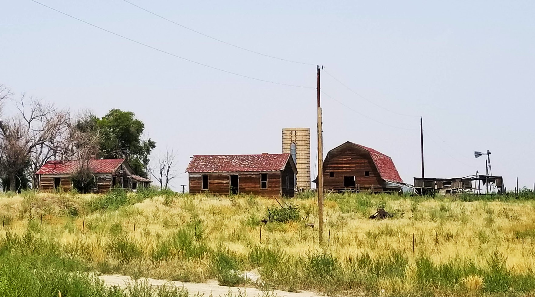
Now back on the road heading north on US-287, we eventually merge onto I-70 westbound. Once in Elbert County, I had found a geocache (GCQTWZ) by an off/on ramp that had a big enough shoulder to park the RV for a few minutes. See the first photo at the top of this blog. I made the quick find and then also noticed the old farm house and barn at the top of the hill. That made for a nice photo too.
A few miles up I-70 in Arapahoe County, I found another exit ramp with a geocache (GC8CD7) that had good parking. Turning onto I-25 northbound, another exit ramp geocache for Larimer County (GCY322) and then a rest area earthcache for Weld County (GC1ME6T).
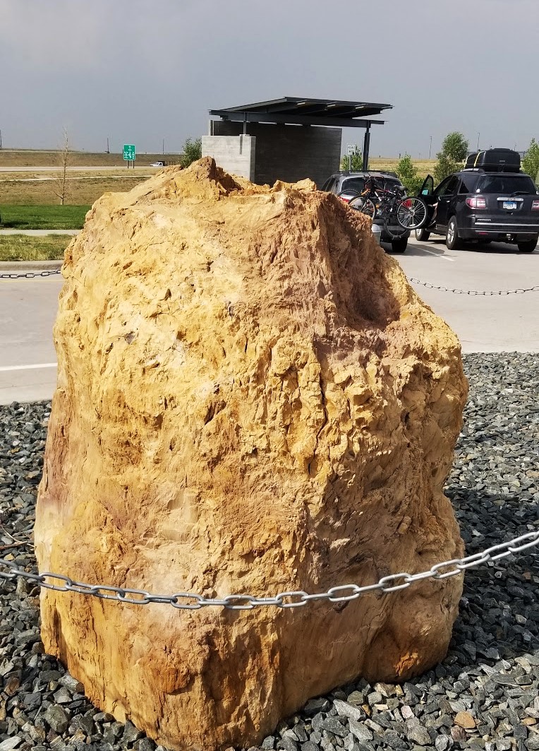
Finally crossing over into Wyoming, we pulled into the Welcome Center just south of Cheyenne where we decided to park for the night. The Wyoming Welcome Center is practically a museum / historical center. We must have taken about 50 photos. These are just a sample. From a petrified tree,
the "Hole in the Wall Gang" with Butch Cassidy and the Sundance Kid,

giant prehistoric skeletal bones that were once large beasts,

and Wyoming cowboys, rodeos and ranch life.

Also located at the Wyoming Welcome Center were two geocaches. One was a multi-cache (GC979A5) and the other an earthcache (GC93HTZ). These gave us credit for Laramie County.
After the tour of the Welcome Center, we drove about a mile to the next exit to grab a bite to eat. Also at the same exit was a virtual geocache (GC946E) that I couldn't pass up. My job is a surveyor and the cache was about a surveyor. 32-year old John Phippin was a dedicated employee of the National Geodetic Survey, Coast and Geodetic Survey.
A resident of Cheyenne, Wyoming, he was working in Blythe, California on an oceanic geodetic survey project in 1992. In April of that year, two men (I'm not gonna mention their names) quit their jobs as carnival workers and began on a crime and killing spree. They broke into Phippin's motel room where they beat him and then stabbed him in the heart. The two then proceeded to load up his possessions and stole his vehicle, which they drove to Las Vegas and murdered another man.

That's it for today. Tomorrow we arrive in Montana, hopefully trouble free! Stay tuned...
To follow along on our travels and keep up with my latest blogs, you may do so here of course by clicking the "Follow" button to the right. And there's also my main website at AwayWeGo.US for the complete index of my traveling adventures going back to 2005. But also by using one or more of your favorite of these social media platforms: Facebook, MeWe, Gab, Reddit, Twitter, GETTR, Instagram, and TruthSocial. These all link directly to my profiles. Again, please feel free to comment and / or share.


.jpg)


.jpg)


.jpg)

