Today we started a little geocaching road trip around Montana to pick up some new caching counties. We drove the backroads in our GeoJeep finding geocaches which took us to some interesting locations. So travel back with us as we go sightseeing, finding a long abandoned car, some creative metal statues, and some wildlife.

On the way to our first geocache, we past by these custom yard art metal sculptures. I just had to pull over and get some photos.


The first geocache (GC4PETT) took us high up on a hill. We found the geocache pretty quickly. But the real treat was the spectacular view from up there.


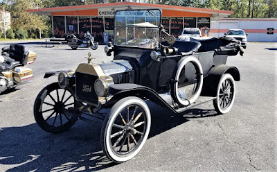
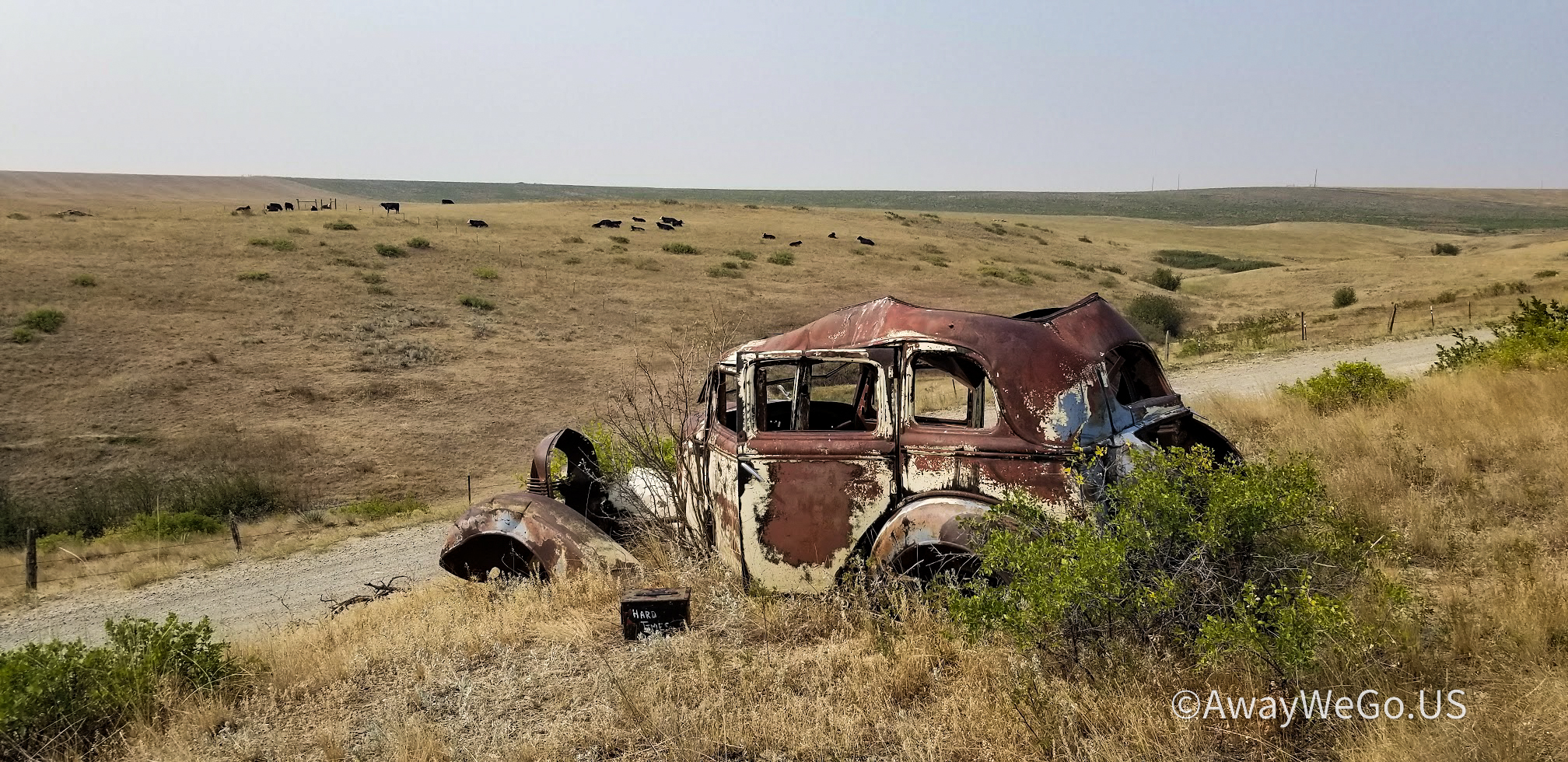
The next geocache over in Stillwater County was called "Hard Times Cache" (GCVHFP). The cache was an ammo can hidden in this old antique abandoned car that had probably been parked there for over a half century. Ya gotta wonder what stories this car could tell.
Also in Stillwater County was our next and a high favorite points geocache (GC15GG0). It was located by the big bear outside the office of the Old West RV Park. It was a nice RV park and looked like a great place to setup camp. But we're traveling and exploring in the GeoJeep and left the motorhome back in Bridger.

Continuing westbound, we entered into Sweet Grass County for our next four geocaches. First up was at the Greycliff Prairie Dog Town State Park for two geocaches (GC1X4BY, GCX39H). There were probably a thousand or more of these prairie dogs running around and ducking in and out of holes. We spent about 30 minutes watching these critters before moving on.


A few miles further down the road is the town of Big Timber. Just off the exit is the Big Timber Information Center and the next geocache (GCKHRJ). On the patio of the information center is a metal sculpture of the "Cowboy Artist." Charles Marion Russell, 1864-1926, was an American artist of the American Old West. He created more than 2,000 paintings of cowboys, Native Americans, and landscapes set in the western United States and in Alberta, Canada, in addition to bronze sculptures.

The last one for the county was right on the edge, just off the exit, and had nearly 300 favorite points. The star was not the location but the geocache (GC3GZT2). Best to explain with a video:
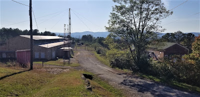
Taking a backroad north from that exit, we crossed over into Park County. It was just a mile up that road where we arrived at the Yellowstone River and our next geocache (GC2W0GC). Here is what remains of the old bridge and can see to the right in the photo a piece of the new bridge crossing over. But predating both of these is where Captain Lewis Clark, half of the Lewis & Clark Expedition, along with along with several other men, Sacajawea, her 18 month old son, and 49 horses passed through here way back in July of 1806 on their way back to reunite with Lewis.

Two exits west on I-90 later, we stopped for another geocache (GC2WTFW) for more Old West history. John Bozeman is noted first for the 1863 establishing of the Bozeman Cutoff (or Bozeman Trail) as a shorter freight route through Wyoming to the Montana gold fields. He laid out the town of Bozeman in 1864.
In April 1867 he was traveling eastward through this area with partner Tom Cover to Ft. Phil Kearny. In camp 2+ miles upriver from here they were reportedly attacked by five Blackfeet when Bozeman was killed.
Inconsistencies in the story and evidence at the site lead some historians to suspect Cover of the death. Bozeman, 32 years old at the time, was buried there for two years, then moved to the Bozeman cemetery.
Another exit and we arrive at the Fort Parker Historical Site and our next geocache (GC1X3BR). This area along the Yellowstone River once served as south-central Montana's cultural crossroads between 1868 and 1875. This was a place where settlers and Indians traded goods and services. Built here in 1869, Fort Parker was the first Crow Agency and a resting point for white explorers as well as Indian leaders. Virtually every major expedition into the Yellowstone Park stopped here. The fort was burned down a year after it was built and replaced with a poorly constructed adobe fort. In 1875, the government moved the Crow Agency to near Absarokee, Montana.

Continuing on into Gallatin County, we stopped for a geocache (GC4CG9K) and historical marker. In 1864, John Bozeman and John M. Jacobs opened the Bozeman Trail. This new trail splits off the Oregon Trail near Douglas, Wyoming and heads north into Montana near Wyola. From there it goes west along I-90 through the town of Bozeman and into Virginia City.
Now we start to head back to the RV in Bridger when we noticed the Montana Grizzly Encounter across the highway. This might be our only chance to see some wildlife while we're up here. Well aside from the gift shop, there was an outdoor area of about an acre with a small pond in the middle. There was only one grizzly bear to see. Five minutes, a few photos, and we're back on the road.

Well that's it for this day. Time to head back to Bridger. We've got more of Montana and Wyoming to come.
To follow along on our travels and keep up with my latest blogs, you may do so here of course by clicking the "Follow" button to the right. And there's also my main website at AwayWeGo.US for the complete index of my traveling adventures going back to 2005. But also by using one or more of your favorite of these social media platforms: Facebook, MeWe, Gab, Reddit, Twitter, GETTR, Instagram, and TruthSocial. These all link directly to my profiles. Again, please feel free to comment and / or share.


.jpg)