Showing posts with label webcam. Show all posts

Friday, September 16, 2022

2021-03-05: Touring the Mississippi Gulf Coast for History and Lighthouses

Finishing up the eastbound segment of our huge looping roadtrip around the east half of the United States, we followed the Mississippi Gulf Coast to check out some lighthouses and other historical sites. Obviously picking up some geocaches along the way too. So join us as we exit the Interstate, drop down to the backroads highway of US-90, and let's see what (and who) we found...

Our first geocaching stop was for a virtual geocache (GCED4C) at the statue of French explorer Jean Baptiste Le Moyne. Born in Montreal, New France (now Canada) in 1680, he landed and explored this area of Bay St Louis, MS in 1699. He was appointed governor of French Louisiana several times  in the early 1700's. Also known as Sieur de Bienville, he died while in Paris, France in 1767.


Moving along to Gulfport, MS, we come to our first lighthouse. Ship Island is located out in the Gulf of Mexico, about 12 miles south of Gulfport. The island got its name because it was often used by early explorers and larger ships to anchor, sending smaller boats navigating the shallower waters to the mainland. With the efforts of Congressman, and later as Senator, Jefferson Davis in the 1840's, Ship Island finally got its first lighthouse built in 1853. It was a 45-foot round tower made of brick.

In 1861, Confederate soldiers abandoned the fort and lighthouse on the island and returned to the mainland. They set the structures on fire to make it more difficult for Union troops to use the lighthouse to aid in navigating the waters. However, Union forces occupied the island before long and had the lighthouse operational once again by late 1862. In 1886, the brick lighthouse was considered unsafe and a square wooden lighthouse was constructed later that year. The lighthouse continued operating by the U.S. Coast Guard until 1957.

In 1959, a private use permit was granted to Philip Duvic who renovated the bottom floor to a kitchen and bathroom, second floor into women's quarters, third floor into a men's dorm, and the top floor a honeymoon suite. He eventually purchased the lighthouse in 1965 when the Coast Guard put lighthouses up for sale.

In 1969, Hurricane Camille severely damaged the wooden structure. And in June 1972, two campers lit a campfire too close for the windy conditions and caught the lighthouse on fire, completely destroying it. In 1999, a replica lighthouse was built on the island but destroyed in 2005 by Hurricane Katrina. And finally, another replica (pictured) was built in 2011, but not on Ship Island. This time right on US-90 in Gulfport making it more accessible to tourists.


I also grabbed the geocache near the lighthouse (GC6ZKCN) before driving off to the next location.

Further east down the beach and a block off of US-90, you'll find this red-brick building and our next virtual geocache (GCD69F). The Mississippi City Courthouse building was originally constructed in 1893 as part of the Harrison County Clerks office, the "Old Courthouse." It was the last remaining structure associated with a complex of courthouse buildings in Mississippi City, which served as the county seat from 1841 until 1902. After that the county seat was moved to Gulfport. The original building was destroyed during Hurricane Katrina in 2005. This replica you now see was constructed in 2009.


Moving on over to Biloxi, we come to one of the lessor known lighthouses on the Gulf Coast. Constructed in 1965 as part of the Broadwater Beach Resort, the resort was destroyed by Hurricane Camille in 1969. Rebuilt as the President Casino in 1992, it too was destroyed in 2005 by Hurricane Katrina. This is all that remains. Even the geocache hidden near the base tends to disappear often and I had to DNF that one (GC6DTPB).


The Biloxi Lighthouse (GC7B8V6) was one of three Mississippi Sound lighthouses authorized in 1847 by legislation sponsored by Mississippi Representative Jefferson Davis. The Biloxi Lighthouse was erected in 1848 and was one of the first cast-iron lighthouses in the South. It has survived two of the deadliest hurricanes in Gulf Coast history, Camille in 1969 and Katrina in 2005. Katrina’s record-breaking storm surge crested at 27.8 feet above mean sea level. It destroyed nearly the entire city, but the lighthouse remained standing.


One of the features of this lighthouse is that it contains a webcam. You can login to the live feed from your smartphone to take that unique selfie as if you were both on the ground and up inside the lighthouse. Yep, that's me down in the lower left corner by the light post.


Our final stop was in Ocean Springs, MS for another virtual geocache (GCEC3D) at the Mississippi Vietnam Veteran's Memorial.


Making our way back to Interstate 10, yeah I know it sounds boring, but we have to get to Central Florida. We spent the following day with family and the next morning saying my last goodbye at my father's funeral. After the funeral we had to get back on the road up to North Carolina where we return to the Maiden Creek solar project for a couple weeks of touch up work. Then we head back to Texas for the next project. But we'll be taking the LOOOONG WAY back via the northern route! So be sure to check back in soon. Until next time...


To follow along on our travels and keep up with my latest blogs, you may do so here of course by clicking the "Follow" button to the right. But also by using one or more of your favorite of these social media platforms: FacebookMeWeGabRedditParlorTwitterRVillageGETTRInstagram, and TruthSocial. These all link directly to my profiles. Again, please feel free to comment and / or share.

Saturday, February 20, 2021

2019-05-12: Geocaching Counties in OBX and NE North Carolina Visiting Kitty Hawk, a Crazy Bird, and Grave Digger

Hey guys! Welcome back! So if you remember from yesterdays blog, I started working on a solar project in North Carolina this past week. Yesterday, the first Saturday off, I geocached the southeast corner of the state to pickup the missing counties I needed for my geocaching map. Today I'll be taking a roadtrip over to the Outer Banks (OBX) and the northeast corner of the state for more counties. So let's get going...


From where I'm staying in Blounts Bay, I first have to go west around the Pamlico River into the town of Washington to pickup US-264 eastbound. By the way, originally called Forks of the Tar, the town of Washington, NC was renamed in 1776 and the first to be named in honor of George Washington.

Sometimes while driving the rural backroads around the country you get to discover some unexpected photo ops that you just have to pull over for. This one was on the way to my first geocache. Driving along US-264 and crossing over Scranton Creek, I spotted this old sailboat that was probably victim of one of the many storms that have hit the Carolinas. My first thought was "GILLIGAAANNN!!!"


And speaking of storms... my first geocache was in Hyde County. It was located at a roadside historical marker for the Providence Methodist Church (GC57KRV). There wasn't anything to see here other than the sign and a cornfield. But back on September 16-17, 1876, the church was "moved by the hand of God." It seems that the church floated away from the center of town during a flood and landed here. Then the following day when the waters receded, it pushed the church back almost to the exact spot it started in town nearly two miles away!

Moving on up into Tyrrell County, I stopped for a quick roadside cache (GC1FEDM). From there were continued the backroads north into Columbia, NC and picked up US-64 eastbound. Usually driving the backroads you can encounter some unexpected sites. I passed by a Seafood Market with about a dozen of these metal sculptures. Here's just a couple of them.


Crossing the Alligator River into Dare County, my next geocache (GC2Y1PC) was at the remains of the old ferry docks. The ferry established in 1931 by W. T. Baum while it was State Highway 90 and gave travelers a way of crossing the river verses driving all the way around to the south. Soon thereafter the state began subsidizing Mr. Baum and providing a free service to users. Upon the completion of US-64 in the 1950's, more traffic arrived and additional ferry crossings scheduled. Eventually a bridge was built over the river connecting both sides of US-64 in 1962 and the ferry abandoned. You can still see the remains of the docks used by so many in the past.


Continuing on US-64 east, I cross over Croatan Sound onto Roanoke Island. It was here where the first English colonists came and attempted to settle back in 1585. On the third attempt 90 men, 17 women, and 11 children were left behind on the island in 1587. By the time the supply shipped returned again in 1590, the colonists had disappeared never to be seen again.

Also on the island are my next three geocaches locates at the Outer Banks Welcome Center. The first one called OBX Velkominne Respite (GC38G6K) was a very creative cache at one of the picnic tables with over 200 favorite points. From there take a stroll down the boardwalk for a rather difficult magnetic container hide (GC4K4NH) about halfway down.


I hadn't planned on spending so much time here. But the caches and the views were worth it. And finally, down at the very end of the pier was the final geocache to be found here (GC477R6). I guess the best way to describe it would be to leave you with a couple videos:


My next geocache in Dare County on the OBX was the most historic and where I spent the most time. "Dawn of Aviation" (GCB57D) is a virtual geocache on Kill Devil Hill near Kitty Hawk. It was on this hill where two bicycle shop owners from Ohio, Orville and Wilbur, built a flying contraption and brought it down here for a test flight. On December 17, 1903, the Wright Brothers made four successful flights gradually increasing in lengths at 120 feet, 175 feet, 200 feet, and finally 852 feet.

After passing both the House and Senate, President Calvin Coolidge signed the act to establish the Kill Devil Hill National Monument on March 2, 1927. The first monument was a 10-ton granite marker placed on December 17, 1928 at the approximate location of the 1903 liftoff and a cornerstone was laid atop Kill Devil Hill for the larger monument. Construction of the 60-feet art-deco designed triangular monument was completed in November 1932.


From the monument at the top of the hill looking out over the flight path. The parking and visitor center is off to the right side.


Just one of the many scenes in Sculpture Gardens. These life sized statues showcase the many people, photographers, the plane and more there on that momentous day.


One last geocache here on the outer banks turns out to be a webcam cache. Whenever you encounter a webcam cache you want to try and get it. They're no longer added so once they've been archived, they're gone. "Sun n' Surf" (GC2585) webcam was atop the Shrimp Shack looking out over the pier. How webcams used to work was a two-person activity. You'd have to stand in the correct spot, call someone at a computer who could screen shot the photo. Now with smartphones, you can do it yourself.


Leaving the OBX on US-158 north back on the mainland. Another one of those "Hey Lookie There" moments! Passing through Poplar Branch, I spot the Grave Digger monster truck and the Digger's Dungeon shop! Oh, I just HAD to pull over for some roadside attraction photos! Posing the GeoJeep next to the oversized Grave Digger of course. And how about the fastest mailbox in the world too.


Making my way back, I entered into Camden County and picked up a quick roadside geocache in some trees (GCTEQN). Nothing special about the cache or the place, but I did get a photo of this disturbed young bird that I wasn't sure it could fly yet. It was just hopping from branch to branch. Then just gave me that look like I just woke it up.


One more quick roadside geocache (GC4MHAH) for Pasquotank County and then I call it a day. Time to get back and prepare for work tomorrow. I picked up a lot of new caching counties this weekend. Hmmm now to plan next weekends county caching run. See you then...

Saturday, November 28, 2020

2019-03-09: A Packed Geocaching Roadtrip Returning from Minnesota to Texas: Day 3 in Kansas and Oklahoma

Hello again and welcome to Day 3 of the roadtrip returning from a business meeting in Minnesota and driving back to Texas. CuteLittleFuzzyMonkey (CLFM) and I took three days driving from TX to MN. Do we make it back to Texas today? Let's get going and see...

We left Manhattan, Kansas at sunrise and headed east on US-24 down the road into Wamego, KS. The town of Wamego is the birthplace of Walter P. Chrysler. You'll also find the Columbian Theater where you can see turn-of-the-century murals from the 1893 Chicago Worlds Fair. Probably the most popular attraction is the OZ Museum and all the Toto statues around town.


But what CLFM and I came for was our first geocache, a webcam geocache (GCPGXD). There were several webcams around town. We took our pose in front of the United Methodist Church.


Our final stop before leaving town was the Old Dutch Mill (GC83C3) virtual cache. Built in 1879 by Dutch immigrant John B. Schonhoff on his farm twelve miles north of Wamego, this old mill was used to grind grain into flour and cornmeal. In 1925, thirty-five team and wagons moved the windmill to this site. Each stone was taken down, numbered, and rebuilt exactly as the original. A bust of Ceres, goddess of grain, is set above the window. The mill is 25 feet in diameter and forty feet high.


Then we backtracked a few miles to Manhattan, KS because we forgot about the virtual geocache at the Kansas State Vietnam Veterans Memorial (GC6887).

Heading south on Hwy 177 for a few miles, we arrived at Konza Prairie Research Nature Preserve. The Konza Prairie located in the Flint Hills and is managed by Kansas State University as a long term ecological research site. This vast ecological system provides some spectacular views as you arrive at the visitors center. This was once part of the 2923 acre Dewey Ranch and was purchased in sections by the Nature Conservancy and Kansas State University from 1971 to 1979 for a total of 8600 acres today. The Konza Prairie was named after the Konza Indians. It also offers a trail system that can be combined for a 6 mile loop.

There was a virtual geocache and an earthcache along the highway (GCB63B, GC1DJV8). Then there was another virtual geocache (GC6E84) on the westside of the preserve as well as another virtual "Ashland Community" (GC6E86) outside to the north. Looking at the satellite imagery, it looked like we should be able to drive around the outside and get both of those. We really weren't up for the 6 mile hike at this time. So we gave it a shot.

Getting to the Ashland Community was pretty easy and we parked right out front of the historical building. Then following Google Earth, we continued down the muddy road around and into the westside of the preserve. Drove right up to within a couple hundred feet of the old water well. Sure made it easier than a long hike. And with the muddy conditions, I got to put the GeoJeep in 4x4 mode again.


Now jumping onto I-70 west for a short trip to the hill overlooking Fort Riley. This virtual geocache brings us to an Atomic Cannon (GC698E). Now I've never even heard of an atomic cannon! This is why I love geocaching! According to the historical marker at the site of the cannon: "This is one of only three atomic cannons in existence. The other two are located at Ft. Sill, Oklahoma and the U.S. Army Ordinance Center in Aberdeen, Maryland. This cannon was placed in service on November 17, 1952 and was deactivated in August 1963. Two 375 HP engines were used to transport the 42-foot, 280-mm cannon at 35 M.P.H. to the desired firing locations. The cannon can fire a projectile 11 inches in diameter for more than 20 miles. This cannon was never fired."

From the parking area, you can see the barrel of the massive cannon pointing outward. Standing next to it, it's like the huge cannons on a Navy battleship. Looking back downhill, that's CLFM nearby, I-70 going left to right, Junction City to the far left, and Fort Riley way off in the distant right side.


Driving on US-77 southbound in Herington, KS, we stop at the Father Padilla Memorial Park. There we find a not-as-big-cannon and our next virtual geocache (GCACE0). It seems like a pea shooter by comparison.


At the park across the street was this bench that was just calling out for me to take a photo!


Back to I-70 westbound, we take a ride over to Abilene, Kansas. There we found a large boulder which marks the northern terminus of the Texas Cattle Trail (GCGA9K). The plaque gives a little history, including the following, over three million cattle were delivered here. The trail was in operation from 1867 to 1871. The dollars brought in by the cattle trade and those hustling the cowboys gave Abilene the foundation of prosperity that still carry it today. The wild wild west was definitely here! Gunfights in the street, fistfights in the saloons, and prostitutes working the cowboys made for many wild nights. The upper class citizens of Abilene desired a more reputable image and laws were passed here that brought the cattle trade to an end. The cattle drives moved west to cities like Ellsworth, Hays and Dodge. Abilene continued to prosper without the cattle trade and is still a successful community.

Also in Abilene, you'll find the Dwight D. Eisenhower Presidential Library and Museum. And of course it's also another virtual geocache (GCBB05). President Eisenhower was born in Texas and lived there until age 1 1/2. His parents then moved back to Abilene. There he grew up and remained until he joined the military. Even though after his military and political career he moved to Gettysburg, he always considered Abilene his hometown and where his Library and Museum was built.


Next on our target list was a virtual geocache at the site of the Old Salina Brick and Tile Company (GC2E7C). We got the required bit of information needed for the answer and moved on.

Also located in Salina, Kansas is some aviation history (GC7B69P). In 1942 the Smoky Hill Army Airfield was constructed southwest of Salina. When the base closed in 1967 it left Salina with one of the largest Municipal Airport runways in the world. Turns out that wasn't the end of Salina's aviation story. For many years aircraft parts were built in several of the old base buildings by several familiar manufacturers. In more recent years it has become home to K-State Polytechnic with pilot programs in flight including a unmanned flight program. Military aircraft are still a common site at the airport with several reserve units having training facilities on the airport properties. 38 years after the closing of the military airfield a record breaking round the world flight took off (02/28/05) and landed (03/03/05) on the historic runway. The "Global Flyer" was quite an event and this monument is the centerpiece of a newly dedicated park with extensive history of the Airfield.


Heading south from Salina on I-135, we go down a short drive to Coronado Heights Park (GC3483). Located up on a hill overlooking Saline and McPherson Counties. Coronado Heights receives its name from Spanish Explorer Francisco Vasquez de Coronado who visited central Kansas in 1541. He was looking for the Native American community of Quivira where he was told "trees hung with golden bells, and pots and pans were beaten of gold." Coronado didn't find his gold.

In the 1930's, the Works Progress Administration built a picnic area and castle like building out of Dakota limestone. There was also a traditional geocache hidden a short walk down one of the trails (GC1TNG5).


Continuing southbound on I-135, there's a roadside attraction photo opp and our next virtual geocache (GC348A). Though I don't know how I missed taking a photo myself. So I'll use CLFM's photo. This used to be the "Happy Chef" which stood outside the Happy Chef Restaurant in McPherson. Someone bought it and moved it here. Now it looks like Mr Moneybags from the Monopoly game.


On the way to Canton to pay respects to Edgar Miller, we found two geocaches (GC824R0, GCG6V6) on the road to and in the cemetery. Edgar was an 18 year old ranch hand who bravely rode across the prairie to get help for his bosses wife who was very ill. He was captured by Cheyenne warriors who tortured, scalped, and murdered him, leaving his body in the weeds. For the complete riveting story, visit the Santa Fe Trail Research website.


Then there's the "Nothing But Blue Sky" virtual geocache in Newton, KS (GCAE93). Located in Centennial Park is this huge piece of artwork sculpture created by three artists.


Finally making it down into Oklahoma, we make string of geocaching stops in cemeteries to claim new counties. One cemetery geocache in each county of Alfalfa (GC2BFZ3), Grant (GC3NNQM), Garfield (GC71GHP), Kingfisher (GCMJND), Blaine (GC4J0Y3), and Caddo (GC7KGVK).

By now it's getting late, already dark, but we're still going on. Also in Caddo County, in the town of Anadarko, OK, we stop by the former Rock Island Railroad Depot (GCGA01). Built in 1902, it is now a museum and a virtual geocache. The museum was closed at 9:30 PM while we were there, but I did manage to see the cool old fire truck parked out front.


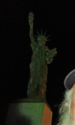
Moving down to Grady County, we get our last cache for the day. A virtual geocache for another one of those miniature Statue of Liberty monuments (GCFC05).


We finish the day near midnight finally getting some sleep down in Lawton, OK. Twenty-eight geocaches, about a dozen new counties, and nearly 18 hours later I'm exhausted! But it was a great day for geocaching and sightseeing through history.

Until tomorrow... ZZZzzzzz........