Saturday, December 26, 2020

Discovering the Ghost Town of Oakville Texas and Researching Its History

Hello Friends, Travelers, and Geocachers. Welcome to another day in our AwayWeGo's Geocaching Adventures. Today I want to invite you along this roadtrip as I stop to explore a South Texas ghost town called Oakville.

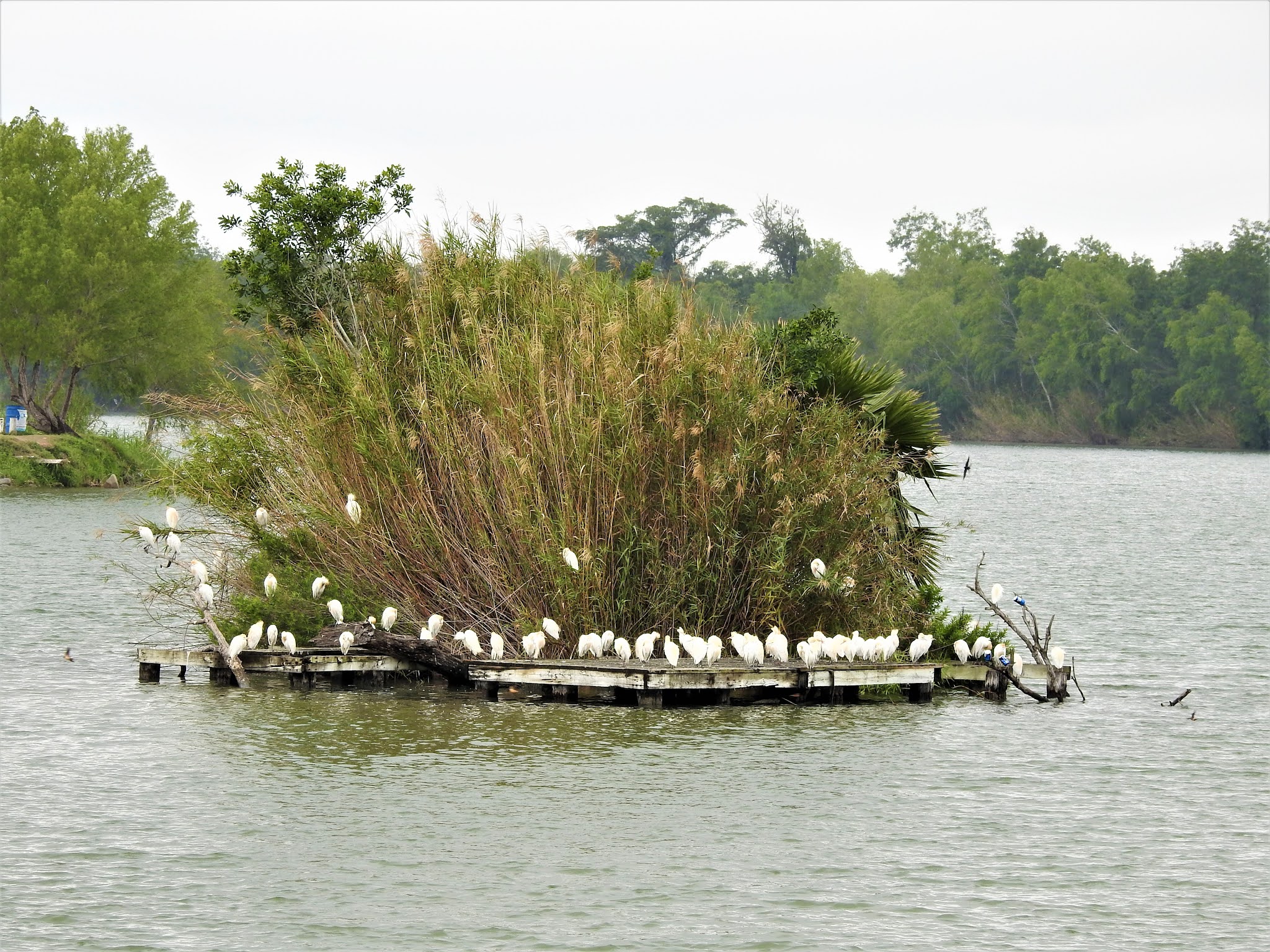
It started out as my usual 360+ mile Sunday drive from Killeen, Texas down to Roma in the Rio Grande Valley. I was driving down I-37 and exited off the highway to get two geocaches in the Oakville Cemetery (GC2KPBH, GC78PKP) on the west side of the Interstate. From the historical marker at the Oakville Cemetery: "Donated in 1857 by Thomas Wilson, who also gave land for Main Town Square. The property was originally part of the 1831 McMullen McGloin land grant from Mexico. Among graves are those of J.T. James, the founder of Oakville; early pioneers; and organizers of Live Oak County."

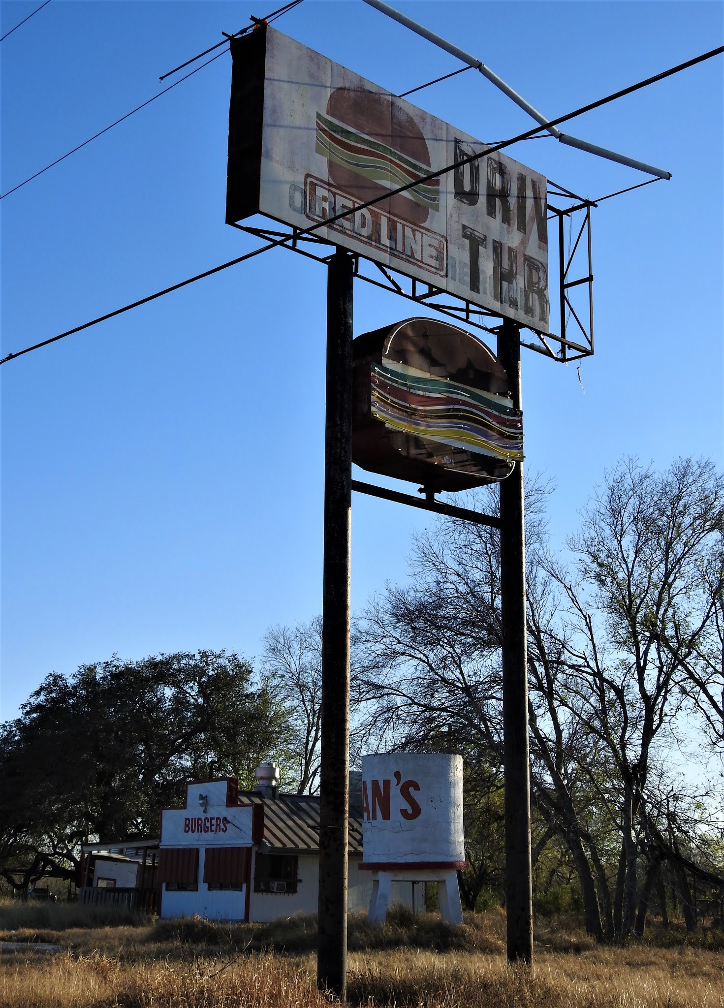
As I was driving up the onramp heading south, I noticed out the corner of my eye across the east side of the highway all the old buildings of the town. That really sparked my interest so I continued driving down the Interstate six miles to the next exit. Then got off and made a u-turn another six miles back to Oakville.


Arriving in the Coastal Bend of Texas in the early 1800’s, Irish immigrants became the first settlers of a region that includes what is now known as the town of Oakville. At that time the community was referred to as "on the Sulphur" because it was on Sulphur Creek. It was also called Puenta de la Piedra ("Rock Bridge") by Spanish gold seekers, because two miles east on the Nueces River the San Antonio-Brownsville road crossed a natural rock bridge. After the Texas Revolution, Oakville was a station on the stage line from San Antonio to Corpus Christi. It had become a bustling place of commerce because it was the crossroads of ox-cart caravans and mule trains that crawled the muddy roads of Texas between the coast of the Gulf of Mexico and Brownsville to San Antonio. Oakville was the half-way point and merchants & travelers used it as a rest stop on such long, hazardous journeys of the day.

Oakville became county seat after Thomas Wilson offered 640 acres for a townsite; residents accepted the location on September 8, 1856. The name was taken by the court from a newspaper advertisement of business lots. Oakville had the county's first post office, established in 1857, and the first courthouse was built. The Oakville Baptist Church, constructed in 1856, had 128 members by 1857.


During the Civil War and for some years afterwards, Oakville and the surrounding region became a "hotbed of lawlessness." Looking through old newspapers, I found this article from the "Austin Weekly Statesman" October 5, 1876: "The state of society about Oakville, a frontier village, has been simply terrible. The people are divided into two classes; one, permanent, cattle-growing farmers; the other, horse and cattle thieves. They have shot and killed one another until honest men feared to tell the truth, and to punish red-handed villainy was impossible."

Historian Walter Prescott Webb described Oakville as "a hard country where civil authorities were helpless and took no notice of any outrage." As the county seat, Oakville grew into a thriving town that shipped cattle, horses, cotton, and wool, with a dozen or more stores, two hotels, a livery stable, a steam gristmill and cotton gin, a school, and two churches. However, with this boom of activity, the thought of the Wild Wild West that TV shows and movies were made of come to mind.

Growing to over 400 in population, there were 7 saloons in Oakville to provide the cattle crews plenty to drink and entertainment. Many stories of drunken cowboys, a lot of liquor flowed and many thrown in jail to sober up. Some of this spilled over into frontier violence in the form of horse thievery, cattle rustling and murder.

It took Texas Ranger Captain McNelley to clean up the lawless element in the 1870's. The Texas Rangers cleared out the outlaws in the region and brought them to the Live Oak County Jail in the county seat of Oakville, for justice. The standing historic jail was the third jail used in Oakville, the first two proving inadequate. The first one was a mud structure and the second of wood; both of one story construction. It was decided that something had to be done - for one, angry citizens could shoot the prisoners dead thru the jail bars in the absence of the Sheriff whilst he was away handling business.


The stone jail became a source of community pride. It was the latest design, the state-of-the-art in incarceration at the time of its construction. At two stories tall, it provided for safe lock-up in the upstairs cells until the judge arrived and provided formal offices for the Sheriff downstairs in which to conduct business. It also allowed for the sheriff's or jailer's family to reside on the first floor should they elect to do so. This important building served as the county’s jail from 1887-1919. The jail was constructed of hard native 22” sandstone, rough-hewn blocks, hauled by ox-cart from a nearby quarry.

For the burgeoning community, a jail of this stature was literally an advertisement and enticement to incoming settlers that Oakville would be a success in that it promoted civility and safety for it’s residents. The "modern" stone Oakville Jail of the 1880’s symbolized the arrival of the law to Oakville and to frontier Texas where previously only the six-shooter, rifle and the Texas Rangers administered justice to the wild and woolly lawless. Many a badman came to lament the day he entered the Oakville Jail. It is told that over 40 men hanged in the notorious sprawling live oak “Hanging Tree” outside on the Town Square.

Law and order once again established, Oakville's location as the halfway point between San Antonio and the Gulf Coast continued to create a boom of activity and business. The county's first free school building was established in 1881, and in 1899 Oakville established the county's first independent school district. The Oakville First National Bank, opened in 1905 by Dudley Blair and Lee Hinton, was also the county's first. The population of Oakville reached 400 in 1885, fell to 320 in 1892, then rose to a maximum of 450 in 1914.


Oakville's demise came just as many a ghost towns did in the west.  About 10 miles to the south, George West had plotted and named a town after himself. He courted the San Antonio, Uvalde, and Gulf Railroad to lay their tracks through his town and succeeded in 1913. The residents of Oakville began relocating to George West. And in 1919, George West became the county seat when its founder offered $75,000 to build a new courthouse there. State highway maps of 1936 showed a cemetery, two churches, a school, and several businesses and residences at the site. In 1940 the community reported a population of 350. By the 1970's only the Baptist church, the post office, three service stations, and scattered dwellings remained.


The State of Texas designated the town of Oakville a historic landmark in 1936 and placed a granite marker there. In 2004, the Oakville Jail was placed on the National Register of Historic Places.

Since the 1970's when Albert and Mari Davila first spotted the two-story stone jailhouse rising up out of the surrounding live oak and cactus. Over the following years, every time they'd pass by on their way down to Padre Island, they would stop for another look and exploring what appeared to be an abandoned town square. They eventually fell in love with the jailhouse and wanted to turn it into their vacation retreat house. They found the owners and purchased the Oakville Jail along with the abandoned town square in 2005.

With no windows or doors, they discovered many critters now calling it home as well. It was a slow process clearing up and cleaning out, but in 2007 restoration of the jail was completed. Locals had been admiring the work and inquiries into renting the jailhouse for special events and overnight stays began coming in. One by one the Davila's have been restoring old structures and adding to their number of rooms to rent. You can find more information about the restoration and photos at their website oakvillejail.com.


So that's it for another edition of my blog. I really enjoy finding these once forgotten treasures like the Oakville, Texas ghost town and sharing them with you. I'm also glad to see that someone has taken an interest and begun to restore the town square into what a typical pioneer town square might have looked like back in the 1800's.


For some reason, the closing theme song of the Beverly Hillbilly's TV show is running through my head. Yeah I know it's got nothing to do with Texas. But I'll leave it with you as anyway, though slightly modified: 

"Well now it's time to say good bye to You and all your kin.
And I would like to thank you folks fer kindly droppin in.
You're all invited back next week to this blog of mine,
To have a heapin'helpin of these words that come to mind.

Geocaching it is. Explore a spell, Put the hiking boots on.
Y'all come back now, y'hear?"

Thursday, December 24, 2020

2019-04-14: Geocaching Fossils, a Cemetery, Dams and Aqueducts in Central Texas

So I got a late start this morning on my Sunday drive of 360+ miles from Killeen, Texas down to Roma, Texas for a week of working. But I still managed to squeeze in some geocaching in the San Antonio area. Let's get going...


My first stop was at Cibolo Creek for some fossils and an earthcache (GC3CC0F). Here I found the same kinda fossilized rock used on the fort at St. Augustine back in Florida. After getting the answers I needed to get credit for the cache, I went to look for the traditional geocache that was hidden here as well. I wasn't thinking clearly about that one though. It was called "Bridge Over Troubled Water" (GC20H46). I had forgotten that I was down by the creek for the earthcache. I looked all around for about 15-20 minutes unsuccessfully trying to find it. Had to log a DNF on that one. Thinking back on it now though, it's rated a 1.5/1.5 cache and probably an easy find up by the road on TOP of the bridge! Oh well, maybe next time.


Continuing down the road to a quick roadside park and grab geocache. It was an easy cache to find, but a challenge cache to log a find (GC329EA). The challenge for this one was to find 150 geocaches hidden by the same geocacher. Currently I have found 150 geocaches each by eight different cachers.


My next two geocaches are at the Mission Burial Park Cemetery (GC6JVNP, GC6KY0W). With interments dating back to the 1850's, there are nearly 50,000 burials here. The one that caught my attention most was this Sanderson Family Mausoleum. Containing six members of the family, beginning with David D. Sanderson (1822-1892). The entry is guarded by two sphynx looking statues.


Next door to the east of the cemetery runs the San Antonio River. There you'll find a virtual geocache called "Dam, Ditch, and Aqueduct" (GC4CB0). This was a two-part multi-virtual. My wife and I were here back in November and found the first stage but never made it to the final. Today I'm back to complete the find. Along this section of the river is the Espada Dam and Aqueduct.

From the historical marker: "This is the oldest continuously used Spanish built diversion dam in Texas. Has provided irrigation water since its construction sometime between 1731 and 1745. The dam originally 270 feet long, is built on a natural rock foundation. A portion of the east wing is now covered by the nearby flood control levee. Despite a true reverse buttress making an angular turn at the center of the channel the dam has withstood many years of destructive floods with only minor repairs required to maintain its sound condition. The 8 foot tall structure diverts approximately 4500 gallons of water per minute into the 4 mile long irrigation ditch known as "Acequia De Espada." By gravity flow the acequia provides irrigation water for 400 acres of land in the vicinity of Mission San Francisco De La Espada. The mouth of the acequia may be seen on the opposite bank of the river just upstream from the dam. The dam and irrigation system was engineered by Franciscan Missionaries and constructed by Indian converts, a remarkable feat at that time."


So that was it for today. Grabbed some lunch and gas afterwards and then straight driving all the way down to the Rio Grande Valley. I'm glad you rode along with me and I'll see you again next time.

Saturday, December 19, 2020

2019-04-07: Geocaching Through Texas Independence History in Cemeteries, Memorials, and a Haunted House

Welcome back to AwayWeGo's Geocaching Adventures Blog. My geocaching name is AwayWeGo.US and these are stories about our travels around the United States. Like most weekends, today is another Sunday driving 360+ miles back to work day. I live in Killeen, Texas and drive down to Falcon Lake in the Rio Grande Valley where I work as a construction surveyor during the week.


After about 30 minutes of driving, my first stop was at an IHOP in Georgetown for breakfast. Before leaving, I grab the quick geocache just outside the parking lot (GC20T2K).

I decided to make a detour and attend this geocaching event in Victoria, TX. Heading down US-183, I made a stop at the San Pablo Cemetery in Lockhart for another quick geocache find (GC3QKN0). The San Pablo Cemetery has about 100 burials beginning in the late 1930's and is still in use today.

Stopping again at the Luling City Cemetery for another cache (GC3VCVD), you also get a view of a giant watermelon. In 1954, Hermon Allen, principal of the Luling Elementary School, proposed the idea of a celebration to honor the growers and promote the Luling watermelon market. The festival includes a watermelon contest for the largest grown. The biggest Black Diamond champion melon in the festival’s history weighed in 141 pounds. The event has grown so large that as many as 30,000 people have attended.


Arriving down in the town of Gonzales, TX, I stopped for a virtual geocache at the "Old Time Justice" (GCGB8Q). The jail was built in the 1880's and is now a museum. It wasn't open at this time. I'll have to return one day to take a tour myself. The photos of it look interesting.

There's a legend that while Albert Howard was waiting for the date of his hanging from his jail cell, he had a view of the clock tower on the courthouse to watch the time. Until the very end he swore of his innocents and said that the four faces of the clock tower would never keep the same time again as long as he was hanged. Over the years and several attempts to fix it, the clocks have never kept the same time.


Then there's also the "Immortal 32" virtual cache (GCG84Q). In February 1836, Colonel Travis sent a letter from the Alamo to all Texans and all Americans while under besiege by the Mexican Army. Only 32 men answered that call for Texas Independence and all 32 were from the town of Gonzales. This memorial and reflecting pond are dedicated to those brave 32 men who gave their lives in support of their brothers at the Alamo.


Well I made it down to Victoria, TX at the Ted B. Reed Park for the geocaching event (GC83TBD). There were eight in attendance and always good meeting other geocachers. I got to stay for a little while before hitting the road and continue south.


Just to the west outside of Victoria is my next geocache at the Coletoville Cemetery (GC4T8AB). Originally named Steiner's Settlement, after early German Carl Steiner. The settlement dates back to 1849. When an epidemic of diphtheria hit the German settlement, two of August and Thekla Spitzer's children died. Ten-year-old Henry and six-year-old Robert were buried by their parents in 1873 on this site. In May of 1873, the Spitzer's deeded the land to the trustees of the new school and evangelic German church of the German community of Steinerville. The community was later renamed Coletoville for the nearby Coleto Creek.

Continuing southwest into Goliad County, my next stop was at the La Bahia Cemetery (GC282ND). There you'll also find this significant memorial of the Texas Independence. After the battle of Coleto (March 19 - 20, 1836), where a Texas Army under Col. James Walker Fannin met defeat by Mexicans in superior numbers, the Texas soldiers were held in Presidio La Bahia, supposedly as war prisoners.

However, by order of Mexican Gen. Antonio Lopez de Santa Anna, 370 of Fannin's men were marched out and massacred on Palm Sunday, March 27, 1836. The wounded were shot one by one in the fort compound. Col. Fannin was the last to die. Because of their profession, Drs. J. H. Barnard, J. E. Field and Jack Shackelford were spared; about 25 men were saved by a Mexican woman, "The Angel of Goliad". Approximately 30 escaped by feigning death or by swimming the San Antonio River. The Texans' corpses were stripped and partly burned, but left unburied.

This atrocity three weeks after the fall of the Alamo gave Texans part of the battle cry -- "Remember the Alamo! Remember La Bahia!" -- under which decisive victory was won at San Jacinto on April 21, 1836. Gen. Thomas J. Rusk and the Texan Army afterwards marched here and gathered the bones of Fannin's men from the terrain. From Presidio La Bahia the remains were carried in procession to the grave, and there given a military funeral and burial on June 3, 1836.


Amid the cruelties of the Texas war for independence, one notable woman committed acts of bravery and compassion. Francisca Alavez ("The Angel of Goliad") accompanied Mexican Army Captain Telesforo Alavez to Texas in March 1836. In seven incidents between March and April, she intervened with Mexican troops under command of Gen. José de Urrea to help captured Texian prisoners at Agua Dulce, Copano, La Bahia, Victoria and Matamoros.

On March 20, Maj. William P. Miller and 75 men of his Nashville Battalion were captured as they unloaded their ship at Copano Bay. Alavez insisted that binding cords which cut off circulation be removed and food and water be provided. The men were moved to Presidio La Bahia at Goliad, where hundreds of Col. James Fannin's troops were already held after their capture at Coleto Creek. At least 342 men were taken out of the fort on March 27 and shot under orders of Gen. Santa Anna in what was termed the Goliad Massacre.

Alavez helped save the lives of many men, including 16-year-old Benjamin Hughes. Another Survivor, Dr. J.H. Barnard, recalled that she pleaded for their lives, helped sneak out some troops at night and hid some of the men. Her humanitarian acts included tending to wounds and sending messages and provisions to those still imprisoned.


Driving into Berclair, TX, I first arrive at the Berclair Cemetery for my next geocache (GC38VDX). Berclair was a ranching area when the railroad arrived in 1889. The name supposedly derived from the combination Bert and Clair Lucas, one of the ranchers. A hotel was built to provide housing for the railroad workers in 1887 and travelers once completed. A post office was established in 1889. The cemetery below covered in spring wildflowers.


One remaining attraction in Berclair is the haunted Berclair Mansion (GCYFCJ). This 10,000 square foot, 22-room mansion was built in 1936. Etta Terrell had the house constructed out of concrete and steel in an effort to "fireproof" it after her previous house burnt down. Etta and her four sisters lived in the house. Etta passed away in the house in 1956. The sisters remained living in the mansion until the last one passed away in 1968. The homes furnishings remain as the sisters left them with antiques dating back to the 1700's. Then in 1999, the heirs in the family donated the mansion as a museum to the Beeville Art Association.

The Art Association hired maintenance workers and landscapers to keep up the property. It was about this time when unexplained sightings and sounds started happening. Several reported seeing elderly women in the windows, waving to them. Volunteers for the museum say they’ve heard voices as well as doors closing in the otherwise empty house, for no apparent reason. And the Corpus Christi Spook Central’s supernatural investigation team has reportedly recorded at least 10 unexplained voices occurring in the mansion over the period of one night.

The house is open for tours the last Sunday of each month. We may have to come back for another visit one day.


Still having 3 hours of driving to go plus stopping at the grocery store and grabbing dinner, I made that the last geocache for the day. The was a lot of historical and interesting stops today that I didn't get to explore more. Just means I'll have to go back again one day.

Thanks for stopping by and I hope to see you again soon.  

Saturday, December 12, 2020

2019-04-02: Driving Over to South Padre Island, Texas to Find Virtual Geocaches

Hey everybody! So after being off work for nearly two months, they've called me back to the wind farm down in the Rio Grand Valley in South Texas. I've enjoyed the time off out geocaching as you may have guessed from my previous blog posts. But after a couple of geocaching roadtrips, it's time to go back to work.

Being back for a week, today we got some rain which made it a little too wet and muddy to work. So we got off a bit early. But it's never to wet for geocaching. I decided to take a short roadtrip from the westside of the RGV to the eastside.

I arrived on South Padre Island, Texas and to my first virtual geocache (GCB15D). "Sailed Through This Pass" is a monument dedicated to the brave fishermen who have used this port and ventured into the Gulf of Mexico.


Now backtracking westbound, the next two virtual geocaches are near the Welcome to South Padre sign at the bridge to the island. Well actually one of them IS the welcome sign (GC7B7K1). And the other is nearby for a reminder of when an 80 feet section of the Queen Isabella Memorial Causeway bridge collapsed after a barge accidently hit one of the pillars in 2001. The virtual geocache (GC8753) recognizes the memorial for the eight motorists who lost their lives as well as a monument for the survivor.

There's also a statue of the islands namesake. Padre Jose Nicolas Balli's (1771-1829) family immigrated from Spain in 1569 and became large landowners in the lower Rio Grande Valley. In 1800 Balli applied to King Charles IV of Spain for 11 1/2 leagues of land on the island, and in 1804 started its first settlement, Rancho Santa Cruz. Padre Balli served as collector of finances for all the churches in the Rio Grande Valley. He also founded the first mission in present Cameron County. His ministry was a great influence on the lives of early South Texas settlers.


Back on the mainland side of the bridge is the "Beacon of the Night" (GC83C9) virtual cache. The Point Isabel Lighthouse was built of brick in 1852 and brought from New Orleans by schooner. The beacon's 16 mile range guided ships into the harbor and to the Rio Grande. It is one of the oldest lighthouses on the Texas Gulf Coast. It also played a significant part in military operations around the mouth of the Rio Grande for over a century, with some interruptions, has served the region as an aid to seamen.


The next virtual geocache called "Catch and Release" (GCAEC0) was located at the Pirates Landing Restaurant. Supposedly there was a world record sheepshead fish caught there on the pier. Looks like a big fish. Is it true? Can't tell you that as I haven't found any verification of such record. But what I did find was the World Record Largest Fly Fishing Rod.


And finally the last one I had time for was the Palo Alto Battlefield National Historical Park (GCC88D). This prairie of sharp cordgrass, dense mesquite, cactus and other thorny plants was the location of the first battle of the Mexican War. United States troops led by General Zachery Taylor, whom later becomes the 12th U.S. President, went up against and defeated Mexican troops led by General Mariano Arista.


Well that's it for this quick trip across the Rio Grande Valley. Time to grab a quick bite to eat and drive the couple of hours back to Falcon Lake on the westside. I hope to see you back again soon for another installment of the AwayWeGo's Geocaching Adventures. 

Saturday, December 5, 2020

2019-04-01: Geocaching and Exploring Early Mexican-American History in the Rio Grande Valley of Texas

Hello and Welcome Back! So after my long and packed roadtrip from Texas to Minnesota and back, I had another two weeks off before getting called back to the wind farm down in the Rio Grande Valley. I managed to get one week of work behind me before overnight and this mornings rains made it too muddy to work. But a rain day off from work means an extra day for geocaching and exploring early Mexican-American history of small towns in the Rio Grande Valley.


My first stop is the town of Roma, Texas, just a few miles down the road from where I'm staying. A new cache was published over the weekend called "Cactus House" (GC85FFK). Just a couple of blocks from Roma's point of entry bridge over the Rio Grande River into the United States, is an old long abandoned brick house that's been taken over by nature. I found the geocache on this Monday morning and a nice clean log sheet to claim a First-to-Find!


From there I went a few blocks over to the Roma Historic District. Not a typical border town settlement, Roma, founded in 1765, is distinctive for its historic high-walled, gated, family compounds that reflect strong ties to 18th century northern Mexico, which was then part of the Spanish Empire. The planning, colonization and land grant system was the brainchild of Jose de Escandón and focused on civil development. Today, Roma is the only American Spanish colonial settlement that preserves the character of Escandón’s town planning.

The community is directly across the river from Ciudad Miguel Alemán, Mexico. The Roma Historic District, a National Historic Landmark district in the City of Roma, contains architecture influenced by Spanish colonial culture and by the bustling 19th century Rio Grande trade route that brought goods and people from the Gulf of Mexico to the continent’s interior. The Roma Historic District contains the best and most intact collection of ethnically diverse buildings and structures in the border region.

The site of Roma was part of the Mexican town of Mier about 10 miles northwest of modern Roma, in what was New Spain’s Nuevo Santander. Don José de Escandón founded the Spanish colonial province of Nuevo Santander in the mid-18th century. Spanish colonists from Mexico settled Mier in the 1750's and received land grants along the Rio Grande, where they formed family ranches. In the 1760's, the Spanish colonial government granted two tracts on the northern side of the river to the Salinas and Sáenz families, who were among the founding families of Mier and whose descendants still reside in Roma. The tracts they received were the first permanent European settlements at the Roma site.

Soon after the Mexican War for Independence ended in 1821, Roma became an independent community. One of the earliest records of Roma is in American colonist Stephen F. Austin’s chart of Texas, which literally put Roma on the map. After the Mexican-American War ended, Roma belonged to the United States. In the 1840's, Euro-American entrepreneurs settled in Roma, Texas, and married into the founding families.

German immigrant and master-builder Enrique (Heinrich) Portscheller settled in the region in 1865, married a Mier woman, and eventually moved to Roma. Portscheller added to the beauty of the local building techniques with his trademark decorative molded brick and use of New Orleans-type wrought-iron balconies. In addition to his work in Roma, Portscheller designed buildings in the border towns of Mier, Rio Grande City, and Laredo. Though there are other towns where this type of brickwork endures, Roma sustains the highest level of density, integrity, and quality in its 19th century Rio Grande brick and stone craftsmanship.

The John Vale / Noah Cox House (GC7JGVK) served as both a home and business location for John Heinrik Vale and Noah Cox, who were deeply embroiled in Civil War activities in Roma. Vale, a Swedish immigrant, had come to America in 1840 seeking adventure. During the Mexican American War, Vale volunteered for Zachary Taylor’s Army of Occupation and was encamped in Camargo. He chose to remain in the region, marrying a woman from Ciudad Mier in Tamaulipas and taking up residence across the Rio Grande in Roma. In 1853 he built a two-story home on the town’s main plaza.


Three years later he sold the house to Cox, a representative of the New Orleans firm of Stadeker & Mecklinburger & Cox, who continued to use the house as both a residence and mercantile center. In addition to his mercantile operations during the Civil War, Cox also served in the Confederate Texas Cavalry. For his part, Vale engaged heavily in the lucrative cotton trade that funneled through the city of Roma during the Civil War, doing business with Joseph Kleiber, a key player in Confederate business operations on the Gulf of Mexico. 

The geocache I found, my second attempt at looking, was on the ruins of the wall which surrounded the side and backyard. Hopefully they don't completely restore this section of the wall because I like the way it looks now.


Also built by John Vale around 1850's, the Leocadia Leandro Garcia House is similar in style and construction to the Noah Cox House across the Plaza. Originally, the house contained commercial space on the ground floor with residential space above. The house was later remodeled as a building for a dance hall and now owned by the Knights of Columbus.


Manuel Guerra, the legendary political and economic boss of Starr County, commissioned Portscheller to build his family compound in 1884. A native of Mier, Guerra printed his own currency to be redeemed by his ranch workers at his store. The two-story brick structure sits assuredly along the upper western edge of the plaza, extending for half a block with fine classical brick detailing and a historic two-color metal balcony that delicately embellishes its second story. A one-story warehouse completes the L-shaped complex enclosing a courtyard with original outbuildings. Never to be outdone by competitors, the Guerra family also operated the first gas station in Roma with a pump installed near the chamfered corner entrance (since removed).


The seven men, pictured in 1911, in Roman collars and broad brimmed hats were Missionary Oblates of Mary Immaculate (OMI) who had travelled from their missions scattered throughout the Rio Grande Valley along the river. Since 1849, this Calvary of Christ have been building churches and chapels from Brownsville to Laredo.


Arriving in Mission, Texas and turning back towards the river, I make another stop in Anzalduas Park. It's a riverside park popular with bird watchers. I was here once before and found a couple of geocaches. But there was one that I previously DNF'd (GC6AF7Y). Today was redemption as I found it this time. Out on the Rio Grande I could see why this park was popular among bird watchers.


At my next geocache (GC84NC2), I see the ruins of this structure up on the hill. Next to the Juan Diego Academy stands the remains of the Villa Queen of Peace (photo below and at top of page). Though the cache page says Oblate Monastery, I can't find any information about it's history or that it was indeed a monastery. So I'm not sure when it was built or what happened to it. If you have any information as to its history, please comment below.


Nearby was geocache (GC6Z60B) and my next piece of history. The La Lomita (meaning small hill) Chapel was constructed by the Oblates in 1865, then rebuilt in 1899 on these 122 acres willed to them in 1861 as it was nearly halfway between Brownsville and Roma. The Oblates moved their ministry to the growing city of Mission in 1908. Now it is a historical landmark, a park, and a place of pilgrimage.


Looks like an oven outside the chapel.


I hope you have enjoyed the sampling of early Rio Grande Valley history. There is much more to see if you every get the chance to be down in this area. I didn't even get to any of the cemeteries. Overall I managed to find many more quick roadside geocaches for a total of 32 finds for the day.

Until next time, I look forward to your comments here or on any of my social media accounts. Hopefully I have inspired you to go out and explore the rich history along the many backroads and small towns of this great country.

There are new ways to follow me. Follow the blog directly by using buttons on the right of your computer screen. Or through various social media platforms:  FacebookMeWeParlerGabTwitterInstagramMAGAbook, and Reddit. Follow us on any or all of these platforms and whichever you choose, please leave your comments. We'd love to hear from you and it encourages us to continue sharing our adventures.

Sunday, November 29, 2020

2019-03-10: A Packed Geocaching Roadtrip Returning from Minnesota to Texas Day 4: Oklahoma & Finally Home!

WOW, What a trip! This packed geocaching roadtrip from Texas to Minnesota began a week ago yesterday. Now I'm finally back home. But wait let me not jump ahead and leave out today.


CuteLittleFuzzyMonkey (CLFM) and I started out early this morning in Lawton, Oklahoma. After breakfast and coffee, we drove over to the Fort Sill visitors center. Fort Sill was originally staked out January 8, 1869 by Maj Gen Phillip Sheridan to stop Indian Tribes from raiding border towns in Texas and Kansas. The garrison was originally called Camp Wichita and was referred to by the Indians as "the Soldier House at Medicine Bluffs." Sheridan later changed the name to Fort Sill in honor of his West Point classmate Brig Gen Joshua Sill, who died in the Civil War.

Today it is a U.S. Army Base covering almost 94,000 acres. It serves as home of the United States Army Field Artillery School as well as the Marine Corps' site for Field Artillery MOS school, the United States Army Air Defense Artillery School, the 31st Air Defense Artillery Brigade, and the 75th Field Artillery Brigade. Fort Sill is also one of the four locations for Army Basic Combat Training. It has played a significant role in every major American conflict since 1869.

Because CLFM has a military I.D., it was a little easier for the both of us to enter the base, as long as he was driving. So we swapped seats and now I was the navigator. Our first goal was to find the grave of a famous warrior.

Geronimo (1829 - 1909) was a prominent leader and medicine man from the Bedonkohe band of the Apache Tribe. From 1850 through 1886, Geronimo fought against Mexican and United States military campaigns in Northern Mexico's Chihuahua and Sonora and in the United States' New Mexico and Arizona.

In 1886, he "surrendered" for his third and last time. This last time he didn't break out. He was first sent to San Antonio, TX as a POW. Then transferred to Fort Pickens in Florida, Mt Vernon Barracks in Alabama, and finally Fort Sill, Oklahoma in 1894. With the exception of becoming an "attraction" in Pawnee Bill's Wild West Show around the country, Geronimo spent the remainder of his life farming with his family on land surrounding Fort Sill. He died of pneumonia on February 17, 1909 after being through from his horse and laying out in the cold overnight.

He is buried there at Fort Sill among the rest of his family and other Apache POW's. His gravesite is the virtual geocache we came looking for (GC3B0D).


Also located within Fort Sill are our next two geocaches, a virtual (GCKPGE) and an earthcache (GC27G76). From the historical marker: "This Unique Landmark at the eastern end of the Wichita Mountains was noted, described, and explored by all early expeditions and was held in deep reverence by the Indian tribes of this area from time immemorial.

"The four contiguous porphyry bluffs form a picturesque a mile in length on the south side of Medicine Bluff Creek, a tributary of Cache Creek and Red River. It is evidently the result of an ancient cataclysm in which half of a rock dome was raised along a crack or fault.


"When Fort Sill was established in 1869, the Indians named it “The Soldier House at Medicine Bluffs.” The site is rich in legends and history. You are facing the north side of bluff no. 3, which consists of a sheer cliff 310 feet high, rising abruptly from the creek. A rock cairn erected by medicine men on its summit was still standing when Fort Sill was founded. Here the sick were brought to be healed or disposed of by the Great Spirit, young braves fasted in lonely vigils seeking visions of the supernatural, and warriors presented their shields to the rising sun for power. Legends say that this was also a famous place for Indian suicides. The huge fissure between bluffs no. 2 and 3 was known as the “Medicine Man’s Walk.”"


Leaving Fort Sill, we loop around over to the Wichita Mountains Wildlife Refuge. Established in 1901, the 59,020 acre refuge hosts a rare piece of the past - a remnant mixed grass prairie, an island where the natural grasslands escaped destruction because the rocks underfoot defeated the plow. The refuge provides habitat for large native grazing animals such as American bison, Rocky Mountain elk, and white-tailed deer. Texas longhorn cattle also share the refuge rangelands as a cultural and historical legacy species. More than 50 mammal, 240 bird, 64 reptile and amphibian, 36 fish, and 806 plant species thrive on this important refuge.

The Wichita Mountains Wildlife Refuge is also home to many virtual geocaches and earthcaches. We don't have the time to find all of them, but we will go after a few of the easier drive by caches. The longer hikes along the trails will have to wait another day.

The first virtual geocache (GCAE84) is located by this rock structure. Kinda like a small cave to serve some purpose of an early settler.


Another virtual cache by the stone archway leading into the Medicine Bluff Park (GC2413). Then there's this small little man-made cave, though this one has a door (GC2412). You know I think we may have ventured into The Shire! These are all Hobbit Houses! Bilbo Baggins must be on another adventure.


Nearly 60,000 acres of natural beauty. No sighting of any elk, bison, or deer yet.


On April 4, 1926, Rev. Anthony Mark Wallock (1890–1948), an Austrian immigrant raised in Chicago, initiated an Easter service and dramatic production with cast of five in the Wichita Mountains of Oklahoma. The play quickly grew into a large, traditional passion play, attracting thousands of spectators each year. The 1926 Easter service, held near Medicine Park in the Wichita Mountains, drew two hundred visitors and grew to five hundred the next year. In 1930 approximately six thousand people witnessed the pageant. Oklahoma City's WKY radio broadcast the production live in 1936, and it was carried nationwide on two hundred stations. By the late 1930s the event annually drew more than 100,000 observers.

In 1934–35 the Works Progress Administration (WPA) built the present Holy City of the Wichitas five miles west of its original location. A dedication ceremony in 1935 commemorated the completion of numerous full-sized buildings and structures, including the temple court, Pilate's judgment hall, Calvary's Mount, the Garden of Gethsemane, watch towers, rock shrines, and perimeter walls. By the next year WPA workers had built the Lord's Supper building, Herod's Court, a chapel, and other amenities.

The script generally depicts Jesus' life from birth through crucifixion and resurrection. In its first years, the several-hours-long drama began in the early morning, between two and three o'clock, and culminated at sunrise with the resurrection. At sunrise in 1935 skywriter Art Goebel inscribed "Christ Arose," above the pageant grounds, and in subsequent years aviators were hired to write or to drop flowers at the end of the ceremony. Attendance peaked in the 1940's and slowly declined to as few as three thousand in the 1980's. In 1985, trying to bolster the crowd, the pageant changed its schedule to begin at midnight and end in the dark at four in the morning. In 1986 the start time changed to nine o'clock in the evening, although many traditionalists desired the sunrise ending. In 1997 three thousand people experienced one of the nation's longest-running Easter pageants.

The event has never charged admission. The 150-acre site is leased from the federal government by the Wichita Mountains Easter Pageant Association, a private organization. Situated in the Wichita Mountains National Wildlife Refuge, the Holy City of the Wichitas admits tourists during daylight hours.

This is also our next virtual geocache (GCAFF3). I tried to do a panoramic photo of the site, but it doesn't do it justice. You just gotta see it in person if you're ever in the area.


The next virtual geocache is located at the Jed Johnson Dam (GC1BE1). The Dam and Lake Jed Johnson was created in 1940 across the Blue Beaver Creek. Covering 57 acres, its primary purpose is preservation of wildlife habitat. The surrounding area is home to deer, elk, longhorn cattle, and bison.


Just one more virtual cache and then it's time to be heading south. This one was at a huge family sized picnic table at one of the campgrounds. Supposedly, the largest camping site picnic table in Oklahoma (GC5B5D).

One of the nearby towns that surround the WMWR is Cache, Oklahoma. And for a geocacher, it's mandatory to stop and find atleast ONE cache in cache! After a few photos by the "Welcome to Cache" sign, we drove to the nearby Pete Coffey Mennonite Church to grab the "Cache Stash" traditional cache (GC6GVYK).


So now it's after lunch, though we haven't even eaten lunch. We still have 300 miles and about 5 hours of driving to get home, CLFM even further. So we skip all remaining geocaches and make a beeline for home stopping only for food and gas. It was some long days caching well into the night. After 119 caches, dozens of new counties, and over 3000 miles later, it'll be good to be home. (And that doesn't even include all the geocaches that CLFM managed to get while I was in training meetings for two days.) Now I need a vacation to recoup from my vacation!

Now to plan the next roadtrip. There are new ways to follow me. Follow the blog directly by using buttons on the right of your computer screen. Or through various social media platforms:  FacebookMeWeParlerGabTwitterInstagramMAGAbook, and Reddit. Follow us on any or all of these platforms and whichever you choose, please leave your comments. We'd love to hear from you and it encourages us to continue sharing our adventures.