Showing posts with label Mexican War. Show all posts

Saturday, December 19, 2020

2019-04-07: Geocaching Through Texas Independence History in Cemeteries, Memorials, and a Haunted House

Welcome back to AwayWeGo's Geocaching Adventures Blog. My geocaching name is AwayWeGo.US and these are stories about our travels around the United States. Like most weekends, today is another Sunday driving 360+ miles back to work day. I live in Killeen, Texas and drive down to Falcon Lake in the Rio Grande Valley where I work as a construction surveyor during the week.


After about 30 minutes of driving, my first stop was at an IHOP in Georgetown for breakfast. Before leaving, I grab the quick geocache just outside the parking lot (GC20T2K).

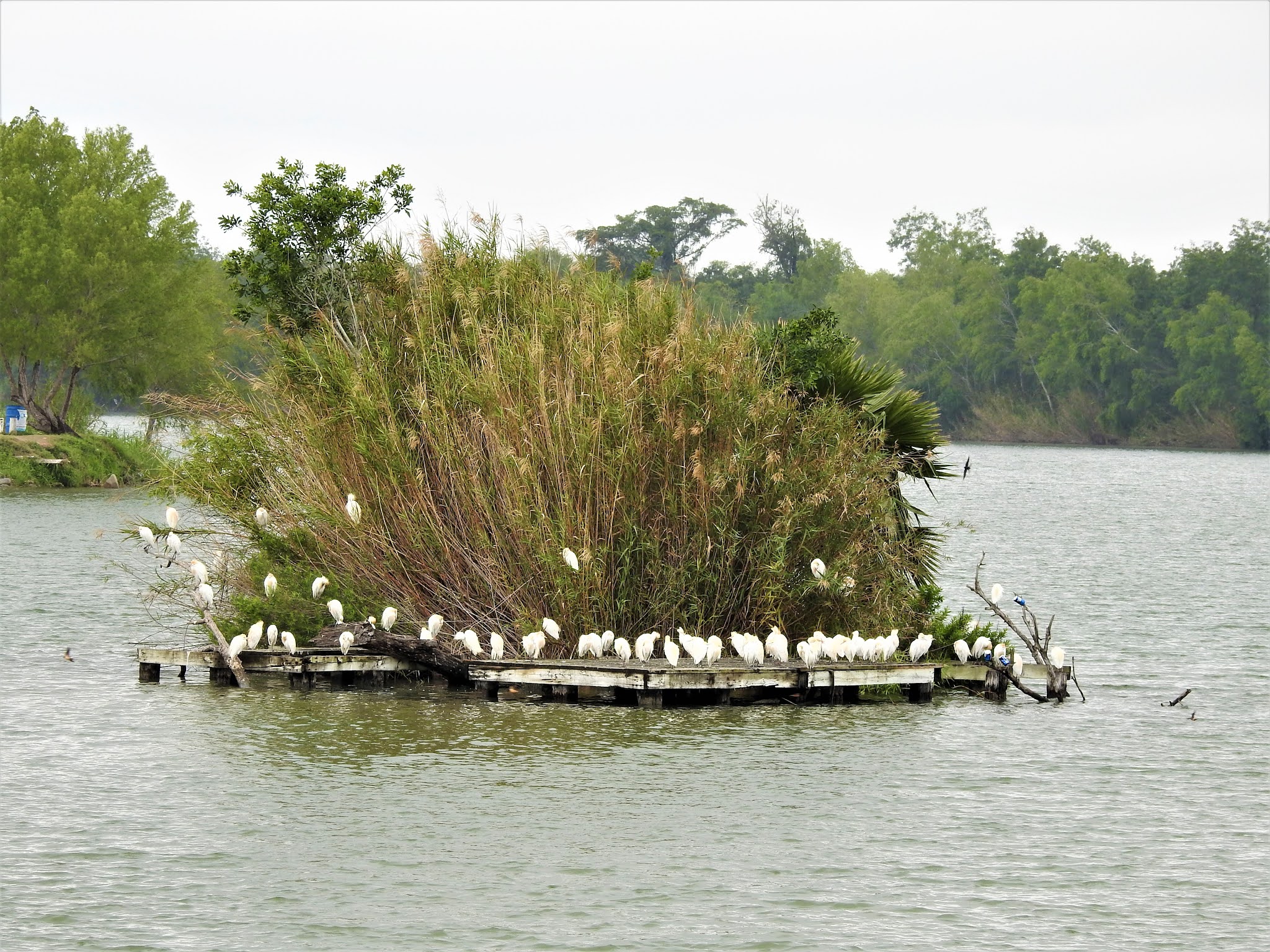
I decided to make a detour and attend this geocaching event in Victoria, TX. Heading down US-183, I made a stop at the San Pablo Cemetery in Lockhart for another quick geocache find (GC3QKN0). The San Pablo Cemetery has about 100 burials beginning in the late 1930's and is still in use today.

Stopping again at the Luling City Cemetery for another cache (GC3VCVD), you also get a view of a giant watermelon. In 1954, Hermon Allen, principal of the Luling Elementary School, proposed the idea of a celebration to honor the growers and promote the Luling watermelon market. The festival includes a watermelon contest for the largest grown. The biggest Black Diamond champion melon in the festival’s history weighed in 141 pounds. The event has grown so large that as many as 30,000 people have attended.


Arriving down in the town of Gonzales, TX, I stopped for a virtual geocache at the "Old Time Justice" (GCGB8Q). The jail was built in the 1880's and is now a museum. It wasn't open at this time. I'll have to return one day to take a tour myself. The photos of it look interesting.

There's a legend that while Albert Howard was waiting for the date of his hanging from his jail cell, he had a view of the clock tower on the courthouse to watch the time. Until the very end he swore of his innocents and said that the four faces of the clock tower would never keep the same time again as long as he was hanged. Over the years and several attempts to fix it, the clocks have never kept the same time.


Then there's also the "Immortal 32" virtual cache (GCG84Q). In February 1836, Colonel Travis sent a letter from the Alamo to all Texans and all Americans while under besiege by the Mexican Army. Only 32 men answered that call for Texas Independence and all 32 were from the town of Gonzales. This memorial and reflecting pond are dedicated to those brave 32 men who gave their lives in support of their brothers at the Alamo.


Well I made it down to Victoria, TX at the Ted B. Reed Park for the geocaching event (GC83TBD). There were eight in attendance and always good meeting other geocachers. I got to stay for a little while before hitting the road and continue south.


Just to the west outside of Victoria is my next geocache at the Coletoville Cemetery (GC4T8AB). Originally named Steiner's Settlement, after early German Carl Steiner. The settlement dates back to 1849. When an epidemic of diphtheria hit the German settlement, two of August and Thekla Spitzer's children died. Ten-year-old Henry and six-year-old Robert were buried by their parents in 1873 on this site. In May of 1873, the Spitzer's deeded the land to the trustees of the new school and evangelic German church of the German community of Steinerville. The community was later renamed Coletoville for the nearby Coleto Creek.

Continuing southwest into Goliad County, my next stop was at the La Bahia Cemetery (GC282ND). There you'll also find this significant memorial of the Texas Independence. After the battle of Coleto (March 19 - 20, 1836), where a Texas Army under Col. James Walker Fannin met defeat by Mexicans in superior numbers, the Texas soldiers were held in Presidio La Bahia, supposedly as war prisoners.

However, by order of Mexican Gen. Antonio Lopez de Santa Anna, 370 of Fannin's men were marched out and massacred on Palm Sunday, March 27, 1836. The wounded were shot one by one in the fort compound. Col. Fannin was the last to die. Because of their profession, Drs. J. H. Barnard, J. E. Field and Jack Shackelford were spared; about 25 men were saved by a Mexican woman, "The Angel of Goliad". Approximately 30 escaped by feigning death or by swimming the San Antonio River. The Texans' corpses were stripped and partly burned, but left unburied.

This atrocity three weeks after the fall of the Alamo gave Texans part of the battle cry -- "Remember the Alamo! Remember La Bahia!" -- under which decisive victory was won at San Jacinto on April 21, 1836. Gen. Thomas J. Rusk and the Texan Army afterwards marched here and gathered the bones of Fannin's men from the terrain. From Presidio La Bahia the remains were carried in procession to the grave, and there given a military funeral and burial on June 3, 1836.


Amid the cruelties of the Texas war for independence, one notable woman committed acts of bravery and compassion. Francisca Alavez ("The Angel of Goliad") accompanied Mexican Army Captain Telesforo Alavez to Texas in March 1836. In seven incidents between March and April, she intervened with Mexican troops under command of Gen. José de Urrea to help captured Texian prisoners at Agua Dulce, Copano, La Bahia, Victoria and Matamoros.

On March 20, Maj. William P. Miller and 75 men of his Nashville Battalion were captured as they unloaded their ship at Copano Bay. Alavez insisted that binding cords which cut off circulation be removed and food and water be provided. The men were moved to Presidio La Bahia at Goliad, where hundreds of Col. James Fannin's troops were already held after their capture at Coleto Creek. At least 342 men were taken out of the fort on March 27 and shot under orders of Gen. Santa Anna in what was termed the Goliad Massacre.

Alavez helped save the lives of many men, including 16-year-old Benjamin Hughes. Another Survivor, Dr. J.H. Barnard, recalled that she pleaded for their lives, helped sneak out some troops at night and hid some of the men. Her humanitarian acts included tending to wounds and sending messages and provisions to those still imprisoned.


Driving into Berclair, TX, I first arrive at the Berclair Cemetery for my next geocache (GC38VDX). Berclair was a ranching area when the railroad arrived in 1889. The name supposedly derived from the combination Bert and Clair Lucas, one of the ranchers. A hotel was built to provide housing for the railroad workers in 1887 and travelers once completed. A post office was established in 1889. The cemetery below covered in spring wildflowers.


One remaining attraction in Berclair is the haunted Berclair Mansion (GCYFCJ). This 10,000 square foot, 22-room mansion was built in 1936. Etta Terrell had the house constructed out of concrete and steel in an effort to "fireproof" it after her previous house burnt down. Etta and her four sisters lived in the house. Etta passed away in the house in 1956. The sisters remained living in the mansion until the last one passed away in 1968. The homes furnishings remain as the sisters left them with antiques dating back to the 1700's. Then in 1999, the heirs in the family donated the mansion as a museum to the Beeville Art Association.

The Art Association hired maintenance workers and landscapers to keep up the property. It was about this time when unexplained sightings and sounds started happening. Several reported seeing elderly women in the windows, waving to them. Volunteers for the museum say they’ve heard voices as well as doors closing in the otherwise empty house, for no apparent reason. And the Corpus Christi Spook Central’s supernatural investigation team has reportedly recorded at least 10 unexplained voices occurring in the mansion over the period of one night.

The house is open for tours the last Sunday of each month. We may have to come back for another visit one day.


Still having 3 hours of driving to go plus stopping at the grocery store and grabbing dinner, I made that the last geocache for the day. The was a lot of historical and interesting stops today that I didn't get to explore more. Just means I'll have to go back again one day.

Thanks for stopping by and I hope to see you again soon.  

Saturday, December 12, 2020

2019-04-02: Driving Over to South Padre Island, Texas to Find Virtual Geocaches

Hey everybody! So after being off work for nearly two months, they've called me back to the wind farm down in the Rio Grand Valley in South Texas. I've enjoyed the time off out geocaching as you may have guessed from my previous blog posts. But after a couple of geocaching roadtrips, it's time to go back to work.

Being back for a week, today we got some rain which made it a little too wet and muddy to work. So we got off a bit early. But it's never to wet for geocaching. I decided to take a short roadtrip from the westside of the RGV to the eastside.

I arrived on South Padre Island, Texas and to my first virtual geocache (GCB15D). "Sailed Through This Pass" is a monument dedicated to the brave fishermen who have used this port and ventured into the Gulf of Mexico.


Now backtracking westbound, the next two virtual geocaches are near the Welcome to South Padre sign at the bridge to the island. Well actually one of them IS the welcome sign (GC7B7K1). And the other is nearby for a reminder of when an 80 feet section of the Queen Isabella Memorial Causeway bridge collapsed after a barge accidently hit one of the pillars in 2001. The virtual geocache (GC8753) recognizes the memorial for the eight motorists who lost their lives as well as a monument for the survivor.

There's also a statue of the islands namesake. Padre Jose Nicolas Balli's (1771-1829) family immigrated from Spain in 1569 and became large landowners in the lower Rio Grande Valley. In 1800 Balli applied to King Charles IV of Spain for 11 1/2 leagues of land on the island, and in 1804 started its first settlement, Rancho Santa Cruz. Padre Balli served as collector of finances for all the churches in the Rio Grande Valley. He also founded the first mission in present Cameron County. His ministry was a great influence on the lives of early South Texas settlers.


Back on the mainland side of the bridge is the "Beacon of the Night" (GC83C9) virtual cache. The Point Isabel Lighthouse was built of brick in 1852 and brought from New Orleans by schooner. The beacon's 16 mile range guided ships into the harbor and to the Rio Grande. It is one of the oldest lighthouses on the Texas Gulf Coast. It also played a significant part in military operations around the mouth of the Rio Grande for over a century, with some interruptions, has served the region as an aid to seamen.


The next virtual geocache called "Catch and Release" (GCAEC0) was located at the Pirates Landing Restaurant. Supposedly there was a world record sheepshead fish caught there on the pier. Looks like a big fish. Is it true? Can't tell you that as I haven't found any verification of such record. But what I did find was the World Record Largest Fly Fishing Rod.


And finally the last one I had time for was the Palo Alto Battlefield National Historical Park (GCC88D). This prairie of sharp cordgrass, dense mesquite, cactus and other thorny plants was the location of the first battle of the Mexican War. United States troops led by General Zachery Taylor, whom later becomes the 12th U.S. President, went up against and defeated Mexican troops led by General Mariano Arista.


Well that's it for this quick trip across the Rio Grande Valley. Time to grab a quick bite to eat and drive the couple of hours back to Falcon Lake on the westside. I hope to see you back again soon for another installment of the AwayWeGo's Geocaching Adventures. 

Saturday, December 5, 2020

2019-04-01: Geocaching and Exploring Early Mexican-American History in the Rio Grande Valley of Texas

Hello and Welcome Back! So after my long and packed roadtrip from Texas to Minnesota and back, I had another two weeks off before getting called back to the wind farm down in the Rio Grande Valley. I managed to get one week of work behind me before overnight and this mornings rains made it too muddy to work. But a rain day off from work means an extra day for geocaching and exploring early Mexican-American history of small towns in the Rio Grande Valley.


My first stop is the town of Roma, Texas, just a few miles down the road from where I'm staying. A new cache was published over the weekend called "Cactus House" (GC85FFK). Just a couple of blocks from Roma's point of entry bridge over the Rio Grande River into the United States, is an old long abandoned brick house that's been taken over by nature. I found the geocache on this Monday morning and a nice clean log sheet to claim a First-to-Find!


From there I went a few blocks over to the Roma Historic District. Not a typical border town settlement, Roma, founded in 1765, is distinctive for its historic high-walled, gated, family compounds that reflect strong ties to 18th century northern Mexico, which was then part of the Spanish Empire. The planning, colonization and land grant system was the brainchild of Jose de Escandón and focused on civil development. Today, Roma is the only American Spanish colonial settlement that preserves the character of Escandón’s town planning.

The community is directly across the river from Ciudad Miguel Alemán, Mexico. The Roma Historic District, a National Historic Landmark district in the City of Roma, contains architecture influenced by Spanish colonial culture and by the bustling 19th century Rio Grande trade route that brought goods and people from the Gulf of Mexico to the continent’s interior. The Roma Historic District contains the best and most intact collection of ethnically diverse buildings and structures in the border region.

The site of Roma was part of the Mexican town of Mier about 10 miles northwest of modern Roma, in what was New Spain’s Nuevo Santander. Don José de Escandón founded the Spanish colonial province of Nuevo Santander in the mid-18th century. Spanish colonists from Mexico settled Mier in the 1750's and received land grants along the Rio Grande, where they formed family ranches. In the 1760's, the Spanish colonial government granted two tracts on the northern side of the river to the Salinas and Sáenz families, who were among the founding families of Mier and whose descendants still reside in Roma. The tracts they received were the first permanent European settlements at the Roma site.

Soon after the Mexican War for Independence ended in 1821, Roma became an independent community. One of the earliest records of Roma is in American colonist Stephen F. Austin’s chart of Texas, which literally put Roma on the map. After the Mexican-American War ended, Roma belonged to the United States. In the 1840's, Euro-American entrepreneurs settled in Roma, Texas, and married into the founding families.

German immigrant and master-builder Enrique (Heinrich) Portscheller settled in the region in 1865, married a Mier woman, and eventually moved to Roma. Portscheller added to the beauty of the local building techniques with his trademark decorative molded brick and use of New Orleans-type wrought-iron balconies. In addition to his work in Roma, Portscheller designed buildings in the border towns of Mier, Rio Grande City, and Laredo. Though there are other towns where this type of brickwork endures, Roma sustains the highest level of density, integrity, and quality in its 19th century Rio Grande brick and stone craftsmanship.

The John Vale / Noah Cox House (GC7JGVK) served as both a home and business location for John Heinrik Vale and Noah Cox, who were deeply embroiled in Civil War activities in Roma. Vale, a Swedish immigrant, had come to America in 1840 seeking adventure. During the Mexican American War, Vale volunteered for Zachary Taylor’s Army of Occupation and was encamped in Camargo. He chose to remain in the region, marrying a woman from Ciudad Mier in Tamaulipas and taking up residence across the Rio Grande in Roma. In 1853 he built a two-story home on the town’s main plaza.


Three years later he sold the house to Cox, a representative of the New Orleans firm of Stadeker & Mecklinburger & Cox, who continued to use the house as both a residence and mercantile center. In addition to his mercantile operations during the Civil War, Cox also served in the Confederate Texas Cavalry. For his part, Vale engaged heavily in the lucrative cotton trade that funneled through the city of Roma during the Civil War, doing business with Joseph Kleiber, a key player in Confederate business operations on the Gulf of Mexico. 

The geocache I found, my second attempt at looking, was on the ruins of the wall which surrounded the side and backyard. Hopefully they don't completely restore this section of the wall because I like the way it looks now.


Also built by John Vale around 1850's, the Leocadia Leandro Garcia House is similar in style and construction to the Noah Cox House across the Plaza. Originally, the house contained commercial space on the ground floor with residential space above. The house was later remodeled as a building for a dance hall and now owned by the Knights of Columbus.


Manuel Guerra, the legendary political and economic boss of Starr County, commissioned Portscheller to build his family compound in 1884. A native of Mier, Guerra printed his own currency to be redeemed by his ranch workers at his store. The two-story brick structure sits assuredly along the upper western edge of the plaza, extending for half a block with fine classical brick detailing and a historic two-color metal balcony that delicately embellishes its second story. A one-story warehouse completes the L-shaped complex enclosing a courtyard with original outbuildings. Never to be outdone by competitors, the Guerra family also operated the first gas station in Roma with a pump installed near the chamfered corner entrance (since removed).


The seven men, pictured in 1911, in Roman collars and broad brimmed hats were Missionary Oblates of Mary Immaculate (OMI) who had travelled from their missions scattered throughout the Rio Grande Valley along the river. Since 1849, this Calvary of Christ have been building churches and chapels from Brownsville to Laredo.


Arriving in Mission, Texas and turning back towards the river, I make another stop in Anzalduas Park. It's a riverside park popular with bird watchers. I was here once before and found a couple of geocaches. But there was one that I previously DNF'd (GC6AF7Y). Today was redemption as I found it this time. Out on the Rio Grande I could see why this park was popular among bird watchers.


At my next geocache (GC84NC2), I see the ruins of this structure up on the hill. Next to the Juan Diego Academy stands the remains of the Villa Queen of Peace (photo below and at top of page). Though the cache page says Oblate Monastery, I can't find any information about it's history or that it was indeed a monastery. So I'm not sure when it was built or what happened to it. If you have any information as to its history, please comment below.


Nearby was geocache (GC6Z60B) and my next piece of history. The La Lomita (meaning small hill) Chapel was constructed by the Oblates in 1865, then rebuilt in 1899 on these 122 acres willed to them in 1861 as it was nearly halfway between Brownsville and Roma. The Oblates moved their ministry to the growing city of Mission in 1908. Now it is a historical landmark, a park, and a place of pilgrimage.


Looks like an oven outside the chapel.


I hope you have enjoyed the sampling of early Rio Grande Valley history. There is much more to see if you every get the chance to be down in this area. I didn't even get to any of the cemeteries. Overall I managed to find many more quick roadside geocaches for a total of 32 finds for the day.

Until next time, I look forward to your comments here or on any of my social media accounts. Hopefully I have inspired you to go out and explore the rich history along the many backroads and small towns of this great country.

There are new ways to follow me. Follow the blog directly by using buttons on the right of your computer screen. Or through various social media platforms:  FacebookMeWeParlerGabTwitterInstagramMAGAbook, and Reddit. Follow us on any or all of these platforms and whichever you choose, please leave your comments. We'd love to hear from you and it encourages us to continue sharing our adventures.

Monday, September 7, 2020

2018-09-11: A New Country, the Twin Towers, and Ghost Towns Along the Rio Grande in South Texas

Hello again and welcome back to another edition of AwayWeGo's Geocaching Adventures. AwayWeGo.US is my geocaching name which I have been using since 2006.

Today's adventure is due to an overnight and early morning rain in the Rio Grande Valley. This made for some muddy conditions at work. And when working outdoors in construction building a wind farm, that means a day off. But makes for a great day to go Geocaching and exploring!

Having never been to Mexico before, this would be the perfect opportunity to grab a geocache across the border to achieve my fifth country. And on this September 11th day, I have the perfect "twin tower" cache in mind.


But let's not get ahead of myself. I started out in the small community where I was staying. Falcon, Texas was moved from an original Falcon at the junction of Medio Creek and the Rio Grande in southeast Zapata County during the flood in August 1953, which was caused by the completion of Falcon Dam in December 1952.

Settlers had been brought to the area by Col. José de Escandón in the 1750's. The Spanish crown set the land aside for the colonists of Revilla, known as Guerrero, after Mexican independence. In the mid-1700's the king of Spain granted 6,123 acres to José Clemente Gutiérrez, who later sold the land to José Clemente Ramírez. In 1780 Ramírez married Margarita de la Garza Falcón, thus uniting two of the area's most distinguished families, and moved to the old site of Falcón. The place was called Ramireño de Abajo. In the early 1900's Ildefonso Ramírez opened a general store there.

In 1915 a post office was established, and the village changed its name to Falcon, in honor of the wife of the founder. This was done because there was already a post office a few miles away called Ramireño, at Ramireño de Arriba, and the post office needed a different name. Old Falcon had 4.01 acres in common riverfront and 12.27 acres in its town tract. The government offered to move the settlement of families to Zapata, the county seat, where good schools, parks, water, sewage disposal, and paved and curbed streets would be available; but the families, whose ancestors had come to the area, settled it and opted to keep their site.

The government closed the dam before paying for the land and improvements, figuring they had several years before the water would rise—there had been six years of drought. The water suddenly rose after four days of rain starting on August 23, 1953, and on August 28 the 450 families of Lopeño and Falcon were hurriedly evacuated in a pouring rain. By the day's end, only the church steeple, a few windmills, and the tops of a few houses showed above the muddy reservoir. Residents of the inundated communities left behind furniture, clothing, toys, even pets. Some walked rather than accept rides from the hated commission that had built the dam and driven them from their 200-year-old settlements. Later, the government refused to pay them the full price for their homes and belongings because they were no longer usable.

The government had also picked out a common site for all of the local cemeteries, but all of the villages affected by Falcon Dam voted to buy their own separate sites. A total of 162 graves was moved from the old Falcon cemetery, only ten of them unidentified. The cemetery today has over 300 permanent residents. There wasn't a geocache here yet, so I hid one myself (GC7XMCW).


Six miles to the north is the new town of Lopeño. It replaced old Lopeño and four other small farming and ranching communities - San Pedro, San José, Santa Fé and El Tigre. Lopeño is named for Antonio López, husband of Doña Ysabel María Sánchez, to whom a 6,366-acre land grant, named Señor San José, was given by the king of Spain on July 16, 1767.

During the early 1800's a parcel of this grant passed to the Ramírez family, founders of Falcon. In 1821 Benito Ramírez constructed a combination home, fort, and chapel, known later as Fort Lopeño, which stood until covered by the waters of Falcon Lake. It was built at the Lopeño crossing of the Rio Grande. There was also a famous shrine in front of his El Tigre Ranch well, where local residents drew water, and worshiped before the Señor San José Church was built in Lopeño. The shrine, dedicated to Our Lady of Guadalupe, was artistically cut from limestone, with beautifully carved hands and feet, delicate features, and a chaplet encircling the crown.

Company K, Fifth United States Infantry regiment, maintained Camp Lopeño there for twelve days ending May 10, 1856, before returning to Ringgold Barracks, Rio Grande City, during the Cortina War. Serafín Benavides established a store at Lopeño in the early 1900's, the only supply point in the area at the time. Andrés Serna carried the mail by horseback from Zapata to Lopeño from 1900 until his death in 1908; he had a keen mind, but could not read. Before starting his route, he would have the names and destinations read to him, and would sort them in order, never making a mistake in his delivery.

When the original Lopeño was about to be moved, the International Boundary and Water Commission wanted all the displaced communities to move their cemeteries to a single location at U.S. 83 and Farm Road 496, but the residents insisted on separate cemeteries. They mapped out their graveyards and identified 1,501 of the 1,753 burial sites; Lopeño had 207 burials, thirty-eight of which remained unidentified. The new community and cemetery are located on a 6,525-acre tract of land first granted in 1767 to María Josepha Guerra. I hid a geocache there also since it didn't have one either (GC7XMFN).


Continuing north on US-83, I arrived in the town of Zapata. Zapata dates to Spanish land grants that go back to 1767. When the first settlers crossed the Rio Grande the town was called Habitacion. Then Carrizo, then Bellville after Governor Peter Bell. Finally the permanent name of Zapata was authorized to honor Col. Antonio Zapata, one of the founders of the Republic of the Rio Grande. In the early 1850's, two military posts, Camp Drum and Camp Harney, were located at Zapata to combat border disturbances and prevent Indian attacks. The population of Zapata increased suddenly when people from Guerrero crossed the river to escape the Mexican Revolution. In 1953, Zapata was another border town that moved to higher ground when Falcon Dam was built.

I found my next geocache at the Mertens Frontier Ranch Store and Museum (GCZRE6). It was an interesting looking gift shop. Couldn't go inside though since it was closed. Maybe next time...


Next was a quick roadside cache in Ramirez (GC20ZBK). Originally it was two miles south of its current site on the banks of the Rio Grande. The property was granted to José Luis Ramírez in 1784 by the king of Spain. It was not assigned in 1767, when most of the Revilla grants were made, because incursions of Comanche Indians made the area uninhabitable. Ramírez and his wife, María Bacilia Martínez, lived with their family in Revilla (Old Guerrero) until 1810, when they built a house of native hand-cut sandstone on their property across the river. The building stood until it was submerged by the Falcon Lake Reservoir in 1953.

The town of San Ygnacio was settled in 1830 - making it the oldest town in Zapata County. The San Ygnacio area was in the 18th century part of a large Spanish colonial land grant, extending on both sides of the Rio Grande. Early ranchos were established on the south bank of the Rio Grande, one of which, called Revilla (and later supplanted by present-day Guerrero), was across the river from the site of San Ygnacio. Jesus Treviño, a wealthy landowner from Revilla, purchased acreage on the north bank of the Rio Grande, and built a single-chamber stone structure in 1830, which is the oldest surviving portion of the rancho. This structure was probably not a permanent habitation, but was likely intended as shelter from the elements and Native American attacks. Treviño's son-in-law, Blas Maria Uribe, added to this structure in building campaigns between 1851 and 1871, which transformed it into the compound seen today. One of its features is a native stone made into a polished sundial and set into the north wall of the fort. It was named for the patron saint of Guerrero, Saint Ignatius Loyola.

There wasn't a geocache yet hidden in this town. So I visited the Blas Maria Uribe Cementerio where he was the second person to be buried here on April 24, 1895. The cache I hid there is GC7XMGN.


Confederate troops fought followers of Juan Cortina here during the Civil War. In 1890 revolutionaries against the regime of Porfirio Díaz led raids into Mexico from San Ygnacio. In June of 1916, troops of President Carranza crossed the border and engaged a U. S. Cavalry unit stationed there. During the early 1900's San Ygnacio had a post office, several stores, a drugstore and remained a commercial center for the region. The population in 1908 was just under 200 persons. It doubled by 1931 but decreased back to 225 by the end of WWII. San Ygnacio was used (like Roma) for scenes in the 1951 movie Viva Zapata with Marlon Brandon in the title role.

Driving down US-83 back towards the dam at Falcon Lake, I stop for 3 more geocaches at the county and state parks (GC1836V, GC3XEHA, GC3XEH5). Now off to the dam and my first cache in Mexico.

I was still a bit nervous about going across the dam over into Mexico. From what I had looked up it seemed like it would be a fairly easy adventure out to the memorial and back. But the fact that I didn't have a passport, just my drivers license, and the fact that it was the most dangerous section of the border with illegal crossings and drug trafficking, kept me hesitant.

Since my anxieties were already high, I skipped the first cache there by the U.S. Border Patrol and Immigration checkpoint. Not being a very busy crossing, I felt as though they'd all be watching me as I'm wandering around looking for some hidden object.

I drove to the gate and was stopped by a green uniformed Border Patrol agent. Explaining that I didn't have a passport, just my Florida drivers license, and that all I wanted to do was go halfway across the dam to take pictures of the memorial and the views... the big question... WOULD THEY LET ME BACK IN! He just kinda grinned and said that "he had no problem with it. But the guys in blue from Immigration on the return side might have some questions."

Officially called the International Falcon Reservoir, it is located on the Rio Grande east of Zapata. The huge lake is bounded by Starr and Zapata counties, Texas, and the county and city of Nuevo Ciudad Guerrero, Tamaulipas, Mexico. The dam and reservoir provide for water conservation, flood control, hydroelectric energy, and recreation. The project is owned, authorized, and operated by the United States and Mexico through the International Boundary and Water Commission. The project is named for the relocated town of Falcon.


The idea of a dam six miles east of the present site began about 1935, and the lake was approved by treaty at its present location in the late 1940's. Work began in 1951, and deliberate impoundment started on August 25, 1953. The reservoir was dedicated by presidents Dwight D. Eisenhower and Adolfo Ruiz Cortines on October 19, 1953. The five-mile-long rolled earthfill and concrete embankment was completed on April 8, 1954. The first power was generated commercially on October 11, 1954. The dam is 150 feet above the riverbed, with a crest elevation of 323 feet above sea level. Almost two miles of the dam is in the United States, and nearly three miles is in Mexico. The cost of the lake to the United States was $35 million. Flood-control benefits to the United States had totaled $130 million by January 1, 1986.


All lands on the United States side, except for Falcon State Park, are privately owned above 307 feet. The area of the lake varies from 87,000 acres at elevation 301.2 feet to 115,400 acres at the maximum elevation of 314.2 feet. The reservoir has a summer storage capacity of 2,371,220 acre-feet.

Each country has three 14,750-horsepower turbines running three 10,500-kilowatt generators at each plant. Four units are possible if needed. Under terms of the treaty the United States receives 58.6 percent of the conservation storage and Mexico 41.4 percent; financing of the project was based on the same percentages. The drainage area above the dam is 164,482 square miles; 87,760 is in the United States and 76,722 in Mexico. The United States side provides nine public access areas, including the dam itself, along which runs a two-lane highway connecting Farm Road 2098 and Mexican Highway 2.

I found this really cool website with more information about the history of the area, the building of the dam, and the archaeology of the settlements during construction as well as during a drought in the 1990's that had exposed many of the homes and churches that had been underwater for 40 years.


In the photo above, I am near the geocache (GC1N6HD) location in Mexico looking back towards the United States. After spending about 30 minutes out there enjoying the scenery, taking photos, and getting a new country for geocaching, I figured I'd better get back to Texas. But first... WOHOO!! Now I have found geocaches in 5 countries: the United States, Canada, Greece, Germany, and now Mexico!

So I pull back up to the checkpoint on the United States return side. Out steps the man in the blue Immigration and Customs Enforcement uniform, better known as I.C.E. After handing him my drivers license and he begins to ask some questions. I explained that I just wanted to get some photos of the monument and from the dam. I told him that I didn't go nor did I have any interest in going through the Mexican checkpoint. He asked about what brought me here from Florida and I told him I was working on the new wind farm that was beginning construction just up the road. He found that interesting and we talked about that for another few minutes until another vehicle finally pulled up behind me. Said goodbye and returned back to the motherland safely!

That's it for today. Hopefully you didn't get bored with all the rich history I included in the text. If you like that sort of thing, please let me know. Leave your comments below or subscribe to this blog with the button on the right. You can also follow me on Facebook, Twitter, Reddit, Instagram, and now Parler. Looking forward to your comments and letting me know you're out there.

See you next time...