Showing posts with label bushwhacking. Show all posts

Saturday, October 30, 2021

2020-05-10: Jeeping and Geocaching in a Florida Forest Finding some Creative Caches!

WOW, it was a fun day! Welcome back to my AwayWeGo's Geocaching Adventures Blog. Normally my adventures are roadtrips finding geocaches that focus more on the destination. Today was all about finding some creative geocache containers in the Osceola National Forest. So come on aboard the GeoJeep and let's see what kind of crazy caches we can find...


After talking to some of our local geocacher friends, we heard about a fun power trail (a lot of caches along a road at or near the minimum required distance apart) where the majority of the geocache containers were unique and amusing. These were located within the Osceola National Forest in North Florida, not far from the campground which we were staying in Fort White.


After a few hours of wheeling and tromping through the woods, we had found a total of 41 geocaches with only 1 DNF. Unlike the other of my blog posts, I give you the caches GC# and link to the geocache page. However for this blog, because I'm showing you photos of the geocache itself, I'm not going to provide that info so that you might be pleasantly surprised when you find it yourself. Your only hint as to the location is that they are just a few of the nearly 1000 geocaches hidden within the Osceola National Forest.

I leave you now with photos of these creative geocache containers. If these are sparked your interest in this hobby, feel free to ask a question or leave your comments below. I always look forward to hearing from my readers.

See you next week...


To follow along on our travels and keep up with my latest blogs, you may do so here of course. But also by using you favorite of these social media platforms: FacebookMeWeGabRedditParlorTwitter, and Instagram. These all link directly to my profile. Again, please feel free to comment and / or share.

Monday, February 29, 2016

2016-02-06: Geocaching and Canyon Hiking in Dickens Springs

Today we wanted to do some rough terrain hiking and Geocaching. Our last few months back in Florida, we starting doing the bushwhacking and hiking through scrub and swamp. While the chance of hiking a swamp in West Texas is ZERO, there is opportunity to do some bushwhacking through the forest.

About an hour east of Lubbock are several Geocaches with high terrain rating located within Dickens Springs. So after breakfast, we headed out on US-82 into Dickens County and the town of Dickens. After stopping by the historic Dickens County Courthouse and the County Jail buildings for photos, we arrived at the Dickens County Springs Park from 1891.


The history of the springs from the Historical Marker:
At one time, water covered this area. Sandstone, the prominent rock around this site, is porous, causing exposed strata at canyon rims to form a natural drainage outlet for upland aquifers, making possible the existence of these springs. Situated at the head of a canyon ravine immediately below the Upper Prairie Region of the Rolling Plains, the ancient springs have been a favored human habitat since the earliest human occupation in this region. Many nomadic tribes have used the site, leaving behind a wealth of archaeological evidence. 
John A. Askins and his family settled near these springs in late 1883, and it became known to pioneers as Askins Springs. A traveling real estate developer called Dr. M. S. Crow arrived here in 1891 and was a driving force in the organization of the town of Dickens about a half-mile west of the Askins land. In 1891 he gave a speech proclaiming his intent to give ten acres around "Crow Springs," as he called them, to the town of Dickens. The new city park became known as Dickens Springs. Generations of Dickens citizens and tourists, attracted by the rugged and colorful scenery and the unique collection of plants, have visited this site for picnics and social gatherings. In 1978 the departments of Anthropology and of Park Management at Texas Tech University made an intensive survey of the land surrounding Dickens Springs. Though many artifacts were lost to souvenir hunters, the university workers uncovered a variety of ancient tools, rarely of local origin. In the 21st century, Dickens Springs continues to provide water and beauty to the area for modern visitors as it did for the nomadic peoples of the past.

So we drove towards the springs and canyon area and about halfway down the entrance the road forks. Naturally I take the right fork. Not having ever been here before, we later learned I should've went left. You'll see why as you continue reading!

We arrive at the parking area for the Chuck Wagon (GC4ZZA4). A quick find of our first cache, and we go check out the chuck wagon. A makeshift replica of an old west covered wagon with a picnic table in the center. Hopefully in the hotter summer months, they have a canvas giving shade to those having a picnic.


As you can see from the photo above, if you do decide to have a picnic here, you will have an incredible view of the canyon. Our next cache was called the "Forgotten Picnic Table" (GC552R2). Looking above at the picture again and the trees in the foreground, that's where the spring flows. That's also the location of our next cache. DOWN into the canyon! We started down what appeared to be several different trails leading down, but none panned out. So we just started bushwhacking our way through the trees, bushes, and thorns.

It's kinda hard to tell in the photo below, but the first is looking down through the trees what we had to get through. After about 30 minutes, we finally made it to the bottom and found the forgotten picnic table and the cache.


Now the next cache seemed to be in the direction of the top of canyon on the opposite side about 1/4 mile away. But before we climbed back up the opposite side, I wanted to find the origin of the spring. Plus it was kinda going in the same direction anyway. So we followed the small creek upstream to the spring.


REALLY?! We arrive at the springs only to find stairs and a trail leading UP to the other parking area. Yeah, remember that fork in the road I mentioned? If we had taken the left fork, we could have parked and taken the easy way down into the canyon. I know, I know... where's the adventure in that right? So we check out the springs and take the trail up to the giant steel teepee covering another picnic table.


Now checking out the remaining caches, we were now closer to The Mystery of the Dug-Out-Mine cache (GCHYXZ). While not really a mine, this is actually a replica of the original first home built around 1878 by John Askins (even though the above sign at the entrance suggests 1883). The dugout was a common sense first home for early settlers in timber poor West Texas. John Askins traveled to Colorado City, TX for the tin used to roof his dugout. The remains of the original dugout were located about 200 yards to the south. But this method was a quick way to get shelter until more lumber or brick could be brought in to build a house.


Finding the cache above and behind the dugout house.
Looking back down the canyon from the cache in the above photo, if you look closely to the top right side, you can hopefully make out the frame of the chuck wagon. We bushwhacked our way down to the forgotten picnic table below the trees in the center of the photo. Then towards the camera to the right for the springs and up to the dugout house out of the photo to the right. Now the last cache was over to the top of the hill to the left side of the canyon.


So we went back down the stairs to the spring and followed the creek a short ways until we got to within 200' of the cache (GCHYXW). Then it was climbing UP the side of the canyon through rock, sand, and trees to get to this boulder you see below. We searched for about 15 minutes without any luck. This cache on the opposite side of the canyon doesn't get looked for as often as the others. The last time it was found was in May of 2014. Since then there has only been one other cacher logging a DNF in March of 2015. And now almost another year later and our DNF. I don't like going through all this and not come away with a find.


Having now hiked back down to the creek, we decided not to go the short route back to the car which would also require bushwhacking back up the canyon. Instead we went back up to the springs and the teepee parking area, and walked the road back to the fork and then down again to the chuck wagon and our car. I forgot how long a walk it was going around the long way, but it felt like a mile!

Driving back up to the entrance of the park, there was one last cache (GC54JDT) to get and another short hike up the hill. If you look back up to the photo of the entrance, you'll see the hill off to the left side. Yep, we now had to hike up there too!

The last cache for the day was at the Dickens Cemetery (GC5HGQC). A quick find and we then headed back to Lubbock. Another long but adventurous day hiking in the wilderness. Yes, our muscles maybe a little sore, but definitely well worth it!

Monday, February 15, 2016

2015-11-18: Geocaching Around Jasper County Texas

This morning after dropping Candy off at work in Kirbyville, I drove further north up to Jasper County, Texas. Jasper itself is a small town with only a few Geocaches around. But I took a drive up to check out an apartment and to the more rural areas of the county to go Geocaching.

After picking up one cache in town at a half vacant shopping center, I drove north on US-96. My first stop was a small neglected cemetery. A couple of secondary roads off the main highway later, and passing by the overgrown hiking trail going up the hill towards the cemetery, I finally found the entrance.

It was about a 1/4 mile hike to a small fenced area of about 10' by 20' with only one marked gravesite. Baby Girl Behannon who lived only 9 days in 1884. Getting back to the cache though, it was still further into the woods and required some bushwhacking to get to. But having done so, I was not only rewarded with finding the cache but also finding a little creek.


Several more Geocaches later and I came upon another cemetery cache. Nothing particularly historical or significant with this one, but it was a cemetery cache.


The last cache for the day was a magnetic key holder hidden about halfway down a bridge over another creek. No place to park on the bridge, so I parked down on the shoulder about 250' away and walked back. After leaning WAY over the side to reach down for the cache and signing the log, I heard dogs barking. Looking in that direction, I saw 3 dogs barking and running towards me about 500'-600' away. YIKES! Fortunately the car is in the other direction! I quickly replace the cache and sprint towards the GeoMobile. Yes! Inside the car with doors closed with maybe 100' to spare. That was close.

Enough excitement for today.

Thursday, February 11, 2016

2015-10-18: Out for a Sunday Drive and Geocaching Along the Way

Today was a day for a Sunday drive down the backroads of Florida to see what we can find while Geocaching along the way. Took the Turnpike north to Clermont where we stopped for breakfast at the Cracker Barrel. From there we headed out west on SR-50 all the way to Tarrytown. I think the last time out here we turned north on Hwy 471, so today we turned south.

We picked up a quick geocache at a guardrail crossing the Little Withlacoochee River. Then turning into the Richloam Wildlife Management Area to get a few more geocaches. The next cache we came was called JayJay's Swamp where our recent purchase of rubber boots came in handy!


A couple of more caches in the woods and a little bit of bushwhacking. When we started out this morning we didn't have any intention of doing ANY hiking today. But when you're so close, it's hard to resist! And then there was this one... We drove as close as we could get, we put the rubber boots back on and began the short hike along the trail. Even with the boots though, the water was starting to get too deep. It was heading towards the river. So we passed and backed out.
 

Continuing down 471 southbound, we found a few more roadside caches before picking up US-98 into Lakeland and heading back home.

2015-10-11: The Quest for the Apocalypse in the Ocala National Forest

Today's Geocaching adventure was planned shortly after the last hike and we couldn't have asked for better weather! The BAG+/- Group consisted of TeamFelixG, clark boys, Daykinator, saylorboys+mom and the two of us. We met up along CR-19 at Morman Branch Creek with a goal of conquering the Apocalypse caches.

But first following east, Barking Moonbat was the warm-up cache. After putting on the gear, we all headed down the short trail leading into the cool water. There were 3 of us who decided to wear knee high rubber boots based upon previous photos. Standing at the roadside looking down into the shallow waters, we thought a good choice on the rubber boots! However, it didn't take but a few steps disappearing into the woods to realize they proved worthless as recent rains made for high tide further down! It seems as the floor of the creek varies from shallow to deep and back again. And as one of the 3, I can say it didn't make any easier on the dry sections with a gallon of water in each boot. A quick find at GZ and we reversed direction back towards the Apocalypse...


Having made our way back to the cars, we continued following the creek towards the west, spending most of our time in the cool waters. We found it easier to move forward instead of bushwhacking through the brush. Which we occasionally did as the creek would twist to the right and left too far off course only to pick it back up again. Also upon crossing the dry spots, those of us with the boots would pause briefly for a yoga pose (see photos), draining the water from the boots. We arrived at Soulbait Springs for another quick cache find and getting ever closer to the Apocalypse.


The next cache along the Morman Branch Creek was called "I get by with a little help from...", Geocaching is a great example of "getting by with a little help from." Because if on days like this if we were to trek out here as individuals, where would the fun be? It's having such adventurous friends to share in the experience that's makes it all worth while. I think we are the newest members of the B.A.G. and have enjoyed each trip with our newest friends.


WE MADE IT! Our quest to conquer the "Apocalypse, When?," "Apocalypse-End," and "Paint Fiction's Apocalypse" caches was completed! We sloshed through the water, we squished through the mud almost loosing one member, we bushwhacked through the brush, we came, we found, and we conquered! Then we celebrated!


But was it really the end? Of course not! We could have backtracked along the coolness of the creek towards the cars. But been there, done that. We've seen that already. The adventure is always to press forward, to see things previously unseen. Plus there were two more caches to get. The plan was to hike all the way down to SR-40 where a rendezvous vehicle was left to take us back to Morman Creek on CR-19. However, due to time constraints of one member of the group, we were only able to grab one of the remaining two caches because they were in two different directions.

We continued bushwhacking south towards SR-40 and towards the next cache called "Outta the Boat." This cache hadn't been found in THREE YEARS! Upon arriving at ground zero, the search began. Most of the time finding an ammo can in the woods is fairly easy. However this one had three years worth of growth and decay to cover it. 

Another good reason to go Geocaching with a group of friends. Not only for the camaraderie, but for having more eyes to look! As we moved about searching and re-searching, saylorboys+mom was practically standing on top of it. Then as she moved away to search another location, I moved into where she was just looking and began poking my hiking stick into the ground when I heard a THUMP! Removing all the debris, I found the three year lonely cache!


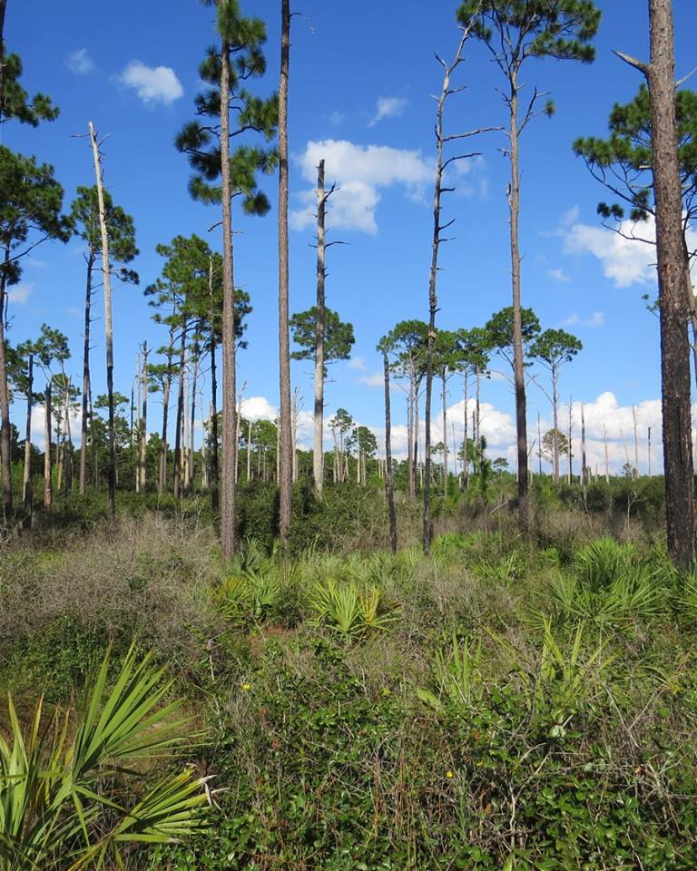
From there is was non-stop bushwhacking through the thick palmettos, brush, and occasional briers. There was supposed to be a trail somewhere along the way to make it a little easier, but we didn't come across it until nearly reaching SR-40 and TeamFelixG's pickup truck.


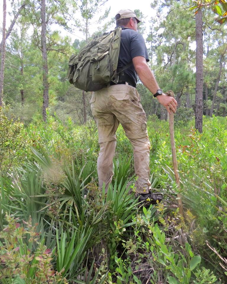
Standing on a fallen tree to see if there's a trail to be found.


We made it back to the transport truck and back to civilization! After driving back around to the Morman Creek parking area, two of us had to depart and head back to Tampa. As if what we just went through the past several hours wasn't enough punishment for one day, the remaining four of us decided to drive further north to find Pat's Island Sinkhole. There was a digital souvenir available for finding an earthcache, and we each still needed one.

So we hopped into our GeoMobiles and drove a few miles north up to Forrest Road 51, then west over to the Florida Trail. There you'll find Pat's Island Trailhead. Another mile long hike through the woods and we found the sinkhole. Three of us climbed down to the bottom and got the required info needed to achieve a find, while Candy stayed up top to take our photo.

Looking down.


It was another GREAT adventure! We found and conquered the Apocalypse, experienced the great outdoors in old natural Florida, and enjoyed the fellowship of friends. I glad you stopped by to read about our adventure. Feel free to leave your comments. I look forward to hearing from you.