Showing posts with label train trestle. Show all posts

Sunday, June 9, 2019

2017-09-24: Geocaching a Couple of Pioneer Cemeteries in Texas

So Friday night we drove over from West Texas into the Killeen/Ft Hood area to look at some houses to rent. That is how we spent yesterday. Today we made the drive back to Monahans, stopping a few times along the way to grab some Geocaches.

Our first cache was a quick one right at the hotel and then another in the Walmart parking lot. Then we drove over along side the airport to find the Brown (Okay Community) Cemetery cache (GC4QKZ8). 

Elisha Ivy, for whom Ivy Mountain Road was named, established a home and store in this vicinity in the 1860s. In the 1870s, a community known as Liberty Hill developed northwest of his property. In 1896, when the rural settlement applied for a post office, its name was changed to Okay. Area residents supported churches, a school and businesses, and Samuel Marion and Mary Elizabeth (Evans) Brown set aside land for a community burial ground, formally deeding it in 1907.

As military installations in the area grew, the community of Okay was displaced and ceased to exist in the early 1940s. In 1953, the U.S. Government decided to extend the runway at Gray Air Force Base, where the Brown (Okay Community) Cemetery was located, approximately 1,600 feet southwest of this site. The Army Corps of Engineers moved 70 graves, 30 of which were for unidentified individuals, to this location and aligned the burials similarly to original positions. The earliest marked grave dates to 1882 and is that of infant David Davis. Today, the cemetery is a reminder of the Okay community and the families who lived there, added to the long list of ghost towns.

Our next stop was for another Brown Cemetery geocache (GC3D2BY) just outside of San Saba, TX. After living for a time in Arkansas, John H. "Shorty" Brown (1817-1896), his wife Jane Ann, and some of their children came here. Brown helped found San Saba in 1854 and became a civic leader. Although San Saba County provided a graveyard, Brown and his wife deeded this plot of land near their home for a family burial ground. Jane Ann, who bore 17 of Browns 21 children, was probably the first burial here about 1874. Brown's son and son-in-law who were murdered are buried here along with other family members and friends.

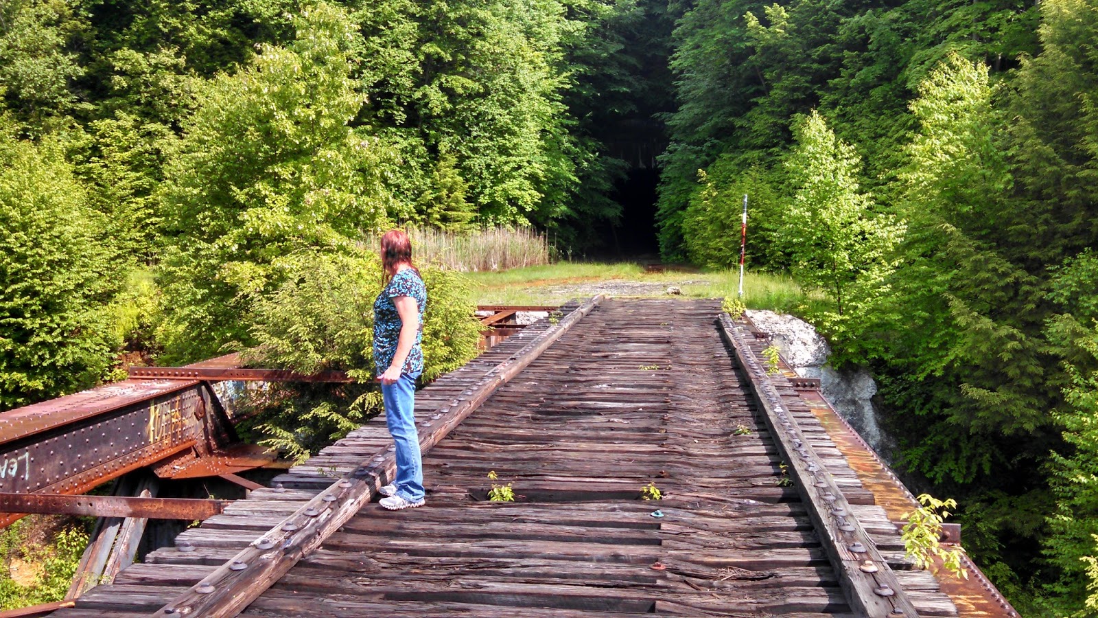
Next to the cemetery is a community park that has a train trestle railroad track passing over the entrance that made for a nice photo. I just wish I could have removed those signs first and then taken the picture.


Our next and last geocache of the day was located in a town called Eden, TX. The Pioneers Rest Cemetery (GCM02B) was set aside in 1882 when the town of Eden was platted by Fred Ede. Though older burials may be present, the earliest tombstone is that of the five-week old infant son of Frederick and Susan (Reynolds) Shutt, buried in 1882. Several graves for children and infants bear witness to the harsh conditions of pioneer life.Adults, too, faced difficult time. John Emmett Molloy and Charles Edward Waring both were killed in accidents with horses. According to oral history, a woman named Carson was killed by a runaway horse in 1887 and is buried in an unmarked grave of an estimated 33 or 34 burials believed to have taken place here, only fifteen tombstones remained standing at the dawn of the 21st century, but Pioneers Rest Cemetery continues to be a chronicle of Eden's history. Unfortunately when it comes to the cache, this one was a DNF as it was missing.

Not as big a geocaching adventure as usual, but this wasn't a caching trip. More of taking care of some business with some caching tossed in to break up the long drive. Thanks for stopping by to read our blog. See you out at the next cache...

Wednesday, February 17, 2016

2015-12-05: A Forestry Museum, Cemeteries, Train Trestles and More Geocaching!

FINALLY! After two weeks in a Beaumont hotel, we finally moved into an apartment up in Jasper, Texas! Now we can finally unpack the cars, cook meals, and have some room to move around! That also puts us about an hour north and more opportunities to grab caches in new Texas counties.

The downside however is that the nearest Starbucks is either back down in Beaumont or almost an hour to the north west up in Lufkin! And it has been a rare occasion for Candy to go without her daily Starbucks. Having to work all week, Saturday and Sundays are not only gonna be Geocaching days, but a run to a Starbucks day too!

So this morning we took US-69 north and headed for Lufkin! After arriving in Lufkin and getting our Starbucks and breakfast at Cracker Barrel, I looked for caches in and around the town and saw a virtual cache. And we always try to get the virtual caches. This one was at the Forestry Museum. My first thought was that it would be a quick "find the answer and go" museum. But as it turned out it was rather interesting! We spent close to an hour there inside and outside looking at all the displays and learning about the industry. We also took 55 photos! But we won't bore you with that many. Just three pics: one inside and one each of Candy and I on the old train engine. A cool place if you're ever in the area and it's also FREE to enter and browse around.


Another quick cemetery cache there in Lufkin and we headed back down US-69 to pick up some more geocaches along the way. The next stop was an old train trestle bridge. It was last found in December of 2013, with 3 DNF's in 2014 and nothing since then. I wanted to keep this piece of the past from going unnoticed. It's these locations that keep most of us Geocachers playing the game. I mean why else would anyone go down here. If we were not cachers, we wouldn't have stopped in this town. Just in case, I grabbed a couple of replacement caches depending on what we found (or didn't find) in order to keep this one active.

So we parked the car on the edge of a community park where the once laid railroad tracks passed through. We walked into the woods on the overgrown trail about 1/4 mile to the bridge. Looking all over the top and down below, I found only a tether attached to one of the pylons. If that was the cache, I can understand why it was missing. Looking at all possible locations, I decided it best to place a magnetic micro cache on one of the metal brackets that is reachable from the top, but only viewable from the bottom to make it more difficult to get muggled.

The only downside was that the container was white on a dark brown and black trestle. It stuck out like a sore thumb to any kid or person out there who may spot it. But I left it there in place. When we got back this evening, I looked up one of the local cachers to see if they go out there to: 1) make the find for themselves and 2) bring some brown spray paint to better hide the container. Which they agreed they would do so.


Another stop in Huntington was a cemetery cache. The geocache coordinates took us into the woods next to the cemetery a ways and we looked unsuccessfully for about 10-15 minutes. There was also some recent clearing and some new barbed wire put up between the woods and cemetery. So the best guess was that the property owner found and removed the cache. Oh well, you do have to DNF one at times.

The next cache down the road was a historical marker for the ghost town of Jonesville, TX located in Angelina County. Jonesville was the second of Angelina County’s four county seats, sandwiched between Marion and Angelina (aka Homer). It served in this capacity from 1854-1858. Jonesville never grew and in its short reign as county seat the people never got around to building a courthouse. County offices were rented. The 1858 election that made Angelina the county seat spelled the end of Jonesville. Ballots were said to have been burned and the resulting vote was recorded as 221 to Angelina while Jonesville got a mere 130. Jonesville residents fought with an opposing group from Angelina and some 40-50 people were indicted for the fracas. After the election Jonesville started into a decline from which it never recovered.


Continuing further south on US-69 and entering into the town of Zavalla, we found another cache at another old train trestle. Two train bridges in one day! This one right along side the highway and easier to get to. But still a nice piece of forgotten history.


A few more geocaches around the east of Zavalla through some rough forest roads towards the Sam Rayburn Lake. Sometimes I drive our GeoPrius places that it just wasn't meant for it to go. That's why Candy bought me a license plate for the front that says: "My Owner Thinks I'm A Jeep." It would be an adventure if I kept it on the pavement!

That's it for today. I hope you are enjoying my blog of our Geocaching adventures. Feel free to share it with your friends.

Friday, January 29, 2016

2014-06-11: Road Trip Day #5 Hiking the Rails in Pennsylvania

Today is another big day! Not only is today my birthday, but today we're setting out to get a Geocache that has been on my watchlist for a couple of years. Another example of Geocaching bringing you to some really cool places!

If you were visiting western Pennsylvania or even Pittsburgh, you probably wouldn't have any idea this place was even here. It's not a tourist area. There's no signs directing you here. So unless you're either a local or a Geocacher, you'll probably miss out on this great adventure.

Just a few miles off of I-80 near the town of Clarion, NE of Pittsburgh, remains the remnants of a bygone era. The rails and ties that run through the woods have been removed. But the tunnel and the train trestle bridge remain. High above the Clarion River is the Clarion Trestle. Only used now for hikers, adventure seekers, and probably some party goers too.

After exiting the Interstate, we drive a few miles through some winding back roads until we reach the small pull off area for parking. I grab the backpack with water and flashlights and we begin the climb up the hill to the level ground where the tracks used to lay. Its not long before we see the eerie dark hole into which we must pass through. You don't realize the size of the tunnel until you reach the entrance. It was huge. Then excitement continues to build as you look into the darkness and see the tiny light coming from the other end.


I didn't think to measure, but the tunnel must have been 500'-600' long. It was damp and cool inside. And I didn't smell or hear any bats either, so that was good. Once we pass through the tunnel, we see the trestle bridge high above the river. Also, this side of the mountain seemed a bit foggy with a lite drizzle of rain. We started to venture out over the bridge, but the wooden R/R ties seemed a little slippery and damp. So we decided to follow the path running parallel to the river to get the Geocache. It was about a half mile hike through the woods with the last 200' going up the side of the hill.


After hiking out of the woods and back to the bridge, the sun had come out and began drying things off. So we felt a little safer out on the wooden beams and we decided to go walking out further and enjoy the views from high above the river. You just can't do this on most train trestles because they're still in use. You get caught in the middle of the bridge and a train comes, you got nowhere to go. Here you can take your time and enjoy the views, the peace, and the serenity.


And now for the really spooky part. With the sun shinning, warming the air, and high humidity, the cool damp air from within the tunnel began pouring out in a fog like a flowing river. And once inside the tunnel, the fog just filled the whole thing. The first time walking through you could at least see the other end. This time you couldn't see but 20' ahead. Kinda like driving through a thick fog at night with your headlights on. When we got to the center, we turned and looked in both directions and you could not see the outside.


Continuing to press on, we finally began to see the light at the end of the tunnel and made it back to the car. Across the street was another small creek. Beyond the creek you could see that there were several cement support structures that one held the railroad tracks crossing over on that side. They were probably 25'-30' tall. There was also a Geocache atop of one of those, but we hadn't anyway of climbing to reach the top of it.

On thing I learned was to always check ahead of time, even at the last minute, for any additional caches. Down in that little valley among the back roads, I lost cell phone service. Even with Verizon! Anyway, I had only written down and programmed those 2 caches from when I first started watching them. If I would have checked again that morning, I would have noticed that there was another Geocache located right at the bridge. Just a little hike down the side of the hill to its base and we could have made it two cache finds there. Oh well... another time.

We managed a couple more simple Geocaches that afternoon, but called it an early day after the long drive yesterday and into last night.