Showing posts with label monument. Show all posts

Sunday, March 17, 2024

2021-07: The Final Week of Our 5300 Mile Road Trip from Texas to Indiana to Florida and Back to Texas

In todays edition of the AwayWeGo's Adventures Blog, we're winding down these last few days of our 5300 mile road trip to purchase our motorhome. These last 2300 miles went by much faster than we would have gone in the past. Driving the big RV we stuck to the Interstates for the most part. I gotta learn how to route plan better so that we can still do some sightseeing and geocaching. We did stop to see a few things on some overnight stops. So climb onboard the big Eagle Bus and let's go for a ride...


After leaving the Cummins shop in Cincinnati, Ohio on Wednesday we jumped on I-75 and headed south. About an hour later getting through the Cincinnati traffic, I pulled into the I-75/I-71 Rest Area in Kentucky to park for the night. Thursday we drove nearly 400 miles into North Georgia and stayed the night in the I-75 Southbound Rest Area near Resaca, GA.

Friday is here and on the way down to Florida, I did stop at a rest area about halfway near Sycamore, GA to stretch my legs and grab a geocache (GC89X9V). We ended the day at a Cracker Barrel in St Augustine, FL along I-95. While there we had dinner with Candy's mother and brother.

On Saturday we drove down to Umatilla, Florida, where my mother lives, and stayed there two nights at the Olde Mill Stream RV Resort. This gave me a chance to spend time with my mother as well as see my two sons down in Orlando on Sunday. But alas it's never long enough time as we had to get back to Texas and back to work. I did manage to grab a geocache (GC46KYD) there in Umatilla before taking off.

Monday morning we said our goodbye's and drove 382 miles up to Troy, Alabama. We boondocked for the night in a Walmart parking lot. I did have some daylight left and drove over to the Bicentennial Park to grab a geocache (GC1C6D5) for Pike County and take these next few photos.


From there I drove the GeoJeep over to Crenshaw County. I stopped at the crossroads of US-331 and CR-50 at what seems to be an old abandoned gas station / country store. Nothing to buy anymore but I did find the geocache for the county (GC55ZNK).


Continuing north on US-331, there was another geocache stop that caught my interest. It had some recent DNF's so I didn't even bother looking for it. But I did want to stop for the photo opp. It was another Veterans Memorial (GC2W9EC) and I took the photo of the GeoJeep underneath the F-16 fighter jet you see at the top of this page. With more DNF's to follow the geocache was eventually archived, but I still added the GC link so you can find this memorial park.

And finally just one more quick geocache (GC5M26B) stop at a fireworks stand on the way back to the RV.

We noticed that the refrigerator had stopped working so I went into Walmart and bought a cooler and some ice. Most of our food went into it. Now I have to figure out where and when I can find a place to get it checked out.

Tuesday morning we left Troy, Alabama driving north on US-231 into Montgomery. There we turned west onto US-80. Arriving in Selma, Alabama, I stopped at a small Sunoco truck stop to fuel up. Not being very busy, we decided a good place to stop for a few while I took the GeoJeep to pickup some breakfast at Hardee's. This also gave me a chance to grab a geocache for Crenshaw County (GC5PYDF).

Continuing westbound on US-80, we eventually picked up I-20 westbound at the Mississippi state line. I eventually stopped again at a rest area in Scott County to stretch my legs and grab a geocache (GC7JVWB). With just over 500 miles of driving for the day, we finally made it to the Texas Welcome Center on I-20 and parked it for the night. I got out to stretch my legs and grabbed another geocache (GC6Z4ZB).

On Wednesday we arrived in Killeen, Texas where my Candy's daughter lives. It was the house my wife lived in for a few years before she started traveling with me. If you've been reading my blogs for a while, you might remember most of my blog posts were about the long drive on Sunday back from Killeen to a jobsite somewhere in Texas.

Candy's granddaughter is now home after her three week road trip with us around the country. And we are able to gather much of our clothes, dishes, and other items we still had stored there and load them into the motorhome. Now our new home-on-wheels feels more like our home.

I did find an RV repair place nearby in Harker Heights to finally get our refrigerator checked out. We boondocked in the parking lot of the old shopping center which they occupied the end of. While waiting, I did drive over to the Pleasant Hill Cemetery and grab a geocache (GC6G1Y5). It is one of the oldest cemeteries in Bell County and dates back to 1855.

Lone Star RV Service eventually was able to check out the refrigerator on Friday. Turned out to be a bad motherboard. Surprisingly there was a recall on it twenty years ago and it had never been completed on that unit. So it would be fixed for FREE! The downside was that it had to be ordered and take a few weeks. But they did show me how to temporarily get it working using a magnet to reset it.

After a few days of boondocking, we needed to dump the tanks and get fresh water. And being late in the afternoon, we decided to wait until morning to get back on the road. So we found an RV park over in Kempner.

Thirty minutes later and about a mile away from the Rocky River RV Resort, the engine temperature gauge on the dash starts to climb and the warning buzzer goes off just as I'm pulling in the entrance. I park in front of the office and steam is coming out the back of the motorhome and the Jeep is covered in engine coolant. The guy from the RV park and myself is looking it over but the Cummins diesel engine is just covered in coolant. He calls a diesel mechanic he knows and the guy is able to come first thing in the morning to check it out. I let it cool down a bit, do our check in, and drive over to our spot for the night.

The mechanic drove over from Waco Saturday morning and was able to diagnose that a freeze plug was leaking on the side of the head. He pulled out the bad plug and drove into town. A couple of auto parts stores later, he was only able to find one of those temporary rubber expandable plugs to install. But it works and that's what matters.

We stayed one more night there in Kempner. Sunday morning came and we finally got back on the road. We headed up I-35 northbound through Dallas and arrived in Bonham, Texas just in time to be back to work on Monday.

Three weeks and over 5300 miles later, this road trip adventure comes to an end. Here's a recap and links to the blog pages if you missed any of it:


To follow along on our travels and keep up with my latest blogs, you may do so here of course by clicking the "Follow" button to the right. And there's also my main website at AwayWeGo.US for the complete index of my traveling adventures going back to 2005. But also by using one or more of your favorite of these social media platforms: FacebookMeWeGabRedditTwitterGETTRInstagram, and TruthSocial. These all link directly to my profiles. Again, please feel free to comment and / or share.

Thursday, March 30, 2023

2021-03-30: Visiting history in St Louis, Missouri via Route 66 and the Gateway Arch on Day 8 of our 3404 Roadtrip Adventure

Welcome back friends! Today we finally make it out of the State of Illinois, cross over the Mighty Mississippi River, and into St. Louis Missouri. We'll pay our respects to some notable figures buried in the Bellefontaine Cemetery and I finally get a chance to stop for a visit to the St Louis Gateway Arch. So hop on board as we continue to Geocache through history...


Our first stop was a quick geocache (GC50RQ2) find in Greenville, Illinois to mark our overnight stay and getting a find for Bond County.

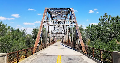
Then we jump onto I-70 westbound. Instead of taking it all the way into St Louis, we detour onto the northern I-270 route. This not only takes us into Madison County, IL, but also over to the Route 66 Chain of Rocks Bridge and an Earthcache (GC68M54). Over its 50 year history, Route 66 crossed the Mississippi River at five different locations: 1) McKinley Bridge, 2) MacArthur Bridge, 3) Old Chain of Rocks Bridge, 4) MLK Jr Memorial Bridge and 5) Poplar Street Bridge.


This crooked crossing spanning the Mississippi River was a memorable passage for Route 66 travelers. The privately funded bridge was built in 1929 as a toll bridge. The distinctive 22-degree bend in the middle resulted from the need to build on solid rock footings on the river floor. Eventually turned over to the city of Madison, IL, it became the US-66 Northern Bypass from 1936-1965. In 1967, the New Chain of Rocks Bridge opened just to the north replacing this one to vehicular traffic. Now it is a pedestrian / bicycle bridge. We walked out to the center where Illinois meets Missouri where there was also a virtual geocache (GC2258).


There is also one stage of a 5-part Adventure Lab Cache here. We were only able to complete the one question as the other 4 stages were back in the other direction and I'm not backtracking.

These two structures you see here are just south of the bridge and look like they're a couple of secluded castles. In reality, they are water intakes for a series of locks and dams for the Chain of Rocks Canal to the east. This 17-mile section of the Mississippi River is very treacherous to navigate with its rocky bottom. In the 1940's-50's, the Army Corp of Engineers created a straight canal on the eastside of Chouteau Island to make it easier for ships and barges to navigate and bypass the rocky rapids.


Next we looped up, around, and crossed the mighty river on the New Chain of Rocks Bridge into Missouri. Our first stop over here was in the Bellefontaine Cemetery just a few miles in. So there was one gravesite we came to see. But upon arriving, we discovered there was so much more history here to see. Such as...

... William Clark (GC7B7DX) of the Lewis and Clark explorers. Born in Caroline County Virginia, Clark moved with his family to Louisville, Kentucky in 1785. In 1789, he joined the militia. He was commissioned a lieutenant in the regular army in 1792. One of the men briefly under his command was Meriwether Lewis. Clark left the army in 1796. In 1803, Captain Meriwether Lewis invited Clark to share the leadership of a corps of exploration in an extensive journey into the vast uncharted area newly acquired by the United States with the Louisiana Purchase. Clark acted as mapmaker and artist, portraying in great detail the life they observed.


After Clark's successful return from the Pacific coast three years later, President Jefferson awarded him 1,600 acres and made him Brigadier General of militia for the Louisiana Territory as well as superintendent of Indian affairs. He held that post the rest of his life. From 1813, he served as governor of the Missouri Territory. Clark died in St. Louis where a 35-foot gray granite obelisk was erected to mark his grave.


The Wainwright Tomb is one of Bellefontaine Cemetery’s most well-known mausoleums. It was designed in 1891 by renowned architect Louis Sullivan. Entombed here is Elis Wainwright, a millionaire brewer who lived from 1850 – 1924. He’s also known for the Wainwright Building in downtown St. Louis, one of the world’s first skyscrapers. Notably, Louis Sullivan designed that too. But the tomb was originally constructed for his wife Charlotte who’d passed away at the age of 34. Wainwright would then go on the run to Paris after being indicted in a bribery scandal. Decades later, he was finally entombed next to his wife upon his death.


The grave of Herman Luyties (1871 – 1921) is among the most unique at Bellefontaine Cemetery. And it has a rather creepy backstory. Luyties, the owner of the first drug store in St. Louis, took a trip to Italy at the turn of the 20th century. There, he fell in love with a model who ultimately rejected his proposal for marriage. But Luyties couldn’t let her out of his mind, and he even commissioned a sculptor to immortalize his former lover in stone. Now, in some form at least, Luyties can lie forever with the woman who wouldn’t have him. Over time, the marble statue gradually eroded due to weather, and so it was later placed in the glass box we see it in now.


Adolphus Busch (1839 – 1913) was a well-known brewer who ran the Anheuser-Busch Company with his father-in-law, Eberhard Anheuser. And like Anheuser, Busch was also born in Germany. As a young adult he emigrated to St. Louis which was home to a large German community at the time. And that meant that there was also a large market for beer. Following Anheuser’s death, Busch became president of the company. And thanks to his marketing expertise and innovations like refrigerated freight cars, he helped Budweiser become a nationally recognized beer brand in the 19th century.


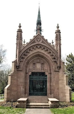
Today at Bellefontaine, the Busch Mausoleum is one of the more notable tombs on display. It was designed by the Barnett, Haynes & Barnett architectural firm in the Bavarian Gothic style but made with local stone. It supposedly cost around $250,000 to build at the time, which equates to over a couple million dollars today!


The main reason for stopping by this cemetery was to visit the gravesite of Rush Hudson Limbaugh III. The majority of people know the name, many who listened loved him, and the others who only know what was told about him probably hated him. Rush was a radio personality, political commentator, and author. He got his start in radio in 1971 at radio station WIXZ as a DJ in Pennsylvania reporting "farm news." Within 18 months, however, he was fired due to a "personality conflict" with the program director. He went through a number of radio stations, working as a deejay and a talk show host, but it wasn't until 1984, when he became famous with his radio show on KFBK in Sacramento, California. He could voice any opinion he felt, regardless of how controversial.

(At the time of our visit, Rush's headstone had yet to be installed.)

His show was picked up by ABC-Radio in 1988, now being broadcast all over the country for what would be over three decades. It eventually rose to 600 stations and 27 million weekly listeners. Limbaugh was inducted into the Radio Hall of Fame in 1993 and the National Association of Broadcasters Hall of Fame in 1998. Additionally, he was a five-time winner of the National Association of Broadcasters Marconi Award for Excellence in Syndicated and Network Broadcasting. Limbaugh's unabashed love of country and belief in American Exceptionalism caused detractors to seek controversy in every broadcast.

He was well liked for his charity work, using his show for the annual Leukemia and Lymphoma Society Telethon and the Marine Corps–Law Enforcement Foundation. He also was not afraid of poking fun of himself, voicing himself in cameos for three episodes of Family Guy.

Limbaugh, a cigar and former cigarette smoker, was diagnosed with lung cancer, eight days after his 69th birthday. On February 4th, during President Donald Trump's State of the Union Address, he awarded Limbaugh the Presidential Medal of Freedom. After his lung cancer diagnosis, he continued working on his radio show as much as he could. "I told the staff that I have a deeply personal relationship with God." Limbaugh died on February 17, 2021, at the age of 70.

(A more recent photo with the headstone.)

Continuing south for several miles along the banks of the Mississippi River into St Louis, we finally found a parking spot a few blocks away from the Gateway Arch (GC7ED). Along the way we spot the Tom Sawyer River Boat getting ready to pass underneath the historic Eads Bridge. This was the first bridge across the Mississippi at St. Louis. It was a major engineering feat, the largest bridge built at that time and the very first steel bridge. Completed in 1874, it is the oldest bridge standing on the Mississippi River. It was designed and built by James Buchanan Eads, an engineer famous for his ironclad gunboats built for the Union in the Civil War.


Nearing the Arch, we pass by this statue of Lewis and Clark and their dog coming ashore after crossing the river during their expedition.


During my days as a truck driver, I used to pass through St Louis on Interstate 40 often and could only get a view of the Gateway Arch out my window. I had always wanted to stop for a closer look, but parking a 70' long 18-wheeler within walking distance in downtown St Louis is probably not an easy task. Now, finally, we are able to get an up-close look at this monument.


Now for some history and facts. The St Louis Gateway Arch (GC7ED) is 630 feet tall and 630 feet wide at it base. The idea for a memorial to commemorate the western expansion of the United States began to take shape in 1933. On June 15, 1934, President Franklin D. Roosevelt signed the bill into law, instituting the United States Territorial Expansion Memorial Commission. In December 1934, the Jefferson National Expansion Memorial Association discussed organizing an architectural competition to determine the design of the monument. Local architect Louis LeBeaume had drawn up competition guidelines by January 1935. On December 21, 1935, President Roosevelt signed Executive Order 7253 to approve the memorial and 82-acre National Historic Site.


On February 18, 1948, Eero Saarinen's design was chosen from among the initial 172 entries in the design contest. After much deliberation and planning, the official groundbreaking ceremony finally occurred on June 23, 1959 at 10:30 AM. The first order of business was to build a tunnel and reroute the railroad tracks. In 1961, the foundation of the structure was laid and construction of the Arch itself began on February 12, 1963 as the first steel triangle of the south leg was set in place. The arch's visitor center opened on June 10, 1967, and the tram began operating on July 24. Upon it's competition, the arch became the tallest memorial in the United States and the tallest stainless steel monument in the world. The official dedication ceremony was finally held on May 25, 1968 by then Vice-President Hubert Humphrey.

Because of its tight quarters inside and limited exits, the Secret Service has forbidden all Presidents from ascending the Gateway Arch due to security concerns. The only exception was made in 1967 when he was 77 years old, former President Dwight D. Eisenhower was in town to give a speech. He had signed the order for the construction of the Arch in 1954. He paid a visit to the site after it had already closed to the public and insisted he get a ride on the tram to the top.

One more stop in St Louis before leaving the downtown traffic. I've played the game of chess since I was a kid. I taught my two sons when they were young. And when they started in a private Christian School, I formed and hosted the Chess Club for 2 years. So when I saw this virtual geocache at the World Chess Hall of Fame, we just had to stop. Outside they have the Guinness Record World's Largest Chess Piece (GC890GN) at 20 feet tall and a 9'2" diameter base and weighing in at 10,860 pounds!


Now to get out of the city to the rural open roads, find something to eat, and get some rest. To follow along on our travels and keep up with my latest blogs, you may do so here of course by clicking the "Follow" button to the right. But also by using one or more of your favorite of these social media platforms: FacebookMeWeGabRedditParlorTwitterGETTRInstagram, and TruthSocial. These all link directly to my profiles. Again, please feel free to comment and / or share.

Friday, November 25, 2022

2021-03-26: Day 4 of Turning a 1400 Mile Road Trip into a 3404 Mile Adventure! From Ohio into Indiana.

So today was Day 4 of our adventurous road trip where we turned a simple 1400 mile drive from NC to TX into a 12 day 3404 mile sightseeing tour! On this fourth day we finished traveling through Ohio and into Indiana, continuing to pick up new geocaching counties and finding more remnants of the old National Road. So come ride along with us as I share our geocaching adventures with you.


Waking up in Columbus, Ohio this morning, our first stop was for some Starbucks coffee. Well, Candy got a Starbucks coffee. I got the geocache in the parking lot (GC25QYX). Then we drove a few blocks away to a Dunkin Donuts where I then got a coffee and donuts for myself as well as a muffin for Candy.

Continuing our westbound roadtrip and following the Historic National Road (now US-40), we pulled into the Sunset Cemetery in Franklin County for several geocaches hidden here (GC77D86, GC4QFG8, GC54E7E, GC4ER7X). All three geocaches had a lot of favorite points awarded to them so we just had to stop by and find them. A nice Veterans Memorial was on display. But Jack's Cache was by far the favorite and even posted both a photo and video of it below. Be sure to have your sound turned up when playing the video!


(Turn Sound ON With Video!)

One of the advantages of driving the backroads on a roadtrip are the unexpected gems that get to be discovered along the way! Passing through the small Village of Lafayette in Madison County, Ohio, what first got me to stop was spotting this tour of Jeep history somebody had displayed on this fence. It was a perfect photo opp for the Geo Jeep Travel Bug!


Then taking a closer look at the old buildings along this stretch of the historical highway. This first one here I can't find much information on it. The plaque above the front entrance says "Deer Creek Tp, Sub-Dist No 1, 1906." I'm thinking it was an early school that has long been closed. One of the rear buildings has B. S. A. on it and can only assume that at some time in its historical past that the Boy Scouts of America had rented the building. If any of you can provide further details, please use the comment box below. It would be greatly appreciated.


This other building across the street is on the National Register of Historical Places. From the historical marker: "The Red Brick Tavern is a classic roadside inn and tavern from the heyday of the National Road. Constructed between 1836 and 1837, it was in operation when the road was completed past its front door. Over the years, the Red Brick Tavern was a popular place for travelers along the Historic National Road in Ohio. The Tavern hosted six presidents of the United States; John Quincy Adams, Martin Van Buren, William Henry Harrison, John Tyler, Zachery Taylor, and Warren G. Harding."


Running north and south along the west side of Lafayette is Deer Creek. To claim a geocache in Madison County we went to the Deer Creek Cemetery (GC1ZDYX) which is next to the creek. While some of my favorite geocaches are cemetery caches, I was more interested in the geocache next to the cemetery.

Crossing the creek about a 1000 feet south of the current alignment of the National Road / US-40, spans the remnants of an early railroad bridge This Interurban bridge was part of the railway that was part of the Springfield London Columbus route. This railway was run by the Columbus London & Springfield Railway from 1902-1939. The Interurbans provided a quick and cheap alternative to regular railroad for transporting people. As for the geocache, well I couldn't find it. Along with many others. It has since been archived.


The next county over is Clark County. It's also where my next two geocaches are located (GCZEFX, GCRDQC). In 1841, Ezra Baker gave the township land to the northeast edge of Enon for a cemetery. Land was added to the Enon Cemetery in 1884, in 1906, and again in 1978. There are earlier burials than 1841, but these were moved from family plots. Three Revolutionary soldiers, two War of 1812 soldiers, many from the Civil War, plus soldiers of more recent wars, are buried in the cemetery. There is a Soldier’s Monument, bearing the names of 31 local men who died during the Civil War, but not necessarily brought home for burial.


Continuing westbound a few miles and dropping down into Greene County, we make a stop for a quick geocache in the corner of a parking lot to claim the county (GC104NY).

After Greene was Montgomery County and the next three geocaches. The first one was located at the Polk Grove Cemetery (GC3W2YG). The cemetery is located next to the Polk Grove United Church of Christ. Since I didn't have time to look around the cemetery, I'll just leave you with this little tidbit. What's the difference between a cemetery and a graveyard? A graveyard is what they used to call a cemetery located on church grounds.

The second geocache was another location along the historic National Road. Patty's Bridge (GC196PD), located in Englewood Metro Park, is named after the James Patty family who owned a 160-acre farm in Butler Township. The Patty's brick farmhouse, torn down in about 1975, was located on the high ground northeast of the bridge. The original stone abutments for the bridge are still in place and demonstrate the skill of the workman building the highway. The National Road was America's first interstate highway.


Thomas Jefferson was president when construction of the road began in 1807. It started in Cumberland, MD and reached this part of Ohio in about 1838. The original route of the National Road took it due west of Patty's Bridge and into Harrisburg (now Englewood) Ohio. After Englewood Dam was completed in 1922, the National Road (which later became U. S. Route 40) was rerouted to the south and over the dam. By 1840, the National Road was completed to Vandalia, IL and then later to St. Louis, MO. Today this road spans the entire United States from Cumberland, MD to San Francisco, CA.


We stopped for one more geocache in Montgomery County. It was for a tasty treat at the Esther Price Candies chocolate factory (GC44BKB). It was an expensive geocache. Yep, we bought about $60 worth of chocolates by the time we left!


Our final county geocache for Ohio was a quick roadside stop in Preble County (GC2PMGT).

Crossing over into Indiana, the first county is Wayne County. And for our next geocache we stopped at the Old National Road Welcome Center (GC1WJPK). The Indiana portion was built between 1829 and 1834, linking the eastern seashore with the western interior. The automobile revived The National Road in the 1920's. As cars and trucks took to the road, the federal government established a nationwide network of paved, all-weather highways.

The Old National Road was one of the first routes designated under the new federal highway numbering system in 1926, US Route 40, a transcontinental highway. Once again, the new road gave way to new opportunities. Like the blacksmith shops and taverns of the past, gas station, diners, and motels lead the way to a new era of prosperity. Until the 1970's, with the completion of Interstate 70, US-40 was one of the country's primary east-west routes.

Next door over in Henry County, my geocaching county stop was at the New Lisbon Cemetery (GC8RFP1). After finding the geocache, just a quick glance around and a photo before continuing down the road.


Wanting to make up time and get to Indianapolis before it gets too late, I hop onto Interstate 70. The next county is Hancock County. We stopped for a quick westbound rest area geocache (GCPTZV).

We finally pulled into Indianapolis and I head to the Indianapolis Speedway. But it was too late. The Speedway was closing. From there we drove to the south side of the city to the Holy Cross and St Joseph Cemetery. I was here once before way back in 2007. I was once an over-the-road truck driver. The trucking company I worked for had a terminal several blocks away. While I was there getting the truck serviced, I saw online that there were some famous interments in this cemetery and walked down to see them.


Now they have some much needed upgraded headstones to replace the neglected and broken previous headstones. And a new historical marker which reads: "There are few better known names in automotive circles world wide than Chevrolet. Millions drive the Internationally respected cars, but few know that the company and its revered name originated with three brothers, Louis, Gaston and Arthur Chevrolet. Of Swiss heritage, their story is one that reflects the very foundation of American society. Louis migrated to America at the turn of the 20th century, and after earning enough money, sent for his brothers.

"The brothers immersed themselves in automotive technology as designers, mechanics, and racing drivers. All three raced multiple times in the famed Indianapolis 500, with Gaston winning the 1920 classic. Capitalizing on their huge popularity, Louis founded the Chevrolet Motor Company in 1911. And, despite leaving the firm in 1916, the automotive giant retains the name."


After Gaston won the 1920 Indianapolis 500, he died later that year in a racing accident. Louis died of a heart attack in 1941. Arthur retired in 1942 to Slidell, Louisiana where after suffering from depression, he committed suicide in 1946.

To get credit for Marion County, we went to Concordia Cemetery just a block away. There we found two geocaches to complete the spot on the map (GC2B3N9, GC2B45F).

That was it for Day #4. We drove up to Crawfordsville in Montgomery County. That's the next county we need and the next location of our geocaches. So we found a place to stay there for the night. Tomorrow we'll finish up Indiana and start into Illinois. I look forward to seeing you back again.

To follow along on our travels and keep up with my latest blogs, you may do so here of course by clicking the "Follow" button to the right. But also by using one or more of your favorite of these social media platforms: FacebookMeWeGabRedditParlorTwitterRVillageGETTRInstagram, and TruthSocial. These all link directly to my profiles. Again, please feel free to comment and / or share.

Saturday, August 27, 2022

2021-03-04: Visiting the Less Touristy Sites in New Orleans

Hey Everyone! Welcome back to Day #2 of our 4,000+ mile roadtrip. Today we start off in New Orleans, Louisiana. Not the Mardi Gras, the bars, restaurants, and nightlife party, but the historical, less visited, peaceful attractions. So hop onboard and join us for a geocaching adventure...


We started the day with breakfast, a cache, and a new county at a Waffle House just down the street. We ordered a couple of breakfast bowls to-go. While they were cooking, I grabbed the geocache (GC8MND3) in the parking lot to fill in the blank for St. Charles Parish.

My next county cache was in Jefferson Parish. At the Veterans Memorial Century of Sentries Park, there was a multi-cache hidden here which I could not find the final stage (GC110R8). But it was still a worthy stop. There were many military display's such as the Douglas A-4 Skyhawk Vietnam War attack plane, a 1941 Plymouth Sedan Army staff car, a Vietnam River Patrol boat, a couple of cannons and a torpedo.


Now since I couldn't find that last geocache for the county, I settled on a quick parking lot LPC hide (GC77DYE).

In Orleans Parish, our next stop was the site of the Spanish Fort at Bayou St. John (GC8GC4J). The first small fort here was erected by the French in 1701, before the founding of the city of New Orleans, to protect the important trade route along Bayou St. John. After Louisiana passed to Spanish control, a larger brick fort was constructed at the site of the neglected old French fortification; this was known as San Juan del Bayou. Louisiana passed back to France and then to the hands of the United States. The fort was decommissioned in 1823.


This is the story of the grave at Spanish Fort. During the Spanish days, the Commandant of Fort St. John was Sancho Pablo. He had opened negotiations with the chief of a local Choctaw tribe, Waw-he-wawa (White Goose), who lived down the bayou with his daughter Owaissee (Bluebird). Sometimes Pablo visited the Indian camp and became acquainted with Bluebird as well.

One day, as the legend goes, Bluebird took her canoe down Bayou St. John to the lake. The choppy waters began to pound her canoe until it nearly capsized. Seeing this from the fort, Sancho Pablo ordered his men to prepare a boat at once to rescue her. When they reached her, Pablo personally lifted Bluebird into the Spanish boat to safety and escorted her home. Needless to say, Sancho Pablo and Bluebird fell in love with each other. Bluebird would paddle down the bayou again and again at night to meet with Sancho.

White Goose became suspicious, however, that his daughter was meeting with this Spaniard; and he became alarmed being strongly opposed to such a relationship. He secretly followed his daughter down the bayou one night and discovered that she was meeting with Pablo. White Goose therefore resolved to kill the Spaniard. On an ominously dark night, the Indian father traveled down the bayou in a canoe alone. As the canoe approached the fort in the pitch black night, Pablo believed the boat contained Bluebird coming to visit. Instead the Spaniard soon discovered it was Bluebird's father who came only for blood. White Goose killed Sancho Pablo on the spot.


Legend has it that Pablo's last words were of his eternal love for Bluebird. The soldiers in the fort soon were startled by the sounds of the struggle, but the Indian chief had disappeared. The Spanish soldiers buried the body of their leader on the grounds of the old Spanish Fort. Legend says that the Indian village relocated. Neither Bluebird nor White Goose was ever heard from again.
(https://allpoetry.com/poem/513738-Sancho-Pablo-And-Bluebird-by-Dreamweaver)

And then, not too far away, was the Milneburg Lighthouse (GC8GC4N). Originally called Port Pontchartrain Lighthouse until 1929. This now landlocked lighthouse was located at the end of Milneburg pier. The brick lighthouse was built in 1855 which replaced the original wooden one which was built in 1832. Milneburg was a small town on the lake shore that was absorbed by New Orleans. The area was connected to the city by Elysian Fields Avenue. In 1830 it was decided to build the region's first railway along the route. The Pontchartrain Rail-Road started steam locomotive which carried people and cargo along the 5 mile trip. The port boomed. Hotels, saloons, bath houses, and resorts were built around it. The importance of Milneburg in shipping declined in the late 19th century, but it remained an important resort. Between 1920s and 1930s new land was reclaimed by dreading the shallows of Lake Pontchartrain which brought the end of old Milneburg.


Unfortunately I didn't get the geocache that was there. It wasn't that I didn't find it, but I didn't get to look. From where I took this photo were two parking spots. We got out of the GeoJeep to walk over for a closer look and to find the cache. Almost immediately, up rolls a golf cart with a security guard telling us that we can't walk out to see the lighthouse because of covid. REALLY? If it were not for the security guard, I'd be able to look completely all around in every direction and NOT see a single person except for my wife and I. I'm pretty sure covid would NOT be an issue. Oh well, off to the next one.

We planned on visiting the most famous of the New Orleans cemeteries, Saint Lewis Cemetery Number 1. With famous permanent residents like voodoo priestess Marie Laveau (1801-1881), civil rights activist Homer Plessy (1862-1925) of the Plessy vs Ferguson Supreme Court case, and future resident and actor Nicholas Cage who already has a 9' tall pyramid placed for his tomb. But it was closed because of... you guessed it... covid.

So we went across the highway to the Metairie Cemetery where we found six of the more than a dozen geocaches hidden there. The Metairie Cemetery Association received its charter in May 1872. This large cemetery was built on a former racetrack, and the oval track shape is still there. Metairie was part of the Rural (Victorian) Cemetery Movement. It’s landscaped and features elements like lakes and wide roads connecting to footpaths. Interments of note include singer Louis Prima, 49 kings of Carnival, and numerous Louisiana state governors and NOLA mayors.

Just a couple of notable residents here: Thomas Milton Benson (1927-2018), who was the owner of the NFL's New Orleans Saints and the NBA's New Orleans Pelicans.


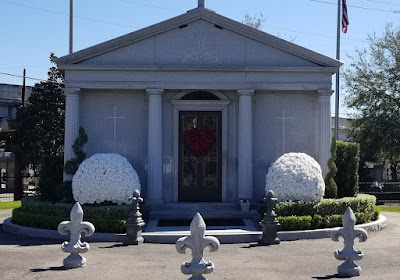
Josie Arlington was a New Orleans madam whose crypt was once believed to be haunted. It was rumored that the statue of the woman in front of the tomb would come to life and walk the cemetery grounds at night. It was later discovered that a street light reflecting off the tomb gave it a reddish glow, lending credence to the rumors of the haunting. Josie Arlington's body was later moved to an unknown location within the same cemetery.

Located in the center of the Metairie Cemetery is the Tomb of the Army of Northern Virginia. Dedicated on May 10, 1881, the monument was erected in memory to the men of the Division of the Army of Northern Virginia, who served and died in the Civil War. The monument, made of white granite, rises fifty feet above the ground with a statue of General Stonewall Jackson on top and the inscription: "ARMY OF NORTHERN VIRGINIA, LOUISIANA DIVISION," and "FROM MANASSAS TO APPOMATTOX, 1861 TO 1865." Located within the hill below this monument, is a large chamber containing the vaults of many Confederate Officers.

Jefferson Davis, President of the Confederate States, was the unrepentant highest ranking Confederate leader of the South. By the time his peaceful death occurred while visiting New Orleans, he was the symbol of the Lost Cause and the most revered man in the South. Eighteen months after his death and temporary burial in New Orleans Metairie Cemetery, Davis's widow, Varina, decided the final burial place was to be Richmond's Hollywood Cemetery, considered the National Cemetery of the Confederacy. 


His remains, were removed from the vault in New Orleans and placed on a flag-draped caisson escorted by honor guards composed of his old soldiers to Memorial Hall, where he lay in state. The next day, as thousands of people silently watched from the sidewalks and balconies, the caisson bore his body to a waiting funeral train. On the way, bonfires beside the tracks lit up ranks of Davis's old soldiers standing at attention beside stacked arms. In Richmond, Gray haired veterans escorted him to the Virginia statehouse where thousands filed past in respect before internment.

Jefferson Davis was the only Southern leader shackled in a dungeon and sacrificed as atonement for the sins of many. He refused to apply for a pardon because, he said, "I have not repented." In 1978, the United States Congress posthumously restored Davis's citizenship. 

Driving east into Saint Bernard Parish, we stop for my next county cache at Chalmette Battlefield and National Cemetery (GCA55A). Major General Andrew Jackson's troops were outnumbered and less experienced yet they defended and secured the port of New Orleans from British invasion on January 8, 1815. This victory at the Chalmette Plantation was the last major battle in the War of 1812. The American victory preserved U.S. claims to the Louisiana Purchase territory, prompted settlement in the Mississippi River Valley, made Jackson a national hero, and encouraged American pride and unity.

The construction of a monument honoring Andrew Jackson and his troops was the first step in recognizing the importance of the battlefield and saving it for future generations. In 1852 the Louisiana legislature appropriated funds to purchase land at the battlefield and build a monument there. The project was plagued with funding problems for decades and was finally completed in 1908. In 1939 Chalmette National Historical Park was created and the site became part of the National Park Service.


The destruction of their plantation during the Battle of New Orleans left the de Chalmet family in financial trouble. In 1817, brothers Hilaire and and Louis St. Amand bought the land. The St. Amands were prominent free people of color who already owned several plantations. In the early 1800's, it was not unusual for free people of color to own plantations and slaves in Louisiana. Actually according to the 1860 U.S. census, only 4% of southern whites owned slaves while 28% of freed blacks in New Orleans owned slaves.

The first owner of the Malus-Beauregard House was Madeleine Pannetier Malus, a widow who purchased land from the St. Amand brothers when they divided the land into small tracts in 1832. Malus built a French Colonial house in 1833 or 1834. After her death in 1835, Caroline Fabre Cantrelle bought the house and remolded it to the Greek Revival style it is currently. Its last private owner was Rene Beauregard, son of Confederate General P. T. Beauregard, who purchased it in 1880. The New Orleans Terminal Company then owned the property until 1949, when it became part of the Chalmette National Historical Park.


Looking at the house from the front or the back and you get the impression of an ominous grand estate. In reality, when you look at it from the side, the house is only one room deep with only four rooms on each floor.


The Chalmette National Cemetery was established in 1864 as a burial place for Union soldiers who died in the Gulf area during the Civil War. It also served as a site for reburials of soldiers from battlefield cemeteries in the region. This plot of land was part of the battlefield during the Battle of New Orleans. Only four U.S. veterans of the War of 1812 are buried here. None of the British who died in the battle are buried in the cemetery.


Also located on four acres of the battlefield, is the Freedmen's Cemetery. It was established by the Freedmen's Bureau in 1867, when the bureau received permission to use a portion of the battlefield as a civilian burial ground. The property reverted to other ownership when the bureau was discontinued, and the cemetery gradually fell into ruins. All above ground traces disappeared before the start of the 1900's.

The National Park Service received stewardship of the cemeteries in 1933. There are over 15,000 individuals buried in the 17.5 acre cemetery. Veterans of all major American wars and conflicts are interred here. Of these 15,000, more than 6,700 are unknown. By 1945 all available burial sites were either taken or reserved and the cemetery was closed. It was re-opened briefly in the 1960's for burial of Vietnam Veterans.

There are two burials I wanted to bring to your attention. One is the oldest and belongs to Pvt Elkanah Anderson (1774-1815). Marched from Hickman County Tennessee, then fought and died at the Battle of New Orleans. Mortally wounded in battle on January 8, 1815, then died on January 14, 1815.

The other was Sarah Rosetta Wakeman (1843-1864). Civil War Union Soldier. The oldest child in a poor, large farming family in upstate New York, she left home at nineteen years of age and found she could make more money by dressing as a man and working as a coal handler on a canal boat. Upon learning she could make thirteen dollars a month as a soldier, she disguised herself as a man and enlisted on 30 August 1862 in Montgomery County, New York, as "Lyons Wakeman" in the 153rd New York Volunteer Infantry, Company G which shortly thereafter would be redesignated as Company H. She served until she died of dysentery after fighting in the Battle of Pleasant Hill in Louisiana. Details of her experiences are found in her letters compiled in a book entitled "An Uncommon Soldier" edited by Lauren Cook Burgess. Her total service in the U S Army covered more than one year and seven months.


And finally, our last stop in New Orleans was out of this world (GCB50B). This is the Michoud Assembly Facility for NASA where much of the United States Space Program began. The Saturn 5 booster stage that launched all of the moon missions as well as all of the External Tank for the Space Shuttles were built here. Currently portions of the Orion Capsule slated to take the first men to Mars is being built here.

There used to be two metal sculptures near this virtual geocache location. One is honoring STS 107 which was the Columbia Mission that was lost upon reentry over Texas. The other is dedicated to the Challenger Crew who made the ultimate sacrifice when the shuttle exploded shortly after launching off the coast of Florida.


So that was our tour of New Orleans. Probably NOT the typical sites that most visitors to the "Big Easy" see. Maybe next time when we have longer to stay we'll check out the downtown restaurants and go on a ghost tour or something normal like most tourists. See you next time.

To follow along on our travels and keep up with my latest blogs, you may do so here of course by clicking the "Follow" button to the right. But also by using one or more of your favorite of these social media platforms: FacebookMeWeGabRedditParlorTwitterRVillageGETTRInstagram, and TruthSocial. These all link directly to my profiles. Again, please feel free to comment and / or share.