Hello again everyone and welcome back to our AwayWeGo's Work Traveling and Geocaching Adventures Blog. Well it's road trip time! Our time in Texas was only a couple of weeks. Now I'm needed in Montana. WOHOO! It's been a long time since I was in Montana. So let's hook up the Jeep to the motorhome, hit the road, and see what we can discover.
So a couple days ago I was at work in Bonham, Texas. About noon on Thursday I received a phone call asking if I wanted to go on an adventure to Montana for a short task that should take only a week. WHY OF COURSE! Cool. So he'll let me know on Friday. About 10 AM on Friday he calls me back to say it's a go and can I be in Montana by Monday? I'll do my best. I tell my co-workers there in Bonham that I gotta go. By noon I'm hooked up to the motorhome and on the road.
About an hour or so into the drive westbound on US-82, I'm getting some noise on the back end of the motorhome. I turned on my emergency flashers, pulled over onto the shoulder and took a look. The rear airbags were deflated and the suspension was completely down causing some tire rub. Ughh!! Googled an RV shop who could take a look and the nearest was in Wichita Falls, TX. Not too far, but only able to go 20-30 mph, it was going to take a while.
The clock was ticking past and I was running out time to get there. I finally arrived but a mere 10 minutes too late. They were already closed. It was after 5 pm on a Friday. I guess I'll be sitting in their parking lot for the weekend until their mechanics return on Monday morning.
Saturday morning I started thinking about it and extended the rear jacks down to raise the rear of the motorhome. I slid underneath not really knowing what to look for. I took some photos of the air bags and suspension. There was a Freightliner shop about a block away that was open. I hopped into the Jeep to see if I can figure out a solution. Their shop was too busy to take in anything new but he looked at the pics and immediately saw the problem. The level adjustment rod was broken.
After a short discussion, I figured I could fix it myself. He sent me over to the parts department. The parts guy said there were two different ones. So I went back to the motorhome, removed the old one and brought it back. I bought the correct replacement and installed it. You can see from the combined photo below the broken part on the left and the new part on the right.
Living the RV life and traveling the country isn't always a dream vacation! However, we're back on the road headed north on US-287/385 into the Oklahoma panhandle and then Colorado.
I did get a call from the other surveyor I was to be meeting up with in Montana on Monday. He was leaving from a jobsite in Mohave, CA but got called back to the jobsite for another task before leaving. Then got sick and tested positive for Covid for the third time. Now he's in quarantine for two weeks. So we now have plenty of time to get there.
Since I have already completed my geocaching counties for Texas and Oklahoma, I didn't spend any time stopping for geocaches. We finished the day yesterday crossing into Colorado and parking for the night at an old truck stop in Springfield. Now that we're in Colorado with plenty of time to reach Montana, I can start picking up new counties for my geocaching map.
Today is Sunday and before hooking the GeoJeep back up to the motorhome, I drove over to the Springfield Cemetery to find a geocache for Baca County (GC1FBM8).
Driving north up the road into Prowers County, we made a roadside picnic area stop at Gobbler's Knob for an Earthcache (GC3HVX5) at these giant beehive looking rock formations. Unlike a traditional geocache, an earthcache doesn't have a container with a log sheet to sign. It's more of an educational geocache. You observe the geological area and have to answer some questions about it. Most are fairly easy but some are like taking a college course. I was never good in science and just answer as best I can.


Also in Powers County, we just had to make a slight detour for our next two geocaches (GC76E0, GC1Y6H5) at a historical site and a dark time in our nations history. After the Japanese had bombed Pearl Harbor, President Roosevelt ordered over 110,000 men, women, and children of Japanese descent to be rounded up and detained in what was basically a military style P.O.W. camp. Japanese-Americans, two-thirds of which were United States citizens, removed from their homes and incarcerated in these remote camps scattered throughout the country. Not a single one was ever convicted of espionage or sabotage.

From August 1942 to October 1945, more than 10,000 people passed through the gates, living behind barbed wire and under armed guard at the Granada Relocation Center, also known as Amache. At its peak, over 7,300 detainees from a variety of professional, vocational, and educational backgrounds now worked as farmers, staffing the camp hospital, and a limited amount of other tasks. All received a fraction of their former income. Some 2,000 children and teens attended camp schools. During its occupation, the Amache detention camp was the 10th largest community in Colorado.
The total land area of Camp Amache was 10,000 acres. Only 640 acres was used for residential, mess halls, and other buildings which you see in the map below. The rest was used for agricultural purposes, growing crops and food for the detainees and the military bases around the world. Camp Amache was the smallest of the ten total detention camps scattered around the United States.

During the three years in use, the War Relocation Authority recorded 107 deaths in the camp. Many of those who died were cremated and their ashes kept in urns by the family. Others were buried here. After the war and their release, all but nine of those buried were removed and reburied closer to home. Nearly one thousand young men and women who were initially detained here, went on to serve in the military during the war. Most were analysts and interpreters for Military Intelligence Service in the Pacific. The stone monument you see in the cemetery, erected in 1983, is to honor the 31 men who died in combat as well as those 107 who died at Camp Amache.

Camp Amache's residents, often referred to as internees and inmates, were under 24-hour guard by military police stationed in eight towers along the barbed wire fence. When authorities deemed that the detainees posed no threat, the guards were removed from the towers. Though they continued their post at the main entrance and patrolled the perimeter, watching over daily activities and religious ceremonies.
Averaging about 7,000 Japanese-Americans at any given time, living quarters were at bare minimum. The one-square mile residential area was comprised of 29 blocks, each containing up to 13 barracks buildings divided into 6 rooms each. A bare lightbulb, a closet with no door, coal-fired heater, unassembled canvas cots and rough wool blankets were the only furnishings that greeted internees. Imagine being taken from your own home without provocation, held prisoner without being charged with any crime, for three years, for no reason other than being of Japanese descent.

Families of seven or fewer were assigned to a single room measuring 20' x 24'. The end units, measuring 16' x 20', usually housed either 4 single men or two couples without children. For a semblance of privacy, they often hung a sheet if they had one. They found ways to personalize and improve their cramped and sparse living conditions. Homemade curtains provided minimal relief from the constant wind and pervasive dust, but none against the brutal winter cold or unbearable summer heat. Rarely discarded pieces of scrape wood would be made into a table, chair, or shelf.
Like I said in the beginning, it was a dark few years in our nations history when we could willing deny approximately 75,000 American citizens their Constitutional rights and imprison them without charge or due process. Today only the few marked graves, erected memorials, some original foundations, and reconstructed couple of buildings remain.
After an hour of driving around in this historic, yet somber 640 acres, it was time to get back on the road. There was no barbed wire fencing and no armed guards in the towers anymore. We had the freedom to drive away. But remember those who were unjustly held prisoner in this remote location in southeast Colorado.
Back in the motorhome and driving north on US-287, we make a geocaching stop for Kiowa County. In the small town of Eads was a community park with a big enough parking spot for the motorhome. After finding the nicely hidden and creative geocache (GC9C5DN), we check out the dozen historical information boards about life on the plains of eastern Colorado. Including this Kindred Spirits monument.
Continuing on into Cheyenne County, we pull into the little town of Kit Carson, Colorado. Just as we arrived, I noticed the temperature gauge climbing! I quickly pull over into this empty lot to check it out. Another freeze plug sprung a leak. Oh great. Small town with a population of 250 people. This isn't good.
Half a block away is a small rv park. I drove over and parked in the only spot available. While checking in a talking with the owner, he says there is a good mechanic in town that he will call in the morning. And if he's too busy, he'll call the mayor who used to be a diesel mechanic too. There's hope after all. Guess I'll find out tomorrow morning.
Well it's still early in the day. Since we're stuck here we might as well go exploring and geocaching.
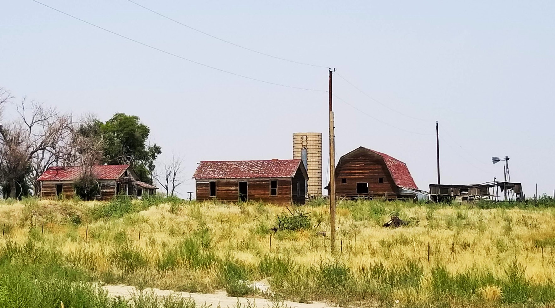
We hop in the GeoJeep and continue down the road. First stop a few miles away was this very small Colorado ghost town called Wild Horse. Town history from one of the two geocaches here (GC6RWXV): "A small detachment of U.S. Cavalry was assigned to protect the surveyors as they laid out the grade stakes for a new railway line. Early one morning in 1869, as the cavalry rounded a bend in the Big Sandy about twelve miles west of Kit Carson, they saw a band of several hundred wild horses around a water hole. The water supply was good so the troops decided to establish an outpost camp and call it the Wild Horse Station. From 1869 until 1906 Wild Horse was just a station."
The school building which still stands in Wild Horse was built in 1912. Between 1921 and 1923 the Wild Horse School was a branch of Cheyenne County High School and conducted classes for freshmen and sophomores.
"The boom was on and from 1906 to 1909 other buildings included a two block lumberyard and office, drug store, two restaurants, two livery barns, three saloons (one only lasted a few weeks) a hardware store, pool hall, two cream stations, a barber shop, newspaper building (The Wild Horse Times), a shoe shop, another grocery store and dry goods store, a depot of sorts (two box cars joined together), a warehouse, a butcher shop and the Alfalfa Valley Bank. Local promoters proclaimed Wild Horse to be the "best little town in the world." Soon after 1909, after automobiles began to displace the horse, one livery barn became a garage. Wild Horse reached a peak about 1910-1911 at which time Charles Collins bought the controlling interest in the bank and moved it to Kit Carson."

Then a series of fires hit the town. The warehouse burned; it was not replaced. A restaurant burned and then the butcher shop. Then came the big fire in 1917 which destroyed almost entirely the east portion of town which was the business section. Someone started a fire in a wood stove in the cream station and some time after midnight, the stove toppled over and flames engulfed the town. Water was in short supply in those days and the bucket brigade was no match for the fire. The destruction was complete; the value of the loss was nearly total."
"It was the beginning of the end for Wild Horse. Part of the town was rebuilt but the Depression and the "dirty thirties" followed soon after and like so many other small towns, Wild Horse lost its young folks to greener pastures."
The McIntire Cemetery (GC1Y3ZB), also known as the Wild Horse Cemetery, is a very small cemetery. There are only 66 internments here, the oldest from 1884 and another in 1887 while just a Calvary camp station. The rest are after 1908 when the town started growing. John McIntire was a large ranch owner who immigrated from Ireland. John died in November of 1931 at the age of 83 and is buried here.
Out on the western edge of Cheyenne County is another ghost town and another geocache (GC20AJE). Joseph O. Dostal, a Bohemian immigrant and veteran of the Civil War, came to Colorado in 1866 and established the J.O.D. Ranch to the west of Kit Carson, CO. The J.O.D. headquarters was located and the town of Aroya established in 1869 as a camp for the railroad workers near the new Kansas-Pacific Railroad which built a watering hole there.
Most of the original townsite was lost due to a fire. The current location was three miles east and selected due to being closer to a better water source. The businesses which survived the fire moved their buildings to the new location. As the town continued to grow, the smaller school house at the old site was left behind and a larger school house was built at the new townsite. That school building is still standing to and pictured below.
Over the years since the state highway bypassed the town, its businesses closed, the buildings were torn down, and the people moved away. Only the schoolhouse, the old gas station, and the store building remain standing.
Crossing over into Lincoln County for two more geocaches, the first was a quick rest area stop (GC1FBCZ).
Then about a half-mile south of US-287/US-40 down a county dirt road, is what remains of the ghost town of Clifford, Colorado. The geocache (GC1Y3RG) brought me to this small area containing the graves of three children. It is believed that they were children of railroad workers. Two sisters (4 yr old and infant) from 1893 and another infant girl from 1907.
Doing my research for the blog, I couldn't much on Clifford's history. Perhaps it was settled because of a nearby stage station called Mirage, which there is no trace of left. And then because of the three graves, maybe it was a railroad camp. There is the old schoolhouse pictured below still standing. And a supposedly haunted Montgomery Ward catalog house remaining. A couple of foundations, but nothing else remains. However...
... there could be some buried treasure hidden in the area! I found another site that tells a story of notorious gang of robbers on a crime spree in 1847 back in Sacramento, California. They then decided to lay low and made their way to eastern Colorado. By 1862, the gang were living a quiet life as farmers and ranchers.
But they still had the itch and joined together for one more big score: $100,000 in gold in the form of an Army payroll headed for Denver. (That's about $3.1 Million in today's dollars!) Well I'm gonna sum it up and say "Big Shootout, only 2 of the gang survived and got away with the gold." But it was buried out on the plains near Clifford. One clue was found years later in 1931 and another was found in 1934. I implore you to take 2 minutes to read "The Missing Treasure of Clifford, Colorado" by James M Deem. It's worth it to read, as Paul Harvey puts it, the rest of the story!
My final stop was just up the road in Hugo, Colorado. There was this restored Union-Pacific Railroad passenger depot, now used for community functions.
Also in Hugo is this Union-Pacific Railroad Roundhouse (GC1YA9Q). This is one of only three roundhouse buildings still in existence. A roundhouse is basically a semi-circular maintenance building. A circular turntable was located at the center of the radius on the side of the building. As the locomotive moved onto the turntable, it could then be rotated and aligned to the track which allowed the train to move into and out of the stall to be worked on.
Typically after a railroad closes and sells off its facilities, the new owner will often remodel the structure for its own use. In this instance though the only thing that changed was the removal of the roundhouse turntable. Now in the hands of Lincoln County, the Hugo Roundhouse was restored by the county and Roundhouse Preservation Inc about ten years ago.
Well that ends a crazy day. A DIY suspension repair to start the day. Driving from Texas to Colorado while geocaching and sightseeing. Then having another freeze plug coolant leak on the motorhome in a very rural small town. Hopefully we'll be able to get it repaired in the morning. Stay tuned...
To follow along on our travels and keep up with my latest blogs, you may do so here of course by clicking the "Follow" button to the right. And there's also my main website at AwayWeGo.US for the complete index of my traveling adventures going back to 2005. But also by using one or more of your favorite of these social media platforms: Facebook, MeWe, Gab, Reddit, Twitter, GETTR, Instagram, and TruthSocial. These all link directly to my profiles. Again, please feel free to comment and / or share.


.jpg)


