Showing posts with label Missouri. Show all posts

Wednesday, October 11, 2023

2021-06-18: Summer Road Trip to Buy Our "New-to-Us" Home and Geocaching Through Missouri, Illinois, and Indiana

So here we are on this Day 3 of our 5300+ mile summer road trip from West Texas to Indiana to Connecticut, back to Indiana to Florida and ending in NE Texas. The main reason for this roadtrip is to look at and hopefully purchase our "new-to-us" home-on-wheels. Along the way, we'll be picking up as many new geocaching counties as we can and seeing some of the sites along the way. So hop on board the GeoJeep and let's go see what we can find.


Well we didn't quite make it out of Missouri yesterday. We stayed the night in the town of Sikeston in Scott County. We were going to have dinner at the famous Lambert's, where they throw the fresh rolls out to you. But we weren't up for the long lines and over an hour wait! So we came back this morning to grab the geocache (GC2JC3X) for the county and take some photos.


Driving east on US-60, we crossed over into Mississippi County. We stopped for a quick geocache (GC4KW34) in Bertrand for the county and kept moving.

Further down the road I spotted this roadside historical marker and had to stop for a photo. "Rev. Owen Whitfield with the support of local landowner, Mr. Thad Snow, and 1500 black and white sharecroppers camped here in harsh January weather several days in 1939 to protest the plight of Boot Heel sharecroppers. The event received national attention. Owen and Zella Whitfield met with Pres. Roosevelt and ultimately received his support for the cause. This community has dedicated January 10 as Thad Snow - Owen Whitfield Day."


My next three geocaches were all in one corner of a park. There was a virtual geocache (GC710E) and two earthcaches (GC1A369, GC1A36F). Fort Defiance State Park is right at the corner of Missouri, Illinois, and Kentucky as well as the confluence of the Mississippi River and the Ohio River. It is also the lowest elevation point in Illinois.


On November 14, 1803, Lewis and Clark landed here with their Corps of Discovery party. Commissioned by President Thomas Jefferson to explore and survey the recently purchased Louisiana Territory, their six days here was one of the longest stops made by the expedition. Their stay allowed Captain Meriwether Lewis to teach Captain William Clark how to navigate using a compass and a sextant. Because the 3rd Principal Meridian begins at the mouth of the Ohio River, astronomical observations at this point were crucial.


Above: nearly 175 million tons of goods are shipped via the Mighty Mississippi River each year. Below: Candy and her grand-daughter down at the southernmost point of Illinois and the convergence of the two rivers. The Ohio River is entering from the left. The Mississippi River enters from the right-rear and continues down to the far right.


Our last stop for today was just a few miles away in a town called Cache, Illinois (GCR01C). I can't find out much info on the community of Cache, IL other than it was laid out in January 1904. Found a newspaper article in April 1927 suggesting the town was flooded out. Then a few decades later the Cache River was rerouted to empty into the Mississippi River instead of the Ohio River. Whatever happened to the town, this bridge isn't singing anymore.


While researching the town for this blog, I came across some articles for a cemetery called "Seven Mile Graveyard" located between Cache and Cairo. The Find-A-Grave website had 7 memorials listed, but no photos. I came across another 8 newspaper articles of people that were buried there and added those memorials. Then I came across a more recent article of the cemeteries demise:

Excerpt from the Southern Illinoisan, April 30, 1999:
"The cemetery was incorporated in 1853. In 1878, many people who died in a yellow fever epidemic were buried there. By 1921, the cemetery was overgrown and unkempt. In 1955, the land was purchased and the cemetery was bulldozed and turned into a pasture, a piece of history turned to dust and memory."

So sad. Perhaps one day someone can further research local records and discover the location of the cemetery. Maybe even more names of those long forgotten souls can be discovered and added to the Find-A-Grave website. And if just one descendent can make that genealogical connection, even better!

Well we still had about 430 miles of driving to get to Decatur, Indiana by tonight. So the rest of my planned geocaches had to be bypassed. That's NOT something I like doing either. Tomorrow morning we go check out our potential new-to-us home-on-wheels!

To follow along on our travels and keep up with my latest blogs, you may do so here of course by clicking the "Follow" button to the right. And there's also my main website at AwayWeGo.US for the complete index of my traveling adventures going back to 2005. But also by using one or more of your favorite of these social media platforms: FacebookMeWeGabRedditTwitterGETTRInstagram, and TruthSocial. These all link directly to my profiles. Again, please feel free to comment and / or share.

Saturday, September 16, 2023

2021-06-17: Summer Road Trip to Buy Our "New-to-Us" Home and Geocaching Through Texas, Arkansas and Missouri

Hello Friends! Well some of our regular readers may recall that the primary reason that we are able to go on so many geocaching roadtrip adventures is because we work in construction. We travel from project to project across the country and had to find short term rentals in each town to live in while there working. My wife has been traveling and working with me for about two years now, though this last solar project we just completed near Fort Stockton, Texas she didn't work on it.

When we arrived in the nearby small town of McCamey at the beginning, the choices for rental accommodations were old rundown houses from the 1940's. My wife took one look and decided she'd stay with her daughter in Killeen, TX for the duration. Now that it has completed, I have three weeks before starting at the next location in North Texas. So what to do but go on a roadtrip to Indiana where I found our "new to us" home to buy! Finally after a year of looking... a wish comes true!


My last day on the project was a Tuesday. I had packed up everything in the Jeep that morning and I made the 5-hour drive to Killeen after work that evening. On Wednesday, Candy and I packed as much as we could into our little 2-door Jeep for us as well as her teenage grand-daughter who rode along with us on this roadtrip adventure.

So we left Central Texas and our first stop wasn't until Texarkana, Arkansas or is it Texas? Or Arkansas? Actually it IS in both! The courthouse sits right on the state line. Now that's a divided court and was a virtual geocache, now archived (GC829D).


After 450 miles of driving, we stopped at a hotel in South Hot Springs, Arkansas for the night. Waking up Thursday morning and checking out, we grabbed a quick geocache (GC1KGXN) right there in the parking lot before hitting the road.

But not before taking a quick drive into the historical Hot Springs National Park and Bathhouse Row. Hot Springs, Arkansas, gets its name from the naturally 143 °F thermal spring waters found here. Flowing out of the ground at almost one million gallons of water each day. Native Americans called this area “the Valley of the Vapors,” and it was said to have been a neutral territory where all tribes could enjoy its healing waters in peace. Spanish and French settlers claimed the area in the mid-1500s. In fact, famous explorer Hernando de Soto was the first European to visit Hot Springs in 1541.

While it is true that President Grant designated Yellowstone as the first "National Park" in 1872, it can also be said that Hot Springs, Arkansas was technically the first national park when President Andrew Jackson designated Hot Springs a "Federal Reservation" in 1832 for public use. Hot Springs didn't officially become a National Park until 1921.


Bathhouse Row has evolved over the years from it's rustic beginnings to the modern spas of today. In the 1830's, Hot Springs earliest facilities were make shift shelters perches over individual springs. Later elaborate Victorian bathhouses flourished along the avenue. But those wooden structures were susceptible to rot and devastating fires. The present mix of Spanish Mission to neoclassical architecture date from 1911 to 1939, the Golden Age of bathing.


Medicinal bathing peaked in 1946 and many of the traditional bathhouses have closed or converted into the modern spas. Traditional bathing remains at the Buckstaff Bathhouse. The National Park Service has landscaped many of the exercise paths that were considered essential to good health. Like earlier visitors, you can still stroll the brick Grand Promenade behind Bathhouse Row or hike mountain trails throughout the National Park.


Walking among the shops there on the row, I spotted an iconic Zoltar fortune teller machine made famous from the 1988 movie "Big" starring Tom Hanks. Hmmm, what should I wish for?


Also spotted this restored antique Harley-Davidson motorcycle. Not sure about those white tires though!


And then there's this statue standing outside of Diablos Tacos and Mezcal restaurant. Still too early for lunch so just took a photo.


While walking down Bathhouse Row, we did find three geocaches and completed an Adventure Lab. Along with what I've already shared with you, they also highlighted Hot Springs history with Babe Ruth and baseball (GC2ZDMJ), the cemetery (GC3JFJ9, GC92RGD), and Al Capone and organized crime in the 1930's.

Time to get back on the highway heading north. Since I've already gotten the geocached counties along the way from previous trips, I tried to make up some time and skipped a lot of the geocaches I had picked out. Got back to I-30 into Little Rock to US-67 towards the northwest.

When we get to the town of Walnut Ridge, I make a right turn onto US-412 eastbound. It didn't take long before I thought it was a big mistake. CONSTRUCTION TRAFFIC!! My next target cache was still over 40 miles. While waiting for the lane to open back up to proceed, I thought I'd check the nearby geocaches. What do I see but a new geocache hidden on my birthday (June 11), published on the 13th, and STILL yet to be found four days later! I guess it was just waiting for us to pass by! I knew exactly what it was just from name "Dollar Skirt" (GC9CMGQ). Found and stamped the blank log sheet! WOHOO a First-to-Find! Thanks for construction traffic!

Then we crossed over into Dunklin County, Missouri and made a quick roadside geocaching stop for the county (GC3ABN5). Next door in Pemiscot County we found a very large geocache with a LOT of favorite points (GC1REX7) to complete the "heal" of Missouri.

Also in the town of Hayti was this restored one-room schoolhouse. The Hayti school building was built in 1874 and was used until 1895. There was a geocache there too but we couldn't find it, as well as several previous geocachers too. It has since been archived.


Jumping onto I-55 northbound a few miles into New Madrid County, we soon exit into the town of New Madrid, Missouri. There were three geocaches on my to-do list in town to be found. The first one was at the Byrne-Howard Cemetery (GC2M4Q4). The cemetery was established in 1833 with the burial of Morgan Byrne. He was joined by his wife Jane just two years later. This small cemetery has acquired 29 permanent residents between 1933 and 1947.


We also stopped by the Hunter-Dawson State Historical Site (GC47ZVN). William and Amanda Hunter owned a successful dry goods business in New Madrid as well as a floating store selling goods up and down the Mississippi River. They built their antebellum mansion with Georgian, Greek Revival and Italianate features popular during the period. The mansion took nearly a year to build and was completed in May of 1860. Unfortunately William died in 1859 before the house was completed.


In 1874 Ella, the Hunter's youngest daughter, married William Dawson. Upon Amanda's death in 1876 Ella and William moved into the mansion. Dawson served three terms in the Missouri State Legislature. In 1884 he was elected to the US House of Representatives. In addition, he served on the planning committee of the 1898 World's Fair in Chicago.

The home did suffer damage during the Great Flood of 1937. (There is a spot in the house where you can see the water mark on the wall.) Descendants of the Hunter family occupied the home until 1958. In 1966 it was purchased by the city of New Madrid. A year later the city donated the site to the state to use as a state historic site. The home now stands as a testimony to the grand lifestyle of the successful businessman prior to the Civil War.

Speaking of the Civil War, while the Union troops occupied New Madrid, the Confederates controlled passage of the Mississippi River just around the bend upstream on a large island in the middle of the river. This prevented supplies from reaching New Madrid or any Union troops further south. In March of 1862, Colonel Josiah Bissell, commanding the "Engineer Regiment of the West," surveyed land north and east of New Madrid. Bissell found swamps and bottomland inundated with early spring floodwaters and suggested to Brigadier General John Pope cutting a canal from north of the island going west into New Madrid allowing steamboats and other ships to bypass the Confederate forces. Pictured below is a submergible saw used to cut down trees below the waterline allowing boats to maneuver through the thick swamps.


Island #10 in the Mississippi River

Backing up a bit for earlier history, New Madrid was the first American town in Missouri. Founded in 1789 by George Morgan, Princeton graduate and Indian trader, on the site of Francois and Joseph Le Sieur's trading settlement. Named for Madrid, Spain, the town was to be an American colony. Morgan was promised 15 million acres by the Spanish ambassador, eager to stop U.S. expansion with large land grants. In 1800, Spain traded the territory back to France in the Third Treaty of San Ildefonso. After trying to regain control of Saint-Domingue (the present Haiti), where a slave rebellion was underway, Napoleon gave up on his North American colonies, agreeing to sell this territory to the United States in 1803 as part of the Louisiana Purchase.


And finally, the New Madrid Earthquake (GC1DRVR), made up of a series of monstrous and lessor shocks, which began December 16, 1811, and continued for over a year. One of the great earthquakes of the world because of severity and length it caused little loss of life in a thinly settled region. Some of the shocks were felt as far of 1100 miles.


So that's it for today. Tomorrow we see a little more of Missouri before getting into Illinois and Indiana.

To follow along on our travels and keep up with my latest blogs, you may do so here of course by clicking the "Follow" button to the right. And there's also my main website at AwayWeGo.US for the complete index of my traveling adventures going back to 2005. But also by using one or more of your favorite of these social media platforms: FacebookMeWeGabRedditTwitterGETTRInstagram, and TruthSocial. These all link directly to my profiles. Again, please feel free to comment and / or share.

Friday, April 7, 2023

2021-03-31: Exploring the Historic Route 66 Through Missouri on Day 9 of Our 3400 Mile Roadtrip Adventure

Winding down on Day 9 of our crazy 3400 mile geocaching and sightseeing roadtrip adventure through history, we spent the day in Missouri trying to follow the original sections of the famous Route 66 highway from St Louis to Joplin. Along the way we stopped at many of the roadside attractions that Route 66 is famous for: a super-sized rocking chair, historic gas stations, old abandoned bridges and more. Oh and let's not forget picking up new geocaching counties along the way too! So hop on board the GeoJeep and let's go for a drive...


Our first two county cache stops was in Crawford County. A travel bug hotel geocache (GCKC79) next to the Crawford County Historical Marker.

Continuing westbound on Old Route 66, we enter the town of Cuba, MO. There we spot several places that look interesting. Among them were the Missouri Hick BBQ with an old garage out building to the side. Or perhaps it was the smoker shack where they slow cooked their BBQ. Don't know but it looked pretty cool.


Next door to it is the Wagon Wheel Motel. Now listed on the National Register of Historic Places, it was built in 1935 and originally called the Wagon Wheel Cabins, Cafe, and Station. Standard Oil leased the station for one year after WWII. The cabin rooms have been upgraded and modernized while still maintaining the exterior historic charm.


A couple of other noteworthy places to stop for a photo in Cuba would be the Holy Cross Catholic Church and the Crawford County Historical Museum, both made of the same stone walls as the motel.

Just a few minutes further in the town of Fanning is our next geocache (GC1G43E). The Rockin' on Route 66 cache brings you to the Fanning US 66 Outpost and the World Famous Rocker seen at the top of this blog post. After a few photos and finding the geocache, we started to drive off.

At the same time I took a drink from my McD's iced coffee I just purchased a few miles back in Cuba. I think I only got 3 or for sips from it as it was more ICE than coffee! So I looped right around and parked back by the Outpost. We went inside to see if they had some bottled Starbucks or Dunkin coffee to pour into my cup. Yep! We ended up spending much more as we walked out with the coffee, a few novelty soda's and some homemade fudge. The proprietor was also very friendly and welcoming. I highly recommend that you be sure to take a look around inside the Outpost as well after getting your required Rocking Chair photo.


While staying on the Old Route 66 can be very interesting, it is also a slower pace and very time consuming. We still have to get to Texas for the next project before too long. Since I already had a geocache found in the next county, Phelps, I jumped back onto the parallel I-44 to quickly put some miles behind us.

Exiting back off into Pulaski County, we make a stop for our next geocache and our first ghost town in a while. "A Gathering of Hookers" geocache (GC174AZ) brings you to the only remnants of the small community that was once called Hooker, MO. Built in 1900, this church building and cemetery are the only evidence of the early pioneers. The slow curving Old Route 66 (1926-43 alignment) passed by right in front of the church. When the new and improved 4-lane US-66 was built (1943-77 alignment), it was straightened and by-passed many of these communities.


A few Route 66 curves later and we arrive at the Devil's Elbow. A small lumberjack settlement began here after the Civil War around 1870. The name derived from a tight U-shaped bend in the Big Piney River. When the lumberjacks would send their logs downstream, they often got jammed up in "a devil of an elbow," which became known as Devil's Elbow.

Also here at the Devil's Elbow are my next three geocaches (GC175JD, GC1TG2P, GC17E9W). I'm just gonna give you a brief description of my two photos below before telling you about a great web page to go look at for more. This bridge was actually built in 1923 as part of the MO-14 state road connecting the communities. Three years later it became part of the original Route 66 alignment. However with the 4-lane realignment of Route 66 in 1943, came a new bridge. This was used only for local traffic and without regular maintenance, it was eventually condemned. Route 66 enthusiasts saved, restored it in 2013, and now open for vehicular traffic once again.


Following the curve around a half-mile to higher ground you get a good look at a section of the Big Piney River where the double truss railroad bridge crosses over.


Now for more historical information and lots of old and new, before and after photos, if you really get into history like I do, take a look at this web page I found on the Devil's Elbow community. It's a quick read and along with the photos and map will give you a better understanding of the Route 66 alignments. As well as some of the businesses that came and gone, and a revealing photo of the 2017 flood.

Making my way further westbound, we arrive in the town of Waynesville, still in Pulaski County, and our next two geocaches. The "Wire Road Stop" virtual geocache (GCE7E0) brings you to an old Stagecoach Stop listed on the National Register of Historic Places. Originally built as a complex with two log cabins in the 1850's, it was later rebuilt with wood in the antebellum style. A stagecoach stop for the Burden and Woodson Stage, also a tavern, used as a hospital during the Civil War, and a hotel after the war. Later abandoned and rundown it had been condemned by the city in 1982. Local citizens got together and saved the historical building. It is now the Old Stagecoach Stop Museum.


The other geocache was at the Talbot House (GC46FPX). One of Waynesville's oldest homes, it was constructed in 1885 by the Rev Albert Washington Davis. Dr. C.A. Talbot purchased the home in 1915 and used it as a residence for his family as well as an office for his medical practice for the next 30 years. After his death in 1945, his widow then rented rooms to boarders. Today, the current owners use it as an Antiques, Collectibles, and Gift Shop business.


Moving on down the road into Laclede County and some more geocaches along the Mother Road. The Gasconade River Bridge (GC8V6TP) is next on the list. I love these old bridges. Like the Devil's Elbow Bridge, this bridge was built during the construction of Missouri's State Highway 14 a few years before Route 66. And again with the new expanded 4-lane Route 66, the lack of maintenance and repairs led to the closure and condemnation by the state in 2014. The Route 66 enthusiasts are trying to rescue and restore this bridge as well.


My next two geocaches are in Lebanon, MO. A quick stop and find for the Graffiti Tunnel (GC8AVN3).


The other geocache has over 500 favorite points and is the second largest cache that I've ever found, with the old Space Coast Geocaching Store cache in Florida being the largest. This one is called Jolly Green Giant (GC1MDCE) and is Missouri's largest ammo can.


There was just one more geocache we stopped for right before leaving the county. Nothing really to see here. But it was a Challenge cache (GC41F8V) that required you to have found a cache in at least 25 states before claiming the find. Well we've found one in 49 states, so I figured I'd stop quickly and sign the log sheet.

Another chance to make up some time as we already have Webster County, I jumped onto I-44 over to Greene County. There were two geocaches (GC2ZFAA, GC2Z72F) near the intersection of I-44 and US-65 that had some favorite points because of their creativity. They were easy to get to and easy to find. Had an interesting containers. What I liked most and wasn't even mentioned on the geocaching listing, was the historical pioneer cemetery just down the short trail.

It was the Union Campground Cemetery which was established in 1840 by the Presbyterian Church for open air camp meetings. Historical research by locals and decedents put the number of burials at around 200. However, documentation has only confirmed 84 burials.


Staying on the Interstate to get through Springfield, I took the first exit into Lawrence County to once again pick up the Old Route 66. Knowing that Route 66 was being built to the west following the old stagecoach trail, Sydney Casey purchased some property in 1925 in the small community of Spencer near Johnson Creek. There he built his businesses in a row of connected buildings, kinda like a mini shopping center. There was a gas station / garage, barber shop, cafe, and grocery store.


Strategically placed on the right just past the Johnson Creek Bridge (GC7TE1D) which was built two years earlier, Casey was open for business from the Route 66 travelers crossing the bridge. Looking west through the bridge, you can just make out his shops on the right past the Jeep. Then another 1/4 mile beyond and further up the hill was the Camp Lookout Cabins for the weary travelers looking for a break from the road.


The businesses prospered until the new Route 66 alignment a couple miles to the north bypassed this section of the original roadway in 1960. Then eventually killed any thru traffic with the construction of Interstate-44. The cabins no longer exist except for a couple of the foundations can be seen in the grass. Fortunately with the historical interest and fans of Route 66, what does remain here in Spencer has been rescued and slowly restored. Along with the geocache on the bridge, there are 4 easy multi-caches going up the hill using clues gathered from the shops (GC7RPV0, GC7RPY7, GC7RPZ0, GC7RQ04).

Passing through west into the community of Phelps, I spotted this old school building. The Phelps School was a one-room school built in 1888. Classes were held there until 1952. It was later abandoned and fell into disrepair in the 1980's. Eventually the community got together and restored it.


Entering into Jasper County and approaching the town of Carthage, we arrive at our next geocache. The Jalopy (GC4QMA6) is another example of artist Lowell Davis creations, an old car driven by a hillbilly and his hound dog.


Well that's our quick tour of Route 66 through Missouri. One day in the future, probably after retirement, we'll get to take a slower and complete roadtrip stopping in all the small communities. But it's late now and we made it to Joplin. Believe it or not we found a great Greek restaurant called Mythos. Time for a bite to eat and then get some sleep! She got the grilled chicken salad and I got the sampler platter.


To follow along on our travels and keep up with my latest blogs, you may do so here of course by clicking the "Follow" button to the right. But also by using one or more of your favorite of these social media platforms: FacebookMeWeGabRedditParlorTwitterGETTRInstagram, and TruthSocial. These all link directly to my profiles. Again, please feel free to comment and / or share.

Thursday, March 30, 2023

2021-03-30: Visiting history in St Louis, Missouri via Route 66 and the Gateway Arch on Day 8 of our 3404 Roadtrip Adventure

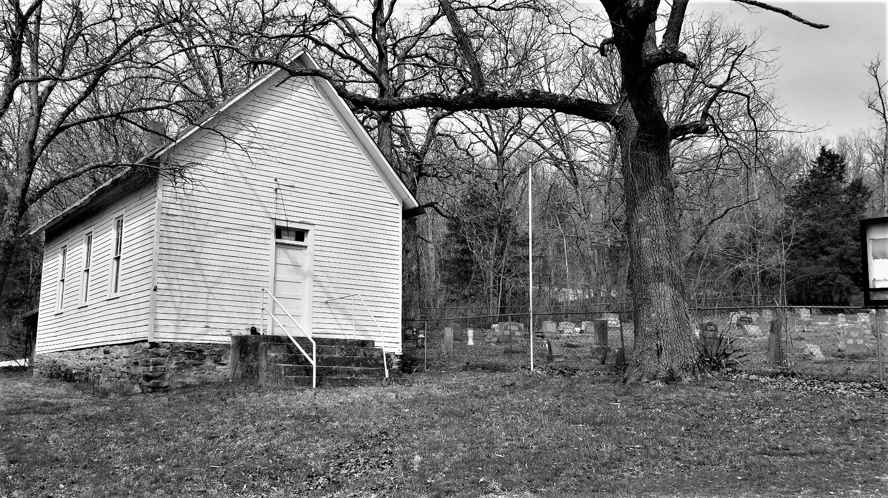
Welcome back friends! Today we finally make it out of the State of Illinois, cross over the Mighty Mississippi River, and into St. Louis Missouri. We'll pay our respects to some notable figures buried in the Bellefontaine Cemetery and I finally get a chance to stop for a visit to the St Louis Gateway Arch. So hop on board as we continue to Geocache through history...


Our first stop was a quick geocache (GC50RQ2) find in Greenville, Illinois to mark our overnight stay and getting a find for Bond County.

Then we jump onto I-70 westbound. Instead of taking it all the way into St Louis, we detour onto the northern I-270 route. This not only takes us into Madison County, IL, but also over to the Route 66 Chain of Rocks Bridge and an Earthcache (GC68M54). Over its 50 year history, Route 66 crossed the Mississippi River at five different locations: 1) McKinley Bridge, 2) MacArthur Bridge, 3) Old Chain of Rocks Bridge, 4) MLK Jr Memorial Bridge and 5) Poplar Street Bridge.


This crooked crossing spanning the Mississippi River was a memorable passage for Route 66 travelers. The privately funded bridge was built in 1929 as a toll bridge. The distinctive 22-degree bend in the middle resulted from the need to build on solid rock footings on the river floor. Eventually turned over to the city of Madison, IL, it became the US-66 Northern Bypass from 1936-1965. In 1967, the New Chain of Rocks Bridge opened just to the north replacing this one to vehicular traffic. Now it is a pedestrian / bicycle bridge. We walked out to the center where Illinois meets Missouri where there was also a virtual geocache (GC2258).


There is also one stage of a 5-part Adventure Lab Cache here. We were only able to complete the one question as the other 4 stages were back in the other direction and I'm not backtracking.

These two structures you see here are just south of the bridge and look like they're a couple of secluded castles. In reality, they are water intakes for a series of locks and dams for the Chain of Rocks Canal to the east. This 17-mile section of the Mississippi River is very treacherous to navigate with its rocky bottom. In the 1940's-50's, the Army Corp of Engineers created a straight canal on the eastside of Chouteau Island to make it easier for ships and barges to navigate and bypass the rocky rapids.


Next we looped up, around, and crossed the mighty river on the New Chain of Rocks Bridge into Missouri. Our first stop over here was in the Bellefontaine Cemetery just a few miles in. So there was one gravesite we came to see. But upon arriving, we discovered there was so much more history here to see. Such as...

... William Clark (GC7B7DX) of the Lewis and Clark explorers. Born in Caroline County Virginia, Clark moved with his family to Louisville, Kentucky in 1785. In 1789, he joined the militia. He was commissioned a lieutenant in the regular army in 1792. One of the men briefly under his command was Meriwether Lewis. Clark left the army in 1796. In 1803, Captain Meriwether Lewis invited Clark to share the leadership of a corps of exploration in an extensive journey into the vast uncharted area newly acquired by the United States with the Louisiana Purchase. Clark acted as mapmaker and artist, portraying in great detail the life they observed.


After Clark's successful return from the Pacific coast three years later, President Jefferson awarded him 1,600 acres and made him Brigadier General of militia for the Louisiana Territory as well as superintendent of Indian affairs. He held that post the rest of his life. From 1813, he served as governor of the Missouri Territory. Clark died in St. Louis where a 35-foot gray granite obelisk was erected to mark his grave.


The Wainwright Tomb is one of Bellefontaine Cemetery’s most well-known mausoleums. It was designed in 1891 by renowned architect Louis Sullivan. Entombed here is Elis Wainwright, a millionaire brewer who lived from 1850 – 1924. He’s also known for the Wainwright Building in downtown St. Louis, one of the world’s first skyscrapers. Notably, Louis Sullivan designed that too. But the tomb was originally constructed for his wife Charlotte who’d passed away at the age of 34. Wainwright would then go on the run to Paris after being indicted in a bribery scandal. Decades later, he was finally entombed next to his wife upon his death.


The grave of Herman Luyties (1871 – 1921) is among the most unique at Bellefontaine Cemetery. And it has a rather creepy backstory. Luyties, the owner of the first drug store in St. Louis, took a trip to Italy at the turn of the 20th century. There, he fell in love with a model who ultimately rejected his proposal for marriage. But Luyties couldn’t let her out of his mind, and he even commissioned a sculptor to immortalize his former lover in stone. Now, in some form at least, Luyties can lie forever with the woman who wouldn’t have him. Over time, the marble statue gradually eroded due to weather, and so it was later placed in the glass box we see it in now.


Adolphus Busch (1839 – 1913) was a well-known brewer who ran the Anheuser-Busch Company with his father-in-law, Eberhard Anheuser. And like Anheuser, Busch was also born in Germany. As a young adult he emigrated to St. Louis which was home to a large German community at the time. And that meant that there was also a large market for beer. Following Anheuser’s death, Busch became president of the company. And thanks to his marketing expertise and innovations like refrigerated freight cars, he helped Budweiser become a nationally recognized beer brand in the 19th century.


Today at Bellefontaine, the Busch Mausoleum is one of the more notable tombs on display. It was designed by the Barnett, Haynes & Barnett architectural firm in the Bavarian Gothic style but made with local stone. It supposedly cost around $250,000 to build at the time, which equates to over a couple million dollars today!


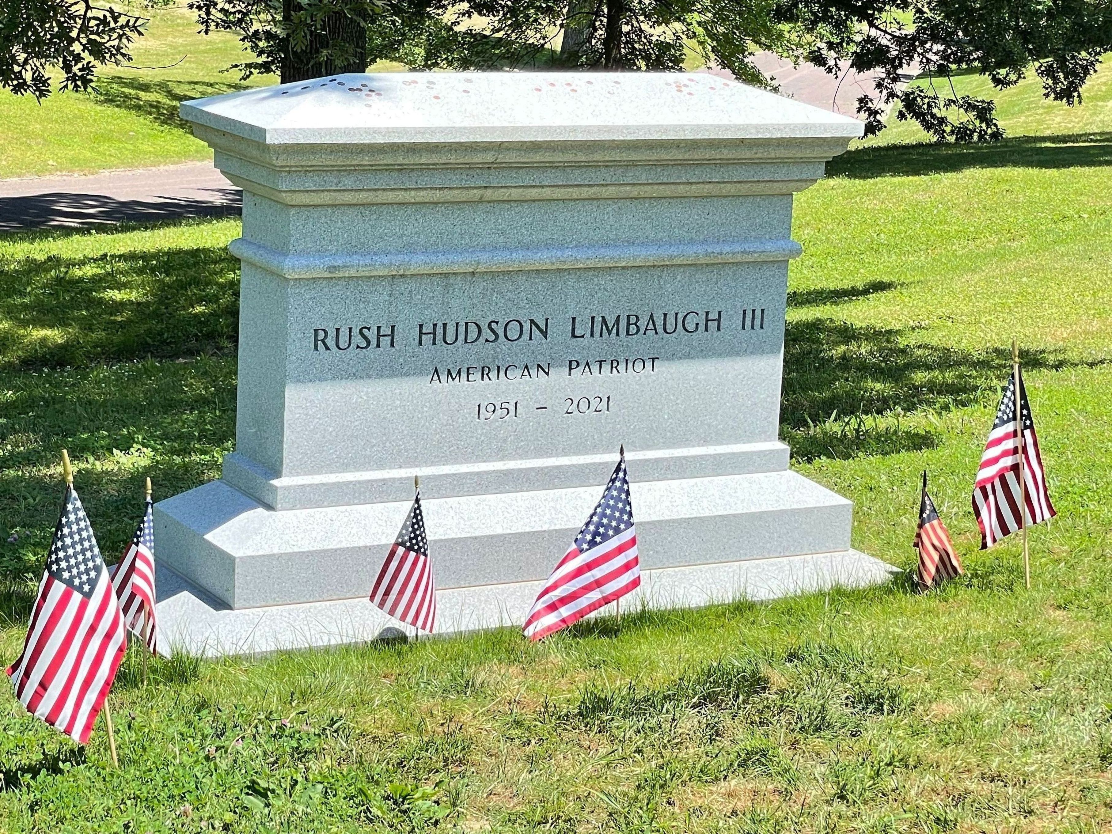
The main reason for stopping by this cemetery was to visit the gravesite of Rush Hudson Limbaugh III. The majority of people know the name, many who listened loved him, and the others who only know what was told about him probably hated him. Rush was a radio personality, political commentator, and author. He got his start in radio in 1971 at radio station WIXZ as a DJ in Pennsylvania reporting "farm news." Within 18 months, however, he was fired due to a "personality conflict" with the program director. He went through a number of radio stations, working as a deejay and a talk show host, but it wasn't until 1984, when he became famous with his radio show on KFBK in Sacramento, California. He could voice any opinion he felt, regardless of how controversial.

(At the time of our visit, Rush's headstone had yet to be installed.)

His show was picked up by ABC-Radio in 1988, now being broadcast all over the country for what would be over three decades. It eventually rose to 600 stations and 27 million weekly listeners. Limbaugh was inducted into the Radio Hall of Fame in 1993 and the National Association of Broadcasters Hall of Fame in 1998. Additionally, he was a five-time winner of the National Association of Broadcasters Marconi Award for Excellence in Syndicated and Network Broadcasting. Limbaugh's unabashed love of country and belief in American Exceptionalism caused detractors to seek controversy in every broadcast.

He was well liked for his charity work, using his show for the annual Leukemia and Lymphoma Society Telethon and the Marine Corps–Law Enforcement Foundation. He also was not afraid of poking fun of himself, voicing himself in cameos for three episodes of Family Guy.

Limbaugh, a cigar and former cigarette smoker, was diagnosed with lung cancer, eight days after his 69th birthday. On February 4th, during President Donald Trump's State of the Union Address, he awarded Limbaugh the Presidential Medal of Freedom. After his lung cancer diagnosis, he continued working on his radio show as much as he could. "I told the staff that I have a deeply personal relationship with God." Limbaugh died on February 17, 2021, at the age of 70.

(A more recent photo with the headstone.)

Continuing south for several miles along the banks of the Mississippi River into St Louis, we finally found a parking spot a few blocks away from the Gateway Arch (GC7ED). Along the way we spot the Tom Sawyer River Boat getting ready to pass underneath the historic Eads Bridge. This was the first bridge across the Mississippi at St. Louis. It was a major engineering feat, the largest bridge built at that time and the very first steel bridge. Completed in 1874, it is the oldest bridge standing on the Mississippi River. It was designed and built by James Buchanan Eads, an engineer famous for his ironclad gunboats built for the Union in the Civil War.


Nearing the Arch, we pass by this statue of Lewis and Clark and their dog coming ashore after crossing the river during their expedition.


During my days as a truck driver, I used to pass through St Louis on Interstate 40 often and could only get a view of the Gateway Arch out my window. I had always wanted to stop for a closer look, but parking a 70' long 18-wheeler within walking distance in downtown St Louis is probably not an easy task. Now, finally, we are able to get an up-close look at this monument.


Now for some history and facts. The St Louis Gateway Arch (GC7ED) is 630 feet tall and 630 feet wide at it base. The idea for a memorial to commemorate the western expansion of the United States began to take shape in 1933. On June 15, 1934, President Franklin D. Roosevelt signed the bill into law, instituting the United States Territorial Expansion Memorial Commission. In December 1934, the Jefferson National Expansion Memorial Association discussed organizing an architectural competition to determine the design of the monument. Local architect Louis LeBeaume had drawn up competition guidelines by January 1935. On December 21, 1935, President Roosevelt signed Executive Order 7253 to approve the memorial and 82-acre National Historic Site.


On February 18, 1948, Eero Saarinen's design was chosen from among the initial 172 entries in the design contest. After much deliberation and planning, the official groundbreaking ceremony finally occurred on June 23, 1959 at 10:30 AM. The first order of business was to build a tunnel and reroute the railroad tracks. In 1961, the foundation of the structure was laid and construction of the Arch itself began on February 12, 1963 as the first steel triangle of the south leg was set in place. The arch's visitor center opened on June 10, 1967, and the tram began operating on July 24. Upon it's competition, the arch became the tallest memorial in the United States and the tallest stainless steel monument in the world. The official dedication ceremony was finally held on May 25, 1968 by then Vice-President Hubert Humphrey.

Because of its tight quarters inside and limited exits, the Secret Service has forbidden all Presidents from ascending the Gateway Arch due to security concerns. The only exception was made in 1967 when he was 77 years old, former President Dwight D. Eisenhower was in town to give a speech. He had signed the order for the construction of the Arch in 1954. He paid a visit to the site after it had already closed to the public and insisted he get a ride on the tram to the top.

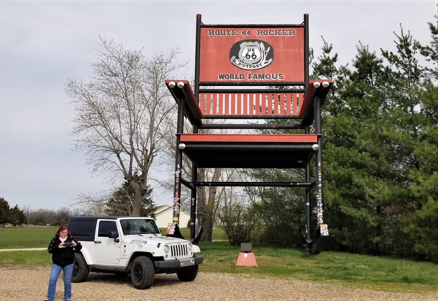
One more stop in St Louis before leaving the downtown traffic. I've played the game of chess since I was a kid. I taught my two sons when they were young. And when they started in a private Christian School, I formed and hosted the Chess Club for 2 years. So when I saw this virtual geocache at the World Chess Hall of Fame, we just had to stop. Outside they have the Guinness Record World's Largest Chess Piece (GC890GN) at 20 feet tall and a 9'2" diameter base and weighing in at 10,860 pounds!


Now to get out of the city to the rural open roads, find something to eat, and get some rest. To follow along on our travels and keep up with my latest blogs, you may do so here of course by clicking the "Follow" button to the right. But also by using one or more of your favorite of these social media platforms: FacebookMeWeGabRedditParlorTwitterGETTRInstagram, and TruthSocial. These all link directly to my profiles. Again, please feel free to comment and / or share.