Showing posts with label creek. Show all posts

Saturday, January 22, 2022

2020-07-04: Day 2 of Our Roadtrip Through the Smoky Mountains and Finding Fugitive Crash Site and Smallest Post Office

Welcome back friends, Jeepers, Geocachers, RVers, and Adventurers. On this Day 2 of our long weekend roadtrip geocaching through the Smoky Mountains, we got to see the beauty of the mountains while discovering some other sites of interest as well. Such as the bus and train crash scene from the movie "The Fugitive" and the smallest post office in the country. But not to get ahead of myself. So climb aboard the GeoJeep and lets go exploring.


Leaving Morganton, I drove back north towards the Blue Ridge Parkway. Our first stop was just a simple LPC (Light Post Cache)(GCV6EB). It made for a quick stop and credit for Mitchell County. Now usually you'll find just a pill bottle with the logsheet inside under these skirts. But this was a first time for me seeing that the entire skirt was used as the geocache container.


A few miles later over in Yancy County, I made another quick park and grab geocache stop to claim a find in that county (GC18PVC). Continuing on US-19 over into Madison County, we made a stop at the Mars Hill Recreation Park for one more quick geocache (GC5CWVV).

The next one on the list is just another of the many reasons I like Geocaching. In Jackson County, specifically in the town of Dillsboro along the banks of the Tuckasegee River, there's a geocache hidden up above the Fugitive Train Wreck (GC3F9ZA). In the 1993 movie "The Fugitive," starring Harrison Ford and Tommy Lee Jones, included a wreck involving a train and a prison bus. 


This wreck was staged near Dillsboro on a rail siding in the GSMR maintenance yard, between the working rail tracks and Haywood Road, the rail cars and bus remain in the same location today. Year round you can get a good view of the Illinois Dept of Corrections transport bus. But as you can see from our photos, the train is a bit hard to see with all the summertime foliage.


We even drove around to the other side of the river to get a different view, but not much better. The best view of the wreckage would be to take a ride on the Great Smokey Mountain Railroad which runs on the tracks right along side of it.


Driving west on US-64 to Clay County, the most western North Carolina county we needed to complete our map, we target the nearest geocache "The Legend of the Fairy Cross" (GC3GX90). This section of US-64 runs alongside Buck Creek. We exit the highway closer to the geocache onto the parallel National Forest Road, which looks like it might have been the Old US-64.


There was a small pull-off area to get to Buck Creek, so I decided to stop for a moment for some photos. I like these old roads enclosed by bushes and trees. After a few minutes of enjoying the sounds of the creek and taking some photos, we drove up a little further and turned onto Buck Creek Road.


For all my geocaching friends I thought I'd post a rare photo of my GeoJeep. Usually I'll post just the hood logo in front of something or have the tracking code blurred out like in the pic above. I'm only gonna leave this here a week, maybe longer, so log your "Discovered It" soon. I don't normally allow virtual discoveries so please don't copy this photo to your social media sites. And please include the location of where I'm parked in your discovered log. Thanks.

50ATJ9

Now back to the geocache. According to the description on the cache page: "this general area has a great history of minerals and mining. We are aware of at least 4 abandoned mines nearby. One of the minerals unique to the area is staurolite crystals, also known as fairy crosses because of their unique shape.

"Two thousand years ago, so the Cherokee legend of Fairy Crosses begins, the "Yunwi Tsunsdi," or Little People, lived in the beautiful mountains of what is now North Georgia and Western North Carolina. Shy and elusive creatures, the Little People were revered throughout the Cherokee Nation for their ability to find people lost in the thickly forested mountains of the region.

"One evening, while the Little People were enjoying an enchanted celebration of dance, music and song, a foreign messenger arrived bearing the sad news of the Crucifixion of the Son of the Great Creator. So moved were the Little People upon hearing the news of the loss of one so great, that they were moved to tears. As their tears fell to the ground, they turned into Fairy Crosses, where they can be found to this day."

Well I don't know anything about the little people or fairy crosses, but I did find the geocache down by the creek. I looked along the banks a few minutes for some minerals or cool rocks, but I didn't see anything special. Didn't want to spend too much time there though.


Finally rounding the corner and headed back to the east towards the campground, we followed US-64 into Highlands and Cashiers. Once in Highlands, I started taking the rural backroads to my next stop. It was there we found the Smallest U.S. Post Office in the country, at just 6 feet by 6.5 feet.

Originally built in 1878 about a mile away on Whiteside Road next to a grist mill at Sliding Rock, our next stop below. It remained there for 69 years and its first postmasters were Thomas and Elizabeth Grimshawe. In 1911 the Grimshawes sold their property to Warren and Lena Alexander who acted as the postmasters for 36 years. In 1947 they sold their property and the post office was moved near its current location once owned by the Alexander's daughter. Mae Alexander Passmore was postmaster for the final 6 years until President Dwight Eisenhower closed all third class post offices in 1953.


It was then moved and used as a ticket office and post card stand until returning here in 1976. Falling into disrepair and still getting the occasional tourist visitor, in 1999 neighbors decided to restore the post office and move it off the road a little bit and provide safe parking. From the photos displayed inside, the front area where I'm sitting was the customer area and the back half for mail and storage. Currently hanging on the back wall is the last flag which flew over the post office from the 1950's.


Driving a mile up the road we get to Sliding Rock. Actually a waterfall flowing over a large smooth rock, it turns a creek into a natural waterpark. A popular place in the summer time to cool off as you can see. There was a geocache on the short trail leading from the parking area to the rock but I couldn't find it. (The cache has since been archived as many others could not find it as well.)


And finally, one last quick roadside geocache (GC3C0B0) in Transylvania County to complete my final 100 North Carolina counties Geocaching map!

That was it for Day #2 of our long holiday weekend. On Day #3, Candy wasn't feeling well and we drove nonstop back to the campground at Lake Norman. I hope you have enjoyed this roadtrip through the Smoky Mountains. And perhaps found something I've written about to add to your bucket list of places to visit. See you back real soon.

To follow along on our travels and keep up with my latest blogs, you may do so here of course. But also by using you favorite of these social media platforms: FacebookMeWeGabRedditParlorTwitterRVillageGETTR and Instagram. These all link directly to my profile. Again, please feel free to comment and / or share.

Saturday, August 28, 2021

2019-12-28: Spending the Day in Big Bend National Park

It's been 13 years since I was last here at Big Bend National Park in West Texas. Spending the last few years just a few hours north of here, I figured it was about time I paid another visit. We spent two nights in Alpine, TX as our base so we could get here early, stay all day, and not have a long drive home afterwards. Big Bend NP is over 1200 square miles and that's a lot to explore and see. So let's get going!


We arrived just after dawn to a cloudy morning which kinda hindered having some great sunrise photos. Our first geocache was an earthcache called "Fins of Fire" (GC3AZVV) facing the Chisos Mountains to the east, describing the layers and spikes and the creation of the mountains from volcanic activity.


Continuing the beautiful route down the Ross Maxwell Scenic Drive, we arrived at the Solol Vista Overlook and another earthcache (GC2NJRH). The amazing views here are awe inspiring. And from this vantage point we barely get a glimpse of our destination Santa Elena Canyon some fourteen miles in the distance. From here though it's just a tiny notch in the mesa across the valley.


In the panoramic photo below taken from the Sotol Overlook, from left to right are: Trap Mountain, Goat Mountain, Santa Elena Canyon, Kit Mountain, across the valley to Tule Mountain, Burro Mesa, Little Christmas Mountain, and Christmas Mountain.


After the overlook, we stopped at Tuff Canyon for another earthcache (GC72D1C). Tuff Canyon is the deepest of the dry washes in Big Bend NP. This also makes it very dangerous during or after a rain as the gathering waters pick up velocity and can cause a flash flood rushing between the canyon walls. Over time the rushing waters slowly dig a deeper channel while at the same time eroding and smoothing the layered rock walls.


The mountains and cliff walls are plentiful. Just driving the roads, you won't even need to get out of your car to be amazed at the views.


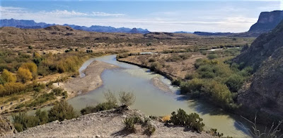
Now we get to the Santa Elena Canyon observation area (GC37ECH). The Santa Elena Canyon is one of the most famous landmarks within Big Bend National Park. Looking from the overlook area, that's the United States on the right, Mexico on the left, and the shallow Rio Grande River flowing up through the middle and curving to the left. A lot of people stop there to get their photos. However if you keep following the road around, it will take you down to the entrance, or should I say the exit.


Where the Rio Grande exits the canyon, there's the Santa Elena Canyon Trailhead. The Terlingua Creek drains into the Rio Grande River just as it exits the canyon. You can see it in the next photo coming in from the left. Most of the time the water level is low enough and you can easily walk across rocks without getting wet. Once you cross over and climb the short hill you enter the trailhead that has been paved creating an easy hike with stairs and switchbacks up 160 feet to the point from which I took the photo.


Once you make the short hike up and over at the trailhead, you make your way down the trail into the cool canyon. Because of the 1500 feet canyon walls that seem to raise up forever, they block out the sun except for the short time it is directly overhead. We continued our hike down and back to see how far we could go. Officially it's a 1.5 mile out and back hiking trail.


At this point, we came to the end of the trail. This is about as far as you can hike without getting wet. Now I was wanting a kayak so I could keep going to see what's around the corner. One of these days I just might do that.


Backing up a little ways there's this huge rock that had fallen near the edge of the bank of the Rio Grande. I talked Candy into climbing out on the rock with me and handed my phone to another hiker to take our photo. I think this turned out much better than trying to take a selfie and still get the full canyon effect.


Having made our way back in the GeoJeep, it was time to hit some of the offroad trails. First we drove back up the Ross Maxwell Scenic Drive and looped around over to the Panther Junction Visitors Center. This time we finally bought one of those National Park Passport books that you get stamped each time you visit a national park or historical site.

From there we made our way down to Glenn Springs Road. It's a gravel road that even a regular car can make it through, see the first pic at the top of the blog. There might be some parts that may be a little rough, but I'd drive down most of it if I still had the Prius and the turn around if I got to an impassible section.

After several miles it turns into Black Gap Road as it nears the spring. There it does become a rougher section that really requires high clearance vehicle. Just past the Glenn Spring primitive campsite I found my next virtual geocache (GCR2A8). The U.S. Calvary once used this location for a few years. If you look hard enough you can still find parts of the foundations of some of the buildings. At the top of the nearby hill you'll find some scattered wooden crosses for the cemetery. To get credit for finding the virtual cache you need to email the number of crosses. The Find-A-Grave website only lists five memorials here. If you use that number you won't have the correct number as there are more than that. And not having any names on the wooden crosses, they are known only to God.


Another hour or so of offroad fun in the GeoJeep and we make our way to the exit roads and back up to Alpine, Texas. It wasn't until later that I realized the Black Gap Road was one of the trails in the Jeep Badge of Honor series. If I had used the BoH app to check in from the trail, I could have gotten my first badge. Oh well, I guess that's a good excuse to have to come back and explore some more of the Big Bend National Park. There is still much to see out here that I haven't gotten to yet. And I recommend this place to be put on your bucket list one day. Just try to avoid summer as the temps are easily in the triple digits!

To follow along on our travels and keep up with my latest blogs, you may do so here of course. But also by using you favorite of these social media platforms: FacebookMeWeGabRedditParlorTwitter, and Instagram. These all link directly to my profile. Again, please feel free to comment and / or share.

Friday, February 7, 2020

2018-04-14: Geocaching in Historic Round Rock, Texas

Hello again and thank you for joining us at our Away We Go Geocaching Blog! For today we stuck to one area. We had drove down from Killeen, Texas about 30 miles south to have lunch at our favorite Greek restaurant in Georgetown called Plaka Greek Cafe. If you're ever in the area, you gotta give it a try! Delicious Greek Food Fast!


After lunch we decided to take a short drive down to Round Rock, Texas to grab a couple of virtual geocaches and tour some history. Permanent settlement began in this area in the late 1830s. By 1848, former Austin Mayor Jacob Harrell moved here, selling town lots near the Stagecoach Road crossing at Brushy Creek. A post office named “Brushy Creek” opened in 1851 in Thomas Oatts’ store. Three years later, the name changed to “Round Rock” for a distinctive limestone formation marking a natural ford for wagons. The Round Rock is our first virtual geocache (GCA219) for the day.


With immigration from several states and Sweden, the population doubled during the 1850's, bringing new stores, churches, fraternal lodges and grain mills. The first institution of higher learning, Round Rock Academy, began in 1862. After the Civil War, the former trail and stage road became a prominent cattle drive route. In 1876, the International-Great Northern Railroad developed a new townsite east of the existing Round Rock. A commercial district sprang up along Georgetown Avenue (Main Street) with construction of many limestone buildings. “New Town” quickly eclipsed the established settlement, whose postal name changed again to “Old Round Rock.” For months, the new site was the railroad terminus, bringing lumber and flour mills, cotton gins, blacksmith and wagon shops, banks, hotels, restaurants, stores and schools. Round Rock challenged the state capital for economic control of central Texas, boasting six hotels to Austin’s five and serving as the retail hub for several counties to the west. The railroad also made Round Rock a more cosmopolitan place, bringing new residents from all over the U.S. And all around the world.

Across the street from the rock is the Chisholm Trail Crossing Park. Throughout the park are several statues commemorating heritage. Also located in the park is a micro geocache called Pioneer Muggles (GC7G934) with a 4.5 out of 5 difficulty rating. We didn't have too much time to spend on it and only gave it about 10-15 minutes. So sometimes we have to pass on a cache and walk away with a DNF. This was one of those times.


Well-positioned for growth by its location on major transportation routes, Round Rock became one of the nation’s fastest-growing cities by the late 20th century. Two dozen commercial buildings in Round Rock’s historic downtown were listed in the National Register of Historic Places in 1983.

A couple of blocks down the road is our next geocache called Travel Bug Motel 6 (GC42HG1). It had a lot of favorite points so we had to stop. A quick find and we're on our way to the next one.

Our last stop for the day was at the Round Rock Cemetery just down the road. One of the first things we noticed were all the blue bonnets blooming. The "complex" is actually three cemeteries in one: the Round Rock Cemetery, Hopewell Cemetery, and an old Slave Cemetery. There were two traditional (GC3Z43M, GC1B09G) and one virtual cache (GC91B5) in this cemetery complex.  


Walking through the cemetery, I noticed a couple of busted and crumbling crypts. Whenever I see these things I usually think "the zombies have escaped!"


Probably the most famous resident here in Round Rock Cemetery is Samuel Bass. Born July 21, 1851 on a farm near Mitchell, Indiana, Sam was orphaned before he was thirteen and spent five years at the home of an uncle. In 1870, he arrived in Denton, Texas and worked for a while in a sheriff's office. In a few years he bought a little sorrel mare, became interested in horse racing, and had the fastest horse in Texas. One his fame spread, he couldn't get any bets against him to make any money.

So Sam helped drive a herd of stolen cattle to Nebraska where he stayed for nearly a year. Sam used his ill-gotten money to buy a saloon but he was soon restless. On a whim he sold the saloon and bought a gold mine that went broke almost immediately. He took up robbing stage coaches and fell in with some men with grander ambitions. On September 17, 1877, Sam and five others held up a Union Pacific train in Fort Bend, Nebraska. On board was $60,000 in newly minted $20 gold pieces plus $1300 in cash. Now $10,000 richer, Sam headed straight back to Texas.

Sam managed to make it back to adopted home of Denton, Texas boasting of a Black Hills gold strike to explain his sudden wealth. He spent lavishly on his friends and those who helped him hide out in the woods eluding the law. From his base near Dallas, Sam and his new gang held up two stagecoaches and robbed four trains within two months. He and the bandits were the object of a chase across North Texas by posses and a special company of Texas Rangers. Sam eluded his pursuers until his band rode into Round Rock, intending to rob a small bank. There on July 19, 1878, the gang became engaged in a gun battle with Texas Rangers led by Major John B. Jones. Wounded in the gun fight, Sam Bass was found lying helpless in a pasture north of town and died two days later on his 27th birthday.


Historical marker: One-half acre of Old Round Rock Cemetery was set aside for slave burials. Enclosed by cedar posts and barbed wire, sites are marked head and foot by large limestone rocks. Some rocks are hand-grooved with names and dates. White graves here are dated as early as 1851. The first marked grave of a freed slave is dated 1880. Although there are 40-50 known burial sites of freedmen and the burial ground is still in use, no interments of former slaves occurred after the turn of the century. (1979)


So that was it to our spontaneous little adventure to see some of Round Rock history. I hope you have enjoyed the stories and photos. Just a reminder to Like Us on Facebook or Follow Us on Twitter. See you next time!

Sunday, November 17, 2019

2017-12-28: Surprise Road Trip: Texas to Maryland Day 2

So welcome back and a quick recap of where I'm at. Because my wife was pulled from our Christmas vacation and sent on a business trip to Baltimore, I decided to drive there from Texas to surprise her. Yesterday I drove over 500 miles and stopped just west of Memphis, Tennessee, over on the Arkansas side. Along the way the GeoDogs and I are stopping for caches in needed counties to fill in those empty spaces on the map. In case you missed it, you can read all about Day 1 here before continuing to fill you in on the Why, Where, and Wohoo!


Waking up at dawn this morning in Brinkley, Arkansas, I loaded up the GeoDogs in the car and we began Day 2 of our Surprise Road Trip. Brinkley is located in Monroe County and one that I needed. Not far from the hotel was a park with a simple and quick cache, Best Park Ever (GC1XC5F), I could easily grab and be on my way. And not to worry about muggles this early in the morning.

Back on the road and a long stint before the next scheduled cache county. Eastbound on I-40, across the Mighty Mississippi River, through Memphis after 105 miles we arrive in Shelby County, Tennessee at a town called Arlington. It wasn't right off the exit, but the NoWhere Road cache (GC3RYBG) was pretty easy to get to and I thought it wouldn't take much time away from traveling. Found it quickly but the container was empty. Added a new log sheet and was on my way.

Taking the backroads back to the interstate, I passed by this old abandoned spooky house. It would have been cool to go exploring inside. But it was beyond the fence on private property. So just photos for now.


Just twenty-six miles down the interstate was my next stop in Haywood County and a quick cache called Koko Moto (GC2GAB3). A quick find right off the exit and return eastbound quickly.

Forty-seven miles later and I find myself in Henderson County at the Independence Cemetery. A small unincorporated community in Tennessee just a few miles from the interstate. The cache was called Earn Your Independence (GC111HB). Cemetery caches are among my favorites because of the stories and history that could be found in them. With the small church and graveyard it was hard to resist not taking a quick walk among the headstones. The cemetery was well kept with the exception of the space between these two headstones. Husband and wife headstones. I've heard about some people who don't want their burial site to be well mowed grass because they like gardening, trees, vines, etc. Could this be the reason? Or perhaps turmoil and chaos in the marriage? Hmmm. I guess we'll just have to imagine what truth has been confined to the grave.


Continuing east and across the Tennessee River, I arrive in Humphreys County and grab a quick off the exit cache. Pond Bottom at Cuba Landing (GCX8NR) was a quick cache with a view of North Fork Blue Creek. A quick stop for the cache and to let the Chihuahuas take care of their business.


A short 14 mile drive later and I'm in Hickman County at another unincorporated community called Only, TN. Here was an Earthcache called Lee & Gould Furnace (GC15QK3). Samuel Lee and James Gould built the furnace in 1833 as part of an ironworks that employed hundreds. They located here due to the proximity of the raw materials needed to produce iron. The furnace stands as a reminder of an early industry.


Williamson County was the next stop thirty miles east. The Flying Alphabet cache (GCX9NE) was at a truck stop near the exit. A nice quick stop that I could park next to it and let the GeoDogs out as a distraction while I made the find.

The next exit down was Cheatham County and another quick right off the exit No Map Needed cache (GC3V7K4) in a busy shopping area. Again I was able to position the car to block the view from muggles to make the quick find.

Thirty-eight miles and through Nashville later, I arrived at Wilson County for my next cache. Wash Day at Belinda City (GC1DVEN) was just the cache needed right off the exit at the edge of a parking lot for a quick find to keep me moving forward.

Next was a nice long stint of 115 miles over to Roane County. The New Years Resolution cache (GC5JHVJ) was so close to the exit it was practically still on the exit!

Sixty-seven miles later and passing through Knoxville, I arrived in Sevier County and the town of Kodak. There I grabbed Scorpio the Scorpion cache (GC3Q3DT) to claim a county find.

Speaking of Knoxville, they have one of my favorite cache finds. I found Knoxville's Fastest Headstone (GCNBF5) way back in 2008. The cache is located near the headstone of A. J. Pete Kreis who was from Knoxville. He was a favorite to win the 1934 Indy 500 race but was killed during practice when his car crashed over the wall and burst into flames. If you've ever watched the race on TV and in the intro do a brief history of the race, they usually show that crash. Well his giant rectangular headstone has the track outlining it and his car going over the wall. Pretty cool to see if you're ever in the Knoxville area.

My last cache for the day was in Hamblen County off I-81 in Morristown. Pull Out #3 cache (GCMJ18) is another one of those quick park and grab at the exit caches for the highway traveler.

Welcome to Virginia! Finally making it through Tennessee longways east to west, I drive another 115 miles to Marion, Virginia. When I got off the exit ramp I'm staring at these signs and begin to chuckle so I just had to take a picture. You got the Atkins (diet) to the right or the Hungry Mother to the left! Well I thought it was funny. Maybe cause I was driving for 625 miles, I'm tired, and ready for a hotel. I should make it to Baltimore tomorrow to surprise my wife. Talking to her on the phone a few minutes ago, she now thinks I'm still in Texas driving around the state Geocaching. With the freezing temps there in Baltimore, she's starting to come down with a cold and not feeling too good. Hopefully arriving with her puppies and myself will cheer her up! Come back tomorrow to see what happens!

Saturday, February 27, 2016

2016-01-24: Cemeteries, Canyons, and History Around Crosby County Texas

Today was a Geocaching day for finding lonely caches and cemeteries around Crosby County Texas. Lonely caches are either difficult or caches that are way out of the way in the middle of nowhere and nobody wants to drive to go find them.

So today we headed east on US-82 out to our first cache at the Crosbyton Cemetery (GC5HGV5). In 1909 when James Boggs, one of the -N- cowboys became ill and was thought to be dying, Julian Bassett had the Crosbyton cemetery laid out. TJ Walling, foreman, Buck Creamer, and JP Goins did the work. However, Boggs did not die. The first person buried at the Crosbyton cemetery was Willie Oliver, eighteen month old daughter of Mrs. Laura Oliver. She was buried on the north side where a small wooden fence enclosed the grave.


Just down the road, still in Crosbyton, is the Mt Zion Cemetery and our next cache (GC54293). Developed as a burial ground for the community's African-Americans in the early to mid-1900s, many of the stone grave markers have become chipped and broken. Pieces remain, but whole sections of names and dates of deaths are missing. About 10 years ago  Doddrick Quincy, a 16-year-old Boy Scout of the South Plains Council, lead a crew of Troop 333 Scouts in restoring the cemetery as part of his Eagle Scout project. The Scouts had to find unmarked graves and try to learn who is buried in each plot. The cemetery was built by the Mt. Zion Church, an African-American church built in 1924.


Our next cache was near an intersection that had four historical signs telling about a nearby ranch, the Texas Rangers, Old Dewey Lake, and the Mackenzie Trail. Though there wasn't anything there to see or take a picture of, it was interesting reading.

Moving along to another cache (GCHRXD) at a Texas rest area along US-82. This was a fun rest area! There was a creek running along the back side with a hiking trail. Now you can't pass up a hiking trail!


Our next cache was one of those out-of-the-way lonely caches that rarely get visited. Along the way we passed by some really great views and took some pictures. We also passed by a couple of historical signs. The first was about the Leatherwood School. To summarize it read:
This area of Crosby County was settled in 1898 by the family and relatives of M.G. Leatherwood. As other families began to arrive, the need for a nearby school became apparent. As a result, the Leatherwood Common School District was created in 1912.   
The first classes held in the spring of 1913 in a one-room schoolhouse on land donated by M.G. Leatherwood, were taught by Ellsworth Ham. The location of the school was changed twice before it was moved to this site at the eastern edge of the county.
At the height of its growth, Leatherwood School employed three teachers who taught 36 students in a three room schoolhouse. The final classes were held in 1949 when the area was made part of the Crosbyton School District.
 Another historical marker we passed:
The Pansy Baptist Church was organized in 1905 to serve the residents of the Pansy community. Church services were conducted in the school building until when the congregation constructed its first sanctuary. An arbor was built on the church grounds for revival services.
After a couple of moves and rebuilds, the latest being in 1965. Through the years population dwindled in the rural community of Pansy. In 1995 the remaining members voted to disband. The church building was donated to the Mt Zion Baptist Church, an African-American congregation in Floydada. The building was moved 32 miles by 140 volunteers. 


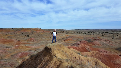
We finally arrive at our next Geocache (GCHRBA) called Cosmic View. A scenic area of the canyon and almost a year since the previous cacher logged a visit. It was definitely worth the trip though. We each took a turn for a photo and then a panoramic view.


Our next stop was Red Mud Cemetery (GC4ZZ83). First known as Tap Cemetery, as the little town of Tap was about 1/2 mile NE of this site. As Redmud Creek was nearby, it later became known as Redmud Cemetery. Will Barger homesteaded this land, and was shot by a neighbor in April 1886. His wife died of TB in July 1886 and was buried by his side. The number of graves increased and in 1906 the land owners on the north and south gave one acre each for the cemetery. In 1909 a group took the care of the cemetery as a project and the day for the annual cemetery working was set on June 6, it is still observed each year.


So as we were walking around the cemetery, we spotted this odd headstone. At first glance it looks as though Ida Peterson died BEFORE she was born. But after closer inspection, it seems as though they stamped the "9" in 1948 upside down!


We found a total of eleven caches for today before heading back home to end another great weekend of Geocaching.