Showing posts with label canyons. Show all posts

Saturday, August 28, 2021

2019-12-28: Spending the Day in Big Bend National Park

It's been 13 years since I was last here at Big Bend National Park in West Texas. Spending the last few years just a few hours north of here, I figured it was about time I paid another visit. We spent two nights in Alpine, TX as our base so we could get here early, stay all day, and not have a long drive home afterwards. Big Bend NP is over 1200 square miles and that's a lot to explore and see. So let's get going!


We arrived just after dawn to a cloudy morning which kinda hindered having some great sunrise photos. Our first geocache was an earthcache called "Fins of Fire" (GC3AZVV) facing the Chisos Mountains to the east, describing the layers and spikes and the creation of the mountains from volcanic activity.


Continuing the beautiful route down the Ross Maxwell Scenic Drive, we arrived at the Solol Vista Overlook and another earthcache (GC2NJRH). The amazing views here are awe inspiring. And from this vantage point we barely get a glimpse of our destination Santa Elena Canyon some fourteen miles in the distance. From here though it's just a tiny notch in the mesa across the valley.


In the panoramic photo below taken from the Sotol Overlook, from left to right are: Trap Mountain, Goat Mountain, Santa Elena Canyon, Kit Mountain, across the valley to Tule Mountain, Burro Mesa, Little Christmas Mountain, and Christmas Mountain.


After the overlook, we stopped at Tuff Canyon for another earthcache (GC72D1C). Tuff Canyon is the deepest of the dry washes in Big Bend NP. This also makes it very dangerous during or after a rain as the gathering waters pick up velocity and can cause a flash flood rushing between the canyon walls. Over time the rushing waters slowly dig a deeper channel while at the same time eroding and smoothing the layered rock walls.


The mountains and cliff walls are plentiful. Just driving the roads, you won't even need to get out of your car to be amazed at the views.


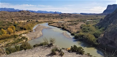
Now we get to the Santa Elena Canyon observation area (GC37ECH). The Santa Elena Canyon is one of the most famous landmarks within Big Bend National Park. Looking from the overlook area, that's the United States on the right, Mexico on the left, and the shallow Rio Grande River flowing up through the middle and curving to the left. A lot of people stop there to get their photos. However if you keep following the road around, it will take you down to the entrance, or should I say the exit.


Where the Rio Grande exits the canyon, there's the Santa Elena Canyon Trailhead. The Terlingua Creek drains into the Rio Grande River just as it exits the canyon. You can see it in the next photo coming in from the left. Most of the time the water level is low enough and you can easily walk across rocks without getting wet. Once you cross over and climb the short hill you enter the trailhead that has been paved creating an easy hike with stairs and switchbacks up 160 feet to the point from which I took the photo.


Once you make the short hike up and over at the trailhead, you make your way down the trail into the cool canyon. Because of the 1500 feet canyon walls that seem to raise up forever, they block out the sun except for the short time it is directly overhead. We continued our hike down and back to see how far we could go. Officially it's a 1.5 mile out and back hiking trail.


At this point, we came to the end of the trail. This is about as far as you can hike without getting wet. Now I was wanting a kayak so I could keep going to see what's around the corner. One of these days I just might do that.


Backing up a little ways there's this huge rock that had fallen near the edge of the bank of the Rio Grande. I talked Candy into climbing out on the rock with me and handed my phone to another hiker to take our photo. I think this turned out much better than trying to take a selfie and still get the full canyon effect.


Having made our way back in the GeoJeep, it was time to hit some of the offroad trails. First we drove back up the Ross Maxwell Scenic Drive and looped around over to the Panther Junction Visitors Center. This time we finally bought one of those National Park Passport books that you get stamped each time you visit a national park or historical site.

From there we made our way down to Glenn Springs Road. It's a gravel road that even a regular car can make it through, see the first pic at the top of the blog. There might be some parts that may be a little rough, but I'd drive down most of it if I still had the Prius and the turn around if I got to an impassible section.

After several miles it turns into Black Gap Road as it nears the spring. There it does become a rougher section that really requires high clearance vehicle. Just past the Glenn Spring primitive campsite I found my next virtual geocache (GCR2A8). The U.S. Calvary once used this location for a few years. If you look hard enough you can still find parts of the foundations of some of the buildings. At the top of the nearby hill you'll find some scattered wooden crosses for the cemetery. To get credit for finding the virtual cache you need to email the number of crosses. The Find-A-Grave website only lists five memorials here. If you use that number you won't have the correct number as there are more than that. And not having any names on the wooden crosses, they are known only to God.


Another hour or so of offroad fun in the GeoJeep and we make our way to the exit roads and back up to Alpine, Texas. It wasn't until later that I realized the Black Gap Road was one of the trails in the Jeep Badge of Honor series. If I had used the BoH app to check in from the trail, I could have gotten my first badge. Oh well, I guess that's a good excuse to have to come back and explore some more of the Big Bend National Park. There is still much to see out here that I haven't gotten to yet. And I recommend this place to be put on your bucket list one day. Just try to avoid summer as the temps are easily in the triple digits!

To follow along on our travels and keep up with my latest blogs, you may do so here of course. But also by using you favorite of these social media platforms: FacebookMeWeGabRedditParlorTwitter, and Instagram. These all link directly to my profile. Again, please feel free to comment and / or share.

Saturday, August 14, 2021

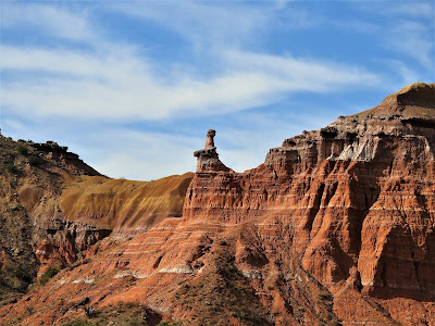
2019-11-25: Our Return to Hiking the Lighthouse Trail in Palo Duro Canyon Texas

Welcome back friends, family, geocachers, RV'ers, Jeepers, and everyone else who just happened to drop by my AwayWeGo's Geocaching Adventures blog. This is more about just geocaching though. I'm here to share my travels around this great country. The geocaching just helps me find some of those out-of-the-way very rural backroads "not-on-your-tourist-map" great sightseeing treasures.

If you'd like to follow along via many of the social media sites. I'll provide links at the end of this blog. I'd also love to hear from you, so please feel free to comment here or on the social sites. And please by all means share my stories with your friends too. I hope my stories inspire you to get out and explore.


Well after my opening paragraph, today we DID do the touristy thing and return to the Palo Duro Canyon. We both had this Thanksgiving week off so we decided to take a drive up to Amarillo, Texas and do some hiking in the Canyon. We were here a few years earlier to make this hike and that's where I proposed to her. (see "She Said Yes!") We've been married now for just over three years.

Plus along the hiking trail up to the famous rock formation called The Lighthouse, there was a trail of geocaches hidden. Many of those caches had been missing and we had to DNF them. They've since been replaced and now we can redeem those DNF's.


The weather couldn't have been better! It was cool out and with sunny skies, it made for perfect hiking. It also made for some pretty good photos I think. This next photo I call Sitting Chief. I don't know if it has an official name, but that's what I think of every time I see it.


Some background info from the Palo Duro website: The history of the canyon goes back a long ways. The Clovis and Folsom peoples first lived in the canyon and hunted large herds of mammoths and giant bison. More recently, the Apache, Comanche, and Kiowa took advantage of the canyon's plentiful resources. These early cultures left behind rock art and bedrock mortars where they ground mesquite beans and roots for food. The early Spanish explorers probably discovered the canyon and called it Palo Duro, Spanish for Hard Wood.

The Red River War between the U.S. Army and southern Plains Indians lasted from June 1874 to the spring of 1875. A decisive battle occurred in the canyon on Sept. 28, 1874. Colonel Ranald S. Mackenzie led the 4th U.S. Cavalry in a surprise attack at dawn on a camp of Comanches, Kiowas and Cheyennes. The families fled up the canyon, leaving everything behind. MacKenzie’s troops captured 1,400 ponies and shot most of them. Soldiers also burned all the teepees and winter stores. With no horses or supplies, the families had no choice but to return to the reservation. The reign of Native Americans over the Panhandle plains ended soon after.


Charles Goodnight, a former Texas Ranger, drove 1,600 Longhorn cattle to Palo Duro Canyon in 1876. He and his partner John Adair, an English aristocrat, founded the JA Ranch in 1877. At its peak in 1885, the ranch grazed 100,000 head of cattle on 1,325,000 acres spread across the Panhandle. After Adair died, his widow, Cornelia, took over as Goodnight’s partner. In 1887, Goodnight decided to scale back his ranching activities. The partnership ended that year, and the partners divided the land. Most of the canyon belonged to the JA Ranch up until 1890. Adair descendants continue to run the JA Ranch today.

The state bought the land for the park from Fred S. Emory in 1933. Soon after, Civilian Conservation Corps workers arrived, and spent the next five years creating a park. First, they built a camp for their home base, and then they set to work in the immense canyon. The men built the winding road to the canyon floor. Until it was finished, they hiked in and out of the canyon on what is now the CCC Trail. CCC workers made all of the park’s original improvements, including El Coronado Lodge (now the Visitor Center), the cabins on the rim and canyon floor, and trails. Designers planned the park to maximize views and complement the surroundings. The CCC used local stone and wood for building materials. In addition, workers forged decorative metal and crafted furniture. The park opened in 1934 before it was complete. It is the second largest park in the state parks system today, with about 28,000 acres


So of the 6 or 8 remaining caches along the trail that we needed to find, we only DNF'd just one... again. Since our last visit there was added a virtual geocache (GC7B6H7) and an earthcache (GC81YE8) up at Lighthouse Point. Upon arriving, we did the obligatory oohs and aahs, took in the views and captured some photos. Then after a short time we hunted for the answers for the caches before descending down into the canyon for our hike back to the parking lot. It is a beautiful Texas State Park and one of my favorite places in the country. I'm sure we will be returning again often.


I hope you have enjoyed our visit today to Palo Duro Canyon up in the panhandle of Texas. To follow along on our travels and keep up with my latest blogs, you may do so here of course. But also by using you favorite of these social media platforms: Facebook, MeWe, Gab, Reddit, Parlor, Twitter, and Instagram. These all link directly to my profile. Again, please feel free to comment and / or share. Until next time... see you out on the road!

Sunday, May 7, 2017

2017-04-17: Judge Roy Bean, an Old Fort, Cemeteries, and the Pecos River

Well our weekend is over and we drove back home along the Texas / Mexico border. Before leaving Eagle Pass, we drove around town checking out some of the historical spots.

Our first stop was down along the border at Fort Duncan. A temporary post called Camp Eagle Pass was established at the start of the Mexican War in 1846 by Captain Sidney Burbank with Companies A, B, and F of the First United States Infantry. In November 1849, the post was renamed Fort Duncan, honoring Col James Duncan, a hero of the Mexican War. The fort consisted of a storehouse, two magazines, four officers quarters, a stone hospital, in addition to quarters for enlisted men. (The red brick building above was the hospital.)

The fort served as a frontier outpost near the trail of California emigrants; a base of operations against hostile Lipan Apache Indians. In 1851 it became the headquarters of the First Infantry. By 1856 the garrison included units of mounted rifles and first artillery. Abandoned in May 1859, the post was re-garrisoned by Robert E. Lee in March 1860 because of border assaults by Juan N. Cortina, desperado of the area. At the outbreak of the Civil War in 1861, the fort was again abandoned only to be occupied later as "Rio Grande Station", by Confederate forces.

In 1861, Fort Duncan was re-garrisoned by the 9th Infantry and headquarters company of 41st Infantry under Col William R. Shafter. Seminole-Negro Scouts, organized here on August 16, 1870, played a large part in ridding Western Texas of Indians. After 1883, the post declined in importance; known as Camp Eagle Pass.
Fort Duncan played a part in aviation history when the first military cross-country flight, from Fort McIntosh in Laredo, landed here in 1911. Its use as a training camp continued during World War I. Mexican border troubles in 1916 again brought reoccupation.

By 1932 the Army abandoned the post. In 1938, the fort property was purchased by the city of Eagle Pass, for use as a Park and Recreation area. The infantry barracks were leased by the Local Council of Boy Scouts.

In 1939 the barracks became the Fort Duncan Country Club and remained as such except during World War II when it was also an officers club for the Eagle Pass Army Air Force Advanced Flying School.


After walking around the fort, we drove north a few blocks to the downtown area looking for the post office. We didn't need the post office, but I had read about an interesting spot on the Find-A-Grave website. This spot, at Rio Grande and Monroe in Eagle Pass, is approximately the site of the first city cemetery here. For some reason, after the 1880's the cemetery was abandoned. It was later developed on and paved over, effectively destroying it. During the construction of a post office nearby in the 1950's, a tombstone was discovered, as well as several graves.

We never did find it though. I wasn't thinking that the current Google search for post office was a different post office from the 1950's. It wasn't until I looked the website again and re-reading the description that we were a few blocks away. Maybe next time passing through we'll find it.

From there we drove over to Shelby Park along the Rio Grande River. The park is mostly used by those leaving their cars on the Texas side and walking across the International Bridge into Piedras Negras. There were also about a half dozen border patrol agents getting ready to launch two airboats for patrol. The photo below looks over into Mexico and the bridge would be located off frame to the left.


Well now it was time to finally hit the road and put some miles behind us. We still had almost five hours of driving with 10 Geocaches and some sites to see along the way. Driving north along US-277 we found three quick caches: one at a cemetery (GC4N23X) and two roadside caches (GC29WHF and  GC35ZC8), before arriving in Del Rio for lunch.

Westbound on US-90, our next cache was the Ye Olde 4-Wheeler (GC36XP2) which brought me to stop and capture a photo of this old west wagon before it completely fell apart.


Next was another cemetery cache (GC3B4NE) in Comstock. In 1882 and 1883, the Galveston, Harrisburg, and San Antonio Railroad built track through Val Verde County and the town was established as a station and named for John B Comstock, a railroad dispatcher. The graves date back to 1883, but there were three that really caught my attention. No stories behind them. It's just the emotion and photo opportunity they gave me. Like this first one of Lucy Denmead who couldn't escape death in 1902, or did she?


Next cache (GC5N4E2) was at the rest area where US-90 crosses the Pecos River. I once passed through here 10 years ago while I used to drive an 18-wheeler, long before this rest area was built. Back then I had to park on the shoulder. The only thing I do remember was the remains of the old highway which ran down towards the river to the original bridge built in 1923 and destroyed by floodwaters in 1954. The current Pecos High Bridge is 1310 feet long and 273 feet above the water, and is the highest highway bridge in Texas.

At this southern end of the Pecos River it empties into the Rio Grande just a half mile down.


Just down the road was another cache (GC2NZHP) and another bridge. These two bridges cross Eagles Nest Creek Canyon just north of the Rio Grande River.


In nearby Langtry was our next cache (GCK9CH) and someplace I've wanted to stop for a long time, the "Law West of the Pecos." In 1882 the lawlessness was so bad that the railroad asked for help from the Texas Rangers. The closest legal authority was in Fort Stockton over 100 miles away. With the blessing of the Rangers and the railroad a proprietor of a store housed in a tent in Vinagaroon was appointed as the first Justice of the Peace in Pecos County (now Val Verde County) August 2, 1882.

Roy Bean never one to stand on ceremony tried his first case the week before the appointment. In 1883 the judge moved his business and his court to Langtry, Texas. There he built the Jersey Lilly Saloon, Court Room and Pool Hall. Some legends cite Bean as being a "hanging" judge, but there is no record that he ever sentenced a man to be hanged. The only law book the Judge ever owned was the 1879 Revised Statues of Texas. Occasionally he actually used it.

The "Judge" had great admiration and fascination for the famous English actress Lillie Langtry. She was internationally know as the "The Jersey Lily so he named his establishment after her. A sign painter commissioned (for food and drink) to letter the sign misspelled "Lily".

One of the most colorful stories about the Judge is true. He successfully promoted the Maher - Fitzsimmons prize fight in February 1896. It was staged in defiance of U.S. and Mexico law on a sand bar in the middle of the Rio Grande River.

A couple more quick caches along the way home and that was the end of another adventurous weekend of exploring the history of the Old West Texas. Thanks again for stopping by and following along in our adventures. Until next time, happy trails.

Monday, March 28, 2016

2016-03-26: More Hiking and Geocaching in the Guadalupe Mountains National Park

Hello again and welcome back to another one of our Geocaching adventures. After last weeks exhausting hike up Guadalupe Peak, today was supposed to be one of those driving from cache to cache days. However, one of Candy's co-workers heard about our hike and saw the photos and she wanted to go hiking with us. She is also in the Marine Reserves and was leaving soon, so a change of plans and back to the Guadalupe Mountains National Park.

This time we decided on hiking through the McKittrick Canyon trail. That trail had an earthcache (GC1WAPB) near the trailhead and visitors center, as well as two virtual Geocaches out on the trail. When we arrived at this visitors center, a few miles east of last weeks visitor center for the peak trail, we found that the restrooms were out of order. So we drove back to the main road and the nearby rest area. While there, we found the two quick LPC Geocaches also.

Now back at the visitors center, we gathered our backpacks and headed onto the trail. It was a little bit later a start than last week as it was now close to noon. I also came prepared this time for the "day use fee" and did not have to search for loose change.

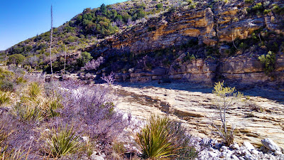
This hike was definitely easier than last week being mostly flat in the beginning. The McKittrick Canyon trail follows along the mostly dry stream bed, crossing through it several times as the trail and stream wind through the canyon. It was another clear blue sky day which made for some excellent views of the mountains on both sides of our hike. I'll let you enjoy a few pictures before I continue writing.


The next few pictures show the dry stream bed. For the first mile or so, there isn't any water flowing at all. From the looks of the erosion and the smoothness of some of the rock, it appears as though they get a whole lot of water flowing through here at times. But since we've been to West Texas, it hasn't rained that much.


After about a mile and a half down the trail we began to see a small clear stream flowing within the bed. It had a pretty decent flow rate going so it was a little puzzling. It seemed as though it may have been coming from a spring and then disappearing into the rock again. The way the trail weaved in and out, we never did see the beginning or the end of the water flow to know from where it came or where it went to. I figured on the way back, maybe we'll follow the stream bed instead of the trail to see how and where it originated.

About this time we encountered the park ranger hiking up the trail. I slowed a bit to let him catch up to me while the girls continued their pace. After a few minutes I asked him about the stream. He didn't really say it was a spring, but just that it began and ended.

He told me the story that the once land owner, Wallace Pratt (I'll get to him shortly), said the stream flowed constantly back in the 1920's and 30's through the canyon until it exited into the desert and dried up. Then in the late 30's and early 40's there were two floods. Mr. Pratt said that after the second flood, the stream just sank into the ground. And from then on it just flows on a few segments for a short distance.

So I still don't know how it originates or where it ends. But we will have to return again for another hike. Maybe we'll follow the stream bed then to find out.


So now for the next half mile or so, we're still hiking along with the park ranger and I notice on my GPS that we're getting closer to our first virtual Geocache (GC3A26). At about 300' away from the cache pointing to the right, the park ranger also says he has arrived at his destination. It seems we were going to the same place. Although he didn't know anything about Geocaching because I was explaining it to him along the way and that it was the main reason that had us hiking this trail.

We left the trail at these two stone pillars which led up to this old stone. The Wallace Pratt Lodge was the summer residence of Wallace Pratt (1885-1981), the principal donor of the lands that would become Guadalupe Mountains National Park. Pratt was a petroleum geologist employed by the Humble Oil Company, scouting for oilfield leases in west Texas. Pratt visited the Guadalupe Mountains in 1921, and taking a liking to the place, he bought a quarter share of the McCombs Ranch. There was at one time a road that led down into the canyon to the house. But the park service had it torn up and removed long ago.

In 1929 Pratt bought out his partners, ending up owning a large portion of the canyon, which featured waterfalls flowing over travertine dams, a lush, quiet place in the high desert. In the winter of 1931-1932 Pratt started construction of a house in the canyon, designed by Houston architect Joseph Staub. The cabin was built by Staub's former employee Vance Phenix and Vance's brother Dean, a carpenter, with stonemason Adolph May. The cabin was built of local limestone and heart pine. There was even a separate two car garage for their "his and hers" Mecedes-Benz's.The Pratt family spent summers at the cabin, which they called the Stone Cabin, and briefly lived at the cabin during Wallace Pratt's early retirement, while they built their final retirement home, the Ship On The Desert, outside of the canyon. The cabin accommodated the Ship on the Desert's architect during its construction. After the family moved to Tucson, Arizona, they donated the cabin, new house and surrounding lands of more than 5,000 acres (2,000 ha) to the National Park Service, the nucleus of Guadalupe Mountains National Park. The cabin was listed on the National Register of Historic Places on March 26, 1975.


So after touring through the old house, we thanked him and continued further up the trail. Now here's where it gets really interesting...


About another mile down the trail we catch up to another couple who left the Pratt House just before us. They were at a fork in the trail. There was a sign there pointing to the "Grotto" to the left and continuing the McKittrick Trail to the right. They asked us if we had been on the trail before, but this was the first time for us all. They were looking for the trail that took them to higher elevation to view the canyon. We wanted the correct trail that led to the virtual cache! They remembered something the park ranger had told them about the Grotto, but didn't remember if that meant to follow that trail. Our GPS was leaning 3.4 miles slightly right. But that doesn't mean much winding around through the mountains. So they went left and we went right.

About a 100' further and we began climbing. Now up to this point and for the last 3 miles to the visitors center, we ONLY had a 200' elevation increase! Now we were starting to climb. I think this was the way the other couple needed to go also.

Even though the elevation was increasing more dramatically, it was still a fairly easy trail for a moderate rating. Then we encounter the rocks!!! The trail went from a smooth incline to an extremely rocky, big boulder steep incline! This was more like rock climbing than a hiking trail. Even the severe rated trail for the peak wasn't this rough. But we're adventurers, so we continue on. Perhaps it's just a short rough section that gets back to normal just around the next boulder. And according to the GPS, we're still heading in the right direction.

Continuing to climb, up another 100', then another 100', just when you think that if you climb over this spot and around that corner, there we'd find the normal trail again. Somewhere around the 400'-500' mark, it looked like a split so I quickly went ahead to the left to see if there was a way through. Nope that was a dead end. So I yelled back to have them head the other way.
I went ahead quickly up that side as well and saw no end in sight. It was just more large rocks and steep climbing. Finally I suggested we call it quits and head back down. It looked like we were getting closer to the top, but I'd hate to have climbed another 200'-300' only to encounter and dead end cliff wall.

So we all agreed and headed back down the rocks. Finally we get back down to the normal looking trail when suddenly there's a fork in the trail. WHAT? We don't remember that! Where did THAT come from? I zoom in on the GPS and noticed that we had came from the left. NO WAY!!! The TRAIL actually switched back to continue up the other direction! We didn't even notice that. So in reality, we were NOT climbing up the trail but just a rock wash.


The two pictures above don't do justice, but kinda give you a sample of what we climbed. We didn't take many pictures in that area as we kept our phones in our pockets to keep our hands free for climbing! In the photo below, you see the thick trees at the bottom? Down in there is where we missed the switchback on the trail. Now from there follow the crevice up the left to that large shaded area. That's about where we climbed to before turning back down.


So while we were at the switchback, three hikers came through and we asked if they had been on this trail before. Nope, it was their first time as well on this trail but said they hiked a lot. It showed as they walked fairly quickly. After debating a brief moment, we decided to continue forward on the correct trail to see where if we could make it to the other virtual Geocache, still more than three miles away. But that was a straight line distance, not the actual trail distance.

We caught up with the three hikers after a couple of switchbacks as they were seated and grabbing a snack. One of them began asking us what our plan was and if we had a car parked at the visitors center. He informed us that the front gate would be locked at 6:00 pm and we should be back at the visitors center by 5:30 in order to make the drive out the gate in time. By now it was 2:30 and there was no way to make it to the virtual cache AND still have time to make it back. So we decided to turn around and head back.

Just about that time, the couple we met by the Pratt House and later at the fork to the Grotto came walking down the trail from further up. They were puzzled at how they had passed us when I explained about our misfortune of making the wrong turn and we hiked up the rocks. They said the Grotto wasn't that far down their trail which they took. After looking at it, they doubled back and followed the trail we took. They however made the switchback and passed us while we were rock climbing.


The walk back was brisk, yet seemed to take forever. Especially that last mile! I kept watch on the GPS and it wouldn't move for long stretches as we rounded the base of a mountain along the trail. It just kept pointing to the mountain as we had to round the base to the other side. Then the compass would point straight and we'd start closing in on the car. But the needle would start to veer off to the side again as we rounded another corner. Our total hiking distance according to the GPS was 9.19 miles.

It was another great Geocaching adventure and a fun hike. Not as sore this time as last week. Even with our wrong turn climbing up the rocks, we still had a good day. Candy's co-worker also enjoyed her day hiking and learning about Geocaching. It's too bad she's being transferred in a couple weeks. Maybe we'll be able to get one more hike in before that.

That's it for now. See you back again next time.