Welcome back friends, RV'ers, Geocachers, Jeepers, and fellow travelers. When we last left you, we had just arrived to our next RV park in Bridger, Montana. The last time I was this far up in the northwest was way back in 2008 as a truck driver. While driving a big rig you don't get to see too much except out the windshield. This time we have the GeoJeep to get around and do some sightseeing. Today we start out at the historical Little Big Horn and Custer's Last Stand. So click and follow along as we tour these sacred grounds...

The Little Bighorn Battlefield National Monument Park (GC6F9E) covers an area of about 765 acres. It consists of the Battle of Little Bighorn that took place on June 25th & 26th, 1876 where Lt. Col. George Armstrong Custer and the 7th Calvary fell against the combined Cheyenne, Sioux and Arapaho force. It also includes the Custer National Cemetery and the battlefield site of the Reno-Benteen skirmish, about 3 miles southeast, with the Cheyenne-Arapaho warriors.

Following the fall of Custer and the 7th Calvary, the 11th Infantry led by Captain George K Sanderson buried Custer and his men on the battlefield where they fell. He also constructed the first monument on the site. From his official report dated April 7th, 1879 he wrote:
"I accordingly built a mound out of cord wood filled in the center with all the horse bones I could find on the field. In the center of the mound I dug a grave and interred all the human bones that could be found, in all, parts of four or five different bodies. This grave was then built up with wood for four feet above ground. The mound is ten feet square and about eleven feet high; is built on the highest point immediately in rear of where Gen'l Custer's body was found."
In July of 1881, Lieutenant Charles F Roe and the 2nd Calvary built the granite memorial which still stands today on top of Last Stand Hill. About 220 soldiers remains were reinterred around the base of the new memorial, but left the markers in place where they had fallen.

In 1890, the stakes which marked where the soldiers had fallen were replaced with the marble markers you see today. Starting in 1999, the first of many red granite markers for the Cheyenne, Sioux and Arapaho Warriors were set in place where they fell.

To make it easier to spot for the hundreds of thousands of tourists who visit each year, Custer's marker was given a black background. Custer's remains had been reinterred to West Point long ago back in 1877, as well as many of the other officers remains were moved to Fort Leavenworth, Kansas or cemeteries across the country as requested by their families.

Custer National Cemetery was first designated as a U.S. National Cemetery on January 29, 1979 to protect the soldiers graves buried there. In December of 1886 it was re-designated as the National Cemetery of Custer's Battlefield Reservation to include soldiers graves of other wars. Eventually the name was shortened to Custer National Cemetery. Buried soldiers of the 7th Calvary, whos remains were discovered on the battlefield after the 1881 memorial was built, were reinterred here and listed as unknown.

The remains from 25 other cemeteries were transferred to here when frontier forts closed at the end of the Indian Wars. The fallen from many famous battles, Fetterman, Wagon Box, Hayfield, Big Hole and Bear Paw, now rest here.
Until reaching capacity in 1978, this cemetery accepted reservations for veterans and their spouses. There are soldiers here who fought in the Indian Wars, Spanish American War, World Wars I & II, Korea, and Vietnam.
There's a great book written by James Donovan that I highly recommend. "A Terrible Glory: Custer and the Little Bighorn: The Last Great Battle of the American West" is a great book put together from survivor accounts, official reports, and battlefield evidence. We listen to a lot of audio books while traveling down the road and this was one of our favorites. After listening to the Park Ranger give a summarized play-by-play of the battle, the welcome center recommended this book. We listened to it over the next couple of days as we drove around Montana.
After our visit to the battlefield site, we decided to go out geocaching and pickup some new Montana counties. The first one was also in Big Horn County in the town of Hardin. It was a travel bug hotel cache (GC4F5XD) located near the office to an RV park.
On the way to our next geocache, we crossed over into Yellowstone County. Along the side of Highway 47 was this old farmhouse that I just had to pull over and get a photo.

The geocache (GCKNZ4) was near a boat access ramp along the Big Horn River at I-94 and Highway 47. The geocache is called Manual Lisa. A little history lesson from the cache description:
"Manual Lisa was a Cuban native. He lived 1772-1820. He was called Nebr, first white settler. He came up the Missouri in 1807 to start a fur trading venture. He built the 1st Fort Lisa on the Big Horn River. This fort was also called Manual Fort or Fort Manual. Unfortunately, he had to abandon the fort due to pressure from the British and the Indians. He was married to Mary Hampstead Keeney of St. Louis and they traveled between St. Louis and the Bighorn. She assisted the Yellowstone Expedition which had established its headquarters near the Lisa Trading Post. Manual Lisa saw himself as an Indian benefactor not an exploiter. He wrote to William Clark in 1817 (three years before he died) that he had distributed various seeds to help the Indians grow things. Some of these seeds were pumpkins, beans, turnips, and potatoes. He also loaned them traps and arranged for black smithing as needed.
"There is a stone in this area (unfortunately they are on private land) where he carved his name M. Lisa-1807 and another stone with Colter 1810. They are somewhere around the mouth of the Bighorn. The Bighorn and the Yellowstone rivers flow together in this area. There are pictures of these stones at the cafe/casino in Custer, Mt. The pictures were taken in 1920 and you can clearly see the names. The Chamber of Commerce in Hardin, Mt. is trying to put more information together on historical sites in this area."
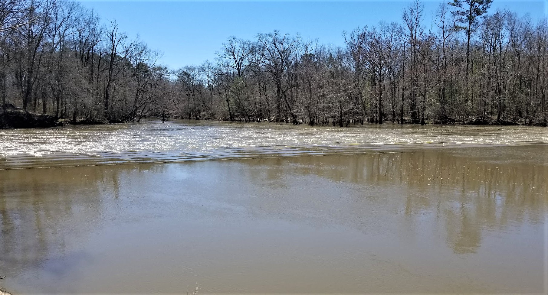
Well I didn't get to see the 200 year old names carved in the stone. But I did get a good view of the Big Horn River and an old bridge around the corner.


And finally, the last geocache was further down I-94 into Rosebud County. Just a quick earthcache at a highway rest area (GC1GCXE). Now on back to the motorhome to end the day. Thanks for riding along.
To follow along on our travels and keep up with my latest blogs, you may do so here of course by clicking the "Follow" button to the right. And there's also my main website at AwayWeGo.US for the complete index of my traveling adventures going back to 2005. But also by using one or more of your favorite of these social media platforms: Facebook, MeWe, Gab, Reddit, Twitter, GETTR, Instagram, and TruthSocial. These all link directly to my profiles. Again, please feel free to comment and / or share.