Showing posts with label dams. Show all posts

Saturday, July 23, 2022

2021-03-03: Roadtrip! Our First Day of a 4000+ Mile Road Trip from Texas to Louisiana

WOHOO!! Time for another road trip!! After four months in southeast Texas, we laid the groundwork on this project and turned it over to the remaining crews. So where's the next big project? Well the next big project is just across the state back in West Texas. 

But first, I gotta make a quick overnight stop in Florida for my father's funeral. Then we head back up to Maiden Creek, North Carolina for two weeks worth of work putting the finishing touches on a project we started last year. And for an adventure we're gonna take the long way back to Texas. I mean what's the excitement of just driving the quickest interstate highway to your destination right? So a 500 mile roadtrip turns into a 4,000 mile roadtrip!


Day #1 of this road trip and my first goal is just getting out of Texas to get a jump on putting miles in the rear view mirrors. Our first stop was at a virtual geocache and an earthcache (GCCF25, GC7VW68) in Dequincy, Louisiana.

In 1897, the Kansas City Southern (KCS) Railroad laid track through the town of DeQuincy and the first depot was built on this site. In the early 1920's KCS began rebuilding or remodeling many of its stations along the line in Western Louisiana. This building was completely rebuild in 1923 and eventually turned into a museum in the 1970's.


Located trackside of the DeQuincy Railroad Museum is a 1913 Steam Locomotive and a 1947 Pullman passenger car. While we were checking out the outdoor displays, a modern day Kansas City Southern freight train whistled past.


Our first new geocaching county to check off the list was up next for Allen Parish. We stopped in the town of Oakdale and the Calcasieu River Dam (GC81VQW). After taking a few photos I began looking unsuccessfully for the geocache. Previous finders said that it was buried, something they're not supposed to be. It has since been archived.


Still needing a geocache for the county, or Parish as they are called in Louisiana, I made a stop for a quick roadside cache (GC8XN4V) as we continued eastbound.

The next county on the list was Evangeline Parish. Near the town of Bayou Chicot is the Vandenburg Cemetery and my next geocache (GCW780). A well maintained cemetery with over 800 interments here, the oldest dating back to 1818. It's too bad that I don't have more time to look around here.

Did you know there is a difference between a cemetery and a graveyard? I mean everybody, including myself, usually just calls them cemeteries. But traditionally a graveyard is a cemetery that's attached to a church. Just like my next geocache...

The White's Chapel United Methodist Church (GC3730Q) was built in 1894 by Hugh and Lee Evans on land donated by Wilson A. O'Quin Sr. It was named in honor of Rev. Frederick White who organized it in 1870. There are less than 300 interments buried here with the oldest dating back to 1877, a SGT Leon Joseph Campbell.


While it was great to visit an old historic church and graveyard, I wasn't able to find the geocache. And not wanting to get too far behind in miles, I skip the next few geocaches and drive quickly beyond Baton Rouge. Though that also meant skipping a few needed counties too. That just a reason for another road trip!

When normally passing through down I-10 east-west, most people take the I-12 shortcut between Baton Rouge and Slidell. Since I still wanted to get those lower counties, I went south into Ascension Parish and the town of Prairieville. The Prairieville Cemetery (GC35J5A) is scattered with old growth oak trees which makes for a beautiful setting and a little spooky too. The cemetery has over 3000 interments dating back to 1812.


Moving right along, the next geocache is just a quick roadside park and grab at an I-10 exit for a find in St. James Parish (GC50YRT). While here we ran into another geocacher named SWAseekers, who was also on a county caching run in Southern Louisiana.

Next in St. John the Baptist Parish, I met up with SWAseekers once again for a quick parking lot geocache (GC8BC9X).

Since we didn't want to get into New Orleans during the busy evening hours, we decided to call it a day. Plus it was already after 5:00 PM and we were hungry and tired. Tomorrow morning we'll visit New Orleans while it is less crowded. Thanks for riding along and we'll see you again soon!

To follow along on our travels and keep up with my latest blogs, you may do so here of course by clicking the "Follow" button to the right. But also by using one or more of your favorite of these social media platforms: FacebookMeWeGabRedditParlorTwitterRVillageGETTRInstagram, and TruthSocial. These all link directly to my profiles. Again, please feel free to comment and / or share.

Saturday, January 9, 2021

2019-04-20: Geocaching, Hiking, and Exploring the Beautiful Wichita Mountains Wildlife Refuge in Oklahoma

For today's adventure, we are once again Away-WE-Go for this Easter holiday weekend. Most of these blog posts I'm usually by myself on my Sunday drive back to work. Having this long weekend off, we decided to take a drive up to Oklahoma.


If you recall last month on my long roadtrip back from Minnesota, I had stopped at the Wichita Mountains Wildlife Refuge. I mentioned that they perform a live Passion Play every Easter and have been doing it for nearly 80 years. You can read more about that by revisiting my blog page here. Candy and I thought it would be a great idea to go and see it. So we drove up yesterday.

The granite walls of the Wichita Mountains offered refuge to waves of people over many centuries, beginning with Nomadic Native Americans. In the late 1800's, conservationists made plans to re-establish bison and other imperiled species in the region. Looking for the best habitat, they decided that the sheltered prairie of the Wichita Mountains was the ideal location.

This morning we came here to see more of the natural refuge, do some hiking, and hopefully see some wildlife. For our first stop we drove over to French Lake and parked by the Bison Trail for a hike over to the dam. The many dams located in this refuge which form all the lakes were constructed in the 1930's as park of the Federal Work Projects. We hiked the Elk Trail back to the GeoJeep. It was a pleasant, clear, perfect weather morning. Got some nice views of the lake and the dam. The only wildlife we saw was a bunch of turtles and some fish in the lake.


From there we drove south on Indiahoma Road down to our first geocache. The "Heart Rock Earthcache" (GC3AQ2J) is a large outcrop of lava rock forced up from below the surface. Many, many years of erosion created this heart shaped rock on a pedestal that's about chest high when standing next to it. If it wasn't at such an angle, it'd make a great picnic table. While there is a pull-off parking area for the scenic views, there's no mention of this heart rock formation. Just another reason why I like geocaching to find the unique roadside attractions.


Just as we got back to the GeoJeep, we were just in time to see a parade of more than a dozen old tractors going by. Now I'm not really into tractors but seeing some antique machinery being driven down the road was pretty cool.


Back up on State Road 49 through the middle of the Refuge, we come upon Prairie Dog Town. A field of hundreds of prairie dogs running around and popping up and down from their underground city. I wish I had my Nikon camera with me but I left it back in Texas. So I only have this fuzzy phone photo. Takes good pics normally, but not so good when you zoom in close.


Next we drive over to the southside of Quanah Parker Lake to the Little Baldy Trailhead. Crossing the Quanah Creek Dam which forms the lake, we begin hiking the Little Baldy Trail. Little Baldy is one of the rocky hills within the refuge. We hiked up to the top of for the views and for the Little Baldy virtual geocache (GC1E4D).


Returning to the GeoJeep and continuing down the road a few miles we finally saw some bison. So we pulled over, took some photos, and watched for a while.


It was now mid-afternoon and we didn't plan very well. We're now out of water and hungry because we didn't think about bringing snacks or food. We stopped by the Holy City of the Wichitas for a quick look to see what of the situation. People were already gathering and picking out their spots to watch the Passion Play which was still 10 hours away from starting. Candy got a quick look around at the buildings. They had bottled water but nothing to eat. So we needed to go back into Lawton to eat and return later.

As we were driving out we stopped at this structure. Completed in 1927, Benjamin Ferguson and his family lived in this house until 1942. About a half mile to the east is the Ingram Homestead. They were both built out of the round granite core stones that cover the hillsides of the refuge, and both were acquired during the 1901 land lottery held at Fort Sill. They reflect the hard work, ingenuity, and craftmanship of earlier generations.

In 1942, the U.S. Army used the right of eminent domain to acquire the homesteads to expand the artillery range of the adjacent Fort Sill. Fifteen years later the planned expansion was scrapped and the homesteads became a part of the Refuge. In 1981 they were added to the National Register of Historic Places.


After grabbing some dinner and now back at the hotel to freshen up after all the hiking today, we were too exhausted to drive back to the Refuge to sit and wait for the play to start. But now that we have a better understanding of what it would be like, we're better prepared to come back again. Though next time we'll have folding chairs, a cooler with drinks, and plenty of food.

Still a great day of hiking and exploring the Wichita Mountains Wildlife Refuge. Come back tomorrow for the roadtrip home. I've got a few interesting places on the agenda for the roadtrip home. See you then...

Thursday, December 24, 2020

2019-04-14: Geocaching Fossils, a Cemetery, Dams and Aqueducts in Central Texas

So I got a late start this morning on my Sunday drive of 360+ miles from Killeen, Texas down to Roma, Texas for a week of working. But I still managed to squeeze in some geocaching in the San Antonio area. Let's get going...


My first stop was at Cibolo Creek for some fossils and an earthcache (GC3CC0F). Here I found the same kinda fossilized rock used on the fort at St. Augustine back in Florida. After getting the answers I needed to get credit for the cache, I went to look for the traditional geocache that was hidden here as well. I wasn't thinking clearly about that one though. It was called "Bridge Over Troubled Water" (GC20H46). I had forgotten that I was down by the creek for the earthcache. I looked all around for about 15-20 minutes unsuccessfully trying to find it. Had to log a DNF on that one. Thinking back on it now though, it's rated a 1.5/1.5 cache and probably an easy find up by the road on TOP of the bridge! Oh well, maybe next time.


Continuing down the road to a quick roadside park and grab geocache. It was an easy cache to find, but a challenge cache to log a find (GC329EA). The challenge for this one was to find 150 geocaches hidden by the same geocacher. Currently I have found 150 geocaches each by eight different cachers.


My next two geocaches are at the Mission Burial Park Cemetery (GC6JVNP, GC6KY0W). With interments dating back to the 1850's, there are nearly 50,000 burials here. The one that caught my attention most was this Sanderson Family Mausoleum. Containing six members of the family, beginning with David D. Sanderson (1822-1892). The entry is guarded by two sphynx looking statues.


Next door to the east of the cemetery runs the San Antonio River. There you'll find a virtual geocache called "Dam, Ditch, and Aqueduct" (GC4CB0). This was a two-part multi-virtual. My wife and I were here back in November and found the first stage but never made it to the final. Today I'm back to complete the find. Along this section of the river is the Espada Dam and Aqueduct.

From the historical marker: "This is the oldest continuously used Spanish built diversion dam in Texas. Has provided irrigation water since its construction sometime between 1731 and 1745. The dam originally 270 feet long, is built on a natural rock foundation. A portion of the east wing is now covered by the nearby flood control levee. Despite a true reverse buttress making an angular turn at the center of the channel the dam has withstood many years of destructive floods with only minor repairs required to maintain its sound condition. The 8 foot tall structure diverts approximately 4500 gallons of water per minute into the 4 mile long irrigation ditch known as "Acequia De Espada." By gravity flow the acequia provides irrigation water for 400 acres of land in the vicinity of Mission San Francisco De La Espada. The mouth of the acequia may be seen on the opposite bank of the river just upstream from the dam. The dam and irrigation system was engineered by Franciscan Missionaries and constructed by Indian converts, a remarkable feat at that time."


So that was it for today. Grabbed some lunch and gas afterwards and then straight driving all the way down to the Rio Grande Valley. I'm glad you rode along with me and I'll see you again next time.

Sunday, November 29, 2020

2019-03-10: A Packed Geocaching Roadtrip Returning from Minnesota to Texas Day 4: Oklahoma & Finally Home!

WOW, What a trip! This packed geocaching roadtrip from Texas to Minnesota began a week ago yesterday. Now I'm finally back home. But wait let me not jump ahead and leave out today.


CuteLittleFuzzyMonkey (CLFM) and I started out early this morning in Lawton, Oklahoma. After breakfast and coffee, we drove over to the Fort Sill visitors center. Fort Sill was originally staked out January 8, 1869 by Maj Gen Phillip Sheridan to stop Indian Tribes from raiding border towns in Texas and Kansas. The garrison was originally called Camp Wichita and was referred to by the Indians as "the Soldier House at Medicine Bluffs." Sheridan later changed the name to Fort Sill in honor of his West Point classmate Brig Gen Joshua Sill, who died in the Civil War.

Today it is a U.S. Army Base covering almost 94,000 acres. It serves as home of the United States Army Field Artillery School as well as the Marine Corps' site for Field Artillery MOS school, the United States Army Air Defense Artillery School, the 31st Air Defense Artillery Brigade, and the 75th Field Artillery Brigade. Fort Sill is also one of the four locations for Army Basic Combat Training. It has played a significant role in every major American conflict since 1869.

Because CLFM has a military I.D., it was a little easier for the both of us to enter the base, as long as he was driving. So we swapped seats and now I was the navigator. Our first goal was to find the grave of a famous warrior.

Geronimo (1829 - 1909) was a prominent leader and medicine man from the Bedonkohe band of the Apache Tribe. From 1850 through 1886, Geronimo fought against Mexican and United States military campaigns in Northern Mexico's Chihuahua and Sonora and in the United States' New Mexico and Arizona.

In 1886, he "surrendered" for his third and last time. This last time he didn't break out. He was first sent to San Antonio, TX as a POW. Then transferred to Fort Pickens in Florida, Mt Vernon Barracks in Alabama, and finally Fort Sill, Oklahoma in 1894. With the exception of becoming an "attraction" in Pawnee Bill's Wild West Show around the country, Geronimo spent the remainder of his life farming with his family on land surrounding Fort Sill. He died of pneumonia on February 17, 1909 after being through from his horse and laying out in the cold overnight.

He is buried there at Fort Sill among the rest of his family and other Apache POW's. His gravesite is the virtual geocache we came looking for (GC3B0D).


Also located within Fort Sill are our next two geocaches, a virtual (GCKPGE) and an earthcache (GC27G76). From the historical marker: "This Unique Landmark at the eastern end of the Wichita Mountains was noted, described, and explored by all early expeditions and was held in deep reverence by the Indian tribes of this area from time immemorial.

"The four contiguous porphyry bluffs form a picturesque a mile in length on the south side of Medicine Bluff Creek, a tributary of Cache Creek and Red River. It is evidently the result of an ancient cataclysm in which half of a rock dome was raised along a crack or fault.


"When Fort Sill was established in 1869, the Indians named it “The Soldier House at Medicine Bluffs.” The site is rich in legends and history. You are facing the north side of bluff no. 3, which consists of a sheer cliff 310 feet high, rising abruptly from the creek. A rock cairn erected by medicine men on its summit was still standing when Fort Sill was founded. Here the sick were brought to be healed or disposed of by the Great Spirit, young braves fasted in lonely vigils seeking visions of the supernatural, and warriors presented their shields to the rising sun for power. Legends say that this was also a famous place for Indian suicides. The huge fissure between bluffs no. 2 and 3 was known as the “Medicine Man’s Walk.”"


Leaving Fort Sill, we loop around over to the Wichita Mountains Wildlife Refuge. Established in 1901, the 59,020 acre refuge hosts a rare piece of the past - a remnant mixed grass prairie, an island where the natural grasslands escaped destruction because the rocks underfoot defeated the plow. The refuge provides habitat for large native grazing animals such as American bison, Rocky Mountain elk, and white-tailed deer. Texas longhorn cattle also share the refuge rangelands as a cultural and historical legacy species. More than 50 mammal, 240 bird, 64 reptile and amphibian, 36 fish, and 806 plant species thrive on this important refuge.

The Wichita Mountains Wildlife Refuge is also home to many virtual geocaches and earthcaches. We don't have the time to find all of them, but we will go after a few of the easier drive by caches. The longer hikes along the trails will have to wait another day.

The first virtual geocache (GCAE84) is located by this rock structure. Kinda like a small cave to serve some purpose of an early settler.


Another virtual cache by the stone archway leading into the Medicine Bluff Park (GC2413). Then there's this small little man-made cave, though this one has a door (GC2412). You know I think we may have ventured into The Shire! These are all Hobbit Houses! Bilbo Baggins must be on another adventure.


Nearly 60,000 acres of natural beauty. No sighting of any elk, bison, or deer yet.


On April 4, 1926, Rev. Anthony Mark Wallock (1890–1948), an Austrian immigrant raised in Chicago, initiated an Easter service and dramatic production with cast of five in the Wichita Mountains of Oklahoma. The play quickly grew into a large, traditional passion play, attracting thousands of spectators each year. The 1926 Easter service, held near Medicine Park in the Wichita Mountains, drew two hundred visitors and grew to five hundred the next year. In 1930 approximately six thousand people witnessed the pageant. Oklahoma City's WKY radio broadcast the production live in 1936, and it was carried nationwide on two hundred stations. By the late 1930s the event annually drew more than 100,000 observers.

In 1934–35 the Works Progress Administration (WPA) built the present Holy City of the Wichitas five miles west of its original location. A dedication ceremony in 1935 commemorated the completion of numerous full-sized buildings and structures, including the temple court, Pilate's judgment hall, Calvary's Mount, the Garden of Gethsemane, watch towers, rock shrines, and perimeter walls. By the next year WPA workers had built the Lord's Supper building, Herod's Court, a chapel, and other amenities.

The script generally depicts Jesus' life from birth through crucifixion and resurrection. In its first years, the several-hours-long drama began in the early morning, between two and three o'clock, and culminated at sunrise with the resurrection. At sunrise in 1935 skywriter Art Goebel inscribed "Christ Arose," above the pageant grounds, and in subsequent years aviators were hired to write or to drop flowers at the end of the ceremony. Attendance peaked in the 1940's and slowly declined to as few as three thousand in the 1980's. In 1985, trying to bolster the crowd, the pageant changed its schedule to begin at midnight and end in the dark at four in the morning. In 1986 the start time changed to nine o'clock in the evening, although many traditionalists desired the sunrise ending. In 1997 three thousand people experienced one of the nation's longest-running Easter pageants.

The event has never charged admission. The 150-acre site is leased from the federal government by the Wichita Mountains Easter Pageant Association, a private organization. Situated in the Wichita Mountains National Wildlife Refuge, the Holy City of the Wichitas admits tourists during daylight hours.

This is also our next virtual geocache (GCAFF3). I tried to do a panoramic photo of the site, but it doesn't do it justice. You just gotta see it in person if you're ever in the area.


The next virtual geocache is located at the Jed Johnson Dam (GC1BE1). The Dam and Lake Jed Johnson was created in 1940 across the Blue Beaver Creek. Covering 57 acres, its primary purpose is preservation of wildlife habitat. The surrounding area is home to deer, elk, longhorn cattle, and bison.


Just one more virtual cache and then it's time to be heading south. This one was at a huge family sized picnic table at one of the campgrounds. Supposedly, the largest camping site picnic table in Oklahoma (GC5B5D).

One of the nearby towns that surround the WMWR is Cache, Oklahoma. And for a geocacher, it's mandatory to stop and find atleast ONE cache in cache! After a few photos by the "Welcome to Cache" sign, we drove to the nearby Pete Coffey Mennonite Church to grab the "Cache Stash" traditional cache (GC6GVYK).


So now it's after lunch, though we haven't even eaten lunch. We still have 300 miles and about 5 hours of driving to get home, CLFM even further. So we skip all remaining geocaches and make a beeline for home stopping only for food and gas. It was some long days caching well into the night. After 119 caches, dozens of new counties, and over 3000 miles later, it'll be good to be home. (And that doesn't even include all the geocaches that CLFM managed to get while I was in training meetings for two days.) Now I need a vacation to recoup from my vacation!

Now to plan the next roadtrip. There are new ways to follow me. Follow the blog directly by using buttons on the right of your computer screen. Or through various social media platforms:  FacebookMeWeParlerGabTwitterInstagramMAGAbook, and Reddit. Follow us on any or all of these platforms and whichever you choose, please leave your comments. We'd love to hear from you and it encourages us to continue sharing our adventures.

Monday, September 7, 2020

2018-09-11: A New Country, the Twin Towers, and Ghost Towns Along the Rio Grande in South Texas

Hello again and welcome back to another edition of AwayWeGo's Geocaching Adventures. AwayWeGo.US is my geocaching name which I have been using since 2006.

Today's adventure is due to an overnight and early morning rain in the Rio Grande Valley. This made for some muddy conditions at work. And when working outdoors in construction building a wind farm, that means a day off. But makes for a great day to go Geocaching and exploring!

Having never been to Mexico before, this would be the perfect opportunity to grab a geocache across the border to achieve my fifth country. And on this September 11th day, I have the perfect "twin tower" cache in mind.


But let's not get ahead of myself. I started out in the small community where I was staying. Falcon, Texas was moved from an original Falcon at the junction of Medio Creek and the Rio Grande in southeast Zapata County during the flood in August 1953, which was caused by the completion of Falcon Dam in December 1952.

Settlers had been brought to the area by Col. José de Escandón in the 1750's. The Spanish crown set the land aside for the colonists of Revilla, known as Guerrero, after Mexican independence. In the mid-1700's the king of Spain granted 6,123 acres to José Clemente Gutiérrez, who later sold the land to José Clemente Ramírez. In 1780 Ramírez married Margarita de la Garza Falcón, thus uniting two of the area's most distinguished families, and moved to the old site of Falcón. The place was called Ramireño de Abajo. In the early 1900's Ildefonso Ramírez opened a general store there.

In 1915 a post office was established, and the village changed its name to Falcon, in honor of the wife of the founder. This was done because there was already a post office a few miles away called Ramireño, at Ramireño de Arriba, and the post office needed a different name. Old Falcon had 4.01 acres in common riverfront and 12.27 acres in its town tract. The government offered to move the settlement of families to Zapata, the county seat, where good schools, parks, water, sewage disposal, and paved and curbed streets would be available; but the families, whose ancestors had come to the area, settled it and opted to keep their site.

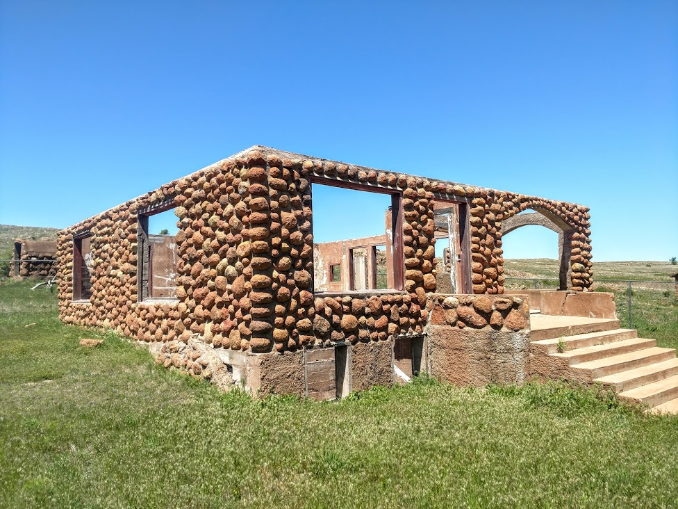
The government closed the dam before paying for the land and improvements, figuring they had several years before the water would rise—there had been six years of drought. The water suddenly rose after four days of rain starting on August 23, 1953, and on August 28 the 450 families of Lopeño and Falcon were hurriedly evacuated in a pouring rain. By the day's end, only the church steeple, a few windmills, and the tops of a few houses showed above the muddy reservoir. Residents of the inundated communities left behind furniture, clothing, toys, even pets. Some walked rather than accept rides from the hated commission that had built the dam and driven them from their 200-year-old settlements. Later, the government refused to pay them the full price for their homes and belongings because they were no longer usable.

The government had also picked out a common site for all of the local cemeteries, but all of the villages affected by Falcon Dam voted to buy their own separate sites. A total of 162 graves was moved from the old Falcon cemetery, only ten of them unidentified. The cemetery today has over 300 permanent residents. There wasn't a geocache here yet, so I hid one myself (GC7XMCW).


Six miles to the north is the new town of Lopeño. It replaced old Lopeño and four other small farming and ranching communities - San Pedro, San José, Santa Fé and El Tigre. Lopeño is named for Antonio López, husband of Doña Ysabel María Sánchez, to whom a 6,366-acre land grant, named Señor San José, was given by the king of Spain on July 16, 1767.

During the early 1800's a parcel of this grant passed to the Ramírez family, founders of Falcon. In 1821 Benito Ramírez constructed a combination home, fort, and chapel, known later as Fort Lopeño, which stood until covered by the waters of Falcon Lake. It was built at the Lopeño crossing of the Rio Grande. There was also a famous shrine in front of his El Tigre Ranch well, where local residents drew water, and worshiped before the Señor San José Church was built in Lopeño. The shrine, dedicated to Our Lady of Guadalupe, was artistically cut from limestone, with beautifully carved hands and feet, delicate features, and a chaplet encircling the crown.

Company K, Fifth United States Infantry regiment, maintained Camp Lopeño there for twelve days ending May 10, 1856, before returning to Ringgold Barracks, Rio Grande City, during the Cortina War. Serafín Benavides established a store at Lopeño in the early 1900's, the only supply point in the area at the time. Andrés Serna carried the mail by horseback from Zapata to Lopeño from 1900 until his death in 1908; he had a keen mind, but could not read. Before starting his route, he would have the names and destinations read to him, and would sort them in order, never making a mistake in his delivery.

When the original Lopeño was about to be moved, the International Boundary and Water Commission wanted all the displaced communities to move their cemeteries to a single location at U.S. 83 and Farm Road 496, but the residents insisted on separate cemeteries. They mapped out their graveyards and identified 1,501 of the 1,753 burial sites; Lopeño had 207 burials, thirty-eight of which remained unidentified. The new community and cemetery are located on a 6,525-acre tract of land first granted in 1767 to María Josepha Guerra. I hid a geocache there also since it didn't have one either (GC7XMFN).


Continuing north on US-83, I arrived in the town of Zapata. Zapata dates to Spanish land grants that go back to 1767. When the first settlers crossed the Rio Grande the town was called Habitacion. Then Carrizo, then Bellville after Governor Peter Bell. Finally the permanent name of Zapata was authorized to honor Col. Antonio Zapata, one of the founders of the Republic of the Rio Grande. In the early 1850's, two military posts, Camp Drum and Camp Harney, were located at Zapata to combat border disturbances and prevent Indian attacks. The population of Zapata increased suddenly when people from Guerrero crossed the river to escape the Mexican Revolution. In 1953, Zapata was another border town that moved to higher ground when Falcon Dam was built.

I found my next geocache at the Mertens Frontier Ranch Store and Museum (GCZRE6). It was an interesting looking gift shop. Couldn't go inside though since it was closed. Maybe next time...


Next was a quick roadside cache in Ramirez (GC20ZBK). Originally it was two miles south of its current site on the banks of the Rio Grande. The property was granted to José Luis Ramírez in 1784 by the king of Spain. It was not assigned in 1767, when most of the Revilla grants were made, because incursions of Comanche Indians made the area uninhabitable. Ramírez and his wife, María Bacilia Martínez, lived with their family in Revilla (Old Guerrero) until 1810, when they built a house of native hand-cut sandstone on their property across the river. The building stood until it was submerged by the Falcon Lake Reservoir in 1953.

The town of San Ygnacio was settled in 1830 - making it the oldest town in Zapata County. The San Ygnacio area was in the 18th century part of a large Spanish colonial land grant, extending on both sides of the Rio Grande. Early ranchos were established on the south bank of the Rio Grande, one of which, called Revilla (and later supplanted by present-day Guerrero), was across the river from the site of San Ygnacio. Jesus Treviño, a wealthy landowner from Revilla, purchased acreage on the north bank of the Rio Grande, and built a single-chamber stone structure in 1830, which is the oldest surviving portion of the rancho. This structure was probably not a permanent habitation, but was likely intended as shelter from the elements and Native American attacks. Treviño's son-in-law, Blas Maria Uribe, added to this structure in building campaigns between 1851 and 1871, which transformed it into the compound seen today. One of its features is a native stone made into a polished sundial and set into the north wall of the fort. It was named for the patron saint of Guerrero, Saint Ignatius Loyola.

There wasn't a geocache yet hidden in this town. So I visited the Blas Maria Uribe Cementerio where he was the second person to be buried here on April 24, 1895. The cache I hid there is GC7XMGN.


Confederate troops fought followers of Juan Cortina here during the Civil War. In 1890 revolutionaries against the regime of Porfirio Díaz led raids into Mexico from San Ygnacio. In June of 1916, troops of President Carranza crossed the border and engaged a U. S. Cavalry unit stationed there. During the early 1900's San Ygnacio had a post office, several stores, a drugstore and remained a commercial center for the region. The population in 1908 was just under 200 persons. It doubled by 1931 but decreased back to 225 by the end of WWII. San Ygnacio was used (like Roma) for scenes in the 1951 movie Viva Zapata with Marlon Brandon in the title role.

Driving down US-83 back towards the dam at Falcon Lake, I stop for 3 more geocaches at the county and state parks (GC1836V, GC3XEHA, GC3XEH5). Now off to the dam and my first cache in Mexico.

I was still a bit nervous about going across the dam over into Mexico. From what I had looked up it seemed like it would be a fairly easy adventure out to the memorial and back. But the fact that I didn't have a passport, just my drivers license, and the fact that it was the most dangerous section of the border with illegal crossings and drug trafficking, kept me hesitant.

Since my anxieties were already high, I skipped the first cache there by the U.S. Border Patrol and Immigration checkpoint. Not being a very busy crossing, I felt as though they'd all be watching me as I'm wandering around looking for some hidden object.

I drove to the gate and was stopped by a green uniformed Border Patrol agent. Explaining that I didn't have a passport, just my Florida drivers license, and that all I wanted to do was go halfway across the dam to take pictures of the memorial and the views... the big question... WOULD THEY LET ME BACK IN! He just kinda grinned and said that "he had no problem with it. But the guys in blue from Immigration on the return side might have some questions."

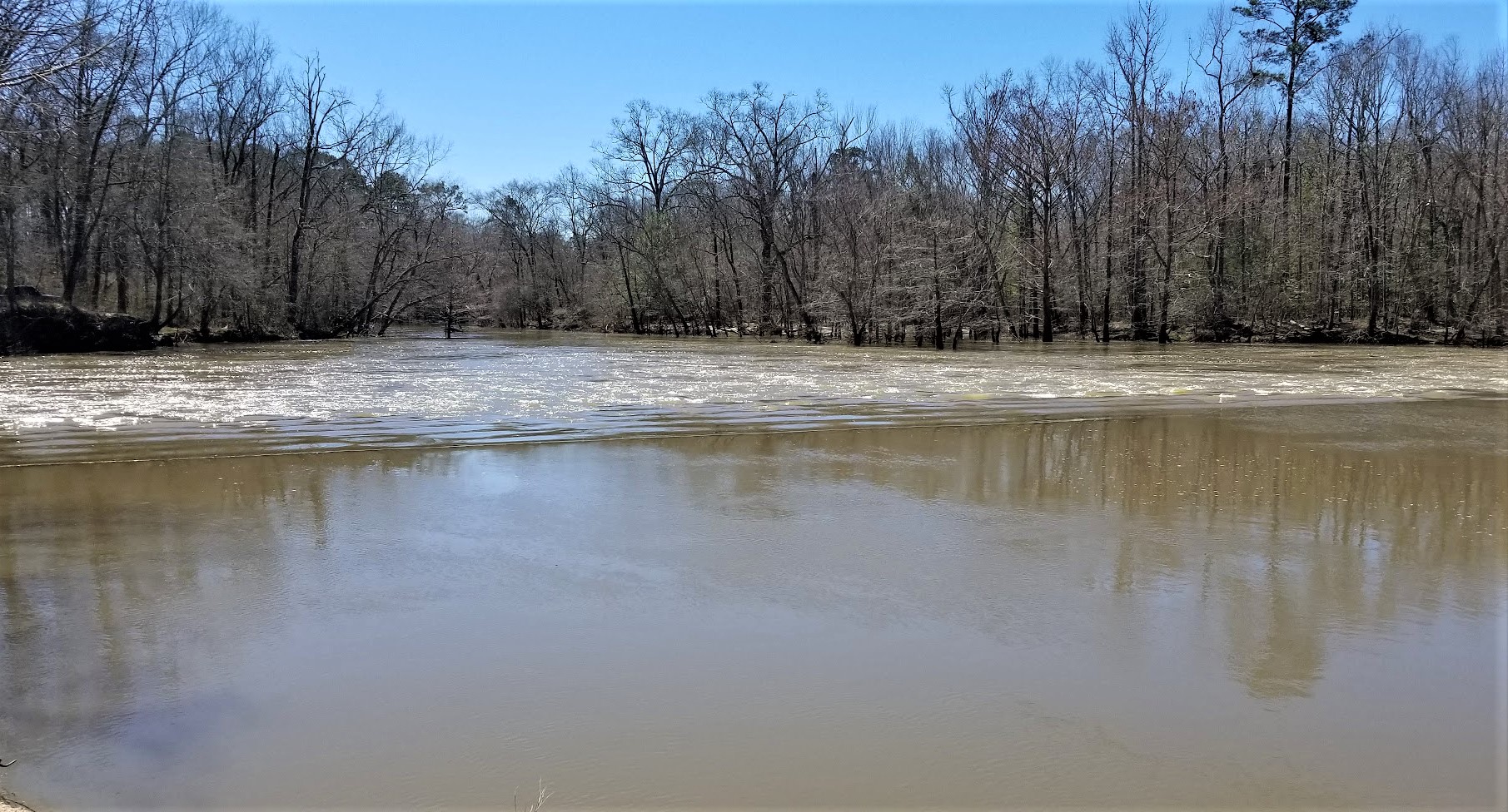
Officially called the International Falcon Reservoir, it is located on the Rio Grande east of Zapata. The huge lake is bounded by Starr and Zapata counties, Texas, and the county and city of Nuevo Ciudad Guerrero, Tamaulipas, Mexico. The dam and reservoir provide for water conservation, flood control, hydroelectric energy, and recreation. The project is owned, authorized, and operated by the United States and Mexico through the International Boundary and Water Commission. The project is named for the relocated town of Falcon.


The idea of a dam six miles east of the present site began about 1935, and the lake was approved by treaty at its present location in the late 1940's. Work began in 1951, and deliberate impoundment started on August 25, 1953. The reservoir was dedicated by presidents Dwight D. Eisenhower and Adolfo Ruiz Cortines on October 19, 1953. The five-mile-long rolled earthfill and concrete embankment was completed on April 8, 1954. The first power was generated commercially on October 11, 1954. The dam is 150 feet above the riverbed, with a crest elevation of 323 feet above sea level. Almost two miles of the dam is in the United States, and nearly three miles is in Mexico. The cost of the lake to the United States was $35 million. Flood-control benefits to the United States had totaled $130 million by January 1, 1986.


All lands on the United States side, except for Falcon State Park, are privately owned above 307 feet. The area of the lake varies from 87,000 acres at elevation 301.2 feet to 115,400 acres at the maximum elevation of 314.2 feet. The reservoir has a summer storage capacity of 2,371,220 acre-feet.

Each country has three 14,750-horsepower turbines running three 10,500-kilowatt generators at each plant. Four units are possible if needed. Under terms of the treaty the United States receives 58.6 percent of the conservation storage and Mexico 41.4 percent; financing of the project was based on the same percentages. The drainage area above the dam is 164,482 square miles; 87,760 is in the United States and 76,722 in Mexico. The United States side provides nine public access areas, including the dam itself, along which runs a two-lane highway connecting Farm Road 2098 and Mexican Highway 2.

I found this really cool website with more information about the history of the area, the building of the dam, and the archaeology of the settlements during construction as well as during a drought in the 1990's that had exposed many of the homes and churches that had been underwater for 40 years.


In the photo above, I am near the geocache (GC1N6HD) location in Mexico looking back towards the United States. After spending about 30 minutes out there enjoying the scenery, taking photos, and getting a new country for geocaching, I figured I'd better get back to Texas. But first... WOHOO!! Now I have found geocaches in 5 countries: the United States, Canada, Greece, Germany, and now Mexico!

So I pull back up to the checkpoint on the United States return side. Out steps the man in the blue Immigration and Customs Enforcement uniform, better known as I.C.E. After handing him my drivers license and he begins to ask some questions. I explained that I just wanted to get some photos of the monument and from the dam. I told him that I didn't go nor did I have any interest in going through the Mexican checkpoint. He asked about what brought me here from Florida and I told him I was working on the new wind farm that was beginning construction just up the road. He found that interesting and we talked about that for another few minutes until another vehicle finally pulled up behind me. Said goodbye and returned back to the motherland safely!

That's it for today. Hopefully you didn't get bored with all the rich history I included in the text. If you like that sort of thing, please let me know. Leave your comments below or subscribe to this blog with the button on the right. You can also follow me on Facebook, Twitter, Reddit, Instagram, and now Parler. Looking forward to your comments and letting me know you're out there.

See you next time...

Friday, June 19, 2020

2018-06-17: Finding and Hiding Geocaches in West Texas Cemeteries

In this addition of my AwayWeGo's Geocaching Adventures blog, once again I'm on my regular Sunday drive from Killeen in Central Texas to Fort Stockton in West Texas.

For my new readers who may not know, I live in Killeen but work in West Texas. So at the end of my work week, either on a Friday or Saturday night, I'm driving home 360 miles eastbound to see my wife. Then on Sunday's I have to drive the 360 miles back. So it's the Sunday's when I do my geocaching and exploring to break up the long drive.

And between the daily commute to work and going home on the weekends, my new GeoJeep is racking up 1200 miles a week!

So let's get caching...

About an hour into driving, I arrived at Buchanan Lake and Dam along Hwy 29 in Llano County. There I found the first geocache and historical marker. C.S.A Salt Works (GC15HQA) was located between Tow Valley and Old Bluffton, 15 miles N.E. and since 1937 under Lake Buchanan. During the Civil War they made salt for the table, curing meat and hides, and feeding cavalry horses.

I wish I was here back in 2007-2009 when there was a drought taking place. Buchanan Lake was down 50% and the ghost town of Old Bluffton, which normally sets at the bottom of the lake, was now exposed. I found a great story at the Texas Observer website if you want to look into that.

On the way to the Llano Cemetery, I stopped at a roadside picnic area for a quick park and grab geocache (GC1Y0AK).

Arriving at the Llano Cemetery, there are actually three geocaches here for me to find (GC6H514, GC7AG8C, GC4R6A4). Area residents founded the city of Llano as the county seat for the newly formed Llano County in 1856. By August 1862, with the interment of one-year-old Tina Miller, this site served as a burial ground. Seventeen year old Emily Young Wright was interred here a few weeks later. Their two gravestones are the earliest marked burials.

One of the geocaches highlights South Carolina native Dillard Cooper. He came to Texas in January 1836 with Captain John Shackelford's Red Rovers, landing at Copano Bay and joining Col. James Fannin's command. Following the Texians' defeat at the battle of Coleto Creek on March 20, the wounded Cooper was among many soldiers taken prisoner at Goliad. One week later, Mexican troops shot and killed more than 300 prisoners; Cooper was among a handful who escaped. He and companions spent two weeks traveling at night through enemy lines and abandoned settlements to reach Texian forces at the Brazos River. Cooper lived in Hays and Colorado counties before moving to farm with his stepson in Llano and San Saba counties in 1878. Dillard Cooper died in 1896.


Another monument that caught my eye was this one for Elmer Lee Crockett. Born in 1896, many years after the Alamo, but died in 1919 at age 22 in France. Hmm... there was a war going on over there. After a little research, I found out that Crockett left Llano to enter the service in September 1917. He arrived in France in February 1918 and was a part of the machine detachment of the air service division. Even though the Armistice was signed in November 1918, Crockett remained in France for active duty. However in January of 1919, Elmer Lee Crockett died from acute appendicitis. It wasn't until August 1921 before his body finally returned to Llano where it was laid here in his hometown.


Continuing westbound on Hwy 29, when I arrived in Grit, Texas, I took a short detour south on US-377 down to the Cavness Cemetery (GC7RCBR). Located in the Streeter Community, around 1855 Irish settlers, including William S. "Uncle Billy" Gamel and the Caveness brothers, began moving to the area. Shortly thereafter, Germans also began to settle in the community. While there are many unknown and undated markers here, two of the oldest are both from 1880. Four year old Steaven Cavness and 86 year old Elias Hiram Hays. I can only assume that one of the Cavness brothers mentioned above was a Robert "Bob" Cavness (1822 - 1902), who is buried here along with his wife Mary (1822 - 1892). There wasn't a geocache here, so I hid one myself.


Sometimes while driving along the backroads of America, you see areas that you just have to pull over and take a photo and that's what I did here while on my way to the next cemetery.


Just north of Streeter was the Coffee Cemetery. As the community of Streeter was growing, Tom Brite opened a store, and Charles Brite once operated a gin and flour mill. A well kept cemetery going back to the 1870's and still being used today. Another cemetery which didn't have a geocache, so I hid one there also (GC7RD83). Near the cache you'll find the headstones of Charles Brite (d.1926) and Tom Brite (d.1927) which are mentioned above. You'll have to find the headstone of W. A. Brite who I can only presume to be their father who died in 1891.


Continuing through very rural dirt backroads, working my way back up to Hwy 29 and arriving at Jacoby Cemetery (GC7RDA1) to hide another geocache. A small family cemetery dating back to 1915 for the not named infant Son of Max and May Jacoby. Still maintained and used, currently only about 30 interments here from the families of Eckert, Hahn, Jacoby, Kuhlman, and a Rolston. While I placed the cache over by the corner post, be sure to pay a visit to Sgt Melvin C Eckert born September 26, 1921 and was killed in action during WWII on June 25, 1943. Here in the Jacoby Cemetery is a memorial headstone with his family. His body is interned at the Ardennes American Military Cemetery Neuville-en-Condroz, Arrondissement de Liège, Liège, B-4121 Belgium.


Then I encountered another one of those "just gotta pull over and take a photo" spots.


Next stop was a quick roadside geocache at a historical marker (GC5ADDH). The Pegleg Crossing on the San Saba River, at the mouth of MacDougal Creek twelve miles east of Menard in Menard Count. For years a favored Indian campground, it entered written history, 1732, as site of Spanish-Apache battle. It was used almost continuously by the Spaniards from the time of the establishment of Santa Cruz de San Sabá Mission in 1757 until the end of the colonial period. In 1849 William Henry Chase Whiting surveyed the ford as a part of a migration road to California. It served the army as a crossing, linking Fort McKavett with San Antonio both before and after the Civil War.

From 1867 until 1888 the San Antonio-San Diego (Southern) Stage Line used the military road; the stage line had a relay station, called Pegleg Station, constructed on a hill overlooking the ford. The Western Trail likewise used the ford for cattle drives from south central Texas to northern ranges and railheads. When State Highway 29 from Mason to Menard was built, Pegleg Crossing was abandoned. Probably named by landowner Wilhelm Harlen for one-legged land commissioner T.W. Ward. Gained notoriety for many hold-ups that occurred at "Robbers' Roost" (1 mile west).

Just two more geocaches before getting back to Fort Stockton. A quick roadside park and grab (GC43AHP) and another historical marker (GC3TXRG). The marker is for the Giddings' Pecos Station.

In the mid-19th century, stagecoach lines were a primary means of moving people, mail and supplies through the region. The U.S. government contracted with Henry Skillman for the San Antonio-El Paso Stage line in 1851. In this area, the route ran along the historic Chihuahua Trail, also know as the Lower Road, which was designed to carry U.S. mail. The service soon added passenger and freight delivery. Skillman and William “Bigfoot” Wallace were two of the better known drivers.

In 1854, George H. Giddings took over the San Antonio to El Paso line and created a series of stage stations in the area. In 1858, he established one near the “S” crossing of the Pecos River. It had two structures built of adobe, limestone and wood. Teamsters used the larger building as a kitchen and dining room and the smaller structure as sleeping quarters. An adobe or high pole corral with a wide gate stood behind the buildings, housing dozens of horses and mules. Water came from a nearby hand-dug well, formerly an existing spring.

In early 1862, a driver of the stage to Fort Lancaster reported Indians had destroyed Pecos Station, and the site was abandoned. Lt. Col. Thomas B. Hunt led a detachment past the ruins in 1869, giving the position as the west bank of the Pecos, 2.5 miles from Camp Melbourne. The exact location of the remote post, however, remained in doubt over the years until archaeological investigations in the early 21st century. Stone foundations and cultural artifacts from the 1850's, along with evidence of earlier Native American occupation, helped identify this isolated scene of frontier life.

That's it for another Sunday drive. There's a lot of history and interesting stories along the backroads of this great country. You just gotta be willing to look for it. And thanks to geocaching it's a little easier to find!