Showing posts with label Indians. Show all posts

Saturday, July 31, 2021

2019-07-28: Geocaching Through Ghost Towns, Cemeteries, History, and Finding an Old Corvette

Welcome back fellow geocachers, travelers, explorers, and Jeepers. Today is cemetery day it seems. On this 300+ mile backroads roadtrip from Central to North Central Texas, I visited several cemeteries searching for history and a ghost story to tell. As usual the passenger seat in the GeoJeep is open, so climb in and let's take a drive through the spooky alley of trees down the middle of the cemetery.


Leaving Killeen, Texas, my first stop as usual is the Dunkin Donuts for an iced coffee and a bagel. Then US-190 west to US-183 north in Lampasas. I make a quick stop for a geocache (GC435CN) at the radio station in Lampasas which for some reason I always skipped before. But today it seemed to be calling for me to stop.

I exit off US-183 near Bozar onto FM1029 going off some very rural backroads driving heading north to my next geocache (GC370W1). Upon arriving at the Trigger Mountain Cemetery I stopped for a photo by the sign and felt that I just had to wear the hat also with a name like Trigger Mountain!


The Trigger Mountain Cemetery is a rather large cemetery for just 13 interments here. But it is also well maintained by the very small community. The first listed burial here is that of 5-year old Riley Burgess Hays in 1904. His father, the Rev L. L. Hays is also buried here and lived to be 99 years old passing away in 1961. The cemetery is still in use today with the most recent burial in 2018.

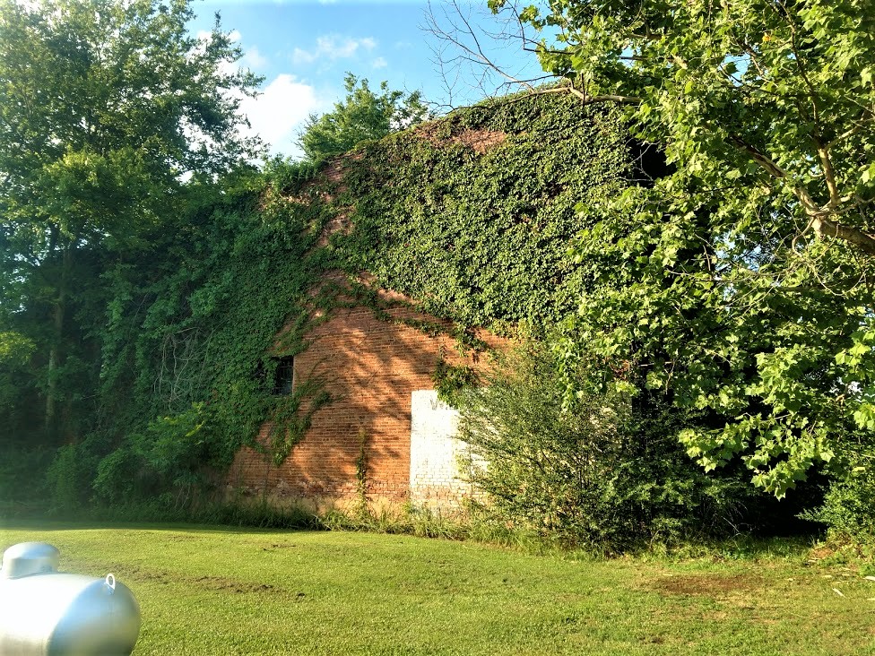
Down another dirt side road about a half mile was Trigger Mountain Hunting. The small geocache (GC3CEEF) had a difficulty rating of 3.0 and a terrain rating of 3.5. Tucked away in the trees, brush, and weeds, it was not an easy task on this hot July afternoon! But success was had and I was able to sign the log.

Continuing down the very rural dirt backroads, I came to the next geocache at Brown's Creek (GC3BYJ4). Down a steep embankment to the creek, this small cache a D4/T4 rating. But with the water currently shallow, I was able to keep dry and stick to the taller rocks to make my way across.

After leaving the creek and just down a little further I came across a cemetery with a historical marker. I check my phone again but I'm not showing any geocache listed here. So I check out the cemetery and read the historical marker: "North Brown Cemetery was named for creek followed by homeseekers. This burial ground originated about 1857 when death struck at a nearby campsite. In the 1870's, North Brown farming community surrounded this site. It had a school and held church services in the schoolhouse. In 1895 local leaders A. A. Boulter, G. M. O'Quin, and J.S. Weatherby secured a deed to the acreage in which graves had so long existed, and North Brown Cemetery Association was formed. After school had closed, proceeds from sale of its site were pledged in 1967 for cemetery care. Pioneer families continue burials here."


Well I just couldn't let this historical cemetery and these pioneers go unnoticed. So I found two headstones of original pioneers and hid my own geocache in a nearby tree (GC8BNKX).


Working my way through the backroads to the small town of Priddy, I had two cemeteries and two geocaches to find. The first was at the St. John's Cemetery (GC22Z1J) with just over 600 interments dating back to 1902. The other was the Zion Lutheran Cemetery (GC19E1A) with over 200 interments dating back to 1889. This older cemetery contains most of the early German settlers to the town of Priddy and has this kinda spooky entrance with the rows of trees. I couldn't decide which I liked better this color photo or the black/white which I opened with at the top of the page.


Trying to make up some time now, I make my way back over to US-183 where I can move a little fast and put some miles behind me. One quick roadside geocache (GC5MVPM) and continue on my way.

But as usual I soon find myself off on the backroad headed towards another cemetery geocache. This one was for the Routh Cemetery (GC1NTWE) in a little community called Blanket. Supposedly named by a couple of surveyors who happened upon some Indians taking shelter under blankets placed over some bushes to give them some protection from a rain storm. As for the cemetery, the oldest marked grave is for that of 19-year-old Elizabeth Routh who died in 1876. She was the daughter of Simeon Levin Routh who is believed to have brought his family out here from Tennessee as part of the Peter's Colony Group to help settle Texas in the 1840's & 50's. Simeon was laid to rest here in 1890 along with his wife and many of their children. There are 58 interments here in total with the most recent in 2005.

Still on the rural backroads, I don't know if you could call this next one a ghost town when at it's peak it only had 100 residents. Owens, Texas, also known as Clio (GC2QM9D), is located eight miles north of Brownwood on U.S. Highway 183 in central Brown County. The town was settled in the early 1870's. The post office, granted in 1878 as Clio, was renamed for E. Owens, who donated the townsite in 1910. It closed sometime after 1930. John W. Yantis promoted sawmills in the area. In the 1930's the town had a school, a church, two businesses, and a number of scattered homes. In 1949 Owens had one business and a population of 100. In 1953 it had a population of forty and no businesses; and in 1965 the population was sixty. No census data was reported for Owens after 1965. In 1983 the community had two churches and a single business. It was still shown on county highway maps in 2000.

Making my way back to US-183, I'm still on the rural dirt and gravel backroads when I pass by this one house with an old 1969 Corvette just sitting there with no tops covered in dirt and dust open to the rain and weather. Made me sad to see that beautiful car being neglected. 


So now I start driving north on US-183 again and after a little bit I see a sign for a cemetery. I look at my phone but don't see a geocache in the area. Well I just have to investigate that further. It is sad finding cemeteries in such neglected care. The rusty sign above the gate just has the name Reagan on it. I can't find much information about this cemetery other than those who are buried here. The Find-A-Grave website shows there to be 14 burials, 12 of those between 1879-1955 and the other two in the 1990's. Though the odd thing is that I can't figure out why it is called the Reagan Cemetery. There are no Reagan's interred here and I can't find a ghost town or community called Reagan. Another website states that it also goes by the name of Latham of which there are two here by that name from the 1880's. Oh well, I find a spot and hide a cache here myself (GC8BNM4). Maybe somebody else will come along and shed some light on this place. Maybe bring some lawn equipment as well!


My last stop was for another geocache (GC22W7R) nearby in the ghost town of the Yellow Mound Community. I couldn't find much in the way of history and settlement. It had never really developed into an incorporated town. Just some local ranchers and farmers. Looking through newspapers for references of Yellow Mound, they started appearing in 1890 and slowed except for obituaries in the 1960's & 70's. Stories of oil discoveries and drilling in 1919-1930, then those stopped. Probably had a surge of workers during that time, but they too moved on. The most interesting newspaper story I found was on July 7, 1964: "Skeleton Discovered in Pasture" read the headline.

"A skeleton thought to be that of a man was found Monday under some undergrowth on a farm near the Yellow Mound Community, seven miles NW of Eastland. Sheriff Lee Horn, one of the officers who went to the scene, estimated the skeleton might have been there as long as 10 years. He based his opinion on the condition of the bones and a weathered shoe along side the skeleton. The find was made by a farm worker rounding up some calves. The sheriff said he would ask a dentist to check gold dental work in the hopes of establishing identity. About five years ago, a skeleton was found near Cisco, 10 miles west of Eastland."

I never did find a follow-up story to this one.

Getting close to work home in Munday, Texas, I was passing by the Brushy Cemetery. I stopped, but by this point it was 6:30 PM and I had already turned a 4 1/2 hour drive into almost 9 hours. Plus it was hot and I was ready to relax, eat, and settle in for the day. With the wind turbines as I backdrop, I thought it was a decent photo. Grabbed my phone, snapped a pic, and continued on.


That's it for today. I hope you enjoyed the ride and my stories. I hope to see you back again soon for another of my geocaching adventures through history.

Saturday, May 22, 2021

2019-06-30: Geocaching My Way to Munday, Texas via a Couple Cemeteries and a Ghost Town

Hello friends, travelers, geocachers and visitors. Welcome to another one of AwayWeGo's Geocaching Adventure roadtrip blog posts. Today's story is another one of my Sunday drives from Killeen, Texas to my work home of Munday, Texas. Along the way, I'll be finding some geocaches and some history to share with you along the Texas backroads. As always, the passenger seat is open in the GeoJeep. Saddle up, grab you cowboy hat and gun (this is Texas), and let's go!


My first stop wasn't very far down the road. Just a quick roadside geocache (GC1G339) in Kempner to start the day off. Nothing here to see, just one for the numbers.

Up next though was a cemetery geocache down a very rural county road. This one hadn't been found in nearly three years. Center Cemetery (GC1HECB) is located east of Lometa and was established in 1866. C.C. Carter was a Private in the Lampasas County Minute Men Confederate States Army. He survived the war but was killed by Indians a year later. I made it harder than it was because of the previous DNF's, but the cache was there and I found it after all this time.


And then there's the Ivy Family. Imagine this family showing up on Family Feud! Only one guy smiling, top row center. Life was rough back then!


Two more nearby, very rural, very lonely geocaches which hadn't been found in nearly five years. I gave them a shot, but they were indeed gone. (GC1CKQ5, GC19407)

Moving right along and passing plenty until I get to the northside of I-20, I finally make a stop for another geocache off US-183 between the towns of Cisco and Eastland. The Bedford Cemetery (GC1K7YT), according to the Find-A-Grave website contains just 19 burials dating from 1897 to 1966. This is an old forgotten very rural cemetery that most of the time goes unmaintained. That was the condition in which I found it. Many of the headstones barely stuck out above the weeds.


Next up just a little further north were three of my favorite things in a geocache: a cemetery, and old church, and some history. Oh and add in a really cool name too! Gunsight Community (GC1KEEY) had all these. From the historical marker: "Records indicate that Gunsight existed on a wagon road from Fort Griffin to Stephenville in 1858. Settlement of the town, however, did not occur until the 1870's. The first recorded burial here was that of Lewis McCleskey in 1877. Gunsight developed as a stage stop and by 1880 contained a post office, school, two churches, grist mill, general store, and a cotton gin. The local economy, sustained by cotton farming and ranching, was boosted by an area oil boom in the 1920's. The town began a steady decline after World War II and today consists of a few houses, a few buildings, and this cemetery."


Gunsight Church Buildings


You can see from the top of the page that I had to get out my black cowboy hat for a photo at the Gunsight Cemetery sign. Unfortunately my selfies were too goofy to include here so you get to see the TB logo on the GeoJeep. One of the interesting graves at the cemetery was this one of several made from stacked stones. Only this one has a tree growing out of it. Hopefully from the foot of the grave and not the head!


Next up was actually a surprise. In the town of Breckenridge, Texas was the Garden Club Park. Within the park were all these birdhouses of various sizes, shapes, and colors. One of them contained a recently hidden geocache (GC86QB9). It had been there for nearly two months with only one unsuccessful attempt. I can tell you it was a little difficult, but I think I just made it more difficult than it should have been. But I DID find the correct birdhouse and stamped the nice clean logsheet for the FTF!! So excited for being FTF, I forgot to take a photo of some birdhouses. Maybe next time...

Then there was the Woodson Cemetery geocache in Woodson, Texas (GC38N75). Now normally I might give you some history about the cemetery. But in this case it's about the history the cache hider has given us in the geocache description. We all know about the Japanese bombing at Pearl Harbor in World War II. But did you also know that Japan managed to bomb to places on the United States mainland? Woodson, Texas was one of those places and the other not too far away also in Texas. It happened on March 24 & 25, 1945. A very interesting and kinda funny story actually. So I urge you to click the GC# link in this paragraph which will take you to the cache page to read "the rest of the story" as Paul Harvey used to say.


And that was it for this Sunday's little road trip geocaching adventure. I hope you enjoyed it and I look forward to any comments you have here or on my social media posts. That lets me know you're out there. See you again next week...

Saturday, April 24, 2021

2019-06-19: Roadtrip Back to Texas Day 2 in SC, GA, and AL Finding History, Old Cars, Trains, Ghost Town and a Tragic Story

WOW, Busy day today! I woke up bright and early this morning ready to go on Day 2 of this Geocaching roadtrip from North Carolina back to Texas. I didn't get off work yesterday until just after noon, so it was a late start getting going. I only made it down into South Carolina. It's Wednesday morning and there are lots of counties and caches on the agenda. I gotta start the new project in Texas on Monday morning. So hop on in the passenger seat and let's hit the road!


After checking out of the hotel in Spartanburg, I drove down I-85 to Greer and my first geocache for Spartanburg County. "Easy Wood's"  is a virtual geocache (GCG9YP) for Woods Chapel Methodist Church and Graveyard across the highway from the BMW plant. Fun fact for the next time you're on Jeopardy or something... what's the difference between a graveyard and a cemetery? A graveyard is next to a church whereas a cemetery is by itself. The Rev. Henry Wood, for whom the church is named, was a Revolutionary War soldier who lived from 1756 to 1843.

Over in Greenville County was a quick and easy little multi-cache (GC2370V) that I had not seen before. A multi-cache consists of at least a stage one or multiple stages to get clues for the final location. This stage one was a travel bug dog tag attached to a tree behind a shopping center. The travel bug code had two numerical digits which you use to substitute into a new set of coordinates which take you to the final location for the real cache. The bonus for this one was that not only do you get a cache find but also get to log a travel bug discovery.

Then a quick park and grab cache for Pickens County (GC4W54R). Also located in Pickens County is Clemson University. There I made a stop for a virtual cache called "Death Valley" (GC1989). There were several different geocaches on campus. However I only made time for just this one. Clemson's Memorial Stadium has the nickname Death Valley because it's view of the cemetery on the hill before the upper decks were constructed.


Driving on down US-123 into Oconee County, there was another quick parking lot cache find to claim that county (GC3C0ZD) and my last for South Carolina.

Crossing the Tugaloo River into Stephens County, Georgia, I stopped soon thereafter for my next geocache at a historical marker. The "Old Tugaloo Town" (GC7TCX9) historical marker reads: "North of this marker, in the center of the lake, once stood and important Indian town. The area now marked by a small island was settled around 500 A.D. and occupied by Cherokee Indians around 1450. Traders were coming to the town by 1690.

"In 1716, while Col. Maurice Moore treated with Charity Hague, Cherokee Conjuror, a group of Creek ambassadors arrived. The Creek Indians, supported by Spain and France, wished to drive the British from the Carolinas, in the Yamassee War. The Cherokees killed the Creek ambassadors and joined the British. By 1717, Col. Tehophilus Hastings operated a trading center at Tugaloo where gunsmith, John Milbourne cared for Cherokee firearms. Indian agent, Col George Chicken visited Tugaloo in 1725 and described it as "...the most ancient town in these parts.

"Tugaloo remained a principal Cherokee town until destroyed by American patriots fighting these allies of the British in 1776."

Slowly making my way westbound, the next county was Habersham County. I stopped in the town of Cornelia for my next geocache at the historic train museum (GC3QGWC). The historic Cornelia Train Depot was first built by the Southern Railway Company in the late 1880's, soon after the town was founded. The railroad depot was originally called Blaine Station for the Republican presidential candidate James Gillespie Blaine. When the first charter of the town was secured by the attorney representing the railroad, Pope Barrow, the name was changed to Cornelia in honor of his wife. The official date of incorporation was October 22, 1887.

The original terminal was damaged in 1910 in a fire, and rebuilt in 1914 to its current appearance. This large passenger and freight station was once the home to two rail lines The Blue Ridge & Atlantic Railroad (also known as the Tallulah Falls Railway) and The Georgia Air Line Railroad, now known as Norfolk Southern. This depot is the symbolic and historic heart of Cornelia and in fact the town's first boundaries were set at one half mile increments in all directions from the depot. Today this depot serves as a railroad museum filled with relics from the days when the railroad ruled, it is also a great place to sit and enjoy the passing trains roll by.


Standing outside the train depot is the 7ft tall Big Red Apple monument. The pedestal it rests on is 8ft tall. The monument was constructed in 1925 and donated by Southern Railway to celebrate the annual festival of the many apples grown in the region.


Driving south on US-441, I crossed over into Banks County and a geocache right at the historical marker at the county line (GC7ED1F). The marker reads: "This line, sometimes called “The Four Mile Purchase Line,” was the boundary between Georgia and the Cherokee Nation from 1804 to 1818. It was established when Georgia bought a four mile strip from the Indians so as to take in Wofford’s Settlement on Nancytown Creek. James Blair was agent for the government, James Vann and Katahahee for the Cherokees. It formed the boundary between Jackson Co. and the Cherokees; later Franklin Co. and the Cherokees, and is now the line between Habersham and Banks Counties."

Back up into White County, I get the "Train of Thought" geocache (GC5PBVQ) for another county at the Mt Yonah Book Exchange. There you'll also find this old railroad train narrow gauge engine.


And then a quick stop for the cache and scenic views at the Popcorn Overlook (GC1F76H) in Rabun County in the Blue Ridge Mountains.


Driving westbound on US-76, I make a quick park and grab stop for Kelly's Bridge (GC34MR8) to pick up Towns County. Followed by two more quick roadside park and grabs in Union County (GC6E5W2, GC72R98), another in Fanin County (GC7YT9F) and one more in Gilmer County (GC3R4BH).

Down in Pickens County, I stop for a virtual geocache (GC7442) at the Zell Miller Mountain Parkway monument. Dedicated in 1986 to the "strong character, integrity, and moral fiber of the people of Appalachia are exemplified in this native son of Georgia's mountains, Zell Miller has dedicated his life to aiding his fellow man. Scholar, author, businessman, teacher, champion of developmental highways, legislator, serving as Lieutenant Governor longer than anyone in Georgia history."


And then there was the "Bomb's Away" geocache in Bartow County (GC50RGA). Not sure why someone would have this setup in their front yard, but when you think you've seen it all... expect the unexpected!


Just down the road from the bomb, is "Old Car City USA, the World's Largest Old Car Junkyard" that has been here since 1931. (GC46W33) I couldn't find the cache that was hidden. And since it was closed, I couldn't go exploring the 6 miles of trails through the woods full of old cars. Not that I had time to do so anyway! But it would be fun to get back here one day to do so. But just what they had out front and peaking through the fence and windows inside was worth the stop.


Quick park and grab caches in Floyd (GC65626) and Polk Counties (GC27Z53) and I was heading for the state line and into Alabama.

My first stops in Alabama were for Cherokee County where I found two geocaches. Driving west on US-278, I took a side road and arrived in the town of Spring Garden for my first cache (GC2583K). Spring Garden was originally named Ambersonville after one of the early families that settled the community. A post office was established in 1842 as Liberty and changed to Spring Garden in 1844. The Selma, Rome, and Dalton Railroad began rail service through the town in 1870. The line later became part of the Southern Railway and was abandoned in the 1970's.

This building here was last known as the W.L. Westbrook General Merchandise Store. Constructed in 1878, it was first known as the P.H. Savage General Merchandise Store, then T.F. Stewart General Merchandise Store. William Lester Westbrook died in October of 1981 and can assume that the store closed around that time period. The second photo I found in the Library of Congress database looks to be from the late 1980's or early 1990's and the store is already abandoned. (The photo I took is from the post office side. The street view is completely covered in vines!)


(photo:  Library of Congress)

The other geocache in this county was a few miles away. The Goshen United Methodist Memorial Park (GC49R24) was established by members, relatives, and friends after a tornado destroyed the church on Palm Sunday, March 27, 1994.

On this Sunday morning, 20 children had begun the service by marching around the sanctuary waving palm branches while the congregation sang the hymn: "Tell me the stories of Jesus." The worship service began with Jesus' triumphal entry into Jerusalem, and was to end with remembering His tragic death on the cross. At approximately 11:30, a tornado with winds up to 250 mph, and moving at a speed of 55 mph descended upon the church. The edge of the half mile wide storm caused a window to break, and within four seconds the building exploded propelling the congregation into literally living the Holy Week story of joy, suffering, death, and resurrection.

Jehovah Jireh, the Lord will provide, had just been sung when the winds blew the roof and the south wall to the north, trapping, injuring, and killing many worshippers. For two hours, persons assisted in the rescue efforts freeing those trapped underneath the debris and treating the injured. By 1:00, four hundred volunteers had arrived to help. Due to the heroic work of many rescue and medical workers, as well as unexpected helpers, 126 people survived. Of the twenty killed, six were children. Those surviving gave remarkable stories of experiencing God's presence and sustaining power in the rescue efforts and through the hard days that followed.


Driving up into Dekalb County, I stopped at the Lebanon Courthouse for a virtual geocache (GCB0CE). The historic courthouse was constructed during the 1840's when Lebanon, the county seat of Dekalb County, was a thriving community with inns, taverns, and government offices. This building remained in use as a courthouse until 1876, when the stagecoaches serving Lebanon gave way to progress. The county seat was then moved to Fort Payne, where railway service was available.

By the time I got here the sun was already setting behind the building making it hard to get a decent photo.


Finally it's getting to be 9:00 pm by the time I get to Scottsboro, Alabama in Jackson County. I grab one last geocache (GC6F458) in a Walmart parking lot to claim the county. Those are about the only caches I want to find in the dark, under a street light!

Well after 15 hours of driving and caching, I'm ready for the hotel! That's it for today. Let's get some sleep and start again early tomorrow morning. I hope you come back again and ride along with me. I'm out... ZZzzzz....

Sunday, November 29, 2020

2019-03-10: A Packed Geocaching Roadtrip Returning from Minnesota to Texas Day 4: Oklahoma & Finally Home!

WOW, What a trip! This packed geocaching roadtrip from Texas to Minnesota began a week ago yesterday. Now I'm finally back home. But wait let me not jump ahead and leave out today.


CuteLittleFuzzyMonkey (CLFM) and I started out early this morning in Lawton, Oklahoma. After breakfast and coffee, we drove over to the Fort Sill visitors center. Fort Sill was originally staked out January 8, 1869 by Maj Gen Phillip Sheridan to stop Indian Tribes from raiding border towns in Texas and Kansas. The garrison was originally called Camp Wichita and was referred to by the Indians as "the Soldier House at Medicine Bluffs." Sheridan later changed the name to Fort Sill in honor of his West Point classmate Brig Gen Joshua Sill, who died in the Civil War.

Today it is a U.S. Army Base covering almost 94,000 acres. It serves as home of the United States Army Field Artillery School as well as the Marine Corps' site for Field Artillery MOS school, the United States Army Air Defense Artillery School, the 31st Air Defense Artillery Brigade, and the 75th Field Artillery Brigade. Fort Sill is also one of the four locations for Army Basic Combat Training. It has played a significant role in every major American conflict since 1869.

Because CLFM has a military I.D., it was a little easier for the both of us to enter the base, as long as he was driving. So we swapped seats and now I was the navigator. Our first goal was to find the grave of a famous warrior.

Geronimo (1829 - 1909) was a prominent leader and medicine man from the Bedonkohe band of the Apache Tribe. From 1850 through 1886, Geronimo fought against Mexican and United States military campaigns in Northern Mexico's Chihuahua and Sonora and in the United States' New Mexico and Arizona.

In 1886, he "surrendered" for his third and last time. This last time he didn't break out. He was first sent to San Antonio, TX as a POW. Then transferred to Fort Pickens in Florida, Mt Vernon Barracks in Alabama, and finally Fort Sill, Oklahoma in 1894. With the exception of becoming an "attraction" in Pawnee Bill's Wild West Show around the country, Geronimo spent the remainder of his life farming with his family on land surrounding Fort Sill. He died of pneumonia on February 17, 1909 after being through from his horse and laying out in the cold overnight.

He is buried there at Fort Sill among the rest of his family and other Apache POW's. His gravesite is the virtual geocache we came looking for (GC3B0D).


Also located within Fort Sill are our next two geocaches, a virtual (GCKPGE) and an earthcache (GC27G76). From the historical marker: "This Unique Landmark at the eastern end of the Wichita Mountains was noted, described, and explored by all early expeditions and was held in deep reverence by the Indian tribes of this area from time immemorial.

"The four contiguous porphyry bluffs form a picturesque a mile in length on the south side of Medicine Bluff Creek, a tributary of Cache Creek and Red River. It is evidently the result of an ancient cataclysm in which half of a rock dome was raised along a crack or fault.


"When Fort Sill was established in 1869, the Indians named it “The Soldier House at Medicine Bluffs.” The site is rich in legends and history. You are facing the north side of bluff no. 3, which consists of a sheer cliff 310 feet high, rising abruptly from the creek. A rock cairn erected by medicine men on its summit was still standing when Fort Sill was founded. Here the sick were brought to be healed or disposed of by the Great Spirit, young braves fasted in lonely vigils seeking visions of the supernatural, and warriors presented their shields to the rising sun for power. Legends say that this was also a famous place for Indian suicides. The huge fissure between bluffs no. 2 and 3 was known as the “Medicine Man’s Walk.”"


Leaving Fort Sill, we loop around over to the Wichita Mountains Wildlife Refuge. Established in 1901, the 59,020 acre refuge hosts a rare piece of the past - a remnant mixed grass prairie, an island where the natural grasslands escaped destruction because the rocks underfoot defeated the plow. The refuge provides habitat for large native grazing animals such as American bison, Rocky Mountain elk, and white-tailed deer. Texas longhorn cattle also share the refuge rangelands as a cultural and historical legacy species. More than 50 mammal, 240 bird, 64 reptile and amphibian, 36 fish, and 806 plant species thrive on this important refuge.

The Wichita Mountains Wildlife Refuge is also home to many virtual geocaches and earthcaches. We don't have the time to find all of them, but we will go after a few of the easier drive by caches. The longer hikes along the trails will have to wait another day.

The first virtual geocache (GCAE84) is located by this rock structure. Kinda like a small cave to serve some purpose of an early settler.


Another virtual cache by the stone archway leading into the Medicine Bluff Park (GC2413). Then there's this small little man-made cave, though this one has a door (GC2412). You know I think we may have ventured into The Shire! These are all Hobbit Houses! Bilbo Baggins must be on another adventure.


Nearly 60,000 acres of natural beauty. No sighting of any elk, bison, or deer yet.


On April 4, 1926, Rev. Anthony Mark Wallock (1890–1948), an Austrian immigrant raised in Chicago, initiated an Easter service and dramatic production with cast of five in the Wichita Mountains of Oklahoma. The play quickly grew into a large, traditional passion play, attracting thousands of spectators each year. The 1926 Easter service, held near Medicine Park in the Wichita Mountains, drew two hundred visitors and grew to five hundred the next year. In 1930 approximately six thousand people witnessed the pageant. Oklahoma City's WKY radio broadcast the production live in 1936, and it was carried nationwide on two hundred stations. By the late 1930s the event annually drew more than 100,000 observers.

In 1934–35 the Works Progress Administration (WPA) built the present Holy City of the Wichitas five miles west of its original location. A dedication ceremony in 1935 commemorated the completion of numerous full-sized buildings and structures, including the temple court, Pilate's judgment hall, Calvary's Mount, the Garden of Gethsemane, watch towers, rock shrines, and perimeter walls. By the next year WPA workers had built the Lord's Supper building, Herod's Court, a chapel, and other amenities.

The script generally depicts Jesus' life from birth through crucifixion and resurrection. In its first years, the several-hours-long drama began in the early morning, between two and three o'clock, and culminated at sunrise with the resurrection. At sunrise in 1935 skywriter Art Goebel inscribed "Christ Arose," above the pageant grounds, and in subsequent years aviators were hired to write or to drop flowers at the end of the ceremony. Attendance peaked in the 1940's and slowly declined to as few as three thousand in the 1980's. In 1985, trying to bolster the crowd, the pageant changed its schedule to begin at midnight and end in the dark at four in the morning. In 1986 the start time changed to nine o'clock in the evening, although many traditionalists desired the sunrise ending. In 1997 three thousand people experienced one of the nation's longest-running Easter pageants.

The event has never charged admission. The 150-acre site is leased from the federal government by the Wichita Mountains Easter Pageant Association, a private organization. Situated in the Wichita Mountains National Wildlife Refuge, the Holy City of the Wichitas admits tourists during daylight hours.

This is also our next virtual geocache (GCAFF3). I tried to do a panoramic photo of the site, but it doesn't do it justice. You just gotta see it in person if you're ever in the area.


The next virtual geocache is located at the Jed Johnson Dam (GC1BE1). The Dam and Lake Jed Johnson was created in 1940 across the Blue Beaver Creek. Covering 57 acres, its primary purpose is preservation of wildlife habitat. The surrounding area is home to deer, elk, longhorn cattle, and bison.


Just one more virtual cache and then it's time to be heading south. This one was at a huge family sized picnic table at one of the campgrounds. Supposedly, the largest camping site picnic table in Oklahoma (GC5B5D).

One of the nearby towns that surround the WMWR is Cache, Oklahoma. And for a geocacher, it's mandatory to stop and find atleast ONE cache in cache! After a few photos by the "Welcome to Cache" sign, we drove to the nearby Pete Coffey Mennonite Church to grab the "Cache Stash" traditional cache (GC6GVYK).


So now it's after lunch, though we haven't even eaten lunch. We still have 300 miles and about 5 hours of driving to get home, CLFM even further. So we skip all remaining geocaches and make a beeline for home stopping only for food and gas. It was some long days caching well into the night. After 119 caches, dozens of new counties, and over 3000 miles later, it'll be good to be home. (And that doesn't even include all the geocaches that CLFM managed to get while I was in training meetings for two days.) Now I need a vacation to recoup from my vacation!

Now to plan the next roadtrip. There are new ways to follow me. Follow the blog directly by using buttons on the right of your computer screen. Or through various social media platforms:  FacebookMeWeParlerGabTwitterInstagramMAGAbook, and Reddit. Follow us on any or all of these platforms and whichever you choose, please leave your comments. We'd love to hear from you and it encourages us to continue sharing our adventures.

Saturday, November 28, 2020

2019-03-09: A Packed Geocaching Roadtrip Returning from Minnesota to Texas: Day 3 in Kansas and Oklahoma

Hello again and welcome to Day 3 of the roadtrip returning from a business meeting in Minnesota and driving back to Texas. CuteLittleFuzzyMonkey (CLFM) and I took three days driving from TX to MN. Do we make it back to Texas today? Let's get going and see...

We left Manhattan, Kansas at sunrise and headed east on US-24 down the road into Wamego, KS. The town of Wamego is the birthplace of Walter P. Chrysler. You'll also find the Columbian Theater where you can see turn-of-the-century murals from the 1893 Chicago Worlds Fair. Probably the most popular attraction is the OZ Museum and all the Toto statues around town.


But what CLFM and I came for was our first geocache, a webcam geocache (GCPGXD). There were several webcams around town. We took our pose in front of the United Methodist Church.


Our final stop before leaving town was the Old Dutch Mill (GC83C3) virtual cache. Built in 1879 by Dutch immigrant John B. Schonhoff on his farm twelve miles north of Wamego, this old mill was used to grind grain into flour and cornmeal. In 1925, thirty-five team and wagons moved the windmill to this site. Each stone was taken down, numbered, and rebuilt exactly as the original. A bust of Ceres, goddess of grain, is set above the window. The mill is 25 feet in diameter and forty feet high.


Then we backtracked a few miles to Manhattan, KS because we forgot about the virtual geocache at the Kansas State Vietnam Veterans Memorial (GC6887).

Heading south on Hwy 177 for a few miles, we arrived at Konza Prairie Research Nature Preserve. The Konza Prairie located in the Flint Hills and is managed by Kansas State University as a long term ecological research site. This vast ecological system provides some spectacular views as you arrive at the visitors center. This was once part of the 2923 acre Dewey Ranch and was purchased in sections by the Nature Conservancy and Kansas State University from 1971 to 1979 for a total of 8600 acres today. The Konza Prairie was named after the Konza Indians. It also offers a trail system that can be combined for a 6 mile loop.

There was a virtual geocache and an earthcache along the highway (GCB63B, GC1DJV8). Then there was another virtual geocache (GC6E84) on the westside of the preserve as well as another virtual "Ashland Community" (GC6E86) outside to the north. Looking at the satellite imagery, it looked like we should be able to drive around the outside and get both of those. We really weren't up for the 6 mile hike at this time. So we gave it a shot.

Getting to the Ashland Community was pretty easy and we parked right out front of the historical building. Then following Google Earth, we continued down the muddy road around and into the westside of the preserve. Drove right up to within a couple hundred feet of the old water well. Sure made it easier than a long hike. And with the muddy conditions, I got to put the GeoJeep in 4x4 mode again.


Now jumping onto I-70 west for a short trip to the hill overlooking Fort Riley. This virtual geocache brings us to an Atomic Cannon (GC698E). Now I've never even heard of an atomic cannon! This is why I love geocaching! According to the historical marker at the site of the cannon: "This is one of only three atomic cannons in existence. The other two are located at Ft. Sill, Oklahoma and the U.S. Army Ordinance Center in Aberdeen, Maryland. This cannon was placed in service on November 17, 1952 and was deactivated in August 1963. Two 375 HP engines were used to transport the 42-foot, 280-mm cannon at 35 M.P.H. to the desired firing locations. The cannon can fire a projectile 11 inches in diameter for more than 20 miles. This cannon was never fired."

From the parking area, you can see the barrel of the massive cannon pointing outward. Standing next to it, it's like the huge cannons on a Navy battleship. Looking back downhill, that's CLFM nearby, I-70 going left to right, Junction City to the far left, and Fort Riley way off in the distant right side.


Driving on US-77 southbound in Herington, KS, we stop at the Father Padilla Memorial Park. There we find a not-as-big-cannon and our next virtual geocache (GCACE0). It seems like a pea shooter by comparison.


At the park across the street was this bench that was just calling out for me to take a photo!


Back to I-70 westbound, we take a ride over to Abilene, Kansas. There we found a large boulder which marks the northern terminus of the Texas Cattle Trail (GCGA9K). The plaque gives a little history, including the following, over three million cattle were delivered here. The trail was in operation from 1867 to 1871. The dollars brought in by the cattle trade and those hustling the cowboys gave Abilene the foundation of prosperity that still carry it today. The wild wild west was definitely here! Gunfights in the street, fistfights in the saloons, and prostitutes working the cowboys made for many wild nights. The upper class citizens of Abilene desired a more reputable image and laws were passed here that brought the cattle trade to an end. The cattle drives moved west to cities like Ellsworth, Hays and Dodge. Abilene continued to prosper without the cattle trade and is still a successful community.

Also in Abilene, you'll find the Dwight D. Eisenhower Presidential Library and Museum. And of course it's also another virtual geocache (GCBB05). President Eisenhower was born in Texas and lived there until age 1 1/2. His parents then moved back to Abilene. There he grew up and remained until he joined the military. Even though after his military and political career he moved to Gettysburg, he always considered Abilene his hometown and where his Library and Museum was built.


Next on our target list was a virtual geocache at the site of the Old Salina Brick and Tile Company (GC2E7C). We got the required bit of information needed for the answer and moved on.

Also located in Salina, Kansas is some aviation history (GC7B69P). In 1942 the Smoky Hill Army Airfield was constructed southwest of Salina. When the base closed in 1967 it left Salina with one of the largest Municipal Airport runways in the world. Turns out that wasn't the end of Salina's aviation story. For many years aircraft parts were built in several of the old base buildings by several familiar manufacturers. In more recent years it has become home to K-State Polytechnic with pilot programs in flight including a unmanned flight program. Military aircraft are still a common site at the airport with several reserve units having training facilities on the airport properties. 38 years after the closing of the military airfield a record breaking round the world flight took off (02/28/05) and landed (03/03/05) on the historic runway. The "Global Flyer" was quite an event and this monument is the centerpiece of a newly dedicated park with extensive history of the Airfield.


Heading south from Salina on I-135, we go down a short drive to Coronado Heights Park (GC3483). Located up on a hill overlooking Saline and McPherson Counties. Coronado Heights receives its name from Spanish Explorer Francisco Vasquez de Coronado who visited central Kansas in 1541. He was looking for the Native American community of Quivira where he was told "trees hung with golden bells, and pots and pans were beaten of gold." Coronado didn't find his gold.

In the 1930's, the Works Progress Administration built a picnic area and castle like building out of Dakota limestone. There was also a traditional geocache hidden a short walk down one of the trails (GC1TNG5).


Continuing southbound on I-135, there's a roadside attraction photo opp and our next virtual geocache (GC348A). Though I don't know how I missed taking a photo myself. So I'll use CLFM's photo. This used to be the "Happy Chef" which stood outside the Happy Chef Restaurant in McPherson. Someone bought it and moved it here. Now it looks like Mr Moneybags from the Monopoly game.


On the way to Canton to pay respects to Edgar Miller, we found two geocaches (GC824R0, GCG6V6) on the road to and in the cemetery. Edgar was an 18 year old ranch hand who bravely rode across the prairie to get help for his bosses wife who was very ill. He was captured by Cheyenne warriors who tortured, scalped, and murdered him, leaving his body in the weeds. For the complete riveting story, visit the Santa Fe Trail Research website.


Then there's the "Nothing But Blue Sky" virtual geocache in Newton, KS (GCAE93). Located in Centennial Park is this huge piece of artwork sculpture created by three artists.


Finally making it down into Oklahoma, we make string of geocaching stops in cemeteries to claim new counties. One cemetery geocache in each county of Alfalfa (GC2BFZ3), Grant (GC3NNQM), Garfield (GC71GHP), Kingfisher (GCMJND), Blaine (GC4J0Y3), and Caddo (GC7KGVK).

By now it's getting late, already dark, but we're still going on. Also in Caddo County, in the town of Anadarko, OK, we stop by the former Rock Island Railroad Depot (GCGA01). Built in 1902, it is now a museum and a virtual geocache. The museum was closed at 9:30 PM while we were there, but I did manage to see the cool old fire truck parked out front.


Moving down to Grady County, we get our last cache for the day. A virtual geocache for another one of those miniature Statue of Liberty monuments (GCFC05).


We finish the day near midnight finally getting some sleep down in Lawton, OK. Twenty-eight geocaches, about a dozen new counties, and nearly 18 hours later I'm exhausted! But it was a great day for geocaching and sightseeing through history.

Until tomorrow... ZZZzzzzz........