Showing posts with label old truck. Show all posts

Saturday, May 15, 2021

Exploring the History of Gilliland, Texas and is it a Ghost Town

Hello and welcome back to another edition of AwayWeGo's Geocaching Adventures. This is one of those blog posts that is a little different than my usual roadtrip stories. After leaving North Carolina, my next construction project brought me to this little town of Gilliland, Texas. For the two months I was here, I got to explore some of the area and take a look into Gilliland's past through some of the abandoned buildings. 

I don't know if I would call this a ghost town or not since at best it reached 120 residents at one time. Now it's down to just 25. But with some of the creepy abandoned buildings, I'll let you decide.

An old abandoned farm house.

There were no Geocaches here for me to find, but I did manage to hide a few myself to bring other Geocachers to this small community to discover what I've found.

Gilliland is located on Farm Road 1756 some seventy miles southwest of Wichita Falls in north central Knox County. The first Anglo-Saxon to arrive to this area was probably was a surveyor (like myself) named Captain Randolph B. Marcy who was commissioned to look for a suitable site for a wild Indian reservation. In 1870 Indians were making forays taking food or spoils or just pillaging. In 1871 the first settlers, who began arriving in covered wagons seeking new opportunities, called the community Coyote on the land between the north and south forks of the Wichita River. Wagon trains brought families who lived in tents, two room picket houses, wagons, and half-dugouts. 

Settlement came in waves by men mostly of European culture until the arrival of a nearby railroad which paved the way for a population explosion. Over the years the area gained a mix of settlers from various locations, including several Norwegian families from Bosque County, who arrived in 1890. Stores, homes, churches and schools sprang up to provide the settlers needs.

The Gilliland school district was established on May 1, 1892, and school began in 1895 with Miss Oma Acker as the first teacher. Over the years several schools were consolidated with the Gilliland district after the now abandoned school building (GC8AN63) was erected in the 1930's. Gilliland's new school featured numerous classrooms, a cafeteria, and a gymnasium that doubled as an auditorium for plays and assemblies. In 1948 its high school was transferred to Munday, leaving Gilliland with only a grade school. It continued until finally closing its doors in 1975.

The Abandoned Gilliland School Gymnasium / Auditorium

District judge W. A. Gilliland became the town’s namesake when the opening of a post office in 1907 required an official name. In 1910 Luther Burgess, Jake Cure, and W. A. Cure built a cotton gin just outside of Gilliland. The gin was modernized in 1936 and proved to be highly productive. Leading settlers included O. M. Olson, who operated a post office in his home in 1907; F. B. McGuire, owner of McGuire's General Store; and longtime postmaster J. S. Cook, owner of three businesses between 1926 and 1934.

Gilliland had an estimated population of fifty in 1925. By 1947 it reported 120 residents and four businesses. In 1971 it had three businesses, and from 1971 to 1990 its population was reported as 103. By 2000 the population had dropped to twenty-five.

Today the community consists of the ruins of the 1930 school, grain silos and a few former businesses being reclaimed by nature – although the community center is in good repair and still in use for meetings and a voter polling place.

The Gilliland Cemetery (GC8AN86) is a well kept still in use cemetery with over 330 interments to date. The one grave that stuck out here is for a man named Liberty Justice who died in 1925. I tried researching this man for a few hours but didn't come up with anything but his spouse and children's names.


So while working here in Gilliland, I'll be living about 20 miles south in the town of Munday. Over the next few weeks I'll be bringing you stories about of my weekend roadtrips between here and Killeen and all the places I've discovered in between.

I leave you with a few more photos from Gilliland:

The Abandoned Gilliland School Gymnasium / Auditorium

Swing-set behind the school and abandoned house.

East-West Hallway of Abandoned School

Front Entrance of Abandoned Gilliland School

Front of Abandoned Gilliland School
You can get a look of the walled entrance which prevented cows from wandering inside.

Abandoned gas station with Esso gas pumps.

Abandoned General Store

Abandoned Former Store or Garage?


Side Door of Abandoned Gilliland School

Abandoned Farm House

Abandoned Old Ford Trucks left in field.


Inside Abandoned Farm House

Abandoned Farm House

Abandoned gas station with Esso gas pumps.

Hwy 267 going south to Munday

Saturday, March 13, 2021

2019-05-26: Roadtrip Day2! The North Carolina County Challenge: Visiting Mt Pilot, Siamese Twins, the Jail Chapel, and the Blue Ridge Parkway

Rise and shine roadtrippers, geocachers, travelers, and friends. Today is Day 2 of our 3-day Memorial Day weekend roadtrip across North Carolina. (Click here for Day 1) We gotta lot of miles west into the mountains to get to today. And hopefully round the corner back east to start the return trip for tomorrow. So grab a cup of coffee, climb into the GeoJeep and let's get going...

I grab breakfast in the lobby and check out of the hotel at the crack of dawn. Before driving away, I first grab the geocache (GCW6C1) in the parking lot to claim a find for Forsyth County. It wasn't a planned cache, but when there's a geocache so close it's hard to just leave it behind.

Driving west into Yadkin County, I pass through East Bend headed for the Mt Olympus Greek Restaurant for my next geocache (GC42WQF). What should have been a quick parking lot find turned into 15 minutes spent for a DNF. Being half Greek, I really wanted to find this one. But no luck this morning. I still need the county so I drive another mile down the road for another quick roadside cache and find that one (GC3YNZM).

On the way to my next geocache, driving the backroads through the country, I spot this old truck sitting off to the side of this gated driveway. Then I notice the skeleton sitting inside and just knew I had to turn around for a photo. As I'm taking the photo, I see the sign and realized that I'm getting my picture taken also.


Driving north on US-52 into Surry County, I see my next goal. As a fan of "The Andy Griffith Show" I wanted to return to Pilot Mountain, also known as Mt Pilot on the TV show. It's been nearly 14 years since I last visited this area with my sons and I hadn't yet started geocaching. There were two geocaches: "This Way to Pilot Mountain" (GC322YP) near the state park entrance and the "Pilot Mountain" Earthcache (GC1195C) up near the observation deck. I drove up the mountain to the parking area and made the short hike to the observation deck. After some photos I gathered the information I needed to claim a find for the earthcache.

Driving up US-52 with a view of Pilot Mountain

The view from the observation deck.

The view from the observation deck.

I wouldn't want to be down below if that rock slides off!

Instead of continuing on up to Mayberry (Mt Airy), since I've been there before, I thought I would check out less popular historical sites. Such as a virtual geocache at the grave of the Bunker Brothers (GCF338). I know... you're probably thinking "Who are the Bunker Brothers?" More commonly known as the Siamese Twins, Chang and Eng were born in 1811 in what used to be called Siam, now Thailand.

In 1829, the twins left Siam to begin touring Europe and the US. They were very popular and drew large crowds in "freak shows" where the twins exhibited various feats of strength and dexterity. In 1839 the brothers quit touring, purchased 150 acres in Traphill, became American citizens and choose the last name of Bunker in honor of a woman they met and admired in New York. In 1845 they purchased 650 acres here in Surry County. A few years later the twins married two sisters, Sallie and Adelaide Yates


Within 9 months and one week of the marriage each sister had given birth to a child. Over the years 19 more children would be born to the sisters. Over time, the two sisters began to fight and would often put Chang and Eng in the middle of their fights. It was decided that the family would split and two houses were built. The two houses were about two miles apart and the twins would spend three days in one house with Sallie and then move in with Adelaide for three days before starting the cycle all over.

Chang passed away on Jan 17, 1874. There were several theories and autopsies performed as to why Eng died, some saying within 30 minutes and others up to two hours. It is often said that Eng was scared to death of the thoughts of his brother being dead and have attributed his death to shock. Others concluding that blood continued transferring from Eng to Chang, but obviously not returning. They were then buried in the lawn at Chang’s house and in the 1920’s were moved to the church that they are at now, which the brothers had donated the land for.


The White Plains Baptist Church was established in 1856 on land donated by Chang and Eng who went to church there. The twins, their wives, and 40 other Bunker's are buried there in the cemetery, plus many other descendants under various other names.

One more geocache for Surry County was at the Dix Freeman Homeplace (GC4P3ER), a favorite location for Round Peak musicians to gather to play their old-time music and hold weekly square dances. Furniture would be moved, sometimes even outdoors, to make room for two or more groups of square dancers in the two room cabin. String musicians, mostly fiddle and banjo players, would stand in the doorways and play their music for the dancers.

“Breaking up Christmas,” usually held after harvest time between Christmas and the New Year, was a time for festivities including music, dancing, socializing and lots and lots of food! Families in this Round Peak area would begin at the Freeman home and then travel to a different cabin every night. Dix Freeman, 1908 – 1995, was an oldtime claw-hammer banjo player who learned to play when he was 10 years old. He credits learning most of his banjo tunes from the legendary Charlie Lowe. Dix played with the Pine Ridge Boys and was a collector of banjos and fiddles, amassing over 237 instruments.

Round Peak Mountain, eleven miles east of here, lends its name to the signature style of old-time fiddle and banjo music that developed in its shadow. The relative isolation of the community and difficulty of travel during most of its history helped to ensure that a limited selection of songs shared and composed by residents would eventually became the core of today’s “Round Peak” music. Round Peak music is characterized by a close interplay between the fiddle and the “fretless” banjo with a driving sound that developed as the musicians played for flat foot and square dancers at frequent social gatherings such as corn shuckings, barn raisings, house parties, and an annual local party tradition referred to as "Breaking Up Christmas."


Moving right along and hopefully picking up the pace. I found a quick roadside geocache in Alleghany County (GC2RTZF) before getting onto the Blue Ridge Parkway. Then quick earthcaches at the Stone Mountain Overlook (GC77NWW) and the Air Bellows Gap Overlook (GC6TP4K).


One more stop further down the parkway exiting at mile marker 248 was for a cache (GC47JGV) at this Jail / Wedding Chapel in Laurel Springs. Gives new meaning to the term "shotgun wedding" I suppose. Doing a little research, I found that that wasn't ever a real jail or chapel. Just painted up that way for a roadside attraction and photo opp. Unfortunately it was a busy area off the parkway with a restaurant and bar across the street and a motel and campground nearby. There were a lot of muggles nearby and made it difficult to search for the cache.


Driving down to Glendale Springs in Ashe County, I stop for a multi-cache. A multi-cache is where you have to go to multiple stages getting clues to the final coordinates. They can be as few as a simple 2-stage cache to as many as you want. I think the longest I've found was a 7- or 8-stage multi-cache.

This one was called "Re-Visit the Past" (GCK8FB). In the late 1800’s Episcopal missionaries came to this region of the Blue Ridge Mountains to provide schooling and medical help for the people living there. Holy Trinity Episcopal Church was built in Glendale Springs in 1901. After the church was officially closed in 1946, members began removing the furnishings and taking them home. For over 30 years the church sat deserted and neglected. In 1972, Rev. Faulton Hodge became priest-in-charge at St. Mary’s Episcopal Church in nearby West Jefferson. In the late 1970’s, he started a campaign to restore Holy Trinity. As work progressed on the building, the original furnishings were returned. Today the church has its original pews, pump organ, Altar, and candle stands.

There's also a cemetery on the property as well that has over 200 interments and is still in use today. According to the findagrave website, the oldest dates back to 1879. After gathering clues from the front and cemetery area, The final cache location was around back by this large statue.


Then there is the "Fast Find" cache (GC5QYT7) in Watauga County followed by another quick roadside stop at "Fall Creek" guardrail cache (GC29P3N) in Wilkes County. Had to take a few pictures at the creek though.


Getting back to the Blue Ridge Parkway southbound, I stop at the Green Mountain Overlook for another earthcache (GC6YHXZ) in Caldwell County and a few photos. I decided to include the GeoJeep in one of them.


Moving down into Avery County there was the Boulderdash Earthcache (GC700KY)...


...followed just down the road by the Artic Window Peak earthcache (GC21N6F) at the Yonahlossee Overlook.


My next stop was down in McDowell County at a cache called Restful River (GC6KHW5). This cache was near the bridge overpass for the North Fork Catawba River and the Honeycutt Creek. Down along the banks were a dozen or more of these butterflies. Every now and then they'd stop long enough for me to get a photo.


And then there's the "Be In Three Places At Once" cache (GC6HE12). Louise's Rock House Restaurant was formerly known as the Linville Falls Tavern and is on the National Register of Historic Places. Built in 1936 by stone mason Lenoir Franklin and owned by C.J. Howell, the tavern was built right where the intersection of three counties converge. The Avery, Burke, and McDowell counties all come together near the fireplace. With the layout of the restaurant, your food is cooked in Avery County, picked up by the wait staff in Burke County, and then served to you in McDowell County. Even though the restaurant was a little busy, the cache was hidden enough by the wall that I was able to quickly retrieve it without being seen. I just forgot to take photos.

Well it was starting to get late in the day. Looks like I'm gonna have to skip a few of the counties still to west and round the corner back towards Blounts Bay. So I head south into Rutherford County and the town of Forest City. There I get a quick parking lot cache (GC4H1H9) to claim that county. Now driving on US-74 eastbound, another quick parking lot cache in Cleveland County (GC16C21). Turning north on US-321 for a park and grab in Lincoln County (GC53CBQ).

Saturday, February 27, 2021

2019-05-19: Caching Counties in North Carolina and Visiting Civil War History

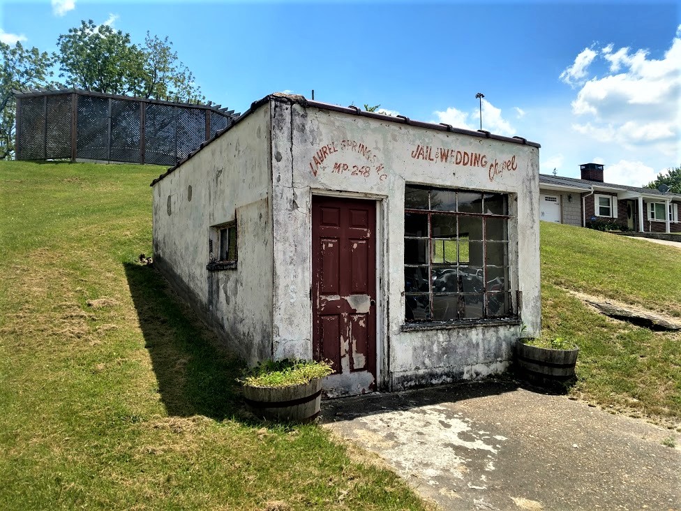
Welcome back to another one of AwayWeGo's Geocaching Adventure stories. After working all week here in North Carolina, on this Sunday day off it's time to go geocaching and pick up some new counties to add to my geocaching county map. So as I look down this trail into what may be ahead, are you ready to go along for the ride? Are you just as curious? The GeoJeep passenger seat is open. Let's go on a roadtrip and see what awaits us.


Starting out with breakfast at Hardies in Washington, NC, I drive north on US-17 up to Old Ford on the way towards my first geocache. Before I get to the geocache, I see this old church building to my right across the street from the Old Ford Church of Christ on my left. I quickly pull over and take a few dozen photos. 

Now I can't just leave it at that and keep you interested. So I start doing some research. Not much on the web via normal searches. But I did find an old newspaper article from November 11, 1928 which describes a centennial celebration. The Old Ford Church was at first a Calvinistic Baptist Church founded by Joseph D. Biggs and Jeremiah Leggett in October 1828 with 20 members. Between 1831 to 1833, Pastor Leggett swayed them towards the Church of Christ. As the membership grew over the years, they outgrew this building.


Further down NC-171, I also spot this old 1956 GMC Pickup Truck just rusting away in somebody's yard. That would be so cool to restore or turn into a radical resto-mod. If I only had the time or money. Well mostly the money to be able to do such a thing.


Now I finally stop for a quick roadside cache (GC42NQV) down a country road before arriving at my target geocache for Washington County. The Roanoke River Lighthouse (GC10RGW) in Plymouth is actually a replica of the lighthouse that used to be at the mouth of the Roanoke River in the Albemarle Sound in 1866.


There's also a boat museum next door with a few old wooden boats used on the river.


Continuing down the river front in Plymouth, I arrive at the next geocache and Civil War history. The C.S.S. Albemarle (GC5NEHF) was contracted by the Confederate Navy in 1863. Gilbert Elliot, a 19-year-old engineer, constructed an ironclad gunboat designed by John L. Porter, the navy's chief architect. Elliot built the vessel at Edwards Ferry on the Roanoke River, 60 miles upstream from Plymouth, where his "shipyard" was Peter Smith's cornfield. It took more than a year to construct the C.S.S. Albemarle , which was 158 feet long and 35 feet wide, and topped with a 60 foot long casemate sheathed with two layers of two inch thick iron plates. Inside the casemate, two large Brooke Rifled cannons could fire hundred pound shells. An 18-foot long white oak ram, also sheathed with iron plates, extended from Albemarle's bow to puncture the sides of wooden vessels and sink them.


Albemarle saw first action on April 19, 1864, during the Battle of Plymouth, when it rammed and sank U.S.S. Southfield. It also indirectly caused the death of the Federal Fleet's Commander, Charles W. Flusser. A shell fired from Flusser's ship, U.S.S. Miami, at Albemarle bounced off the iron plating back onto the Miami and exploded, killing Flusser, who was standing next to the cannon that had fired the shell.

On May 5th, in an engagement in Albemarle Sound, the Albemarle engaged seven US gunboats. Despite being outgunned 60 cannons to two, outshelled 557 to 27, and rammed, the Albemarle escaped destruction. The ironclad was finally torpedoed (blown up with a mine on the end of a wooden spar) on October 27, by a motor launch commanded by Lt William B Cushing, and sank. The Federals recaptured Plymouth on October 31st.

Outside the Port O' Plymouth museum sits a replica of the 6.4 inch Brooke Rifled Cannon. Developed by Commander John Mercer Brooke (CSA), who served as Chief, Department of Ordnance and Hydrography. While closely resembling the Parrot Gun used by the Union, the Brooke Rifle is considered to be the finest cannon on both sides of the war. The fact that the bore had rifling, or spiraled grooves in the barrel to spin the projectile, made it extremely accurate. While the two original cannons from the Albemarle are on display at the Norfolk Navy Base, inside the Plymouth museum are some of the original shells fired from the Albemarle.


Entering into Bertie County, I drive over to the north side of the Cashie River to catch a ride on the Sans Souci Ferry. There was a virtual geocache halfway across. But the ferry was closed and I wasn't able to get the find. But there was a recently placed traditional cache (GC85629) on the north bank of the river and I was able to retrieve and sign the log for it.

Continuing may way around to the north side of Albemarle Sound, I make my next stop at the Beaver Hill Cemetery (GC84AZ7) in Chowan County. The geocache highlighted the sadness and struggles of the Littlejohn Family living in the late 1700's. According to the Find-A-Grave website, the cemetery dates back to 1778 and Catherine Littlejohn who lived only 6 days. Only four of the twelve Littlejohn children lived beyond age 20. And Catherine was just one of four Littlejohn children who didn't even make it to see their first birthday.

There are now more than 6000 permanent residents in the Beaver Hill Cemetery. This angel statue was located within the cemetery and looks over those here.


Across the creek from the southeast corner of the Beaver Hill Cemetery, is the Providence Burial Ground (GC84E7C). From the plaque: "Established in the late 18th century, this African-American cemetery is the final resting place for free blacks, slaves, and emancipated people buried here through the late 19th century. Among those interred here are several family members of Thomas Barnswell, a free black property owner; Molly Horniblow, a free black businesswoman and grandmother of author and abolitionist Harriet Jacobs; and Jonathan Overton, a free black veteran of the Revolutionary War, a Private in the 10th NC Regiment of the Continental Line." (2001) There wasn't much to see here anymore. Just an empty lot with a couple headstones remaining and a few place markers.

Continuing on US-17 east, the next county over was Perquimans County. Located in the town of Hertford along the banks of the Perquimans River is a virtual geocache at a historical house (GC4740). The 1730 Newbold-White House is one of North Carolina's oldest examples of colonial architecture. The house served as an important meeting place for the state's Quaker congregations as well as a center for governmental courts and assemblies.

A land grant from the Lords Proprietors to Joseph Scott for 640 acres included this tract of land and house site. Personal journals of Quaker missionary George Fox describe a meeting with Joseph Scott and his neighbors at his home in 1672. Later Scott, along with his family and neighbors, established their own Quaker congregation. Following the death of his first wife, Scott married Mary Hudson in 1683. Until her death in 1692, Mary Hudson Scott opened her home as a meeting place for Quaker congregations.

James Coles and his wife, Mary, bought the land in 1703. The property was sold at auction in 1726 and was bought by Abraham Saunders, a Quaker and planter. Saunders most likely built the one-and-one-half-story brick dwelling that later came to be known as the Newbold-White House. The name Newbold-White derived from its last two private owners, Jim Woodward White and John Henry Newbold. The Perquimans County Restoration Association, Inc., purchased the house in 1973 with the intention of preserving it as a historic site.


One more northeast county to go and I wasn't going to pass up without it. I did that back in Texas and had to take a weekend to go all the way back to the north corner to finish the state. Turned out on US-158 east into Currituck County. There were two caches on my target and was looking forward to going after them cause they were on a 4x4 Jeep trail. (GC51Q5F, GC51Q0T) Well I got as far as I could go in the GeoJeep. The rest was bushwhacking through tall weeds and brush in humid 95 degree temperatures. Naw, I'm not up for that right now. Back out to the Hwy and a few more miles for a quick roadside cache (GC7Q131).

Working my way back westbound now, I drive across the top of North Carolina on US-158 into Gates County. I stopped for a quick cache (GC3D5JG) down in Gatesville, NC in a little park at Bennett Creek. No bushwhacking required here.


Taking a different route back, I enter once again into Hertford County. I stopped for a quick roadside geocache (GC5NECT) near a historical marker. The marker reads: "A detachment of United States troops burned Winton on February 20, 1862. The first town to be burned in North Carolina during the Civil War."

Re-entering the westside of Bertie County, I make a quick stop for a cache at the Hoggard Cemetery (GC1NV7W). There's just over 300 interments in this cemetery with the oldest dating back to 1908.

A few more miles down the road from the cemetery, I passed by this huge abandoned house now being overtaken by nature. Looks like it was once a majestic plantation home. I wonder what happened. Who lived here? Why was it abandoned? Sure would be cool to go exploring inside and see what stories I could find.


Now in Martin County I had several geocaching stops. The first was a geocache at the Oak City Cemetery (GC1NV7B) which dates back to 1905. Then gas and a cache in Oak City (GC1NV79).

A quick scenic geocache stop at Conoho Creek (GC5FNJ5).


Finally, I arrive at the scene of the first photo at the top of this page. The Fort Branch Confederate Earthen Fort Civil War site (GC5DDC, GC56HZ7, GC5NEF2) is located two miles below Hamilton, North Carolina and 60 miles upriver of the town of Plymouth. Sitting 70 feet above a bend in the Roanoke River, this Confederate earthen fort provided a safe and clear view of Union gunboats approaching from down river.


Eleven cannon offered significant protection for the railway bridge over the river at Weldon, a weak link in the "Lifeline of the Confederacy" between Wilmington, NC and Richmond, VA. The fort also protected the nearby construction site of the ironclad ram C.S.S. Albemarle which later helped regain control of the lower Roanoke River and Albemarle Sound by sinking wooden Union ships. Citizens of the entire Upper Roanoke Valley benefited from the fort, as well.

Well that's it for today. I picked up some new counties today to fill in my North Carolina map. Next weekend is a 3-day holiday weekend. Gotta plan a weekend roadtrip to get the western counties and hopefully complete the state. Please leave your comments on my blog, good or bad. I look forward to hearing from you. See you soon...