Showing posts with label pioneer. Show all posts

Saturday, August 7, 2021

2019-09-02: Back to West Texas and Finding Geocaches in San Saba, an Old Suspension Bridge, Cemeteries, and a Funny Story

Ugh.. Back to West Texas Again!! Well my time in North Central Texas is over. I had plenty more places to explore and geocaches to find. But I gotta go where the job tells me to go. They needed a surveyor to start a new solar project in McCamey, TX, so I trained my replacement at the wind farm in Gilliland.

I think I have found almost every geocache between Killeen and McCamey, so I'll probably be driving WAY outta route to find some caches and places to explore. So who's ready for a roadtrip? Hop in the GeoJeep and let's get going.


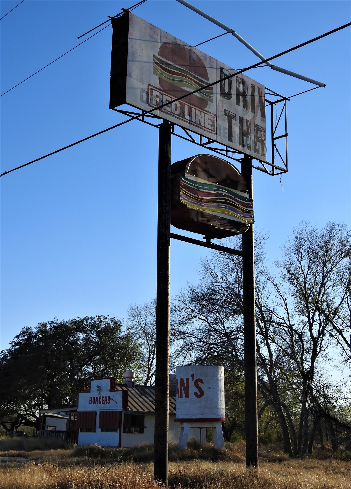
My first stop is taking the rural FM 580 backroad west of Lampasas. Wasn't anything to see here. Just a backroads geocache out in the middle of nowhere (GC15R7W).

Arriving in San Saba, Texas to the Welcome sign on the south side of town, I was greeted by a unique cache container (GC729ET). This cleverly disguised micro cache might be easily skipped if attempting at night.


One block off the main street through town is this 100 year old Methodist Church and my next geocache (GC7285N). I had been wanting to get this one the previous times passing through San Saba, but it is usually a Sunday and the busiest day of the week for this building. On this morning there were still some folks around front (so no photos), but in back where the cache was it was deserted. Found it in short order and continued on my way.

One more stop for the San Saba Cemetery (GC727WY). Previously the Odd Fellows Cemetery, it is located on 17 acres of land about 800 yards north of old town San Saba. On April 18, 1883, the San Saba Chapter of the Independent Order of Odd Fellows (IDOF) purchased 10 acres of this land from J.J. Stockbridge to establish a cemetery, which they maintained for 45 years. On April 3, 1929, the newly incorporated San Saba Cemetery Association purchased the cemetery for $1.00 and an additional 7 acres from Mrs. May Holman, also for $1.00. In 1935 burials from San Saba's earliest City Cemetery, now Rogan Field, were reinterred here.

Once again on the rural backroads north of San Saba, county road 500, I stopped at this cross on the side of the road. Eighteen year old David McBride is buried in the above cemetery, but I can only assume that this roadside memorial was the location where his life was taken so soon.


Continuing up the rural backroads on the way to my next trio of caches, I saw all these beautiful purple plants. They look like mini-pineapples, but very sharp prickly thorns all over them. After taking some photos, I drove on.


The next three geocaches were all in the vicinity of the Regency Suspension Bridge. (GC1A7VT, GC1A1DW, GC1A1DM) Built in 1939 mostly by hand and restored 60 years later in 1999, the Regency Suspension Bridge spans 325 feet from tower to tower. The towers rise 30 feet above the bridge floor, which is 16 feet wide. Engineers list the overall length at 403 feet. Locally known as "The Swinging Bridge", it connects San Saba and Mills Counties across the Colorado River. On December 29, 2003, vandals set the wood surface on fire burning a whole through some of the 4x12 inch planks. Thankfully the bridge was once again repaired. After enjoying the views and taking lots of photos, I was able to find 2 of the 3 geocaches. (08-09-2021 UPDATE: I'm being informed that vandals have struck again and set the bridge on fire and has been closed to traffic.)


Working my way through the maze of gravel roads back south trying to find civilization again, I spotted the Mesquite Cemetery. This small yet maintained cemetery dates back to 1885 and has less than 100 burials. I didn't have it saved in my phone so there wasn't a geocache already here. And unfortunately I didn't have any ready to hide, so it looks like another drive up through here in the future is in store.


My last stop for the day was a geocache (GC2QDCK) along US-190 between Fort McKavett and Eldorado at the intersection of Hwy 2084. More commonly known as the "Toe Nail Trail." Now I've found a lot of references to the "Toe Nail Trail" including a historical marker for Christoval, TX. But as far as a history as to it's name, well there is a ranch called the Toe Nail Ranch. Other than that, all I got to share is what is written on the geocache page. And it's pretty good, so I'm just gonna give it to you word for word. So kudos to cacher Tres Compadres for the description:

"Howdy Pardner,

"My moniker is Handy Hank. But ah answer to most anything, ‘specially when an invitation to share some grub is involved.

"Welcome to Toe Nail Trail. In the late 1880’s, folks a-traveling’ up to Christoval from Scabtown-- That’s what they called that collection of brothels and saloons that “serviced” Fort McKavett ‘afore it became respectable-like and re-named itself Fort McKavett -- had to follow a trail fifteen miles north of the old fort through the Toe Nail Ranch. The ranch, by the way, was named “cuz it angled in a funny way across the corner of the county. Them people in Austin done give the trail a number. Don’t rightly recall what it is. Nothing interesting about a number. Pshaw, most folks still call it Toe Nail Trail and iffen ya ask for it by that ridiculous number, you likely to get a blank stare. Lotta folks have traveled this route over the years and still do. Give ‘em a wave iffen you see some while yer out thar.

"Now, I’ll be helping you with this here Challenge that the Tres Compadres done cooked up. Well, sorta helping you. You’ll find me sharing tidbits of information about the Old West and some of the characters that populated these parts. Pay close attention to what I say, that information might just come in handy along the way. Ya’ll know how that devilish Mommio likes to hide crucial bits and pieces of information from you. And this challenge ain’t no different from her past scribblings. And then there are those clever caches that Mermaid and Horny Toad are known for, expect more of them to show up along the trail.

"Yer journey along this trail from one end t’other, will bring you to all the caches them folks placed for yer entertainment. Ya’ll have to take a side-trip or two down some dirt tracks that lead offen the trail but mostly ya’ll find yerself on the main road. Hopefully, ya won’t be a-meeting up with any o’ the ghosts o’ some o’ the characters that trekked up and down the old trace but keep a sharp eye out for ‘em. A goodly number of them were purty disreputable.

"Ya’ll be careful out there."

Well I hope you got a chuckle out of that one. IF you can decipher the accent on some of the words. That was my adventure for this day. I hope to see you again soon.

Saturday, July 31, 2021

2019-07-28: Geocaching Through Ghost Towns, Cemeteries, History, and Finding an Old Corvette

Welcome back fellow geocachers, travelers, explorers, and Jeepers. Today is cemetery day it seems. On this 300+ mile backroads roadtrip from Central to North Central Texas, I visited several cemeteries searching for history and a ghost story to tell. As usual the passenger seat in the GeoJeep is open, so climb in and let's take a drive through the spooky alley of trees down the middle of the cemetery.


Leaving Killeen, Texas, my first stop as usual is the Dunkin Donuts for an iced coffee and a bagel. Then US-190 west to US-183 north in Lampasas. I make a quick stop for a geocache (GC435CN) at the radio station in Lampasas which for some reason I always skipped before. But today it seemed to be calling for me to stop.

I exit off US-183 near Bozar onto FM1029 going off some very rural backroads driving heading north to my next geocache (GC370W1). Upon arriving at the Trigger Mountain Cemetery I stopped for a photo by the sign and felt that I just had to wear the hat also with a name like Trigger Mountain!


The Trigger Mountain Cemetery is a rather large cemetery for just 13 interments here. But it is also well maintained by the very small community. The first listed burial here is that of 5-year old Riley Burgess Hays in 1904. His father, the Rev L. L. Hays is also buried here and lived to be 99 years old passing away in 1961. The cemetery is still in use today with the most recent burial in 2018.

Down another dirt side road about a half mile was Trigger Mountain Hunting. The small geocache (GC3CEEF) had a difficulty rating of 3.0 and a terrain rating of 3.5. Tucked away in the trees, brush, and weeds, it was not an easy task on this hot July afternoon! But success was had and I was able to sign the log.

Continuing down the very rural dirt backroads, I came to the next geocache at Brown's Creek (GC3BYJ4). Down a steep embankment to the creek, this small cache a D4/T4 rating. But with the water currently shallow, I was able to keep dry and stick to the taller rocks to make my way across.

After leaving the creek and just down a little further I came across a cemetery with a historical marker. I check my phone again but I'm not showing any geocache listed here. So I check out the cemetery and read the historical marker: "North Brown Cemetery was named for creek followed by homeseekers. This burial ground originated about 1857 when death struck at a nearby campsite. In the 1870's, North Brown farming community surrounded this site. It had a school and held church services in the schoolhouse. In 1895 local leaders A. A. Boulter, G. M. O'Quin, and J.S. Weatherby secured a deed to the acreage in which graves had so long existed, and North Brown Cemetery Association was formed. After school had closed, proceeds from sale of its site were pledged in 1967 for cemetery care. Pioneer families continue burials here."


Well I just couldn't let this historical cemetery and these pioneers go unnoticed. So I found two headstones of original pioneers and hid my own geocache in a nearby tree (GC8BNKX).


Working my way through the backroads to the small town of Priddy, I had two cemeteries and two geocaches to find. The first was at the St. John's Cemetery (GC22Z1J) with just over 600 interments dating back to 1902. The other was the Zion Lutheran Cemetery (GC19E1A) with over 200 interments dating back to 1889. This older cemetery contains most of the early German settlers to the town of Priddy and has this kinda spooky entrance with the rows of trees. I couldn't decide which I liked better this color photo or the black/white which I opened with at the top of the page.


Trying to make up some time now, I make my way back over to US-183 where I can move a little fast and put some miles behind me. One quick roadside geocache (GC5MVPM) and continue on my way.

But as usual I soon find myself off on the backroad headed towards another cemetery geocache. This one was for the Routh Cemetery (GC1NTWE) in a little community called Blanket. Supposedly named by a couple of surveyors who happened upon some Indians taking shelter under blankets placed over some bushes to give them some protection from a rain storm. As for the cemetery, the oldest marked grave is for that of 19-year-old Elizabeth Routh who died in 1876. She was the daughter of Simeon Levin Routh who is believed to have brought his family out here from Tennessee as part of the Peter's Colony Group to help settle Texas in the 1840's & 50's. Simeon was laid to rest here in 1890 along with his wife and many of their children. There are 58 interments here in total with the most recent in 2005.

Still on the rural backroads, I don't know if you could call this next one a ghost town when at it's peak it only had 100 residents. Owens, Texas, also known as Clio (GC2QM9D), is located eight miles north of Brownwood on U.S. Highway 183 in central Brown County. The town was settled in the early 1870's. The post office, granted in 1878 as Clio, was renamed for E. Owens, who donated the townsite in 1910. It closed sometime after 1930. John W. Yantis promoted sawmills in the area. In the 1930's the town had a school, a church, two businesses, and a number of scattered homes. In 1949 Owens had one business and a population of 100. In 1953 it had a population of forty and no businesses; and in 1965 the population was sixty. No census data was reported for Owens after 1965. In 1983 the community had two churches and a single business. It was still shown on county highway maps in 2000.

Making my way back to US-183, I'm still on the rural dirt and gravel backroads when I pass by this one house with an old 1969 Corvette just sitting there with no tops covered in dirt and dust open to the rain and weather. Made me sad to see that beautiful car being neglected. 


So now I start driving north on US-183 again and after a little bit I see a sign for a cemetery. I look at my phone but don't see a geocache in the area. Well I just have to investigate that further. It is sad finding cemeteries in such neglected care. The rusty sign above the gate just has the name Reagan on it. I can't find much information about this cemetery other than those who are buried here. The Find-A-Grave website shows there to be 14 burials, 12 of those between 1879-1955 and the other two in the 1990's. Though the odd thing is that I can't figure out why it is called the Reagan Cemetery. There are no Reagan's interred here and I can't find a ghost town or community called Reagan. Another website states that it also goes by the name of Latham of which there are two here by that name from the 1880's. Oh well, I find a spot and hide a cache here myself (GC8BNM4). Maybe somebody else will come along and shed some light on this place. Maybe bring some lawn equipment as well!


My last stop was for another geocache (GC22W7R) nearby in the ghost town of the Yellow Mound Community. I couldn't find much in the way of history and settlement. It had never really developed into an incorporated town. Just some local ranchers and farmers. Looking through newspapers for references of Yellow Mound, they started appearing in 1890 and slowed except for obituaries in the 1960's & 70's. Stories of oil discoveries and drilling in 1919-1930, then those stopped. Probably had a surge of workers during that time, but they too moved on. The most interesting newspaper story I found was on July 7, 1964: "Skeleton Discovered in Pasture" read the headline.

"A skeleton thought to be that of a man was found Monday under some undergrowth on a farm near the Yellow Mound Community, seven miles NW of Eastland. Sheriff Lee Horn, one of the officers who went to the scene, estimated the skeleton might have been there as long as 10 years. He based his opinion on the condition of the bones and a weathered shoe along side the skeleton. The find was made by a farm worker rounding up some calves. The sheriff said he would ask a dentist to check gold dental work in the hopes of establishing identity. About five years ago, a skeleton was found near Cisco, 10 miles west of Eastland."

I never did find a follow-up story to this one.

Getting close to work home in Munday, Texas, I was passing by the Brushy Cemetery. I stopped, but by this point it was 6:30 PM and I had already turned a 4 1/2 hour drive into almost 9 hours. Plus it was hot and I was ready to relax, eat, and settle in for the day. With the wind turbines as I backdrop, I thought it was a decent photo. Grabbed my phone, snapped a pic, and continued on.


That's it for today. I hope you enjoyed the ride and my stories. I hope to see you back again soon for another of my geocaching adventures through history.

Saturday, December 26, 2020

Discovering the Ghost Town of Oakville Texas and Researching Its History

Hello Friends, Travelers, and Geocachers. Welcome to another day in our AwayWeGo's Geocaching Adventures. Today I want to invite you along this roadtrip as I stop to explore a South Texas ghost town called Oakville.

It started out as my usual 360+ mile Sunday drive from Killeen, Texas down to Roma in the Rio Grande Valley. I was driving down I-37 and exited off the highway to get two geocaches in the Oakville Cemetery (GC2KPBH, GC78PKP) on the west side of the Interstate. From the historical marker at the Oakville Cemetery: "Donated in 1857 by Thomas Wilson, who also gave land for Main Town Square. The property was originally part of the 1831 McMullen McGloin land grant from Mexico. Among graves are those of J.T. James, the founder of Oakville; early pioneers; and organizers of Live Oak County."

As I was driving up the onramp heading south, I noticed out the corner of my eye across the east side of the highway all the old buildings of the town. That really sparked my interest so I continued driving down the Interstate six miles to the next exit. Then got off and made a u-turn another six miles back to Oakville.


Arriving in the Coastal Bend of Texas in the early 1800’s, Irish immigrants became the first settlers of a region that includes what is now known as the town of Oakville. At that time the community was referred to as "on the Sulphur" because it was on Sulphur Creek. It was also called Puenta de la Piedra ("Rock Bridge") by Spanish gold seekers, because two miles east on the Nueces River the San Antonio-Brownsville road crossed a natural rock bridge. After the Texas Revolution, Oakville was a station on the stage line from San Antonio to Corpus Christi. It had become a bustling place of commerce because it was the crossroads of ox-cart caravans and mule trains that crawled the muddy roads of Texas between the coast of the Gulf of Mexico and Brownsville to San Antonio. Oakville was the half-way point and merchants & travelers used it as a rest stop on such long, hazardous journeys of the day.

Oakville became county seat after Thomas Wilson offered 640 acres for a townsite; residents accepted the location on September 8, 1856. The name was taken by the court from a newspaper advertisement of business lots. Oakville had the county's first post office, established in 1857, and the first courthouse was built. The Oakville Baptist Church, constructed in 1856, had 128 members by 1857.


During the Civil War and for some years afterwards, Oakville and the surrounding region became a "hotbed of lawlessness." Looking through old newspapers, I found this article from the "Austin Weekly Statesman" October 5, 1876: "The state of society about Oakville, a frontier village, has been simply terrible. The people are divided into two classes; one, permanent, cattle-growing farmers; the other, horse and cattle thieves. They have shot and killed one another until honest men feared to tell the truth, and to punish red-handed villainy was impossible."

Historian Walter Prescott Webb described Oakville as "a hard country where civil authorities were helpless and took no notice of any outrage." As the county seat, Oakville grew into a thriving town that shipped cattle, horses, cotton, and wool, with a dozen or more stores, two hotels, a livery stable, a steam gristmill and cotton gin, a school, and two churches. However, with this boom of activity, the thought of the Wild Wild West that TV shows and movies were made of come to mind.

Growing to over 400 in population, there were 7 saloons in Oakville to provide the cattle crews plenty to drink and entertainment. Many stories of drunken cowboys, a lot of liquor flowed and many thrown in jail to sober up. Some of this spilled over into frontier violence in the form of horse thievery, cattle rustling and murder.

It took Texas Ranger Captain McNelley to clean up the lawless element in the 1870's. The Texas Rangers cleared out the outlaws in the region and brought them to the Live Oak County Jail in the county seat of Oakville, for justice. The standing historic jail was the third jail used in Oakville, the first two proving inadequate. The first one was a mud structure and the second of wood; both of one story construction. It was decided that something had to be done - for one, angry citizens could shoot the prisoners dead thru the jail bars in the absence of the Sheriff whilst he was away handling business.


The stone jail became a source of community pride. It was the latest design, the state-of-the-art in incarceration at the time of its construction. At two stories tall, it provided for safe lock-up in the upstairs cells until the judge arrived and provided formal offices for the Sheriff downstairs in which to conduct business. It also allowed for the sheriff's or jailer's family to reside on the first floor should they elect to do so. This important building served as the county’s jail from 1887-1919. The jail was constructed of hard native 22” sandstone, rough-hewn blocks, hauled by ox-cart from a nearby quarry.

For the burgeoning community, a jail of this stature was literally an advertisement and enticement to incoming settlers that Oakville would be a success in that it promoted civility and safety for it’s residents. The "modern" stone Oakville Jail of the 1880’s symbolized the arrival of the law to Oakville and to frontier Texas where previously only the six-shooter, rifle and the Texas Rangers administered justice to the wild and woolly lawless. Many a badman came to lament the day he entered the Oakville Jail. It is told that over 40 men hanged in the notorious sprawling live oak “Hanging Tree” outside on the Town Square.

Law and order once again established, Oakville's location as the halfway point between San Antonio and the Gulf Coast continued to create a boom of activity and business. The county's first free school building was established in 1881, and in 1899 Oakville established the county's first independent school district. The Oakville First National Bank, opened in 1905 by Dudley Blair and Lee Hinton, was also the county's first. The population of Oakville reached 400 in 1885, fell to 320 in 1892, then rose to a maximum of 450 in 1914.


Oakville's demise came just as many a ghost towns did in the west.  About 10 miles to the south, George West had plotted and named a town after himself. He courted the San Antonio, Uvalde, and Gulf Railroad to lay their tracks through his town and succeeded in 1913. The residents of Oakville began relocating to George West. And in 1919, George West became the county seat when its founder offered $75,000 to build a new courthouse there. State highway maps of 1936 showed a cemetery, two churches, a school, and several businesses and residences at the site. In 1940 the community reported a population of 350. By the 1970's only the Baptist church, the post office, three service stations, and scattered dwellings remained.


The State of Texas designated the town of Oakville a historic landmark in 1936 and placed a granite marker there. In 2004, the Oakville Jail was placed on the National Register of Historic Places.

Since the 1970's when Albert and Mari Davila first spotted the two-story stone jailhouse rising up out of the surrounding live oak and cactus. Over the following years, every time they'd pass by on their way down to Padre Island, they would stop for another look and exploring what appeared to be an abandoned town square. They eventually fell in love with the jailhouse and wanted to turn it into their vacation retreat house. They found the owners and purchased the Oakville Jail along with the abandoned town square in 2005.

With no windows or doors, they discovered many critters now calling it home as well. It was a slow process clearing up and cleaning out, but in 2007 restoration of the jail was completed. Locals had been admiring the work and inquiries into renting the jailhouse for special events and overnight stays began coming in. One by one the Davila's have been restoring old structures and adding to their number of rooms to rent. You can find more information about the restoration and photos at their website oakvillejail.com.


So that's it for another edition of my blog. I really enjoy finding these once forgotten treasures like the Oakville, Texas ghost town and sharing them with you. I'm also glad to see that someone has taken an interest and begun to restore the town square into what a typical pioneer town square might have looked like back in the 1800's.


For some reason, the closing theme song of the Beverly Hillbilly's TV show is running through my head. Yeah I know it's got nothing to do with Texas. But I'll leave it with you as anyway, though slightly modified: 

"Well now it's time to say good bye to You and all your kin.
And I would like to thank you folks fer kindly droppin in.
You're all invited back next week to this blog of mine,
To have a heapin'helpin of these words that come to mind.

Geocaching it is. Explore a spell, Put the hiking boots on.
Y'all come back now, y'hear?"

Sunday, June 28, 2020

2018-07-03: The Quest for 10,000 Geocaching Finds: Day 2 and Day 3 Part 1

Welcome back to Day #2 of our Quest for 10,000 Geocaching Finds! Actually in today's blog, I cover Day #2 and the first part of Day #3. Just to recap, I'm off of work this week for the 4th of July holiday. So I set a goal to reach my 10,000th geocache. On day #1 I found 60 caches so that brought me up to 9970, only 30 more to go!

For Day #2, I hit another power run just south of Killeen and picked up another 22 geocaches bringing my total up to 9992 finds. Most were quick park and grabs along the roadside so I don't have any photos to show you. But two caches did get favorite points from me for their creativity. Those were "Jennings Branch" (GC4VHNF) and "Pineworker's Revenge" (GC6PVWG). Only 8 more caches to go!

So that's it for Day #2 and as you can see it would have made for a very short blog post for the day. Therefore, I decided to include the first stop of my Day #3.

I began Day #3 at the Oakwood Cemetery in Austin, Texas. From the historical marker: "In 1839, when Austin was being opened as a site favored for the Capital of the Republic of Texas, a regular burial place was established in what is now the southwest part of Oakwood Cemetery. A decedent was buried on this hill at a spot to the right of Oakwood's present main entrance and northwest of the Hebrew ground within the enclosure. It was not until September 1, 1856, however, that the land legally became city property. On that day the Legislature of Texas transferred the burial tract from the public lands to the corporate city of Austin. Across the decades, the name has changed: in 1886 it was the "City Cemetery"; 1903 "Austin City Cemetery"; and in 1912 "Oakwood".


"Here lies the mortal remains of many pioneers and builders of Austin, and their successors. Among the national and state personalities, cabinet members, governors and other high state officials, mayors, business and professional leaders, and solid citizens from all walks of life.

"The two Jewish sections of Oakwood have been given perpetual care by Temple Beth Israel since 1876. The Austin city government accepted responsibility for permanent care of Oakwood Cemetery in 1970."

Below I'm gonna highlight just some of the much rich history to be found in this historic cemetery. There is more to be found here I'm sure. But due to time constraints, I just looked for the historical markers or headstones that caught my eye.

George Washington Glasscock was born in Kentucky in 1810. He served in the Illinois Militia in the Black Hawk War of 1832 as 1st Lieutenant and commander over Abraham Lincoln. Later, he was Lincoln's business partner in flat-boating on the Sangamon River.

In 1834, George came to Texas and settled in Zavala. As events unfolded in 1835, he quickly became involved in the Texas Revolution, fighting along side Jim Bowie and Ben Milam in the siege of Bexar. After independence, George was a surveyor and moved to the Williamson County area in 1846, where he opened the area's first grist mill and donated land for the county seat. He settled in Austin and became a state legislator and a prominent citizen. Georgetown and Glasscock County are named in his honor. This is the headstone of George and his wife Cynthia.


Thomas "Tom" Green was a Civil War Confederate Brigadier General. Prior to the Civil War, he served as an Army officer in the Mexican-American War and as clerk of the Supreme Court of Texas. He entered the Civil War as a Colonel in the brigade of General H. H. Sibley and saw service in New Mexico. In 1863, he was promoted Brigadier General in command of the Texas Confederate forces, participated in Battle of Galveston and at Mansfield and Pleasant Hill, Louisiana. At the Battle of Blair's Landing, April 12, 1864, he was killed at short range by the cannon of a Federal gunboat on the Red River. A Texas county was named in his honor.


Georgia native Lewis Miles Hobbs Washington came to Texas about 1835 and joined the Revolutionary forces at San Antonio. A member of Col Fannin's staff, he served with the Georgia Battalion at Refugio and Goliad. He was appointed to an office in Sam Houston's Presidential Administration during the days of the Republic. Washington was killed in Nicaragua while in Central America as a news reporter. His body was not recovered but his wife, Rebecca, is buried here.


A small mausoleum belonging to Matthew Kreisle (1831-1882) and wife Sophie Kreisle (1834-1903).


A native of North Carolina, Abner Hugh Cook came to the newly created capital city of Austin in 1839 with a skill in design and construction that soon earned him the title of master builder. Working as architect, engineer, and contractor, Cook produced some of the finest public buildings and Greek revival homes in Texas, including the governor's mansion and the Neill-Cochran House. A charter member of Austin's First Presbyterian Church, Abner Cook died soon after completing work on the old main building (now razed) on the University of Texas campus.


A native Sweden, Swante Palm was was a leader of early Swedish immigration to Texas. Influenced by his nephew, Swen Magnus, Palm came to Texas in 1844. He settled first in La Grange, where he served as postmaster and worked in Swenson's general store. Both men moved to Austin in 1850 and continued their business relationship. In 1854 Palm married Agnes Christine Alm. Their son, Swante Sture, was born in 1855, but died in infancy.

Politically active, Palm held a number of public offices, including Travis County justice of the peace, alderman, and postmaster. As vice consul to Texas for Sweden and Norway, he was instrumental in bringing thousands of Swedish immigrants to the Swedish Evangelical Lutheran Church (now Gethsemane Lutheran Church) in Austin. Swedish King Oscar II knighted Palm in 1884 for his service to Sweden and Texas' Swedish immigrants. A devoted book collector, Palm amassed a large library which he donated to The University of Texas in 1899, increasing its holdings by over sixty percent. An Austin school was later named in his honor.


Mississippi native William M. "Buck" Walton attended the University of Virginia and studied law in Carrollton, MS. In 1853, he moved to Austin, where his first law partner was A. J. Hamilton, the later Governor of Texas. In 1862, he enlisted in the Confederate Army, serving in Co. B, 21st Texas Calvary. He was elected Texas Attorney General in 1866. In the practice of law he had few peers in land litigation, and was considered one of the best criminal defense attorneys in Texas. Esteemed for his generosity, Major Walton was a well known public speaker, author and civic leader. He retired in 1907, but remained active until his death at age 83. He is buried here with his wife of 60 years, Lettie Watkins Walton, their four children and other family members.


Born in Huntsville, Madison County, Alabama in 1815, Andrew Jackson Hamilton studied law and was admitted to the bar in Talladega in 1841. Moving to Texas in 1846, he began practicing law in LaGrange, Fayette County. He was appointed acting state Attorney General in 1849, and in 1850 was elected to a term in the State House of Representatives. Hamilton was elected to the United States House of Representative as an Independent Democrat in 1858, representing the Western District of Texas. He did not seek re-election in 1860 and later moved to New Orleans, Louisiana.

During the Civil War, he was commissioned a Brigadier General of Volunteers and in 1862 was appointed Military Governor of Texas, with headquarters at federally-occupied New Orleans and Brownsville. In June 1865 Hamilton was appointed by President Andrew Johnson as the 11th Governor of Texas, a provisional post in the early Reconstruction period; he served for 14 months. He was a Texas Supreme Court justice in 1866, a delegate to the Loyalist Convention in Philadelphia in 1866, and an unsuccessful candidate for Governor of Texas in 1869. He died of tuberculosis in Austin.


Born Susanna Wilkerson in Tennessee, she was the wife of Captain Almaron Dickinson and was the sole adult Anglo survivor that witnessed the massacre at the Battle of the Alamo. On the morning of March 6, 1836, as the troops of General Antonio López de Santa Anna stormed the mission, Captain Dickinson ran to his wife, reported that all was lost, and expressed hope that she could save herself and their child. Although he died at the Alamo, his wife and child Angelina survived. Following the fall of the Alamo, Susanna was escorted from the Alamo mission, interviewed by Santa Anna himself and sent by him with a message to Sam Houston. She was a strong woman survivor and remained a patriot of Texas, but the memory of those days would haunt her the rest of her life.


One more burial to note that doesn't have a headstone or marker, but did receive a historical marker. Jacob Fontaine was born in Arkansas and came to Austin about 1850 as a slave of Episcopal Minister Edward Fontaine. In 1864, Jacob began preaching separate services for fellow slaves attending the First Baptist Church, then founded the First Baptist Church Colored, about 1867. Jacob also established five other churches in this area and a county association of black baptists. He was politically active; published the "Gold Dollar," an early black newspaper; and urged black voters to support Austin's bid for the University of Texas in 1881. He is buried here in an unmarked grave.

So that is how Day #3 started out and what turns out to be THE DAY of achievement reaching my goal of 10,000 geocaching finds! Come back again for the conclusion and see what incredible Geocaching Adventure I selected for this huge milestone.