Sunday, June 9, 2019

2017-09-24: Geocaching a Couple of Pioneer Cemeteries in Texas

So Friday night we drove over from West Texas into the Killeen/Ft Hood area to look at some houses to rent. That is how we spent yesterday. Today we made the drive back to Monahans, stopping a few times along the way to grab some Geocaches.

Our first cache was a quick one right at the hotel and then another in the Walmart parking lot. Then we drove over along side the airport to find the Brown (Okay Community) Cemetery cache (GC4QKZ8). 

Elisha Ivy, for whom Ivy Mountain Road was named, established a home and store in this vicinity in the 1860s. In the 1870s, a community known as Liberty Hill developed northwest of his property. In 1896, when the rural settlement applied for a post office, its name was changed to Okay. Area residents supported churches, a school and businesses, and Samuel Marion and Mary Elizabeth (Evans) Brown set aside land for a community burial ground, formally deeding it in 1907.

As military installations in the area grew, the community of Okay was displaced and ceased to exist in the early 1940s. In 1953, the U.S. Government decided to extend the runway at Gray Air Force Base, where the Brown (Okay Community) Cemetery was located, approximately 1,600 feet southwest of this site. The Army Corps of Engineers moved 70 graves, 30 of which were for unidentified individuals, to this location and aligned the burials similarly to original positions. The earliest marked grave dates to 1882 and is that of infant David Davis. Today, the cemetery is a reminder of the Okay community and the families who lived there, added to the long list of ghost towns.

Our next stop was for another Brown Cemetery geocache (GC3D2BY) just outside of San Saba, TX. After living for a time in Arkansas, John H. "Shorty" Brown (1817-1896), his wife Jane Ann, and some of their children came here. Brown helped found San Saba in 1854 and became a civic leader. Although San Saba County provided a graveyard, Brown and his wife deeded this plot of land near their home for a family burial ground. Jane Ann, who bore 17 of Browns 21 children, was probably the first burial here about 1874. Brown's son and son-in-law who were murdered are buried here along with other family members and friends.

Next to the cemetery is a community park that has a train trestle railroad track passing over the entrance that made for a nice photo. I just wish I could have removed those signs first and then taken the picture.


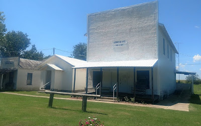
Our next and last geocache of the day was located in a town called Eden, TX. The Pioneers Rest Cemetery (GCM02B) was set aside in 1882 when the town of Eden was platted by Fred Ede. Though older burials may be present, the earliest tombstone is that of the five-week old infant son of Frederick and Susan (Reynolds) Shutt, buried in 1882. Several graves for children and infants bear witness to the harsh conditions of pioneer life.Adults, too, faced difficult time. John Emmett Molloy and Charles Edward Waring both were killed in accidents with horses. According to oral history, a woman named Carson was killed by a runaway horse in 1887 and is buried in an unmarked grave of an estimated 33 or 34 burials believed to have taken place here, only fifteen tombstones remained standing at the dawn of the 21st century, but Pioneers Rest Cemetery continues to be a chronicle of Eden's history. Unfortunately when it comes to the cache, this one was a DNF as it was missing.

Not as big a geocaching adventure as usual, but this wasn't a caching trip. More of taking care of some business with some caching tossed in to break up the long drive. Thanks for stopping by to read our blog. See you out at the next cache...

Saturday, June 8, 2019

2017-08-19 Geocaching Route 66 in the Texas Panhandle

Welcome back to our Geocaching Adventures blog. Sorry for the delay in this post. Hopefully I'll be getting caught up with my writing soon.

On this weekend back in August, we had first made a stop in Lubbock, Texas for a visit to a cardiologist there. Afterwards we made our way up to Amarillo where we would stay for two nights while we Geocached and explored the Texas Panhandle. The goal was to go Geocaching in the ten remaining counties to finish the area.
County #1 Carson: While in Amarillo last year we had visited the famous Cadillac Ranch. This time  around we made a stop at our first cache and the lessor known Bug Ranch (GCDB98) on the east side of town. The Bug Ranch is the unsuccessful 2002 marketing idea of the Crutchfield Family for their Trading Post and Ranch. The five VW Beetles, closed trading post and motel are now just a place for tourists to get a photo opp and leave their spray painted signature behind. So I've seen the Cadillac Ranch, the Airstream Ranch down in Florida, and now the Bug Ranch. Are there any more?

Continuing eastbound on I-40/US-66, our next stop was a two-fer virtual (GC8B0E) and a traditional (GC68M62) cache in Groom, TX. As a former trucker, I had passed by this 190 foot tall cross and a couple of others like it throughout the country. 
If the huge cross wasn't enough, there are 12 prayer stations with 12 life-sized statues depicting various stages of Jesus' life. And further off to one side are more life-sized statues of the Lord's supper, 
Golgotha and the three crosses, and a cave representing the empty tomb. And finally a visitors center and gift shop.

What was supposed to be a quick stop, a few photos and go, turned into over an hour of looking, reflecting, and browsing the store. If you're ever driving down the highway and come upon one of the amazing crosses around the country, be sure to take the time and stop.

County #2 Wheeler: Getting back on track and two counties over, we stopped in Lela, TX to travel back in time a little. Originally called Story when it was established in 1902, a postmaster changed it the following year to Lela in honor of his wife's sister. By 1906 a nearby town became the center of trade and attention drawing residents and businesses away from Lela. The post office closed in 1976 and the school in 1992. The town's population has only grown from 50 in the 1940's to just over a hundred today. But it does contain two Geocaches: at the Old Lela Cemetery (GC61X3E) and the old red brick schoolhouse (GC2XZ1P).


County #3 Collingsworth: We then headed south on FM 1547 into a new county and another ghost town. Near the Salt Fork of the Red River in northwestern Collingsworth County. The town of Dozier was on the Rocking Chair Ranch until the ranch ceased to exist. Post office was granted in 1904 with the Dozier school district being organized five years later when a schoolhouse was built. The school's location changed several times until a larger building was constructed in 1913. This school lasted until 1929, when a brick school was built. By 1930 the population of Dozier was 60 and it somehow increased during the Great Depression to 100 by 1940. There's a historical marker there (GC245QN) but the school building itself has recently collapsed. As for the cemetery, it is still in use to this day and has over 400 permanent residents.


Over to US-83 and turning back to the north, I make a quick stop for an easy guard rail cache (GC21677). Back into Wheeler County and the town of Shamrock at the intersections of US-83, US-66, and I-40. Shamrock is the nearby town that boomed taking away from Lela that I mentioned earlier. The first cache I stopped for there brought us to a huge mural on the side of a building. Crossroads of Highways (GC2167E) highlights the towns history.


Another in the town of Shamrock is the Get Your Kicks! cache (GC1Q175). Going back to the famous Route 66 days, the Tower Station and U-Drop Inn's unique design and architecture were the inspiration for the body shop owned by the character Ramone in the animated movie "Cars."


There were two more caches in the NW corner of Wheeler County that I couldn't pass up. The first was at the Mobeetie Cemetery and called Wild West: Miss Mollie's Love (GC5EPXK). Mobeetie Cemetery is the first known established cemetery in the Texas Panhandle. It was born of necessity, established as a final resting place for those whose journey ended in Mobeetie, which evolved from an 1875 hunters camp and nearby army post. Over the course of time, some of the grave markers have been destroyed by both tornadoes and natural decay. The oldest gravestone is dated May 2, 1882. Other burials include outlaws, accused horse thieves, those killed by a 1898 tornado, ladies of the evening and the infant daughter of Temple Lea Houston. In addition it is the final resting place for the famed Texas Ranger Captain G.W. Arrington.

The cache is named for Miss Mollie Brennan. Her original marker has since long been destroyed or decayed, a memorial headstone is placed in the vicinity. It reads: Killed January 24, 1876, in a gunfight in Mobeetie, she was a young blue eyed, black haired beauty Lady Gay Saloon girl. She jumped in front of Bat Masterson and saved his life in the fight between Bat and Corporal Melvin A. King of Fort Elliot. This fight is where Bat received his leg wound and started using his famous cane. (Mobeetie was then Sweetwater City.) She was about the first one buried in this cemetery somewhere near this marker.

The other cache is at the Mobeetie Jail Museum (GC2GYFX). Mobeetie was as rank a place as any fancier of rankness could ever want. Gamblers, prostitutes and gunfighters turned Mobeetie from Hidetown into a frontier Sodom and Gomorra. Pioneer Panhandle cattleman Charles Goodnight described the town as "patronized by outlaws, thieves, cut-throats and buffalo hunters, with a large percentage of prostitutes."Temple Lea HoustonSam Houston's youngest son, wrote his wife that Mobeetie was "a baldheaded whiskey town with few virtuous women."

If you enjoy history as much as I and are intrigued by the previous paragraph, I encourage you to read more about Mobeetie's history following these links: Texas Escapes, a Bald-Headed Whisky Town, and Judge vs Marshal.


County #4 Roberts: Gotta keep moving along and up to Miami, TX in Roberts County for our next trio of geocaches. First was the Emerson No. 1 cache (GC3GQ1H) at the Miami Railroad Depot and Roberts County Museum. Miami supposedly derives its name from an Indian word meaning "sweetheart." The first settler on this site was Marion Armstrong, who in 1879 erected a half-dugout stagecoach stand near Red Deer Creek on the mail route from Mobeetie and Fort Elliott to Las Vegas, New Mexico. The town was platted in 1887 by B. H. Eldridge on the proposed route of the Southern Kansas (later Panhandle and Santa Fe) Railway. Samuel Edge and Mark Huselby purchased several lots and formed the Miami Townsite Company. Supplies for the railroad-construction crews were furnished by daily stages from Mobeetie. By 1888 Miami had 250 inhabitants and three hotels, three grocery stores, two saloons and a cafe, two livery stables, a post office, a mercantile store, a drugstore, and a tin shop. When Roberts County was organized in January 1889, Miami was chosen as county seat. The election, however, was declared fraudulent in December, and Parnell, twenty-five miles northwest, was the legal seat of county government until Miami won another election in November 1898. The present courthouse was built in 1913 to replace an earlier wooden structure.

The next two caches in Miami are located at the cemetery (GC5R93X, GC5R93C). The earliest cemetery in the town of Miami was established shortly after 1887 when the Southern Kansas Branch of the Atchison, Topeka and Santa Fe Railroad was extended through Miami. The earliest known burial is that of early pioneer William T. Lard who died on December 6, 1888 and was reinterred here prior to 1900.


County #5 Hemphill: Continuing up US-60 across the line into Hemphill County for a quick roadside cache. In the Shadow of the Giants (GCJZ0E) takes you to an area surrounded by oil wells with a huge dinosaur looking over them from the top of the hill. Because dinosaurs make the oil deep down in their underground factory right?


A few miles up the road stopping at the cemetery in Canadian, TX for the Hammer & Anvil cache (GC69PMF). After a bit of searching, we came up empty handed and had to log a DNF.

County #6 Lipscomb: Ugh, too much sightseeing and gotta make up time. Fortunately the next cache (GC117XQ) is a quick roadside stop cutting across the SW corner of Lipscomb County.

County #7 Ochiltree: Yay! Next over into Ochiltree County and another quick Cache and Dash (GC500DK) geocache at a picnic area.

County #8 Hansford: Now heading westbound on TX-15, we arrived at the Hansford County Cemetery (GC6BJJW) for our next geocache. It's the first burial ground set aside in this county. The earliest grave was that of Mrs Alfie P. McGee who died in 1890. Also buried here are the Cator Brothers, founders of Zulu Stockade, and the Wright Brothers, not the flyers but early ranchers. It was the only official cemetery in the county until 1928 and is still in use today. We didn't take time to look around though. Just grabbed the cache and drove on.

Getting late and running out of time, we turn south on TX-136 heading back to the hotel in Amarillo. The final two of the ten counties I needed will have to wait another day.

On the way back I still stopped for two more cemetery caches. I already had those counties so they won't count. Land for the establishment of Lieb Cemetery (GC5P1RG) was donated by Will Blakey and W.O. Jarvis in the spring of 1902. A meeting was held for the purpose of building a schoolhouse. Plans were made and lumber was hauled by wagon from Channing. Completion of the school was in April 1903. A two month school term was held that spring. Classes were held at Lieb until 1929, when the district was consolidated with two new districts, Pringle and Morse. The school building mentioned on the marker is now a community building for meetings of farmers in the area and sets adjacent to the cemetery.

That last one for the day was the Unknown Cemetery (GC5EPY6) located out in the farm land. There were just a few headstones of which only one could be barely legible. The headstone reads: N W Reeder 1827 1896. Neither the previous cache owner nor the current cache owner could find any information on the pioneer cemetery. And I checked the Findagrave website with the name listed above and came up empty as well. You can see from the photo below that if you didn't already know there was a cemetery there you wouldn't realize it.


So after a long day of caching and driving over 400 miles around the Texas panhandle, we made it back to the hotel in Amarillo with 20 caches and 8 new counties. Tomorrow we head back home down to West Texas.

Monday, September 25, 2017

2017-07-06: Driving Back to West Texas Day 3: Geocaching Through Texas History and Cemeteries

Welcome back to my drive from Florida to West Texas on Day 3 and final leg of my journey. Today's ride should be about 450 miles, probably much more depending upon my Geocaching stops. On the agenda are some cemeteries, a ghost town, an old church, and some historical buildings. And some new caching counties of course!

This morning started out in Centerville, TX at Hwy 7 and I-45. Driving westbound on Hwy 7, it wasn't long before I made it to the next county and my first cache (GC3WT26) at the Wesley Chapel Cemetery. Here is where you'll find Tennessee native Isaac Phillip Stem who enlisted in Western Frontier service in that state in 1836. In October 1836, he moved to Texas and joined the Republic of Texas Army at Houston. Continuing to serve in the military, Stem was a participant in the Battle of Plum Creek on 8-12-1840, in present Caldwell County. The battle was fought between Texas soldiers and Comanche Indians, who had raided the coastal towns of Linnville and Victoria. Stem served in the Somervell Campaign of 1841 and was a member of a cavalry of mounted volunteers during the Mexican War.

After his discharge from the Texas troops in 1846, Stem joined the US Infantry at Corpus Christi, Texas and continued in the war with Mexico. Discharged at Monterey due to illness, he later returned to Tennessee and joined the Tennessee Volunteers at Memphis. He later transferred into the US Infantry once again. Isaac Phillip Stem and his wife, Lucy Ann Weaks, were the parents of eight children. The family moved to Robertson County in 1869 and Stem became a farmer and rancher. He died in 1893 and was buried here beside his wife.

While Isaac played a part in the history of Texas, the interesting headstone was that of his son Washington Taylor (W.T.) Stem. The marker reads: "W. T. Stem and Wives." Doing some research all I could find was one website (werelate.org) that listed two wives. An Eliza Jane Henderson which he married in December 1873 and Catherine Johnson in February 1884. But the odd part is that there are no headstones around for either of them.

Here are a few more photos of Wesley Chapel Cemetery. There are 58 known interments here dating back to 1831.


After a couple of miles through Robertson County, I then entered into a corner of Limestone County. It was an already found county so it wasn't on my list of geocaching counties. However passing by small cemetery with a historical marker, I just had to stop. And guess what there's also a cache here too! (GC112J1)

Bardin King (1819-1891) and Elizabeth Susan Salter (1822-1879) married in Lowndes County, Alabama in 1842. The following year, they traveled west by wagon with their young son William and Susan's parents and siblings, settling in Louisiana. Bardin was successful growing cotton, but in the late 1850s the extended family moved to Texas, settling first in Navarro and Washington counties before arriving in Limestone County in 1870.

The Kings bought 189 acres here from John and Lucinda Wilson, and the family raised cotton and grains, and were active in the Headsville community. Bardin King was a lay minister at Ebenezer Baptist Church (1 mi. S), and sons John, Cullen and Moses also served later in the same capacity, while youngest son Finley became an ordained Baptist minister. Bardin was a charter member of the local Masonic lodge and active in the Patrons of Husbandry, or Grange.

Susan King died in March 1879 and the family buried her here on the farm. The surrounding land became a dedicated cemetery in 1881, when Bardin divided his holdings among his nine living children and set aside one acre for a graveyard. Daughter Susan Leuticia married Robert Holden Williams, and they and their children later continued cotton and corn farming on the family land. Ten members of the King and Williams families were buried in what became known as King Williams Memorial Cemetery and then King-Williams Cemetery. Robert H. Williams died in 1944 and was the last to be buried in the graveyard, which features historic limestone headstones shaded by pine and cedar trees. Family tradition holds an African American freedman named Speight is also buried here in an unmarked grave. The families also added more modern headstones that are easier to read.

After skipping through the next two counties due to previous finds (remember my goal is to finally get home to see my beautiful wife, otherwise it would take weeks because I'd be stopping at every cache), I entered Coryell County. The Eagle Springs Baptist Church (GC2DM1W) congregation grew from an early Coryell County fellowship known as the Church of Onion Creek. Worshipers met in a log building until it burned in 1954. In 1958 this site was acquired for a new church building. In the same year, the Rev John McLain, a Baptist Missionary, organized the Eagle Springs Baptist Church from the earlier congregation.

By 1880 Eagle Springs was a thriving community with two grocery stores, two blacksmith shops, a cotton gin, two churches, two doctors offices, a post office, and a school. The congregation grew also, with many baptisms being held in the Leon River.

During the first decades of the of the twentieth century, families began moving away from Eagle Springs. The community school was closed in 1935, and in 1948 members of the Eagle Springs Baptist Church voted to disband. The church building was retained, however, for reunions and occasional services. It is one of the few remaining structures in the Eagle Springs community.

My next stop was a Virtual Geocache (GCB1BA). I can't say much as to give away the answers to claim a find. Currently used by the Chamber of Commerce, it once housed a cotton depot until the mid-1970's.

Upon reaching the town of Evant, I turned south on US-281 for a few miles in order to drop down into Lampasas County and grab a quick cache in the Pilgrims Rest Cemetery (GCVTQT). There are nearly 200 burials here dating back to the 1880's. Hard to pass up another cache and another cemetery, I continued a few more miles south to the Hines Chapel Cemetery (GCW0ZK) which also dates back to the 1880's. Making a u-turn back to the northside of US-84 into Hamilton County and two more caches at the Murphree Cemetery (GC22Z0YGC22Z10).

Finally back on US-84 heading westbound and crossing over into Mills County, I came to Star, TX and my next Geocache (GC17GNE). It was laid out by Alec Street in the mid-1880s and named for nearby Star Mountain. Calvin Skinner was the first postmaster when Star was granted a post office in 1886, and Alec Street ran a store and a gin. The town continued to grow until a tornado swept through in 1904. The storm leveled several houses and killed a couple of residents. Star had a school in its early days but did not build a permanent church until 1905, when the town reached the zenith of its prosperity. A bank, established in 1910, closed after a robbery in the 1920s. In 1944 Star had eight businesses and a population of 171. For years the cotton gin was the town's economic engine, but the gin shut down in 1950. The population in 1980 through 2000 was eighty-five. The cache was located next to this 1938 stone building converted to a history museum.

After a quick cache in Brown County (GC6XDMM), I entered into Coleman County. The Atchison, Topika, and Santa Fe Railroad established a railway line about eight miles southwest of Coleman in 1904. The town of Valera (GC17TC6) developed in the area around the train depot. It's business district, established parallel to the railroad, reflected the needs of its citizens. Businesses included a post office, a hotel, a bank, a flour mill, a cotton gin, an opera house, grocery stores, a blacksmith shop, a cafe, and a water well in the middle of the street.


Recognizing the need for a community cemetery (GC15315), Mrs Minnie K. Harris deeded more than 5 acres of land in 1922. One of two cemeteries serving the community, it contains more than 400 marked graves, and at least 5 unmarked graves. The first recorded burial was that of Mrs N. C. Kidwell in 1922.

Next up was a virtual cache (GCD061) located in the next county over. In the town of Ballinger in Runnels County is the Carnegie Library Building. This native limestone library was built in 1909-11 with funds from New York industrialist and philanthropist Andrew Carnegie. Local banker Jo Wilmeth donated the land and the Rev J D Leslie, pastor of the First Presbyterian Church, served as the supervising architect. The buildings auditorium and club rooms were used for a variety of civic cultural events, school social activities, and temporary worship services of several local churches.


After one last and quick cemetery cache (GC6QTTJ) at the Fairfield Cemetery in Coke County, and it was non-stop all the way through to Monahans. It was so good to be back. I parked the U-Haul truck and went inside to see my beautiful wife. The truck can wait to be unloaded in the morning. That completes my long 3-day 1598 mile drive from Florida to West Texas.

See ya next time.

Sunday, September 3, 2017

2017-07-05: Driving Back to West Texas Day 2: Alabama, Mississippi, Louisiana, and Texas

Welcome back to Day 2 of my road trip from Florida back to West Texas. Today begins in Evergreen, Alabama. After a good nights rest at the hotel and a quick hotel breakfast, it was time to hit the road again. I'm still following the backroads of US-84, trying to stay off the interstates as much as possible. At the same time Geocaching and sightseeing along the way.

My first stop was to get gas and a Geocache (GC2APKW) at the Love's Travel Stop for Conecuh County, Alabama. A quick fuel up and find and I was on my way.

The next county over was Monroe County and also the next cache. The Geocache was by a historical marker for Fort Claiborne (GC178A3). Built by General Ferdinand L. Claiborne during the Creek Indian War of 1813-1814 as a base for his invasion of the Alibamo country with the U. S. Regulators, Lower Tombigbee Militia, and friendly Choctaws. Claiborne's campaign culminated in the American victory over the Creeks at the Holy Ground. I was hoping to see something other than the sign, but nothing of the fort remains.

Moving on to Clarke County and a quick roadside cache stop (GC2MYZ7) to claim a find and to continue making good time.

Choctaw County was the last along US-84 in Alabama and a county needed. I stopped at the Bladon Springs State Park for an Earthcache (GC3JAB8). The springs here, named after the original property owner, James Bladon, were first opened to the public as a therapeutic spa in 1838. Seven years later, state geologist and University of Alabama professor Richard T. Brumby and two colleagues from the University of Louisiana traveled to the springs to conduct a comprehensive analysis. Brumby reported his findings in a 27-page book, "An Analysis of the Bladon Springs," published in 1845. Following the report, the tourist trade increased so much that a resort was built, including a bowling alley, cabins, skating rink, and last but not least, a Georgian Revival hotel that could house 200. The resort is gone, but four springs remain, one of which is still covered by the gazebo from the resort days.

I gathered the information I needed for the earthcache and took a few pictures. There were two more caches in the park and I was tempted to take the short hike after them. But the road ahead was calling and I wanted to get some miles put behind me. So across the state line into Mississippi I went.

Wayne County was up first with a quick roadside cache (GC38PV9). After that was a quick Virtual Cache (GCE7A7) in Jones County. Continuing westbound on US-84, I skipped right through Covington County having already found a cache there. Then quick park and grab roadside caches in the remaining Mississippi counties of Jefferson Davis (GC388J0), Lawrence (GC1RNA2), Lincoln (GC35WGT), Franklin (GC35WGT), and Adams County (GCTV6P).

Crossing the state line into Louisiana, they have Parishes instead of counties. My first stop in Concordia Parish is the Delta Music Museum (GC1D5VZ) along the Blues Trail. Louisiana and Mississippi have long shared a close musical relationship. One of the most important musical paths was that between Natchez, MS and Ferriday, LA, where African American entrepreneur Will Haney operated Haney's Big House for several decades. In addition to major national acts the club featured local musicians including Ferriday's Leon "Pee Wee" Whittaker and Natchez's Hezekiah Early and Y. Z. Ealey. A young Jerry Lee Lewis often visited the club, soaking up the sounds of the blues.

I had arrived to the museum just as it was closing up. She watched and we chatted as I searched for and found the Geocache. After signing the log, we went inside and she gave me a quick tour of the museum.

Two more quick caches in LaSalle Parish (GC23AXN) and Natchitoches Parish (GC4XHMC) before arriving in Sabine Parish and a cemetery cache (GC2D9MA). Fender Cemetery has over 300 interments dating back to 1851. One of the spookier graves is of this red brick tomb that seems to have been elevated a few inches. Kinda makes you think that the undead comes crawling out at night searching for innocent victims to carry back to the underworld.


I crossed the Sabine River into Texas at sunset and got a spectacular view. Driving nearly 600 miles today, I've got around 450 miles to go. Can't wait to get home to see my Beautiful Sweet Wife!

2017-07-04: Driving Back to West Texas Day 1: Florida, Georgia, and Alabama

So today's the day to hit the road and drive back to West Texas. And of course this won't be a boring I-10 forever non-stop westbound trip. No way. I just can't take a road trip without Geocaching and sightseeing. Plus there's another opportunity to pickup some new Geo-Counties! So I'll be taking the scenic byways of US-84.

I woke up just after 5 AM, gathered my things and quickly hit the road. From Umatilla, Florida heading north on SR-19 through the Ocala National Forest, west on SR-40 and over to I-75 northbound to Georgia. First on my Geocaching county list was Echols County, Georgia.

Non-stop express driving all the way up to US-129 in Jasper, FL, taking that exit to head directly north into Echols County. Now when most people travel they book a flight because it's all about the destination. I prefer to drive because it's more about the journey. The destination will be there all the same, but on a journey there's much more to discover. While passing through Jasper, I spotted this old forgotten rusty Jeep sitting out behind this business among other piles of scrap metal objects. Something about the sadness in the way it looked caused me to slow and make a u-turn for a photo capturing that moment and emotion.

Crossing the border into Georgia and Echols County, there were three caches along the route and I needed to find at least one to achieve the "Found County" status.  The first cache (GC4CJNF) on my list was located at the Echold County Museum and Statenville's oldest house. A combination of No Trespassing signs, fenced in property, and the neighbors outside getting ready for a July 4th BBQ, and I decided to skip this one and move on. It has since been archived.

Second on the list was "Down by the Riverside." (GC5Q27T) Just out on the west side of Statenville along the Alapaha River is a boat ramp and my next cache location. After spending about 10 minutes looking without any luck, I gave in and walked down by the riverside for some photos of the calm muddy waters. Two down, one to go.


The last cache along the way and my last hope for a find in the county was a Country Cache (GC5DBXA). Stopping along the road side, I quickly saw the spot that looked like it might have had a cache placed there but without a container. I continued looking around just in case, swatting away mosquitoes on this humid day, hoping that maybe I just overlooked it. But in the end I had to drive away without a smiley, leaving Echols County still unfound. Strike three, I'm outta there.

The next county was Lowndes County where I-75 runs through Valdosta. Having already cached here, I drove through to save some time. It was there in Valdosta where I picked up highway US-84 for my long journey westbound.

Brooks County was next in line where a quick stop at Quitman's Hangout cache (GC39155) gave me my first caching find and first new caching county for the day. Hopefully this would be the beginning of a caching streak!

Continuing west on US-84, I skipped through Thomas County having found a cache there on a previous road trip, I arrived into Grady County. Before I arrived at my next Geocache, I passed by this old small roadside cemetery and just had to pull over to explore. It was the Lester Poulk Braswell Pearce Cemetery. There are 60 interments there with many unknown graves that no longer have any readable markings on them. The oldest known grave is that of a Rev Mann Dutton who died in 1857 at the age of 61. I found an article that said as recent as 2001, this cemetery was so overground with weeds and vines that it took two hours just to walk through and find all the graves. Glad someone has cleaned it up.

A few miles down the road was another cemetery and my next county cache (GC26MCP). Dr. Joseph Griffin was a black physician. In 1935 he began practicing medicine in Bainbridge, Georgia. He built a 50 bed hospital and established the Southwestern Medical Society. In honor of south Georgia's first black physician, the Dr. Joseph H. Griffin Memorial Gardens was created in Grady County.


Another quick cache find in Decatur County (GC152M9) and I was off to the next one. A short detour to the north up into Miller County and a bridge cache (GC5RNRN). Just down from the bridge was this old church and another cemetery. The cemetery is still in use today. I did see this one dead tree that inspired a photo.


After the short detour, I made my way back south to US-84 and into Seminole County to find my next quick cache (GC5Y3A8).

For the last county in Georgia, it was off to picturesque Howard's Mill in Early County (GC27247). I couldn't find anything on the history of the mill. Though it appears to be used as a private home or for special events now.


Arriving in Alabama, the first two counties were Houston and Dale Counties. I had already found caches there so it was another chance to make up some time breezing through. Next on the list was Coffee County and the town of Enterprise, AL. By this time it was getting late in the afternoon and surprisingly this was the only town that was having a 4th of July celebration around the town square. There was a carnival setup in the square and it appeared that the whole town may have been in attendance.


I had three caches on my radar there. The first being a virtual cache (GCAC2D) located at a statue on Main Street as you enter the downtown area. I can't say much more about it because I'd be giving away some answers you need to claim the cache.


The second cache on my list was at the old train depot (GCT3MX) built in 1903. The first freight shipments and passengers came here on the Alabama Midland railroad in 1898 immediately after construction of the roadbed. That was also the year when most of the brick business buildings downtown were completed.

The one that caught my eye was the Rawls Hotel. This original two-story brick structure also built in 1903 by Japeth Rawls, developer of some of the earliest turpentine plants in Coffee County. This building was remodeled in 1928 and three-story wings added by Jesse P. Rawls, founder of the first electric power system in Enterprise. The Rawls Hotel was the center for business and social gatherings until its closing in the early 1970's.


My last cache to see in Enterprise was at the old jail (GC2FKAY). Unfortunately it was closer to the town square and busy with people coming and going for the festivities. And me being in a large U-Haul, I figured it be best to just pass on this one until next time in the area.

Covington County was the next to enter and my last cache of the day. It was just a quick and easy WalMart cache (GC24TFV).

I ended the day in Evergreen, AL after 431 miles of driving. Claiming some new counties for my Geocaching list, seeing some sights, and learning some history. Tomorrow is a new day. I hope to make it across and into Texas, but there's still 1300 miles to get all the way back. At least halfway would be good.

See you then.