Sunday, September 18, 2016

2016-08-21: Standing on the corner of Texas and New Mexico

Welcome back! Today we headed north up into New Mexico for a couple more First-to-Finds (FTF's) and a few other Geocaches along the way.

Our first stop was a little town about 20 miles north in Wink, Texas. Known for being the hometown of Roy Orbison from the age of 10. He started his first band while attending high school here. There was a historical marker there at an empty lot which we assumed the house once stood.

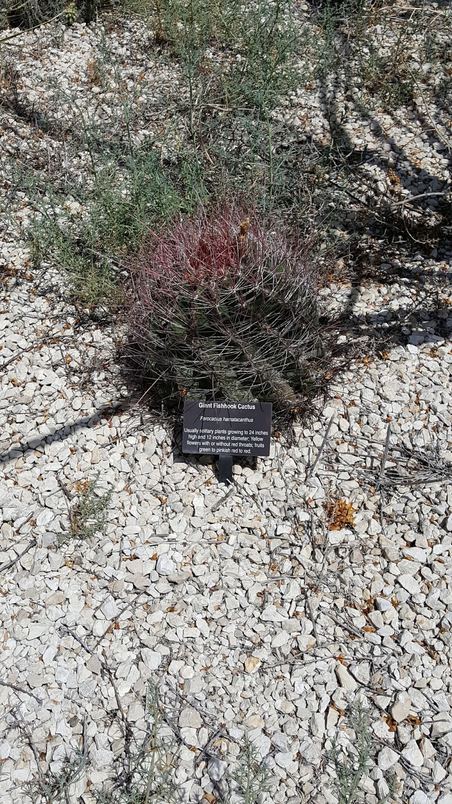
After reading the sign we drove to the nearby community park and our first cache (GC6QCTC). Another new Geocache placed by MedicoJoe and another FTF for us. This was a nice park and we walked the entire perimeter to take pictures of the Looney Tunes character statues on display. 


Our next stop was just on the outskirts of Wink. There along the roadside sits a historical marker for the Old Wink Cemetery (GC6QK7Z). The exact locations of the individual graves are not known. The Old Wink Cemetery is the burial site of 26 persons who died during the early days of the oil boom, 1926-1929. Shifting sands over the years have erased all vestige of the graves. According to the old timers in Wink, the cemetery is located in the Monument Draw. Although it is dry now, during the 1950s - 60s it was flooded with oil field runoff water and the area was under water for over 10 years. Several of the Wink residents remember fishing and hunting here. There are no current signs of the cemetery today. It is part of a local ranch.

As for the Geocache, we searched for about 15-20 minutes but came up empty. We found the rocks from the hint given, but no cache container. I believe it was too close to the historical marker and muggled by someone stopping to read the sign. (As a side note, we did find the cache two days later after the MedicoJoe replaced and moved further away from the sign. Another FTF!)

Continuing north for a few more miles, we reached the state line between Texas and New Mexico and our next cache (GC6QK3N). Another new cache placed by MedicoJoe and another FTF!

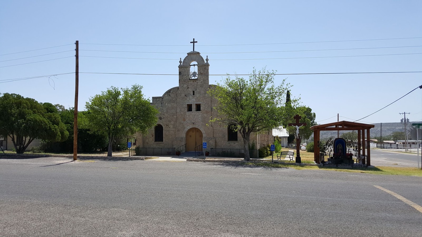
The next town was called Jal, NM and our next cache was at the Jal Cemetery (GC6QK3B). In the 1880s, several brothers brought a herd of cattle to Monument Draw, six miles southeast of the present city. The cattle were branded with the initials of the previous owner (John A.Lynch) and the cattle soon came to be called the JAL Cattle. The men who worked the herd referred to them as the Jal cowboys. In time the name became synonymous with the settlement itself. Though after finding the Geocache, a quick walk around the cemetery and we didn't notice any old graves so we didn't take any pictures. But we did get another FTF!

Closer into the center of town was a community park and another FTF (GC6QK43).

Driving SW on Hwy 205 a few miles to a town called Bennett, NM was our next Geocache (GC2H0NE). This next cache was a piece of history which goes to show how government usually makes matters worse and not better:
Here are the ruins of a whole way of life, apparently gone forever. This “camp” was started in the middle 1930’s when the natural gas boom sprouted out of the oil boom. In the 1940’s the pipeline system was finally becoming part of the infrastructure we know today, but even then you could drive from Jal to Odessa and beyond at night just by the light of the flares that were burning off the natural gas so they could pump the oil. Then the natural gas became valuable and furnaces, stoves and even “ice boxes” (refrigerators to you newbies) were powered by natural gas. 
El Paso Natural Gas Company Jal #1 plant was built to collect, treat, and pump natural gas all the way to California. To support the plant, houses were built for the employees and their families. An instant middle class was formed by the camps that sprouted all over the oil fields. Other companies like Phillips, Shell, and Texas-New Mexico quickly joined suit. Jal, New Mexico was then advertised as the “Gas Capitol of the World”. More natural gas flowed through these companies’ pipelines here than anywhere else in the world.
The plants were unique communities. Every employee had a house as a benefit of employment. Every house had indoor plumbing, free water, free electricity, free garbage collection, and of course, free natural gas! It was a Company Camp. The plants had to make their own electricity to run, and the camps benefited. The plants had to obtain their own water and the camps benefited. The houses were built and owned by the companies because the plants ran 24/7 and the workers were conveniently nearby working shifts. The kids that grew up in the camps virtually lived in a large family setting. Everybody knew everybody and lived in a homogeneous mix of mothers, fathers, brothers and sisters where we learned to get along. We still get along and call ourselves Camp Brats. 
Jal became sort of a Company Town, with many plants surrounding it and the Main Offices located there. The Company built a golf course. The Company built the Clinic and hired/attracted a doctor to come to Jal. Company ball teams were formed. 
The tax structure of the State, at the time, benefited Jal, New Mexico. The oil and gas royalties off the School Lands in the area went directly to the local schools. Jal had a great school and great teachers! Virtually every Camp Brat had at least an opportunity to go to a college or university, and most of us did. Life was good, life was great! What could go wrong? 
The “Government” is what went wrong. Local, State and Federal government intervention went wrong. Free houses? Can’t have that, there aren’t any taxes paid. Free water? Can’t have that, there aren’t any taxes paid and it is just not fair to everybody else, so they said. Same for the electricity, the utility companies just weren’t getting their cut. State school land taxes were shifted to the general fund and Jal lost most of its school funding to the northern population centers of the state. 
By the 1970’s our way of life was falling apart. By the 1980’s the camps were being broken up and the houses torn down and/or moved away, lock, stock and barrel. What you see left here 20 to 30 years later is government’s handiwork.
Continuing north again going through town we came to our next Geocache which was a multi-cache (GCJ77H). It also brought us to this huge work of art. "The Trail Ahead" was sculpted by local artist Brian Norwood and dedicated in September of 2000. The statues consists of seventeen metal silhouettes stretching for approximately 400 feet. The largest measures over twenty feet tall! They honor the ranching heritage of Jal, New Mexico.


Circling back around towards the south and back towards home, we come to our next cache (GC2AB0) and the corner of New Mexico and Texas. The COMPROMISE OF 1850. The results of the Mexican War (1846–48) brought Texas into serious conflict with the national government over the state's claim to a large portion of New Mexico. The claim was based on efforts by the Republic of Texas, beginning in 1836, to expand far beyond the traditional boundaries of Spanish and Mexican Texas to encompass all of the land extending the entire length of the Rio Grande. Efforts to occupy the New Mexican portion of this territory during the years of the republic came to naught.

After numerous unsuccessful attempts to resolve the issue, Senator James A. Pierce of Maryland introduced a bill that offered Texas $10 million in exchange for ceding to the national government all land north and west of a boundary beginning at the 100th meridian where it intersects the parallel of 36°30', then running west along that parallel to the 103d meridian, south to the 32d parallel, and from that point west to the Rio Grande. The bill had the support of the Texas delegation and of moderate leaders in both the North and South. Holders of bonds representing the debt of the Republic of Texas lobbied hard for the bill, for it specified that part of the financial settlement be used to pay those obligations. The measure passed both houses of Congress in the late summer of 1850 and was signed by President Fillmore.
This square marks the corner that divides the two states. While I'm standing on the New Mexico side, Candy is standing in nearby Texas! Maybe not as cool as Four Corners, but still cool.

Our last Geocache of the day (GC69XEN) was at the Sand Hills. Mapped by U. S. Government, 1849, for gold seekers and settlers. Known earlier to Indians and many Spanish explorers. A 100-mile belt of sand in Winkler and 4 other Texas counties and in New Mexico. Width varies from 3 to 20 miles; outer dunes are held by dwarf oaks. Water at 2' depth supports willows, cottonwoods, and a plum thicket. (The plums gave food to early settlers.) Many dunes more than 70' high. Heavy, shifting sands a natural barrier to travel. Campsite and game reservation for Indians. Now part of expansive cattle ranges and rich oil fields. Being from Florida when we saw this much sand it usually had a large body of water on the other side.


So that was today's Geocaching Adventure. We hope you've enjoyed it and maybe learned something new. Perhaps it has also inspired you to get out and explore the area around you.

Saturday, September 17, 2016

2016-08-13: A Walk in the Park and Some Geocaching FTF's!

Mission GC Souvenir
Today was a short day in comparison to our other Geocaching Adventures. We only had one goal in mind for today. We had to find a Multi-Cache in order to receive a Souvenir in the Mission GC task. A Multi-Cache is a traditional Geocache that has more than one stage. Typically went you arrive at the posted coordinates you'd find clues that would give you the coordinates to the next stage until you find the final cache container. So I looked up the nearest Multi-Cache that we have not yet found which was over in Odessa and we set out to find it.

So as we were getting ready to leave Monahans this morning, we get an email notification from Geocaching that a new geocache was published 21 miles to the north of us in Kermit, TX. A detour was made heading north to Kermit to try and get First-To-Find (FTF) on the new cache.

We arrived in Kermit to the "downtown" area and the former Bud's TV shop. According to the cache page description, Bud's TV used to be a video rental store as well as selling TV's, VCR's, and the hot new DVD players back in the day. We looked around for about 15-20 minutes before finally giving up. I don't like DNF's on a cache, especially on a FTF.

So we leave empty handed and drive east towards Odessa. Our first stop in Odessa was the Starbucks of course! Then over to Memorial Park and the Buffalo Wallow Multi-Cache (GC4CQA1). A buffalo wallow or bison wallow is a natural topographical depression in the flat prairie land that holds rain water and runoff. Originally this would have served as a temporary watering hole for wildlife, including the American bison. This particular wallow grew rather large due to the number of bison in the area. Plus with the construction of Odessa and this becoming the water runoff location, it's now a scenic lake. There's also numerous statues around the lake which made for a nice walk on a beautiful day! We saw lots of ducks and turtles too. Plus finding two other traditional caches around the lake was a bonus. (GC2MW9GGC4DBMC)


As we were leaving Odessa and headed back to Monahans, the phone beeped again and three more new caches were published back in Kermit! So we took the long way home again. The first cache we came to was called Barry's Lease (GC6Q514). It was another new cache published by a new Geocacher "MedicoJoe." We searched for a few minutes and was coming up empty. So I began expanding the search area. I finally found it about 140' away! I also found a nice clean logsheet where we signed the top for a FTF! WOHOO!!

At that time we see an ambulance pull up and the CO steps out of the vehicle. We had a good chat and he explained that he realized the coordinates were off and he was getting a more accurate reading. He also said he corrected the coordinates for the Bud's TV cache also.

We made two more stops and two more FTF's at GC6Q4W6 and GC6Q51D before heading back over to Bud's TV for another look. With the updated coordinates, we found the cache quickly for a total of FOUR FTF's on the day! Thanks MedicoJoe for placing these new caches.

That's it for today. Like I said, not a big adventure for today but a beautiful walk in the park with a beautiful girl and some FTF's. See ya next time.

Saturday, August 13, 2016

2016-07-24: West Texas Ghost Towns, Cemeteries, an Old Church, and a War Memorial

Hello again. Today's Geocaching Adventure takes us to several cemeteries, ghost towns, a Vietnam war memorial, and some more sights around West Texas. So we're glad you stopped by. So buckle up and let's begin.

After a Starbucks stop in Odessa, we head just north to a small town called Gardendale for our next two caches GC4KKDB and GC34VGJ. The second one brought us to this Mystery Mansion. According to the cache page, a man began building this house in 1950 but never finished it. For a long time he lived in a small travel trailer along side it. Inside the house are stairs that lead up to nowhere, doors that open to brick walls. Kinda reminds me of the Winchester Mansion in California. A mystery for sure.


Heading back down between Odessa and Midland near the airport is a virtual cache. For those of you reading about our adventures who are not familiar with Geocaching, a virtual cache is one that doesn't have an actual container with a log sheet. In order to claim a find you must visit the cache location and find the required answers listed within the cache description.

This particular virtual Geocache (GCE131) brings us to a Vietnam War Memorial honoring the Odessa and Midland residences who gave all for the freedom of others.


Back on the I-20 highway westbound, we make it down the road to Stanton, TX and our next Geocache (GC1MZF0). With the purpose of founding a monastery and a German Catholic Colony, Carmelite Monks, in 1881, began the first catholic church between Fort Worth and El Paso. The adobe and brick monastery was completed in 1884, and St. Joseph's Church in 1885. Sisters of divine providence opened a short-lived school, 1887; reopened, 1894, by Sisters of Mercy. In 1897, Carmelite Monks disbanded and sold property to Sisters of Mercy, who operated a convent and academy until abandonment after a tornado severely damaged the facilities on June 11, 1938. All that remains are a dormitory, ruins of other buildings, and the cemetery.

While passing through the center of Stanton, we passed by what looked like an old Ford dealership. I didn't see a parking lot full of cars for sale, just an old building which appeared to be a showroom and offices. Because of the glare on the plate glass windows it was hard to get any decent photos, but there was an old Model A sedan and a 49 Ford along with a new model.


Driving south out of Stanton, we head to Evergreen Cemetery on the southern end of town for our next couple of caches. (GC2V38B & GC31QVK) I don't know much on the history of this cemetery, but one of the oldest headstones I saw was that of Pvt Julius F Leisering who died on September 14, 1890.


A few more caches later and we're driving south from Big Spring, TX on US-87 to our next Geocache (GC1JHNM). Another cool thing about Geocaching is even though you've found a great spot to hide a cache, you may not know its history. But eventually you may come across another Geocacher who does know the story behind your mystery.

That's the case with our next cache. The CO had driven by this place several times and even stopped to look for clues. But could not find out what this place was. However it was still interesting enough to hide a cache here and called it "History's Mysteries." Well five years later another cacher was here to make the find and had the story from a cousin who grew up and still lives down the road. At one time this road and Overton road were the San Angelo highway. The building was a gas station.

A few miles further south and east we find our next two Geocaches (GC3QB8Z & GC1JHMN) for another Texas ghost town. Hyman was on Farm Road 2183 twenty-seven miles southwest of Colorado City in southwestern Mitchell County. It was the site of the last school district to be organized in the county, in 1923 and was named after Mr. and Mrs. Harry Hyman, who donated the school lot. By 1930 eighty students were enrolled from the district, which covered eighty-four square miles. A post office was established at the community in September 1924 with Sarah M. Hyman as postmistress; it stayed open until around 1947, when the town reported two businesses and fifty residents. In 1945 the local school district was broken up and divided by the Colorado City, Westbrook, and Forsan schools. Hyman was the site of a radio navigation station for military aviation. The station was decommissioned with the closing of Webb Air Force Base in Big Spring. In 2000 three families still lived in the community, and the abandoned navigation station, a cemetery, and the ruins of a church remained at the Hyman townsite.


While the last cemetery may be somewhat forgotten and neglected, this next one has an interesting story behind it. Our next Geocache (GC29137) took us to an unknown cemetery of unknown graves. Not too many feet to the right of this photo is an oil well and many more in the surrounding field. The oil field workers discovered these graves, took some of their piping and created a makeshift fence. They try to keep the site maintained as they come to inspect the oil pumps and pipelines.

The story of the graves is that an old stagecoach trail passed through this area. The two theories are a woman and three children or a woman, two children and a dog. Also unknown is how they died. Could it have been Comanche Indians, stagecoach robbers, or perhaps they tried a homestead but failed. We may never know.

Just some sunflowers along the way.
Our final two Geocaches (GC1J0D5 & GC1H3ZW) for the day brought us to the Coahoma Cemetery. Coahoma, Texas, on I-20 ten miles northeast of Big Spring in east central Howard County, probably took its name from Coahoma County, Mississippi, which in turn derived its name from an Indian word meaning "red panther." Early names for the community included Signal Mountain and Signal Mountain Station, after a nearby hill. 


After the 1881 arrival of the Texas and Pacific Railway in the area, Coahoma grew into a retail trade center and shipping point. Its residents built their first school in 1891, and Gertrude McIntyre was the first teacher. By the time its second school was built in 1904, the town had a post office. Machinery and oilfield supplies became the most important goods distributed from Coahoma after the major oil strike of 1926. In 1928 the town had 600 residents, and its school district served 205 pupils. Between 1936 and 1956 the community's population rose from 620 to 802 and the number of commercially rated businesses went from eighteen to twenty-three. In 1960 the population was reported as 1,239, and in 1970 it was 2,000. In 1980 Coahoma had 1,069 residents. At that time the community also had twenty-four businesses, a bank, and a post office. In the early 1990s it was an incorporated community with a population of 1,157 and forty-eight rated businesses. In 2000 Coahoma had forty-eight businesses and a population of 932.

If you spend time looking through this small cemetary you might run accross one of its notorious residents. Texas outlaw Rube Boyce. He was well known in the region as a rustler and robber and was known to have killed at least three men. The El Paso stage followed the Northern San Antonio to El Paso National Road through Fredericksburg, Mason, Menard, and on to El Paso. The route crossed the San Saba River at Peg Leg Crossing, a few miles north of' London. Rube Boyce was adept, as well as habitual, at stopping and robbing the stage in a gap just west of Peg Leg Crossing. A stage driver on that run suggested that a scheduled stop be established in the gap to allow for Boyce's robberies so that the driver could keep the stage on schedule. As mentioned, stage robbing was not his only vice.


Well that was our Geocaching Adventure for today. Lot's of interesting sites and history learned for today. We hope you're enjoying our stories and will see you back soon.

Sunday, August 7, 2016

2016-07-16: Geocaching Through Stone Artwork, a Cemetery, and a Train Robbery

Hello again and welcome back to our next addition to the AwayWeGo Geocaching Adventure blog. Today we're heading to the southeast Permian Basin of West Texas to find Geocaches in both Terrell and Crockett Counties. This will finally complete our Permian Basin Counties and qualify us to log a find on the PBC Challenge cache (GC2MX53).

But before we get to caching, coffee time. No Starbucks though. That's going east. First we drive south down to Ft Stockton and the Clockwork Coffeehouse. This is Candy's first stop before going into work each day. It's a nice little coffee shop with some delicious scones! It's my first time here and now I know why she likes it. 

From there we drive south on US-285 towards Sanderson, TX and US-90. Our first two caches (GC32891GC293FW) in Sanderson involve artwork on stones. These pieces of art displayed in two parks depict the life and history around Terrell County.


Originally called Strobridge, Sanderson began it's history in 1881 with the construction of the Galveston, Harrisburg, and San Antonio Railroad. With only a few sheep ranchers in the area at the time, it became the midway railroad depot between San Antonio and El Paso. The town began to flourish with the influx of hundreds of railroad workers and the increase in sheep and cattle ranchers as it became a major shipping location for livestock.

When Terrell County was created in 1905, Sanderson became the county seat. Another big boost to the economy came with the invention of he automobile. In 1922, the San Antonio to El Paso Trail became Texas Highway #3 and later US-90, the main route in the south between the east and west. Businesses of all types began to pop up as travelers began to stop here. The community continued to thrive with a maximum population growth of about 3,000 in the 1950's.

On June 11, 1965, Sanderson encountered a devastating flash flood killing 27 people and destroying numerous houses and businesses. Over the years with the boom in automobile travel, passenger railroad travel was on the decline. And in 1970 the Southern Pacific Railroad turned over it's passenger operations to Amtrak and focused on it's freight operations.

And if you're familiar with the animated movie CARS, then you'll understand the next blow to the town came with the creation of Interstate Highway 10 to the north of town. Travelers abandoned the slower pace of US-90 for the express I-10, bypassing the Sanderson.

The final setback came when the railroad moved all it's crew operations further to the west in Alpine which uprooted and relocated many families. Though Amtrak still makes a stop in Sanderson, no passenger facilities were maintained and the old depot was eventually demolished in 2012.

Today only about 900 residence still call Sanderson home. One of the remaining evidence of a past boom town, is the Kerr Mercantile building. Joe Kerr opened his store in 1892 which grew over the years. Also a successful rancher, he eventually built this corner mercantile building in 1927 which sold everything from hardware to groceries to the community. The Kerr family continued to operate this business over the years until the eventual close in January 1999 due to the decline in population.


Heading east on US-90 on the outskirts of Sanderson, we stopped by the cemeteries for our next Geocache (GC638RP) and some more history. There were segregated cemeteries. Cedar Grove Cemetery for the Anglo Americans and the Santa Rita Cemetery for the Hispanic Mexicans. As with the more eastern south having segregated whites and blacks, here the Mexicans were segregated not only in the cemetery but once had to sit in the balcony of the old theater among other establishments in town.

One of the notable burials here are for Ben "Tall Texan" Kilpatrick and Ole Hobek. Once a part of Butch Cassidy's Wild Bunch Gang, Kilpatrick and Hobek tried holding up a train at Baxter's Curve in Terrell County on March 13, 1912. A Wells-Fargo employee was able to kill Ole with an ice mallet when he put down his gun to check his bag. He then grabbed the gun, shot and killed the Tall Texan when he returned to the same train car. This was the last train robbery attempt in Texas. They were buried in the same unnamed grave for a number of years and eventually the historical society placed this headstone in 1985.


Our next Geocache (GC11C1B) was a quick stop along US-90 in the middle of nowhere. Just a short hike up the hill to get a good view of the area. When we got back to our car and were ready to drive away, a state trooper pulled in behind us to see if we were ok. We said yes, we were just sightseeing and climbed the hill for some pictures. He said it is rare for somebody to stop along this stretch unless they were broke down or needed help. What can I say, we're not ordinary people!


Our next stop didn't have a cache, but it did have a historical sign and a photo opp. The U.S. Government first invested in Terrell County Aviation in 1919, with an airfield built west of Sanderson for the 90th Aero Squadron that flew biplanes for the border patrol. After the squadron relocated, the East Dryden Aerodrome was an active field until 1941. During WWII, American Airlines and the government joined to build a new civilian intermediate and emergency military landing field here. The Civilian Aeronautics Administration supervised construction that ended in October 1943. Later named Terrell County Airport, this facility has also hosted civil air patrol and military training exercises.


Next on the Geocaching list (GC2JKRG) and heading closer towards home is dedicated to Alley Oop. Located in Iraan, TX, this park highlights one of the towns most famous residents. Cartoonist V. T. Hamlin came up with the idea for the comic strip character while working in the oil boom here in the 1920's. Alley Oop, the strip's title character, was a sturdy citizen in the prehistoric kingdom of Moo. He rode his pet dinosaur Dinny, carried a stone war hammer, and wore nothing but a fur loincloth. He would rather fight dinosaurs in the jungle than deal with his fellow countrymen in Moo's capital and sole cave-town. Despite these exotic settings, the stories were often satires of American suburban life.


Along the edge of the park there is a blade on display from one of the many wind turbines in the area. These things look huge when they are standing tall, but even bigger when you're standing along side it! Now imaging that when the windmills are standing and turning, there are THREE of these blades rotating. That's some wingspan!


Well that's our day today. Join us again soon for another one of our Geocaching and Sightseeing Adventures. And remember, feel free to share our stories with your Facebook or Google+ friends, leave your comments below to say hi, and select the "Follow Blog" button to keep updated with our travels. Until next time, happy caching!

Sunday, July 17, 2016

2016-07-02: Being Attacked by Alien Birds in Roswell, New Mexico

Hello and Welcome Back to AwayWeGo's Geocaching Adventure Blog. Today's adventure had us going up into New Mexico and was supposed to be deep into the earth at Carlsbad Caverns. However we forgot that it was a holiday weekend and it was very busy! So we decided to skip it for another day and continue up the road to Roswell, NM to see if we can find some extraterrestrials.

Our first Geocaching stop was near the town of Malaga at a New Mexico historical marker. (GC2AXZ6) The marker was to highlight the travels of Don Antonio de Espejo, leader of the third expedition to explore New Mexico, who passed near the spot on his return to Mexico City in 1583. After learning of the martyrdom of two Franciscan friars from an earlier expedition, he explored the Pueblo country and then followed the Pecos River Valley south.

Soon we arrived in the galactic rest stop of Roswell, NM only to find a packed downtown area due to the annual UFO Festival! Just not going to be our day. The line for the UFO Museum was out the door and down the block. I looked at the phone and found a nearby cache away from the activities that would also give us a moment to park and figure out what to do.

Arriving at our next Geocache (GC3A0KF) at the James Phelps White House. Built in 1912 and lived in by the family until 1972, the house was donated to the Historical Society of Southeast New Mexico in 1976. Now it is a museum.

Today the museum was closed, but we pulled in to find a car parked there with two ladies inside, probably in their 60's, and looking at us rather inquisitively. Were they also Geocaching? I parked about 5-6 spots away from them. After a minute or two, she pulled over closer about two spots away on my side. We stayed in our car and I just continued looking at my phone like I was texting. She then back out again and pulled up right next to us on Candy's side and rolled down her window. We then noticed she had cuts on her face and was bleeding. She proceeded to warn us about a bird that had swooped down and attacked them. This was the reason she had cuts on her face. We thanked her for the warning and they left.

Well being so close to the cache, I didn't want to leave without an attempt. The parking lot was about 100' from the cache location. We looked out the window but didn't see any bird flying around. I opened the door and looked some more. Nothing. A few SECONDS after standing up and looking around, this bird comes out of nowhere swooping down to about a foot above my head! I quickly jumped back into the car. There IS an alien attack bird out there on the loose! Now what to do?
Looking carefully we noticed a driveway running right along side the house and around back. So I pulled out from the parking lot and into the narrow driveway until I was just a few feet from the cache. Now we had some protection from the car, the house, and an overhang. I quickly jump out and spotted the cache. I brought it back to the car where I stamped the log sheet and placed it back. WOW! We've been on hikes with the threat of snakes, alligators, scorpions, and now Attack Birds from Outer Space! Let's get outta here!

Back over to the main street through town where we managed to find a place to eat. A Mexican restaurant with slow service and just OK food. Nothing special but we were hungry. After lunch, we quickly strolled through the two blocks of festivities for a look. Mostly arts & craft booths with some alien stuff added to the mix. One of the most creative displays was this one guy who turned old tires into alien creatures, plants, and other objects. These were my distant relatives, the Goodyear family, from the planet Yokohama of the Uniroyalverse. On the drive out of town we stopped for gas and had my picture taken with a very patriotic visitor.


Heading south and back towards home, we stopped in the town of Artesia, NM. I noticed on the drive up a couple of statues along the roadside but didn't stop. But since Carlsbad and Roswell were packed full of tourists, I decided to stop here. The first one pictured below is called "El Vaquero" (the cowboy) and is firing a warning shot from his pistol into the air the warn the "Trail Boss" of the second photo that he has spotted some cattle rustlers coming their way.


The next two statues were also virtual Geocaches. The first virtual cache (GCGJGK) brought us to the First Lady of Artesia Sallie Chisum, a school teacher, reading a book to kids about outlaw Billy the Kid.


The next virtual cache (GCJC1X) commemorates the first oil well in Southeast New Mexico and the men who made it happen. The two men are John Gray and Mack Chase who were in the industry for many years. Below that is a statue that depicts the first oil well from 1924.


One last Geocaching stop (GC2CR17) for the day at a cemetery near Lakewood, NM. A small cemetery dating back to 1906. By now it was hot and we were wanting to get back, so we forgot to take some pictures.

When we finally made it back down to Carlsbad, we decided to take a different route the rest of the way. We headed east along Jal Highway (128) and happened to pass by these lakes. They appeared to be salt water lakes and then noticed a sign for a salt mine. It's kinda hard to see from the photo and we didn't find any path to get down closer to the lake, but it looks as though that "white sand" around the edges was salt. There were also some parts that had tree stumps and other debris sticking up and they were all white and covered with salt also.


But that was our Geocaching Adventure for the day. Not what we had originally planned, but being spontaneous isn't bad either.