Monday, July 8, 2019

2017-10-29: An Old Spanish Fort, A Ghost Town, and Baby Head Cemetery

Today is Sunday which means our time at the house in Killeen is coming to an end. Gotta make the 360+ mile drive back to West Texas and get ready for work tomorrow. And of course we'll be making a few stops to Geocache along the way. 

Our first stop in the Texas Hill Country of Llano County was because of an unusual name. A Texas ghost town by the name of Babyhead and the Baby Head Cemetery (GC51AGX). From the historical marker: "According to local oral tradition, the name "Babyhead" was given to the mountain in this area in the 1850's, when a small child was killed by Indians and its remains left on the mountain. A local creek also carried the name, and a pioneer community founded in the 1870's became known as Baby Head. The oldest documented grave here is that of another child, Jodie May McKneely, who died on New Year's Day 1884. The cemetery is the last physical reminder of the Baby Head community, which once boasted numerous homes, farms, and businesses."

There are other stories and theories and to this day no one really knows the truth. If you are as curious as I was, you can find out more at The Mystery at Babyhead Mountain by Dale Fry.


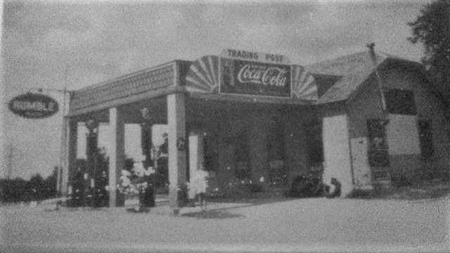
Continuing westbound on Highway 29, the next caching county needed was Mason County. We stopped in the historic small town of Art, Texas (GC6KP9A). Not exactly a ghost town but not really much of a town in size. Interestingly though it still has a post office with a population that's always been in the teens and twenties.

Heinrich Conrad Kothmann (1798-1881) and his wife Ilse Katherine Pahlmann (1810-1905) and their family sailed from Germany to Indianola, Texas in 1845. Among the first families to settle in Fredericksburg, the Kothmanns were issued a 640-acre land grant in Mason County in 1848. In 1856 they moved again and were among the first immigrant families in this area called Willow Creek. A trained cabinetmaker and musician, Kothmann began ranching and acquired another 640-acre tract of land. Located on their former homestead, the Kothmann Cemetery is all that remains of the original ranch site. It contains only five graves, all of Kothmann family members.

Along with a few other German families, a log church was built in 1958. In 1875, they raised a stone church which also served as a school. Otto Plehwe purchased a newly established general store from J. A. Hoerster in 1886. Plehwe thought the area needed a post office as well as a store and the government agreed. Postal officials even went with Plehwe’s suggested name, one the new post master thought had a nice ring to it: Plehweville. However, not an easy name to remember or pronounce, many residents were happy with it and many letters would get lost by the postal service.

In 1890, a new larger Methodist Episcopal Church was erected and is still in use to this day. The stone building was still used for school up until 1945 when the rural schools were consolidated to Mason. By 1920, Eli Dechart had taken over as store owner and post master of Plehweville. He recommended the new name for the post office of Plehweville, Texas be Art, Texas – Art being the last three letters of Dechart. The government agreed and Plehweville became Art.

One thing I forgot to do was get a photo.

The next Geocache was in Menard County, the ghost town of Hext (GC5AD72).  It was known as Maringo (Marengo) when the area was settled in the 1870s, but residents changed the name to Hext in the late 1890s in honor of Joseph Robert Hext. A local post office was established in 1897 with Ennis Stark as postmaster. In 1914 the community had a cotton gin, a hotel, two general stores, and 125 residents. A Church of Christ had been organized in 1904, and a Baptist church was established in 1916. By the mid-1920s, population estimates for the community had fallen to forty; they rose to sixty in the late 1940s and remained at that level through the mid-1980s. The community reported sixty-four residents in 1988. In 2000 the population was seventy- three. Today the postmaster stated that the post office serves 49 residents through its boxes and route deliveries. It is one of the smallest in Texas. At one time Hext had a school.

Also in Menard County is the Presidio de San Saba (GC6P54K). Once known as Presidio San Luis de las Amarillas, a fortress constructed in 1757 by a Spanish force led by Captain Don Diego Ortiz Parilla. The presidio, which was subsidized by the Spanish crown, had a threefold purpose: to protect the nearby Mission Santa Cruz de San Sabá, to assess the validity of rumors of rich silver deposits in the area, and to guard the Spanish frontier against the threat of Indian encroachment. Both in physical size and number of troops, the Presidio was the largest and most important military installation in Texas for its time.  The fort's companion site of the Mission Santa Cruz de San Sabá was built a few miles downstream.
The presidio and its accompanying mission were the first place that Europeans in Texas came into conflict with the Comanche Indians and found that Plains Indians, mounted on Spanish horses and armed with French guns, constituted a fighting force superior to that of the Spanish colonials. The course of history was changed at the Mission and Presidio; eventually, the Spanish withdrew from the frontier creating other lines of defense along the Rio Grande. The Presidio only lasted another decade and a half, abandoned by decree of the Viceroy of New Spain in 1772. Over one hundred and fifty years later, the 1936 Texas Centennial Commission contracted the reconstruction of the Presidio in an effort to recapture the region’s past, and the northwest portion of the Presidio rose once again. Today, Menard is helping to preserve and interpret the archeological remains that surround this community. Travelers may observe the ruins of the Presidio reconstruction where archeologists have spent several years uncovering artifacts pertaining to the site and the Spanish Colonial period in Texas.


Our final stops for the day were in Schleicher County in the town of Eldorado, Texas. One cache was at the Eldorado Cemetery (GC27D82) and by the Courthouse and Old Jail in the town square (GC163MG). County Courthouse marker: Constructed in 1923-24, this courthouse replaced an earlier building on this site which burned in 1917. Designed by noted architect Henry T. Phelps of San Antonio, the 3-story Classical Revival structure features four half-round giant order Doric columns which support a large entablature. Native stone for the building was obtained from nearby quarries. The 1905 Schleicher County Jail was built with limestone by T.S Hodges. Built with a gallows, that was never used, the jail was vacated in the early 1960's.


It was a beautiful day. We got to see some interesting places and learn more about Texas history. Thanks for reading about our adventures.

Thursday, June 13, 2019

2017-10-28: A Crumbling School, Cemetery, a Bridge, Dinosaurs, and Chocolate!

Welcome back and WOW what a day! Today we have everything from a crumbling school, to a cemetery, an old bridge, going way back to the days of dinosaurs, and finishing the day with decadent CHOCOLATE! So lets get started...

After finishing up work yesterday in West Texas, we made the long drive to Killeen last night. Today was a day for geocaching and exploring. After breakfast, we made our way up to Bosque County for our first cache and a new county. The Mosheim School (GC15B39) is a crumbling landmark of an era faded into the past. The town formerly known as Live Oak was settled in the 1850s with Jonathan Dansby given as an early (if not the first) settler.


A man named Jeff Howard built the first store in 1886 and submitted the name Mosheim for a post office which was granted the following year. In 1896 Mosheim had fifty people, a school, and several businesses. The population went from 171 in 1904, to 100 by 1925 and then reached its zenith in 1941 with 200 Mosheimers. It remained close to 200 until the late 1960s when it declined to 75. The town lost its post office in 1976.


The school was built in 1923 and by 1970 it had closed it's doors. Looking at various photos of the school online, the taller section above the entry along with the roof had collapsed sometime between 2013 and 2016. There's a really good article at the KWTX website talking to two locals who grew up and went to that school.

Just up the road is the town of Clifton, where we found our next two caches at the cemetery (GC6RW7N, GCT7BK). Clifton was founded in the winter of 1852–53, when the families of Samuel Locker, Monroe Locker, Frank Kell (whose grave and statue in the photo), and T. A. McSpadden settled in the vicinity. The town was named Cliff Town after the limestone cliffs that surround it. Over the years the name was altered to Clifton. The site was originally on the banks of Clear Branch. The Masonic hall and a log schoolhouse were the first public buildings. The post office was established in 1859. The First Presbyterian Church of Clifton was organized in 1861 and is the oldest church in continuous service in the county. The Baptists built the first church building in Clifton in 1884–85. After the Civil War J. Stinnett built a flour mill that was powered by the Bosque River. It was replaced in 1868 by a limestone mill, which was eventually converted to the electric power plant that provided the first electricity for Clifton homes. A three-story school known as Rock School was built around 1870 and served the community for more than twenty years. In 1893 a new building was constructed on property donated to the Clifton school system.


In 1880 the Gulf, Colorado and Santa Fe Railway built a station a mile south of Clifton. Merchants moved their businesses closer to the railroad station, and the town thrived as a business and trade center. The Merchant Exchange and Flour Mill, the first steam flour mill in the Bosque valley, was established in 1887 or 1888. The Clifton Record, a newspaper that began publishing in 1895 under the ownership of W. C. O'Brian, continued to serve the community through the years. Clifton also served as the county seat between 1890 and 1892. Clifton Lutheran College, later known as Clifton College, opened in 1896. The community was incorporated in 1901. An earlier attempt at incorporation in 1891 failed when the election results were declared invalid. A fire on December 23, 1906, destroyed a large portion of the business district, which was eventually rebuilt. The Clifton Volunteer Fire Department was organized in 1907. The town's need for a hospital was met by Dr. V. D. Goodall and Dr. S. L. Witcher in 1938. The Lutheran Sunset Home for the elderly was established in Clifton in 1954. The town had an estimated population of 204 in 1904 and 3,195 in 1990. It had 100 businesses in the 1980s. In the early 1990s an exotic-animal preserve open to tourists was located southwest of Clifton on Farm Road 3220. In 2000 the population was 3,542 with 262 businesses.

After leaving the cemetery, we headed to the north side of town to visit a piece of history before it becomes history. The Clifton Whipple Truss Bridge (GC6RW6C) was built in 1884. Still in use as one of only two bridges crossing the North Bosque River east of town. It had asphalt over the original wooden planks. But it's days are numbered. You can kinda see in the photograph, they're building a new modern bridge right next to it. And the word is when the new one is completed that the planks will be removed making it impassable. That's a shame. I like these old bridges. They should at least leave it for pedestrians, fishing, or just because.


Around the corner from the bridge was this rock structure. Wasn't sure what it was as there were no signs or anything. Perhaps a part of the old mill? So I began to Google for answers. Not even close to being an old mill. The City of Clifton offered the State of Texas 80 acres of land along the Bosque River for a state park. The state never accepted the donation, and the area remained a city park. Civilian Conservation Corps (CCC) Company 878 arrived in June 1933 to begin work on the park. The CCC built picnic and fireplace units, a semicircular seating area, entry portals, concession building and latrine all out of limestone. The CCC left their camp in Clifton in January 1934. This is what remains of the abandoned latrine!

Then there's this building on the corner. The sign says "First Chance," but I couldn't find any information on it. Then Bryan Davis from the BackRoads of Texas FB Group was able to help me out. He sent me this information: "My late friend Anna (Wood) Compton knew a lot of local history. Not sure many will recognize this photo from 80 years ago. This was a popular stopping point just before crossing the Bosque River on the west side of Clifton, where the old Whipple Truss Bridge stood. Anna lived here with her parents in the 1930s and her dad sold bait and tackle, picnic supplies, barbeque, cigarettes, and other goods. The Wood family lived in a back room partitioned with a sheet from public view. What fascinated Anna and me was that nothing appeared being done to preserve the limestone structure which was her childhood home. I've been told it is the oldest structure in present-day Clifton, pre-dating the move of Clifton to its present location with the arrival of the railroad about 1881. I recall Dan Orbeck and Ferman Grimm saying their families also owned the structure at various times. I'm sure there are issues with it being in a flooding zone, but I hope some measures are being taken to insure this landmark, which has survived some 150 years and numerous floods, receives proper preservation."

Thank you Bryan. I never thought the building would have been that old! Here's a picture Bryan sent me from back in the past:


From there we drove north on up into Somervell County and a town called Glen Rose. The town had a couple of statues around the courthouse square.


Also in the town square, is the tiny Hopewell Post Office and our last cache for the day (GC9B44). There are (or were) Hopewells in Franklin, Houston, Red River, Smith, Upshur and Williamson Counties. Somervell’s Hopewell is now covered by Squaw Creek Lake. Fortunately, great effort was taken to preserve a part of the forgotten community by moving its tiny post office to Glen Rose to sit on the courthouse square next to the museum. It's short history lasted from 1901 through 1904.


From there we drove over to the Dinosaur Valley State Park. In 1908, a flood of epic proportions roared down the Paluxy. It washed out all bridges and culverts on the river and scoured the riverbed. A year later, nine-year-old George Adams discovered something amazing in the river:  large, three-toed tracks - theropod tracks. Nearly 20 years later, a fossil collector for the American Museum of Natural History in New York named R. T. Bird saw one of the theropod tracks in a shop in New Mexico. He decided to come to Texas and check out the site. While exploring in the river, he was amazed to discover what looked like sauropod tracks, along with the theropod tracks. The tracks were the first proof that sauropods walked on land. The park opened in 1972 to preserve these valuable dinosaur track sites and to allow people to learn from and enjoy them. They also have some nice hiking trails along the river.


Getting late in the afternoon, and both starving by this point, we stopped in the town of Hico for dinner at the Jersey Lily's Mexican Restaurant. It was pretty good. The town is also known for this legend that supposedly Billy the Kid really wasn't shot and killed in his young life. But lived out a long life under an alias here in Hico. But what we REALLY liked best about this whole town was a visit to Wiseman House Chocolates! While at the restaurant I was looking up other things and town and saw this place. We just had to go visit after dinner. And it was a good thing we did!

They had this pure hot chocolate that was the best hot chocolate we've ever tasted. Something about taking pure melted chocolate, adding a tiny bit of water to keep it from hardening, and sipping it from a shot glass. So rich and delicious that's all you really need. The best chocolate I've ever had. We ended walking out with over $100 worth of several different types of chocolate, including this pure chocolate high healed shoe for Candy! I think it'll just be displayed in our kitchen forever. I can't see eating this shoe. Does chocolate go bad? Guess we'll never know.


Well that's the end of a wonderful day! I thank you for reading and following along in our adventures! Until next time...

Tuesday, June 11, 2019

2017-10-14: Geocaching in a Cemetery, at a Cannon, and a Ghost Town

Thank you for returning to our AwayWeGo's Geocaching Adventures Blog. My name is Mark and I'm the blogging half of the awayWEgo. Today wasn't a busy caching day. I'm still working as a construction surveyor on a commercial solar power plant in West Texas. But now with a home also in Killeen, about 5-6 hours away, where the better half of the awayWEgo will soon be working. This means a long commute on the weekends.

On today's long 360+ mile drive back to West Texas, we made a few stops to geocache and break up the long drive. This also gives us a chance to see some historical sights and learn about Texas.

Our first geocache was in a town called Brady at the cemetery (GC2H37Q). Live Oak Cemetery in Brady, TX has over 4200 permanent residents dating back to the 1800's. Two graves that caught my attention were these brick covered plots. The one having the opened top makes me wonder if they've escaped and now wandering the surface with the walking dead.


McCulloch County was organized in 1876 with Brady as county seat. The first courthouse was built in 1879. This second and current courthouse was completed in 1900 on the same site. Modified Roman architecture employing arch vault, Victorian copula, pine woodwork, flooring, and native sandstone from local quarries.

The town of Brady is often called "The Heart of Texas" because of it's almost near geographical center of the state. There is a historical marker north of town referencing the geographic center. However, the actual geographical center is a few miles from it and located on private property.

Also in town square and to the side of the courthouse is our next cache called KA-BOOM (GC2HF3A). It took some searching and Candy actually spotted it first with her keen eyes. Hidden on a United States Army 155mm Howitzer model M114A1, upgraded to A2 Type, and built in 1944. Dedicated on Veterans Day November 11, 1995 to honor all McCulloch County Veterans. 


Continuing westbound a few miles, we arrived at our first ghost town and our next geocache (GC15638). West Sweden was settled in 1905 when a flock of Swedish immigrants transmigrated from their farms in Travis and Williamson County, led by their pastor Ernest Severin. The town's name carried on a tradition (after New Sweden in Travis County and nearby East Sweden, Texas) but the town never prospered and it is believed the residents returned to their previous homes. The community remained on highway maps in 1948 but by the 1980's it was just a memory. All that remains is the cemetery.


And finally, we make a stop in the Garden of Eden (GC4FKW0). The town was not named after the biblical garden but after one Frederick Ede (the 'n' was added later), a settler who moved to Concho County in the early 1880s. In fact it was Ede who donated land for the townsite and town square. He was thus honored when the town was granted a post office in 1883. 

By 1890 Eden had a population of 107 and growth was steady and promising. 1908 brought a public windmill and well. Eden incorporated in 1911. In 1912 Eden became the end of the line for a stretch of track of the Gulf, Colorado and Santa Fe Railroad running from Lometa. The town had 600 people in 1914 and got its own school district in 1920. The population went from 600 in 1925 to 1,603 in 1941. The population peaked in 1954 with 1,993 people.

Near the center of town you'll find the Garden of Eden. A community garden full of native flowers and trees. It was a nice little stroll and we found the cache hidden among the rocks.

Monday, June 10, 2019

2017-10-13: Cemeteries, a Tank, a Mexican Fort, and a Giant Teapot

Hello again and welcome back. So we spent the last two days moving into the house in Killeen. Now it's time for some fun and exploring. Today's Geocaching adventure has us driving around east central Texas to pick up some new counties.

Our first stop was down in Bastrop County and a town called McDade. There we grabbed a virtual cache (GCFF19) and a cemetery cache (GC41K67). McDade was founded in 1869 in the expectation of the arrival of the Houston and Texas Central Railroad. The town was named after James W. McDade who may have had something to do with the railroad. In the early days it was also called Tie Town or Tie City because ties and logs for the railroad were stored there.

When you think of the wild west and gunfights, you usually think about Tombstone and Deadwood. But this little known town of McDade, Texas experienced more shootings, lynchings, stabbings and 
assassinations between 1875 and 1884 than Tombstone and Deadwood combined! They need to make a movie about the outlaws and vigilantes there. But I encourage you to read more about the town at Texas Escapes.


One more quick roadside cache in McDade (GC6K3KY) then we continue down US-290 towards Washington County. There we stop for a quick Cowboy Wine cache (GC2QX0G) at a winery, but no time for tasting. Gotta keep moving. Then another picnic area cache along Mill Creek (GCNNDN).


Now over in Grimes County in the town of Navasota we find our next 5 geocaches. The first was called Real American Hero (GC23PZ6). March 23, 1999 the United States Department of the Army delivered a model M-60ATTS tank serial number 3757-A to this site. The M-60 combat tank equipped with a 105 mm cannon was deployed in the Vietnam and Desert Storm wars. This tank is dedicated to all members of the VFW Post 4006. The marker is dedicated in memory of Chief Bos n' Mate Sam Corolla Ret. USN who was instrumental in acquiring this tank.

Also in Navasota is the Oakland Cemetery and our next three geocaches (GC23PZY, GC23PZK, GC6KY3J). One of the celebrity burials is that of a musician, Mance Lipscomb Sr (1895-1976). His father taught him the basics of fiddling and was self-taught the guitar. Developed a distinctive finger-picking style that complemented his singing style. Lipscomb was "discovered" in 1960 at age 65. He saw his first album, and first recording, Texas Songster, released a year later. His music and life have been well documented on film, appearing in several 1960s and 1970s blues documentaries including The Blues Accordin' to Lightnin' Hopkins (1968), Blues Like Showers of Rain (1970), A Well Spent Life (1971), and Out of the Black Into the Blues (1972).

Our last geocache in town was a quick park and grab hidden at and placed by the Navasota Police Department (GC77NVV). Before heading out of town, we had to make one more stop. There wasn't a cache there. But when the town is home to the world's largest teapot you just have to pay a visit. Located next to Martha's Bloomers, a plant and garden nursery, it's a free stop for a photo opp.


Continuing north on TX-6, we arrive in Brazos County and the town of College Station. We had a quick stop at an A-maze-ing virtual cache (GCDB0A). What's the difference between a maze and a labyrinth? maze is a complex branching (multicursal) puzzle that includes choices of path and direction, may have multiple entrances and exits, and dead ends. A labyrinth is unicursal i.e. has only a single, non-branching path, which leads to the center then back out the same way, with only one entry/exit point. So is this a maze or a labyrinth? Neither, it's a virtual cache!


Not too far away was a gadget cache (GC5CRV6). Gadget caches are a lot of fun, but can also be frustrating. They're usually easy to find, as this one was. But there's always a brain teasing challenge to figure out how to get them open! Fortunately I have encountered one of these before so it was fairly easy.


Our next Geocache was over in Burleson County at a historical marker for Fort Tenoxtitlan (GC1J60X). Founded by Mexico as a bulwark against Anglo-American immigration, this fort and its nearby city were twice proposed for the capital of Texas. Alarmed by the influx of Anglo settlers into Texas, Mexico in 1830 sought to erect a line of forts to keep out the intruders. The ancient Aztec name for Mexico City (originally pronounced "Ten-ox-teet-lan") was given this site; it means "prickly pear place". So hopeful of the fort's success was the military commandant of the region that he envisioned it as the capital of Texas. But Anglo immigration did not cease. Instead it thrived on the friendship of the local soldiers and incoming pioneers. The colonizer Sterling C. Robertson introduced scores of settlers.

In 1832 the soldiers were withdrawn and the fort finally defaulted to the Anglos. Subsequently it was a supply center and mustering point for expeditions against the Indians. During its brief life many Texas patriots lived here, including 5 signers of the Texas Declaration of Independence, a martyr of the Alamo siege, and 7 soldiers of the Battle of San Jacinto. Tenoxtitlan was again suggested for the capital of Texas during the Republic, but Austin won out. In 1841, after many Indian raids, the site was abandoned.

Unfortunately, there's nothing left of the fort to see.

We finished off the day with one last cemetery cache but unfortunately it had been muggled and we had to log a DNF. It was a fun day with lots to see. But time to get back to the new house and relax.


Sunday, June 9, 2019

2017-09-24: Geocaching a Couple of Pioneer Cemeteries in Texas

So Friday night we drove over from West Texas into the Killeen/Ft Hood area to look at some houses to rent. That is how we spent yesterday. Today we made the drive back to Monahans, stopping a few times along the way to grab some Geocaches.

Our first cache was a quick one right at the hotel and then another in the Walmart parking lot. Then we drove over along side the airport to find the Brown (Okay Community) Cemetery cache (GC4QKZ8). 

Elisha Ivy, for whom Ivy Mountain Road was named, established a home and store in this vicinity in the 1860s. In the 1870s, a community known as Liberty Hill developed northwest of his property. In 1896, when the rural settlement applied for a post office, its name was changed to Okay. Area residents supported churches, a school and businesses, and Samuel Marion and Mary Elizabeth (Evans) Brown set aside land for a community burial ground, formally deeding it in 1907.

As military installations in the area grew, the community of Okay was displaced and ceased to exist in the early 1940s. In 1953, the U.S. Government decided to extend the runway at Gray Air Force Base, where the Brown (Okay Community) Cemetery was located, approximately 1,600 feet southwest of this site. The Army Corps of Engineers moved 70 graves, 30 of which were for unidentified individuals, to this location and aligned the burials similarly to original positions. The earliest marked grave dates to 1882 and is that of infant David Davis. Today, the cemetery is a reminder of the Okay community and the families who lived there, added to the long list of ghost towns.

Our next stop was for another Brown Cemetery geocache (GC3D2BY) just outside of San Saba, TX. After living for a time in Arkansas, John H. "Shorty" Brown (1817-1896), his wife Jane Ann, and some of their children came here. Brown helped found San Saba in 1854 and became a civic leader. Although San Saba County provided a graveyard, Brown and his wife deeded this plot of land near their home for a family burial ground. Jane Ann, who bore 17 of Browns 21 children, was probably the first burial here about 1874. Brown's son and son-in-law who were murdered are buried here along with other family members and friends.

Next to the cemetery is a community park that has a train trestle railroad track passing over the entrance that made for a nice photo. I just wish I could have removed those signs first and then taken the picture.


Our next and last geocache of the day was located in a town called Eden, TX. The Pioneers Rest Cemetery (GCM02B) was set aside in 1882 when the town of Eden was platted by Fred Ede. Though older burials may be present, the earliest tombstone is that of the five-week old infant son of Frederick and Susan (Reynolds) Shutt, buried in 1882. Several graves for children and infants bear witness to the harsh conditions of pioneer life.Adults, too, faced difficult time. John Emmett Molloy and Charles Edward Waring both were killed in accidents with horses. According to oral history, a woman named Carson was killed by a runaway horse in 1887 and is buried in an unmarked grave of an estimated 33 or 34 burials believed to have taken place here, only fifteen tombstones remained standing at the dawn of the 21st century, but Pioneers Rest Cemetery continues to be a chronicle of Eden's history. Unfortunately when it comes to the cache, this one was a DNF as it was missing.

Not as big a geocaching adventure as usual, but this wasn't a caching trip. More of taking care of some business with some caching tossed in to break up the long drive. Thanks for stopping by to read our blog. See you out at the next cache...