Wednesday, October 11, 2023

2021-06-18: Summer Road Trip to Buy Our "New-to-Us" Home and Geocaching Through Missouri, Illinois, and Indiana

So here we are on this Day 3 of our 5300+ mile summer road trip from West Texas to Indiana to Connecticut, back to Indiana to Florida and ending in NE Texas. The main reason for this roadtrip is to look at and hopefully purchase our "new-to-us" home-on-wheels. Along the way, we'll be picking up as many new geocaching counties as we can and seeing some of the sites along the way. So hop on board the GeoJeep and let's go see what we can find.


Well we didn't quite make it out of Missouri yesterday. We stayed the night in the town of Sikeston in Scott County. We were going to have dinner at the famous Lambert's, where they throw the fresh rolls out to you. But we weren't up for the long lines and over an hour wait! So we came back this morning to grab the geocache (GC2JC3X) for the county and take some photos.


Driving east on US-60, we crossed over into Mississippi County. We stopped for a quick geocache (GC4KW34) in Bertrand for the county and kept moving.

Further down the road I spotted this roadside historical marker and had to stop for a photo. "Rev. Owen Whitfield with the support of local landowner, Mr. Thad Snow, and 1500 black and white sharecroppers camped here in harsh January weather several days in 1939 to protest the plight of Boot Heel sharecroppers. The event received national attention. Owen and Zella Whitfield met with Pres. Roosevelt and ultimately received his support for the cause. This community has dedicated January 10 as Thad Snow - Owen Whitfield Day."


My next three geocaches were all in one corner of a park. There was a virtual geocache (GC710E) and two earthcaches (GC1A369, GC1A36F). Fort Defiance State Park is right at the corner of Missouri, Illinois, and Kentucky as well as the confluence of the Mississippi River and the Ohio River. It is also the lowest elevation point in Illinois.


On November 14, 1803, Lewis and Clark landed here with their Corps of Discovery party. Commissioned by President Thomas Jefferson to explore and survey the recently purchased Louisiana Territory, their six days here was one of the longest stops made by the expedition. Their stay allowed Captain Meriwether Lewis to teach Captain William Clark how to navigate using a compass and a sextant. Because the 3rd Principal Meridian begins at the mouth of the Ohio River, astronomical observations at this point were crucial.


Above: nearly 175 million tons of goods are shipped via the Mighty Mississippi River each year. Below: Candy and her grand-daughter down at the southernmost point of Illinois and the convergence of the two rivers. The Ohio River is entering from the left. The Mississippi River enters from the right-rear and continues down to the far right.


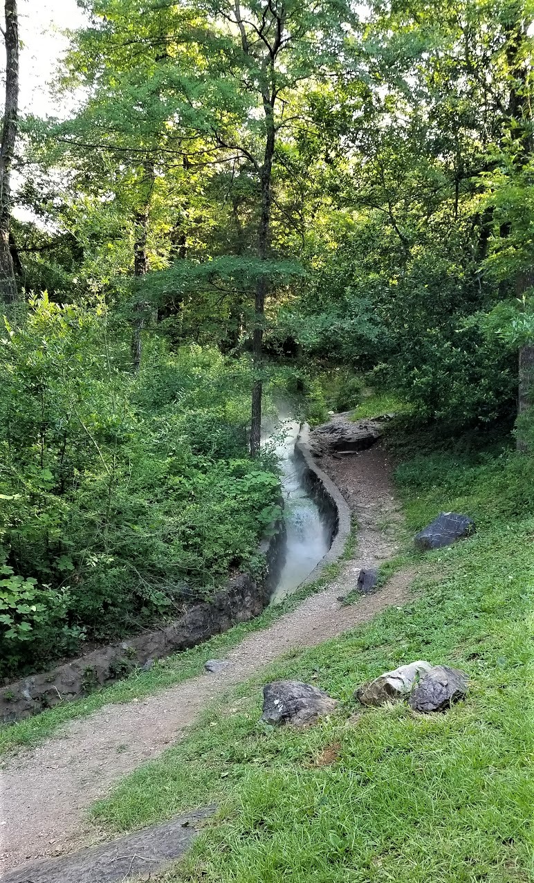
Our last stop for today was just a few miles away in a town called Cache, Illinois (GCR01C). I can't find out much info on the community of Cache, IL other than it was laid out in January 1904. Found a newspaper article in April 1927 suggesting the town was flooded out. Then a few decades later the Cache River was rerouted to empty into the Mississippi River instead of the Ohio River. Whatever happened to the town, this bridge isn't singing anymore.


While researching the town for this blog, I came across some articles for a cemetery called "Seven Mile Graveyard" located between Cache and Cairo. The Find-A-Grave website had 7 memorials listed, but no photos. I came across another 8 newspaper articles of people that were buried there and added those memorials. Then I came across a more recent article of the cemeteries demise:

Excerpt from the Southern Illinoisan, April 30, 1999:
"The cemetery was incorporated in 1853. In 1878, many people who died in a yellow fever epidemic were buried there. By 1921, the cemetery was overgrown and unkempt. In 1955, the land was purchased and the cemetery was bulldozed and turned into a pasture, a piece of history turned to dust and memory."

So sad. Perhaps one day someone can further research local records and discover the location of the cemetery. Maybe even more names of those long forgotten souls can be discovered and added to the Find-A-Grave website. And if just one descendent can make that genealogical connection, even better!

Well we still had about 430 miles of driving to get to Decatur, Indiana by tonight. So the rest of my planned geocaches had to be bypassed. That's NOT something I like doing either. Tomorrow morning we go check out our potential new-to-us home-on-wheels!

To follow along on our travels and keep up with my latest blogs, you may do so here of course by clicking the "Follow" button to the right. And there's also my main website at AwayWeGo.US for the complete index of my traveling adventures going back to 2005. But also by using one or more of your favorite of these social media platforms: FacebookMeWeGabRedditTwitterGETTRInstagram, and TruthSocial. These all link directly to my profiles. Again, please feel free to comment and / or share.

Saturday, September 16, 2023

2021-06-17: Summer Road Trip to Buy Our "New-to-Us" Home and Geocaching Through Texas, Arkansas and Missouri

Hello Friends! Well some of our regular readers may recall that the primary reason that we are able to go on so many geocaching roadtrip adventures is because we work in construction. We travel from project to project across the country and had to find short term rentals in each town to live in while there working. My wife has been traveling and working with me for about two years now, though this last solar project we just completed near Fort Stockton, Texas she didn't work on it.

When we arrived in the nearby small town of McCamey at the beginning, the choices for rental accommodations were old rundown houses from the 1940's. My wife took one look and decided she'd stay with her daughter in Killeen, TX for the duration. Now that it has completed, I have three weeks before starting at the next location in North Texas. So what to do but go on a roadtrip to Indiana where I found our "new to us" home to buy! Finally after a year of looking... a wish comes true!


My last day on the project was a Tuesday. I had packed up everything in the Jeep that morning and I made the 5-hour drive to Killeen after work that evening. On Wednesday, Candy and I packed as much as we could into our little 2-door Jeep for us as well as her teenage grand-daughter who rode along with us on this roadtrip adventure.

So we left Central Texas and our first stop wasn't until Texarkana, Arkansas or is it Texas? Or Arkansas? Actually it IS in both! The courthouse sits right on the state line. Now that's a divided court and was a virtual geocache, now archived (GC829D).


After 450 miles of driving, we stopped at a hotel in South Hot Springs, Arkansas for the night. Waking up Thursday morning and checking out, we grabbed a quick geocache (GC1KGXN) right there in the parking lot before hitting the road.

But not before taking a quick drive into the historical Hot Springs National Park and Bathhouse Row. Hot Springs, Arkansas, gets its name from the naturally 143 °F thermal spring waters found here. Flowing out of the ground at almost one million gallons of water each day. Native Americans called this area “the Valley of the Vapors,” and it was said to have been a neutral territory where all tribes could enjoy its healing waters in peace. Spanish and French settlers claimed the area in the mid-1500s. In fact, famous explorer Hernando de Soto was the first European to visit Hot Springs in 1541.

While it is true that President Grant designated Yellowstone as the first "National Park" in 1872, it can also be said that Hot Springs, Arkansas was technically the first national park when President Andrew Jackson designated Hot Springs a "Federal Reservation" in 1832 for public use. Hot Springs didn't officially become a National Park until 1921.


Bathhouse Row has evolved over the years from it's rustic beginnings to the modern spas of today. In the 1830's, Hot Springs earliest facilities were make shift shelters perches over individual springs. Later elaborate Victorian bathhouses flourished along the avenue. But those wooden structures were susceptible to rot and devastating fires. The present mix of Spanish Mission to neoclassical architecture date from 1911 to 1939, the Golden Age of bathing.


Medicinal bathing peaked in 1946 and many of the traditional bathhouses have closed or converted into the modern spas. Traditional bathing remains at the Buckstaff Bathhouse. The National Park Service has landscaped many of the exercise paths that were considered essential to good health. Like earlier visitors, you can still stroll the brick Grand Promenade behind Bathhouse Row or hike mountain trails throughout the National Park.


Walking among the shops there on the row, I spotted an iconic Zoltar fortune teller machine made famous from the 1988 movie "Big" starring Tom Hanks. Hmmm, what should I wish for?


Also spotted this restored antique Harley-Davidson motorcycle. Not sure about those white tires though!


And then there's this statue standing outside of Diablos Tacos and Mezcal restaurant. Still too early for lunch so just took a photo.


While walking down Bathhouse Row, we did find three geocaches and completed an Adventure Lab. Along with what I've already shared with you, they also highlighted Hot Springs history with Babe Ruth and baseball (GC2ZDMJ), the cemetery (GC3JFJ9, GC92RGD), and Al Capone and organized crime in the 1930's.

Time to get back on the highway heading north. Since I've already gotten the geocached counties along the way from previous trips, I tried to make up some time and skipped a lot of the geocaches I had picked out. Got back to I-30 into Little Rock to US-67 towards the northwest.

When we get to the town of Walnut Ridge, I make a right turn onto US-412 eastbound. It didn't take long before I thought it was a big mistake. CONSTRUCTION TRAFFIC!! My next target cache was still over 40 miles. While waiting for the lane to open back up to proceed, I thought I'd check the nearby geocaches. What do I see but a new geocache hidden on my birthday (June 11), published on the 13th, and STILL yet to be found four days later! I guess it was just waiting for us to pass by! I knew exactly what it was just from name "Dollar Skirt" (GC9CMGQ). Found and stamped the blank log sheet! WOHOO a First-to-Find! Thanks for construction traffic!

Then we crossed over into Dunklin County, Missouri and made a quick roadside geocaching stop for the county (GC3ABN5). Next door in Pemiscot County we found a very large geocache with a LOT of favorite points (GC1REX7) to complete the "heal" of Missouri.

Also in the town of Hayti was this restored one-room schoolhouse. The Hayti school building was built in 1874 and was used until 1895. There was a geocache there too but we couldn't find it, as well as several previous geocachers too. It has since been archived.


Jumping onto I-55 northbound a few miles into New Madrid County, we soon exit into the town of New Madrid, Missouri. There were three geocaches on my to-do list in town to be found. The first one was at the Byrne-Howard Cemetery (GC2M4Q4). The cemetery was established in 1833 with the burial of Morgan Byrne. He was joined by his wife Jane just two years later. This small cemetery has acquired 29 permanent residents between 1933 and 1947.


We also stopped by the Hunter-Dawson State Historical Site (GC47ZVN). William and Amanda Hunter owned a successful dry goods business in New Madrid as well as a floating store selling goods up and down the Mississippi River. They built their antebellum mansion with Georgian, Greek Revival and Italianate features popular during the period. The mansion took nearly a year to build and was completed in May of 1860. Unfortunately William died in 1859 before the house was completed.


In 1874 Ella, the Hunter's youngest daughter, married William Dawson. Upon Amanda's death in 1876 Ella and William moved into the mansion. Dawson served three terms in the Missouri State Legislature. In 1884 he was elected to the US House of Representatives. In addition, he served on the planning committee of the 1898 World's Fair in Chicago.

The home did suffer damage during the Great Flood of 1937. (There is a spot in the house where you can see the water mark on the wall.) Descendants of the Hunter family occupied the home until 1958. In 1966 it was purchased by the city of New Madrid. A year later the city donated the site to the state to use as a state historic site. The home now stands as a testimony to the grand lifestyle of the successful businessman prior to the Civil War.

Speaking of the Civil War, while the Union troops occupied New Madrid, the Confederates controlled passage of the Mississippi River just around the bend upstream on a large island in the middle of the river. This prevented supplies from reaching New Madrid or any Union troops further south. In March of 1862, Colonel Josiah Bissell, commanding the "Engineer Regiment of the West," surveyed land north and east of New Madrid. Bissell found swamps and bottomland inundated with early spring floodwaters and suggested to Brigadier General John Pope cutting a canal from north of the island going west into New Madrid allowing steamboats and other ships to bypass the Confederate forces. Pictured below is a submergible saw used to cut down trees below the waterline allowing boats to maneuver through the thick swamps.


Island #10 in the Mississippi River

Backing up a bit for earlier history, New Madrid was the first American town in Missouri. Founded in 1789 by George Morgan, Princeton graduate and Indian trader, on the site of Francois and Joseph Le Sieur's trading settlement. Named for Madrid, Spain, the town was to be an American colony. Morgan was promised 15 million acres by the Spanish ambassador, eager to stop U.S. expansion with large land grants. In 1800, Spain traded the territory back to France in the Third Treaty of San Ildefonso. After trying to regain control of Saint-Domingue (the present Haiti), where a slave rebellion was underway, Napoleon gave up on his North American colonies, agreeing to sell this territory to the United States in 1803 as part of the Louisiana Purchase.


And finally, the New Madrid Earthquake (GC1DRVR), made up of a series of monstrous and lessor shocks, which began December 16, 1811, and continued for over a year. One of the great earthquakes of the world because of severity and length it caused little loss of life in a thinly settled region. Some of the shocks were felt as far of 1100 miles.


So that's it for today. Tomorrow we see a little more of Missouri before getting into Illinois and Indiana.

To follow along on our travels and keep up with my latest blogs, you may do so here of course by clicking the "Follow" button to the right. And there's also my main website at AwayWeGo.US for the complete index of my traveling adventures going back to 2005. But also by using one or more of your favorite of these social media platforms: FacebookMeWeGabRedditTwitterGETTRInstagram, and TruthSocial. These all link directly to my profiles. Again, please feel free to comment and / or share.

Saturday, August 19, 2023

2021-05-30: Visiting the Notorious Bonnie and Clyde Hangouts and Graves in Dallas, Texas

Welcome back friends, geocachers, RV'ers, and fellow travelers. On this particular roadtrip adventure, we were passing through Dallas, Texas and decided to take a break from the driving. We set out to retrace some of the stomping grounds of the infamous Bonnie and Clyde with the help of a Geocaching Adventure Lab. The couple became national news figures as they traveled the mid-west from 1932-1934, with their criminal gang during the Great Depression. Just about everyone has heard the story or seen the movies. Now let's go visit some of their hangouts around West Dallas...


Clyde Chestnut Barrow was born in 1909 into a poor farming family in Ellis County, Texas, southeast of Dallas. The family moved to Dallas in the early 1920's as part of a wider migration pattern from rural areas to the city, where many settled in the urban slum of West Dallas. The Trinity River Squatter's Camp was the industrial slum along the river bank underneath where the current Margaret Hunt Hill Bridge is now located. Back during the depression, the area you see below was a maze of tents, wagons and makeshift huts, in the mud, without running water, gas, or electricity.


While living in the squatters camp, the Barrow family collected and sold scrap metal from a mule-pulled cart. A drunk motorist hit and destroyed the cart and killed the mule. With the money awarded to them from the insurance claim, Clyde's parents built the Barrow Star Service Station in Cement City. The family lived in a shack attached to the back of the gas station.


Barrow was first arrested in late 1926, at age 17, after running when police confronted him over a rental car that he had failed to return on time. His second arrest was with his brother Buck soon after, for possession of stolen turkeys. Barrow had some legitimate jobs during 1927 through 1929, but he also cracked safes, robbed stores, and stole cars.

Bonnie Elizabeth Parker was born in 1910 in Rowena, Texas. Her father, Charles Robert Parker, was a bricklayer who died when Bonnie was four years old. Her widowed mother, Emma (Krause) Parker, moved her family back to her parents' home in Cement City, where she worked as a seamstress.

In her second year in High School, Bonnie met Roy Thornton. The couple dropped out of school and married on September 25, 1926, six days before her 16th birthday. Their marriage was marred by his frequent absences and brushes with the law and proved to be short lived. They never divorced, but their paths never crossed again after January 1929. After she left Thornton, Bonnie moved back in with her mother and worked as a waitress in Dallas. Bonnie briefly kept a diary early in 1929 when she was aged 18, writing of her loneliness, her impatience with life in Dallas, and her love of photography. Bonnie was still wearing the wedding ring Thornton had given her when she died. This is a photo of Bonnie's elementary school which still stands today.


Eagle Ford School

Clyde met 19-year-old Bonnie through a mutual friend in January 1930, and they spent much time together during the following weeks. Their romance was interrupted when Clyde was arrested and convicted of auto theft and was sent to Eastham Prison Farm in April 1930 at the age of 21. He escaped from the prison farm shortly after his incarceration using a weapon Bonnie smuggled to him. He was recaptured shortly after and sent back to prison.

Clyde committed his first murder in prison of another inmate, with a pipe crushing his skull, in retaliation for repeatedly sexually assaulting him. Another inmate who was already serving a life sentence claimed responsibility. In order to avoid hard labor in the fields, Clyde purposely had two of his toes amputated in late January 1932, either by another inmate or by himself. Because of this he walked with a limp for the rest of his life. What he didn't know however, his mother had already successfully petitioned for his release and he was set free six days after his intentional injury. He was paroled from Eastham on February 2, 1932, now a hardened and bitter criminal. His sister, Marie said, "Something awful sure must have happened to him in prison because he wasn't the same person when he got out."

On January 6, 1933, officers were staking out this house owned by Lilly McBride, sister of one of the Barrow Gang members. A shootout occurred around midnight and Clyde killed 52-year-old Tarrant County Deputy Sheriff Malcom S. Davis beside the front porch.


Now surrounded by a golf course, this is the Eagle Ford Road Bridge. Back in 1933, this area was known as the "Devil's Back Porch." This once isolated area of West Dallas was rarely policed and is where Bonnie and Clyde often were hiding out in their stolen cars. It was also a gathering place for their family and friends to come and visit with the wanted outlaws.


In May of 1934, a posse of six officers from Texas and Louisiana had followed the trail of Bonnie and Clyde to the Bienville Parish. The setup an ambush along Louisiana State Highway 154 south of Gibsland. At approximately 9:15 am on the morning of May 23rd, the couple came speeding down the road in a Ford Deluxe V-8 Sedan, Clyde's preferred stolen car of choice. The officers immediately opened fire and began unloading about 130 rounds towards the car. In the end, there where 112 bullet holes in the vehicle. Seventeen rounds found their way into Clyde's body and 26 into Bonnie.

The Belo Mansion was built in the 1890's by Colonel A. H. Belo, founder of the Dallas Morning News. The mansion was later leased to funeral home operators George Loudermilk and Will Sparkman. The body of Clyde Barrow's bullet riddled body was laid out in the parlor for public viewing. Approximately 20,000 people came from all over to file past and get a glimpse of this notorious outlaw's remains. Today, this building is the current home of the Dallas Bar Association and Law Review.


Even though it was Bonnie and Clyde's wish to be buried together, the Parker family refused. Clyde Barrow's funeral was at sunset on May 25th at the Western Heights Cemetery next to his brother Marvin where they share a single headstone. There's a geocache hidden nearby (GC7K52N).


Bonnie Parker was laid to rest the following day on the 26th in the Fishtrap Cemetery. Her body was later moved in 1945 to the new Crown Hill Cemetery in Dallas where you can also find another geocache (GC596A).


So that was our quick historical tour around Dallas, Texas and Bonnie & Clyde's stomping grounds and final resting place. One of these days when passing through Primm, Nevada, we'll have to stop by Whiskey Pete's Hotel and Casino to see the bullet riddled Ford Deluxe V-8 there on display.

To follow along on our travels and keep up with my latest blogs, you may do so here of course by clicking the "Follow" button to the right. And there's also my main website at AwayWeGo.US for the complete index of my traveling adventures going back to 2005. But also by using one or more of your favorite of these social media platforms: FacebookMeWeGabRedditTwitterGETTRInstagram, and TruthSocial. These all link directly to my profiles. Again, please feel free to comment and / or share.

Sunday, July 23, 2023

2021-05-29: A Weekend Roadtrip up to Oklahoma's Ouachita National Forest and the Talimena National Scenic Byway

Well we had a 3-day weekend, so I decided another quick geocaching roadtrip in the GeoJeep was just what we needed. After a little research I discovered the Talimena National Scenic Byway located up in southeast Oklahoma and the Ouachita National Forest.  There's geocaching, offroad Jeep trails, and lots of scenic views. So we drove up from Central Texas yesterday and today we went for a drive. Follow along as we explore what I called the "Blue Ridge Parkway" of the mid-west...


Starting out in the town of McAlester in Pittsburg County, our first geocache was at the Oakhill Cemetery (GC3Q1R1). There were well over 16,000 burials here dating back to 1863. East of town, closer to Richville, is the Carbon Cemetery (GC425CH). This one is a bit smaller with less than 200 internments and even fewer remaining headstones.


Taking the rural backroads of Highway 1 into Latimer County, we soon encounter the Higgins Hitching Post geocache (GC6N344) and two more at the Mountain Station Cemetery (GC74MF4, GC77XHN). These were near the Overland-Butterfield Stage Route. The cemetery's earliest grave dates back to 1859. Andrew Mackey was killed in a stage coach wreck on a return from a California gold field.

Passing by Buffalo Mountain, we drove up to the top for our next geocache (GC3D0EJ). I didn't find the cache cause I wasn't up for bushwhacking at the time. But it was well worth the drive up as this is a spot used frequently by hang gliders and the views are spectacular.


At the western end of the Talimena National Scenic Byway is the former Welcome Center. It was recently closed due to budgetary cutbacks. Peaking through the windows it looks as though it had only been closed for a few  minutes. Everything is still in it's place. So I found the geocache (GC8JVDN) and we were on our way.


The Talimena Scenic Byway is a 54 mile drive through the Ouachita National Forest from Talihina, Oklahoma (OK-1) to Mena, Arkansas (AR-88). Let's begin the drive and take on the scenic vistas.


It didn't take long to get to the first roadside pull-off and geocache at the Choctaw Vista (GC1GNDE). A few people parked and taking in the scenery. Lucky for us none were interested in the ammo can geocache in the woods.

A few hundred feet and across the highway is parking for the Choctaw National Trail and another geocache with a bit of historical value (GCVKB6). After a short 0.2 mile hike from the parking area, I got about as good a photo as I can get of this nearly 200 year old road, abandoned, forgotten, and being reclaimed by nature. The Fort Smith to Fort Towson Military Road was constructed by hand in 1832 by the U.S. Army under the command of Capt John Stuart of the 7th Infantry. It extends over 130 miles of rugged terrain through the Choctaw Nation.


The road was originally used to relocate the Choctaw people to their new home in Indian Territory and to move supplies and troops between Fort Towson in Oklahoma and Fort Smith in Arkansas. Robert E. Lee, General Zachary Taylor, Ulysses S. Grant, and other famous figures used the road. Travelers from Poteau, Wister and Talihina used the road until about 1930.

Our new roadside scenic view was at the Holson Valley Vista. Snapped some more photos and grabbed another geocache (GCXA75).


Next was the Panorama Vista, though with so many people at this stop I just wandered into the woods and grabbed the geocache (GCVKAG).

Soon after though there was another scenic vista and we once again stopped to view it. One legend has it that Deadman Vista got its name from many years ago when horse thieves were caught on a nearby trail. With justice swift back in those days, the thieves were hung from an oak tree in a nearby gap. Here's Candy taking pics at the scene and reading the historical markers.


This wasn't one of the scenic vista's, but after passing through here, I just had to have a photo. Drove a few miles to a spot I could make a u-turn. Then passed through again until I could find another spot for another u-turn. Then, safely parking off the road, I proceeded to take several photos. Oh, if only I still had my Corvette and traffic blocked for miles at both ends!


Upon reaching the north/south road of US259, we took a little side trip to the south. I like finding old abandoned sections of roads and bridges. And this "Lost Highway" geocache brought me right to one (GC34XWB). Safely pulling off onto the shoulder of US259 and taking a short hike along the old road alignment I found the old single lane bridge which crossed Big Cedar Creek almost completely reclaimed by nature.


A few miles further down US259 is the Pipe Springs geocache (GC40Z2M). Pipe Springs dates back to the 1920's when the Oklahoma-Rich Mountain Railroad built a fifteen mile spur from Page, Oklahoma to the new sawmill town of Pine Valley. The railroad workers drove a pipe into the ground to get water to supply their needs. It also provided clean fresh water to the loggers on the mountain.


So now to get back to the Talimena Scenic Byway, I could have just made a u-turn and gone back north on US259 and re-see what we just saw. Nope, we got to keep moving forward and discovering new things. Plus we got the GeoJeep! Right next to the pipe spring was this 2-track Jeep trail going east and reconnecting to Talimena. I can never remember to turn on the video for the entire trails,  but here's a short clip:


Back on the scenic byway, we make our way over to our next virtual geocache at the Kerr Nature Center (GCH896). But it was closed.

Moving right along down to the Sunset Point Vista. At this scenic view parking area there were two earthcaches (GC3R2NE, GCZ8ZT) and a traditional geocache (GC2JRG5). The earthcaches focused on the folds of the earth and the glaciers that were in this region. The traditional was a short hike up the hill where I took this photo looking back at the GeoJeep.


So the plan was to drive all the way across the Scenic Byway over to Mena, Arkansas. But it is already nearing 5:00 PM and we haven't even reached the Oklahoma-Arkansas State Line yet. After too more geocaches at the Kiamichi Valley Vista (GCTXYH) and Chaha Vista (GC8HT2Z), I decide that it's best to go ahead and backtrack to US259 heading south.

We arrive at the Three Sticks Monument virtual geocache (GC69F2). The dedication sign at Three Sticks says they symbolize land, wood and water. It recognizes U.S. Sen. Robert S. Kerr, U.S. Sen. Mike Monroney, U.S. Rep. Carl Albert, Gov. Raymond Gary and R.G. Miller for their contributions to conservation in southeastern Oklahoma. It's too bad the vandals have to put their graffiti all over it.


On the way to Three Sticks, we passed by this other monument so we backtracked to see what it was. Turns out there was also a geocache there too (GC20VE3). On Oct. 29, 1961, President John F. Kennedy and his entourage traveled to southeastern Oklahoma to dedicate a highway. US259 was a much-needed north-south thoroughfare, opening up that part of the state for commerce and tourism. It was an astounding moment in history; the president of the United States on hand for an Oklahoma highway dedication. The State of Oklahoma and the Knights of Columbus marked the occasion with this granite stone.


One final geocache (GC3DZWV) stop before making the trek back to civilization in search of dinner! Lenox Mission School established in 1853 by Dr. Simon L. Hobbs and wife as part of the Presbyterian Church mission. This is the site of the mission. The marker on the highway says that they started with 48 students. Nothing remains except for a small, fenced cemetery. Dr. and Mrs. Hobbs are buried in this cemetery.


That's our journey across most of the Talimena National Scenic Byway. I hope you enjoyed it and perhaps added it to your "To-Do" list the next time you're in SE Oklahoma.

To follow along on our travels and keep up with my latest blogs, you may do so here of course by clicking the "Follow" button to the right. And there's also my main website at AwayWeGo.US for the complete index of my traveling adventures going back to 2005. But also by using one or more of your favorite of these social media platforms: FacebookMeWeGabRedditTwitterGETTRInstagram, and TruthSocial. These all link directly to my profiles. Again, please feel free to comment and / or share.