Showing posts with label Georgia. Show all posts

Saturday, October 9, 2021

2020-04-05: Geocaching Counties Around Georgia and Finding a Covered Bridge, an Old Jeep, Cemeteries and More

Welcome back to the AwayWeGo Geocaching Adventures blog. Our job has us traveling all across the country. We prefer the rural backroad and byways when driving from jobsite to jobsite because they have the most interesting places. We find most of these historic and roadside attractions because of geocaching, but then there are often a lot of unexpected surprises too.

In today's edition, we've been in Georgia working for a week now and it's our first day off. So of course it's time for a mini-roadtrip around the backroads of Georgia to add some new counties to the geocaching map. So hop on in the GeoJeep and let's go see what we can find!


A short drive down the road on the way to our first geocache, I pass by this house with some old rusty farm equipment off to the side. But what caught my eye the most was the old rusty Jeep. Along with the trucks back within the trees, it's kinda sad that they're just abandoned and left to rust and rot away.


Now in Webster County, it was a quick roadside geocache stop for the county (GC1W1MN).

Driving north on Georgia Hwy 41, we arrived in Marion County. Right at the county line is what remains of the ghost town community of Church Hill (GC71HPY). As early as 1812, Methodist missionaries came into this area and found the Indians to be receptive to the Gospel, so missions were established to teach and minister to the Indians. Following these missionaries came large numbers of immigrants from the eastern United States and from North and South Carolina. The mission points were established along trading paths which developed into the "Old Salt Trail" and later St Mary's Road from Columbus to the coast.


Here near three crossroads, a large church community developed. Five churches soon sprung up in this community originally known as Searsville. After the Baptist, Methodist, Presbyterian, Bible Baptist, and Christian Church's were established the area was more commonly known as Church Hill. The Shiloh-Marion Missionary Baptist Church is the only remaining church of the five. What began as a Baptist Missions Point in 1812, became Shiloh Baptist Church in 1835 with 8 members. At its peak it grew to 150 members. Presently there are about 12. A time capsule was placed back in 1995 to be opened in 2045. (For a full recount of the history of Church Hill with photos and more, visit https://ursa.mercer.edu/handle/10898/12398)


Across the street is the Shiloh Baptist Church Cemetery. Many of the communities early pioneers and Civil War veterans are buried here. There are also some smaller cemeteries nearby and all that remain of the other churches. Among the cemeteries are segregated sections, one for slaves and another for Native Americans.


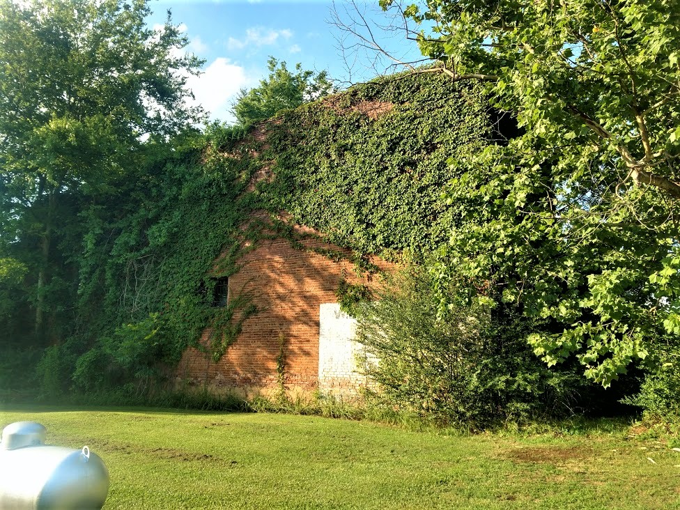
Also in Marion County and further north in the town of Buena Vista, we stopped for another geocache behind the historic old Gypsy Camp Grist Mill (GC71K1Q). There were a LOT of logs out behind the building and I spent a LOT of time looking at all the possible hiding places. But I wasn't able to find the cache and had to DNF it. But I did learn some history.

The Gypsy Camp Grist Mill was moved from its original location to its current site on the Murray Estate in 1930. At the time, the mill was a key agricultural asset to the community. It used electricity to power a network of chutes and belts woven through the three-story building to grind corn into meal. It operated for thirty years, closing in the early 1960's. Gypsy Camp Grist Mill got its name from a nearby campground and store where for a few weeks every winter ‘gypsies’ made their home, purchased supplies, and traded. The gypsies were believed to be of Serbian and Russian decent and migrated to the United States during the 1850's.


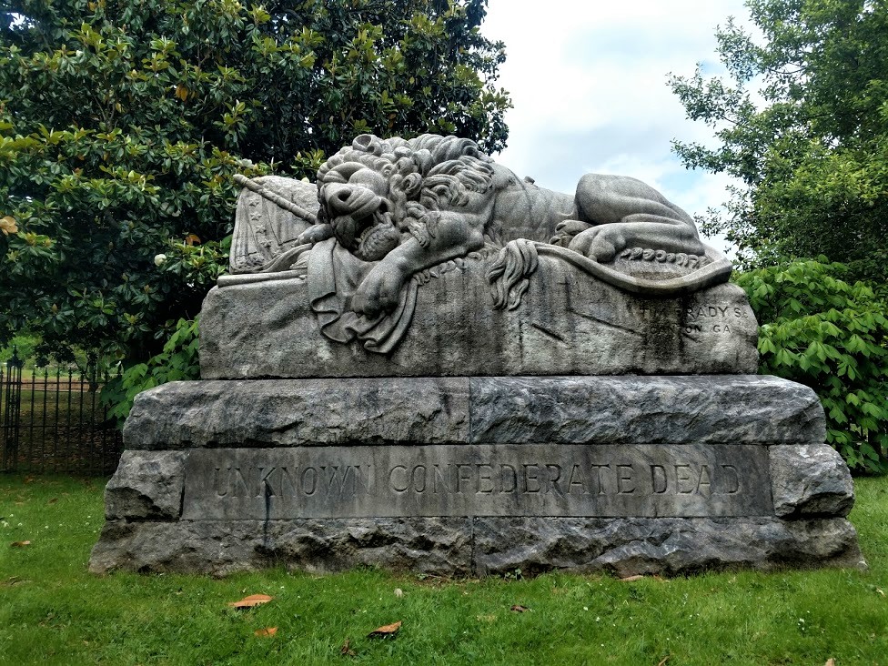
Crossing the line into Talbot County, I make a quick stop to find a geocache in an old pay phone (GC51AA7). Then at the top of the county there was another geocache at this historical marker (GC3XR5X). A large memorial which reads: "In Honor of Our Confederate Heroes, Sons of Confederate Veterans 1896, Echols Guards Camp #1711 S.C.V., 2005"


Next up in Meriwether County, in the town of Manchester, is this train car and my next geocache (GC70TEH). It's called Elliott Station as a memorial for Tyron Elliott, a prominent member of the community.


The next two geocaches were at the Red Oak Creek Covered Bridge (GC2885, GC6QDNP). Also located in Meriwether County, this bridge was built in the 1840's by freed slave and noted bridge builder Horace King (1807 - 1885). Constructed on the town lattice design, the bridge's web of planks crisscrossing at 45- to 60-degree angles are fastened at each intersection with a total of approximately 2,500 wooden pegs, or trunnels. Although King is credited with the construction of many covered bridges throughout West Georgia, this is his only surviving bridge of this design. At 391 feet, including the approaches, this structure is the oldest and longest wooden covered bridge in Georgia. And you can still drive across it!


If you look carefully down the side of the covered bridge you will notice a change in the wood forming a line about 2/3 of the way up the side. On July 7, 1994, the river flooded over and rose up to that height.


Now in Coweta County in the town of Senoia, there's another bridge. This town in Georgia is often used in filming the TV show "The Walking Dead." In The Walking Dead, this old bridge, which crosses over railroad tracks, is in the fictional town of "Woodbury" in the TV show. While I didn't find the geocache (GC86RNR) on the bridge, I still like finding old bridges.


Here's the GeoJeep in downtown Senoia. You might recognize this street scene and a gazebo where a virtual geocache (GC89183) is located in other films such as "Driving Miss Daisy" and "Fried Green Tomatoes."


Crossing Line Creek into Fayette County, I stopped for a quick park & grab Challenge Cache (GC6JM2D). A Challenge Cache is usually a simple cache to find. However you have to meet certain achievements in order to log a find on it. This one requires you to have found 1000 geocaches before logging a "Found It." I passed that accomplishment a long time ago! And then there was the State Souvenir Challenge cache (GC7QN34) up the road. That one required you to find a least one cache in 10 different states. Yep, passed that one a long time ago too!

From there taking GA-34 over into Heard County and the town of Franklin, I make a quick find at the Veterans Memorial Park (GC69X5M).


Nearly 8 PM and heading south, I make one more stop as it's getting dark for a quick cache in Troup County (GC2D30C). We picked up nine new caching counties on this run today. Still a little more than 100 miles of driving to get back and I gotta work tomorrow, we drive straight there. Found a lot of history on our adventure today. I hope you have enjoyed the ride and come back soon. See you next time...

To follow along on our travels and keep up with my latest blogs, you may do so here of course. But also by using you favorite of these social media platforms: FacebookMeWeGabRedditParlorTwitter, and Instagram. These all link directly to my profile. Again, please feel free to comment and / or share.

Saturday, October 2, 2021

2020-03-30: Roadtrip Day 4: Driving Through Alabama and Arriving in Georgia

Today was the fourth and final day of our Texas to Georgia roadtrip. This has been a great drive so far on the backroads and byways, seeing the sites, geocaching and picking up new counties along the way. For today we found some Civil War history, old cemeteries, a bird-dog champion and more. But I'm getting ahead of myself. Hop on in the GeoJeep and let's get rolling... 


Leaving out of Montgomery, Alabama, our first stop was southeast of town for a geocache at the Carter Hill Cemetery (GC2VFET). With just over 300 interments, the Carter Hill Cemetery dates back to 1844 with the burial of Andrew Allen. Along with his wife and two sons, they are the first four burials in this cemetery.

And then one more quick roadside geocache (GC2R7Y8) before leaving the county.

Continuing eastbound into Bullock County, we arrive in Union Springs and the Bird Dog Field Trial Capital of the World (GC56NF0). On February 21, 1996, the City of Union Springs and the Tourism Council of Bullock county dedicated this life-size bronze statue of an English Pointer. Sculpted by Bob Wehle, the monument pays tribute to the 11 men honored by the Bird Dog Field Trial Hall of Fame, to Bullock County’s unexcelled upland game country and bird dogs, and to the men and women who participate in the sport of field trialing.


Also located in Union Springs was this Log Cabin Museum. From the historical marker: "Early settlers of this area cleared land and built their first homes of logs in the 1830's. This cabin was built by Rueben Rice Kirkland (1829 - 1915) about 1850. He and his first wife had ten children while living in the log home.

"At one time an additional bedroom and chimney were on the right side, and the back porch was closed in for cooking and eating. A small log kitchen stood a few feet from the back and was later converted to a smoke house. The milk house beside the well was on stilts to protect butter and milk from animals.

"In 1981 the Bullock County Historical Society moved the cabin into Union Springs from its original site at Stills Cross Roads in Southern Bullock County and restored it as a museum."


If you look at the very first photo at the top of the blog, you can see that this new location of the cabin is off to the side of the Old City Cemetery, also known as The Confederate Cemetery. The historical marker reads: "Micajah Norfleet Eley donated land in 1849 for the Baptist Church and an adjoining public cemetery. The oldest cemetery in Union Springs, it served the city for 36 years. The Confederate Monument at the center (seen in the top photo) was unveiled at the intersection of Prairie and Hardaway Streets on March 29, 1895 by the Ladies Memorial Association. In 1973 it was moved to its present location.


"Locally known as the Confederate Cemetery, it includes the tombstones of some twenty-two Confederate soldiers. Below the Confederate soldiers' grave sites is a marker which reads: "Union Prisoners of War, 1861-1865, Victims of Plague."


US-82 eastbound over into Barbour County, the next geocache (GC2MY21) was a quick roadside stop at another historical marker. There wasn't anything to see there. Just the historical marker for the Election Riot of 1874 which read: "Near here is Old Spring Hill, the site of one of the polling places for the November 3, 1874 local, state, and national elections. Elias M. Keils, scalawag and judge of the city court of Eufaula, was United States supervisor at the Spring Hill ballot box. William, his 16-year-old son, was with him. After the polls closed, a mob broke into the building, extinguished the lights, destroyed the poll box and began shooting. During the riot, Willie Keils was mortally wounded. The resulting congressional investigation received national attention. This bloody episode marked the end of Republican domination in Barbour County."

Crossing the state line into Quitman County, Georgia, I quickly exit the bridge and turn back towards the reservoir for my next geocache (GC8M6AW). To the right just outside the photo below is the US-82 bridge which crosses over the lake. This little path heading down to the water is what remains of the old road that you used to drive between Alabama and Georgia before the Walter F. George Lock and Dam was built in 1962. Now it sits underwater.


Our last two geocaches were in Randolph County. The first was a quick roadside park and grab just east of the town of Cuthbert (GC7EV1G). The second was in the town of Shellman, Georgia (GC887JW). Originally called Ward Station, Shellman was established in 1883 and named after Major W. F. Shellman, who was the traffic manager for the Central Georgia Railroad. This was the Shellman Railroad Depot.


There's also these muraled silos in Shellman that portray the history and scenes of Shellman's past.


The next county over is Terrell and that's where we'll be staying and working. Time to settle in and relax after a long road trip. I hope you have enjoyed these last four days traveling along the rural backroads and byways of this great country of ours. And if I have inspired you to get off the Interstates and onto the scenic roadways, leave me a comment and let me know.

To follow along on our travels and keep up with my latest blogs, you may do so here of course. But also by using you favorite of these social media platforms: FacebookMeWeGabRedditParlorTwitter, and Instagram. These all link directly to my profile. Again, please feel free to comment and / or share.

Saturday, April 24, 2021

2019-06-19: Roadtrip Back to Texas Day 2 in SC, GA, and AL Finding History, Old Cars, Trains, Ghost Town and a Tragic Story

WOW, Busy day today! I woke up bright and early this morning ready to go on Day 2 of this Geocaching roadtrip from North Carolina back to Texas. I didn't get off work yesterday until just after noon, so it was a late start getting going. I only made it down into South Carolina. It's Wednesday morning and there are lots of counties and caches on the agenda. I gotta start the new project in Texas on Monday morning. So hop on in the passenger seat and let's hit the road!


After checking out of the hotel in Spartanburg, I drove down I-85 to Greer and my first geocache for Spartanburg County. "Easy Wood's"  is a virtual geocache (GCG9YP) for Woods Chapel Methodist Church and Graveyard across the highway from the BMW plant. Fun fact for the next time you're on Jeopardy or something... what's the difference between a graveyard and a cemetery? A graveyard is next to a church whereas a cemetery is by itself. The Rev. Henry Wood, for whom the church is named, was a Revolutionary War soldier who lived from 1756 to 1843.

Over in Greenville County was a quick and easy little multi-cache (GC2370V) that I had not seen before. A multi-cache consists of at least a stage one or multiple stages to get clues for the final location. This stage one was a travel bug dog tag attached to a tree behind a shopping center. The travel bug code had two numerical digits which you use to substitute into a new set of coordinates which take you to the final location for the real cache. The bonus for this one was that not only do you get a cache find but also get to log a travel bug discovery.

Then a quick park and grab cache for Pickens County (GC4W54R). Also located in Pickens County is Clemson University. There I made a stop for a virtual cache called "Death Valley" (GC1989). There were several different geocaches on campus. However I only made time for just this one. Clemson's Memorial Stadium has the nickname Death Valley because it's view of the cemetery on the hill before the upper decks were constructed.


Driving on down US-123 into Oconee County, there was another quick parking lot cache find to claim that county (GC3C0ZD) and my last for South Carolina.

Crossing the Tugaloo River into Stephens County, Georgia, I stopped soon thereafter for my next geocache at a historical marker. The "Old Tugaloo Town" (GC7TCX9) historical marker reads: "North of this marker, in the center of the lake, once stood and important Indian town. The area now marked by a small island was settled around 500 A.D. and occupied by Cherokee Indians around 1450. Traders were coming to the town by 1690.

"In 1716, while Col. Maurice Moore treated with Charity Hague, Cherokee Conjuror, a group of Creek ambassadors arrived. The Creek Indians, supported by Spain and France, wished to drive the British from the Carolinas, in the Yamassee War. The Cherokees killed the Creek ambassadors and joined the British. By 1717, Col. Tehophilus Hastings operated a trading center at Tugaloo where gunsmith, John Milbourne cared for Cherokee firearms. Indian agent, Col George Chicken visited Tugaloo in 1725 and described it as "...the most ancient town in these parts.

"Tugaloo remained a principal Cherokee town until destroyed by American patriots fighting these allies of the British in 1776."

Slowly making my way westbound, the next county was Habersham County. I stopped in the town of Cornelia for my next geocache at the historic train museum (GC3QGWC). The historic Cornelia Train Depot was first built by the Southern Railway Company in the late 1880's, soon after the town was founded. The railroad depot was originally called Blaine Station for the Republican presidential candidate James Gillespie Blaine. When the first charter of the town was secured by the attorney representing the railroad, Pope Barrow, the name was changed to Cornelia in honor of his wife. The official date of incorporation was October 22, 1887.

The original terminal was damaged in 1910 in a fire, and rebuilt in 1914 to its current appearance. This large passenger and freight station was once the home to two rail lines The Blue Ridge & Atlantic Railroad (also known as the Tallulah Falls Railway) and The Georgia Air Line Railroad, now known as Norfolk Southern. This depot is the symbolic and historic heart of Cornelia and in fact the town's first boundaries were set at one half mile increments in all directions from the depot. Today this depot serves as a railroad museum filled with relics from the days when the railroad ruled, it is also a great place to sit and enjoy the passing trains roll by.


Standing outside the train depot is the 7ft tall Big Red Apple monument. The pedestal it rests on is 8ft tall. The monument was constructed in 1925 and donated by Southern Railway to celebrate the annual festival of the many apples grown in the region.


Driving south on US-441, I crossed over into Banks County and a geocache right at the historical marker at the county line (GC7ED1F). The marker reads: "This line, sometimes called “The Four Mile Purchase Line,” was the boundary between Georgia and the Cherokee Nation from 1804 to 1818. It was established when Georgia bought a four mile strip from the Indians so as to take in Wofford’s Settlement on Nancytown Creek. James Blair was agent for the government, James Vann and Katahahee for the Cherokees. It formed the boundary between Jackson Co. and the Cherokees; later Franklin Co. and the Cherokees, and is now the line between Habersham and Banks Counties."

Back up into White County, I get the "Train of Thought" geocache (GC5PBVQ) for another county at the Mt Yonah Book Exchange. There you'll also find this old railroad train narrow gauge engine.


And then a quick stop for the cache and scenic views at the Popcorn Overlook (GC1F76H) in Rabun County in the Blue Ridge Mountains.


Driving westbound on US-76, I make a quick park and grab stop for Kelly's Bridge (GC34MR8) to pick up Towns County. Followed by two more quick roadside park and grabs in Union County (GC6E5W2, GC72R98), another in Fanin County (GC7YT9F) and one more in Gilmer County (GC3R4BH).

Down in Pickens County, I stop for a virtual geocache (GC7442) at the Zell Miller Mountain Parkway monument. Dedicated in 1986 to the "strong character, integrity, and moral fiber of the people of Appalachia are exemplified in this native son of Georgia's mountains, Zell Miller has dedicated his life to aiding his fellow man. Scholar, author, businessman, teacher, champion of developmental highways, legislator, serving as Lieutenant Governor longer than anyone in Georgia history."


And then there was the "Bomb's Away" geocache in Bartow County (GC50RGA). Not sure why someone would have this setup in their front yard, but when you think you've seen it all... expect the unexpected!


Just down the road from the bomb, is "Old Car City USA, the World's Largest Old Car Junkyard" that has been here since 1931. (GC46W33) I couldn't find the cache that was hidden. And since it was closed, I couldn't go exploring the 6 miles of trails through the woods full of old cars. Not that I had time to do so anyway! But it would be fun to get back here one day to do so. But just what they had out front and peaking through the fence and windows inside was worth the stop.


Quick park and grab caches in Floyd (GC65626) and Polk Counties (GC27Z53) and I was heading for the state line and into Alabama.

My first stops in Alabama were for Cherokee County where I found two geocaches. Driving west on US-278, I took a side road and arrived in the town of Spring Garden for my first cache (GC2583K). Spring Garden was originally named Ambersonville after one of the early families that settled the community. A post office was established in 1842 as Liberty and changed to Spring Garden in 1844. The Selma, Rome, and Dalton Railroad began rail service through the town in 1870. The line later became part of the Southern Railway and was abandoned in the 1970's.

This building here was last known as the W.L. Westbrook General Merchandise Store. Constructed in 1878, it was first known as the P.H. Savage General Merchandise Store, then T.F. Stewart General Merchandise Store. William Lester Westbrook died in October of 1981 and can assume that the store closed around that time period. The second photo I found in the Library of Congress database looks to be from the late 1980's or early 1990's and the store is already abandoned. (The photo I took is from the post office side. The street view is completely covered in vines!)


(photo:  Library of Congress)

The other geocache in this county was a few miles away. The Goshen United Methodist Memorial Park (GC49R24) was established by members, relatives, and friends after a tornado destroyed the church on Palm Sunday, March 27, 1994.

On this Sunday morning, 20 children had begun the service by marching around the sanctuary waving palm branches while the congregation sang the hymn: "Tell me the stories of Jesus." The worship service began with Jesus' triumphal entry into Jerusalem, and was to end with remembering His tragic death on the cross. At approximately 11:30, a tornado with winds up to 250 mph, and moving at a speed of 55 mph descended upon the church. The edge of the half mile wide storm caused a window to break, and within four seconds the building exploded propelling the congregation into literally living the Holy Week story of joy, suffering, death, and resurrection.

Jehovah Jireh, the Lord will provide, had just been sung when the winds blew the roof and the south wall to the north, trapping, injuring, and killing many worshippers. For two hours, persons assisted in the rescue efforts freeing those trapped underneath the debris and treating the injured. By 1:00, four hundred volunteers had arrived to help. Due to the heroic work of many rescue and medical workers, as well as unexpected helpers, 126 people survived. Of the twenty killed, six were children. Those surviving gave remarkable stories of experiencing God's presence and sustaining power in the rescue efforts and through the hard days that followed.


Driving up into Dekalb County, I stopped at the Lebanon Courthouse for a virtual geocache (GCB0CE). The historic courthouse was constructed during the 1840's when Lebanon, the county seat of Dekalb County, was a thriving community with inns, taverns, and government offices. This building remained in use as a courthouse until 1876, when the stagecoaches serving Lebanon gave way to progress. The county seat was then moved to Fort Payne, where railway service was available.

By the time I got here the sun was already setting behind the building making it hard to get a decent photo.


Finally it's getting to be 9:00 pm by the time I get to Scottsboro, Alabama in Jackson County. I grab one last geocache (GC6F458) in a Walmart parking lot to claim the county. Those are about the only caches I want to find in the dark, under a street light!

Well after 15 hours of driving and caching, I'm ready for the hotel! That's it for today. Let's get some sleep and start again early tomorrow morning. I hope you come back again and ride along with me. I'm out... ZZzzzz....

Saturday, January 30, 2021

2019-05-04: Moving Day Roadtrip from Texas to North Carolina Day 2 in AL, GA, & SC Historic Cemetery, House, and Gas Station

Well after 16 hours of driving and geocaching yesterday, it's time to hit the road again for day two of my roadtrip from Texas to North Carolina. Todays drive will take me from Alabama, through Georgia, to South Carolina. So jump in and let's see what we can find!


My first stop was for the "Trussville Civitan" Alabama's First Geocache (GC126). This cache was hidden way back on January 2001. The are only 48 geocaches left that were hidden during that month. For geocaching statistics, there's a Jasmer Calendar that lets a cacher know what months their found caches were hidden in. I only had one open spot for 2001 and it was January.

So I arrived near the geocache location in the parking area of a park. At the center of the park was this Veterans War Memorial. Took a quick photo before I went for a walk.


There was a walking and biking paved trail down along the Cahaba River. There were quite a few people out getting their morning exercise along that trail. I'm more interested in what was in the woods and headed for that. Only a few hundred feet in and away from the curious eyes of the muggles, I found the 18 year old prize that has been found nearly 1700 times and added my name to the log. YAY! Now just two more spots for July and August of 2000 to fill in the blanks. Even harder as there are only seven of those in the United States.


Before leaving town I spotted this old gas station and just had to stop for a photo. The building was originally constructed as a Gulf Service station in the late 1950's. In 2013 the building was bought by Rocky Neason who turned it into the Classic Cars and Garage Museum. The station was transformed into a Standard Oil Gas Station replica and filled with many 50's & 60's era antiques collected by Rocky Neason during his 31 years in the industry. There was a 50's 2-seater T-Bird and a 60's mid-year Corvette behind the bay doors during my visit. But I understand the cars get traded out with his collection from time to time.


Moving along for a cache in St. Clair County, Alabama. "Final Resting Place" (GC7ETF0) is a geocache located in the Moody Cemetery. There are over 900 interments here dating back to 1860. With the muggle here mowing the lawn, I just found the cache and moved on.

A few quick park and grab caches for Calhoun County (GC82XM4, GC36J12) and a Dunkin Donuts coffee. Crossing the state line into Georgia, I exit I-20 for two more quick caches in Carroll County (GC7F5J3, GC7F5GY).

Now I'm in downtown Atlanta. Not my favorite place to be. But there are some "must do" geocaches there. Fortunately it is Saturday so traffic isn't too bad. The first is a D5/T5 challenge cache called "The Lower 48 States" (GC5EQQT). Located a couple blocks from the state capital, it is an easy cache to find yet a very difficult cache to claim. It requires you to find at least one cache in each of the lower 48 states. I've managed to find one in 49 states, only missing Hawaii.

Then I take a drive over to the historic Oakland Cemetery. It was established in 1850 as the Atlanta Cemetery on 6 acres of land southeast of the city. It was expanded to 48 acres by 1867 and renamed in 1872 to reflect all the oak and magnolia trees. The magnificent entry gate pictured below was constructed in 1896. From 1936 to 1976, the cemetery is neglected and fall into disrepair. The cemetery was placed on the National Register of Historic Places and a restoration began. Eventually the Historic Oakland Foundation was created and maintains the grounds. An average of 105,000 visitors tour this cemetery every year. Today it is my turn.


There are two virtual geocaches there. The first one I found is for "The Master" (GCD42A). The geocache is dedicated to one of golfs greatest players, Robert Tyre "Bobby" Jones, who won multiple Masters Championships in the 1920's. You'll find his headstone at the coordinates.

The other virtual geocache is called "The Lyin' Cache" (GC64DF). Oakland’s most centrally located character area is the final resting place of approximately 7,000 Confederate soldiers, many of whom are unknown. Following Oakland’s acquisition of additional land, this four-acre portion of the cemetery began its transformation in 1866 by the Atlanta Ladies Memorial Association (ALMA). Several hundred of these graves were originally marked by simple painted wooden headboards, then replaced by marble markers with rounded tops in 1890.

Near the center of the Confederate Burial Grounds, Oakland’s tallest monument is a sixty-foot granite obelisk memorial to the Confederate Dead. Erected by the ALMA, the foundation of Stone Mountain granite was laid in 1870, on the day of the funeral of Robert. E. Lee. The monument wasn’t completed and dedicated until Confederate Memorial Day, on April 26, 1874.

Flanking the obelisk to the northeast, the Lion of Atlanta monument commemorates unknown Confederate soldiers who died in the Battle of Atlanta. The large sculpture carved in marble from Tate, Georgia was commissioned by ALMA and unveiled in 1894. With the famous Lion of Lucerne as his model, T.M. Brady depicted a weeping lion, representing courage, dying on a Confederate flag.


(Jumping ahead to 2020... Sadly, political and civil unrest has led to vandalism of this nearly 130 year old memorial. On the nights of May 28, May 31, June 5, and June 6, 2020, members of BLM and Antifa went into Oakland Cemetery and vandalized the Lion statue, the Obelisk, some of the headstones, and one of the historical markers within the Confederate Burial Grounds. The geocache has been archived.)


The monument at the Neal family plot is one of the most beautiful in Oakland Cemetery. Mary Elizabeth (Lizzie) Neal was the daughter of Thomas Neal and Mary (Mollie) Cash. Before moving to Georgia from Louisiana three years earlier, she lost six siblings. She suffered from rheumatism for several months before her death. Her sister, Emma, cancelled a trip to the Arctic to care for her Lizzie in the last days of her life. Created by her father after her and her mother's deaths, Lizzie is thought to be represented by the woman on the right of the monument.


Three more interments here worth mentioning. Joseph Jacobs (1859-1929) was a businessman and pharmacist. While it was John Pemberton who invented Coca-Cola in 1885, it was Joseph Jacobs that introduced it to the public on May 8, 1886.

Also, there's Margaret Mitchell (1900-1949), author of the book "Gone With the Wind." On August 11, 1949, she was hit by a drunk driver while crossing the road at Peachtree and 13th with her husband on the way to see a movie. She died eight days later.

Finally, and jumping again forward to 2020, singer, songwriter, and actor Kenny Rogers was laid to rest in Oakland Cemetery on March 20, 2020.

All in all there are estimated to be about 70,000 interments here. I spent almost two hours exploring this cemetery and didn't get see it all. But I do need to get back on the road. It's late in the afternoon and I still have ground to cover. So let's get moving.

The next six geocaching stops were quick roadside or parking lot caches to get six new counties in Rockdale County (GC5GT56), Newton County (GC84173), Walton County (GC2X92M), Greene County (GC1AFQN), Taliaferro County (GC19WT6), and Warren County (GC1DZ99). Along the way traveling down these backroads, you often see houses or buildings that have long been abandoned and nature is consuming them. If you're anything like me you begin to wonder what they once were and what happened that allowed them to get to this condition.


Continuing over into McDuffie County we stop for some history. "The Rock House" (GC21JD6) is an 18th Century stone dwelling and is the only surviving house associated with the Colonial Wrightsboro Settlement (1768). Its builder, Thomas Ansley, used weathered granite, quarried in its natural form from the nearby geographic fall line, as building material. The granite, along with pine timbers and cypress shingles, gave the house a distinctive Georgia character. The architectural style of the Rock House is similar to stone houses in the Delaware Valley of New Jersey from which Ansley migrated. It is the earliest dwelling in Georgia with its original architectural form intact.

The home is now owned by the Wrightsboro Quaker Foundation and has been rumored to be haunted. The Augusta Paranormal Society visits this location from time to time.


Across the street is a large monument erected in 2002 among many small crosses. "The great tornado (Type 5) entered McDuffie County at RR Mile Post 42. At 12:45 PM, March 20, 1875 the Rock House lost windows, a cook house, corncrib and gin. In the center of the cemetery a giant oak was blown down. This marker was in the center of the tornados path." There are 18 names with dates listed of those who are believed to be buried there. The dates range from 1809 through 1848.

Continuing to research the history of the Ansley Family, the last name was Anne Ansley (born 1801 - died 1848) was the daughter of Abel and Lydia Ansley. Before she died, she married Willey Carter and they had eleven children. One of those eleven children was Littleberry Walker Carter, who eventually became the Great-Grandfather of President James Earl "Jimmy" Carter, Jr.


Crossing the Savanah River over into South Carolina, I stop at the Welcome Center for a quick geocache for Aiken County (GC1048M). Then take the first exit and drive north a couple miles for another quick roadside geocache to pick off Edgefield County (GC81EPX).

For Lexington County (GC4N3FV) it was "The Duck Inn Travel Bug Motel." A creative geocache container large enough to hold plenty of travel bugs and coins to move up and down the Interstate. And finally the last geocache of the day was in Richland County (GC4GX30).


Another long day of driving and geocaching. I continued to the town of Lugoff, SC where the next geocache is located. But instead of finding the cache, I check into a hotel. It's after 9 PM and I'm tired! Not a bad day though, picking up a lot of new counties and finding some historical places. I appreciate you riding shotgun and hope you enjoyed the roadtrip. We got one more day tomorrow to get to North Carolina. Until then, it's sleep time.