Showing posts with label sculpture. Show all posts

Thursday, November 12, 2020

2019-03-02: A Packed Geocaching Road Trip from Texas to Minnesota and Back! Busy Day #1 TX & OK

Hey Everybody! Welcome back to another of my adventures. This road trip adventure is brought to you by the company I work for. You ever have to take a business trip to corporate headquarters for a training meeting or something. The company wants to fly you in, pays for the hotel, and fly you back home. A long way to go, but you don't get to see anything.

Since I was between projects and had the free time, I asked if I could drive up and get reimbursed for the gas and hotels instead of them paying for airfare. And the answer was YES! Sounds like a road trip to me! So I start planning a route and looking up geocaches from Killeen, Texas to Minneapolis, Minnesota.

I also thought it would be fun to go along with another geocacher. So I inquired of another former Floridian cacher who's now living in Austin called "CuteLittleFuzzyMonkey", or CLFM for short. We've tried caching together before but just could never get our schedules to line up. He got back to me in a couple of days and said the timing works out perfect so it was a go!

Today was the day to hit the road and CLFM drove up to Killeen from Austin to meet me at my house. We both have GeoJeeps, but I prefer to drive so we took mine. Since he's got all the caches picked out and navigating, it only makes since for him to be in the passenger seat anyway right! Plus he's officially still on the clock and has to answer work related texts and emails too. So... AwayWeGo...

Our first stop was a puzzle cache up in Dallas. Puzzle geocaches are usually not at the posted coordinates. I hate puzzles because I'm not good at solving them. Fortunately CLFM is a puzzle master and has hidden many of them himself. Plus this one was called "Infinite Monkey Theorem" (GC3BT76) so we just had to find this one! I took one look at the puzzle and had no clue. But he solved it and we found the cache.

Next up was a virtual cache. A virtual geocache has no physical container. There are requirements like answering questions or taking a selfie at the given location. This is the original Pegasus (GC7B9NE) that once rotated 450 feet high above Dallas atop the Renaissance Revival Magnolia Building. The 40' tall flying red horse rotated on the 50' tall oil derrick above the 29 story building for the offices of the Magnolia Oil Company, which later was acquired by the Mobil Oil Company, from 1934 through 1999. This original sign was packed away in storage and replaced with a new sign. Found in 2012 and restored, it was moved to it's new location and lit up once again in 2015 at this Omni Dallas Hotel location.

Our last stop in downtown Dallas was another virtual geocache at this 30' eyeball (GC7B77Z). Created by artist Tony Tasset in 2007 for a temporary display in Chicago. After time in storage and a stop in St Louis, the Joule Hotel in Dallas purchased it in 2013 to anchor its sculpture garden. It certainly is an eye catcher! (Sorry, I couldn't resist.)


Continuing on our way north, our next stop was at the Oakland Cemetery for two geocaches in Marshall County, Oklahoma (GC57HYM, GC5NHBK).

Then over to Johnston County for another virtual geocache at a veterans memorial park (GCGDCQ). The park is dedicated to the residents of Tishomingo who gave their lives in the various wars. One of the displays included this Blue Angels fighter jet.


A quick stop at the McAlister Cemetery gave us a cache in Carter County (GC2B84E). Sadly though, it also gave me a pain in my back! OUCH!! I've picked up heavy objects, bend the knees, don't bend the knees, no problem. This is the second time I've reached for a micro cache and just send a huge pain shooting through my lower back. The first one was leaning over a guard rail and reaching in for the cache. This time I see the cache, just reach into the bush, and almost drop to my knees in pain. Not the way I want to start this road trip.

Continuing north on I-35, we stop at a rest area to use the facilities and grab a cache for Murray County, Oklahoma (GC6TRPJ). Ugh... getting in and out of the Jeep is painful. It's not bad while I'm sitting. The heated seats help.

Now it's time for another virtual geocache. You know the best thing about geocaching is that you find some of the strangest things. In Cleveland County, we found some Bug Art (GCF12E). Someone actually took this full sized VW Beetle and added some legs to make it look like a bug for a great roadside attraction.


Some quick roadside caches (GC7ZGMJ, GC1VN87) and another puzzle cache (GC5EX03). And then there's this virtual cache for the Oklahoma City Air Force Memorial (GCF69C).


And this virtual cache at the Oklahoma City Memorial (GC4772). I wish we had time to look around further but we have a long road ahead and a lot of geocaches to find. Plus my back was killing me still.


After seven more geocaches, we ended the night in Perry, Oklahoma. I thought it would finally be good to lay down and stretch my back out. Wishful thinking. My back was so  tight I could barely move. I crawled into bed but I couldn't even take my shoes off. I couldn't take my jacket off. I couldn't move at all. Eventually I did manage to get some sleep but not much. Maybe an hour or so. Hopefully tomorrow will be better.

Saturday, June 13, 2020

2018-06-09: Geocaching in Central Texas Through History, Cemeteries, an Elephant and Fairies!

Welcome to another edition of our AwayWeGo's Geocaching Adventures Blog. While I'm still way behind in my writing, I am hopeful that one day I'll catch up. I even stopped finding new caches for a few months at the beginning of this year in an effort to catch up. But none the less, much of what I tell you about is still there for you to see today if you like. So let's get started and see what we found on this day back in June 9, 2018.

Having worked only 5 days this week instead of the usual 6 days, I took the opportunity to go out on a Geocaching Adventure with my wife today. We decided to take a drive up to Hico, Texas to get some chocolates. It's a few hours away, but the chocolate is worth it! Along the way we'll be grabbing some caches and sightseeing on this roadtrip.

Our first geocache is called "Iron Elephant" (GC5XFB3). The cache was placed along the roadside where this rather large sculpture of an elephant happens to be sitting. It was hard to get a decent photo from the phone with it sitting so far off the roadway. As I was pulling away and passing by the Rockin-R Ranch gate, I saw another large statue of a giraffe. Again, sorry for the poor photo quality. But if you happen to be driving up SR-36 near Whiteway, TX, keep your eyes open for some large wildlife!


Just up the road in Whiteway is the Evergreen Cemetery (GC171KZ). Whiteway (formerly Whitesboro), in southeast Hamilton County, was established to serve the needs of motorists between Jonesboro and Hamilton. The settlement had a school, a church, a cemetery, and scattered farm units in 1936. At one time its population was fourteen; in 1966 four inhabitants were reported. Whiteway was named for Steve White, a local resident, whose sons established and operated the filling station, garage, body shop, and grocery. Whiteway appeared on local maps during the late 1980's, but no population figures were available. By 2000 the population was listed as ten. There was a John Stephen White (1880-1964) buried in the cemetery, but I'm not sure if he was the one the town was named after.


On the way to our next cache, I saw this old covered wagon sitting on the property corner of this ranch entrance. I just had to pull over and take a photo. You never know what you may find driving the rural backroads of this country.


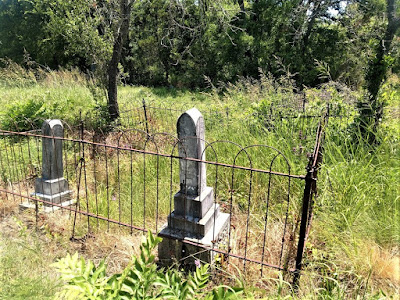
Our next geocache was at the Rock House Church and Cemetery (GC10924).There's not much left to the actual church structure. I forgot to even get a photo. The cemetery is in dire need of some TLC. Mostly overgrown with weeds and shrubs. Some of the headstones have been broken.

Trying to research, I can't find any history on this church or the cemetery. The only thing that I can find is that there are 115 burials here dating back to 1870. Other than that... if you know of any information I'd be happy to hear from you.


Not too far away was our next cache at Bulman Cemetery (GC1CW5R). Established in 1884 because of the death of Emily Bulman, the wife of the Rev Henry Jefferson Bulman who was one of the early settlers in the area. There are just over 140 burials in this cemetery. One of the interesting displays by a headstone is this red boot in a basket.


Continuing northbound, we came upon this small town called Fairy, Texas. There wasn't a geocache in this town so it didn't come up on my radar. But I did take a quick stop for a few photos.

Fairy was first known as Martin's Gap for James Martin, an early settler who took an oxcart through the mountain gap, which wasn't an easy thing to do back in the day. When the post office was established in 1884, the town was named for Fairy Fort, the daughter of Confederate Army Captain Battle Fort. At a mere 2' 7" and about 28 lbs, Fairy Fort was one of the smallest Texans on record. She was married and divorced twice and had only one child, by her first husband, who died at birth in 1893. She died on October 22, 1938 at age 73 and is buried in the Fairy Cemetery.

Photo credit: TexasEscapes.com

The town of Fairy had a cotton gin from 1900 to about 1936 and schools, churches, and businesses serving the greater ranching and farming community. In 1947 Fairy had a post office, three churches, three businesses, and 150 people. The post office closed in 1957, and the Fairy school district was consolidated with the Hamilton schools in 1967. In 1980, 1990, and 2000 the population was thirty-one. Pictured below is one of the remaining churches and a tree carving in town.


Maybe next time through they'll have a geocache to find or I'll hide one myself.

We finally arrived in Hico, Texas and our chocolate destination! Wiseman House Chocolates is a must stop when visiting Hico. This is our third time here and the chocolates are some of the best we've ever had.

Next a quick stop by the Hico Cemetery for our next geocache (GC6YNN7). There's just over 4000 interments dating back to 1862.

Then off to the Carlton Cemetery (GCT77Q). On July 9, 1867, a farmer J. E. Pinkerton traveling to Carlton on horseback, became bogged down in a muddy swamp while crossing Tywhappatee Creek. While struggling to free his horse he was attacked and killed by a band of renegade Comanche Indians. This occurred the same day that renegade Comanche Indians attacked the country school house seven miles northeast of Hamilton. Two children were taken captive and their teacher Ann Whitney lost her life protecting her students. It is unknown which attack happened first. Pinkerton was the first burial  in what became Carlton Cemetery.


And finally our last geocache for the day was at the Toliver Cemetery (GC14DV8). Burial place of pioneer settlers, including James H. Neel, one of first seven men to bring families here in 1852. His home was a quarter mile to the east of cemetery. He was also postmaster of Resley's Creek Village 1858 to 1866.


That's it for today. Don't forget to follow along with us on Facebook to get the latest updates and occasional pictures not found in our blog posts. See you next time.

Sunday, October 23, 2016

2016-10-01/02: Road Trip to Florida; Cowboys Stadium, Cemetery, History, and Duck Dynasty

ROAD TRIP! On today's blog I'll be covering a two day road trip from West Texas to Florida. We hit the road early on the Saturday morning of October 1st. Having 1430 miles to drive in 2 days, add in fuel and food stops, and of course some Geocaching too, we've got a lot of driving ahead of us!

After leaving Monahans around 6:00 AM, a couple of hours later, we pulled into a McDonald's in Sweetwater for some McMuffins. And of course there just happened to be a Geocache (GC38PN6) there too so we had to find it as well. Within a few minutes, we were on the road again. Finally in Abeline we spot a Starbucks near the I-20 exit so we grabbed a couple coffees and another quick Geocache (GCWC1E).

Those first two Geocaches were unplanned and just happened to be nearby when making other stops. Hey, you can't NOT look for them when you're so close right?

But we did have some caches planned. When we got into Ft Worth, TX, we merged over onto I-30 eastbound and into Arlington. There we stopped for our first scheduled virtual Geocache (GC90F2). It was a beautiful statue of three horses surrounded by water fountains at this shopping center. We got the required info needed to claim the find and a few photos with GeoDog Max.


On our way to the next planned virtual cache, we passed by the Dallas Cowboys Stadium as well as the Texas Rangers Field. Well we just had to get a photo there too and grab the cache (GC15RDP) across the street!


Around the corner about a block away was a nice park and another planned virtual cache stop (GC7029). From there we got a good view of Cowboys Stadium. There were also these large Caelum Moor Stones around the park and a multi-stage Geocache (GC30RJB), from which after gathering information from the stones, we were able to find the final stage. The five freestanding granite sculptures weighing a total of 540 tons will enhance the environmental landscape along Johnson Creek in Arlington’s Entertainment District.

The stone monuments range in height from 8 to 30 feet. The Latin name “Caelum” is derived from a constellation in the southern skies known as the sculptor’s tool or chisel. “Moor” refers to the windswept landscapes of Scotland. The celtic names of each of the five groupings reflect the ancestry of the sculptor’s patron. Caelum Moor was commissioned in 1984 by Jane Mathes Kelton, CEO of the Kelton Mathes Development Corporation and heir of the Scottish-American television magnate, Curtis Mathes. According to the sculptor, Kelton wanted the artwork to serve as a centerpiece for a proposed business park development along I-20, reminiscent of the ancient sites of Scotland and England and reflecting of her family’s heritage. From 1986 to 1997, Caelum Moor was located at the headwaters of Johnson Creek along Interstate 20. In 1997, the sculpture was donated to the City and stored to make way for commercial development. Caelum Moor was once listed on the Smithsonian Institution’s National Registry of Art in Public Places. They were relocated to this park in 2009.


Our main reason for stopping here was to get Tombstone (GC62), a multi-cache and the oldest Geocache in Texas! Hidden on September 26, 2000, this cache also fills another empty spot on my Jasmer calendar. It's had over 1500 finds since then. It's placed in Doug Russell Park and is three stages. The last two stages are near the location of the Berachah Home and Cemetery. We walked over to the first stage easy, got the info we needed for the final north coordinates. Then we walked over to stage two and got the needed info for the final west coordinates. That's where my problem began. After frustratingly searching for 30 minutes (Candy and GeoDog Max had long been back to the car with the a/c on) for the supposedly easy final stage, I finally decided to recheck my coordinates. Well the north coordinates didn't save correctly in my phone and therefore I was searching in the wrong place! Once I put the correct coordinates in and began searching the correct location, I found it within minutes. YAY!!

The Berachah Rescue Society was organized at Waco in 1894 by the Rev. J. T. Upchurch for the protection of homeless girls and unwed mothers. Nine years later he opened the Berachah Industrial Home at this site. Ten buildings were located here including a print shop for publication of the "Purity Journal." The cemetery which contains more than eighty graves, was first used in 1904 for the burial of Eunice Williams, one of the residents. The home closed in 1935, but the site was used until 1942 as an orphanage run by Upchurch's daughter Allie Mae and her husband Frank Wiese. Most of the graves here are marked without names or dates. Many more just have a first name and year died.


Finally back to I-20 heading east. We spent a couple of hours in the Arlington area and now we have to make up some time. So no more stops until we needed another gas stop in East Texas. And of course while the gas is pumping I checked my phone and there was a cache there too (GC4EE5P). A quick find and back on the road. It was soon getting dark and we drove over halfway into Louisiana.

As it turned out the hotel we stayed in was located in West Monroe, LA. And just around the corner was the Duck Commander Headquarters! The location of the Duck Dynasty TV show is filmed here. So before heading down the highway, we had to stop by for a few photos.


We didn't stop much on Sunday because we still had over 760 miles to go. But we stop just before the Mississippi River at Grant's Canal for another virtual Geocache (GCGDM2). During the summer of 1862, the Union's first attempt to bypass the Confederate Army at Vicksburg by digging a canal across DeSoto Peninsula failed. By January 1863, the Union had reoccupied the Louisiana shore opposite Vicksburg. Gen Ulysses S. Grant ordered work on the canal resumed. The canal was to be 60 feet wide, 1 1/2 miles long, and deep enough to float any vessel on the river. Ground was broken on January 30, black work gangs assisted by fatigue details from the Union Army began to work. Later, steam pumps and dredge boats were employed. To stop the work, the Confederates placed several big guns on the shore opposite the canal's exit but the work progressed. On March 7, the upper dam gave way, flooding the entire peninsula. Grant's Canal had failed. After gathering the information we needed to qualify for the cache find, we continued eastbound.

After about 3 1/2 hours later on US-98 in South Mississippi, it was time for a break to stretch our legs a bit. I looked up some caches ahead of us and found a cemetery just off the road with three caches (GC445DQGC445DVGC445DP). 

There was a gas and food stop along the way, but nothing to write about. We arrived in St Augustine, FL about 9:30 PM. A long day of driving. Sleep was soon thereafter!

Sunday, September 18, 2016

2016-08-21: Standing on the corner of Texas and New Mexico

Welcome back! Today we headed north up into New Mexico for a couple more First-to-Finds (FTF's) and a few other Geocaches along the way.

Our first stop was a little town about 20 miles north in Wink, Texas. Known for being the hometown of Roy Orbison from the age of 10. He started his first band while attending high school here. There was a historical marker there at an empty lot which we assumed the house once stood.

After reading the sign we drove to the nearby community park and our first cache (GC6QCTC). Another new Geocache placed by MedicoJoe and another FTF for us. This was a nice park and we walked the entire perimeter to take pictures of the Looney Tunes character statues on display. 


Our next stop was just on the outskirts of Wink. There along the roadside sits a historical marker for the Old Wink Cemetery (GC6QK7Z). The exact locations of the individual graves are not known. The Old Wink Cemetery is the burial site of 26 persons who died during the early days of the oil boom, 1926-1929. Shifting sands over the years have erased all vestige of the graves. According to the old timers in Wink, the cemetery is located in the Monument Draw. Although it is dry now, during the 1950s - 60s it was flooded with oil field runoff water and the area was under water for over 10 years. Several of the Wink residents remember fishing and hunting here. There are no current signs of the cemetery today. It is part of a local ranch.

As for the Geocache, we searched for about 15-20 minutes but came up empty. We found the rocks from the hint given, but no cache container. I believe it was too close to the historical marker and muggled by someone stopping to read the sign. (As a side note, we did find the cache two days later after the MedicoJoe replaced and moved further away from the sign. Another FTF!)

Continuing north for a few more miles, we reached the state line between Texas and New Mexico and our next cache (GC6QK3N). Another new cache placed by MedicoJoe and another FTF!

The next town was called Jal, NM and our next cache was at the Jal Cemetery (GC6QK3B). In the 1880s, several brothers brought a herd of cattle to Monument Draw, six miles southeast of the present city. The cattle were branded with the initials of the previous owner (John A.Lynch) and the cattle soon came to be called the JAL Cattle. The men who worked the herd referred to them as the Jal cowboys. In time the name became synonymous with the settlement itself. Though after finding the Geocache, a quick walk around the cemetery and we didn't notice any old graves so we didn't take any pictures. But we did get another FTF!

Closer into the center of town was a community park and another FTF (GC6QK43).

Driving SW on Hwy 205 a few miles to a town called Bennett, NM was our next Geocache (GC2H0NE). This next cache was a piece of history which goes to show how government usually makes matters worse and not better:
Here are the ruins of a whole way of life, apparently gone forever. This “camp” was started in the middle 1930’s when the natural gas boom sprouted out of the oil boom. In the 1940’s the pipeline system was finally becoming part of the infrastructure we know today, but even then you could drive from Jal to Odessa and beyond at night just by the light of the flares that were burning off the natural gas so they could pump the oil. Then the natural gas became valuable and furnaces, stoves and even “ice boxes” (refrigerators to you newbies) were powered by natural gas. 
El Paso Natural Gas Company Jal #1 plant was built to collect, treat, and pump natural gas all the way to California. To support the plant, houses were built for the employees and their families. An instant middle class was formed by the camps that sprouted all over the oil fields. Other companies like Phillips, Shell, and Texas-New Mexico quickly joined suit. Jal, New Mexico was then advertised as the “Gas Capitol of the World”. More natural gas flowed through these companies’ pipelines here than anywhere else in the world.
The plants were unique communities. Every employee had a house as a benefit of employment. Every house had indoor plumbing, free water, free electricity, free garbage collection, and of course, free natural gas! It was a Company Camp. The plants had to make their own electricity to run, and the camps benefited. The plants had to obtain their own water and the camps benefited. The houses were built and owned by the companies because the plants ran 24/7 and the workers were conveniently nearby working shifts. The kids that grew up in the camps virtually lived in a large family setting. Everybody knew everybody and lived in a homogeneous mix of mothers, fathers, brothers and sisters where we learned to get along. We still get along and call ourselves Camp Brats. 
Jal became sort of a Company Town, with many plants surrounding it and the Main Offices located there. The Company built a golf course. The Company built the Clinic and hired/attracted a doctor to come to Jal. Company ball teams were formed. 
The tax structure of the State, at the time, benefited Jal, New Mexico. The oil and gas royalties off the School Lands in the area went directly to the local schools. Jal had a great school and great teachers! Virtually every Camp Brat had at least an opportunity to go to a college or university, and most of us did. Life was good, life was great! What could go wrong? 
The “Government” is what went wrong. Local, State and Federal government intervention went wrong. Free houses? Can’t have that, there aren’t any taxes paid. Free water? Can’t have that, there aren’t any taxes paid and it is just not fair to everybody else, so they said. Same for the electricity, the utility companies just weren’t getting their cut. State school land taxes were shifted to the general fund and Jal lost most of its school funding to the northern population centers of the state. 
By the 1970’s our way of life was falling apart. By the 1980’s the camps were being broken up and the houses torn down and/or moved away, lock, stock and barrel. What you see left here 20 to 30 years later is government’s handiwork.
Continuing north again going through town we came to our next Geocache which was a multi-cache (GCJ77H). It also brought us to this huge work of art. "The Trail Ahead" was sculpted by local artist Brian Norwood and dedicated in September of 2000. The statues consists of seventeen metal silhouettes stretching for approximately 400 feet. The largest measures over twenty feet tall! They honor the ranching heritage of Jal, New Mexico.


Circling back around towards the south and back towards home, we come to our next cache (GC2AB0) and the corner of New Mexico and Texas. The COMPROMISE OF 1850. The results of the Mexican War (1846–48) brought Texas into serious conflict with the national government over the state's claim to a large portion of New Mexico. The claim was based on efforts by the Republic of Texas, beginning in 1836, to expand far beyond the traditional boundaries of Spanish and Mexican Texas to encompass all of the land extending the entire length of the Rio Grande. Efforts to occupy the New Mexican portion of this territory during the years of the republic came to naught.

After numerous unsuccessful attempts to resolve the issue, Senator James A. Pierce of Maryland introduced a bill that offered Texas $10 million in exchange for ceding to the national government all land north and west of a boundary beginning at the 100th meridian where it intersects the parallel of 36°30', then running west along that parallel to the 103d meridian, south to the 32d parallel, and from that point west to the Rio Grande. The bill had the support of the Texas delegation and of moderate leaders in both the North and South. Holders of bonds representing the debt of the Republic of Texas lobbied hard for the bill, for it specified that part of the financial settlement be used to pay those obligations. The measure passed both houses of Congress in the late summer of 1850 and was signed by President Fillmore.
This square marks the corner that divides the two states. While I'm standing on the New Mexico side, Candy is standing in nearby Texas! Maybe not as cool as Four Corners, but still cool.

Our last Geocache of the day (GC69XEN) was at the Sand Hills. Mapped by U. S. Government, 1849, for gold seekers and settlers. Known earlier to Indians and many Spanish explorers. A 100-mile belt of sand in Winkler and 4 other Texas counties and in New Mexico. Width varies from 3 to 20 miles; outer dunes are held by dwarf oaks. Water at 2' depth supports willows, cottonwoods, and a plum thicket. (The plums gave food to early settlers.) Many dunes more than 70' high. Heavy, shifting sands a natural barrier to travel. Campsite and game reservation for Indians. Now part of expansive cattle ranges and rich oil fields. Being from Florida when we saw this much sand it usually had a large body of water on the other side.


So that was today's Geocaching Adventure. We hope you've enjoyed it and maybe learned something new. Perhaps it has also inspired you to get out and explore the area around you.

Friday, February 26, 2016

2016-01-17: Geocaching Along the Texas and New Mexico Borders

So today was a Geocaching day to pickup where we left off yesterday. Picking up new counties and Geocaches of interest along the West Texas and New Mexico borders. We headed west on US-62 down into Brownfield, TX and turned onto US-380 westbound in Terry County.

Before arriving at our first Geocaches for the day, I saw a historical marker on the side of the road. As we are driving around exploring new areas, not only is Geocaching a good way to find places of interest but also the historical markers. So we pulled over to find that the building before us is what remains of the ghost town of Tokio. There were two towns in Texas that went by the name Tokio. (correct spelling) During WWII, the other changed it's name to Wiggins.

This town kept the name. The first school was built in 1911. Tokio was granted a post office in 1912. In 1929, Tokio had a population of only 15. It's record high population was in the 1940's with 125. Over the years, larger school buildings were constructed until the school finally merged with the Brownfield School District after the 1945-46 school year. There are still a few residences in the area, but the town officially folded and all that remains is the old school building.


Stopping for three quick caches in the town of Plains, we continued west on US-380 to the state line. There were several caches located near the state line. The most interesting was a virtual cache (GC41C6) at the memorial for the founder of the now ghost town of Bronco, TX.

At the age of 13, Herschel Robert Field saddled his horse, left his home in Batesville, AR and braved his way through Indian territory to become a cowboy in West Texas. In 1891, he began working for the T Fork Ranch in Wichita County, Texas and later the XIT Ranch. He eventually decided to move to Arizona, but along the way he was attracted by the grazing lands in Western Yoakum County. Field saw this area as a place where a cowboy with limited means might start his own ranch. In 1903, he purchased some land and started a store right at the Texas-New Mexico line.

Soon after he opened the store, he applied for the rights to a post office. He secured the post office from the agency in Washington, but they rejected the name. A traveling salesman suggested Bronco after seeing a cowboy ride a wild horse. And that's how the town got it's name. Settlers began congregating around Field's store in Bronco. By 1912 the population grew to about 25. At it's peak in the 1960's, the towns population grew to 180. Today there are only about a dozen residences scattered about and all the businesses have closed.


Continuing west on US-380 and into New Mexico, we entered into the town of Tatum. There was a metal fab shop there that made all kinds of sculpture and signs and we just had to pull over for a couple of pictures.


We found a few Geocaches in Tatum and turned north on Hwy 206 picking more caches every now and then. Now most of the time, you tend to find unusual out of the way sites because another Geocacher has placed a cache nearby causing you stop. But along this highway, we found one of the Roswell alien crash sites. Well maybe not really, but there's a farmer with a sense of humor!


Local wildlife.
One of the caches along the way was inside a 100 Grand Candy tin (GC5JBT5) at the entrance to the Candy Oil Field Service Treating Plant. And of course with Candy being named Candy and the company being named Candy and the cache having a candy theme. OK, well you get the idea...


We continued up Hwy-206 to Milnesand and turned back east on Hwy 262, eventually picking up Hwy 114 back to Lubbock. Overall we found 17 caches and a few more new counties. But best of all we had a nice drive through history.