Friday, March 11, 2016

2016-03-10: Geocaching and GeoArt Getting an "A" For My Effort

Today I had to drive up to Clovis, NM to take care of some business and on the way back decided to go Geocaching. But first I had to grab one cache in Clovis since it was 100 miles away from Lubbock. Gotta keep my cache-to-cache distance miles growing. Last I checked it was over 411,000 miles! So a quick LPC next door to where I was and headed back.

Just south of Littlefield, TX was this GeoArt that I've had my eye on. A few days ago, I solved all the puzzles so I could get the correct coordinates to the caches. Driving down the rural dirt roads through farm land with rarely a muggle in site, after about an hour and 30 caches later, I spelled the letter "A" in Geocaches. Most of them were fairly easy with a couple of difficult nano's in the mix.

That was it for today. Hey it's a weekday! See ya next time.

A photo of the letter "A" GeoArt.

Monday, March 7, 2016

2016-03-06: Geocaching Through a Few Cemeteries and a POW Chapel

Today was a day to go Geocaching and to finish up some of the caches we had planned for yesterday but ran out of time. Candy was also sick with the cold, but didn't want to sit around the apartment. So we got a late start and will try to get as many as we can.

One of the unknown graves.
Our first stop was at Springlake Cemetery (GCMV7E), the only remains of the Springlake ghost town. Well maybe not a ghost town per say. The whole town just moved. This burial ground served the original residents of the Springlake community. The area was opened for settlement in 1908 by the George C. Wright Land Company. It was named for the nearby Springlake Ranch. D.B. Shiflet donated the first two acres for the cemetery. The first burial took place in 1909. Of the 356 known graves, five are unmarked. The community of Springlake was relocated in 1935, 4.75 miles southeast. The town once had a hotel, supply store, school and post office. But only the cemetery remains at the original site. As for the cache, well it must have relocated also. It hasn't been found in almost two years.

A few caches later and we arrived at the next Geocache of interest (GC38T16). The old Waggners Grocery Store located on US-385. Located just south of Dimmitt, TX, I could not find any history of the grocery store or when it closed down. But this is what remains today. 


A few miles up the road is this long and almost forgotten Flagg Cemetery (GC4XKVM). I couldn't find any other history on this cemetery other than what's on the monument. Used between 1920-30 and the cache page states that a local farmer mows it every once in a while. Most of the graves are marked with just a cross without any name. There's only two headstones with names and dates.


Several more caches later and we made it up to Hereford, TX. There was the location of our next historically significant cache (GC1GNK4). According to the Texas State Historical Association's Handbook of Texas Online, during World War II, Hereford became the site of a prisoner of war camp named the Hereford Internment Area or Camp Hereford. Covering a section of land, the camp was constructed in July 1942 at a cost of two million dollars. Italian prisoners occupied the site from April 1943 to January 1946. The first American Military Police unit arrived in 1943. Italian captives arrived in April of that same year. The prisoners were brought to Hereford by train and marched the approximately 4 miles to the camp. The first prisoners were escorted by guards who had no ammunition since it had not arrived yet. By September of 1943, the camp contained 5,000 prisoners. The openness of the flat high plains of Texas served as a deterrent to escape since escapees would be easily spotted. However, one escapee named Luigi Montalbetti traveled 300 miles toward Mexico before he was recaptured by the Texas Border Patrol.

The maximum-security policy was soon replaced by a policy of maximum utilization, and enlisted men were hired out to work on local farms at a rate of ten cents an hour. The officers, however, were incarcerated in separate compounds and not required to work. The mutual regard that developed between the prisoners and their captors was shown at St. Mary's Catholic Church in Umbarger Texas. There, seven Italian officers and two enlisted men made wood carvings, painted murals, and installed stained-glass windows, donating their labors in the spirit of Christian brotherhood. Parishioners reciprocated by providing them with bountiful meals. Each night the Italians smuggled the surplus back into the officers' compound, which was under a retaliatory starvation order from April through December 1945.

In late summer 1945, as the Nons (non-collaborators) recognized that the war was wrapping up and they would soon be leaving, they began to think of the five prisoners who had died while at Camp Hereford. What would become of these men after the war? They almost certainly would be forgotten in the otherwise unmarked area east of the camp designated as the cemetery. They concluded that a memorial was needed, both to mark the gravesites and to serve as remembrance of their deceased friends. Using scavenged bricks, broken glass, surplus materials, and a few purchased supplies, they built a small chapel in just a couple of weeks, complete with an altar, double French doors, stained-glass windows, and a marble-like concrete surface. They dedicated it with a plaque honoring the five men. The men were eventually re-interred at Fort Reno, OK. in 1947.

Rapid repatriation began with the end of the war, and in January 1946 the last 4,000 prisoners boarded special troop trains for their return to Italy. The camp was placed on the surplus list on February 1, 1946. All that remains today is a water tower, swimming pool and the memorial chapel constructed by the POWs. A 13-by-13-foot plaster-over-brick chapel, now vandalized, memorializes the five POWs who died in the camp.


After nine Geocaching finds and two DNF's, we headed back to Lubbock. Probably the best stop today was the POW chapel. If you like to travel and learn about history, Geocaching is definitely the game to play. Where do we go to next?

Sunday, March 6, 2016

2016-03-05: From Earth Texas to Billy the Kid in New Mexico

What a day! I think we drove about 400 miles all together. I mean we DID drive to Earth and back! Saw some strange things, learned a lot of history, and met up with Billy the Kid. Geocaching does take you to some pretty unique places.

After several quick roadside Geocaches, our first cache of interest was at the Halfway Cemetery (GC5NEFE). Now, I'm not sure what it was halfway between but the thing that comes to my mind is a Catholic cemetery for those in purgatory. Or maybe zombies? I don't know...

Actually the Halfway community developed around a school establishment in 1909. The name signifies its location between the county seats of Plainview and Olton. A post office operated in Halfway from 1910 to 1914. In 1945 the community had a school, two churches, a cotton gin, and a population of twenty-five. The school closed in 1952, and the building is now used as a community center. In 1980 Halfway had a gin, an agricultural equipment plant, churches, several businesses, and a population of seventy. In 1990 and again in 2000 the population was fifty-eight.


Since we've gotten halfway there... next stop is Planet Earth! (GC3H4VG) And now we know the question that has baffled scientists for many years. No, the earth is NOT millions and billions of years old. Nope, the Earth was established  in 1924. Everything in the history books before that was just our imaginations.

Earth, Texas was established by William E. Halsell, who laid out the townsite in 1924. Originally Halsell named the city Fairlawn, but in 1925 it was renamed Earth when it was learned that there was already a town in Texas by the name of Fairlawn. In order to find a new name the townspeople sent in suggestions, and the agreed-upon best name was chosen.

They even put the name on this huge tower so all the UFO's and space aliens headed over to Roswell know where they are.


Now our next cache was about 100 miles away across the state line into New Mexico. We wanted to make sure we got to it today, so we skipped all the others between there and will grab as many as we can on the way back. So we continued west on US-70 onto US-84 all the way out to Fort Sumner, NM.

Our first stop and next cache (GC8493) is who made Fort Sumner famous. This virtual cache brought us to the grave sight of the wild west outlaw Billy the Kid. Not exactly a good photo of the headstone, but his headstone was stolen twice! The first time it went missing for 26 years before its location was discovered. Within the large cage are three graves belonging to Billy the Kid and his friends Tom O'Folliard and Charlie Bowdre. After Billy the Kid's headstone was recovered the second time, a cage was built around the entirety and the headstone itself bolted down at the foot of his grave.


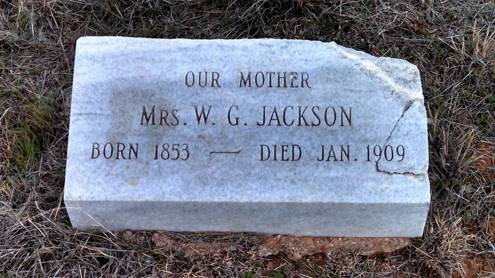
There are several more gravesites here at the historic Fort Sumner site. Here are just a couple samples.


There were four more Geocaches located in the town of Fort Sumner. One at the Billy the Kid Museum (GC29XY8), the Fort Sumner historical marker (GC1P67K), and two more at the main cemetery in town (GC60CPY and GC60CR4). And now that we've gotten all those, we still had 162 miles and more caches to get on the way home!


On the way back in another old town of Taiban we found our next three caches. The first one was the former trading post, former antique store, and now just former and abandoned business (GC34E7G). The Taiban Trading Post was built in 1915 and was once a thriving business.


The next cache in Taiban was the End of the Road (GCV8MZ). Here sits the remains of the First Presbyterian Church of Taiban. Completed in December of 1908 at a cost of $250, its first sermon was presented by the Reverend John R. Gass. As the towns population dwindled due to the depression and drought, the church held its last service in 1936.

As we arrived here, we see a pickup truck with Texas plates on it and a guy with something on a stick walking towards the church and right into the front door. I thought maybe another cacher holding a car GPS. I walk down the side of the church towards the back looking for the cache and he went all the way through the church and is out back. I ask him if he's Geocaching and he says he was taking a video. We get to talking and it turns out he's on vacation from Germany and traveling through Texas and New Mexico for 12 days. We chat for a little while and wish each other safe travels.

On the eastern edge of town was our next cache at the Watering Hole (GC1RVY1). This once liquor store, maybe even a bar is now half burned down. Once a destination for the thirsty, now only a destination for Geocachers.


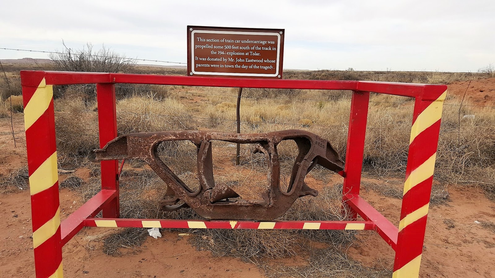
Continuing eastbound was our next cache (GC617HR) and piece of history. At noon on November 30, 1944, a World War II supply train hauling 165 five-hundred-pound bombs headed for the Pacific Theater derailed in Tolar. The train caught fire and the bombs exploded. The blast, which leveled nearly every building in town, could be heard 60 miles away. It vaporized 500 feet of track and sent a 1,500-pound axle crashing through a store and rolling out the back. One person, Jess Brown, was killed in the explosion after a piece of iron shrapnel struck his head.


Our last cache for the day just west of Clovis, NM was located at the Blacktower Cemetery (GC61N67). Located west of the Chavez West Housing addition near Cannon Air Force Base, the cemetery is considered to be a lost cemetery and shows signs of not having been kept up for a long time. Tall grass, weeds and stickers guard the entrance to this piece of eastern New Mexico's history, but at one point airman from neighboring Cannon Air Force Base turned out to restore and clean up this treasure. 
According to a June, 2009 article, 25 volunteers showed up to the cemetery to clear away the weeds and shovel away the sand that had blown over the headstones. In the six years since the service project, the cemetery has fallen back into its forgotten, buried state. Railroad tie steps still exist and lead visitors to the entrance of the cemetery where several headstones are visible, but extremely difficult to get to.

According to a May 22, 2009, Clovis News Journal article, the Blacktower Cemetery was originally started as a family cemetery and became the final resting place for 42 individuals. The article cites local High Plains Historical Foundation member Harold Kilmer as saying that Blacktower is unique because research suggests that two Civil War veterans are buried there: Emmett Fulkerson, who died June 17, 1911, and William Brantley, who died Feb. 7, 1908. Kilmer said the cemetery was started by an unknown farmer’s family about 1906 after an infant’s death.


After looking around the cemetery at some of the headstones, we finally arrive in Clovis, NM and a wide variety of restaurant choices! You would think by now we would have learned to pack a picnic lunch for our adventures. Because having past through Clovis heading west out to Fort Sumner, spending time in Fort Sumner, then driving back to Clovis, there's not much for places to eat! By now we're practically starving! 

So we grab a quick sandwich at Subway before driving the two hours back to Lubbock. We ended the day with 16 Geocaching finds and a new county in New Mexico. And another day of adventure through history.

Thursday, March 3, 2016

2016-03-02: The Ultimate Gadget Cache!

In my ten years of Geocaching, it's always nice to come across a creative cache. Early on in the years they were few and far between. But these days they're getting more frequent and even more creative. They've even got an "unofficial" category for them called Gadget Caches.

And today I think I have found one of the best that I've come across so far. It's called the Ultimate Gadget Cache (GC5RDMC) and it's located in Clovis, NM. Looks like a simple box right? A regular sized cache. There's a reason there's a bench there. It gives you some place to sit while you figure out how to get it open! It took me about 30 minutes to finally access the log book!

The one end is blank, the other end has a key lock on it, and there's a hidden panel on the side. This was a fun 3-stage, maybe 4-stage depending upon how you look at it. The photos I have below I don't think are spoilers. Upon my first inspection of the gadget cache, I knew these doors had to open. I just had to figure out HOW to open them. What a great, fun cache!


2016-02-28: Geocaching Through History and Counties in North Texas

Hello again and welcome back to our Geocaching adventure blog. We hope you have been enjoying our travels so far. Today we set out to find caches in some new Texas counties. We're past the halfway point finishing the day with 133 of the 254 Texas counties.

Setting out from Lubbock after breakfast, we headed north on I-27. Our first stop was the Abernathy Cemetery in Hale County. A quick cache find here. The cache was located in some trees behind this headstone. Of all the cemeteries we've been in and the headstones looked at, I think this was the first with a Corvette on top. I'm sure this one cost a pretty penny too. However, after spending so much on this headstone, you would have thought they would have spelled "BELEIVE" correctly!


Continuing north on I-27 and a few more quick caches near an old grain silo, another at the Hale Center Cemetery, and follow by the Kress Cemetery.


Then, a couple miles to the northeast of the town of Kress and sitting out in the middle of farm land lies three very lonely graves. The Wright Cemetery cache page (GC5R9B1) doesn't give much history, but I was able to locate some info at Find A Grave showing 11 burials here. I only found 3 headstones. Looks like headstones have been run over by farm tractors throughout the years.


About a mile down the road from the cemetery looking across the farms and the flat plains, I saw a tiny black silhouette of an old truck and just had to investigate. And this is what we found sitting out on the corner of the dirt road and the end of the driveway to the farm house. It had seen better days and would make a great restoration project.


The next cache on our journey today was at Rose Hill Cemetery (GC31F7A). The history of this community cemetery dates back to October 1890. Just three months after Swisher County was organized and Tulia was named county seat. The first recorded burial here is that of 18 year old Louis Harral who died on October 17, 1890. His parents obtained permission from landowner T. W. Adams to bury their son on this hillside south of the Middle Tule Creek. Twelve days later, 4 year old Robert Alonzo Hutchinson died and was buried on the hill near Louis. In 1906 five acres of land surrounding the graves were officially set aside for a community cemetery.


Also in Tulia on display at the local VFW is our next cache (GC14K6N). This retired North American F-86 SabreJet.


Our next stop located in Briscoe County was built in 1894 of handcut stone hauled here by horse-drawn wagons from Tule Canyon. The Briscoe County Jail (GC2KVTG) stands as the lasting reminder of what courage and dedication mean in preserving law, order and integrity.

Early day sheriff's families rented the lower floor as a residence. It was also used by Red Cross workers for sewing during World War I. Near the old jail is the county courthouse and administration building.


Continuing east from Tulia over to the town of Silverton for our next cemetery cache (GC5N53J). I couldn't find much history about Silverton Cemetery, but while finding the cache I spotted these to headstones belonging to Robert S. Christian (23) and Warner S. Reid (24). They both died on the same day of October 23, 1895. After doing further research, I found newspaper article from from 1995 that had the story of these two. In summary, while moving a very large herd of cattle along with 75 other cowboys; lightning struck killing these two young men, both their horses, and ten cattle. You can see the full story from the newspaper link.


A couple more caches later and we're in the little town of Quitaque and our next  two caches (GC1RVHP). The first settler in the area was the Comanchero trader José Piedad Tafoya, who operated a trading post on the site from 1865 to 1867, trading dry goods and ammunition to the Comanches for rustled livestock. In 1877 George Baker drove a herd of about 2,000 cattle to the Quitaque area, where he headquartered the Lazy F Ranch. Charles Goodnight bought the Lazy F in 1880 and introduced the name Quitaque, which he believed was the Indian word for "end of the trail."

Residents used other area graveyards to bury the deceased until 1922 when brothers Alvin and Edgar Howard donated ten acres for cemetery use. The first person interred in RestHaven Cemetery (GC1QZJV) was Katie Daniel in 1922.

The next town down the road was originally called Turkey Creek, then Turkey Roost by the locals. Eventually it was shortened to just Turkey by the time the Turkey Hotel, now a Bed & Breakfast, opened its doors in 1927. There was supposed to be a cache hidden near the hotel (GC1X8B3), but  we couldn't find it and neither could the last few cachers. It looked as though there may have been some bushes there at one time. And the cache owner hasn't been active since 2010.


Turkey is also known for being the hometown of Bob Wills which is our next virtual cache (GCCDBD). James Robert "Bob" Wills (1905 – 1975) was an American Western swing musician, songwriter, and bandleader. Considered by music authorities as the co-founder of Western swing, he was universally known as the King of Western Swing. Wills formed several bands and played radio stations around the South and West until he formed the Texas Playboys in 1934 with Wills on fiddle, Tommy Duncan on piano and vocals, rhythm guitarist June Whalin, tenor banjoist Johnnie Lee Wills, and Kermit Whalin, who played steel guitar and bass. The band played regularly on a Tulsa, Oklahoma radio station and added Leon McAuliffe on steel guitar, pianist Al Stricklin, drummer Smokey Dacus, and a horn section that expanded the band's sound. Wills favored jazz-like arrangements and the band found national popularity into the 1940s with such hits as "Steel Guitar Rag", "New San Antonio Rose", "Smoke On The Water", "Stars And Stripes On Iwo Jima", and "New Spanish Two Step".

Also in town is this old restored gas station and Bob Wills and the Playboys tour bus.


Moving on to our next county and next cache (GC62PGC). This area of Motley County was first called "White Flat" due to the tall white needlegrass which covered the flat prairie land. A post office, named Whiteflat, was established for the rural settlement in 1890 at the request of W. R. Tilson.

At its height, the community boasted four grocery stores, three service stations, three garages, two cafes, a hardware store, two gins, and three churches. A school first housed in a one room schoolhouse built by volunteers, opened in 1890. It was replaced by a four room school in 1908, and in 1922 a new two story brick structure was erected (see photo). It also served as a community gathering place.

Dependent on an economy based on agriculture and small family farms, the community began to decline during the depression and dust bowl years of the 1930's. The Whiteflat school closed in 1946 when it was consolidated with Matador schools. The local churches disbanded in the 1960's, the post office closed in 1966 following the death of the last postmaster, and the last remaining retail store closed in 1968. A few residence still exist, but it's pretty much a ghost town.

The Whiteflat Cemetery (GC2P34E) dates back to 1894. The hardest thing to see although quite common at that time, are headstones for babies and children. And here the Green family had three. And based on the headstones, they were probably of little means as well.


Our next cache in Motley County was Bob's Oil Well (GC17NTQ) and a piece of American roadside attractions. From the historical marker: "Greenville, Texas native Luther Bedford "Bob" Robertson (1894-1947), a veteran of WWI, came to Matador in the 1920's. He was a gas station attendant in 1932 when he decided to open a service station here. To promote his new business, he built a wooden oil derrick over the station. He patented his design, and in 1939 replaced the wooden derrick with one of steel that reached 84 feet in height and included lights.
Robertson was a gifted businessman and promoter, and he used any opportunity to advertise his operation and attract customers. He kept a cage of live rattlesnakes for the amusement of tourists, and from that initial attraction grew a zoo that included lions, monkeys, coyotes, a white buffalo and other animals. He paid long distance truckers to place advertising signs at strategic points across the nation noting the mileage to Bob's Oil Well in Matador, and they became well known to the motoring public. As a result of his success, Robertson enlarged his operation to include a grocery, cafe and garage.
Bob Robertson dies in 1947, and two weeks later a high wind toppled the steel derrick that had been the trademark of his business. His widow restored it two years later with even larger lights. The business did not continue long after, however, and closed in the 1950's. Later efforts to re-open it were short lived. Today, the site serves as a reminder of a time when such bold roadside architecture was in its infancy and of a man who, through his business, widely promoted his adopted hometown."


The Motley County Jail was next. Similar to the Briscoe County Jail above, this 2-story jail was erected in 1891, the year Motley County was organized. Cells were on the top floor of the structure and the jailer's living quarters on the lower level. The first courthouse, also built in 1891, later burned, but this jail remains as a symbol of Motley County's frontier heritage.


Our last cache to highlight was at the Cottle County Heritage Museum (GC13AA8). I liked the old ambulance and fire truck outside. 


It was a long day and I think we drove over 300 miles. But we learned a lot of history, saw some cool sites, and just had a great day driving through Texas.