Saturday, November 20, 2021

2020-06-03: Another Geocaching Roadtrip Through the Backroads of Georgia

Well our time in Florida is done and it's off to a new project in North Carolina. According to Google it's just a simple 8 hour day trip drive to get there. But where's the fun in that! In reality, it actually took us 2 1/2 days to get there! We try to avoid the Interstate Highways and take the backroads, sightseeing and geocaching along the way.

On this first day of our roadtrip through Georgia, we visited several old cemeteries, old churches, and some other historical places. Finding 14 geocaches, we picked up 11 new caching counties in the process! So come onboard, ride along and see what and who we've found today...


Our first stop after leaving Florida was a geocache in the Howell Cemetery (GC2FPY3) for Echols County, Georgia. The cemetery has about 130 interments, most dating from 1916 through the present. But there is one burial listed on the Find-A-Grave website dated 1839. The small community of Howell once had a post office established in 1899 which remained until 1957. A township was incorporated in 1905, but it was eventually dissolved in 1995.


Also in Echols County is the Wayfare Primitive Baptist Church and Cemetery, previously known as the Cow Creek Baptist Church and Cemetery (GC3F0E8). The church was established in 1847 and the first meeting held in September. The cemetery has nearly 1800 interments and the oldest headstone dates back to 1845. 


At the end of the entry road, there is another historical marker describing an Indian skirmish at Cow Creek. "New here, on August 27, 1836, Georgia Militia companies commanded by Col. Henry Blair, Captain Lindsay, and Capt. Levi J. Knight, fought a skirmish with Creek Indians and routed them, killing two and taking several prisoners. During this summer the Indians had committed many raids and massacres as they traversed the border counties on their way to Florida to join the Seminoles. Georgia troops had been following them for weeks, and overtook this band in the cypress swamp, on the edge of Cow Creek."

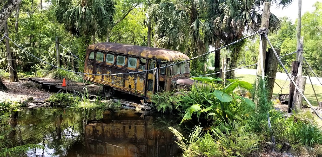
Driving over to Lakeland, GA in Lanier County, I stopped by Camp Patten for my next geocache (GCT6ZP). Camp Patten was donated by Mr. Lawson Leo Patten (1896-1983) to the South Georgia Council of the Boy Scouts of America in 1965 to further promote the ideals and methods of the Scouting movement.


A half-mile up the road was the Burnt Church and Haunted Cemetery (GC121CF). One of the first churches constituted in the area was Union Baptist Church. It was organized on October 21, 1825 on the banks of the Alapaha River at Carter's Meeting House. Captain Jesse Carter settled the land earlier in 1925 to provide more room for his family, slaves, and hundreds of cattle. In 1836 as a band of Creek Indians passed on their way to join the Seminoles at Noochee, near present day Fargo, they set fire to the Union Church. It was later called the Burnt Church. (Note: I've found conflicting dates for the fire. Some websites have it as 1836 and others 1854. It's possible that there were two fires or that the church was rebuilt in 1854. The church also was subject to a restoration in 1998.)


It is said that the church and cemetery grounds are haunted. A teacher and several of her students, who were using the church as a school, perished in the flames. She and the children were buried along side one another, but time and weather has wiped away all traces of their graves. Stories are told though that loud, unintelligible voices of children can be heard and apparitions known locally as "walkers" can be seen among the many tombstones.

Perhaps one of those "walkers" is this unknown man who hasn't found his eternal rest:


Moving right along, a quick stop for a geocache in Berrien County (GC8CZCH). And a quick roadside cemetery geocache for Atkinson County (GC6NNX5). Continuing to check counties off the list, two quick geocaches for Coffee County (GC617BC, GC6047Y), including this obvious container hidden in plain site.


Moving right along into Irwin County, there was a quick park and grab in the town of Ocilla (GC5JPDC). Followed by a short woodsy walk in Paulk Park in Fitzgerald for Ben Hill County (GC507M3).


And then there's the Wild Hog Express (GC1FZ6C). Located in Wilcox County, the town of Abbeville is said to be the wild hog capital of Georgia.


Then when I got to Eastman in Dodge County, I had originally set to find a cache at the Eastman House in town. But there were some renovations being done outside making it too difficult approach and find the cache. So I quickly look up and find a cemetery cache outside of town.

I'm so glad that was the case because you know I like cemeteries, especially with an old church, and then toss in some history too! (GC1CX07) President Jefferson Davis, his wife and children arrived at this site on May 8, 1865. He had rejoined his wife 20 miles south of Dublin. Traveling with them were the Davis’ four children, Varina, Maggie, Jefferson, Jr. and Joseph. Traveling with President Davis was John Regan, Postmaster General of the Confederacy, Captain Gevin Campbell and Lt. Barnwell. Personal aides John Wood, Preston Johnson, son of General Albert Sidney Johnson, Francis Lubbock, the former Governor of Texas, and Colonel Charles E. Thornburn, a secret agent for the Confederate Government. Traveling with Mrs. Davis and her children were Mrs. Davis’ sister Margaret Howell, Mrs. Burton Harrison, the President’s private secretary, a seven-man mounted military escort, and some of the President’s personal servants.

The following morning the president’s party crossed the present Highway 341 at approximately where Friendship Baptist Road is now. They followed this route to what is referred to as 5 points. Further along Friendship Baptist Road they would come to Levi (Tiger Bill) Harrell’s farm where they stopped for the noon meal. Turning south, they passed through what is now Rhine and then west to the river.

Mrs. Davis was to remain behind and follow the next day. Fearing the roads would become impassable due to the heavy rains that had started to fall would heighten the chances of Mrs. Davis’ capture, Preston Johnson returned to the campsite to inform Mrs. Davis to leave immediately and join her husband in Abbeyville.

Many have pondered why the Davis’ didn’t stay in the Parkerson Church located just across the swamp. The Parkerson Church is the one of the oldest churches in Dodge County having been built in June 1831. (Dodge County being Pulaski and Telfair Counties at that time.) The original building was a log house built by Jacob Parkerson, a Revolutionary War Veteran who donated the land and the first to be buried here in 1843.


The second burial here is Private William Hannibal Weekes who died in the Civil War at the young age of 28. There are less than 300 total interments at this cemetery.


Next on the list was some more history at the Orange Hill Cemetery (GC8N95D) in Hawkinsville for Pulaski County. There are more than 3000 interments here dating as far back as 1833. There are many large and elaborate monuments here.


One broken headstone I'd like to tell you about belongs to 30 year old Tom Woolfolk. He was convicted of killing nine family members with a short handled axe in Macon on the night of August 6, 1887. He was tried several times in Bibb and then Perry, Georgia and was publicly hung on October 28, 1890. Up until the last minute he proclaimed his innocence. He was one of the last people to be hung before they did away with public hangings.

"The Shadow Chasers" by Carolyn DeLoach, (Woolfolk revisited), is a book about this case. The author uncovered much undiscovered evidence and was able to conclude that the actual murderer was Simon Cooper, a hired hand of the family. After Cooper's death, a diary was found that he had written, notating the Woolfolk murders just as Tom had stated. He had also written a statement, "Tom Woolfolk was mighty slick, but I fixed him. I would have killed him with the rest of the damn family, but he was not at home."


The victims are buried in Macon's Rose Hill cemetery. Its reported that thousands of people also came to Macon for the funeral. That they lined the streets of what is now Spring St. and Riverside Dr. as the horse drawn hearses went by. There weren't enough hearses in Macon/Bibb County to accommodate all the victims and many had to be borrowed from surrounding areas. The victims were Richard F. Woolfolk, father, then aged 54; his wife Mattie H (Tom's stepmother), aged 41; their six children, Richard F. Jr., 20; Pearl, 17; Annie, 10; Rosebud, 7; Charlie, 5; baby Mattie, 18 months old; and 84-year old Temperance West, a relative of Mrs. Woolfolk.

Tom is buried beside one of his sisters from his Father's first marriage to Susan M. Woolfolk. He was the youngest of 3 siblings from the first marriage. His mother passed away shortly after his birth at the age of 24. The sisters from the first marriage were not living with their father at the time of the murders.

One final quick roadside geocache (GC40DP0) in Twiggs County before calling it a day.

We found a total of 14 geocaches today and managed to pick up 11 new counties for our geocaching map. I hope you enjoyed the ride-a-long. Another big day tomorrow as we continue making our way through Georgia on our way to North Carolina.

To follow along on our travels and keep up with my latest blogs, you may do so here of course. But also by using you favorite of these social media platforms: FacebookMeWeGabRedditParlorTwitter, RVillage, GETTR and Instagram. These all link directly to my profile. Again, please feel free to comment and / or share.

Saturday, October 30, 2021

2020-05-10: Jeeping and Geocaching in a Florida Forest Finding some Creative Caches!

WOW, it was a fun day! Welcome back to my AwayWeGo's Geocaching Adventures Blog. Normally my adventures are roadtrips finding geocaches that focus more on the destination. Today was all about finding some creative geocache containers in the Osceola National Forest. So come on aboard the GeoJeep and let's see what kind of crazy caches we can find...


After talking to some of our local geocacher friends, we heard about a fun power trail (a lot of caches along a road at or near the minimum required distance apart) where the majority of the geocache containers were unique and amusing. These were located within the Osceola National Forest in North Florida, not far from the campground which we were staying in Fort White.


After a few hours of wheeling and tromping through the woods, we had found a total of 41 geocaches with only 1 DNF. Unlike the other of my blog posts, I give you the caches GC# and link to the geocache page. However for this blog, because I'm showing you photos of the geocache itself, I'm not going to provide that info so that you might be pleasantly surprised when you find it yourself. Your only hint as to the location is that they are just a few of the nearly 1000 geocaches hidden within the Osceola National Forest.

I leave you now with photos of these creative geocache containers. If these are sparked your interest in this hobby, feel free to ask a question or leave your comments below. I always look forward to hearing from my readers.

See you next week...


To follow along on our travels and keep up with my latest blogs, you may do so here of course. But also by using you favorite of these social media platforms: FacebookMeWeGabRedditParlorTwitter, and Instagram. These all link directly to my profile. Again, please feel free to comment and / or share.

Saturday, October 23, 2021

2020-04-19: Geocaching Florida From Fort White to Cedar Key to Find a Closed Island, a Ghost Town, and an Old House

Hello everyone! So after our quick couple of weeks at the Georgia project, we're back in our home state of Florida to start a new project in Fort White! We arrived mid-week and check into the River Run Campground. After working the remainder of the week, we had the first weekend off so it was time to go exploring and geocaching along the rural backroads of Florida. So hop on in the GeoJeep and let's go see what we can find...


First on the list for Saturday was driving on up to Discount Tire in Lake City. After two years and 100,000 miles on the GeoJeep, it was time to finally upgrade to some new tires and wheels. Because we do drive it a LOT, I didn't want to go too big and loose the 16-18 MPG. But I did want something that looked a little more off-road than the originals. I like it! What do you think?


On Sunday, we decided to take a drive on over to the Gulf Coast at Cedar Key. What a great way to spend a spring day but on a beach in Florida, Right? NOT! We drove all the way down here only to find that the island is closed off to non-residents because of the virus. Well so much for that plan. We head back towards Fort White grabbing geocaches along the way starting with two quick roadside caches on Hwy 24 on the way to Cedar Key (GC1AHDY, GC6FJWA).

Approaching Chiefland, we grabbed a roadside geocache on CR345 (GC4YP47). Then in Chiefland, we passed by Barnhill Landscape and they had a landscape display which I just had to stop and get some pics of. This one especially was my favorite of an old school bus crossing a rickety bridge. I give you two versions; the black and white photo below and the color photo from a different angle at the top of the blog post.


The next stop was for a geocache at the ghost town and Levyville Cemetery (GC44F5N). The history of Levyville is short. The Levy County seat for only a few years in the mid-1800's. The town slowly disappeared after losing its position to Bronson in 1870, and was virtually non-existent by the early 1900's. The railroad could "make or break" a town, and bypassing Levyville definitely broke it. There was a brief Civil War skirmish fought in the area as well. The "new" courthouse, built in 1867, which became redundant when Bronson became the county seat, was sold to the newly-formed Masonic Lodge #51 in 1870, and eventually moved to Chiefland. All that remains of this historic town are two cemeteries. This one has nearly 60 interments with the oldest belonging to Levi Wright who died in 1858.


Then there was "This Old House" (GC3HAY9) located in Bell, Florida. I couldn't find anything out about this house or when it was built. It does kinda remind me of the Jed Clampett house before he moved to Beverly Hills.


And finally, an Earthcache at the Suwannee River (GC679MY). This is what natural Florida looks like. The water level was a little high at this time. This is just one of the many public boat ramps to access this 246 mile long river which flows from south Georgia to the Gulf of Mexico.


That's it for today. Not a very big roadtrip, but a nice drive nonetheless. Until next time, see you back here soon...

To follow along on our travels and keep up with my latest blogs, you may do so here of course. But also by using you favorite of these social media platforms: FacebookMeWeGabRedditParlorTwitter, and Instagram. These all link directly to my profile. Again, please feel free to comment and / or share.

Saturday, October 9, 2021

2020-04-05: Geocaching Counties Around Georgia and Finding a Covered Bridge, an Old Jeep, Cemeteries and More

Welcome back to the AwayWeGo Geocaching Adventures blog. Our job has us traveling all across the country. We prefer the rural backroad and byways when driving from jobsite to jobsite because they have the most interesting places. We find most of these historic and roadside attractions because of geocaching, but then there are often a lot of unexpected surprises too.

In today's edition, we've been in Georgia working for a week now and it's our first day off. So of course it's time for a mini-roadtrip around the backroads of Georgia to add some new counties to the geocaching map. So hop on in the GeoJeep and let's go see what we can find!


A short drive down the road on the way to our first geocache, I pass by this house with some old rusty farm equipment off to the side. But what caught my eye the most was the old rusty Jeep. Along with the trucks back within the trees, it's kinda sad that they're just abandoned and left to rust and rot away.


Now in Webster County, it was a quick roadside geocache stop for the county (GC1W1MN).

Driving north on Georgia Hwy 41, we arrived in Marion County. Right at the county line is what remains of the ghost town community of Church Hill (GC71HPY). As early as 1812, Methodist missionaries came into this area and found the Indians to be receptive to the Gospel, so missions were established to teach and minister to the Indians. Following these missionaries came large numbers of immigrants from the eastern United States and from North and South Carolina. The mission points were established along trading paths which developed into the "Old Salt Trail" and later St Mary's Road from Columbus to the coast.


Here near three crossroads, a large church community developed. Five churches soon sprung up in this community originally known as Searsville. After the Baptist, Methodist, Presbyterian, Bible Baptist, and Christian Church's were established the area was more commonly known as Church Hill. The Shiloh-Marion Missionary Baptist Church is the only remaining church of the five. What began as a Baptist Missions Point in 1812, became Shiloh Baptist Church in 1835 with 8 members. At its peak it grew to 150 members. Presently there are about 12. A time capsule was placed back in 1995 to be opened in 2045. (For a full recount of the history of Church Hill with photos and more, visit https://ursa.mercer.edu/handle/10898/12398)


Across the street is the Shiloh Baptist Church Cemetery. Many of the communities early pioneers and Civil War veterans are buried here. There are also some smaller cemeteries nearby and all that remain of the other churches. Among the cemeteries are segregated sections, one for slaves and another for Native Americans.


Also in Marion County and further north in the town of Buena Vista, we stopped for another geocache behind the historic old Gypsy Camp Grist Mill (GC71K1Q). There were a LOT of logs out behind the building and I spent a LOT of time looking at all the possible hiding places. But I wasn't able to find the cache and had to DNF it. But I did learn some history.

The Gypsy Camp Grist Mill was moved from its original location to its current site on the Murray Estate in 1930. At the time, the mill was a key agricultural asset to the community. It used electricity to power a network of chutes and belts woven through the three-story building to grind corn into meal. It operated for thirty years, closing in the early 1960's. Gypsy Camp Grist Mill got its name from a nearby campground and store where for a few weeks every winter ‘gypsies’ made their home, purchased supplies, and traded. The gypsies were believed to be of Serbian and Russian decent and migrated to the United States during the 1850's.


Crossing the line into Talbot County, I make a quick stop to find a geocache in an old pay phone (GC51AA7). Then at the top of the county there was another geocache at this historical marker (GC3XR5X). A large memorial which reads: "In Honor of Our Confederate Heroes, Sons of Confederate Veterans 1896, Echols Guards Camp #1711 S.C.V., 2005"


Next up in Meriwether County, in the town of Manchester, is this train car and my next geocache (GC70TEH). It's called Elliott Station as a memorial for Tyron Elliott, a prominent member of the community.


The next two geocaches were at the Red Oak Creek Covered Bridge (GC2885, GC6QDNP). Also located in Meriwether County, this bridge was built in the 1840's by freed slave and noted bridge builder Horace King (1807 - 1885). Constructed on the town lattice design, the bridge's web of planks crisscrossing at 45- to 60-degree angles are fastened at each intersection with a total of approximately 2,500 wooden pegs, or trunnels. Although King is credited with the construction of many covered bridges throughout West Georgia, this is his only surviving bridge of this design. At 391 feet, including the approaches, this structure is the oldest and longest wooden covered bridge in Georgia. And you can still drive across it!


If you look carefully down the side of the covered bridge you will notice a change in the wood forming a line about 2/3 of the way up the side. On July 7, 1994, the river flooded over and rose up to that height.


Now in Coweta County in the town of Senoia, there's another bridge. This town in Georgia is often used in filming the TV show "The Walking Dead." In The Walking Dead, this old bridge, which crosses over railroad tracks, is in the fictional town of "Woodbury" in the TV show. While I didn't find the geocache (GC86RNR) on the bridge, I still like finding old bridges.


Here's the GeoJeep in downtown Senoia. You might recognize this street scene and a gazebo where a virtual geocache (GC89183) is located in other films such as "Driving Miss Daisy" and "Fried Green Tomatoes."


Crossing Line Creek into Fayette County, I stopped for a quick park & grab Challenge Cache (GC6JM2D). A Challenge Cache is usually a simple cache to find. However you have to meet certain achievements in order to log a find on it. This one requires you to have found 1000 geocaches before logging a "Found It." I passed that accomplishment a long time ago! And then there was the State Souvenir Challenge cache (GC7QN34) up the road. That one required you to find a least one cache in 10 different states. Yep, passed that one a long time ago too!

From there taking GA-34 over into Heard County and the town of Franklin, I make a quick find at the Veterans Memorial Park (GC69X5M).


Nearly 8 PM and heading south, I make one more stop as it's getting dark for a quick cache in Troup County (GC2D30C). We picked up nine new caching counties on this run today. Still a little more than 100 miles of driving to get back and I gotta work tomorrow, we drive straight there. Found a lot of history on our adventure today. I hope you have enjoyed the ride and come back soon. See you next time...

To follow along on our travels and keep up with my latest blogs, you may do so here of course. But also by using you favorite of these social media platforms: FacebookMeWeGabRedditParlorTwitter, and Instagram. These all link directly to my profile. Again, please feel free to comment and / or share.