Showing posts with label ghost town. Show all posts

Sunday, June 13, 2021

2019-07-14: Geocaching Through Texas Ghost Towns, Cemeteries, Abandoned Places and a Train Depot

Welcome back to another episode of my Sunday 300+ mile drive from Central to North Texas while Geocaching through ghost towns, cemeteries, abandoned places, and history. Oh, and a great "Santa Claus Bank Robbery" story too! The passenger seat of the GeoJeep is open so climb aboard and let's go for a backroads roadtrip!


My first stop was just down the road and a quick park and grab cache (GC288JF). Then another quick stop in the old downtown of Lampasas (GC23Z9K). Good thing it's a Sunday morning cause this one is probably harder during the week with activity of muggles around and about. Driving north on US-183, I stopped for two geocaches at the Goldthwaite City Park (GC7VARK, GCTPY1).

Next up was the ghost town of Democrat Community (GC333E9). From the historical marker: "Although settlement of this area dates to 1878, this graveyard was not established until the turn of the 20th century. The earliest documented grave is that of one-year-old Lee Ella Deen, daughter of W. F. and M. L. Deen, who died in November 1904. In February 1905, J. L. Chancellor deeded the surrounding three acres of land to the citizens of the Democrat and Rock Springs communities for use as a public burial ground. Among the early graves in the cemetery are those of a number of infants and children, victims of the influenza epidemic that raged worldwide in the early 20th century, and veterans of the Civil War, World War I and World War II. A reflection of area history, the cemetery remained in use at the turn of the 21st century."

The church across the road from the cemetery is used as a community center now by the few remaining residents of the Democrat and the Rock Springs Communities.


Driving further up into the town of Comanche, I arrived for my next geocache at the old train depot (GC6H0EC). Comanche was established in 1858, when Captain John Duncan offered the county 240 acres on Indian Creek as a site for a county seat. The commissioners' court accepted the donation, and Ransom Tuggle was authorized to lay out the townsite. T. J. Nabors built the first house. The new town replaced Cora as county seat in May 1859. The first courthouse was a "picket house"—a structure of logs cut and split on the ground, set vertically in a ditch, and covered with boards also made on the ground. The post office was established in 1860 and a newspaper, the Comanche Chief, began publication in 1873. The town, a supply base for Texas ranches during its early history, was incorporated in 1873.


By 1892 Comanche had 2,500 residents, the Fort Worth and Rio Grande Railway, a daily stage, and numerous businesses. By 1915 the population was 4,500, and the town was a flourishing farm-market center and transportation center. Over the years the population would fluctuate down to as few as 3,415 and back up to nearly 4,500 again.

This geocache was a 2-stage multi-cache. I obtained clues at the train depot to figure out the final coordinates of the cache container which was located at the town's Oakwood Cemetery. When Captain John Duncan this land to establish the county seat, he specified sufficient portions be set aside for a graveyard, churches, and schools. A cemetery of about 6.5 acres was established and named Oakwood for the impressive oak trees growing on the site. The earliest marked grave is that of one-year-old John Neely, who died in January 1861.

The one grave that caught my eye was of M.R. (Boss) Greene (10-14-1843 to 5-12-1877). He was a Deputy U.S. Marshall who pursued  Dee and James Bailey for passing counterfeit quarters in Comanche. After a 10-mile chase, he captured and disarmed the brothers. Catching Greene off guard because of an unruly horse, one prisoner took Greene's rifle and shot him. He returned fire with his hand gun but was fatally wounded in the exchange. The prisoners escaped only to be recaptured and hanged on a live oak tree here in the cemetery where Greene is buried.


The next geocache was at the Amity Cemetery (GC2YQ7R). From the historical marker here: When 14-year-old Charles Farley died in Feb. 1878, his parents buried him near their farmhouse, as this frontier locality had no cemetery at the time. Three months later Fannie Nichols (1875-78) died and was buried nearby. The Farleys then donated an acre of land as a community graveyard. The neighbors built an adjacent brush arbor for funerals and general gatherings. In the summer of 1878, Baptists organized a church, naming it Amity (friendship). Before erecting their own buildings, Baptists and Methodists held services in the brush arbor or at Amity School (1 mi. NW).

William H. Lindley (1840-1913) bought land south of the Farley Farm in 1885. When new surveys placed the cemetery on his land, Lindley deeded the burial ground to the public. Later his son-in-law, George Brown, gave an additional acre to be used if needed. A large tabernacle with permanent fixtures replaced the brush arbor and was used for funerals until 1938 or 1939, when it was severely damaged by a storm. Free-will donations have maintained the cemetery since 1951. A "First Sunday in June Singing" which Amity Baptist Church originated in 1897 now serves as an annual memorial day and homecoming. By 1978 Amity Cemetery has nearly 400 graves.

On the way to my next stop, and one of the things I like about driving the backroads, was this unexpected picturesque scene of the giant hay wheels sitting on this green pasture. Contrast with the blue sky and white clouds I just had to stop and capture the photo.


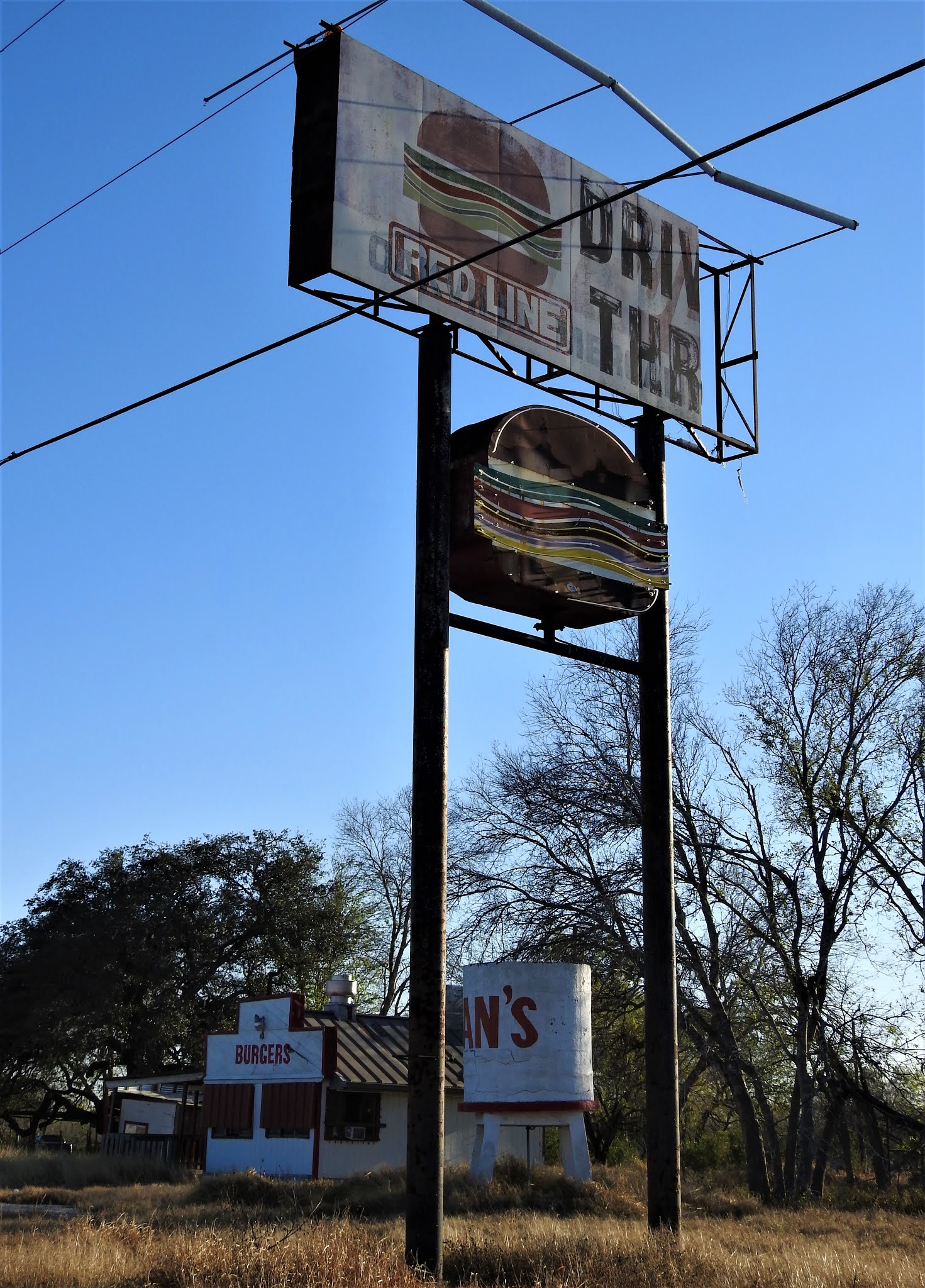
Up US-183 north of Rising Star, Texas was this abandoned building. I couldn't find out anything about it and couldn't decipher the name on the front. I also couldn't find the geocache on the side by the tree either (GC5M0MG). Looks like it may have been a store or gas station. Someone even suggested it looks like it could have been a post office. Got a lot of stuff stored inside now.


Also nearby is the Romney Lutheran Cemetery geocache (GC1HMM2). It's a small rural cemetery with less than 100 interments. The earliest known marker dates back to 1901. The town of Romney was established in 1880 when former West Virginian J.W. White arrived and named the community after his former hometown. The community was granted a post office in the early 1890s which remained open through 1931. Romney had always been an agricultural community, primarily cotton. At the turn of the 20th Century, it had most essential businesses as well as a school. A boll weevil infestation in 1914 curtailed growth although it limped along into the 1960s when it still had a gas station and two stores. The 1940 population was given as 40 residents. A slow decline drove this number down to a mere 12 by the 1980 census - where it has remained.


To the east of Romney was the Long Branch Church and Cemetery geocache (GC1KEEB). Formerly organized on July 16, 1885, the Long Branch Baptist Church held its first worship services in an old schoolhouse on land donated by R. B. Covington. The thirteen charter members were served by W. B. Cobb, the church's first minister, until August 1886. Missionary pastors continued to hold monthly services over the years. The congregation, which built its first sanctuary on this site in 1905-06, has provided significant service to the Long Branch Community and the surrounding area throughout its history. The cemetery has nearly 700 interments dating back to 1882.


Then there was also the Pleasant Hill Baptist Church and Cemetery (GC7G2XZ) near the town of Carbon. The few original charter members met in the old Pleasant Hill Schoolhouse in 1892 and organized the Pleasant Hill Baptist Church. Although the first church structure, built in 1905, was destroyed by fire later that year, another was erected in 1906. A new structure was also built in 1945. Several pastors of this church have also held eminent positions at institutions of higher learning in the area. This congregation has remained active in community and mission programs. The cemetery has just over 300 interments and dates back to 1904.


Heading back towards US-183, near the intersection is a TXDOT sign which displays the distance back to the town of Carbon. There's also a geocache near the sign (GC12CTF). I'm glad someone at TXDOT has a sense of humor for the properly distanced placement as well as the geocacher picking this spot to hide a cache. Now I'm thirsting for a carbonated beverage!


My second to last stop of the day was another cemetery geocache in Cisco at the Oakland Cemetery (GC3M5V5). With over 7500 interments located in this cemetery dating back to the 1870's. There are two that I want to bring to your attention: Sheriff George Emory "Bit" Bedford and Deputy George W. Carmichael. They were mortally wounded during what was called the "Santa Claus Bank Robbery" of 1927. Around noon on December 23, 1927, four men dressed up at Santa and attempted to rob the First National Bank of Cisco, Texas. At the time it was one of Texas' most infamous crimes and led to the largest manhunt in state history.

Because of the numerous bank robberies that took place in the recent months, the Texas Bankers Association announced a $5,000 reward for anyone shooting a bank robber during the crime. So when a bystander managed to escape early during the robbery and shouted out into the streets to get the attention of law enforcement, that also attracted anyone and everyone with a gun to assist in taking down one of the four Santa's. There is more to this story, though a quick read, and I encourage you to click the link in the previous paragraph and read the entire account at the Texas State Historical website. You'll be glad that you did!


Continuing north a couple miles out of Cisco, I spotted a cemetery sign and had to investigate further. This small unkept cemetery was called Reagan Cemetery and according to the FindAGrave website contains 14 burials. Though I don't know why it called Reagan as there are no Reagans' buried here. Nor could I find any information about a town or community in the area called Reagan. The oldest is dated 1879. There wasn't a geocache here, so I hid one myself (GC8BNM4) to bring others to this forgotten cemetery.


So that was it for stopping. It was already after 5PM and I still had 100 miles of driving to go. Along with getting a bite to eat, going to the grocery store so I have lunch for work tomorrow, etc etc. Thanks for riding along and I hope you come back again for another geocaching adventure.

Saturday, May 22, 2021

2019-06-30: Geocaching My Way to Munday, Texas via a Couple Cemeteries and a Ghost Town

Hello friends, travelers, geocachers and visitors. Welcome to another one of AwayWeGo's Geocaching Adventure roadtrip blog posts. Today's story is another one of my Sunday drives from Killeen, Texas to my work home of Munday, Texas. Along the way, I'll be finding some geocaches and some history to share with you along the Texas backroads. As always, the passenger seat is open in the GeoJeep. Saddle up, grab you cowboy hat and gun (this is Texas), and let's go!


My first stop wasn't very far down the road. Just a quick roadside geocache (GC1G339) in Kempner to start the day off. Nothing here to see, just one for the numbers.

Up next though was a cemetery geocache down a very rural county road. This one hadn't been found in nearly three years. Center Cemetery (GC1HECB) is located east of Lometa and was established in 1866. C.C. Carter was a Private in the Lampasas County Minute Men Confederate States Army. He survived the war but was killed by Indians a year later. I made it harder than it was because of the previous DNF's, but the cache was there and I found it after all this time.


And then there's the Ivy Family. Imagine this family showing up on Family Feud! Only one guy smiling, top row center. Life was rough back then!


Two more nearby, very rural, very lonely geocaches which hadn't been found in nearly five years. I gave them a shot, but they were indeed gone. (GC1CKQ5, GC19407)

Moving right along and passing plenty until I get to the northside of I-20, I finally make a stop for another geocache off US-183 between the towns of Cisco and Eastland. The Bedford Cemetery (GC1K7YT), according to the Find-A-Grave website contains just 19 burials dating from 1897 to 1966. This is an old forgotten very rural cemetery that most of the time goes unmaintained. That was the condition in which I found it. Many of the headstones barely stuck out above the weeds.


Next up just a little further north were three of my favorite things in a geocache: a cemetery, and old church, and some history. Oh and add in a really cool name too! Gunsight Community (GC1KEEY) had all these. From the historical marker: "Records indicate that Gunsight existed on a wagon road from Fort Griffin to Stephenville in 1858. Settlement of the town, however, did not occur until the 1870's. The first recorded burial here was that of Lewis McCleskey in 1877. Gunsight developed as a stage stop and by 1880 contained a post office, school, two churches, grist mill, general store, and a cotton gin. The local economy, sustained by cotton farming and ranching, was boosted by an area oil boom in the 1920's. The town began a steady decline after World War II and today consists of a few houses, a few buildings, and this cemetery."


Gunsight Church Buildings


You can see from the top of the page that I had to get out my black cowboy hat for a photo at the Gunsight Cemetery sign. Unfortunately my selfies were too goofy to include here so you get to see the TB logo on the GeoJeep. One of the interesting graves at the cemetery was this one of several made from stacked stones. Only this one has a tree growing out of it. Hopefully from the foot of the grave and not the head!


Next up was actually a surprise. In the town of Breckenridge, Texas was the Garden Club Park. Within the park were all these birdhouses of various sizes, shapes, and colors. One of them contained a recently hidden geocache (GC86QB9). It had been there for nearly two months with only one unsuccessful attempt. I can tell you it was a little difficult, but I think I just made it more difficult than it should have been. But I DID find the correct birdhouse and stamped the nice clean logsheet for the FTF!! So excited for being FTF, I forgot to take a photo of some birdhouses. Maybe next time...

Then there was the Woodson Cemetery geocache in Woodson, Texas (GC38N75). Now normally I might give you some history about the cemetery. But in this case it's about the history the cache hider has given us in the geocache description. We all know about the Japanese bombing at Pearl Harbor in World War II. But did you also know that Japan managed to bomb to places on the United States mainland? Woodson, Texas was one of those places and the other not too far away also in Texas. It happened on March 24 & 25, 1945. A very interesting and kinda funny story actually. So I urge you to click the GC# link in this paragraph which will take you to the cache page to read "the rest of the story" as Paul Harvey used to say.


And that was it for this Sunday's little road trip geocaching adventure. I hope you enjoyed it and I look forward to any comments you have here or on my social media posts. That lets me know you're out there. See you again next week...

Saturday, May 15, 2021

Exploring the History of Gilliland, Texas and is it a Ghost Town

Hello and welcome back to another edition of AwayWeGo's Geocaching Adventures. This is one of those blog posts that is a little different than my usual roadtrip stories. After leaving North Carolina, my next construction project brought me to this little town of Gilliland, Texas. For the two months I was here, I got to explore some of the area and take a look into Gilliland's past through some of the abandoned buildings. 

I don't know if I would call this a ghost town or not since at best it reached 120 residents at one time. Now it's down to just 25. But with some of the creepy abandoned buildings, I'll let you decide.

An old abandoned farm house.

There were no Geocaches here for me to find, but I did manage to hide a few myself to bring other Geocachers to this small community to discover what I've found.

Gilliland is located on Farm Road 1756 some seventy miles southwest of Wichita Falls in north central Knox County. The first Anglo-Saxon to arrive to this area was probably was a surveyor (like myself) named Captain Randolph B. Marcy who was commissioned to look for a suitable site for a wild Indian reservation. In 1870 Indians were making forays taking food or spoils or just pillaging. In 1871 the first settlers, who began arriving in covered wagons seeking new opportunities, called the community Coyote on the land between the north and south forks of the Wichita River. Wagon trains brought families who lived in tents, two room picket houses, wagons, and half-dugouts. 

Settlement came in waves by men mostly of European culture until the arrival of a nearby railroad which paved the way for a population explosion. Over the years the area gained a mix of settlers from various locations, including several Norwegian families from Bosque County, who arrived in 1890. Stores, homes, churches and schools sprang up to provide the settlers needs.

The Gilliland school district was established on May 1, 1892, and school began in 1895 with Miss Oma Acker as the first teacher. Over the years several schools were consolidated with the Gilliland district after the now abandoned school building (GC8AN63) was erected in the 1930's. Gilliland's new school featured numerous classrooms, a cafeteria, and a gymnasium that doubled as an auditorium for plays and assemblies. In 1948 its high school was transferred to Munday, leaving Gilliland with only a grade school. It continued until finally closing its doors in 1975.

The Abandoned Gilliland School Gymnasium / Auditorium

District judge W. A. Gilliland became the town’s namesake when the opening of a post office in 1907 required an official name. In 1910 Luther Burgess, Jake Cure, and W. A. Cure built a cotton gin just outside of Gilliland. The gin was modernized in 1936 and proved to be highly productive. Leading settlers included O. M. Olson, who operated a post office in his home in 1907; F. B. McGuire, owner of McGuire's General Store; and longtime postmaster J. S. Cook, owner of three businesses between 1926 and 1934.

Gilliland had an estimated population of fifty in 1925. By 1947 it reported 120 residents and four businesses. In 1971 it had three businesses, and from 1971 to 1990 its population was reported as 103. By 2000 the population had dropped to twenty-five.

Today the community consists of the ruins of the 1930 school, grain silos and a few former businesses being reclaimed by nature – although the community center is in good repair and still in use for meetings and a voter polling place.

The Gilliland Cemetery (GC8AN86) is a well kept still in use cemetery with over 330 interments to date. The one grave that stuck out here is for a man named Liberty Justice who died in 1925. I tried researching this man for a few hours but didn't come up with anything but his spouse and children's names.


So while working here in Gilliland, I'll be living about 20 miles south in the town of Munday. Over the next few weeks I'll be bringing you stories about of my weekend roadtrips between here and Killeen and all the places I've discovered in between.

I leave you with a few more photos from Gilliland:

The Abandoned Gilliland School Gymnasium / Auditorium

Swing-set behind the school and abandoned house.

East-West Hallway of Abandoned School

Front Entrance of Abandoned Gilliland School

Front of Abandoned Gilliland School
You can get a look of the walled entrance which prevented cows from wandering inside.

Abandoned gas station with Esso gas pumps.

Abandoned General Store

Abandoned Former Store or Garage?


Side Door of Abandoned Gilliland School

Abandoned Farm House

Abandoned Old Ford Trucks left in field.


Inside Abandoned Farm House

Abandoned Farm House

Abandoned gas station with Esso gas pumps.

Hwy 267 going south to Munday

Saturday, December 26, 2020

Discovering the Ghost Town of Oakville Texas and Researching Its History

Hello Friends, Travelers, and Geocachers. Welcome to another day in our AwayWeGo's Geocaching Adventures. Today I want to invite you along this roadtrip as I stop to explore a South Texas ghost town called Oakville.

It started out as my usual 360+ mile Sunday drive from Killeen, Texas down to Roma in the Rio Grande Valley. I was driving down I-37 and exited off the highway to get two geocaches in the Oakville Cemetery (GC2KPBH, GC78PKP) on the west side of the Interstate. From the historical marker at the Oakville Cemetery: "Donated in 1857 by Thomas Wilson, who also gave land for Main Town Square. The property was originally part of the 1831 McMullen McGloin land grant from Mexico. Among graves are those of J.T. James, the founder of Oakville; early pioneers; and organizers of Live Oak County."

As I was driving up the onramp heading south, I noticed out the corner of my eye across the east side of the highway all the old buildings of the town. That really sparked my interest so I continued driving down the Interstate six miles to the next exit. Then got off and made a u-turn another six miles back to Oakville.


Arriving in the Coastal Bend of Texas in the early 1800’s, Irish immigrants became the first settlers of a region that includes what is now known as the town of Oakville. At that time the community was referred to as "on the Sulphur" because it was on Sulphur Creek. It was also called Puenta de la Piedra ("Rock Bridge") by Spanish gold seekers, because two miles east on the Nueces River the San Antonio-Brownsville road crossed a natural rock bridge. After the Texas Revolution, Oakville was a station on the stage line from San Antonio to Corpus Christi. It had become a bustling place of commerce because it was the crossroads of ox-cart caravans and mule trains that crawled the muddy roads of Texas between the coast of the Gulf of Mexico and Brownsville to San Antonio. Oakville was the half-way point and merchants & travelers used it as a rest stop on such long, hazardous journeys of the day.

Oakville became county seat after Thomas Wilson offered 640 acres for a townsite; residents accepted the location on September 8, 1856. The name was taken by the court from a newspaper advertisement of business lots. Oakville had the county's first post office, established in 1857, and the first courthouse was built. The Oakville Baptist Church, constructed in 1856, had 128 members by 1857.


During the Civil War and for some years afterwards, Oakville and the surrounding region became a "hotbed of lawlessness." Looking through old newspapers, I found this article from the "Austin Weekly Statesman" October 5, 1876: "The state of society about Oakville, a frontier village, has been simply terrible. The people are divided into two classes; one, permanent, cattle-growing farmers; the other, horse and cattle thieves. They have shot and killed one another until honest men feared to tell the truth, and to punish red-handed villainy was impossible."

Historian Walter Prescott Webb described Oakville as "a hard country where civil authorities were helpless and took no notice of any outrage." As the county seat, Oakville grew into a thriving town that shipped cattle, horses, cotton, and wool, with a dozen or more stores, two hotels, a livery stable, a steam gristmill and cotton gin, a school, and two churches. However, with this boom of activity, the thought of the Wild Wild West that TV shows and movies were made of come to mind.

Growing to over 400 in population, there were 7 saloons in Oakville to provide the cattle crews plenty to drink and entertainment. Many stories of drunken cowboys, a lot of liquor flowed and many thrown in jail to sober up. Some of this spilled over into frontier violence in the form of horse thievery, cattle rustling and murder.

It took Texas Ranger Captain McNelley to clean up the lawless element in the 1870's. The Texas Rangers cleared out the outlaws in the region and brought them to the Live Oak County Jail in the county seat of Oakville, for justice. The standing historic jail was the third jail used in Oakville, the first two proving inadequate. The first one was a mud structure and the second of wood; both of one story construction. It was decided that something had to be done - for one, angry citizens could shoot the prisoners dead thru the jail bars in the absence of the Sheriff whilst he was away handling business.


The stone jail became a source of community pride. It was the latest design, the state-of-the-art in incarceration at the time of its construction. At two stories tall, it provided for safe lock-up in the upstairs cells until the judge arrived and provided formal offices for the Sheriff downstairs in which to conduct business. It also allowed for the sheriff's or jailer's family to reside on the first floor should they elect to do so. This important building served as the county’s jail from 1887-1919. The jail was constructed of hard native 22” sandstone, rough-hewn blocks, hauled by ox-cart from a nearby quarry.

For the burgeoning community, a jail of this stature was literally an advertisement and enticement to incoming settlers that Oakville would be a success in that it promoted civility and safety for it’s residents. The "modern" stone Oakville Jail of the 1880’s symbolized the arrival of the law to Oakville and to frontier Texas where previously only the six-shooter, rifle and the Texas Rangers administered justice to the wild and woolly lawless. Many a badman came to lament the day he entered the Oakville Jail. It is told that over 40 men hanged in the notorious sprawling live oak “Hanging Tree” outside on the Town Square.

Law and order once again established, Oakville's location as the halfway point between San Antonio and the Gulf Coast continued to create a boom of activity and business. The county's first free school building was established in 1881, and in 1899 Oakville established the county's first independent school district. The Oakville First National Bank, opened in 1905 by Dudley Blair and Lee Hinton, was also the county's first. The population of Oakville reached 400 in 1885, fell to 320 in 1892, then rose to a maximum of 450 in 1914.


Oakville's demise came just as many a ghost towns did in the west.  About 10 miles to the south, George West had plotted and named a town after himself. He courted the San Antonio, Uvalde, and Gulf Railroad to lay their tracks through his town and succeeded in 1913. The residents of Oakville began relocating to George West. And in 1919, George West became the county seat when its founder offered $75,000 to build a new courthouse there. State highway maps of 1936 showed a cemetery, two churches, a school, and several businesses and residences at the site. In 1940 the community reported a population of 350. By the 1970's only the Baptist church, the post office, three service stations, and scattered dwellings remained.


The State of Texas designated the town of Oakville a historic landmark in 1936 and placed a granite marker there. In 2004, the Oakville Jail was placed on the National Register of Historic Places.

Since the 1970's when Albert and Mari Davila first spotted the two-story stone jailhouse rising up out of the surrounding live oak and cactus. Over the following years, every time they'd pass by on their way down to Padre Island, they would stop for another look and exploring what appeared to be an abandoned town square. They eventually fell in love with the jailhouse and wanted to turn it into their vacation retreat house. They found the owners and purchased the Oakville Jail along with the abandoned town square in 2005.

With no windows or doors, they discovered many critters now calling it home as well. It was a slow process clearing up and cleaning out, but in 2007 restoration of the jail was completed. Locals had been admiring the work and inquiries into renting the jailhouse for special events and overnight stays began coming in. One by one the Davila's have been restoring old structures and adding to their number of rooms to rent. You can find more information about the restoration and photos at their website oakvillejail.com.


So that's it for another edition of my blog. I really enjoy finding these once forgotten treasures like the Oakville, Texas ghost town and sharing them with you. I'm also glad to see that someone has taken an interest and begun to restore the town square into what a typical pioneer town square might have looked like back in the 1800's.


For some reason, the closing theme song of the Beverly Hillbilly's TV show is running through my head. Yeah I know it's got nothing to do with Texas. But I'll leave it with you as anyway, though slightly modified: 

"Well now it's time to say good bye to You and all your kin.
And I would like to thank you folks fer kindly droppin in.
You're all invited back next week to this blog of mine,
To have a heapin'helpin of these words that come to mind.

Geocaching it is. Explore a spell, Put the hiking boots on.
Y'all come back now, y'hear?"