Saturday, August 27, 2022

2021-03-04: Visiting the Less Touristy Sites in New Orleans

Hey Everyone! Welcome back to Day #2 of our 4,000+ mile roadtrip. Today we start off in New Orleans, Louisiana. Not the Mardi Gras, the bars, restaurants, and nightlife party, but the historical, less visited, peaceful attractions. So hop onboard and join us for a geocaching adventure...


We started the day with breakfast, a cache, and a new county at a Waffle House just down the street. We ordered a couple of breakfast bowls to-go. While they were cooking, I grabbed the geocache (GC8MND3) in the parking lot to fill in the blank for St. Charles Parish.

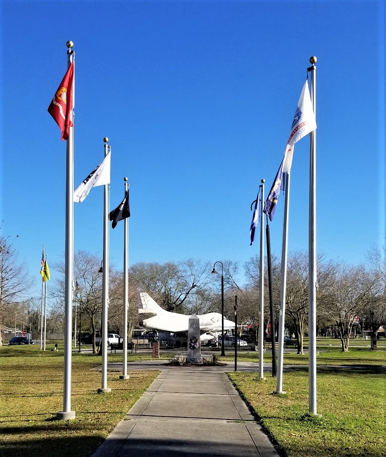
My next county cache was in Jefferson Parish. At the Veterans Memorial Century of Sentries Park, there was a multi-cache hidden here which I could not find the final stage (GC110R8). But it was still a worthy stop. There were many military display's such as the Douglas A-4 Skyhawk Vietnam War attack plane, a 1941 Plymouth Sedan Army staff car, a Vietnam River Patrol boat, a couple of cannons and a torpedo.


Now since I couldn't find that last geocache for the county, I settled on a quick parking lot LPC hide (GC77DYE).

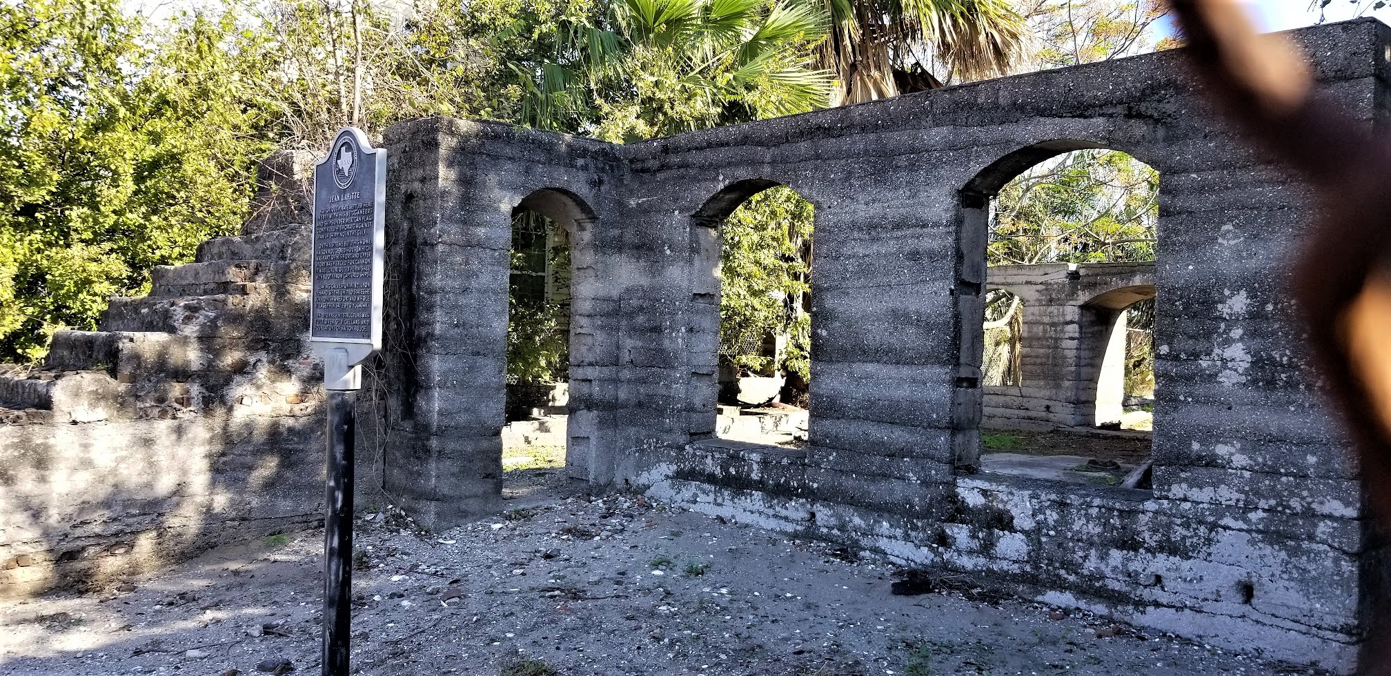
In Orleans Parish, our next stop was the site of the Spanish Fort at Bayou St. John (GC8GC4J). The first small fort here was erected by the French in 1701, before the founding of the city of New Orleans, to protect the important trade route along Bayou St. John. After Louisiana passed to Spanish control, a larger brick fort was constructed at the site of the neglected old French fortification; this was known as San Juan del Bayou. Louisiana passed back to France and then to the hands of the United States. The fort was decommissioned in 1823.


This is the story of the grave at Spanish Fort. During the Spanish days, the Commandant of Fort St. John was Sancho Pablo. He had opened negotiations with the chief of a local Choctaw tribe, Waw-he-wawa (White Goose), who lived down the bayou with his daughter Owaissee (Bluebird). Sometimes Pablo visited the Indian camp and became acquainted with Bluebird as well.

One day, as the legend goes, Bluebird took her canoe down Bayou St. John to the lake. The choppy waters began to pound her canoe until it nearly capsized. Seeing this from the fort, Sancho Pablo ordered his men to prepare a boat at once to rescue her. When they reached her, Pablo personally lifted Bluebird into the Spanish boat to safety and escorted her home. Needless to say, Sancho Pablo and Bluebird fell in love with each other. Bluebird would paddle down the bayou again and again at night to meet with Sancho.

White Goose became suspicious, however, that his daughter was meeting with this Spaniard; and he became alarmed being strongly opposed to such a relationship. He secretly followed his daughter down the bayou one night and discovered that she was meeting with Pablo. White Goose therefore resolved to kill the Spaniard. On an ominously dark night, the Indian father traveled down the bayou in a canoe alone. As the canoe approached the fort in the pitch black night, Pablo believed the boat contained Bluebird coming to visit. Instead the Spaniard soon discovered it was Bluebird's father who came only for blood. White Goose killed Sancho Pablo on the spot.


Legend has it that Pablo's last words were of his eternal love for Bluebird. The soldiers in the fort soon were startled by the sounds of the struggle, but the Indian chief had disappeared. The Spanish soldiers buried the body of their leader on the grounds of the old Spanish Fort. Legend says that the Indian village relocated. Neither Bluebird nor White Goose was ever heard from again.
(https://allpoetry.com/poem/513738-Sancho-Pablo-And-Bluebird-by-Dreamweaver)

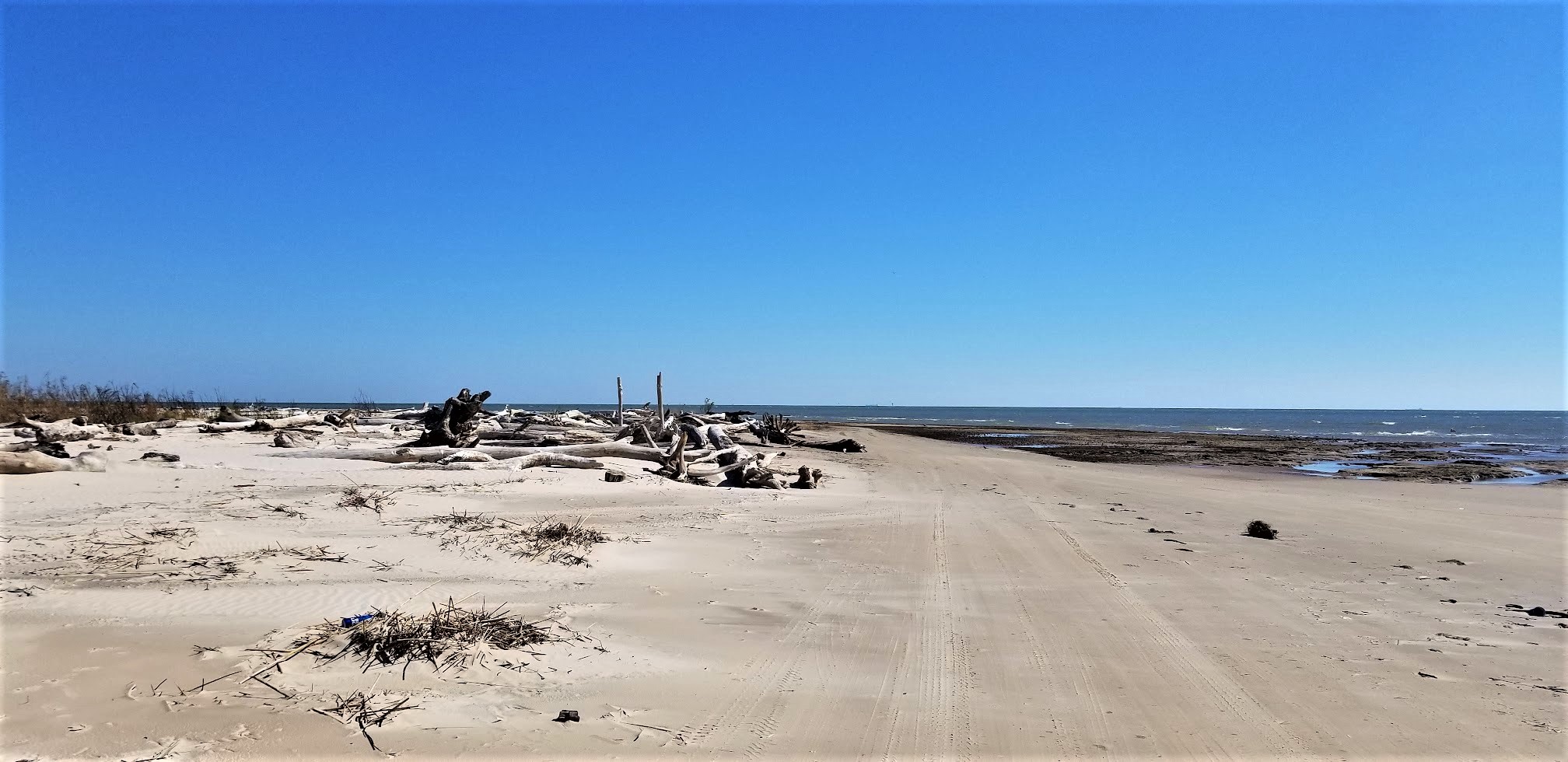
And then, not too far away, was the Milneburg Lighthouse (GC8GC4N). Originally called Port Pontchartrain Lighthouse until 1929. This now landlocked lighthouse was located at the end of Milneburg pier. The brick lighthouse was built in 1855 which replaced the original wooden one which was built in 1832. Milneburg was a small town on the lake shore that was absorbed by New Orleans. The area was connected to the city by Elysian Fields Avenue. In 1830 it was decided to build the region's first railway along the route. The Pontchartrain Rail-Road started steam locomotive which carried people and cargo along the 5 mile trip. The port boomed. Hotels, saloons, bath houses, and resorts were built around it. The importance of Milneburg in shipping declined in the late 19th century, but it remained an important resort. Between 1920s and 1930s new land was reclaimed by dreading the shallows of Lake Pontchartrain which brought the end of old Milneburg.


Unfortunately I didn't get the geocache that was there. It wasn't that I didn't find it, but I didn't get to look. From where I took this photo were two parking spots. We got out of the GeoJeep to walk over for a closer look and to find the cache. Almost immediately, up rolls a golf cart with a security guard telling us that we can't walk out to see the lighthouse because of covid. REALLY? If it were not for the security guard, I'd be able to look completely all around in every direction and NOT see a single person except for my wife and I. I'm pretty sure covid would NOT be an issue. Oh well, off to the next one.

We planned on visiting the most famous of the New Orleans cemeteries, Saint Lewis Cemetery Number 1. With famous permanent residents like voodoo priestess Marie Laveau (1801-1881), civil rights activist Homer Plessy (1862-1925) of the Plessy vs Ferguson Supreme Court case, and future resident and actor Nicholas Cage who already has a 9' tall pyramid placed for his tomb. But it was closed because of... you guessed it... covid.

So we went across the highway to the Metairie Cemetery where we found six of the more than a dozen geocaches hidden there. The Metairie Cemetery Association received its charter in May 1872. This large cemetery was built on a former racetrack, and the oval track shape is still there. Metairie was part of the Rural (Victorian) Cemetery Movement. It’s landscaped and features elements like lakes and wide roads connecting to footpaths. Interments of note include singer Louis Prima, 49 kings of Carnival, and numerous Louisiana state governors and NOLA mayors.

Just a couple of notable residents here: Thomas Milton Benson (1927-2018), who was the owner of the NFL's New Orleans Saints and the NBA's New Orleans Pelicans.


Josie Arlington was a New Orleans madam whose crypt was once believed to be haunted. It was rumored that the statue of the woman in front of the tomb would come to life and walk the cemetery grounds at night. It was later discovered that a street light reflecting off the tomb gave it a reddish glow, lending credence to the rumors of the haunting. Josie Arlington's body was later moved to an unknown location within the same cemetery.

Located in the center of the Metairie Cemetery is the Tomb of the Army of Northern Virginia. Dedicated on May 10, 1881, the monument was erected in memory to the men of the Division of the Army of Northern Virginia, who served and died in the Civil War. The monument, made of white granite, rises fifty feet above the ground with a statue of General Stonewall Jackson on top and the inscription: "ARMY OF NORTHERN VIRGINIA, LOUISIANA DIVISION," and "FROM MANASSAS TO APPOMATTOX, 1861 TO 1865." Located within the hill below this monument, is a large chamber containing the vaults of many Confederate Officers.

Jefferson Davis, President of the Confederate States, was the unrepentant highest ranking Confederate leader of the South. By the time his peaceful death occurred while visiting New Orleans, he was the symbol of the Lost Cause and the most revered man in the South. Eighteen months after his death and temporary burial in New Orleans Metairie Cemetery, Davis's widow, Varina, decided the final burial place was to be Richmond's Hollywood Cemetery, considered the National Cemetery of the Confederacy. 


His remains, were removed from the vault in New Orleans and placed on a flag-draped caisson escorted by honor guards composed of his old soldiers to Memorial Hall, where he lay in state. The next day, as thousands of people silently watched from the sidewalks and balconies, the caisson bore his body to a waiting funeral train. On the way, bonfires beside the tracks lit up ranks of Davis's old soldiers standing at attention beside stacked arms. In Richmond, Gray haired veterans escorted him to the Virginia statehouse where thousands filed past in respect before internment.

Jefferson Davis was the only Southern leader shackled in a dungeon and sacrificed as atonement for the sins of many. He refused to apply for a pardon because, he said, "I have not repented." In 1978, the United States Congress posthumously restored Davis's citizenship. 

Driving east into Saint Bernard Parish, we stop for my next county cache at Chalmette Battlefield and National Cemetery (GCA55A). Major General Andrew Jackson's troops were outnumbered and less experienced yet they defended and secured the port of New Orleans from British invasion on January 8, 1815. This victory at the Chalmette Plantation was the last major battle in the War of 1812. The American victory preserved U.S. claims to the Louisiana Purchase territory, prompted settlement in the Mississippi River Valley, made Jackson a national hero, and encouraged American pride and unity.

The construction of a monument honoring Andrew Jackson and his troops was the first step in recognizing the importance of the battlefield and saving it for future generations. In 1852 the Louisiana legislature appropriated funds to purchase land at the battlefield and build a monument there. The project was plagued with funding problems for decades and was finally completed in 1908. In 1939 Chalmette National Historical Park was created and the site became part of the National Park Service.


The destruction of their plantation during the Battle of New Orleans left the de Chalmet family in financial trouble. In 1817, brothers Hilaire and and Louis St. Amand bought the land. The St. Amands were prominent free people of color who already owned several plantations. In the early 1800's, it was not unusual for free people of color to own plantations and slaves in Louisiana. Actually according to the 1860 U.S. census, only 4% of southern whites owned slaves while 28% of freed blacks in New Orleans owned slaves.

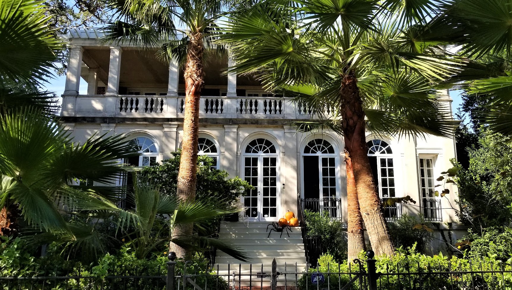
The first owner of the Malus-Beauregard House was Madeleine Pannetier Malus, a widow who purchased land from the St. Amand brothers when they divided the land into small tracts in 1832. Malus built a French Colonial house in 1833 or 1834. After her death in 1835, Caroline Fabre Cantrelle bought the house and remolded it to the Greek Revival style it is currently. Its last private owner was Rene Beauregard, son of Confederate General P. T. Beauregard, who purchased it in 1880. The New Orleans Terminal Company then owned the property until 1949, when it became part of the Chalmette National Historical Park.


Looking at the house from the front or the back and you get the impression of an ominous grand estate. In reality, when you look at it from the side, the house is only one room deep with only four rooms on each floor.


The Chalmette National Cemetery was established in 1864 as a burial place for Union soldiers who died in the Gulf area during the Civil War. It also served as a site for reburials of soldiers from battlefield cemeteries in the region. This plot of land was part of the battlefield during the Battle of New Orleans. Only four U.S. veterans of the War of 1812 are buried here. None of the British who died in the battle are buried in the cemetery.


Also located on four acres of the battlefield, is the Freedmen's Cemetery. It was established by the Freedmen's Bureau in 1867, when the bureau received permission to use a portion of the battlefield as a civilian burial ground. The property reverted to other ownership when the bureau was discontinued, and the cemetery gradually fell into ruins. All above ground traces disappeared before the start of the 1900's.

The National Park Service received stewardship of the cemeteries in 1933. There are over 15,000 individuals buried in the 17.5 acre cemetery. Veterans of all major American wars and conflicts are interred here. Of these 15,000, more than 6,700 are unknown. By 1945 all available burial sites were either taken or reserved and the cemetery was closed. It was re-opened briefly in the 1960's for burial of Vietnam Veterans.

There are two burials I wanted to bring to your attention. One is the oldest and belongs to Pvt Elkanah Anderson (1774-1815). Marched from Hickman County Tennessee, then fought and died at the Battle of New Orleans. Mortally wounded in battle on January 8, 1815, then died on January 14, 1815.

The other was Sarah Rosetta Wakeman (1843-1864). Civil War Union Soldier. The oldest child in a poor, large farming family in upstate New York, she left home at nineteen years of age and found she could make more money by dressing as a man and working as a coal handler on a canal boat. Upon learning she could make thirteen dollars a month as a soldier, she disguised herself as a man and enlisted on 30 August 1862 in Montgomery County, New York, as "Lyons Wakeman" in the 153rd New York Volunteer Infantry, Company G which shortly thereafter would be redesignated as Company H. She served until she died of dysentery after fighting in the Battle of Pleasant Hill in Louisiana. Details of her experiences are found in her letters compiled in a book entitled "An Uncommon Soldier" edited by Lauren Cook Burgess. Her total service in the U S Army covered more than one year and seven months.


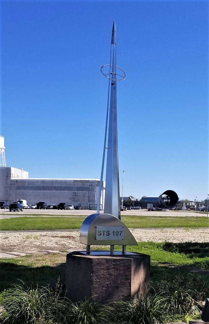
And finally, our last stop in New Orleans was out of this world (GCB50B). This is the Michoud Assembly Facility for NASA where much of the United States Space Program began. The Saturn 5 booster stage that launched all of the moon missions as well as all of the External Tank for the Space Shuttles were built here. Currently portions of the Orion Capsule slated to take the first men to Mars is being built here.

There used to be two metal sculptures near this virtual geocache location. One is honoring STS 107 which was the Columbia Mission that was lost upon reentry over Texas. The other is dedicated to the Challenger Crew who made the ultimate sacrifice when the shuttle exploded shortly after launching off the coast of Florida.


So that was our tour of New Orleans. Probably NOT the typical sites that most visitors to the "Big Easy" see. Maybe next time when we have longer to stay we'll check out the downtown restaurants and go on a ghost tour or something normal like most tourists. See you next time.

To follow along on our travels and keep up with my latest blogs, you may do so here of course by clicking the "Follow" button to the right. But also by using one or more of your favorite of these social media platforms: FacebookMeWeGabRedditParlorTwitterRVillageGETTRInstagram, and TruthSocial. These all link directly to my profiles. Again, please feel free to comment and / or share.

Saturday, July 23, 2022

2021-03-03: Roadtrip! Our First Day of a 4000+ Mile Road Trip from Texas to Louisiana

WOHOO!! Time for another road trip!! After four months in southeast Texas, we laid the groundwork on this project and turned it over to the remaining crews. So where's the next big project? Well the next big project is just across the state back in West Texas. 

But first, I gotta make a quick overnight stop in Florida for my father's funeral. Then we head back up to Maiden Creek, North Carolina for two weeks worth of work putting the finishing touches on a project we started last year. And for an adventure we're gonna take the long way back to Texas. I mean what's the excitement of just driving the quickest interstate highway to your destination right? So a 500 mile roadtrip turns into a 4,000 mile roadtrip!


Day #1 of this road trip and my first goal is just getting out of Texas to get a jump on putting miles in the rear view mirrors. Our first stop was at a virtual geocache and an earthcache (GCCF25, GC7VW68) in Dequincy, Louisiana.

In 1897, the Kansas City Southern (KCS) Railroad laid track through the town of DeQuincy and the first depot was built on this site. In the early 1920's KCS began rebuilding or remodeling many of its stations along the line in Western Louisiana. This building was completely rebuild in 1923 and eventually turned into a museum in the 1970's.


Located trackside of the DeQuincy Railroad Museum is a 1913 Steam Locomotive and a 1947 Pullman passenger car. While we were checking out the outdoor displays, a modern day Kansas City Southern freight train whistled past.


Our first new geocaching county to check off the list was up next for Allen Parish. We stopped in the town of Oakdale and the Calcasieu River Dam (GC81VQW). After taking a few photos I began looking unsuccessfully for the geocache. Previous finders said that it was buried, something they're not supposed to be. It has since been archived.


Still needing a geocache for the county, or Parish as they are called in Louisiana, I made a stop for a quick roadside cache (GC8XN4V) as we continued eastbound.

The next county on the list was Evangeline Parish. Near the town of Bayou Chicot is the Vandenburg Cemetery and my next geocache (GCW780). A well maintained cemetery with over 800 interments here, the oldest dating back to 1818. It's too bad that I don't have more time to look around here.

Did you know there is a difference between a cemetery and a graveyard? I mean everybody, including myself, usually just calls them cemeteries. But traditionally a graveyard is a cemetery that's attached to a church. Just like my next geocache...

The White's Chapel United Methodist Church (GC3730Q) was built in 1894 by Hugh and Lee Evans on land donated by Wilson A. O'Quin Sr. It was named in honor of Rev. Frederick White who organized it in 1870. There are less than 300 interments buried here with the oldest dating back to 1877, a SGT Leon Joseph Campbell.


While it was great to visit an old historic church and graveyard, I wasn't able to find the geocache. And not wanting to get too far behind in miles, I skip the next few geocaches and drive quickly beyond Baton Rouge. Though that also meant skipping a few needed counties too. That just a reason for another road trip!

When normally passing through down I-10 east-west, most people take the I-12 shortcut between Baton Rouge and Slidell. Since I still wanted to get those lower counties, I went south into Ascension Parish and the town of Prairieville. The Prairieville Cemetery (GC35J5A) is scattered with old growth oak trees which makes for a beautiful setting and a little spooky too. The cemetery has over 3000 interments dating back to 1812.


Moving right along, the next geocache is just a quick roadside park and grab at an I-10 exit for a find in St. James Parish (GC50YRT). While here we ran into another geocacher named SWAseekers, who was also on a county caching run in Southern Louisiana.

Next in St. John the Baptist Parish, I met up with SWAseekers once again for a quick parking lot geocache (GC8BC9X).

Since we didn't want to get into New Orleans during the busy evening hours, we decided to call it a day. Plus it was already after 5:00 PM and we were hungry and tired. Tomorrow morning we'll visit New Orleans while it is less crowded. Thanks for riding along and we'll see you again soon!

To follow along on our travels and keep up with my latest blogs, you may do so here of course by clicking the "Follow" button to the right. But also by using one or more of your favorite of these social media platforms: FacebookMeWeGabRedditParlorTwitterRVillageGETTRInstagram, and TruthSocial. These all link directly to my profiles. Again, please feel free to comment and / or share.

Saturday, June 4, 2022

2020-11-22: Geocaching and Sightseeing in Houston, Texas and a Visit to Howard Hughes

Welcome back fellow RV'ers, Jeepers, Geocachers, and travelers. Having a day off from the jobsite, we decided not to hand around the campground but go off on another little roadtrip adventure. Now of ALL the places I've been to, having visited 49 states, from big cities to ghost towns, my two least favorite cities have been Atlanta and Houston. 

Well today we're taking a drive up to Houston, Texas to see if it can redeem itself. Mostly because there's a HUGE cemetery there that I want to go see which happens to have a geocache at the final resting place of Howard Hughes. So climb aboard the GeoJeep and let's go for a drive.  


Arriving in Houston, we stopped for a quick drive by virtual geocache (GC73BD). "The Dancers" virtual geocache would have been cute. But some people are just taking this whole mask wearing thing to the extreme. These topiary bears would look fun, but do you really need to put masks on plants? 


Our next stop was at Hermann Park. This is a huge park near the center of Houston with all sorts of things to see and do. There's the Miller Outdoor Theater (GC5W8YR), the Houston Zoo (GC84FF), a golf course, a Japanese Garden, the Museum of Natural Science, and a small train that runs throughout the park.


Also located within Hermann Park was this large reflection pool. The Mary Gibbs and Jesse H. Jones Reflection Pool is about half the size as the reflection pool at the National Mall in DC at 740 feet long and 80 feet wide. At the north end is this huge statue of Sam Houston, the city's namesake.


Samuel Houston (March 2, 1793 - July 26, 1863) (GC5X8PB) played a major role in the Texas Revolution and became the first President of the Republic of Texas. After serving a second term as the third Texas President, he went on to be one of the first two individuals to represent Texas in the United States Senate after statehood.


Within a few blocks of Hermann Park were two more virtual geocaches. The first was at the Children's Museum of Houston (GC8576). The other was at the Holocaust Museum of Houston, pictured below (GC8501). On March 3, 1996, just 13 years after Siegi Izakson first dreamed of the idea, Holocaust Museum Houston was officially opened for admission with Izakson proclaiming, “This means the Holocaust story will not go away.”

After a $34 million expansion, the Museum reopened in June 2019 after more than doubling in size to a total of 57,000 square feet. Ranked as the nation's fourth largest Holocaust museum, the new three-story structure houses a welcome center, four permanent galleries and two changing exhibition galleries, classrooms, research library, café, 187-seat indoor theater and 175-seat outdoor amphitheater. With more than 50 screens, mini-theaters and interactive terminals are featured throughout the Museum.


Finally arriving in Glenwood Cemetery, we're ready to grab some geocaches (GC8M3QH, GCTNRF, GC5CXCW, GC8M3QC) and take a walk through Houston's history. Glenwood Cemetery was established as a private cemetery in 1871 by the Houston Cemetery Company, which was incorporated by an act of the Twelfth Legislature of the State of Texas on May 12, 1871. After construction, Glenwood opened for business in the summer of 1872.

The gravesite on my bucket list was that of Howard Robard Hughes Jr (GCGZFY). Born December 24, 1905, Howard Hughes was the Elon Musk of the mid-1900's. He was an American business magnate, investor, record-setting pilot, engineer, film director, and philanthropist, known during his lifetime as one of the most influential and financially successful individuals in the world. He first became prominent as a film producer, and then as an important figure in the aviation industry.


Later in life, he became known for his eccentric behavior and reclusive lifestyle—oddities that were caused in part by his worsening obsessive-compulsive disorder (OCD), chronic pain from a near-fatal plane crash, and increasing deafness. He died of kidney failure on April 5, 1976 and is buried here with his parents at Glenwood Cemetery.


The Priester family plot contains the burials of six family members starting in 1906.


One of the many garden like settings within Glenwood Cemetery.


The Crump family plot is a little more cheerful, though I'm not sure if the girl statue is a part of it. The large dog with a bird on it's head is. The plot contains 34 year old Jason Crump, who passed away in 2006, and his father 79 year old James Crump who passed away in 2019.


Throughout Glenwood Cemetery are these beautiful huge oak trees. They kinda make you want to go climbing.


There are many other notable famous people that permanently reside within the cemetery. If you have a moment, visit the Find-A-Grave website for a list of some of them. Such as J.S. Cullinan, the founder of Texaco. Or how about Rienzi Melville Johnston who, at the age of 12, enlisted in the Confederate Army in 1961 and served as a drummer. Thomas Saltus Lubbock Sr., a Confederate Army officer and namesake for the city and county of Lubbock. And actress Gene Tierney.

Across the Buffalo Bayou and a few blocks away was our last geocaching stop at the Founders Memorial Cemetery (GC4TEJE). There are 139 interments dating back to 1836 and all but seven are pre-1900. Here you'll find many participants in the war for Texas independence and the United States Civil War. Check out the entire list at Find-A-Grave.


The one that I wanted to highlight the most was for John Kirby Allen, co-founder of the city of Houston. In 1836, the area of Buffalo Bayou was a humid swamp overgrown with sweet gum trees and coffee bean weeds. In this spot, two brothers from New York recognized the future commercial hotspot of Texas.

John Kirby Allen was born in Orrville, New York, in 1810. Along with his older brother, Augustus Chapman Allen, a professor in mathematics, the two moved to Texas in 1832. John Allen was an astute businessman and natural leader. At the beginning of the Texas Revolution, the Allen brothers did not enlist in the militia but instead worked on supplying and arming the troops, often at their own expense or at cost. He and his brother soon saw the area around Buffalo Bayou could readily become a major seaport. Immediately after the Battle of San Jacinto, the Allen Brothers carefully chose the site of future Houston.


On August 24 and 26, the brothers paid $9,428 for 6,642 acres of land originally granted by Mexico to John Austin, a pioneer colonist. He and his brother ran advertisements in Texas newspapers proposing a new townsite called Houston, a name that Augustus' wife Charlotte had come up with in order to capitalize on the popularity of Sam Houston. 

John Allen continued with his businesses as well as city planning, running a partnership in a shipping business with future first governor of Texas James Pinckney Henderson. Dedicating his short life to building the city he and his brother built from nothing, Allen never married. He died of congestive fever on August 15, 1838, and was buried in Founders Memorial Park, Houston, at the age of 28.

Augustus Allen eventually moved to Mexico in the 1840's. There he served as U.S. Consul for the ports of Tehauntepec and Minotitlan and was engaged in various business enterprises. In 1863, Augustus traveled to Washington, D.C., where he contracted pneumonia. He died there at the Willard Hotel on January 11, 1864. Unable to have his body returned to Houston, his widow Charlotte had him buried in Greenwood Cemetery, in Brooklyn, New York. 

That's it for our tour of Houston history. It has improved on my opinion about Houston, though slightly. We went and found ourselves a nice Greek restaurant before heading back to the RV park in West Columbia. I hope you enjoyed todays adventure.

To follow along on our travels and keep up with my latest blogs, you may do so here of course. But also by using your favorite of these social media platforms: FacebookMeWeGabRedditParlorTwitterRVillageGETTRInstagram, and TruthSocial. These all link directly to my profiles. Again, please feel free to comment and / or share.

Saturday, May 28, 2022

2020-11-14: Visiting the Kreische Brewery Monument Hill and the German Pioneers of Texas History

Todays little road trip took us up to the Kreische Brewery Monument Hill state historical sites in La Grange, Texas. Not only the site of a German immigrant's home and business, but the final resting place of 53 Texans who were killed in the continued skirmishes with Mexico after the Texas Independence. So let's go for a ride and take a walk through history. 


Kinda hard to drive straight there without stopping for a few other geocaches along the way. Our first stop was for an old geocache that has been around since February 2001 (GC29B). The geocache container was a second mailbox a half mile up along a geocachers driveway painted in the colors of the Texas state flag.

The next three geocaches were quick cemetery caches. The Holy Cross Catholic Cemetery (GC4GW6K) has over 1400 interments dating back to 1899. The Lissie Community Cemetery (GC4773G) is a small but well kept community cemetery with less than 150 interments dating back to the early 1890's. And the Lakeside Cemetery (GC47W3A) in Eagle Lake which has over 2600 interments which begin all the way back to the 1860's.

And then there's those unexpected crazy roadside things that make you do a u-turn and snap a quick photo! So here's this giant metal skeleton, probably left over from Halloween, now decorating a Christmas tree. The business is Fusion by Chris Vaughn. I checked out their website and he's a fabricator / designer of some really cool and unique home décor pieces.


Arriving at the Kreische Brewery Monument Hill state historical sites in La Grange, Texas, we stop first at the Monument Hill Tomb as seen at the top of this page. Even after the Republic of Texas won its independence from Mexico, Texans continued to battle in skirmishes with Mexico in continuing border disputes.

Meeting at great oak tree in downtown La Grange, Captain Nicholas Dawson gathered a company of 54 volunteers to help as Texas fought Mexico in and around San Antonio. On September 18, 1842, Dawson and his men made their way to join other Texas forces at the battle of Salado Creek near San Antonio. Along the way they were intercepted by Mexican troops and fighting ensued. Later known as the Dawson massacre, the conflict leaving 36 Texans dead -- including Dawson. Their remains are entombed in a granite crypt on a bluff overlooking the town. (GC3XF1C)


To prevent other attacks, President Sam Houston ordered General Somervell to march about 750 men towards the border. Upon reaching the Rio Grande, the general stopped the men from going forward due to a shortage of supplies. However Colonel Fisher and a group of 300 men continued on down towards the Mexican city of Mier to look for supplies. Fighting started but Fisher's men were outnumbered and eventually surrendered. The remaining men were then marched to prisons in southern Mexico.

During the forced march, the captured Texans managed to escape into the mountains at Hacienda Salado. There, many died without food, water, and shelter. While five managed to returned to the Republic, the remaining 176 men were recaptured. It was decided that every 10th man would be executed. To determine this, each prisoner would draw a bean. If they drew a white bean they live. If they drew a black bean they die. After writing letters home, the condemned men were lined up, blindfolded, and executed as depicted in the mural below. Known as the Black Bean Episode, the event cost 17 men their lives.


To ensure that these men were properly honored and interred, the La Grange community selected this hill for their final resting place in 1848 in a sandstone vault. The Kreische family did its best to care for the grave during their ownership of the property, but it suffered from a lack of formal oversight. In 1905, the state authorized acquisition of .36 acres here and the Daughters of the Republic of Texas raised funds for a new cover for the tomb in 1933. During the 1936 Centennial celebration, the 48-foot shellstone shaft with a stylized art-deco influenced mural was erected to mark the mass grave more prominently.

As for the Kreische family, German immigrant Heinrich Kreische (1821-1882) purchased nearly 175 acres of property in Fayette County in 1849. A stonemason by trade, he built a house, a barn, and smokehouse here on the high south bluff above the Colorado River.


In the 1860's, Kreische began brewing bluff beer near his homesite. Situated on the spring-fed creek, the brewery (GC1D2BQ) included an elaborate tunnel system to provide temperature control for the brewing process. Bluff Beer was sold throughout central Texas and was produced until 1884, two years after Kreische died in a work related accident. The Kreische complex stands as a reminder of German heritage and culture in this region of the state.


Our last stop of the day was a virtual geocache of European settlement history in Texas (GCGG9Q). The Wendish migration to Texas was impelled, in part, by the Prussian insistence that the Wends (or Sorbs, as they called themselves) speak and use the German language, even to the extent of Germanizing their names. The oppression of the Wendish minority extended to working conditions, with Wends being denied the right to do the skilled labor for which they were trained. If they were hired at all, they received less pay than their German counterparts. Prussian agrarian reform laws of 1832 dispossessed the Wends of their real property so they were, in effect, vassals to their Prussian lords.

But most intolerable was the requirement that the Lutheran Wends join the Evangelical Reform churches in one state-regulated Protestant body. The Wends believed this action would dilute their pure Lutheran faith and, rather than accept this decree, they made plans to immigrate to the New World.


In December of 1854, an English sailing vessel, the Ben Nevis, docked in Galveston harbor loaded with some 500 immigrants from Lusatia, an area in eastern Germany comprising parts of Saxony and Prussia. These Slavic pioneers who were to settle in Lee County made the journey from their homeland, not in search of prosperity, but rather in search of religious liberty and the right to speak their Wendish tongue.

On the 150th anniversary of Serbin, Texas, this monument was erected by the church and cemetery. The historical marker states: "Dedicated to the loving memory of those lost during the 1854 Wendish migration from Germany to Serbin. From September 10, 1854, until the dedication of the church cemetery on March 17, 1855, eighty-three men, women, and children perished in route to this place. Most were buried at sea."


Well that was it for this little road trip through Texas history. Better than sitting in a classroom reading from a book, getting out and visiting the small rural towns along America's backroads is very interesting to me and hopefully to you too. Thank you for riding along.

To follow along on our travels and keep up with my latest blogs, you may do so here of course. But also by using your favorite of these social media platforms: FacebookMeWeGabRedditParlorTwitterRVillageGETTR and Instagram. These all link directly to my profile. Again, please feel free to comment and / or share.

Saturday, May 21, 2022

2020-11-01: Visiting Some History, Geocaching and a Pirate on Galveston Island, Texas

After our first week in West Columbia, Texas, we had gotten settled in at the Plantation Oaks Resort RV Park. And we had a week at the new jobsite up in Guy, Texas to begin our next solar construction project. Today, however, was a fun day! We drove over to Galveston Island for some history, some geocaching, and to find a pirate. So who's up for an adventure? Let's go see what we can find!


Our first stop down along the Gulf of Mexico coastline was in Freeport at the mouth of the Brazos River. There was a geocache there called Bryan Beach 4x4 (GCEA24). And when in the GeoJeep, it just calls out to go and find it! Well we did check out the beach but the geocache was nowhere to be found. First hidden way back it 2003 and I guess it frequently washed out to sea. It is now archived since the cache owner has gotten tired of replacing it.


We did spot something sticking up out of the water though. Looks to be a mast from a sailboat. I wonder what happened there. Hmmm, could be an interesting hiding spot for a geocache of the Difficulty 5 / Terrain 5 category!


From the northeast end of Galveston Island at the Fort San Jacinto Historic Point, you can see some of the many cargo ships that come and go through the port.


Also at the Fort San Jacinto Historical Point was our next geocache (GC8V700). There were a lot of muggles (non-cachers) walking by and huge rocks making for many hiding places. I didn't spend much time looking because of those things and ended up DNF'ing that one too.

This part of Galveston Island has had many forts since the early 1800's. Basic Spanish and French forts were established from 1816-1818. Those were replaced by small sand forts and batteries by the Republic of Texas from 1836 to 1844. After Texas statehood and the start of the Civil War, the Confederate Army built sandbag breastworks and an earthen battery named Fort Point in 1863. All traces of these early fortifications were destroyed by the strong winds and tides which regularly reshaped the sandy tip of the island.

A more substantial fortification called Fort San Jacinto was built here by the U.S. Army in 1897. After the fort was destroyed in the hurricane of 1900, the seawall was extended northward in 1921 to protect this area. The fort was rebuilt and new gun emplacements were added for the defense of Galveston during World War II. The fort was decommissioned in 1956 and only one concrete base of the 90-mm guns remains today.

Moving in a few blocks away from the coastline to find some of the historical buildings on Galveston Island, there's the Sacred Heart Church. The earliest Catholic services in the Galveston area were conducted in 1838. The Sacred Heart Church was established as the fourth church on the island in 1884. The original building was destroyed in 1900 Hurricane. This current building was constructed in 1903-04.


Next door to the church is the Bishop's Palace and a virtual geocache (GCH1CG). The Bishop's Palace matched the architecture of the original Sacred Heart Church which was swept away in the Great Storm. Construction lasted from 1886 to 1893 and was built as a private residence for Walter Gresham, a politician-turned-lobbyist during the mansion-building boom of the late-1800's. He had it made of Texas limestone accented with gray granite, pink granite, and red sandstone. This, combined with steel framing, helped it weather the Storm when so many thousands of other buildings were swept into the Gulf of Mexico.

In 1923 it was purchased by the Catholic Diocese of Galveston to become the official residence of the bishop. But only one ever lived there. Reverend Christopher Byrne stayed there until his death in 1950. In 1963, the Catholic Church opened it to the public, making it the first of the Galveston mansions to be turned into a museum.


The St Paul United Methodist Church was founded in the late 1860's and can trace it's history through two earlier Methodist congregations in Galveston. A second larger church building replaced the smaller first structure. This third and current sanctuary was constructed in 1902 to replace the previous which was also lost to the 1900 Hurricane.


The Isaac H. and Henrietta Kempner House. Isaac Herbert Kempner, at age 21 and the eldest of Harris Kempner's eight children, took over his fathers many businesses after his death in 1894. Isaac became an important businessman in his own right and after the 1900 Hurricane demonstrated exceptional civic leadership in his efforts to rebuilt Galveston's entire infrastructure. From 1917 to 1919 he served as Galveston city mayor.

In 1904, the Kempner's purchased three lots and in 1906 their two-story neoclassical style home was completed. In 1924 additional lots became available and a concrete and stucco wing was added. The house remained in the Kempner family until 1970.


The Carl and Hilda Biehl House. Carl Christian Biehl immigrated from Germany in 1905 and founded a shipping company on Galveston. In 1915, Biehl purchased one of the damaged homes and cleared the site to build a new structure for his family. Designed by Anton F. Korn Jr and completed in 1916. The construction consisted of brick and concrete to stand up to the hurricanes and strong winds common to Galveston. The house remained in the Biehl family until 2008.


The William and Adele Skinner House. In 1895, local banker William Skinner and his wife Adele bought this parcel for a home for their young family. The two-story Queen Anne style house was completed in 1896 and remains as one of the more ornate residential designs. This structure was one of the few survivors of the 1900 Hurricane.


This next house didn't have a historical marker and I couldn't find any history other than it was built in 1965. But it does fit in well with the other homes.


The last house I want to share with you is of the notorious pirate Jean Lafitte who settled here in 1817 with his buccaneers and ships, under Mexican flags, continued his assault against Spanish shipping in the Gulf.

Here he built his home, Maison Rouge (Red House), which was part of his fort, and upper story was pierced for cannon. It was luxuriously furnished with booty from captured ships. Leaving Galveston in 1821, upon demand of the United States, he burned his home, fort, and whole village, then sailed to Yucatan.

The walls that remain were built in 1870 over the old cellars and foundations of Maison Rouge. I'm curious as to what remains below the foundations and in the cellar. It would be cool to go down there and have a look around. This is also a virtual geocache.


That was it for our quick little return trip to Galveston Island. We visited here a few years ago in November of 2015 when it was a winter ghost town and most everything was closed.

Back on the mainland and headed to the RV Park in West Columbia, we made a short detour for another historical virtual geocache (GC2E13) in the town of Hitchcock, Texas. In an effort to defend U. S. coasts and shipping lanes against German submarine activity during World War II, the U. S. Navy established bases to house huge lighter-than-air (LTA) craft, also known as blimps were uniquely qualified for coastal defense and observation.

Because of its site on the flat Texas coastal plain, Hitchcock was chosen as the location for one of the nine new blimp bases. Construction began in 1942, and the facility was commissioned on May 22, 1943. The resulting military personnel build-up caused an economic boom in the community.

The Hitchcock base consisted of forty-seven buildings, including a massive hangar to house six blimps, administration buildings, warehouses, living quarters, and recreational facilities. Aircraft from the base, in addition to their regular patrolling duties, were also used to assist with hurricane relief efforts and war bond drives.

In 1944, after the blimps were no longer needed, the Hitchcock base was redesignated for other purposes. Following the war some of the buildings were used by private interests, and after hurricane damage in 1961 the blimp hangar was razed. All that remain are the towering hanger door supports.


Thanks for riding along today. Remember if you happen to find yourself on Galveston Island, there's more to see than the boardwalk on the beach.

To follow along on our travels and keep up with my latest blogs, you may do so here of course. But also by using your favorite of these social media platforms: FacebookMeWeGabRedditParlorTwitterRVillageGETTR and Instagram. These all link directly to my profile. Again, please feel free to comment and / or share.