Showing posts with label church. Show all posts

Saturday, July 23, 2022

2021-03-03: Roadtrip! Our First Day of a 4000+ Mile Road Trip from Texas to Louisiana

WOHOO!! Time for another road trip!! After four months in southeast Texas, we laid the groundwork on this project and turned it over to the remaining crews. So where's the next big project? Well the next big project is just across the state back in West Texas. 

But first, I gotta make a quick overnight stop in Florida for my father's funeral. Then we head back up to Maiden Creek, North Carolina for two weeks worth of work putting the finishing touches on a project we started last year. And for an adventure we're gonna take the long way back to Texas. I mean what's the excitement of just driving the quickest interstate highway to your destination right? So a 500 mile roadtrip turns into a 4,000 mile roadtrip!


Day #1 of this road trip and my first goal is just getting out of Texas to get a jump on putting miles in the rear view mirrors. Our first stop was at a virtual geocache and an earthcache (GCCF25, GC7VW68) in Dequincy, Louisiana.

In 1897, the Kansas City Southern (KCS) Railroad laid track through the town of DeQuincy and the first depot was built on this site. In the early 1920's KCS began rebuilding or remodeling many of its stations along the line in Western Louisiana. This building was completely rebuild in 1923 and eventually turned into a museum in the 1970's.


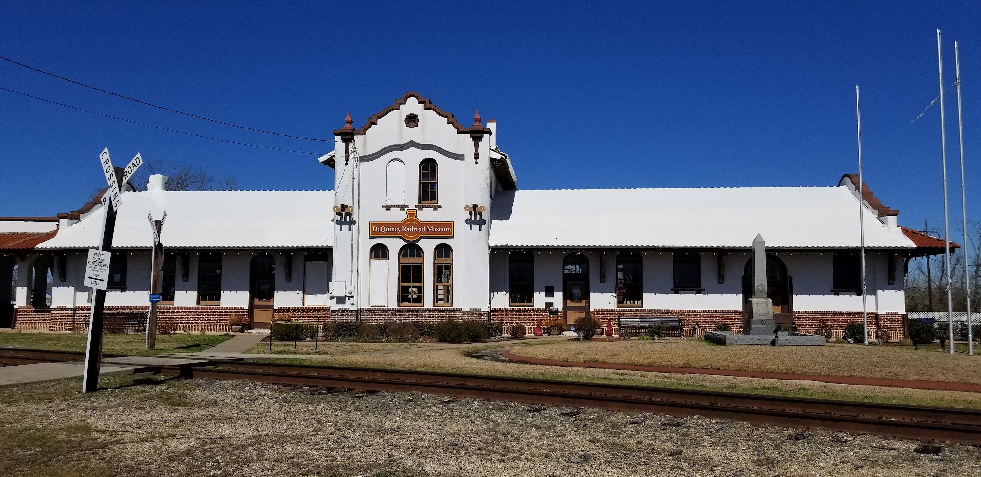
Located trackside of the DeQuincy Railroad Museum is a 1913 Steam Locomotive and a 1947 Pullman passenger car. While we were checking out the outdoor displays, a modern day Kansas City Southern freight train whistled past.


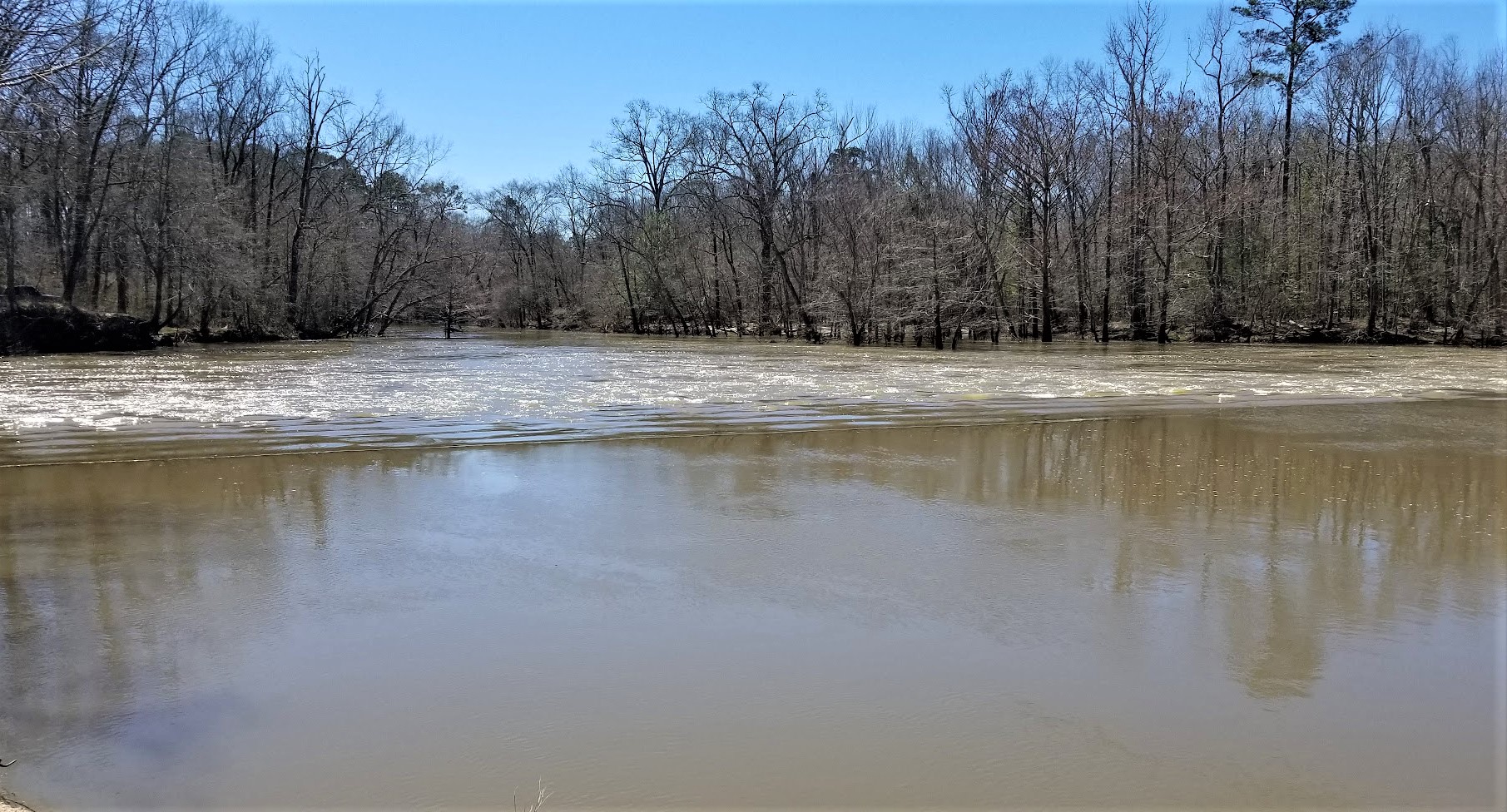
Our first new geocaching county to check off the list was up next for Allen Parish. We stopped in the town of Oakdale and the Calcasieu River Dam (GC81VQW). After taking a few photos I began looking unsuccessfully for the geocache. Previous finders said that it was buried, something they're not supposed to be. It has since been archived.


Still needing a geocache for the county, or Parish as they are called in Louisiana, I made a stop for a quick roadside cache (GC8XN4V) as we continued eastbound.

The next county on the list was Evangeline Parish. Near the town of Bayou Chicot is the Vandenburg Cemetery and my next geocache (GCW780). A well maintained cemetery with over 800 interments here, the oldest dating back to 1818. It's too bad that I don't have more time to look around here.

Did you know there is a difference between a cemetery and a graveyard? I mean everybody, including myself, usually just calls them cemeteries. But traditionally a graveyard is a cemetery that's attached to a church. Just like my next geocache...

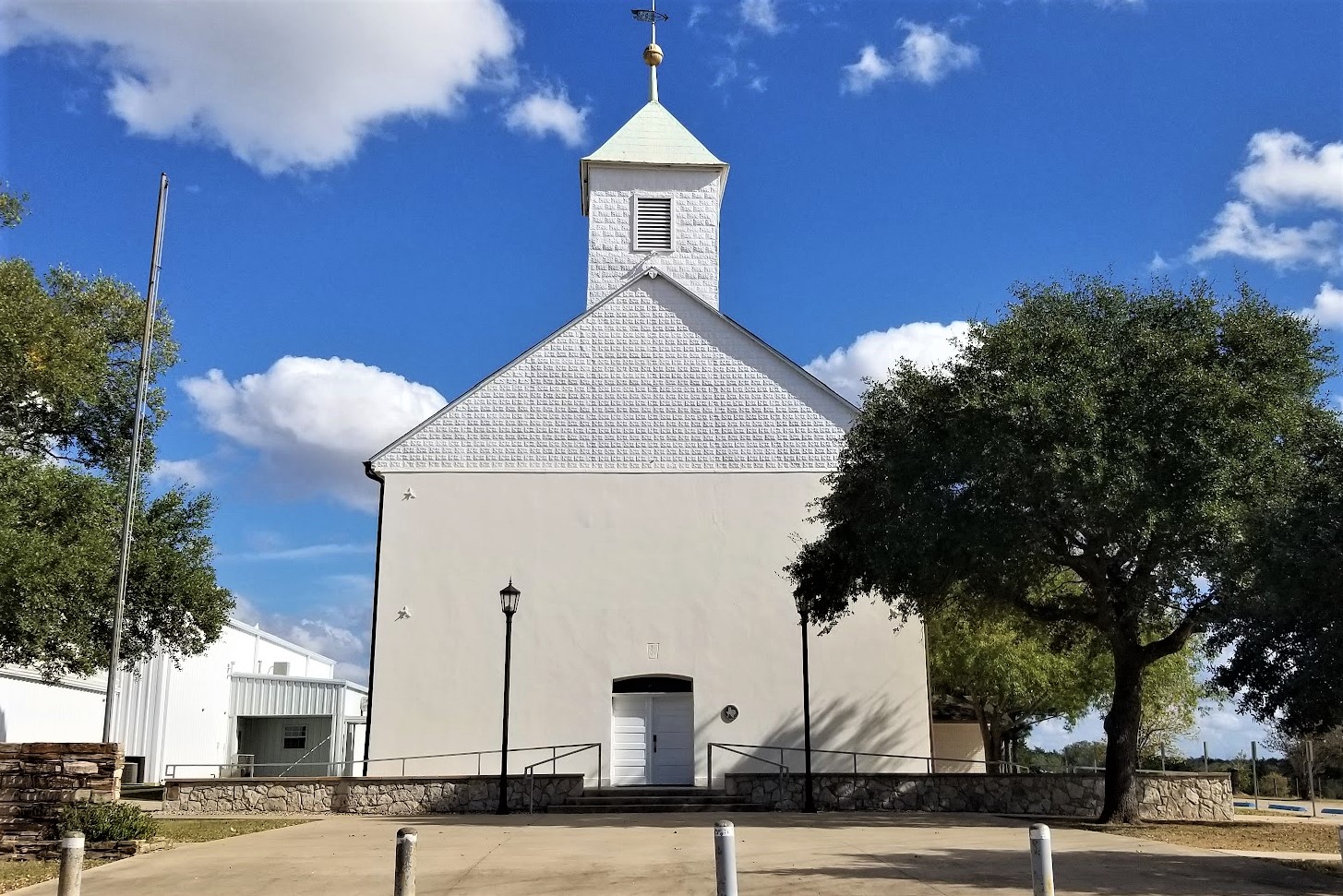
The White's Chapel United Methodist Church (GC3730Q) was built in 1894 by Hugh and Lee Evans on land donated by Wilson A. O'Quin Sr. It was named in honor of Rev. Frederick White who organized it in 1870. There are less than 300 interments buried here with the oldest dating back to 1877, a SGT Leon Joseph Campbell.


While it was great to visit an old historic church and graveyard, I wasn't able to find the geocache. And not wanting to get too far behind in miles, I skip the next few geocaches and drive quickly beyond Baton Rouge. Though that also meant skipping a few needed counties too. That just a reason for another road trip!

When normally passing through down I-10 east-west, most people take the I-12 shortcut between Baton Rouge and Slidell. Since I still wanted to get those lower counties, I went south into Ascension Parish and the town of Prairieville. The Prairieville Cemetery (GC35J5A) is scattered with old growth oak trees which makes for a beautiful setting and a little spooky too. The cemetery has over 3000 interments dating back to 1812.


Moving right along, the next geocache is just a quick roadside park and grab at an I-10 exit for a find in St. James Parish (GC50YRT). While here we ran into another geocacher named SWAseekers, who was also on a county caching run in Southern Louisiana.

Next in St. John the Baptist Parish, I met up with SWAseekers once again for a quick parking lot geocache (GC8BC9X).

Since we didn't want to get into New Orleans during the busy evening hours, we decided to call it a day. Plus it was already after 5:00 PM and we were hungry and tired. Tomorrow morning we'll visit New Orleans while it is less crowded. Thanks for riding along and we'll see you again soon!

To follow along on our travels and keep up with my latest blogs, you may do so here of course by clicking the "Follow" button to the right. But also by using one or more of your favorite of these social media platforms: FacebookMeWeGabRedditParlorTwitterRVillageGETTRInstagram, and TruthSocial. These all link directly to my profiles. Again, please feel free to comment and / or share.

Saturday, May 28, 2022

2020-11-14: Visiting the Kreische Brewery Monument Hill and the German Pioneers of Texas History

Todays little road trip took us up to the Kreische Brewery Monument Hill state historical sites in La Grange, Texas. Not only the site of a German immigrant's home and business, but the final resting place of 53 Texans who were killed in the continued skirmishes with Mexico after the Texas Independence. So let's go for a ride and take a walk through history. 


Kinda hard to drive straight there without stopping for a few other geocaches along the way. Our first stop was for an old geocache that has been around since February 2001 (GC29B). The geocache container was a second mailbox a half mile up along a geocachers driveway painted in the colors of the Texas state flag.

The next three geocaches were quick cemetery caches. The Holy Cross Catholic Cemetery (GC4GW6K) has over 1400 interments dating back to 1899. The Lissie Community Cemetery (GC4773G) is a small but well kept community cemetery with less than 150 interments dating back to the early 1890's. And the Lakeside Cemetery (GC47W3A) in Eagle Lake which has over 2600 interments which begin all the way back to the 1860's.

And then there's those unexpected crazy roadside things that make you do a u-turn and snap a quick photo! So here's this giant metal skeleton, probably left over from Halloween, now decorating a Christmas tree. The business is Fusion by Chris Vaughn. I checked out their website and he's a fabricator / designer of some really cool and unique home décor pieces.


Arriving at the Kreische Brewery Monument Hill state historical sites in La Grange, Texas, we stop first at the Monument Hill Tomb as seen at the top of this page. Even after the Republic of Texas won its independence from Mexico, Texans continued to battle in skirmishes with Mexico in continuing border disputes.

Meeting at great oak tree in downtown La Grange, Captain Nicholas Dawson gathered a company of 54 volunteers to help as Texas fought Mexico in and around San Antonio. On September 18, 1842, Dawson and his men made their way to join other Texas forces at the battle of Salado Creek near San Antonio. Along the way they were intercepted by Mexican troops and fighting ensued. Later known as the Dawson massacre, the conflict leaving 36 Texans dead -- including Dawson. Their remains are entombed in a granite crypt on a bluff overlooking the town. (GC3XF1C)


To prevent other attacks, President Sam Houston ordered General Somervell to march about 750 men towards the border. Upon reaching the Rio Grande, the general stopped the men from going forward due to a shortage of supplies. However Colonel Fisher and a group of 300 men continued on down towards the Mexican city of Mier to look for supplies. Fighting started but Fisher's men were outnumbered and eventually surrendered. The remaining men were then marched to prisons in southern Mexico.

During the forced march, the captured Texans managed to escape into the mountains at Hacienda Salado. There, many died without food, water, and shelter. While five managed to returned to the Republic, the remaining 176 men were recaptured. It was decided that every 10th man would be executed. To determine this, each prisoner would draw a bean. If they drew a white bean they live. If they drew a black bean they die. After writing letters home, the condemned men were lined up, blindfolded, and executed as depicted in the mural below. Known as the Black Bean Episode, the event cost 17 men their lives.


To ensure that these men were properly honored and interred, the La Grange community selected this hill for their final resting place in 1848 in a sandstone vault. The Kreische family did its best to care for the grave during their ownership of the property, but it suffered from a lack of formal oversight. In 1905, the state authorized acquisition of .36 acres here and the Daughters of the Republic of Texas raised funds for a new cover for the tomb in 1933. During the 1936 Centennial celebration, the 48-foot shellstone shaft with a stylized art-deco influenced mural was erected to mark the mass grave more prominently.

As for the Kreische family, German immigrant Heinrich Kreische (1821-1882) purchased nearly 175 acres of property in Fayette County in 1849. A stonemason by trade, he built a house, a barn, and smokehouse here on the high south bluff above the Colorado River.


In the 1860's, Kreische began brewing bluff beer near his homesite. Situated on the spring-fed creek, the brewery (GC1D2BQ) included an elaborate tunnel system to provide temperature control for the brewing process. Bluff Beer was sold throughout central Texas and was produced until 1884, two years after Kreische died in a work related accident. The Kreische complex stands as a reminder of German heritage and culture in this region of the state.


Our last stop of the day was a virtual geocache of European settlement history in Texas (GCGG9Q). The Wendish migration to Texas was impelled, in part, by the Prussian insistence that the Wends (or Sorbs, as they called themselves) speak and use the German language, even to the extent of Germanizing their names. The oppression of the Wendish minority extended to working conditions, with Wends being denied the right to do the skilled labor for which they were trained. If they were hired at all, they received less pay than their German counterparts. Prussian agrarian reform laws of 1832 dispossessed the Wends of their real property so they were, in effect, vassals to their Prussian lords.

But most intolerable was the requirement that the Lutheran Wends join the Evangelical Reform churches in one state-regulated Protestant body. The Wends believed this action would dilute their pure Lutheran faith and, rather than accept this decree, they made plans to immigrate to the New World.


In December of 1854, an English sailing vessel, the Ben Nevis, docked in Galveston harbor loaded with some 500 immigrants from Lusatia, an area in eastern Germany comprising parts of Saxony and Prussia. These Slavic pioneers who were to settle in Lee County made the journey from their homeland, not in search of prosperity, but rather in search of religious liberty and the right to speak their Wendish tongue.

On the 150th anniversary of Serbin, Texas, this monument was erected by the church and cemetery. The historical marker states: "Dedicated to the loving memory of those lost during the 1854 Wendish migration from Germany to Serbin. From September 10, 1854, until the dedication of the church cemetery on March 17, 1855, eighty-three men, women, and children perished in route to this place. Most were buried at sea."


Well that was it for this little road trip through Texas history. Better than sitting in a classroom reading from a book, getting out and visiting the small rural towns along America's backroads is very interesting to me and hopefully to you too. Thank you for riding along.

To follow along on our travels and keep up with my latest blogs, you may do so here of course. But also by using your favorite of these social media platforms: FacebookMeWeGabRedditParlorTwitterRVillageGETTR and Instagram. These all link directly to my profile. Again, please feel free to comment and / or share.

Saturday, May 21, 2022

2020-11-01: Visiting Some History, Geocaching and a Pirate on Galveston Island, Texas

After our first week in West Columbia, Texas, we had gotten settled in at the Plantation Oaks Resort RV Park. And we had a week at the new jobsite up in Guy, Texas to begin our next solar construction project. Today, however, was a fun day! We drove over to Galveston Island for some history, some geocaching, and to find a pirate. So who's up for an adventure? Let's go see what we can find!


Our first stop down along the Gulf of Mexico coastline was in Freeport at the mouth of the Brazos River. There was a geocache there called Bryan Beach 4x4 (GCEA24). And when in the GeoJeep, it just calls out to go and find it! Well we did check out the beach but the geocache was nowhere to be found. First hidden way back it 2003 and I guess it frequently washed out to sea. It is now archived since the cache owner has gotten tired of replacing it.


We did spot something sticking up out of the water though. Looks to be a mast from a sailboat. I wonder what happened there. Hmmm, could be an interesting hiding spot for a geocache of the Difficulty 5 / Terrain 5 category!


From the northeast end of Galveston Island at the Fort San Jacinto Historic Point, you can see some of the many cargo ships that come and go through the port.


Also at the Fort San Jacinto Historical Point was our next geocache (GC8V700). There were a lot of muggles (non-cachers) walking by and huge rocks making for many hiding places. I didn't spend much time looking because of those things and ended up DNF'ing that one too.

This part of Galveston Island has had many forts since the early 1800's. Basic Spanish and French forts were established from 1816-1818. Those were replaced by small sand forts and batteries by the Republic of Texas from 1836 to 1844. After Texas statehood and the start of the Civil War, the Confederate Army built sandbag breastworks and an earthen battery named Fort Point in 1863. All traces of these early fortifications were destroyed by the strong winds and tides which regularly reshaped the sandy tip of the island.

A more substantial fortification called Fort San Jacinto was built here by the U.S. Army in 1897. After the fort was destroyed in the hurricane of 1900, the seawall was extended northward in 1921 to protect this area. The fort was rebuilt and new gun emplacements were added for the defense of Galveston during World War II. The fort was decommissioned in 1956 and only one concrete base of the 90-mm guns remains today.

Moving in a few blocks away from the coastline to find some of the historical buildings on Galveston Island, there's the Sacred Heart Church. The earliest Catholic services in the Galveston area were conducted in 1838. The Sacred Heart Church was established as the fourth church on the island in 1884. The original building was destroyed in 1900 Hurricane. This current building was constructed in 1903-04.


Next door to the church is the Bishop's Palace and a virtual geocache (GCH1CG). The Bishop's Palace matched the architecture of the original Sacred Heart Church which was swept away in the Great Storm. Construction lasted from 1886 to 1893 and was built as a private residence for Walter Gresham, a politician-turned-lobbyist during the mansion-building boom of the late-1800's. He had it made of Texas limestone accented with gray granite, pink granite, and red sandstone. This, combined with steel framing, helped it weather the Storm when so many thousands of other buildings were swept into the Gulf of Mexico.

In 1923 it was purchased by the Catholic Diocese of Galveston to become the official residence of the bishop. But only one ever lived there. Reverend Christopher Byrne stayed there until his death in 1950. In 1963, the Catholic Church opened it to the public, making it the first of the Galveston mansions to be turned into a museum.


The St Paul United Methodist Church was founded in the late 1860's and can trace it's history through two earlier Methodist congregations in Galveston. A second larger church building replaced the smaller first structure. This third and current sanctuary was constructed in 1902 to replace the previous which was also lost to the 1900 Hurricane.


The Isaac H. and Henrietta Kempner House. Isaac Herbert Kempner, at age 21 and the eldest of Harris Kempner's eight children, took over his fathers many businesses after his death in 1894. Isaac became an important businessman in his own right and after the 1900 Hurricane demonstrated exceptional civic leadership in his efforts to rebuilt Galveston's entire infrastructure. From 1917 to 1919 he served as Galveston city mayor.

In 1904, the Kempner's purchased three lots and in 1906 their two-story neoclassical style home was completed. In 1924 additional lots became available and a concrete and stucco wing was added. The house remained in the Kempner family until 1970.


The Carl and Hilda Biehl House. Carl Christian Biehl immigrated from Germany in 1905 and founded a shipping company on Galveston. In 1915, Biehl purchased one of the damaged homes and cleared the site to build a new structure for his family. Designed by Anton F. Korn Jr and completed in 1916. The construction consisted of brick and concrete to stand up to the hurricanes and strong winds common to Galveston. The house remained in the Biehl family until 2008.


The William and Adele Skinner House. In 1895, local banker William Skinner and his wife Adele bought this parcel for a home for their young family. The two-story Queen Anne style house was completed in 1896 and remains as one of the more ornate residential designs. This structure was one of the few survivors of the 1900 Hurricane.


This next house didn't have a historical marker and I couldn't find any history other than it was built in 1965. But it does fit in well with the other homes.


The last house I want to share with you is of the notorious pirate Jean Lafitte who settled here in 1817 with his buccaneers and ships, under Mexican flags, continued his assault against Spanish shipping in the Gulf.

Here he built his home, Maison Rouge (Red House), which was part of his fort, and upper story was pierced for cannon. It was luxuriously furnished with booty from captured ships. Leaving Galveston in 1821, upon demand of the United States, he burned his home, fort, and whole village, then sailed to Yucatan.

The walls that remain were built in 1870 over the old cellars and foundations of Maison Rouge. I'm curious as to what remains below the foundations and in the cellar. It would be cool to go down there and have a look around. This is also a virtual geocache.


That was it for our quick little return trip to Galveston Island. We visited here a few years ago in November of 2015 when it was a winter ghost town and most everything was closed.

Back on the mainland and headed to the RV Park in West Columbia, we made a short detour for another historical virtual geocache (GC2E13) in the town of Hitchcock, Texas. In an effort to defend U. S. coasts and shipping lanes against German submarine activity during World War II, the U. S. Navy established bases to house huge lighter-than-air (LTA) craft, also known as blimps were uniquely qualified for coastal defense and observation.

Because of its site on the flat Texas coastal plain, Hitchcock was chosen as the location for one of the nine new blimp bases. Construction began in 1942, and the facility was commissioned on May 22, 1943. The resulting military personnel build-up caused an economic boom in the community.

The Hitchcock base consisted of forty-seven buildings, including a massive hangar to house six blimps, administration buildings, warehouses, living quarters, and recreational facilities. Aircraft from the base, in addition to their regular patrolling duties, were also used to assist with hurricane relief efforts and war bond drives.

In 1944, after the blimps were no longer needed, the Hitchcock base was redesignated for other purposes. Following the war some of the buildings were used by private interests, and after hurricane damage in 1961 the blimp hangar was razed. All that remain are the towering hanger door supports.


Thanks for riding along today. Remember if you happen to find yourself on Galveston Island, there's more to see than the boardwalk on the beach.

To follow along on our travels and keep up with my latest blogs, you may do so here of course. But also by using your favorite of these social media platforms: FacebookMeWeGabRedditParlorTwitterRVillageGETTR and Instagram. These all link directly to my profile. Again, please feel free to comment and / or share.

Saturday, April 30, 2022

2020-10-20: Forget Graceland, We're Going to the Grotto! From Memphis and Geocaching Across Arkansas Counties

Welcome back everyone. This was Day #3 of our roadtrip from North Carolina to Texas. Last night we ended the day just outside and east of Memphis, Tennessee. And what is the first thing you do in Memphis? Forget Graceland. We going to The Grotto!! Not widely known but something that you must see if you're ever in the area. But until then, come with us for a virtual tour of this nearly 100 year old creation.


The plan was to start the day visiting Elvis's Graceland. But when we arrived at the entrance there were signs everywhere about masks being required. While I've been here before, Candy has not. Plus neither one of us are Elvis fanatics. It's just one of those places that you at least have to visit once in your life. However we just weren't up for touring this house during a "pandemic" wearing these silly masks. Which was a good thing because "Plan B" turned out to be a much better choice!


The Crystal Shrine Grotto is located in the Memphis Memorial Park and is also the coolest cemetery cache I've ever found! (GC9CBBIn 1924, E. Clovis Hinds purchased 160 acres of land on the outskirts of Memphis and transformed it into a tranquil graveyard he would call Memorial Park. A cemetery brochure describes his dream: “He sought not merely a pleasant, peaceful place of repose but an atmosphere steeped in tradition, linking the ancient past with the eternal future.”


Dionicio Rodriguez was born outside Mexico City in 1890 and immigrated to the United States in the early 1920's. He perfected a technique for chemically tinting concrete and then carving or molding it into naturalistic forms that closely resembled stones, logs, tree branches, down to such details as artificial worm holes, cracks in the wood, and peeling bark.  Rodriguez met Hinds here in 1925 and under Clovis’ guidance began the construction of what many would consider his masterpiece — the Crystal Shrine Grotto.


Words and pictures don’t really do it justice; only a personal visit shows the full scope of this endeavor. Using tons of tinted concrete, Rodriguez recreated scenes from the Bible and ancient literature. The Cave of Machpelah overlooks the scenic Pool of Hebron. Nearby are Abraham’s Oak, the Ferdinand IV Sunken Garden, Annie’s Wishing Chair, the Fountain of Youth, and other works — all made of cement. Perhaps the most unusual feature is the Grotto itself, a large manmade cavern carved into a hillside, with the high ceiling studded with thousands of quartz crystals. Inside, visitors can stroll past 10 panels depicting scenes from the life of Christ, which have been enhanced in more recent years by wood figures sculpted by Memphis artist David Day.


How did he carve out this grotto, or form these remarkable things, entirely alone? No one today is quite sure. Few photographs exist showing Rodriguez at work, because he was so secretive about his techniques that he often shrouded his projects in canvas until they were finished. After working at Memorial Park for several years, he left for other projects in other cities. He died in 1955 and is buried in San Antonio, but his remarkable creations live on. That’s because Dionicio Rodriguez took the time to make sure they were built to last. A marker at the Grotto explains that his artwork was “reinforced with steel and copper bar so as to ensure its existence for many centuries to come.”


Looking at some of the gravesites in the cemetery next to The Grotto, we noriced these two musical celebrities. The first headstone shaped, like a park bench, belonged to Marshall Grant (1928 - 2011). Buried there with his wife, he was the bass player for Johnny Cash and the Tennessee Two.


And not too far away from him was the legendary Isaac Hayes (1948 - 2008). A singer, songwriter, actor, composer, and producer, he was most known for the song "Soul Man" and the theme from the movie "Shaft."


We didn't spend much time looking throughout the remainder of the cemetery. There were probably many more graves of interest considering that there are almost 80,000 people laid to rest here. But we got to keep moving...

Crossing the Mighty Mississippi River over into Arkansas, we drove south of Interstate 40 into Lee County. A quick parking lot LPC geocache (GC1GE11) was requirement enough to fill in that caching county map.

Driving south into Phillips County, we found our next geocaching stop and more musical history (GC7KM9T). The son of an Arkansas Farmer, Levon Mark Helm was born May 26,1940, In Elaine Arkansas. He died April 19, 2012 in New York city. Lavon grew up listening to the music of the Arkansas Delta region west of the Mississippi River and Radio from Memphis, Nashville, and the King Biscuit Flower hour show from near by Helena Arkansas.

Helm started up his first rock group, The Jungle Bush Beaters, while in high school. In 1957, he joined Ronnie Hawkin's band as drummer. The group ended up in Canada where new musicians signed on. Levon and his fellow backing musicians split off from Hawkins, becoming Levon and the Hawks and then the Hawks. In 1967, he rejoined his bandmates in West Saugerties, New York. The group started calling themselves "The Band" and began to create and record their own songs. 

The house where Levon grew up, was moved from it's original location, Turkey Scratch five miles north, to its current location in Marvell.


Passing through Monroe County because I already had it, we arrived in Arkansas County. Just south of the town of DeWitt was a cemetery geocache (GC2C14A). I found the cache quickly and took a quick look around. Nothing really caught my attention and I didn't want to spend too much time there. Gotta keep putting the miles behind us.

Moving right along into Desha County, Arkansas, outside the town of Dumas, was a pioneer village and museum (GC3EYQ4). This collection of old buildings from around the area give you an example of what life was like for those seeking a new opportunity on the western frontier. Like this restored pre-1850 log home with the open breezeway in between two rooms to help with ventilation.


Or how about this old country church...


Not exactly luxury, but after working a long hard day on the farm or ranch, even the most meager thin beds would be welcome rest. Most bedrooms were multi-purpose rooms for sitting, reading, or even spinning wool or cotton into yarn or thread.


The next county over was Lincoln County and another quick cemetery geocache (GC1NY24). On the west side of Star City, Arkansas was the Leek-Drake Cemetery. With over 1500 permanent residents here and a lack of time, it was a short find the cache visit and a quick glance around. Nothing jumped out to peak my interest further, so down the road we went.

The same thing happened again in Cleveland County in the town of Rison. The Rison Cemetery geocache (GC1YE4B) was a quick find, a glance around, and move on down the road.

Now usually on my road trips, I have the targeted geocaches planned out so that I can get the needed counties to fill in the blank spaces on my geocaching map. And on occasion there's the unexpected sites that make traveling the back roads worth while too.

Passing through Kingsland, Arkansas, also in Cleveland County, we see the "Welcome to Kingsland" sign with the added "Birthplace of Johnny Cash." Well I'm not a country music fan but I do know who Johnny Cash is. And I've got some friends who are fans, one of which named his two dogs Johnny & Cash. So after a quick Google search we find the location and drive to the neighborhood. The house is gone and is now a community park. There's a church next door too. Along the street is this simple memorial. I kinda expected it to be in better condition than it was and was a little disappointed. But we can say now that we stopped at the "Birthplace of Johnny Cash."


Stopping in the town of Fordyce for a geocache in Dallas County, we come to the First Presbyterian Church (GC7WCDF). The church was first organized in 1883. As the congregation grew, this was their third building and was erected on this site in 1912. Now on the National Register of Historic Places, funds are being raised to restore this old church building.


Continuing our drive westbound, US-79 cuts through the northwest corner of Calhoun County. And finding a quick roadside geocache (GC8FZ1A) at the Welcome to Thornton sign filled in another empty spot needed on our geocaching counties map.

Crossing into Quachita County, the geocache in the Salem Cemetery (GC8TN20) gave us credit for that county. There are almost 2000 interments here in Salem, but no time to look around as it is getting late in the day, dinner time, and we're both hungry.


Our final geocache for the day was at the St. Matthew Cemetery (GC37P88) in Columbia County. About 400 interments, this cemetery dates back to 1867 and still serves the community.


Well we still have not yet made it to Texas. I'm sure we've all heard of "football time." Like the "two-minute warning" actually takes 10-15 minutes of real time. Or when a woman says they'll be "ready in a minute" when getting dressed up for a night out, turns into an hour later. 

Well the same goes for geocachers and road trips. According to Google maps, we should have crossed the Texas state line in about 5 1/2 hours from our start this morning. Here we are 10 hours later and still in southwest Arkansas. But we got to see a lot and had fun too. I mean what's the point of traveling for work if you don't get to enjoy the trip?

Time to finally get some dinner and find a place to stay for the night. We got one more Arkansas county to get to in the morning. Then finally back in Texas. I hope you enjoyed the ride. Post a comment to let me know you were here and feel free to share our blog with your friends. See you again real soon.

To follow along on our travels and keep up with my latest blogs, you may do so here of course. But also by using your favorite of these social media platforms: FacebookMeWeGabRedditParlorTwitterRVillageGETTR and Instagram. These all link directly to my profile. Again, please feel free to comment and / or share.

Saturday, February 12, 2022

2020-09-20: Walking Around the Historical Augusta, Georgia and Finding a Few Geocaches

On this second day of our roadtrip, we started out in Augusta, Georgia. We've passed through this city many times but never really taken the time to explore it. So this morning before we continued the rest of our drive up to the RV park in North Carolina, we spent some time checking out the historical riverfront area of Augusta. So let's take a walk through this historic community.

Founded in 1736 on the western bank of the Savannah River, Augusta, Georgia became the second town of the 13th British colony. General James Edward Oglethorpe, the colony’s founder, ordered the settlement and chose its location at the head of navigation of the Savannah River below the shoals created by the fall line. Oglethorpe’s vision was to establish an interior trading post for purchasing furs and other commodities from Native Americans to compete with New Savannah Town, a small outpost on the South Carolina side of the river.


Augusta thrived as a trading post from the beginning, with several of the South Carolina traders moving their base of operations to the new settlement. By 1739 a fort was completed, and the official surveyor of the colony, Noble Jones, laid out the town. Its colonial plan was similar, but not as elaborate as the one used in Savannah. Augusta’s plan focused on one large square or plaza and was four streets deep and three streets wide. Fort Augusta was adjacent to the 40 town lots on the west side near the river. Augusta named two of its original streets for Georgia’s colonial governors: Reynolds Street for John Reynolds, and Ellis Street for Henry Ellis. These streets are still prominent features of the Downtown Augusta, Broad Street, and Pinched Gut Historic Districts.


As traders populated the town, they brought their wives and began to have children. The desire for a more civilized atmosphere dictated the need for a church. As a British colony, Georgia petitioned the Society for the Propagation of the Gospel for a minister after constructing a church building in 1749. The first minister, the Reverend Jonathan Copp, arrived in 1751 and began conducting services according to the rites of the Church of England. After Georgia’s division into parishes in 1756, the Augusta District fell into St. Paul’s Parish, and the Augusta church became known as St. Paul’s Church (GC7B87M).


The brick pavers above layout the site of the first church in Augusta in 1749. The first church was destroyed during the French and Indian War (1754-1763). When rebuilt, the church became part of Fort Cornwallis until its destruction in 1781, in the Second Siege of Augusta, during the Revolutionary War. The Trustees of the Academy of Richmond rebuilt the third church on this property in 1789. This church was where the First Presbyterian Church was founded in 1804. Later, the congregation would build a new church on Telfair Street and move in, in 1812. The Episcopalian congregation would regain ownership in 1818. Robert Lund designed a new church which was completed and consecrated in 1821. The congregation grew and built a church school in 1843, with an orphanage added in the 1850's. During the Civil War, the property served as a hospital for the Confederacy.


The Great Augusta Fire of 1916 burned the fourth church, along with over 30 blocks of downtown Augusta and Olde Town. Fortunately, they were able to save some of the church furniture. Services continued to be held under a tent and at the courthouse until a new home could be built. The fifth church is the one we see here today. The exterior was designed to resemble church number four, Federal Style. The interior was redesigned in the Georgian style. The baptismal font is from the first church and many items rescued from the fire, from the fourth church, are still in use here today.

According to the Find-A-Grave website, there are 166 burials scattered about on the St Paul's Church graveyard (GC1PA14) dating back to 1754. The cemetery is still used today though not as often as I'm sure even a small burial plot is prime real estate and very expensive.


After the Revolution Augusta became the temporary capital of the new state of Georgia between 1786 and 1795, and many of the leaders of the government moved to the town. One of the most notable was George Walton, a Signer of the Declaration of Independence, who built his home, Meadow Garden, on what was then the outskirts of town. The other of Georgia's Declaration of Independence signers, Colonel William Few Jr, was buried at the St Paul's Cemetery in 1828.


The town continued to grow in size and population governed by a group of Trustees of the Academy of Richmond County. In 1791 they added Telfair Street, named for Georgia Governor Edward Telfair. Telfair Street today is another major artery through the Augusta Downtown and Pinched Gut Historic Districts. President George Washington’s visit in 1791 was a highlight of this period. Legend has it that Augustans planted the large ginkgo tree in his honor at the proposed site of the Richmond County Courthouse, constructed in 1801 and now known as the Old Government House. The Trustees of the Academy built a new school building in 1802, the old Academy of Richmond County.

As Georgia expanded westward and the states of Alabama and Mississippi attracted many of its prosperous planters, Augusta’s economy began to stagnate. The Charleston and Hamburg Railroad in South Carolina reached a point directly across the Savannah River from the heart of downtown Augusta in 1832. In 1833 the Georgia Railroad, chartered in Athens, Georgia, began building westward from Augusta toward a yet unnamed settlement that would eventually become Atlanta.


The railroad did not ensure Augusta’s future, as the tug on Americans to move westward grew ever stronger, but other factors had a positive impact on the city. Spurred by the invention in 1793 of the cotton gin, local farmers grew upland cotton in the surrounding countryside making Augusta the center of a large inland cotton market.

Augusta served as a major center of the Confederacy, providing cotton goods, shoes, guns, munitions, food, and many other commodities. In addition, the city was a religious center of the South hosting meetings for the formation of both the Protestant Episcopal Church in the Confederate States of America at St. Paul’s Church, and the Presbyterian Church in the Confederate States at First Presbyterian Church. The meeting took place there at the invitation of its pastor, Reverend Joseph Ruggles Wilson, who lived with his family in the parsonage, the Woodrow Wilson Boyhood Home.


Next door to the future President’s home was the parsonage of First Christian Church, home of future U.S. Supreme Court Justice Joseph R. Lamar. Wilson and Lamar, both sons of prominent Augusta pastors, were best friends as children.


Following the Civil War, Augusta’s economy struggled but rebounded with the enlargement and expansion of the Augusta Canal in 1875. Several large new cotton mills were built along its banks. As the old city continued to expand, most religious denominations realized the need to establish a second congregation in the western end of the city, and often a third or fourth in the suburban areas. With the expansion of the Augusta Canal, the city was once again a thriving center of a cotton economy. Cotton warehouses lined Reynolds Street between St. Paul’s Church on the east and 9th Street on the west.


Augusta's Imperial Theatre began in 1917 as a vaudeville showcase named The Wells Theatre. On Sunday, October 6, 1918, over 3,000 cases of Spanish Flu were reported. With the death of 52 servicemen from nearby Fort Gordon, the city announced the closure of all public venues, including the theatre. The quarantine began October 7, and during this time Jake Wells encountered great financial difficulties. He sold The Wells to Lynch Enterprises. On November 27, 1918, shortly after the sell, the quarantine is lifted and the theatre opened two weeks later. The Wells Theatre's was soon changed to The Imperial Theatre. Throughout the early 1900's the theatre continued to provide the city of Augusta and the surrounding area with great entertainment. In 1929, as vaudevillian acts decreased in popularity and motion pictures enjoyed meteoric success, Miller decided to renovate the Imperial into a full-time movie house in the popular art deco style. Decades later due to the decline of the downtown area, the Imperial continued as a film theatre until it closed in 1981. In 1985 it was recognized for its architectural significance and reopened as a performing arts venue with the help of local performing arts groups like the Augusta Ballet and the Augusta Players.


Saw this sign on another business in the historic district. I'm don't think there is a long history to research here, but I liked the appropriate name for the bar and thought I'd share it with you.


In 2005, a statue was dedicated in the historic district and James Brown Plaza in honor of the "Godfather of Soul" (GC11BDX). Born in South Carolina in 1933, the family moved to Augusta when he was five years old. He began singing in talent shows as a young child, first appearing at Augusta's Lenox Theater in 1944. As a singer, songwriter, musician and one-of-a-kind performer, James Brown has thrilled millions around the world with his hit recordings and electrifying performances. 


While there is much more that can be said of Augusta's history and many more places to see, we still have a long drive ahead of us to the RV park in North Carolina. So let us get back on the road for now. Until the next time...

To follow along on our travels and keep up with my latest blogs, you may do so here of course. But also by using you favorite of these social media platforms: FacebookMeWeGabRedditParlorTwitterRVillageGETTR and Instagram. These all link directly to my profile. Again, please feel free to comment and / or share.