Showing posts with label creek. Show all posts

Monday, February 22, 2016

2015-12-25: Geocaching Through History on Christmas Day

So today is Christmas day and with family and friends back in Florida, it would've been too much to try and make it back there for a 3-day weekend. And so another day off also means another drive up to Lufkin for a Starbucks coffee. Surprisingly they're open on Christmas morning. Then Geocaching afterwards.

This time leaving Lufkin, we drove north on US-59. Our first stop was at the Walker Cemetery in Angelina County and our first cache for the day (GC5MB7P). In 1846, Thomas R. Walker moved into the area from North Carolina. In 1851, he wed Emily Z. Briscoe, and the couple farmed and reared their children on their homestead. Walker served as county sheriff and county judge, and was a member of the local masonic lodge. Upon his death in 1877, Walker was buried in this cemetery, which had been established before he purchased the land in 1858. Originally known as Red Land cemetery, this burial ground was in use for decades before Walker was buried here. One early marked grave is that of Nathaniel S. Abney (d. 1855), the young son of settler Paul C. Abney.


Further up the road and a couple caches later, we arrived in Nacogdoches. The next cache was at the local fire station. A tribute to firefighters and rather HOT cache!

We also visited the local cemetery of course, the location of yet another Geocache. Only this one was really hard. Hidden at the base of this old magnolia tree underneath a kazzilion leaves! Eventually found the string, but no container. Reading previous logs, it seems as though several others have had the same issue. Went to the car and found a replacement container to continue the cemetery caches.


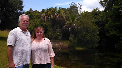
I know it may seem like it at times, but our adventures are not always about Geocaching. When we see nice locations, we usually take some time to enjoy them also. One such place was the Lanana Creek Trail. It was a nice relaxing stroll along the creek.


While driving around town grabbing caches, we noticed a statue which was a tribute to the towns country doctors over the years from back when they used to make house calls. Another statue was of Karle Wilson Baker (1878-1960), nationally acclaimed and nominated for the Pulitzer Prize for poetry.


Our next Geocache was a virtual cache for this old fort. The Stone Fort Museum is housed in a 1936 replica, built on a new site, of Don Antonio Gil Y'Barbo's stone house. Y'Barbo, the founder of present day Nacogdoches, built the stone house circa 1780 as the formal portals to the Spanish District of Texas. The original site of Y'Barbo's house, torn down in 1902, is the corner of Fredonia and Main Streets in downtown Nacogdoches. During its history, the original house served variously as a public building, grocery store, candy store, saloon, and as a temporary fortification during the Magee-Gutierrez, Dr. James Long and Fredonia Rebellion filibusters.


This next cache I'm highlighting was a puzzle cache (GC5NFZA). This one took a lot of creativity and thoughtfulness! It also drove us CRAZY trying to figure it out! We must have spent 30 minutes trying to figure out. After reading previous logs and watching a YouTube video, I finally had a clue and opened it in minutes! WOW, What a fun cache!


The last stop in town before moving on was at this old railroad train. This Shay 36-ton Locomotive was built in 1907. There was supposed to be a cache hidden there by the tree, but we didn't find any evidence of one.


After leaving Nacogdoches, we headed over towards Timpson. There were several newly placed caches that had yet to be found. However, when we finally made it over to them there was another Geocachers name at the top FTF spot. Just 3 hours earlier! Perhaps if we ran our day in the opposite direction... so while we opted for coffee first and Nacogdoches next, we missed out on FTF's. Oh well, still a good day!

Monday, February 15, 2016

2015-11-18: Geocaching Around Jasper County Texas

This morning after dropping Candy off at work in Kirbyville, I drove further north up to Jasper County, Texas. Jasper itself is a small town with only a few Geocaches around. But I took a drive up to check out an apartment and to the more rural areas of the county to go Geocaching.

After picking up one cache in town at a half vacant shopping center, I drove north on US-96. My first stop was a small neglected cemetery. A couple of secondary roads off the main highway later, and passing by the overgrown hiking trail going up the hill towards the cemetery, I finally found the entrance.

It was about a 1/4 mile hike to a small fenced area of about 10' by 20' with only one marked gravesite. Baby Girl Behannon who lived only 9 days in 1884. Getting back to the cache though, it was still further into the woods and required some bushwhacking to get to. But having done so, I was not only rewarded with finding the cache but also finding a little creek.


Several more Geocaches later and I came upon another cemetery cache. Nothing particularly historical or significant with this one, but it was a cemetery cache.


The last cache for the day was a magnetic key holder hidden about halfway down a bridge over another creek. No place to park on the bridge, so I parked down on the shoulder about 250' away and walked back. After leaning WAY over the side to reach down for the cache and signing the log, I heard dogs barking. Looking in that direction, I saw 3 dogs barking and running towards me about 500'-600' away. YIKES! Fortunately the car is in the other direction! I quickly replace the cache and sprint towards the GeoMobile. Yes! Inside the car with doors closed with maybe 100' to spare. That was close.

Enough excitement for today.

Thursday, February 11, 2016

2015-10-11: The Quest for the Apocalypse in the Ocala National Forest

Today's Geocaching adventure was planned shortly after the last hike and we couldn't have asked for better weather! The BAG+/- Group consisted of TeamFelixG, clark boys, Daykinator, saylorboys+mom and the two of us. We met up along CR-19 at Morman Branch Creek with a goal of conquering the Apocalypse caches.

But first following east, Barking Moonbat was the warm-up cache. After putting on the gear, we all headed down the short trail leading into the cool water. There were 3 of us who decided to wear knee high rubber boots based upon previous photos. Standing at the roadside looking down into the shallow waters, we thought a good choice on the rubber boots! However, it didn't take but a few steps disappearing into the woods to realize they proved worthless as recent rains made for high tide further down! It seems as the floor of the creek varies from shallow to deep and back again. And as one of the 3, I can say it didn't make any easier on the dry sections with a gallon of water in each boot. A quick find at GZ and we reversed direction back towards the Apocalypse...


Having made our way back to the cars, we continued following the creek towards the west, spending most of our time in the cool waters. We found it easier to move forward instead of bushwhacking through the brush. Which we occasionally did as the creek would twist to the right and left too far off course only to pick it back up again. Also upon crossing the dry spots, those of us with the boots would pause briefly for a yoga pose (see photos), draining the water from the boots. We arrived at Soulbait Springs for another quick cache find and getting ever closer to the Apocalypse.


The next cache along the Morman Branch Creek was called "I get by with a little help from...", Geocaching is a great example of "getting by with a little help from." Because if on days like this if we were to trek out here as individuals, where would the fun be? It's having such adventurous friends to share in the experience that's makes it all worth while. I think we are the newest members of the B.A.G. and have enjoyed each trip with our newest friends.


WE MADE IT! Our quest to conquer the "Apocalypse, When?," "Apocalypse-End," and "Paint Fiction's Apocalypse" caches was completed! We sloshed through the water, we squished through the mud almost loosing one member, we bushwhacked through the brush, we came, we found, and we conquered! Then we celebrated!


But was it really the end? Of course not! We could have backtracked along the coolness of the creek towards the cars. But been there, done that. We've seen that already. The adventure is always to press forward, to see things previously unseen. Plus there were two more caches to get. The plan was to hike all the way down to SR-40 where a rendezvous vehicle was left to take us back to Morman Creek on CR-19. However, due to time constraints of one member of the group, we were only able to grab one of the remaining two caches because they were in two different directions.

We continued bushwhacking south towards SR-40 and towards the next cache called "Outta the Boat." This cache hadn't been found in THREE YEARS! Upon arriving at ground zero, the search began. Most of the time finding an ammo can in the woods is fairly easy. However this one had three years worth of growth and decay to cover it. 

Another good reason to go Geocaching with a group of friends. Not only for the camaraderie, but for having more eyes to look! As we moved about searching and re-searching, saylorboys+mom was practically standing on top of it. Then as she moved away to search another location, I moved into where she was just looking and began poking my hiking stick into the ground when I heard a THUMP! Removing all the debris, I found the three year lonely cache!


From there is was non-stop bushwhacking through the thick palmettos, brush, and occasional briers. There was supposed to be a trail somewhere along the way to make it a little easier, but we didn't come across it until nearly reaching SR-40 and TeamFelixG's pickup truck.


Standing on a fallen tree to see if there's a trail to be found.


We made it back to the transport truck and back to civilization! After driving back around to the Morman Creek parking area, two of us had to depart and head back to Tampa. As if what we just went through the past several hours wasn't enough punishment for one day, the remaining four of us decided to drive further north to find Pat's Island Sinkhole. There was a digital souvenir available for finding an earthcache, and we each still needed one.

So we hopped into our GeoMobiles and drove a few miles north up to Forrest Road 51, then west over to the Florida Trail. There you'll find Pat's Island Trailhead. Another mile long hike through the woods and we found the sinkhole. Three of us climbed down to the bottom and got the required info needed to achieve a find, while Candy stayed up top to take our photo.

Looking down.


It was another GREAT adventure! We found and conquered the Apocalypse, experienced the great outdoors in old natural Florida, and enjoyed the fellowship of friends. I glad you stopped by to read about our adventure. Feel free to leave your comments. I look forward to hearing from you.

Friday, February 5, 2016

2015-06-06: From Weir-dos to Hiking to Climbing Trees

Today was a mix of a little bit of everything. Taking Candy's granddaughter along with us, we started out in the Dr. Phillips area having lunch at The Greek Flame restaurant. I have hidden a Geocache there on their patio and just recently someone stole the contents out of it. And next week I'm hosting another Geocaching event there.

After lunch we drove down the street by the library to grab an Earthcache about Weir Dams. Behind the library and along Dr. Phillips Rd are several Weir Dams one after another that help to slow the flow of water. We strolled along side getting the answers we needed for the cache, took some pictures, and headed back to the car.


We then headed down to St Cloud and further south on Canoe Creek Rd. The next cache was a short hike in Parker Hammocks, the Prairie Lakes Unit of the Three Lakes Wildlife Management Area.


From there we continued on Canoe Creek Rd over to US-441 south towards YeeHaw Junction. We found several more of those Puzzle / Challenge caches along the roadside and a few more traditional caches. Two of which were my favorite tree climbing caches! Makes me feel like a kid again.


I hope you are enjoying our adventures. Feel free to leave your comments. We'd love to hear from you. Until next time...

Thursday, February 4, 2016

2015-04-04: Geocaching and Roaming Around Back Country Roads

Most of the time when we decide to go Geocaching, we don't really have anyplace in particular to get to. I just sorta pick a direction and we head that way. If I see a road we've never been down before or it looks interesting, we take it. I also have the live Geocaching map open so that if there's a cache nearby, we'll head towards it. We just roam around and see where we end up.

After spending a lot of time recently going north to Ocala, this morning I decided to go southwest. We drove west down I-4 to US-27 and turned south. Reaching Davenport, I saw a cache called "Horseshoe Creek One Lane Bridge." Well that sounded interesting so we went to check it out. We found the narrow bridge, the small creek, and of course the cache.


At the end of that road was the Lake Marion Creek Wildlife Management Area where another cache was located. After parking, it was a short 0.3 mile hike to the cache. A quick find and back to the car and down the road.

From there we drove over to Old Bartow Lake Wales Rd which runs through some ranches and cow pastures. There were quite a few caches down this stretch of road so we found all those and a few more nearby before heading home. A nice drive, a short hike, 20 caches later and another great day.