Saturday, September 18, 2021

2020-03-28: Roadtrip Day 2: Driving Through Louisiana and into Mississippi on the way to Georgia

One thing I like about driving the backroads and byways on a roadtrip is that you never know what you're gonna see around the next corner. Whether it be a scenic overlook, a piece of history, or just something so crazy funny that it requires you to turn around for another look and capture it with a photo. Todays drive had something for everyone. So there's a lot to see now let's get rolling...


After waking up early in Shreveport, Louisiana and going for breakfast, I grabbed a quick urban geocache that was close by (GC7G3XD).

On the way to my next geocache, I passed this old church building. The sign out front said Antioch Baptist Church. It doesn't look like this facility has been used in many years. In preparing to write this blog post, I spent a few hours trying to research some history but kept coming up empty. I can't find anything on this old church.


So I arrive at the next geocache (GC1XVN5) which was just a simple and quick roadside cache to add a new county into the finds list. Upon arriving though and seeing the sign, I guess they take their "No Trespassing" pretty serious! I found the cache quick and got myself outta there!


After another quick roadside geocache (GC7QJ0X), I passed by these two old abandoned houses that were just slowly decaying and falling apart. I'm always curious as to what happened with these homes...


...especially this second house. It looked like it would have been a house to envy back in the day. Come to find out that it is called the Garland House. It was built in 1902 and placed on the National Register in 1994. It is a Queen Anne Revival design. This one is in great need of reviving.


Continuing eastbound on Hwy 2, the next geocache was at the Corney Creek Calaboose (GC26WWQ). A calaboose is a tiny jail. This calaboose in the town of Bernice, LA was built in 1902. The town of Bernice was established in 1899 as a sawmill town after Captain C.C. Henderson built the Arkansas Southern Railroad.


This next stop was rather sad. On the north side of Bernice is the old Mount Olive Cemetery (GC26HGV). This neglected forgotten cemetery contains between 40-50 burials dating as far back as 1860. However, I only saw less than 10 headstones in all this overgrowth. Some of the locals need to come out here and clean this cemetery up.


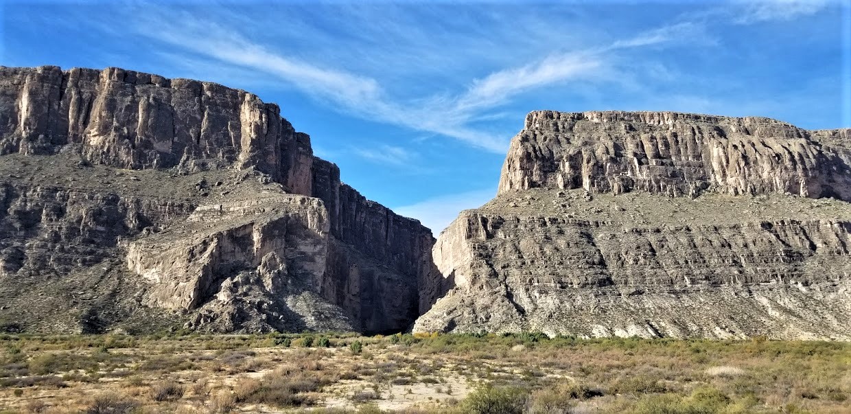
Still following State Highway 2 eastbound to pickup caches in these northern parishes, my next stop is an earthcache and a traditional cache at Elgin Springs (GC20PEP, GCJ4CV). It would have been a quick roadside stop, but I had trouble finding the traditional cache and had to DNF it. As for the earthcache, I got what I needed to answer the questions to log a find. No photos here since it really isn't much to see here. Not exactly what you picture in your mind when you think of natural springs.

To make up for the lack of photos at the springs, I was able to capture two great old car pics as an unexpected surprise. This one below of a 1920's sedan just rusting away among the trees along the highway. And the more humorous one I opened with at the top of the page.


These next two were just quick roadside park and grabs (GC73X26, GC23FEX).

Our next stop was a really cool piece of history in Oak Grove, LA. The Fiske Theatre (GC29ZM9) was first opened in April 1928 and at that time was the premier state of the art movie cinemas in Northeast Louisiana. It was owned and operated by the late Donald Fiske of Oak Grove. The Fiske Theatre was a two level cinema with a first floor that seated 500 people and a balcony that seats 250, as well as a cry room located on the back of the first floor for mothers with small children.

The Fiske Theatre was rebuilt in 1950 and relocated from just down main street to it's current location, and was operated continuously by the Fiske Family until 1987 as a first run cinema. It looks just about the same now as it did in the 1950's. In 1987 as Mr. Fiske's health began to fail him, the theatre was donated to the West Carroll Chamber of Commerce where it has been used mainly for gospel music concerts and other community events since then.


The theatre is in very good condition thanks to the hard work of the chamber volunteers and numerous grants for upkeep from the Louisiana State Legislature. After a two-month renovation period in the fall of 2008, the Fiske Theatre returned as a first run movie theatre on December 15, 2008 with a showing of "Fireproof". The theater is run by volunteers who share a passion for the preservation of this historic movie theater. Any proceeds go to the upkeep of this terrific piece of Americana. At the time of our visit to the Fiske Theatre was closed as the pandemic was just beginning to spread.

Next up was a geocache at the Cotton Museum (GC1CN8D). The Louisiana State Cotton Museum in Lake Providence provides a great introduction to one of Louisiana’s major agricultural crops, and certainly the one for which the Delta area is best known. Its main gallery features an extensive set of interpretive exhibits, including life-sized dioramas, farming equipment, a re-created juke joint and more, all packed into a replica gin house (where cotton fiber was ginned, or separated from the seed).


Also on the grounds of the museum is an impressive array of old plantation buildings, such as a sharecropper’s cabin, a schoolhouse, and a small chapel. And of course an old outhouse where the cache was hidden inside the business deposit area.


One more quick roadside geocache in the town of Transylvania (GC1CN8Z) along with the above museum are two caches for the East Carroll Parish completing the northern counties in Louisiana.


Now we face the Mississippi River and need to cross over. Most would go south to I-20 and cross over into Vicksburg. Been there, done that, and already have those counties. So I turn north into Arkansas. I stop for two quick geocaches along US-65 for Chicot County (GC2QTFTGC2R0NT). Then took US-278 to cross the great river.

Passing through Greenville, Mississippi, I spotted this riverboat and stopped for a quick photo.


The next few stops were part of the Mississippi Blues Trail. In the small town of Holly Ridge you'll find the final resting place of three bluesmen (GC15CJ1). Charley Patton (1891 - 1934) was the most influencing figure in the pioneering era of the Delta Blues. He helped define not only the musical genre but also the image and lifestyle of the rambling Mississippi bluesman. He roamed the Delta using Dockery as his most recent base, and lived his final year in Holly Ridge. Patton and blues singers Willie James Foster (1921 - 2000) and Asie Payton (1937 - 1997) are buried in the Holly Ridge Cemetery.

In the next town of Indianola, MS, I found the B.B. King Corner (GC4MZKG). It was on this corner, when Riley B. King was just a young man of 17, that locals first heard the musician destined to become the "King of the Blues." On June 6, 1980, BB King placed his handprints and signature here in the sidewalk to the left of the guitar.


Our last geocache of the day was at the Indianola City Cemetery (GC30XD5). This is a large well maintained cemetery with over 3,000 interments.


We ended the day in Greenwood, MS, a little more than 300 miles after we started. I picked up some new counties and parishes to fill the map. And we saw a lot of great roadside attractions, planned and a few surprises too. Tomorrow is another day and we still have a long way to go and a lot to see. I hope you come back and join us. See ya next time...

To follow along on our travels and keep up with my latest blogs, you may do so here of course. But also by using you favorite of these social media platforms: FacebookMeWeGabRedditParlorTwitter, and Instagram. These all link directly to my profile. Again, please feel free to comment and / or share.

Saturday, September 11, 2021

2020-03-27: Roadtrip Day 1: Driving Through Texas on the Way to Georgia

ROADTRIP!! Well my part of the project in West Texas is completed and it is time to move on to the next! And that begins our roadtrip to Georgia. Now if you follow Google Maps you'll be taking I-10 all the way across for a quicker yet boring drive. Where's the fun in that? We'll be taking the backroads, the US highways and byways, finding geocaches, exploring history and discovering cool places. So as the song goes: "Eastbound and down, loaded up and...", well we're not truckin' but definitely got the GeoJeep loaded up and packed full. So let's hit the road and see where it takes us.

Day #1 of our roadtrip has us leaving McCamey, Texas on this Friday morning and first stopping in Killeen. There we unload and reload the Jeep trying to figure out what we might need to bring to the east coast. We'll be doing some work in Georgia before starting a new project in Florida. Packing the Jeep with as much as we can fit into it, we get back on the road. I'd like to at least make it out of Texas by the end of the day.

Taking I-35 north, our first geocaching stop was in Waco at the Greenwood Cemetery (GCTE6D, GC68NMY). It was an older cemetery dating back to 1875. One of those interned here is Jules Bledsoe. Born in 1899 and a native of Waco, he was a baritone singer and one of the first black performers on Broadway. He is best known for his song "Old Man River" from the musical "Showboat."

Leaving Waco, we got off the Interstate and onto the backroads of Highway 31 eastbound over to Tyler, TX. There we made a stop at the Rose Hill Cemetery for two more geocaches (GCW154, GC79EF). Two of the headstones that caught my attention were this giant sized piano for an obvious aficionado of the ivory keys. The other I found to be ironic was a simple small cross with no other words except for Big Daddy.


From there we drove up US-271 to Gladewater, TX. While there we stopped for a few geocaches, the first being a virtual at the Veterans Memorial (GCJ0XJ). On the wall next to the memorial was this mural painted on the building. I am assuming that it represents a kinda history of the town. Just not sure about the red-masked Captain America / Scarecrow looking character though.


On the way to our next cache in town, we passed by this beautiful house with a historical marker out front. The house belonged to a Dr. E.L. and Nanny Walker who came from Tennessee to visit E.L.'s brother here in Gladewater in the 1890's and decided to stay. He opened a medical practice and drugstore and purchased this site in 1895. This home was completed sometime prior to 1910.

The Walker House with it's main body constructed of concrete blocks is neoclassical in design, with a symmetrical facade, pronounced 2-story portico, ionic columns, five-bay front and pedimented dormer window. The three-story structure also has two concrete basements. Initially intended for use as an infirmary, the third floor space served as an attic with access to a rooftop widow's walk. Original features included ten fireplaces, a two-floor elevator, and fifteen rooms. Changes over the years included additional rooms and the removal of the elevator during the WWII scrap metal drive. The house remained in the family until 1969.


Another of the Gladewater's geocaches brought us to an area highlighting the areas oil discoveries (GC3NJH5). Another historical marker at this site reads: "On April 7, 1931, this wildcat well drilled by Selby Oil and Gas Co. of Tulsa, OK, came in at 1000 barrels an hour. Located in the Sabine River Bottom a mile south of town, it connected Gladewater to the vast East Texas oil field stretching from Longview to Kilgore. Royalty owners were the Snavely family of Martinsville, IL. Headed by Judge Herschel Snavely, nine relatives came to watch the drilling. L.C. Snavely acquired interest in this land when several Illinois investors underwrote the sawmill and lumber operation of James Moore who in 1906 bought 42,000 acres for $20,000 and moved his enterprise to Gladewater by train. Moore's mill was destroyed in 1913 by a boiler explosion. In 1914 he surveyed and divided the land into equal sections. Investors drew lots to determine their parcels. Oil was discovered under the entire 4200 acre tract. Texaco operated the well from 1938 until its shutdown in 1957. Texaco closed its local office in 1987 after 54 years in Gladewater, and donated this pumping unit from the Texaco-Snavely 'A' Lease #1. The original derrick was wooden."


Gladewater is also known as the Antique Capital of East Texas. One of the antique shops in town looks kinda "antique-ish" itself!


And for the last geocache in town, I went to the Rosedale Cemetery (GC2208R). After finding the cache, I did spot this rather interesting headstone. I guess after the oil dries up, so does all the easy money.


We finished the day by driving over to Shreveport, Louisiana and checking into a hotel. After just over 600 miles of driving, it was time to call it a day.

To follow along on our travels and keep up with my latest blogs, you may do so here of course. But also by using you favorite of these social media platforms: FacebookMeWeGabRedditParlorTwitter, and Instagram. These all link directly to my profile. Again, please feel free to comment and / or share.

Sunday, September 5, 2021

2020-02-23: Jeeping along the James River Road in Mason County Texas

Welcome back friends. Today's adventure is a little bit different than most of my others. There were no geocaches to be found today. I had first seen this video about a year ago of some Jeeps driving through and across the James River and it looked pretty cool. I had forgotten about it until recently. Realizing that we'll probably be leaving Texas for the east coast soon, I looked it up again to try and figure our exactly where it was to drive the trail ourselves. So hop on in the GeoJeep and let's ride some backroads, gravel roads, dirt roads and some water crossings down the James River Road.


The James River flows from the James River Spring, 4½ miles southeast of the ghost town of Noxville in southeastern Kimble County and runs northeast for 36½ miles to its mouth on the Llano River, six miles south of Mason in Mason County. In 1860, Wiles Joy and Lafe McDonald became the first White settlers on the James River. Sometime in the early 1900's the Noxville post office moved to the James River from the Little Devils River.


The James River Road closely parallels the river along the north half but then eventually splits off and separates as it goes south. But not before it crisscrosses over a couple of times. That's where it gets fun for the high clearance off highway vehicle owners who don't mind getting a bit dirty!


And the more rain you get, the more mud there is to play in!


So from the town of Mason, take US-87 south for a short way before turning south on 1723. After a few miles make another right onto 2389. Follow it down until you pass the Llano River, then look for the James River Road turnoff on the right shortly thereafter. Most of the drive is like any other dirt/gravel road, but there are some low water crossings and scenic spots too.


On this day that we drove through here, along with the water crossings, there were also some dry swales too which was kinda odd. But it just added to the various scenes and types of terrain.


Seeing these mini caves and erosion holes in the swale walls above, I thought they'd be some great hiding spots for a geocache. This would test the geocacher to see who's brave enough to reach inside and grab the container.


After an hour or so, we finally arrived at the major crossing of the James River. I've crossed some small creeks before, but none this wide. From inside the Jeep, crossing the river was pretty cool. Once on the other side, I dropped Candy off and drove back across. I wanted her to get a video of the GeoJeep crossing the river. Watching the video afterwards, it doesn't look all that spectacular. The video I had seen a while back was taken from a drone so you're looking down on all the water with the Jeeps crossing over. I guess I need to get a drone for the next time.


After the wider crossing of the river, the road got a bit rockier as we continued south which made for slower traveling. And since the road turned away from the James River, that was the last of the water crossings.


After about four hours on the river road, we eventually made it out and back to the main roads eventually reaching the highway. We still had a few hours getting back to McCamey in West Texas.


It was a fun day out exploring the backroads. Hopefully by sharing this story with you I've made it interesting enough that now it's on your bucket list of places to visit if you're ever in Mason County, Texas.

To follow along on our travels and keep up with my latest blogs, you may do so here of course. But also by using you favorite of these social media platforms: FacebookMeWeGabRedditParlorTwitter, and Instagram. These all link directly to my profile. Again, please feel free to comment and / or share.

Saturday, August 28, 2021

2019-12-28: Spending the Day in Big Bend National Park

It's been 13 years since I was last here at Big Bend National Park in West Texas. Spending the last few years just a few hours north of here, I figured it was about time I paid another visit. We spent two nights in Alpine, TX as our base so we could get here early, stay all day, and not have a long drive home afterwards. Big Bend NP is over 1200 square miles and that's a lot to explore and see. So let's get going!


We arrived just after dawn to a cloudy morning which kinda hindered having some great sunrise photos. Our first geocache was an earthcache called "Fins of Fire" (GC3AZVV) facing the Chisos Mountains to the east, describing the layers and spikes and the creation of the mountains from volcanic activity.


Continuing the beautiful route down the Ross Maxwell Scenic Drive, we arrived at the Solol Vista Overlook and another earthcache (GC2NJRH). The amazing views here are awe inspiring. And from this vantage point we barely get a glimpse of our destination Santa Elena Canyon some fourteen miles in the distance. From here though it's just a tiny notch in the mesa across the valley.


In the panoramic photo below taken from the Sotol Overlook, from left to right are: Trap Mountain, Goat Mountain, Santa Elena Canyon, Kit Mountain, across the valley to Tule Mountain, Burro Mesa, Little Christmas Mountain, and Christmas Mountain.


After the overlook, we stopped at Tuff Canyon for another earthcache (GC72D1C). Tuff Canyon is the deepest of the dry washes in Big Bend NP. This also makes it very dangerous during or after a rain as the gathering waters pick up velocity and can cause a flash flood rushing between the canyon walls. Over time the rushing waters slowly dig a deeper channel while at the same time eroding and smoothing the layered rock walls.


The mountains and cliff walls are plentiful. Just driving the roads, you won't even need to get out of your car to be amazed at the views.


Now we get to the Santa Elena Canyon observation area (GC37ECH). The Santa Elena Canyon is one of the most famous landmarks within Big Bend National Park. Looking from the overlook area, that's the United States on the right, Mexico on the left, and the shallow Rio Grande River flowing up through the middle and curving to the left. A lot of people stop there to get their photos. However if you keep following the road around, it will take you down to the entrance, or should I say the exit.


Where the Rio Grande exits the canyon, there's the Santa Elena Canyon Trailhead. The Terlingua Creek drains into the Rio Grande River just as it exits the canyon. You can see it in the next photo coming in from the left. Most of the time the water level is low enough and you can easily walk across rocks without getting wet. Once you cross over and climb the short hill you enter the trailhead that has been paved creating an easy hike with stairs and switchbacks up 160 feet to the point from which I took the photo.


Once you make the short hike up and over at the trailhead, you make your way down the trail into the cool canyon. Because of the 1500 feet canyon walls that seem to raise up forever, they block out the sun except for the short time it is directly overhead. We continued our hike down and back to see how far we could go. Officially it's a 1.5 mile out and back hiking trail.


At this point, we came to the end of the trail. This is about as far as you can hike without getting wet. Now I was wanting a kayak so I could keep going to see what's around the corner. One of these days I just might do that.


Backing up a little ways there's this huge rock that had fallen near the edge of the bank of the Rio Grande. I talked Candy into climbing out on the rock with me and handed my phone to another hiker to take our photo. I think this turned out much better than trying to take a selfie and still get the full canyon effect.


Having made our way back in the GeoJeep, it was time to hit some of the offroad trails. First we drove back up the Ross Maxwell Scenic Drive and looped around over to the Panther Junction Visitors Center. This time we finally bought one of those National Park Passport books that you get stamped each time you visit a national park or historical site.

From there we made our way down to Glenn Springs Road. It's a gravel road that even a regular car can make it through, see the first pic at the top of the blog. There might be some parts that may be a little rough, but I'd drive down most of it if I still had the Prius and the turn around if I got to an impassible section.

After several miles it turns into Black Gap Road as it nears the spring. There it does become a rougher section that really requires high clearance vehicle. Just past the Glenn Spring primitive campsite I found my next virtual geocache (GCR2A8). The U.S. Calvary once used this location for a few years. If you look hard enough you can still find parts of the foundations of some of the buildings. At the top of the nearby hill you'll find some scattered wooden crosses for the cemetery. To get credit for finding the virtual cache you need to email the number of crosses. The Find-A-Grave website only lists five memorials here. If you use that number you won't have the correct number as there are more than that. And not having any names on the wooden crosses, they are known only to God.


Another hour or so of offroad fun in the GeoJeep and we make our way to the exit roads and back up to Alpine, Texas. It wasn't until later that I realized the Black Gap Road was one of the trails in the Jeep Badge of Honor series. If I had used the BoH app to check in from the trail, I could have gotten my first badge. Oh well, I guess that's a good excuse to have to come back and explore some more of the Big Bend National Park. There is still much to see out here that I haven't gotten to yet. And I recommend this place to be put on your bucket list one day. Just try to avoid summer as the temps are easily in the triple digits!

To follow along on our travels and keep up with my latest blogs, you may do so here of course. But also by using you favorite of these social media platforms: FacebookMeWeGabRedditParlorTwitter, and Instagram. These all link directly to my profile. Again, please feel free to comment and / or share.

Saturday, August 21, 2021

2019-12-24: Visiting the Iwo Jima Monument... in South Texas?

Hey everybody! Well this is a short and sweet blog post. I had some personal business to take care of way down in South Texas in a town called Harlingen, not too far from the southern tip near Mexico. I did want to highlight a couple of places here though. I bet you're probably wondering about this first photo though. Why are you using the Iwo Jima statue pic in a blog about south Texas? Because the original... well I'll get to that in a minute. We haven't left the hotel yet this morning!


So when making reservations on South Padre Island, the "ocean front" rooms were all booked. OK, so second best thing is the "ocean view" rooms. When we arrived last night it was already dark and couldn't tell the difference. This morning I look out and really? Ummm really? Where's the water? Maybe if it rained hard and the parking lot next door flooded! Oh well, just stayed the night anyway. Gotta take care of business and hit the road.


Down the block, I saw this gift shop and just had to pull in for a photo opp with the GeoJeep! Saw something similar in Myrtle Beach, SC and backed the Jeep up into the mouth. This place was open already so I decided not to.


After the quick personal business stop in Harlingen and breakfast at IHOP, we drove over to the Marine Military Academy near the Valley International Airport for two great geocaches. The first was a traditional cache hidden under a tank-like "Expeditionary Fighting Vehicle" (GCMT90). I was so focused on the main attraction, that I forgot to get a pic of it!

The Iwo Jima Monument located in Washington D.C. wasn't the original monument. On Feb 19, 1945, Marines invaded the island of Iwo Jima, a Japanese stronghold in the Pacific. Two days later, Marines reached the top of Mount Suribachi and a small American flag was raised. Later, on the same day, a larger flag was raised by six Marines. Associated Press photographer Joe Rosenthal captured that flag raising on film. A few days later it was published in Sunday papers across America. Sculptor Dr. Felix W. de Weldon, then on duty with the U.S. Navy, saw the photo and constructed a small scale model within 48 hours.


After the war, Dr. de Weldon worked for 9.5 years to create a full size model from molding plaster. The survivors of the flag raising posed for the artist to create their faces. Photos and physical descriptions of the three who gave their lives were used in modeling their faces.

Once completed in plaster, the statue was disassembled and shipped to Brooklyn, N.Y. to be cast in bronze. It took 3 years for the casting process. The bronze parts were then shipped to Washington D.C. for erection in Arlington National Cemetery. The plaster working model was shipped to Dr. de Weldon's studio in Newport, R.I. The U.S. Marine Corps War Memorial was dedicated on Nov. 10, 1954.


In October 1981, after much consideration, Dr. de Weldon gifted the original working plaster model to the Marine Military Academy in Harlingen, TX. This site selection included: 1. Fairly consistant temperature and humidity for preservation of the molding-plaster figures. 2. The street facing the memorial was named Iwo Jima Boulevard in 1965. 3. The MMA is the only place outside of Washington D.C., where proper honors are rendered with battalion-size dress blue parades. 4. The Marine placing the flagpole into the ground was a native of the area, Cpl Harlin H. Block. Block's gravesite resides directly behind the monument. Cpl Block was killed during continued fighting on Iwo Jima only a few days after the flag raising. .

The Iwo Jima Monument was dedicated April 16, 1982 on the MMA Parade Ground. It is coated with fiberglass for weather protection. And now it is also a virtual geocache 
 (GC7B6ED).

From there it was a long 6 hour drive back to Killeen, Texas so Candy can spend Christmas Eve and morning with her grandkids. Then later Christmas Day driving to McCamey in West Texas for work on Thursday. I'm exhausted! I need to go back to work to get some rest! See ya next time...

To follow along on our travels and keep up with my latest blogs, you may do so here of course. But also by using you favorite of these social media platforms: FacebookMeWeGabRedditParlorTwitter, and Instagram. These all link directly to my profile. Again, please feel free to comment and / or share.