Showing posts with label Indians. Show all posts

Tuesday, November 24, 2020

2019-03-08: A Packed Geocaching Roadtrip Returning from Minnesota to Texas: Day 2 in MN, SD, NE, and KS

Hey everyone! I'm glad you made it back to check in on our progress. If you're just joining us, I had a fly in / fly out business trip and turned it into a week long geocaching roadtrip! I recruited my friend and fellow geocacher CuteLittleFuzzyMonkey (CLFM) to go along for the ride. He also did the cache planning and route navigating for the trip.

To catch up to where we are now:
Day 1: Texas to Minnesota in TX & OK
Day 2: Texas to Minnesota in OK, KS, & MO
Day 3: Texas to Minnesota in NE, IA, & MN
Day 1: Minnesota to Texas still in MN

So today we started out in Saint Cloud, Minnesota. Checking out of the hotel at sunrise, our first stop was the parking lot to grab a simple LPC (GC62YJN).

Driving southbound, we stopped in Willmar, MN for our next cache to claim a find in Kandiyohi County. It was the Point Lake Travel Bug Hotel geocache (GCXZ87). This was one cache that I'm glad we're here in the winter with sub-freezing temperatures. While the geocache was hidden among the trees on the bank of the lake, the lake itself was frozen over with ice and snow! Being a Floridian / Texan, this was finally an opportunity to "walk on water." We took turns walking out onto the frozen lake and taking a photo.


Next up was a quick park & grab geocache (GC7AEPM) in Clara City, MN to claim a find in Chippewa County.

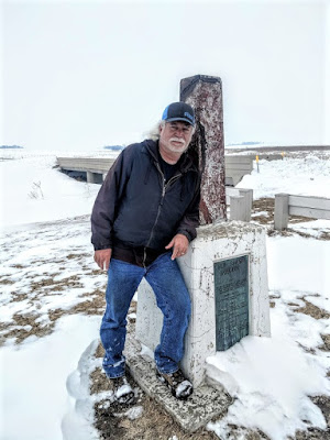
Then there was the Tri-State tri-corner virtual geocache (GC8809). Even though this monument sits on the corner of Minnesota, South Dakota, and Iowa, technically the coordinates are in South Dakota. This was my second tri-state cache in already this year! This one was much colder. Stepping out from the warm GeoJeep, I didn't feel like putting my heavy jacket back on. There was also a traditional cache placed there as well (GC41H35). So it was a 2fer location!


Our next geocache and another virtual (GCFBF1) was along US-18 on the eastside of Canton, SD. There are three roadside historical markers concerning this area. The one the cache focuses on was about the Norwegian immigrants and skiing. Since I don't want to give away the answers, I'll tell you what one of the other historical markers says: The Hiawatha Asylum For Insane Indians.

"Receiving Congressional appropriations in 1899, the Hiawatha Asylum for Insane Indians was the second federal mental hospital and the first dedicated to American Indians. The first patient arrived in 1902, and through 1934, more than 370 patients –ages two to eighty, from fifty tribes nationwide – lived here. Patients did domestic and agricultural work onsite, were occasionally shown to paying visitors, and underwent treatment with methods later deemed outdated and dehumanizing. From 1929 to 1933, federal inspectors found intolerable conditions, inadequate staffing, several sane patients kept by force, and numerous other abuses. In 1933, John Collier, the newly appointed Commissioner of Indian Affairs, ordered the asylum closed. G. J. Moen, with the Canton Chamber of Commerce, filed an injunction to keep the asylum open, but it was overturned in federal court. Many patients were discharged and those who still needed care were sent to St. Elizabeth’s Hospital, Washington, D.C. The major buildings used by the asylum have since been demolished. The Hiawatha Asylum cemetery, where at least 121 patients were buried in unmarked graves, is located between the 4th and 5th fairways of the Hiawatha Golf Club. In 1998, the cemetery was listed in the National Register of Historic Places.

Making our way down to Lincoln, Nebraska, our next two virtual geocaches (GCC963, GCB88C) were located at the Wyuka Cemetery. One cache was to recognize Albert Gordon MacRae (1921 – 1986) was an American actor, singer and radio / television host, who appeared in the film versions of two Rodgers and Hammerstein musicals, Oklahoma!

The other virtual was for an infamous 1950's serial killer. Inspiring the films "The Sadist" (1963), "Badlands" (1973), "Kalifornia" (1993), "Natural Born Killers" (1994), and "Starkweather" (2004). "A Case Study of Two Savages," a 1962 episode of the TV series Naked City, was also inspired by the Starkweather killings. More recently a "Criminal Minds" episode portrayed a newlywed killing spree very similar to the crimes of 19 year old Starkweather and his 14 year old girlfriend Fugate.

Also in Lincoln, NE was another virtual cache at the Lincoln Children's Zoo (GCGJQ1). The cache is highlights the Dakota Age Sandstone which is said to be 130 million years old.

South of Lincoln out in very rural Odell, NE is our next virtual geocache called "Oketo Cut Off" (GC8CCE). I'll give you much of the description from the historical marker without giving away the answers for the cache. During the 1860's, stagecoaches passed near here along the Oketo Cutoff. The cutoff diverged from the Ft Leavenworth to Ft Kearney Military Road northeast of Marysville, Kansas angled northwest to cross the Big Blue River near Oketo, KS and passed through the Otoe Indian Reservation just south of Odell. The cutoff rejoined the main trail between Steele City and Dillar, NE.

The stagecoach company owner, who had the government contract to carry mail and passengers from the Missouri River to California, ordered the cutoff laid out producing a shorter, better road and bypassing Marysville after the town refused to improve the Military Road. Although his coaches used the Oketo cutoff, freighters and other travelers continued to follow the Military Road which had been popular since the 1840's. After only a few months he abandoned the cutoff.

This metal sculpture was there along with the historical marker to recognize this historical trail. Kinda hard to see as it was already dark by the time we arrived.


Well it's late and it's dark out. However even if we wanted to call it a day and stop geocaching, we're out in the middle of nowhere and there's no hotel to be found anyway! So we keep going and have now dropped down into Kansas.

Just north of Concordia, KS, is our next target at the "Kansas POW Camp" virtual cache (GC4CAF). During World War II, 300,000 German Prisoners of War were interred in the United States. Three larger camps were located in Kansas, near Salina (Camp Phillips), at Fort Riley, and just outside Concordia, Kansas. Construction of Camp Concordia began in February, 1943 and the POW camp was turned over to the US Army on May 1, 1943. At its peak Camp Concordia had 4,027 Prisoners, over 800 soldiers and 179 civilian Employees.

Camp Concordia had 304 buildings including a 177 bed hospital, fire department, warehouses, cold storage, and officers club, and barracks, mess halls & administrative buildings for both the German POWs and American soldiers. All of the prisoners at Camp Concordia were members of the German Army. Most were captured in Africa, and the first POWs came from Rommel's Afrika Korps. Only the enlisted POWs worked, most of them on farms, but some worked on the railroad or in the ice plant.

Camp Concordia officially closed on November 8, 1945. Many of the buildings were torn down and others were moved. Some are still serving as homes in Concordia. The only structures remaining at the original location are Guard Post 20, a ware house, some stone walls, the officers club, a few foundations, and the tower which once supported a 100,000 gallon water tank. A two story stone guard tower has been reconstructed and pictured below.


There was one more virtual geocache we got that night before calling it quits. It was for the "Boston Corbett Dugout" (GCFF36). Along this rural Kansas road you will find a small monument which has been erected as a historical marker near the location of a Dugout once owned by Boston Corbett. Boston Corbett was an Army Sergeant who was with a detachment of soldiers searching for John Wilkes Booth. When they caught up with Booth, Corbett was credited and later discharged from the Army for the shot that killed Booth. It seems that Corbett made a spectacular shot through a crack in some barn siding, however Corbett was discharged for failing to follow orders in the shooting.

After being discharged, Corbett homesteaded in Kansas and made this dugout his home for awhile. The eccentric man had a run in with the local sheriff (after showing some local children the business end of his pistol) and through some sympathetic friends he landed a job at the state capital. After an incident where he displayed his 38 at the capital he was sent to the state insane asylum, which he quickly escaped from. He made his way to a friends house and was last seen jumping a train. There is no record of what happened to him after that.

Now getting to and from this last geocache was an adventure of its own! This rural Kansas farmland dirt road was now slushy mud with the melting snow. We were in 4x4 mode for several miles slipping and sliding. It was pitch black with no lights anywhere in site on the horizon. We had limited cell phone service and running low on gas. All we could see was the path before us from the headlights. I was doing my best to stay down the center of the road cause I wasn't sure if under the clean snow on the sides was a ditch. I knew that for the most part, my tires were spinning faster than we were moving! Traction was coming and going at best. I just knew that as long as I was moving forward, I did NOT want to ease off the gas.

After about 20-30 minutes at a slow pace, we finally made it out to a paved road. Now we can finally stop worrying about get stranded out in the middle of nowhere! We made our way to US-24 and followed it to Clay Center, KS. There we finally found a gas station and was able to take a look at the Jeep. I thought it would be covered in mud more than it was. I guess being the wet slushed snow blew off the last 15 or miles.


Still no hotel worth staying at, we continued east over to Manhattan, Kansas. There we were able to find a decent place to finally call it a day about 11 PM, a LONGGGGGG DAY!

Come back tomorrow and see how far we get. Do we make it back home to Texas or not? What other sights to we bring to you? You'll just have to wait and see.

There are new ways to follow me. Follow the blog directly by using buttons on the right of your computer screen. Or through various social media platforms:  FacebookMeWeParlerGabTwitterInstagramMAGAbook, and Reddit. Follow us on any or all of these platforms and whichever you choose, please leave your comments. We'd love to hear from you and it encourages us to continue sharing our adventures.

Monday, September 7, 2020

2018-09-11: A New Country, the Twin Towers, and Ghost Towns Along the Rio Grande in South Texas

Hello again and welcome back to another edition of AwayWeGo's Geocaching Adventures. AwayWeGo.US is my geocaching name which I have been using since 2006.

Today's adventure is due to an overnight and early morning rain in the Rio Grande Valley. This made for some muddy conditions at work. And when working outdoors in construction building a wind farm, that means a day off. But makes for a great day to go Geocaching and exploring!

Having never been to Mexico before, this would be the perfect opportunity to grab a geocache across the border to achieve my fifth country. And on this September 11th day, I have the perfect "twin tower" cache in mind.


But let's not get ahead of myself. I started out in the small community where I was staying. Falcon, Texas was moved from an original Falcon at the junction of Medio Creek and the Rio Grande in southeast Zapata County during the flood in August 1953, which was caused by the completion of Falcon Dam in December 1952.

Settlers had been brought to the area by Col. José de Escandón in the 1750's. The Spanish crown set the land aside for the colonists of Revilla, known as Guerrero, after Mexican independence. In the mid-1700's the king of Spain granted 6,123 acres to José Clemente Gutiérrez, who later sold the land to José Clemente Ramírez. In 1780 Ramírez married Margarita de la Garza Falcón, thus uniting two of the area's most distinguished families, and moved to the old site of Falcón. The place was called Ramireño de Abajo. In the early 1900's Ildefonso Ramírez opened a general store there.

In 1915 a post office was established, and the village changed its name to Falcon, in honor of the wife of the founder. This was done because there was already a post office a few miles away called Ramireño, at Ramireño de Arriba, and the post office needed a different name. Old Falcon had 4.01 acres in common riverfront and 12.27 acres in its town tract. The government offered to move the settlement of families to Zapata, the county seat, where good schools, parks, water, sewage disposal, and paved and curbed streets would be available; but the families, whose ancestors had come to the area, settled it and opted to keep their site.

The government closed the dam before paying for the land and improvements, figuring they had several years before the water would rise—there had been six years of drought. The water suddenly rose after four days of rain starting on August 23, 1953, and on August 28 the 450 families of Lopeño and Falcon were hurriedly evacuated in a pouring rain. By the day's end, only the church steeple, a few windmills, and the tops of a few houses showed above the muddy reservoir. Residents of the inundated communities left behind furniture, clothing, toys, even pets. Some walked rather than accept rides from the hated commission that had built the dam and driven them from their 200-year-old settlements. Later, the government refused to pay them the full price for their homes and belongings because they were no longer usable.

The government had also picked out a common site for all of the local cemeteries, but all of the villages affected by Falcon Dam voted to buy their own separate sites. A total of 162 graves was moved from the old Falcon cemetery, only ten of them unidentified. The cemetery today has over 300 permanent residents. There wasn't a geocache here yet, so I hid one myself (GC7XMCW).


Six miles to the north is the new town of Lopeño. It replaced old Lopeño and four other small farming and ranching communities - San Pedro, San José, Santa Fé and El Tigre. Lopeño is named for Antonio López, husband of Doña Ysabel María Sánchez, to whom a 6,366-acre land grant, named Señor San José, was given by the king of Spain on July 16, 1767.

During the early 1800's a parcel of this grant passed to the Ramírez family, founders of Falcon. In 1821 Benito Ramírez constructed a combination home, fort, and chapel, known later as Fort Lopeño, which stood until covered by the waters of Falcon Lake. It was built at the Lopeño crossing of the Rio Grande. There was also a famous shrine in front of his El Tigre Ranch well, where local residents drew water, and worshiped before the Señor San José Church was built in Lopeño. The shrine, dedicated to Our Lady of Guadalupe, was artistically cut from limestone, with beautifully carved hands and feet, delicate features, and a chaplet encircling the crown.

Company K, Fifth United States Infantry regiment, maintained Camp Lopeño there for twelve days ending May 10, 1856, before returning to Ringgold Barracks, Rio Grande City, during the Cortina War. Serafín Benavides established a store at Lopeño in the early 1900's, the only supply point in the area at the time. Andrés Serna carried the mail by horseback from Zapata to Lopeño from 1900 until his death in 1908; he had a keen mind, but could not read. Before starting his route, he would have the names and destinations read to him, and would sort them in order, never making a mistake in his delivery.

When the original Lopeño was about to be moved, the International Boundary and Water Commission wanted all the displaced communities to move their cemeteries to a single location at U.S. 83 and Farm Road 496, but the residents insisted on separate cemeteries. They mapped out their graveyards and identified 1,501 of the 1,753 burial sites; Lopeño had 207 burials, thirty-eight of which remained unidentified. The new community and cemetery are located on a 6,525-acre tract of land first granted in 1767 to María Josepha Guerra. I hid a geocache there also since it didn't have one either (GC7XMFN).


Continuing north on US-83, I arrived in the town of Zapata. Zapata dates to Spanish land grants that go back to 1767. When the first settlers crossed the Rio Grande the town was called Habitacion. Then Carrizo, then Bellville after Governor Peter Bell. Finally the permanent name of Zapata was authorized to honor Col. Antonio Zapata, one of the founders of the Republic of the Rio Grande. In the early 1850's, two military posts, Camp Drum and Camp Harney, were located at Zapata to combat border disturbances and prevent Indian attacks. The population of Zapata increased suddenly when people from Guerrero crossed the river to escape the Mexican Revolution. In 1953, Zapata was another border town that moved to higher ground when Falcon Dam was built.

I found my next geocache at the Mertens Frontier Ranch Store and Museum (GCZRE6). It was an interesting looking gift shop. Couldn't go inside though since it was closed. Maybe next time...


Next was a quick roadside cache in Ramirez (GC20ZBK). Originally it was two miles south of its current site on the banks of the Rio Grande. The property was granted to José Luis Ramírez in 1784 by the king of Spain. It was not assigned in 1767, when most of the Revilla grants were made, because incursions of Comanche Indians made the area uninhabitable. Ramírez and his wife, María Bacilia Martínez, lived with their family in Revilla (Old Guerrero) until 1810, when they built a house of native hand-cut sandstone on their property across the river. The building stood until it was submerged by the Falcon Lake Reservoir in 1953.

The town of San Ygnacio was settled in 1830 - making it the oldest town in Zapata County. The San Ygnacio area was in the 18th century part of a large Spanish colonial land grant, extending on both sides of the Rio Grande. Early ranchos were established on the south bank of the Rio Grande, one of which, called Revilla (and later supplanted by present-day Guerrero), was across the river from the site of San Ygnacio. Jesus Treviño, a wealthy landowner from Revilla, purchased acreage on the north bank of the Rio Grande, and built a single-chamber stone structure in 1830, which is the oldest surviving portion of the rancho. This structure was probably not a permanent habitation, but was likely intended as shelter from the elements and Native American attacks. Treviño's son-in-law, Blas Maria Uribe, added to this structure in building campaigns between 1851 and 1871, which transformed it into the compound seen today. One of its features is a native stone made into a polished sundial and set into the north wall of the fort. It was named for the patron saint of Guerrero, Saint Ignatius Loyola.

There wasn't a geocache yet hidden in this town. So I visited the Blas Maria Uribe Cementerio where he was the second person to be buried here on April 24, 1895. The cache I hid there is GC7XMGN.


Confederate troops fought followers of Juan Cortina here during the Civil War. In 1890 revolutionaries against the regime of Porfirio Díaz led raids into Mexico from San Ygnacio. In June of 1916, troops of President Carranza crossed the border and engaged a U. S. Cavalry unit stationed there. During the early 1900's San Ygnacio had a post office, several stores, a drugstore and remained a commercial center for the region. The population in 1908 was just under 200 persons. It doubled by 1931 but decreased back to 225 by the end of WWII. San Ygnacio was used (like Roma) for scenes in the 1951 movie Viva Zapata with Marlon Brandon in the title role.

Driving down US-83 back towards the dam at Falcon Lake, I stop for 3 more geocaches at the county and state parks (GC1836V, GC3XEHA, GC3XEH5). Now off to the dam and my first cache in Mexico.

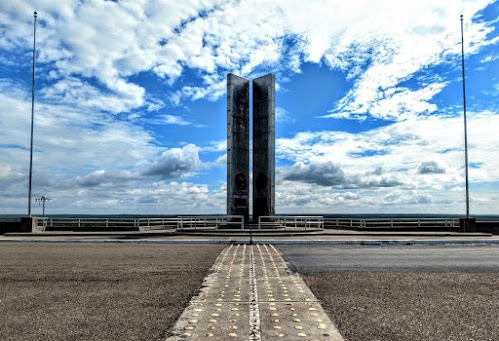
I was still a bit nervous about going across the dam over into Mexico. From what I had looked up it seemed like it would be a fairly easy adventure out to the memorial and back. But the fact that I didn't have a passport, just my drivers license, and the fact that it was the most dangerous section of the border with illegal crossings and drug trafficking, kept me hesitant.

Since my anxieties were already high, I skipped the first cache there by the U.S. Border Patrol and Immigration checkpoint. Not being a very busy crossing, I felt as though they'd all be watching me as I'm wandering around looking for some hidden object.

I drove to the gate and was stopped by a green uniformed Border Patrol agent. Explaining that I didn't have a passport, just my Florida drivers license, and that all I wanted to do was go halfway across the dam to take pictures of the memorial and the views... the big question... WOULD THEY LET ME BACK IN! He just kinda grinned and said that "he had no problem with it. But the guys in blue from Immigration on the return side might have some questions."

Officially called the International Falcon Reservoir, it is located on the Rio Grande east of Zapata. The huge lake is bounded by Starr and Zapata counties, Texas, and the county and city of Nuevo Ciudad Guerrero, Tamaulipas, Mexico. The dam and reservoir provide for water conservation, flood control, hydroelectric energy, and recreation. The project is owned, authorized, and operated by the United States and Mexico through the International Boundary and Water Commission. The project is named for the relocated town of Falcon.


The idea of a dam six miles east of the present site began about 1935, and the lake was approved by treaty at its present location in the late 1940's. Work began in 1951, and deliberate impoundment started on August 25, 1953. The reservoir was dedicated by presidents Dwight D. Eisenhower and Adolfo Ruiz Cortines on October 19, 1953. The five-mile-long rolled earthfill and concrete embankment was completed on April 8, 1954. The first power was generated commercially on October 11, 1954. The dam is 150 feet above the riverbed, with a crest elevation of 323 feet above sea level. Almost two miles of the dam is in the United States, and nearly three miles is in Mexico. The cost of the lake to the United States was $35 million. Flood-control benefits to the United States had totaled $130 million by January 1, 1986.


All lands on the United States side, except for Falcon State Park, are privately owned above 307 feet. The area of the lake varies from 87,000 acres at elevation 301.2 feet to 115,400 acres at the maximum elevation of 314.2 feet. The reservoir has a summer storage capacity of 2,371,220 acre-feet.

Each country has three 14,750-horsepower turbines running three 10,500-kilowatt generators at each plant. Four units are possible if needed. Under terms of the treaty the United States receives 58.6 percent of the conservation storage and Mexico 41.4 percent; financing of the project was based on the same percentages. The drainage area above the dam is 164,482 square miles; 87,760 is in the United States and 76,722 in Mexico. The United States side provides nine public access areas, including the dam itself, along which runs a two-lane highway connecting Farm Road 2098 and Mexican Highway 2.

I found this really cool website with more information about the history of the area, the building of the dam, and the archaeology of the settlements during construction as well as during a drought in the 1990's that had exposed many of the homes and churches that had been underwater for 40 years.


In the photo above, I am near the geocache (GC1N6HD) location in Mexico looking back towards the United States. After spending about 30 minutes out there enjoying the scenery, taking photos, and getting a new country for geocaching, I figured I'd better get back to Texas. But first... WOHOO!! Now I have found geocaches in 5 countries: the United States, Canada, Greece, Germany, and now Mexico!

So I pull back up to the checkpoint on the United States return side. Out steps the man in the blue Immigration and Customs Enforcement uniform, better known as I.C.E. After handing him my drivers license and he begins to ask some questions. I explained that I just wanted to get some photos of the monument and from the dam. I told him that I didn't go nor did I have any interest in going through the Mexican checkpoint. He asked about what brought me here from Florida and I told him I was working on the new wind farm that was beginning construction just up the road. He found that interesting and we talked about that for another few minutes until another vehicle finally pulled up behind me. Said goodbye and returned back to the motherland safely!

That's it for today. Hopefully you didn't get bored with all the rich history I included in the text. If you like that sort of thing, please let me know. Leave your comments below or subscribe to this blog with the button on the right. You can also follow me on Facebook, Twitter, Reddit, Instagram, and now Parler. Looking forward to your comments and letting me know you're out there.

See you next time...

Sunday, June 14, 2020

2018-06-10: Geocaching Through History From Central to West Texas

Welcome back to another of my 360+ mile Sunday drives from Killeen in Central Texas to Fort Stockton in West Texas. Along this weekly drive, I explore the backroads and small towns, cemeteries and ghost towns, and anything of interest along the way. Most of the places I discover are thanks to the game of Geocaching. We got a long way to go, so let's get started.

Now most of the time during this drive, I start finding geocaches early along a route. Then I get side tracked, start heading to this cache and that cache, and next thing I know it's the middle of the afternoon and I still have 300 miles to drive. Today I was determined to make it past Llano before making my first stop. And that I did.

To encourage settlement of the new frontier in the 1830's and 40's, the Republic of Texas granted large portions of land to prospective impresarios. Among the more notable was the one issued to Francis Fisher, Buchard Miller, and Joseph Baker. Comprising some three million acres of land between the Llano and Colorado Rivers, it became known as the Fisher and Miller Colony.

Going westbound on Highway 29, I turned south towards Castell. In 1847 on Fisher-Miller land grants, 3 settlements were begun by German emigration company under commissioner general John O. Meusebach. There was Bettina, the first communal settlement in Texas. It was abandoned in less than a year when supplies ran out. Leiningen three miles to the east, but non-existent today. Castell was the first and only permanent Llano County settlement. It was led by Count Emil von Kriewitz. The towns namesake was Count Carl Frederick Castell-Castell, business manager of the Adelsverein.


The German Lutherans in this area were served by circuit-riding lay minister Dietrich Rode as early as 1870. A congregation was organized in 1893 on the north side of the Llano River in the Leiningen settlement about three miles east. A second church, known as Leiningen Two or Zion, was built on the south side of the river in 1907. The two congregations merged as St Johannes Evangelische Gemeinde in 1926, and a new sanctuary was built. Worship services were conducted in German until the 1950's, and the name was changed to St. Johns Lutheran Church.


Next to the church is the Cemetery and geocache (GC1NVGG). The congregation of St John Lutheren Church had been meeting in its new sanctuary for some four years when the death of one of its members, Anna Charlotte Lillie (Kowierschke) Bauer (1905-1930), led to the purchase of this half acre for use as the church cemetery. Her in-laws J. W. Bauer (1874-1932) and Bertha (Flint) Bauer (1872-1956) are buried nearby in the same plot. The older grave of Christian Schneider (1838-1920) was moved here from an endangered location near the Llano River.

There was a second geocache in town closer to the river, but I didn't find it (GC1NVGB).

Arriving in the town of Mason, Texas, there were two geocaches there that I still hadn't looked for yet. The first was at a historical marker entering the town (GC6E7PP). Created January 22, 1858 and organized August 2, 1858, Mason County was named for its most important settlement, Fort Mason. Garrisoned intermittently from July 6, 1851, to March 23, 1869, Fort Mason was named for Lt. G.T. Mason of the United States 2nd Dragoons, killed in Mexican War action on April 25, 1846 near Brownsville. Fort Mason was one of a chain of posts situated a day's horseback ride apart, from Red River to the Rio Grande, for protecting frontier from Apaches, Comanches, and other Indians.


Exiting the west end of town I stopped for another historical marker and another geocache (GC6E82Z). A native of Kentucky, Thomas S. Milligan (1810-1860) moved to this area in 1855 and operated a change station for the stage line. He was also a rancher and supplied beef to the soldiers at Fort Mason. Shortly after Mason County was organized in 1858 he became the first elected sheriff. Two years later he was killed by hostile indians near his home 1.6 miles NW. His grandson Allen Thomas Murray (1880-1929) became county sheriff in 1924 and like his grandfather, also died in the line of fire. He was killed by a bootlegger in 1929.

When arriving in the ghost town of Grit, Texas, I turned south onto US-377 to head down towards Junction and I-10. I then made a quick roadside geocache stop (GC3PV6R).

A couple of more miles down the road and I arrived at the Long Mountain Cemetery and two more geocaches (GC6EVX0, GC3PV5Q). Long Mountain probably gets its name from a nearby summit, also called Long Mountain. The area, which had been settled for some time by scattered ranchers, began to develop into a community in 1915. There are 240 burials here dating back to a Samuel Silas Jackson in January 1867. The second photo below is that of Dan (d.1900) and Sarah (d.1928) Martin's headstone which has their portraits on it. I'm sure it was placed by a more recent family member.


The next few miles provided just some ordinary roadside geocaches for some quick stops (GC3PV4T, GC58AJJ, and a DNF at GCKNF4). There was another roadside cache that had some history in the location, but nothing left there to see. The ghost town of Erna (GC1JR4C) is said to have been settled shortly after the Civil War, in part by German immigrants. J. N. Andrews operated the only store in the community in 1890. A post office was established there in 1915 with Amos Brewer as postmaster. The office was discontinued in 1919, and mail for the community was sent to Streeter in Mason County. Only a few scattered houses marked Erna on county highway maps in the 1940's. From the mid-1940's through the mid-1960's the population was reported at fifty. By the 1980's only the place name appeared on county maps.

An old farmhouse along one of the rural dirt roads.
The next geocache and ghost town down the road at the Saline and Little Saline Cemetery (GC1M4JK). A few settlers arrived in the area in the 1860's, but the threat of Indian raids kept many people away until the 1870's or 1880's. Shortly after 1900 the Saline school had eighty-four students and two teachers. The school and a church marked the community on county highway maps in the late 1930's. The school closed in 1947, and students were sent to the London school in Kimble County.

The family of Henry Parks settled here in the early 1860's, having found abundant grazing for their cattle. A band of Comanche Indians descended upon the pioneer family. Henry and Nancy Parks and their young grandson, Billy, were slain, their home burned and the cattle driven away. The Parks family were laid to rest where they had been slain. The three bodies, all in one grave, became the first burial in Little Saline cemetery.

The photo below is on the headstone of Marvin Harrison Hight who died December 1917 at age 22. I couldn't find any specific information on him, but I suspect he may have died in battle during World War I.


Continuing south on to my next cache (GC11951), I arrived in London. No not in England, but in Texas. London, aka London Town materialized sometime in the late 1870's or early 1880's when former Union Army officer Len L. Lewis moved into the area to trade horses. Lewis married locally and with holdings of a half-section of land, he planned the future town. Ed, Tom, and Robert Stevenson opened a store there in 1881 and the town was platted to include a square and forty town lots. A post office opened in the Stevenson store in 1892 under the name London and it was used to denote the town as well. London is famous locally for its dance hall located on the main street. The London Cemetery (GC6EG0K) has just over 400 burials dating back to 1908.


Jumping on to I-10 westbound, I continue on down to Copperas Cemetery (GC1M4H9). A deed for this cemetery was executed by D.P. Cowsert to E.S. Alley, County Judge, on May 30, 1890, donating one acre of land out of E.S. Haines Survey #55. First grave was that of William A. Cowsert on February 1, 1888. Residents of the Copperas community tend to cemetery. David Cowsert, who died during World War I, was returned home and buried here in the land of his ancestors. At least eight Civil War veterans , including Colonel John Griffith, were interred in the Copperas Cemetery. Veterans from other wars are among the dead in this beautiful little cemetery in the Copperas and Bois d" Arc valleys. An official historical law officers's marker denotes the burial spot of Ranger Captain Gully Cowsert.


Next door to the cemetery is what remains of the Copperas Methodist Church (GC1M4HA). Organized in 1881 by circuit rider, Andrew Jackson Potter, who helped firmly establish the Methodist church in West Texas. Before construction of church on this site in 1917, services were held in schoolhouse or under brush arbor 3/4 mi. SW on west bank, Copperas Creek. Building site was donated by J. A. Cowsert. Lumber was hauled here by wagon from Menard. Labor was donated by members and other local residents.


Five miles further down I-10 westbound is Roosevelt, Texas. Exiting off the Interstate, I first arrive at a historical marker and my next geocache (GC1M4GR). "From nearby Fort Terrett, this road in 1852 led south to Fort Clark and north to Fort McKavett. Selected mainly because it had water available, it served as the route for freight and mail in 1868, when the forts were reactivated. Over this route went troops, supplies, immigrants and pioneers. It was noted also for the passage of forays of Col. Ranald MacKenzie against hostile Indians to the northwest. After the forts were abandoned in 1883, ranchers drove cattle to market over parts of the road.

Near the historical marker was this old church. It was the Roosevelt Presbyterian Church. A plaque on the wall says the church was organized in 1933 and the building erected in 1947. The building looked to be in decent shape although the sign out by the road was pretty faded. With a population of about 150, I imagine it is still in use today.


Roosevelt, Texas was established with a post office in 1898 and was named by its founder, W. B. Wagoner, for Theodore Roosevelt, who reportedly visited the area with the First United States Volunteer Cavalry (the Rough Riders). It served as a shipping point for feed and supplies for local sheep and goat ranchers. The Patterson and Riek Ranch, established in 1897, imported Angora goats from South Africa in 1925.

In the 1920's the community hosted polo matches, as local ranchers bred polo ponies for national markets as well as horses for the United States Cavalry. Hill Country tourism also added to the local economy in that decade with the establishment of several businesses, including the Luthringer Hotel.

The population of Roosevelt, estimated at twenty-five in 1925, averaged 100 from 1941 through the middle 1980's. In 1990 it was ninety-eight. The population dropped to fourteen in 2000.

The old general store (GC1M4GB) in Roosevelt known as Simon Bros Mercantile opened in the early 1900's and is still in operation. The Back Door Cafe is located behind the store and contains a beautiful mahogany bar that languished for many years in a local barn. The remains of the school and the memorial church are located east of town.The post office is located inside the store and is one of the two smallest still operating in Texas (the other is at Telegraph).


Well it has been a busy day with 18 geocaches and a lot to see. From Roosevelt I still had 180 miles to go and was planning to drive all the way through to Fort Stockton. But after about an hour, I-10 was getting pretty boring! About halfway I was approaching a rest area. I opened up the app and saw that there was a cache there (GC2K4XW). Well that's a no-brainer. I quickly pull in, stretch my legs and grab a cache.

Now on to Fort Stockton to relax for the night and get rested for work tomorrow. Thanks for stopping by. If you've enjoyed my stories, please send me a note in the comments, or through Facebook and Twitter.

Saturday, June 13, 2020

2018-06-09: Geocaching in Central Texas Through History, Cemeteries, an Elephant and Fairies!

Welcome to another edition of our AwayWeGo's Geocaching Adventures Blog. While I'm still way behind in my writing, I am hopeful that one day I'll catch up. I even stopped finding new caches for a few months at the beginning of this year in an effort to catch up. But none the less, much of what I tell you about is still there for you to see today if you like. So let's get started and see what we found on this day back in June 9, 2018.

Having worked only 5 days this week instead of the usual 6 days, I took the opportunity to go out on a Geocaching Adventure with my wife today. We decided to take a drive up to Hico, Texas to get some chocolates. It's a few hours away, but the chocolate is worth it! Along the way we'll be grabbing some caches and sightseeing on this roadtrip.

Our first geocache is called "Iron Elephant" (GC5XFB3). The cache was placed along the roadside where this rather large sculpture of an elephant happens to be sitting. It was hard to get a decent photo from the phone with it sitting so far off the roadway. As I was pulling away and passing by the Rockin-R Ranch gate, I saw another large statue of a giraffe. Again, sorry for the poor photo quality. But if you happen to be driving up SR-36 near Whiteway, TX, keep your eyes open for some large wildlife!


Just up the road in Whiteway is the Evergreen Cemetery (GC171KZ). Whiteway (formerly Whitesboro), in southeast Hamilton County, was established to serve the needs of motorists between Jonesboro and Hamilton. The settlement had a school, a church, a cemetery, and scattered farm units in 1936. At one time its population was fourteen; in 1966 four inhabitants were reported. Whiteway was named for Steve White, a local resident, whose sons established and operated the filling station, garage, body shop, and grocery. Whiteway appeared on local maps during the late 1980's, but no population figures were available. By 2000 the population was listed as ten. There was a John Stephen White (1880-1964) buried in the cemetery, but I'm not sure if he was the one the town was named after.


On the way to our next cache, I saw this old covered wagon sitting on the property corner of this ranch entrance. I just had to pull over and take a photo. You never know what you may find driving the rural backroads of this country.


Our next geocache was at the Rock House Church and Cemetery (GC10924).There's not much left to the actual church structure. I forgot to even get a photo. The cemetery is in dire need of some TLC. Mostly overgrown with weeds and shrubs. Some of the headstones have been broken.

Trying to research, I can't find any history on this church or the cemetery. The only thing that I can find is that there are 115 burials here dating back to 1870. Other than that... if you know of any information I'd be happy to hear from you.


Not too far away was our next cache at Bulman Cemetery (GC1CW5R). Established in 1884 because of the death of Emily Bulman, the wife of the Rev Henry Jefferson Bulman who was one of the early settlers in the area. There are just over 140 burials in this cemetery. One of the interesting displays by a headstone is this red boot in a basket.


Continuing northbound, we came upon this small town called Fairy, Texas. There wasn't a geocache in this town so it didn't come up on my radar. But I did take a quick stop for a few photos.

Fairy was first known as Martin's Gap for James Martin, an early settler who took an oxcart through the mountain gap, which wasn't an easy thing to do back in the day. When the post office was established in 1884, the town was named for Fairy Fort, the daughter of Confederate Army Captain Battle Fort. At a mere 2' 7" and about 28 lbs, Fairy Fort was one of the smallest Texans on record. She was married and divorced twice and had only one child, by her first husband, who died at birth in 1893. She died on October 22, 1938 at age 73 and is buried in the Fairy Cemetery.

Photo credit: TexasEscapes.com

The town of Fairy had a cotton gin from 1900 to about 1936 and schools, churches, and businesses serving the greater ranching and farming community. In 1947 Fairy had a post office, three churches, three businesses, and 150 people. The post office closed in 1957, and the Fairy school district was consolidated with the Hamilton schools in 1967. In 1980, 1990, and 2000 the population was thirty-one. Pictured below is one of the remaining churches and a tree carving in town.


Maybe next time through they'll have a geocache to find or I'll hide one myself.

We finally arrived in Hico, Texas and our chocolate destination! Wiseman House Chocolates is a must stop when visiting Hico. This is our third time here and the chocolates are some of the best we've ever had.

Next a quick stop by the Hico Cemetery for our next geocache (GC6YNN7). There's just over 4000 interments dating back to 1862.

Then off to the Carlton Cemetery (GCT77Q). On July 9, 1867, a farmer J. E. Pinkerton traveling to Carlton on horseback, became bogged down in a muddy swamp while crossing Tywhappatee Creek. While struggling to free his horse he was attacked and killed by a band of renegade Comanche Indians. This occurred the same day that renegade Comanche Indians attacked the country school house seven miles northeast of Hamilton. Two children were taken captive and their teacher Ann Whitney lost her life protecting her students. It is unknown which attack happened first. Pinkerton was the first burial  in what became Carlton Cemetery.


And finally our last geocache for the day was at the Toliver Cemetery (GC14DV8). Burial place of pioneer settlers, including James H. Neel, one of first seven men to bring families here in 1852. His home was a quarter mile to the east of cemetery. He was also postmaster of Resley's Creek Village 1858 to 1866.


That's it for today. Don't forget to follow along with us on Facebook to get the latest updates and occasional pictures not found in our blog posts. See you next time.

Saturday, April 4, 2020

2018-05-20: Exploring and Geocaching in the Historic Town of Mason, Texas

On this weeks long drive from Killeen to Fort Stockton, I spent most of the day exploring and geocaching in the historic town of Mason, Texas.


One of the first settlers in the area was William. S. Gamel in 1846. Fort Mason was established in 1851 and settlers were attracted by the protection that the fort provided from Indians. Germans moved into the area from Fredericksburg and even soldiers settled the town after their discharge. In 1858 the town received mail as well as the fort's supplies from San Antonio. The post office opened in town and the name was changed from Fort Mason to Mason that same year.

In the 1870's Mason County was the scene of a violent feud between German settlers and Anglo ranchers. Known as the "Hoo-Doo" War or the Mason County War - it was a nasty business of many killings with no one ever standing trial.

Mason became a stage stop after the war and it never did get a railroad - usually a very important milestone to a developing town. In 1923 Mason was the largest "city" in Texas without a railroad.


My first stop and geocache was at the Gooch Cemetery (GC1NVFD). There are over 2600 burials in the Old and New sections combined. I couldn't find any information on Benjamin Gooch other than he was born in 1790 in North Carolina. The inscription on his headstone reads: "Christian Patriot, Pioneer in Texas, Under Four Flags, 1834-1872." I can only assume that he was the initial donor of land used for the cemetery.

One burial of interest is that of Adolph Korn. Eleven-year-old Adolph Korn was tending sheep on New Year’s Day, 1870, when three Apache warriors came up to him on horseback. One of the warriors grabbed Adolph, hit him over the head with a gun barrel, pulled him onto his horse, and rode away. That was the last his family saw of him until three years later, when a band of Comanches, who had received the boy in a trade with his abductors, surrendered him to government authorities November 14, 1872, at Fort Sill, Indian Territory (Oklahoma).


He lived with the Comanches for only a few years but was "Indianized" by the experience. After being returned to his family, Adolph never again became completely comfortable with "white" civilization. He withdrew from his family and the community and lived in a cave for a number of years. His last years were spent with his sister Johanna spending most of his time outside, eating raw meat, sleeping outdoors, and avoiding contact with people.

And then there's Private Walton Tart. With the inscription of Texas PVT 636 TD BN and died December 12, 1944 at age 24, I can only assume he was killed in action though I could not find any additional information to verify that.


One more that caught my attention.
The next geocache brought me to the Seaquist Home and the Broad Street Bridge (GC1NVFK). Construction began on the Seaquist Home in 1887 by the Rev. Thomas Broad. In 1891, Banker E. M. Reynolds acquired and enlarged the house. The architect, Richard E. Grosse, also did the ornate stone cutting and woodcarving. Property was then sold to Oscar E. Seaquist in 1919, a Swedish immigrant, who finished the ornate house. This beautiful landmark still owned and occupied by his family. Exemplifying fine workmanship and materials, the house features a third-floor ballroom.


On the same street at the north corner of the property is the Broad Street Bridge. In 1914, the citizens of Mason petitioned the county commissioners court for a reliable means of crossing Comanche Creek, which separated north and south Mason. Initial construction bids were deemed too high and a second petition was presented in 1917. Because Mason had no railroad to transport large pre-fabricated building materials, the Alamo Construction Company crafted the bridge of reinforced concrete on site in 1918. Perhaps the last concrete truss bridge to remain in Texas, the Broad Street Bridge continued to support vehicular and pedestrian traffic in Mason until recently when bollards were installed to block cars from crossing.


Next up is a statue outside the Mason Library honoring its hometown author Fred Gibson (GC1195B). If you're as old as I am, you probably remember reading or watching the movie "Old Yeller" in grade school. The author Fred Gibson was born here in Mason, Texas.


Making my way back to the town square, I stop at the Mason County Jail. A good example of a small, nineteenth-century jail, this structure was built in 1894 from the brown sandstone available in the nearby hills. The ground floor of the county's third jail includes living quarters for the sheriff, while the jail cells are located on the second floor. The modified Romanesque revival building features a massive entry arch, segmental arches over the windows, and a central tower.


My next geocache was at the Old Mason Grammar School (GC13165). Located near Gamel Springs on the grounds of Fort Mason and constructed in 1887. Builder August Brockmann used stones from the former Fort, which were originally quarried on this hill. The school served Mason until 1952, with curriculum including music and German. In the 1960's, the building was used as a library, museum, and youth center. Now it is just the museum and senior center.


Old wagon behind the old school.
German immigrant Anna Mebus (1843-1925) came to Texas in 1858 and married her merchant cousin, Karl Martin (1828-1879). After his death she continued to operate their Mason store and post office, and by the 1880s was handling the cash of area ranchers. In 1901 she helped establish and became president of The Commercial Bank, opened with $3,000 capital. Before a bank building was acquired in 1903, cash was taken home at night. Her sons, Charles (1861-1940) and Max (1863-1941), served as bank officers and helped coin the bank's motto, Safety-Service-Silence. The family operated the bank until 1958.


Sitting proud in the center of the square is the Mason County Courthouse. Constructed in 1909, this is the third courthouse to serve the people of Mason County. Commissioners Court probably met in other locations until the first courthouse was built in 1872. It burned in 1877 and was replaced that year by a second red sandstone building. That one caught fire in 1900. Designed by E. C. Hosford, this Beaux Arts style third courthouse features a center dome and clock tower, gable front porticoes, with two story Doric columns and rusticated stonework with contrasting stone lintels.


Now off to visit the towns namesake. Fort Mason (GC181Q3) is situated near a spring long used by Indians; built of stone quarried from post hill. The Fort helped protect Texas frontier from Indians. Colonel Robert E. Lee, stationed in Texas 2 years, commanded Fort Mason from February 1860 to February 1861. Here he made his decision as to his part in the Civil War, saying: "If the Union is dissolved,... I shall return to my native state and... save in defense... draw my sword on none". He left Fort Mason February 13, 1861. In wartime he remembered "the enemy never sees the backs of Texans".

The fort was abandoned in 1969. The native stone buildings, which once numbered 25 were spirited away (stone by stone) to reappear in town, transformed into residences. In the mid 1970's the pattern was reversed when local citizens rebuilt a former officer’s quarters from the well-used rock.


On my way out of town, I stopped at the Crosby Cemetery and my next geocache (GC1NVFP). The first burial ground for the citizens of Mason and Koocksville, this cemetery traces its history to the 1850's. The oldest documented burial is that of Kate Lemburg, who died in 1856. Also interred here is Mason County's first sheriff, Thomas Milligan (1810-1860). The Crosby family purchased the property surrounding the cemetery in 1866, and it has been known as Crosby Cemetery since that time. Those buried in the cemetery include members of the Crosby and other pioneer families. It stands as a reflection of the area's heritage.


My last geocache of the day was on the outskirts of Mason in what used to be the town of Koocksville (GC1195E). The towns namesake(s) were William and Minna Koock who opened a store in their log house just after the Civil War. Due to its proximity to Mason, the Koocks never saw the need to apply for a post office. Koock's store became a stop for cattle buyers from more western counties.

The log store/ residence was rebuilt as a large stone structure in 1883. The building's second floor served as a community center and a place to hold civic meetings. The town thrived after the Civil War and the new prosperity made Koock a banker as well as a storekeeper. Koock later built a large flour mill and gin on his property but it was torn down and the stone cannibalized to build the VFD building in Mason. Koockvsille did have its own school at one point.

A decline in cattle and sheep prices sent the town into a slump, but when William Koock was killed in a riding accident (1890) his family moved into Mason and eventually sold the businesses (1899). Without the driving force of William Koock, the town would've become a ghost, but it's nearness to Mason has caused it to evolve into part of that city.


While driving the rural backroads of Texas, you never know what you're gonna see.


Just one more stop to make. Last week I mentioned stopping by Gamel Cemetery. I also mentioned William Gamel at the start of this blog as one of the earliest settlers in Mason County, moving here from Georgia. This land was a part of his homestead and you'll find his grave among those here. The oldest known burial is from 1883.

You have to cross this creek to get to the cemetery. Last week it was dry. This week there was a little bit of water there. I did manage to hide a cache there too (GC7Q19Q).


That's it for this week. The rest of the drive was straight through to Fort Stockton and getting ready for work tomorrow. Thanks for stopping by.