Showing posts with label courthouse. Show all posts

Friday, November 26, 2021

2020-06-04: More Geocaching Through the Backroads of Georgia Counties and a Confederate P.O.W. Camp

So on this second day of our roadtrip through the backroads of Georgia, on our way to North Carolina, we still didn't get very far. After nine hours we've barely gone 200 miles from where we started this morning. Also, we only managed to find 6 geocaches located in 4 new geocaching counties. However we did find a 20 year old geocache that was hidden way back in June 2000! There were a lot of cool historical sites on the agenda today. Let's go for a drive and do some sightseeing...


Our first stop was a virtual geocache (GCGMJY) in Andersonville, Georgia. The Andersonville National Historic Site began as a stockade built about 18 months before the end of the Civil War to hold Union Army prisoners captured by Confederate soldiers. This location became the deadliest ground of the Civil War. Nearly 13,000 men died on these grounds.


Located deep behind Confederate lines, the 26.5-acre Camp Sumter (named for the south Georgia county it occupied) was designed for a maximum of 10,000 prisoners. At its most crowded, it held more than 32,000 men, many of them wounded and starving, in horrific conditions with rampant disease, contaminated water, and only minimal shelter from the blazing sun and the chilling winter rain. In the prison's 14 months of existence, some 52,000 Union prisoners arrived here; of those, 12,920 died and were buried in a cemetery created just outside the prison walls. Conditions were so bad here that the residents of the town of Americus, 10 miles to the south, often complained of the smell blowing in their direction.


The stockade was designed in this location with the theory that a small creek passing through the middle would provide fresh drinking water upstream as it entered at the higher elevation. The lower elevation would be used as a latrine downstream and flush sewage out as the water flow exited the camp. Inadvertently, the prison was designed for death. Stockade posts slowed the drainage, and during dry spells the creek was more of a stagnant swamp than flowing stream. Dysentery swept through the camp. Overcrowding soon fouled the water, and the sluggish current failed to wash sewage out of the prison. The stream's bacteria quickly became lethal.


Today, Andersonville National Historic Site comprises three distinct components: the former site of Camp Sumter military prison; the Andersonville National Cemetery, where veterans continue to be buried today; and the National Prisoner of War Museum, which opened in 1998, and serves as a memorial to all American prisoners of war.


The cemetery site serving Camp Sumter was established as Andersonville National Cemetery on July 26, 1865. By 1868, the cemetery held the remains of more than 13,800 Union soldiers whose bodies had been retrieved after their deaths in hospitals, battles, or prison camps throughout the region. Andersonville National Cemetery has been used continuously since its founding and currently averages over 150 burials a year. The cemetery and associated prison site became a unit of the National Park System in 1970.


These six graves were deliberately set apart among the others. These six prisoners were buried with dishonor. Only enlisted soldiers were held at Andersonville. With no Union officers to maintain order, life in the pen became anarchy. A gang known as the Raiders roamed the prison yard, bullying, robbing, and even murdering other prisoners. Eventually, with the blessing of Commandant Wirz, the prisoners formed a police squad called the Regulators and arrested the Raiders. Before their execution, the six Raider leaders were court-martialed by their peers. Confederates provided lumber for the gallows, which was erected near the prison's South Gate. The remaining Raiders were forced to run a gauntlet formed by their fellow prisoners.


After nearly 2 hours of wandering the grounds, looking at all the large state monuments and memorials, the stockade walls, displays and information boards, and just taking it all in, it was time to get back on the road.

From there we went to another historical virtual geocache (GCGVRY). The town of Americus, Georgia plays a part in aviation history. From the statue and historical marker at the Jimmy Carter Regional Airport: "The "Lone Eagle" first flew solo in early May, 1923 from Souther Field. Charles Lindbergh had come to Americus to purchase a surplus aircraft from the World War I training center. He chose a Curtiss JN4 "Jenny." He got the plane with a brand new OX-5 engine, a fresh coat of olive drab dope, and an extra 20 gallon fuel tank for $500. Lindbergh had less than 20 hours of instruction when he soloed. He practiced take-offs and landings for a week; then having filled up with 40 gallons of gas, he set course for Montgomery, Alabama, to start his barnstorming career. Four years later Lindbergh flew alone in "The Spirit of St Louis" from New York to Paris and into aviation history."


Next door at the South Georgia Technical College was our next cache (GC17V02). The land on which the college now sits was once a training facility for WWI and WWII pilots. This is also the where Charles Lindbergh trained and had his first solo flight. It was converted to a college in the late 1940's. This was one of the airplanes located on the campus grounds.


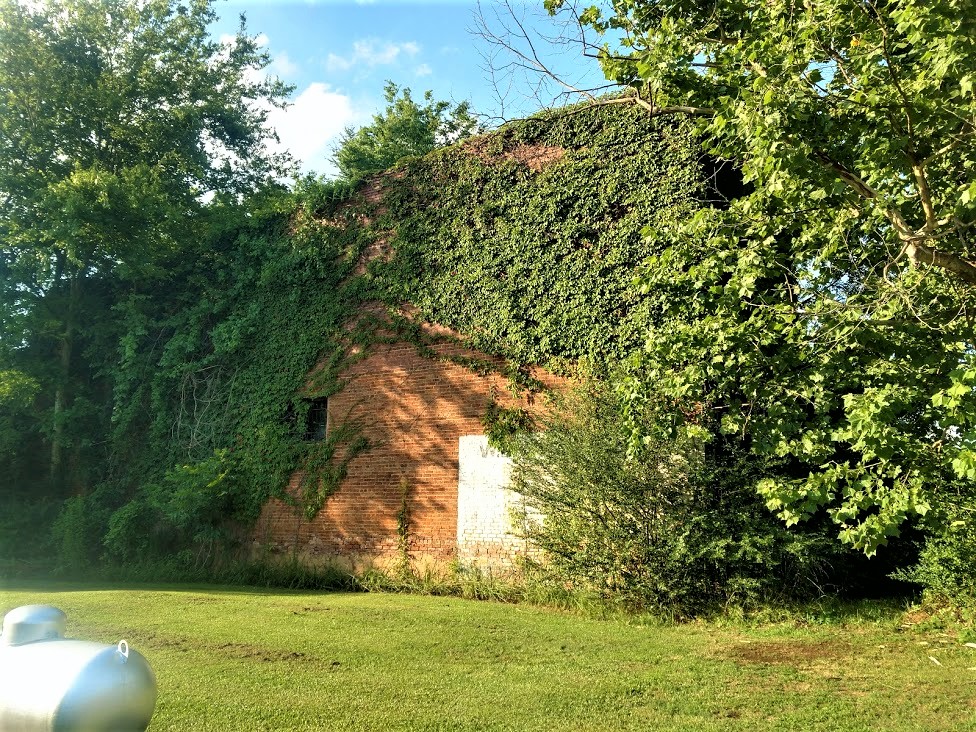
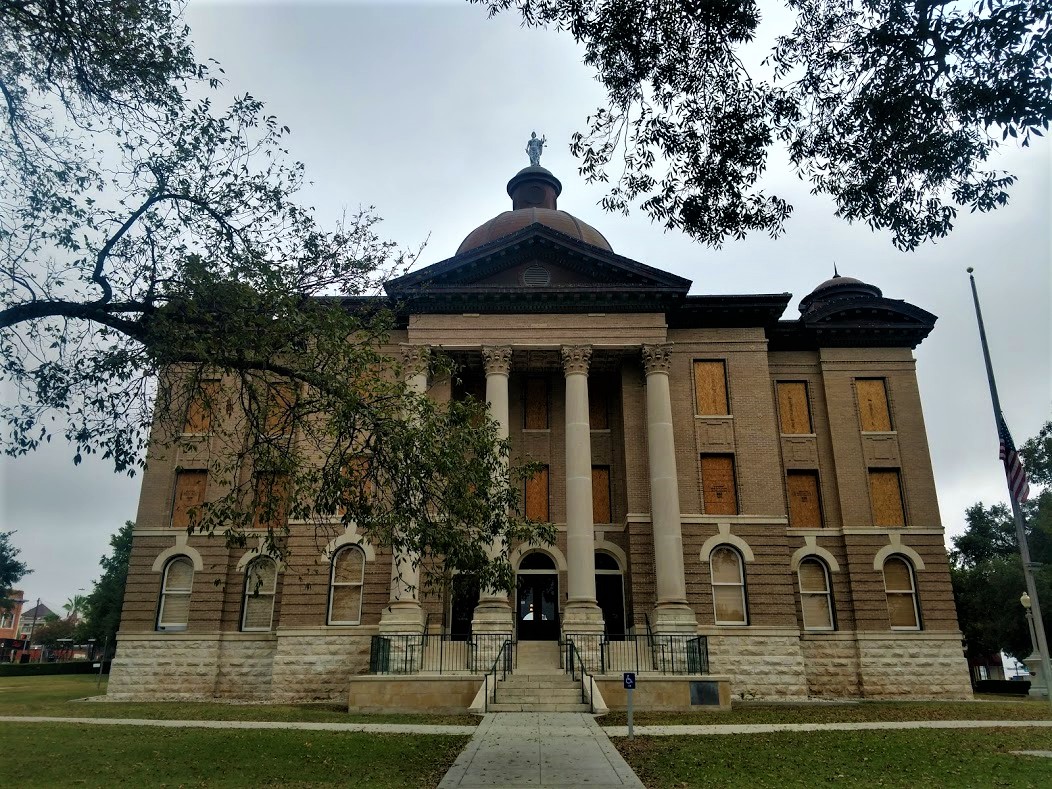
Over in Crawford County in the town of Knoxville, Georgia more history was to be found. My next two geocaches were located by the old courthouse (GC6C5C, GC3DFJG). Crawford County was created by Acts of the Legislature on Dec 9 & 23, 1822, and is named for William H. Crawford, a Georgia statesman. This building served as the county courthouse from 1823 until a new one was constructed in 2001.


Most everyone has heard of Route 66, the Lincoln Highway, and many other historic highways which played a role in the expansion of this country. US-80/GA-22 passing through town was once known as the Federal Wire Road. This highway, created by an Act of Congress in 1810, entered the state at Augusta, passing through Warrenton, Sparta, Milledgeville, Macon and Knoxville to Coweta Town (now called Columbus). It was formally known as the Stage Coach Road. A telegraph line, the first that connected New Orleans with Washington D.C., was erected in 1848. The wires paralleled this road between Columbus and Macon giving to this section of the old highway the name of the Federal Wire Road. This telegraph line was also the first one to be erected in the state of Georgia.

Knoxville also played a role in Texas history. It was here that Joanne Troutman gave to a company of Georgia soldiers commanded by Col. William Ward on their way to fight for the Independence of Texas, a Lone Star Flag. It was carried to Goliad where James Fannin Jr raised it as the Texas National Flag.

One more that I want to mention... Alexis de Tocqueville, the 25 year old French aristocrat and author of Democracy in America, visited this area during his 1831-1832 tour of America.

Over in Jones County we stop at a park for short hike to our next geocache (GC229DF). The first iron foundry in Georgia was established here by Samuel Griswold, who came from Connecticut, settling in Clinton in 1820. He also manufactured about 1,000 cotton gins a year and ran a steam sawmill and grist mill. Moving to Griswoldville in 1849 to be on the railroad his mansion and factories were burned by Sherman in 1864 when he was making pistols and ammunition for the Confederacy. He died in 1867. Daniel Pratt of Temple, NH, later designer of the Alabama capitol, was at one time Griswold's partner.


Moving right along we made a quick roadside stop for a quick cache in Jasper County (GC5RKVD).

Looping around Atlanta to the northeast side, we arrive at our final geocache of the day. This is one that has been on my bucket list for a long time. Beaver Cache (GC1D) was hidden way back in June 2000 and is the 8th oldest active geocache in the world. I had been close to it many times before, but either didn't have the time or just forgot all about it. That completes one more of my Year 2000 calendar. All that's left now is July and August.


So that was Day 2 of our Florida to North Carolina roadtrip. Like I said at the beginning, we saw a lot but didn't get very far.

On Day 3 it was just driving straight through the rest of the way where we reached our destination at the Lake Norman Motorcoach Resort. For the next few months here working at this project, this will be home:


Come back soon as we will be exploring the backroads of North Carolina and completing the last 7 NC Counties while we're here.

To follow along on our travels and keep up with my latest blogs, you may do so here of course. But also by using you favorite of these social media platforms: FacebookMeWeGabRedditParlorTwitterRVillageGETTR and Instagram. These all link directly to my profile. Again, please feel free to comment and / or share.

Saturday, April 24, 2021

2019-06-19: Roadtrip Back to Texas Day 2 in SC, GA, and AL Finding History, Old Cars, Trains, Ghost Town and a Tragic Story

WOW, Busy day today! I woke up bright and early this morning ready to go on Day 2 of this Geocaching roadtrip from North Carolina back to Texas. I didn't get off work yesterday until just after noon, so it was a late start getting going. I only made it down into South Carolina. It's Wednesday morning and there are lots of counties and caches on the agenda. I gotta start the new project in Texas on Monday morning. So hop on in the passenger seat and let's hit the road!


After checking out of the hotel in Spartanburg, I drove down I-85 to Greer and my first geocache for Spartanburg County. "Easy Wood's"  is a virtual geocache (GCG9YP) for Woods Chapel Methodist Church and Graveyard across the highway from the BMW plant. Fun fact for the next time you're on Jeopardy or something... what's the difference between a graveyard and a cemetery? A graveyard is next to a church whereas a cemetery is by itself. The Rev. Henry Wood, for whom the church is named, was a Revolutionary War soldier who lived from 1756 to 1843.

Over in Greenville County was a quick and easy little multi-cache (GC2370V) that I had not seen before. A multi-cache consists of at least a stage one or multiple stages to get clues for the final location. This stage one was a travel bug dog tag attached to a tree behind a shopping center. The travel bug code had two numerical digits which you use to substitute into a new set of coordinates which take you to the final location for the real cache. The bonus for this one was that not only do you get a cache find but also get to log a travel bug discovery.

Then a quick park and grab cache for Pickens County (GC4W54R). Also located in Pickens County is Clemson University. There I made a stop for a virtual cache called "Death Valley" (GC1989). There were several different geocaches on campus. However I only made time for just this one. Clemson's Memorial Stadium has the nickname Death Valley because it's view of the cemetery on the hill before the upper decks were constructed.


Driving on down US-123 into Oconee County, there was another quick parking lot cache find to claim that county (GC3C0ZD) and my last for South Carolina.

Crossing the Tugaloo River into Stephens County, Georgia, I stopped soon thereafter for my next geocache at a historical marker. The "Old Tugaloo Town" (GC7TCX9) historical marker reads: "North of this marker, in the center of the lake, once stood and important Indian town. The area now marked by a small island was settled around 500 A.D. and occupied by Cherokee Indians around 1450. Traders were coming to the town by 1690.

"In 1716, while Col. Maurice Moore treated with Charity Hague, Cherokee Conjuror, a group of Creek ambassadors arrived. The Creek Indians, supported by Spain and France, wished to drive the British from the Carolinas, in the Yamassee War. The Cherokees killed the Creek ambassadors and joined the British. By 1717, Col. Tehophilus Hastings operated a trading center at Tugaloo where gunsmith, John Milbourne cared for Cherokee firearms. Indian agent, Col George Chicken visited Tugaloo in 1725 and described it as "...the most ancient town in these parts.

"Tugaloo remained a principal Cherokee town until destroyed by American patriots fighting these allies of the British in 1776."

Slowly making my way westbound, the next county was Habersham County. I stopped in the town of Cornelia for my next geocache at the historic train museum (GC3QGWC). The historic Cornelia Train Depot was first built by the Southern Railway Company in the late 1880's, soon after the town was founded. The railroad depot was originally called Blaine Station for the Republican presidential candidate James Gillespie Blaine. When the first charter of the town was secured by the attorney representing the railroad, Pope Barrow, the name was changed to Cornelia in honor of his wife. The official date of incorporation was October 22, 1887.

The original terminal was damaged in 1910 in a fire, and rebuilt in 1914 to its current appearance. This large passenger and freight station was once the home to two rail lines The Blue Ridge & Atlantic Railroad (also known as the Tallulah Falls Railway) and The Georgia Air Line Railroad, now known as Norfolk Southern. This depot is the symbolic and historic heart of Cornelia and in fact the town's first boundaries were set at one half mile increments in all directions from the depot. Today this depot serves as a railroad museum filled with relics from the days when the railroad ruled, it is also a great place to sit and enjoy the passing trains roll by.


Standing outside the train depot is the 7ft tall Big Red Apple monument. The pedestal it rests on is 8ft tall. The monument was constructed in 1925 and donated by Southern Railway to celebrate the annual festival of the many apples grown in the region.


Driving south on US-441, I crossed over into Banks County and a geocache right at the historical marker at the county line (GC7ED1F). The marker reads: "This line, sometimes called “The Four Mile Purchase Line,” was the boundary between Georgia and the Cherokee Nation from 1804 to 1818. It was established when Georgia bought a four mile strip from the Indians so as to take in Wofford’s Settlement on Nancytown Creek. James Blair was agent for the government, James Vann and Katahahee for the Cherokees. It formed the boundary between Jackson Co. and the Cherokees; later Franklin Co. and the Cherokees, and is now the line between Habersham and Banks Counties."

Back up into White County, I get the "Train of Thought" geocache (GC5PBVQ) for another county at the Mt Yonah Book Exchange. There you'll also find this old railroad train narrow gauge engine.


And then a quick stop for the cache and scenic views at the Popcorn Overlook (GC1F76H) in Rabun County in the Blue Ridge Mountains.


Driving westbound on US-76, I make a quick park and grab stop for Kelly's Bridge (GC34MR8) to pick up Towns County. Followed by two more quick roadside park and grabs in Union County (GC6E5W2, GC72R98), another in Fanin County (GC7YT9F) and one more in Gilmer County (GC3R4BH).

Down in Pickens County, I stop for a virtual geocache (GC7442) at the Zell Miller Mountain Parkway monument. Dedicated in 1986 to the "strong character, integrity, and moral fiber of the people of Appalachia are exemplified in this native son of Georgia's mountains, Zell Miller has dedicated his life to aiding his fellow man. Scholar, author, businessman, teacher, champion of developmental highways, legislator, serving as Lieutenant Governor longer than anyone in Georgia history."


And then there was the "Bomb's Away" geocache in Bartow County (GC50RGA). Not sure why someone would have this setup in their front yard, but when you think you've seen it all... expect the unexpected!


Just down the road from the bomb, is "Old Car City USA, the World's Largest Old Car Junkyard" that has been here since 1931. (GC46W33) I couldn't find the cache that was hidden. And since it was closed, I couldn't go exploring the 6 miles of trails through the woods full of old cars. Not that I had time to do so anyway! But it would be fun to get back here one day to do so. But just what they had out front and peaking through the fence and windows inside was worth the stop.


Quick park and grab caches in Floyd (GC65626) and Polk Counties (GC27Z53) and I was heading for the state line and into Alabama.

My first stops in Alabama were for Cherokee County where I found two geocaches. Driving west on US-278, I took a side road and arrived in the town of Spring Garden for my first cache (GC2583K). Spring Garden was originally named Ambersonville after one of the early families that settled the community. A post office was established in 1842 as Liberty and changed to Spring Garden in 1844. The Selma, Rome, and Dalton Railroad began rail service through the town in 1870. The line later became part of the Southern Railway and was abandoned in the 1970's.

This building here was last known as the W.L. Westbrook General Merchandise Store. Constructed in 1878, it was first known as the P.H. Savage General Merchandise Store, then T.F. Stewart General Merchandise Store. William Lester Westbrook died in October of 1981 and can assume that the store closed around that time period. The second photo I found in the Library of Congress database looks to be from the late 1980's or early 1990's and the store is already abandoned. (The photo I took is from the post office side. The street view is completely covered in vines!)


(photo:  Library of Congress)

The other geocache in this county was a few miles away. The Goshen United Methodist Memorial Park (GC49R24) was established by members, relatives, and friends after a tornado destroyed the church on Palm Sunday, March 27, 1994.

On this Sunday morning, 20 children had begun the service by marching around the sanctuary waving palm branches while the congregation sang the hymn: "Tell me the stories of Jesus." The worship service began with Jesus' triumphal entry into Jerusalem, and was to end with remembering His tragic death on the cross. At approximately 11:30, a tornado with winds up to 250 mph, and moving at a speed of 55 mph descended upon the church. The edge of the half mile wide storm caused a window to break, and within four seconds the building exploded propelling the congregation into literally living the Holy Week story of joy, suffering, death, and resurrection.

Jehovah Jireh, the Lord will provide, had just been sung when the winds blew the roof and the south wall to the north, trapping, injuring, and killing many worshippers. For two hours, persons assisted in the rescue efforts freeing those trapped underneath the debris and treating the injured. By 1:00, four hundred volunteers had arrived to help. Due to the heroic work of many rescue and medical workers, as well as unexpected helpers, 126 people survived. Of the twenty killed, six were children. Those surviving gave remarkable stories of experiencing God's presence and sustaining power in the rescue efforts and through the hard days that followed.


Driving up into Dekalb County, I stopped at the Lebanon Courthouse for a virtual geocache (GCB0CE). The historic courthouse was constructed during the 1840's when Lebanon, the county seat of Dekalb County, was a thriving community with inns, taverns, and government offices. This building remained in use as a courthouse until 1876, when the stagecoaches serving Lebanon gave way to progress. The county seat was then moved to Fort Payne, where railway service was available.

By the time I got here the sun was already setting behind the building making it hard to get a decent photo.


Finally it's getting to be 9:00 pm by the time I get to Scottsboro, Alabama in Jackson County. I grab one last geocache (GC6F458) in a Walmart parking lot to claim the county. Those are about the only caches I want to find in the dark, under a street light!

Well after 15 hours of driving and caching, I'm ready for the hotel! That's it for today. Let's get some sleep and start again early tomorrow morning. I hope you come back again and ride along with me. I'm out... ZZzzzz....

Saturday, December 19, 2020

2019-04-07: Geocaching Through Texas Independence History in Cemeteries, Memorials, and a Haunted House

Welcome back to AwayWeGo's Geocaching Adventures Blog. My geocaching name is AwayWeGo.US and these are stories about our travels around the United States. Like most weekends, today is another Sunday driving 360+ miles back to work day. I live in Killeen, Texas and drive down to Falcon Lake in the Rio Grande Valley where I work as a construction surveyor during the week.


After about 30 minutes of driving, my first stop was at an IHOP in Georgetown for breakfast. Before leaving, I grab the quick geocache just outside the parking lot (GC20T2K).

I decided to make a detour and attend this geocaching event in Victoria, TX. Heading down US-183, I made a stop at the San Pablo Cemetery in Lockhart for another quick geocache find (GC3QKN0). The San Pablo Cemetery has about 100 burials beginning in the late 1930's and is still in use today.

Stopping again at the Luling City Cemetery for another cache (GC3VCVD), you also get a view of a giant watermelon. In 1954, Hermon Allen, principal of the Luling Elementary School, proposed the idea of a celebration to honor the growers and promote the Luling watermelon market. The festival includes a watermelon contest for the largest grown. The biggest Black Diamond champion melon in the festival’s history weighed in 141 pounds. The event has grown so large that as many as 30,000 people have attended.


Arriving down in the town of Gonzales, TX, I stopped for a virtual geocache at the "Old Time Justice" (GCGB8Q). The jail was built in the 1880's and is now a museum. It wasn't open at this time. I'll have to return one day to take a tour myself. The photos of it look interesting.

There's a legend that while Albert Howard was waiting for the date of his hanging from his jail cell, he had a view of the clock tower on the courthouse to watch the time. Until the very end he swore of his innocents and said that the four faces of the clock tower would never keep the same time again as long as he was hanged. Over the years and several attempts to fix it, the clocks have never kept the same time.


Then there's also the "Immortal 32" virtual cache (GCG84Q). In February 1836, Colonel Travis sent a letter from the Alamo to all Texans and all Americans while under besiege by the Mexican Army. Only 32 men answered that call for Texas Independence and all 32 were from the town of Gonzales. This memorial and reflecting pond are dedicated to those brave 32 men who gave their lives in support of their brothers at the Alamo.


Well I made it down to Victoria, TX at the Ted B. Reed Park for the geocaching event (GC83TBD). There were eight in attendance and always good meeting other geocachers. I got to stay for a little while before hitting the road and continue south.


Just to the west outside of Victoria is my next geocache at the Coletoville Cemetery (GC4T8AB). Originally named Steiner's Settlement, after early German Carl Steiner. The settlement dates back to 1849. When an epidemic of diphtheria hit the German settlement, two of August and Thekla Spitzer's children died. Ten-year-old Henry and six-year-old Robert were buried by their parents in 1873 on this site. In May of 1873, the Spitzer's deeded the land to the trustees of the new school and evangelic German church of the German community of Steinerville. The community was later renamed Coletoville for the nearby Coleto Creek.

Continuing southwest into Goliad County, my next stop was at the La Bahia Cemetery (GC282ND). There you'll also find this significant memorial of the Texas Independence. After the battle of Coleto (March 19 - 20, 1836), where a Texas Army under Col. James Walker Fannin met defeat by Mexicans in superior numbers, the Texas soldiers were held in Presidio La Bahia, supposedly as war prisoners.

However, by order of Mexican Gen. Antonio Lopez de Santa Anna, 370 of Fannin's men were marched out and massacred on Palm Sunday, March 27, 1836. The wounded were shot one by one in the fort compound. Col. Fannin was the last to die. Because of their profession, Drs. J. H. Barnard, J. E. Field and Jack Shackelford were spared; about 25 men were saved by a Mexican woman, "The Angel of Goliad". Approximately 30 escaped by feigning death or by swimming the San Antonio River. The Texans' corpses were stripped and partly burned, but left unburied.

This atrocity three weeks after the fall of the Alamo gave Texans part of the battle cry -- "Remember the Alamo! Remember La Bahia!" -- under which decisive victory was won at San Jacinto on April 21, 1836. Gen. Thomas J. Rusk and the Texan Army afterwards marched here and gathered the bones of Fannin's men from the terrain. From Presidio La Bahia the remains were carried in procession to the grave, and there given a military funeral and burial on June 3, 1836.


Amid the cruelties of the Texas war for independence, one notable woman committed acts of bravery and compassion. Francisca Alavez ("The Angel of Goliad") accompanied Mexican Army Captain Telesforo Alavez to Texas in March 1836. In seven incidents between March and April, she intervened with Mexican troops under command of Gen. José de Urrea to help captured Texian prisoners at Agua Dulce, Copano, La Bahia, Victoria and Matamoros.

On March 20, Maj. William P. Miller and 75 men of his Nashville Battalion were captured as they unloaded their ship at Copano Bay. Alavez insisted that binding cords which cut off circulation be removed and food and water be provided. The men were moved to Presidio La Bahia at Goliad, where hundreds of Col. James Fannin's troops were already held after their capture at Coleto Creek. At least 342 men were taken out of the fort on March 27 and shot under orders of Gen. Santa Anna in what was termed the Goliad Massacre.

Alavez helped save the lives of many men, including 16-year-old Benjamin Hughes. Another Survivor, Dr. J.H. Barnard, recalled that she pleaded for their lives, helped sneak out some troops at night and hid some of the men. Her humanitarian acts included tending to wounds and sending messages and provisions to those still imprisoned.


Driving into Berclair, TX, I first arrive at the Berclair Cemetery for my next geocache (GC38VDX). Berclair was a ranching area when the railroad arrived in 1889. The name supposedly derived from the combination Bert and Clair Lucas, one of the ranchers. A hotel was built to provide housing for the railroad workers in 1887 and travelers once completed. A post office was established in 1889. The cemetery below covered in spring wildflowers.


One remaining attraction in Berclair is the haunted Berclair Mansion (GCYFCJ). This 10,000 square foot, 22-room mansion was built in 1936. Etta Terrell had the house constructed out of concrete and steel in an effort to "fireproof" it after her previous house burnt down. Etta and her four sisters lived in the house. Etta passed away in the house in 1956. The sisters remained living in the mansion until the last one passed away in 1968. The homes furnishings remain as the sisters left them with antiques dating back to the 1700's. Then in 1999, the heirs in the family donated the mansion as a museum to the Beeville Art Association.

The Art Association hired maintenance workers and landscapers to keep up the property. It was about this time when unexplained sightings and sounds started happening. Several reported seeing elderly women in the windows, waving to them. Volunteers for the museum say they’ve heard voices as well as doors closing in the otherwise empty house, for no apparent reason. And the Corpus Christi Spook Central’s supernatural investigation team has reportedly recorded at least 10 unexplained voices occurring in the mansion over the period of one night.

The house is open for tours the last Sunday of each month. We may have to come back for another visit one day.


Still having 3 hours of driving to go plus stopping at the grocery store and grabbing dinner, I made that the last geocache for the day. The was a lot of historical and interesting stops today that I didn't get to explore more. Just means I'll have to go back again one day.

Thanks for stopping by and I hope to see you again soon.  

Sunday, October 25, 2020

2018-12-25: Christmas 2018 Road Trip from Texas to Florida and Back Again

Hello and welcome back to another entry of AwayWeGo's Geocaching Adventures. One of these days I might actually catch up in my writing to the present time. I'm starting to gain some ground. In this blog I take you back to our Christmas roadtrip in 2018. This year we decided to drive from Central Texas to Central Florida to spend Christmas with the family.

It's a 1200 mile drive to get there and since we're leaving out on the 22nd, we'll be spending way too much time on the boring I-10. We do make some detours in Louisiana to go geocaching and pick up some new counties. But the return trip however is when we stick to the backroads the majority of the time! So here's some of the highlights:

Our county first stop was in Vermilion Parish, Louisiana at the Old Mason Cemetery (GC1NR88) in a town called Abbeville. From the historical marker: "On this site was the first of our town's Masonic cemeteries and served Masons and Protestants alike. It has been virtually unused since 1905, although the latest tombstone reads 1954. The earliest recorded death was in 1868. A. G. Maxwell donated this land to Abbeville Lodge in 1869. The first master of the lodge, Dr. W. D. White was buried here as was several of his children. Restoration of the cemetery began in 1997 by dedicated volunteers under the auspices of the City of Abbeville, current owner of this sacred soil."


Continuing east on US-90, we stopped for a quick roadside geocache (GC1NKPH) in New Iberia to get the county of Iberia Parish. Then another cache (GC2KNG5) in the town of Franklin to claim a find in St Mary Parish. Also in St Mary Parish, I stopped for another geocache (GC2HH84) in the town of Amelia near this overpass which had all these vines growing up the columns.


Next on the list was a geocache for Terrebonne Parish in the town of Schriever, Louisiana. The Ducros Plantation (GC28MJ2) is a 12,600 square foot home dating back to 1802. Supposedly the Ducros House is haunted. It is not certain, but there is said to have been a young child who accidentally drowned in the adjacent well nearby as well as the house being home to the natural deaths of many of the previous occupants. The most common activity reported are unexplainable sounds. Foot steps heard in the main hall by the carpenters restoring the plantation and Richard himself has heard a strange dragging noise on the upper gallery. All reports have been during the day. No one has spent a night at Ducros since the early to mid 70's. From the vantage point of the public street I couldn't get a very good photo of the house.

The last geocache for this day in Louisiana was for the Lafourche Parish at the St Joseph Cemetery (GC2V8NJ). The first burial here is that of Marie Madeleine Gaudet (1732-1801). After a half-dozen burials, this cemetery was established in 1817 on the site of the original St Joseph Church, a mission of Assumption. The Calvary-Grotto Shrine to Our Lady of Lourdes, erected in 1883, still stands near the Menard Street entrance. Several historic graves are located here.


We drove all the way to Lake City, Florida the first day. Then on Christmas Eve down to Umatilla, just in time for a family get together. Later that night we checked into our hotel on Cocoa Beach, Florida. Christmas Day we awake to a beautiful view of the Atlantic Ocean. After another day with family in Merritt Island, Florida, it was time to hit the road westbound and return to Texas.


We had more time to get back to Texas so we spent more time on the backroads geocaching and picking up new counties. A couple of stops on Wednesday the 26th in Alabama with one being this huge Live Oak tree (GC7BA7T). It can be found listed on the Alabama Forestry's list of Alabama's Famous & Historic Trees. This publication states this tree was a recognized meeting place when the town of Geneva was first settled. People gathered under this tree for meetings and information of the development of the area.  The Big Oak was measured by the Eastern Native Tree Society in 2009. Measurements recorded were, CBH-22'9", Height-69' and Spread-163.5' x 154.5' making it #94 on the listing. We arrived here after sunset and it was already getting dark. That made it difficult for us to get any decent pictures. Though you can see plenty of photos on the cache page.

Thursday the 27th found us in Mississippi. We picked up several new counties in Stone Co (GC7JGP7), Amite Co (GC311DZ), and Wilkinson Co (GCP29Z). The most interesting geocache of the day was found in Centreville, MS. A virtual cache called "One For The Road" (GCJA19), it is of an old Colt .38 Revolver imbedded into the road from the days of the Works Progress Administration was constructing the original road in the 1930's. Nobody knows the real story behind the gun but there are many tales told. The most common is of a man who found his wife with another man, shot them both, and tossed the evidence into the newly poured concrete. Then there's the bank robber, another a moonshiner, and even a war protester. But we'll probably never know the true story of the revolver in the road.


We ended the night at a hotel in Alexandria, Louisiana. After getting settled in the hotel I made a run for pizza to bring back for dinner. I passed by this place and saw the shapes in the darkness and knew we had to come back in the morning for a better look.

That begins Friday the 28th. On England Drive in Alexandria is this Memorial Park (GC3XCW6). The England Airpark was once England Airforce Base until is was closed during the Clinton administration. The A-10 Warthog was the primary fighter stationed at England, and it is prominently displayed in this awesome real life airplane display area. There are 5 aircraft here on display. This geocache also gets us the Rapides Parish as a new county.


Our next stop was in Grant Parish and a town called Colfax, Louisiana. Reading the historical markers around the courthouse, the first one of interest was about the fire water. The marker reads: "The Famous Burning Well of Colfax. Visitors to this spot were once greeted with a curious site, a burning well. In 1899 a driller named L.B. Hart completed an artesian well at 1103 feet. The water was salty, and it bubbled with gas. Hart struck a match near the flow and promptly got his beard singed when the bubbles ignited. During its lifetime the well ebbed or flowed in response to the levels of the nearby Red River. With the advent of each new eruption someone would light up this unusual landmark. Thousands of tourists remember Colfax by the image of its famous burning well. Ripley once featured it in his "Believe It Or Not" as a well that spewed both fire and water. During WWII visiting soldiers would write back home describing this local wonder. In 1959, a new courthouse displaced the towns old attraction. An artificial fountain with a gas flame was erected, but it could not possibly evoke the awe of visitors as the real one had once done."

Another marker describes a dark time in the towns history. "The Colfax Riot. On this site occurred the Colfax Riot in which three white men and 150 negroes were slain. This event on April 13, 1873 marked the end of carpetbag misrule in the south." At the cemetery, an obelisk there reads: "Erected to the memory of the heroes Stephen Decature Parish, James West Hadnot, Sidney Harris who fell in the Colfax Riot fighting for white supremacy April 13, 1873." I was actually surprised this was still standing considering the political climate of modern times (GC7962B).


After a few more stops we finally made it back home in Killeen, Texas. A weekend to rest up from the trip before heading back to work in South Texas. Thanks for stopping by and I hope you enjoyed the roadtrip! See you next time...

Sunday, September 6, 2020

2018-09-03: Geocaching Through South Texas History From The Alamo to the Rio Grande Valley

Hello and welcome back to another recap of AwayWeGo's Geocaching and Exploring Adventures. On this Labor Day Monday, I drove down from Killeen in Central Texas to Falcon Lake in the Rio Grande Valley. There were a lot of new places to see, so let me get started.

After nearly an hour of driving, I made a stop in south Austin for gas, Dunkin Donuts, and a quick urban geocache (GC79YHY).

From there I proceeded down to San Marcos in the next county over. Hays County was founded in 1848. The courthouse building isn't the first one in the county. The current one was built in 1909. I can't say too much more about it because it's a virtual geocache (GCG9JY) and I don't want to give away any answers.


The next county to the south is Guadalupe County. There I found another virtual geocache (GCGAQQ) in the town of Seguin. That took me to a house called Sebastopol. This Greek Revival house was built in 1854-56, with reinforced load bearing walls of cast-in-place limecrete, an early form of concrete made of lime, sand, and gravel. One of many concrete structures built in Seguin, this is an important surviving example of early concrete technology in the southwest.


Not too far away was the Juan Nepomuceno Seguin gravesite (GC6YTN1) for whom the city was named. Born in 1806, Juan assembled Mexican Texan troops and fought in the 1835 Siege of Bexar. He provided horses and aid for troops of Col. William B. Travis. Further aiding as courier during siege of the Alamo. Juan Seguin commanded Company A Cavalry 2nd Regiment during San Jacinto victory and pursuit of the Mexican Army remnants following San Jacinto battle. After a career in politics, Juan Seguin died in 1890 in Nuevo Laredo, Mexico. His remains were returned to Seguin.


Moving on down to Karnes County, I arrive at my next geocache (GC4K1MF). The second Polish colony in Karnes County, the village in this area grew out of a small settlement known as St. Joe and was formally established in 1873. At times the priest at Panna Maria would conduct services at St. Joseph School in what would become Czestochowa. The "Mother Colony" church at Panna Maria was destroyed by lightning in 1877; Czestochowa settlers decided to build their own church. This was the subject of much controversy among the Polish pioneers of Karnes County. Anton Jarzombek (1836-1922) and Frank Mutz (1814-1891) each donated land for the church. Area residents contributed their labor to build the eighty-five by forty foot church with Gervase Gabrysch (1830-1904) as contractor.


Bishop Anthony D. Pellicer blessed the church on February 10, 1878. Father W. Pelczar was assigned as the first pastor that September. As a sign of their reconciliation, the parishioners from the newly rebuilt Panna Maria church presented the new parish a large painting of the Virgin Mary of Czestochowa, the Patroness of Poland. The two congregations often shared leadership in the ensuing years. The Cestohowa church (adopting the Americanized spelling of the community) thrived into the 20th century.

In the 1930's the church underwent intensive additions and remodeling. Though the original walls remained, the roof was completely removed and the ceiling raised. The north and south wings were added and the steeple was increased in height. In 1998, the church celebrated its 125th anniversary. At that time, the parish consisted of 380 members. The Nativity of the Blessed Virgin Mary Church continues in the traditions of its founders.


Bee County was next on my list. I drove down to this town called Normanna, Texas. The area had been a Mexican land grant back in 1831. In 1874 it was named Walton Station after Sheriff D.A.T. Walton.

Norwegian immigrants moved into the area in 1893, and formed the nucleus of their colony just 2 miles from Walton. When the postal authorities rejected the application for a post office under the name Walton, Normanna was submitted and accepted. The name loosely translates as "the place of Norsemen" but closer to the true meaning is "far North." Seeing that's where they were from, the name was appropriate.

Families descended from the original Norwegian settlers still live in the area. Normanna has a museum in a building that has served as ranch headquarters, a hotel and a residence. The town thrived for years, but then declined after a series of fires and the advent of the automobile. This is that building today.


The geocache (GC10AXF) was located on the west side of town at the Medio Creek Bridge. The bridge was the idea of Viggo Kohler, a man who later built the large Viggo Hotel in Hebbronville (1915). He petitioned the Bee County Commissioners to accept bids in June of 1897. The bridge arrived in kit form and was assembled by the Austin Brothers Bridge Company. It has long since been decommissioned and slowly being reclaimed by nature.


Continuing south into the town of San Patricio, Texas, I went to my next geocache at the Old Cemetery On The Hill (GCMDMV). This cemetery is believed to have been used for generations by Indian tribes and Mexican settlers who lived in this area previous to Anglo colonization. Following the establishment of San Patricio de Hibernia in , the colonists continued to use the old cemetery on the hill.


According to local oral tradition, early graves in the cemetery were marked by wooden crosses and stones bearing Spanish and English inscriptions. Among those interred here are Lt. Marcelino Garcia who was killed at the Battle of Lipantitlan in 1835. Also buried here are soldiers who died in the Battle of San Patricio on February 27, 1836; James McGloin, who's grave was never marked; victims of diseases such as scarlet fever; men killed fighting duels; and many early settlers and their descendants.

After a new cemetery was consecrated at San Patricio in 1872 (GC6C4ZE), the Old Cemetery on the Hill was used infrequently. The old cemetery was neglected for many years until restoration efforts were begun in the 1960's. Some tombstones where lost or destroyed over the years. But the historic graveyard is now maintained.


Passing through the town of Bluntzer, I saw this old schoolhouse. The first Spanish land grant awarded in what is now Nueces County was the Casa Blanca Land Grant. Granted in 1798 by the Spanish government to Juan Jose de la Garza Montemayor (1765-1816) and his three sons, Juan Manuel, Jose Perfecto, and Jose Agustin, it was located between Penitas Creek and the Nueces River. Originally called Penitas Grant, it consisted of 70,848 acres, or sixteen sitios of land.

The school for the town was opened in the 1870's, but flooding by the hurricane of 1919 necessitated its relocation. Justina Bluntzer, daughter of Nicholas, donated the land for the school. This final school building was constructed in 1939. The school held classes until it was consolidated with the Banquete ISD in 1971.


My next geocache was at the Cemeterio De La Luz (GC1CXD6). I couldn't find any information on this cemetery other than there's over 350 burials here dating back to 1926.


Still working my way south, I stop at the Restland Memorial Park cemetery for my next two geocaches (GC2N9WG, GC7TGWT). Located in Bishop, Texas, the town was established in 1910 by F. Z. Bishop on land he had purchased from the Driscoll Ranch. A businessman from Corpus Christi, Bishop dreamed of building a model town on the prairie. He planned, designed, and managed the construction of the townsite. He died in 1950 and was buried in Restland Memorial Park.


My final geocaching stop brought me to the Pedro Garza Zamaora Cemetery (GC23ZNM). There's only 140+ burials dating back to 1904. This row of statues stood out the most.


Well that's it for this days adventure. There's a lot of South Texas / Mexican history to be learned on this drive. We'll be discovering that over the next few months while I work on this new wind project. Until next time, happy caching!