Friday, June 19, 2020

2018-06-17: Finding and Hiding Geocaches in West Texas Cemeteries

In this addition of my AwayWeGo's Geocaching Adventures blog, once again I'm on my regular Sunday drive from Killeen in Central Texas to Fort Stockton in West Texas.

For my new readers who may not know, I live in Killeen but work in West Texas. So at the end of my work week, either on a Friday or Saturday night, I'm driving home 360 miles eastbound to see my wife. Then on Sunday's I have to drive the 360 miles back. So it's the Sunday's when I do my geocaching and exploring to break up the long drive.

And between the daily commute to work and going home on the weekends, my new GeoJeep is racking up 1200 miles a week!

So let's get caching...

About an hour into driving, I arrived at Buchanan Lake and Dam along Hwy 29 in Llano County. There I found the first geocache and historical marker. C.S.A Salt Works (GC15HQA) was located between Tow Valley and Old Bluffton, 15 miles N.E. and since 1937 under Lake Buchanan. During the Civil War they made salt for the table, curing meat and hides, and feeding cavalry horses.

I wish I was here back in 2007-2009 when there was a drought taking place. Buchanan Lake was down 50% and the ghost town of Old Bluffton, which normally sets at the bottom of the lake, was now exposed. I found a great story at the Texas Observer website if you want to look into that.

On the way to the Llano Cemetery, I stopped at a roadside picnic area for a quick park and grab geocache (GC1Y0AK).

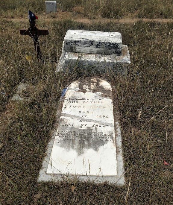
Arriving at the Llano Cemetery, there are actually three geocaches here for me to find (GC6H514, GC7AG8C, GC4R6A4). Area residents founded the city of Llano as the county seat for the newly formed Llano County in 1856. By August 1862, with the interment of one-year-old Tina Miller, this site served as a burial ground. Seventeen year old Emily Young Wright was interred here a few weeks later. Their two gravestones are the earliest marked burials.

One of the geocaches highlights South Carolina native Dillard Cooper. He came to Texas in January 1836 with Captain John Shackelford's Red Rovers, landing at Copano Bay and joining Col. James Fannin's command. Following the Texians' defeat at the battle of Coleto Creek on March 20, the wounded Cooper was among many soldiers taken prisoner at Goliad. One week later, Mexican troops shot and killed more than 300 prisoners; Cooper was among a handful who escaped. He and companions spent two weeks traveling at night through enemy lines and abandoned settlements to reach Texian forces at the Brazos River. Cooper lived in Hays and Colorado counties before moving to farm with his stepson in Llano and San Saba counties in 1878. Dillard Cooper died in 1896.


Another monument that caught my eye was this one for Elmer Lee Crockett. Born in 1896, many years after the Alamo, but died in 1919 at age 22 in France. Hmm... there was a war going on over there. After a little research, I found out that Crockett left Llano to enter the service in September 1917. He arrived in France in February 1918 and was a part of the machine detachment of the air service division. Even though the Armistice was signed in November 1918, Crockett remained in France for active duty. However in January of 1919, Elmer Lee Crockett died from acute appendicitis. It wasn't until August 1921 before his body finally returned to Llano where it was laid here in his hometown.


Continuing westbound on Hwy 29, when I arrived in Grit, Texas, I took a short detour south on US-377 down to the Cavness Cemetery (GC7RCBR). Located in the Streeter Community, around 1855 Irish settlers, including William S. "Uncle Billy" Gamel and the Caveness brothers, began moving to the area. Shortly thereafter, Germans also began to settle in the community. While there are many unknown and undated markers here, two of the oldest are both from 1880. Four year old Steaven Cavness and 86 year old Elias Hiram Hays. I can only assume that one of the Cavness brothers mentioned above was a Robert "Bob" Cavness (1822 - 1902), who is buried here along with his wife Mary (1822 - 1892). There wasn't a geocache here, so I hid one myself.


Sometimes while driving along the backroads of America, you see areas that you just have to pull over and take a photo and that's what I did here while on my way to the next cemetery.


Just north of Streeter was the Coffee Cemetery. As the community of Streeter was growing, Tom Brite opened a store, and Charles Brite once operated a gin and flour mill. A well kept cemetery going back to the 1870's and still being used today. Another cemetery which didn't have a geocache, so I hid one there also (GC7RD83). Near the cache you'll find the headstones of Charles Brite (d.1926) and Tom Brite (d.1927) which are mentioned above. You'll have to find the headstone of W. A. Brite who I can only presume to be their father who died in 1891.


Continuing through very rural dirt backroads, working my way back up to Hwy 29 and arriving at Jacoby Cemetery (GC7RDA1) to hide another geocache. A small family cemetery dating back to 1915 for the not named infant Son of Max and May Jacoby. Still maintained and used, currently only about 30 interments here from the families of Eckert, Hahn, Jacoby, Kuhlman, and a Rolston. While I placed the cache over by the corner post, be sure to pay a visit to Sgt Melvin C Eckert born September 26, 1921 and was killed in action during WWII on June 25, 1943. Here in the Jacoby Cemetery is a memorial headstone with his family. His body is interned at the Ardennes American Military Cemetery Neuville-en-Condroz, Arrondissement de Liège, Liège, B-4121 Belgium.


Then I encountered another one of those "just gotta pull over and take a photo" spots.


Next stop was a quick roadside geocache at a historical marker (GC5ADDH). The Pegleg Crossing on the San Saba River, at the mouth of MacDougal Creek twelve miles east of Menard in Menard Count. For years a favored Indian campground, it entered written history, 1732, as site of Spanish-Apache battle. It was used almost continuously by the Spaniards from the time of the establishment of Santa Cruz de San Sabá Mission in 1757 until the end of the colonial period. In 1849 William Henry Chase Whiting surveyed the ford as a part of a migration road to California. It served the army as a crossing, linking Fort McKavett with San Antonio both before and after the Civil War.

From 1867 until 1888 the San Antonio-San Diego (Southern) Stage Line used the military road; the stage line had a relay station, called Pegleg Station, constructed on a hill overlooking the ford. The Western Trail likewise used the ford for cattle drives from south central Texas to northern ranges and railheads. When State Highway 29 from Mason to Menard was built, Pegleg Crossing was abandoned. Probably named by landowner Wilhelm Harlen for one-legged land commissioner T.W. Ward. Gained notoriety for many hold-ups that occurred at "Robbers' Roost" (1 mile west).

Just two more geocaches before getting back to Fort Stockton. A quick roadside park and grab (GC43AHP) and another historical marker (GC3TXRG). The marker is for the Giddings' Pecos Station.

In the mid-19th century, stagecoach lines were a primary means of moving people, mail and supplies through the region. The U.S. government contracted with Henry Skillman for the San Antonio-El Paso Stage line in 1851. In this area, the route ran along the historic Chihuahua Trail, also know as the Lower Road, which was designed to carry U.S. mail. The service soon added passenger and freight delivery. Skillman and William “Bigfoot” Wallace were two of the better known drivers.

In 1854, George H. Giddings took over the San Antonio to El Paso line and created a series of stage stations in the area. In 1858, he established one near the “S” crossing of the Pecos River. It had two structures built of adobe, limestone and wood. Teamsters used the larger building as a kitchen and dining room and the smaller structure as sleeping quarters. An adobe or high pole corral with a wide gate stood behind the buildings, housing dozens of horses and mules. Water came from a nearby hand-dug well, formerly an existing spring.

In early 1862, a driver of the stage to Fort Lancaster reported Indians had destroyed Pecos Station, and the site was abandoned. Lt. Col. Thomas B. Hunt led a detachment past the ruins in 1869, giving the position as the west bank of the Pecos, 2.5 miles from Camp Melbourne. The exact location of the remote post, however, remained in doubt over the years until archaeological investigations in the early 21st century. Stone foundations and cultural artifacts from the 1850's, along with evidence of earlier Native American occupation, helped identify this isolated scene of frontier life.

That's it for another Sunday drive. There's a lot of history and interesting stories along the backroads of this great country. You just gotta be willing to look for it. And thanks to geocaching it's a little easier to find!

Sunday, June 14, 2020

2018-06-10: Geocaching Through History From Central to West Texas

Welcome back to another of my 360+ mile Sunday drives from Killeen in Central Texas to Fort Stockton in West Texas. Along this weekly drive, I explore the backroads and small towns, cemeteries and ghost towns, and anything of interest along the way. Most of the places I discover are thanks to the game of Geocaching. We got a long way to go, so let's get started.

Now most of the time during this drive, I start finding geocaches early along a route. Then I get side tracked, start heading to this cache and that cache, and next thing I know it's the middle of the afternoon and I still have 300 miles to drive. Today I was determined to make it past Llano before making my first stop. And that I did.

To encourage settlement of the new frontier in the 1830's and 40's, the Republic of Texas granted large portions of land to prospective impresarios. Among the more notable was the one issued to Francis Fisher, Buchard Miller, and Joseph Baker. Comprising some three million acres of land between the Llano and Colorado Rivers, it became known as the Fisher and Miller Colony.

Going westbound on Highway 29, I turned south towards Castell. In 1847 on Fisher-Miller land grants, 3 settlements were begun by German emigration company under commissioner general John O. Meusebach. There was Bettina, the first communal settlement in Texas. It was abandoned in less than a year when supplies ran out. Leiningen three miles to the east, but non-existent today. Castell was the first and only permanent Llano County settlement. It was led by Count Emil von Kriewitz. The towns namesake was Count Carl Frederick Castell-Castell, business manager of the Adelsverein.


The German Lutherans in this area were served by circuit-riding lay minister Dietrich Rode as early as 1870. A congregation was organized in 1893 on the north side of the Llano River in the Leiningen settlement about three miles east. A second church, known as Leiningen Two or Zion, was built on the south side of the river in 1907. The two congregations merged as St Johannes Evangelische Gemeinde in 1926, and a new sanctuary was built. Worship services were conducted in German until the 1950's, and the name was changed to St. Johns Lutheran Church.


Next to the church is the Cemetery and geocache (GC1NVGG). The congregation of St John Lutheren Church had been meeting in its new sanctuary for some four years when the death of one of its members, Anna Charlotte Lillie (Kowierschke) Bauer (1905-1930), led to the purchase of this half acre for use as the church cemetery. Her in-laws J. W. Bauer (1874-1932) and Bertha (Flint) Bauer (1872-1956) are buried nearby in the same plot. The older grave of Christian Schneider (1838-1920) was moved here from an endangered location near the Llano River.

There was a second geocache in town closer to the river, but I didn't find it (GC1NVGB).

Arriving in the town of Mason, Texas, there were two geocaches there that I still hadn't looked for yet. The first was at a historical marker entering the town (GC6E7PP). Created January 22, 1858 and organized August 2, 1858, Mason County was named for its most important settlement, Fort Mason. Garrisoned intermittently from July 6, 1851, to March 23, 1869, Fort Mason was named for Lt. G.T. Mason of the United States 2nd Dragoons, killed in Mexican War action on April 25, 1846 near Brownsville. Fort Mason was one of a chain of posts situated a day's horseback ride apart, from Red River to the Rio Grande, for protecting frontier from Apaches, Comanches, and other Indians.


Exiting the west end of town I stopped for another historical marker and another geocache (GC6E82Z). A native of Kentucky, Thomas S. Milligan (1810-1860) moved to this area in 1855 and operated a change station for the stage line. He was also a rancher and supplied beef to the soldiers at Fort Mason. Shortly after Mason County was organized in 1858 he became the first elected sheriff. Two years later he was killed by hostile indians near his home 1.6 miles NW. His grandson Allen Thomas Murray (1880-1929) became county sheriff in 1924 and like his grandfather, also died in the line of fire. He was killed by a bootlegger in 1929.

When arriving in the ghost town of Grit, Texas, I turned south onto US-377 to head down towards Junction and I-10. I then made a quick roadside geocache stop (GC3PV6R).

A couple of more miles down the road and I arrived at the Long Mountain Cemetery and two more geocaches (GC6EVX0, GC3PV5Q). Long Mountain probably gets its name from a nearby summit, also called Long Mountain. The area, which had been settled for some time by scattered ranchers, began to develop into a community in 1915. There are 240 burials here dating back to a Samuel Silas Jackson in January 1867. The second photo below is that of Dan (d.1900) and Sarah (d.1928) Martin's headstone which has their portraits on it. I'm sure it was placed by a more recent family member.


The next few miles provided just some ordinary roadside geocaches for some quick stops (GC3PV4T, GC58AJJ, and a DNF at GCKNF4). There was another roadside cache that had some history in the location, but nothing left there to see. The ghost town of Erna (GC1JR4C) is said to have been settled shortly after the Civil War, in part by German immigrants. J. N. Andrews operated the only store in the community in 1890. A post office was established there in 1915 with Amos Brewer as postmaster. The office was discontinued in 1919, and mail for the community was sent to Streeter in Mason County. Only a few scattered houses marked Erna on county highway maps in the 1940's. From the mid-1940's through the mid-1960's the population was reported at fifty. By the 1980's only the place name appeared on county maps.

An old farmhouse along one of the rural dirt roads.
The next geocache and ghost town down the road at the Saline and Little Saline Cemetery (GC1M4JK). A few settlers arrived in the area in the 1860's, but the threat of Indian raids kept many people away until the 1870's or 1880's. Shortly after 1900 the Saline school had eighty-four students and two teachers. The school and a church marked the community on county highway maps in the late 1930's. The school closed in 1947, and students were sent to the London school in Kimble County.

The family of Henry Parks settled here in the early 1860's, having found abundant grazing for their cattle. A band of Comanche Indians descended upon the pioneer family. Henry and Nancy Parks and their young grandson, Billy, were slain, their home burned and the cattle driven away. The Parks family were laid to rest where they had been slain. The three bodies, all in one grave, became the first burial in Little Saline cemetery.

The photo below is on the headstone of Marvin Harrison Hight who died December 1917 at age 22. I couldn't find any specific information on him, but I suspect he may have died in battle during World War I.


Continuing south on to my next cache (GC11951), I arrived in London. No not in England, but in Texas. London, aka London Town materialized sometime in the late 1870's or early 1880's when former Union Army officer Len L. Lewis moved into the area to trade horses. Lewis married locally and with holdings of a half-section of land, he planned the future town. Ed, Tom, and Robert Stevenson opened a store there in 1881 and the town was platted to include a square and forty town lots. A post office opened in the Stevenson store in 1892 under the name London and it was used to denote the town as well. London is famous locally for its dance hall located on the main street. The London Cemetery (GC6EG0K) has just over 400 burials dating back to 1908.


Jumping on to I-10 westbound, I continue on down to Copperas Cemetery (GC1M4H9). A deed for this cemetery was executed by D.P. Cowsert to E.S. Alley, County Judge, on May 30, 1890, donating one acre of land out of E.S. Haines Survey #55. First grave was that of William A. Cowsert on February 1, 1888. Residents of the Copperas community tend to cemetery. David Cowsert, who died during World War I, was returned home and buried here in the land of his ancestors. At least eight Civil War veterans , including Colonel John Griffith, were interred in the Copperas Cemetery. Veterans from other wars are among the dead in this beautiful little cemetery in the Copperas and Bois d" Arc valleys. An official historical law officers's marker denotes the burial spot of Ranger Captain Gully Cowsert.


Next door to the cemetery is what remains of the Copperas Methodist Church (GC1M4HA). Organized in 1881 by circuit rider, Andrew Jackson Potter, who helped firmly establish the Methodist church in West Texas. Before construction of church on this site in 1917, services were held in schoolhouse or under brush arbor 3/4 mi. SW on west bank, Copperas Creek. Building site was donated by J. A. Cowsert. Lumber was hauled here by wagon from Menard. Labor was donated by members and other local residents.


Five miles further down I-10 westbound is Roosevelt, Texas. Exiting off the Interstate, I first arrive at a historical marker and my next geocache (GC1M4GR). "From nearby Fort Terrett, this road in 1852 led south to Fort Clark and north to Fort McKavett. Selected mainly because it had water available, it served as the route for freight and mail in 1868, when the forts were reactivated. Over this route went troops, supplies, immigrants and pioneers. It was noted also for the passage of forays of Col. Ranald MacKenzie against hostile Indians to the northwest. After the forts were abandoned in 1883, ranchers drove cattle to market over parts of the road.

Near the historical marker was this old church. It was the Roosevelt Presbyterian Church. A plaque on the wall says the church was organized in 1933 and the building erected in 1947. The building looked to be in decent shape although the sign out by the road was pretty faded. With a population of about 150, I imagine it is still in use today.


Roosevelt, Texas was established with a post office in 1898 and was named by its founder, W. B. Wagoner, for Theodore Roosevelt, who reportedly visited the area with the First United States Volunteer Cavalry (the Rough Riders). It served as a shipping point for feed and supplies for local sheep and goat ranchers. The Patterson and Riek Ranch, established in 1897, imported Angora goats from South Africa in 1925.

In the 1920's the community hosted polo matches, as local ranchers bred polo ponies for national markets as well as horses for the United States Cavalry. Hill Country tourism also added to the local economy in that decade with the establishment of several businesses, including the Luthringer Hotel.

The population of Roosevelt, estimated at twenty-five in 1925, averaged 100 from 1941 through the middle 1980's. In 1990 it was ninety-eight. The population dropped to fourteen in 2000.

The old general store (GC1M4GB) in Roosevelt known as Simon Bros Mercantile opened in the early 1900's and is still in operation. The Back Door Cafe is located behind the store and contains a beautiful mahogany bar that languished for many years in a local barn. The remains of the school and the memorial church are located east of town.The post office is located inside the store and is one of the two smallest still operating in Texas (the other is at Telegraph).


Well it has been a busy day with 18 geocaches and a lot to see. From Roosevelt I still had 180 miles to go and was planning to drive all the way through to Fort Stockton. But after about an hour, I-10 was getting pretty boring! About halfway I was approaching a rest area. I opened up the app and saw that there was a cache there (GC2K4XW). Well that's a no-brainer. I quickly pull in, stretch my legs and grab a cache.

Now on to Fort Stockton to relax for the night and get rested for work tomorrow. Thanks for stopping by. If you've enjoyed my stories, please send me a note in the comments, or through Facebook and Twitter.

Saturday, June 13, 2020

2018-06-09: Geocaching in Central Texas Through History, Cemeteries, an Elephant and Fairies!

Welcome to another edition of our AwayWeGo's Geocaching Adventures Blog. While I'm still way behind in my writing, I am hopeful that one day I'll catch up. I even stopped finding new caches for a few months at the beginning of this year in an effort to catch up. But none the less, much of what I tell you about is still there for you to see today if you like. So let's get started and see what we found on this day back in June 9, 2018.

Having worked only 5 days this week instead of the usual 6 days, I took the opportunity to go out on a Geocaching Adventure with my wife today. We decided to take a drive up to Hico, Texas to get some chocolates. It's a few hours away, but the chocolate is worth it! Along the way we'll be grabbing some caches and sightseeing on this roadtrip.

Our first geocache is called "Iron Elephant" (GC5XFB3). The cache was placed along the roadside where this rather large sculpture of an elephant happens to be sitting. It was hard to get a decent photo from the phone with it sitting so far off the roadway. As I was pulling away and passing by the Rockin-R Ranch gate, I saw another large statue of a giraffe. Again, sorry for the poor photo quality. But if you happen to be driving up SR-36 near Whiteway, TX, keep your eyes open for some large wildlife!


Just up the road in Whiteway is the Evergreen Cemetery (GC171KZ). Whiteway (formerly Whitesboro), in southeast Hamilton County, was established to serve the needs of motorists between Jonesboro and Hamilton. The settlement had a school, a church, a cemetery, and scattered farm units in 1936. At one time its population was fourteen; in 1966 four inhabitants were reported. Whiteway was named for Steve White, a local resident, whose sons established and operated the filling station, garage, body shop, and grocery. Whiteway appeared on local maps during the late 1980's, but no population figures were available. By 2000 the population was listed as ten. There was a John Stephen White (1880-1964) buried in the cemetery, but I'm not sure if he was the one the town was named after.


On the way to our next cache, I saw this old covered wagon sitting on the property corner of this ranch entrance. I just had to pull over and take a photo. You never know what you may find driving the rural backroads of this country.


Our next geocache was at the Rock House Church and Cemetery (GC10924).There's not much left to the actual church structure. I forgot to even get a photo. The cemetery is in dire need of some TLC. Mostly overgrown with weeds and shrubs. Some of the headstones have been broken.

Trying to research, I can't find any history on this church or the cemetery. The only thing that I can find is that there are 115 burials here dating back to 1870. Other than that... if you know of any information I'd be happy to hear from you.


Not too far away was our next cache at Bulman Cemetery (GC1CW5R). Established in 1884 because of the death of Emily Bulman, the wife of the Rev Henry Jefferson Bulman who was one of the early settlers in the area. There are just over 140 burials in this cemetery. One of the interesting displays by a headstone is this red boot in a basket.


Continuing northbound, we came upon this small town called Fairy, Texas. There wasn't a geocache in this town so it didn't come up on my radar. But I did take a quick stop for a few photos.

Fairy was first known as Martin's Gap for James Martin, an early settler who took an oxcart through the mountain gap, which wasn't an easy thing to do back in the day. When the post office was established in 1884, the town was named for Fairy Fort, the daughter of Confederate Army Captain Battle Fort. At a mere 2' 7" and about 28 lbs, Fairy Fort was one of the smallest Texans on record. She was married and divorced twice and had only one child, by her first husband, who died at birth in 1893. She died on October 22, 1938 at age 73 and is buried in the Fairy Cemetery.

Photo credit: TexasEscapes.com

The town of Fairy had a cotton gin from 1900 to about 1936 and schools, churches, and businesses serving the greater ranching and farming community. In 1947 Fairy had a post office, three churches, three businesses, and 150 people. The post office closed in 1957, and the Fairy school district was consolidated with the Hamilton schools in 1967. In 1980, 1990, and 2000 the population was thirty-one. Pictured below is one of the remaining churches and a tree carving in town.


Maybe next time through they'll have a geocache to find or I'll hide one myself.

We finally arrived in Hico, Texas and our chocolate destination! Wiseman House Chocolates is a must stop when visiting Hico. This is our third time here and the chocolates are some of the best we've ever had.

Next a quick stop by the Hico Cemetery for our next geocache (GC6YNN7). There's just over 4000 interments dating back to 1862.

Then off to the Carlton Cemetery (GCT77Q). On July 9, 1867, a farmer J. E. Pinkerton traveling to Carlton on horseback, became bogged down in a muddy swamp while crossing Tywhappatee Creek. While struggling to free his horse he was attacked and killed by a band of renegade Comanche Indians. This occurred the same day that renegade Comanche Indians attacked the country school house seven miles northeast of Hamilton. Two children were taken captive and their teacher Ann Whitney lost her life protecting her students. It is unknown which attack happened first. Pinkerton was the first burial  in what became Carlton Cemetery.


And finally our last geocache for the day was at the Toliver Cemetery (GC14DV8). Burial place of pioneer settlers, including James H. Neel, one of first seven men to bring families here in 1852. His home was a quarter mile to the east of cemetery. He was also postmaster of Resley's Creek Village 1858 to 1866.


That's it for today. Don't forget to follow along with us on Facebook to get the latest updates and occasional pictures not found in our blog posts. See you next time.

Wednesday, May 27, 2020

2018-06-07: Geocaching in West Texas Ghost Towns and a Cemetery

On this day, a Thursday, we got out of work early to have long weekend. This solar project I'm working on here in West Texas is winding down to an end. I thought I would have already been laid off, but as the last surveyor on site, I need to stay until the end. For now I will continue the drive between Fort Stockton and Killeen every weekend.

Normally driving eastbound is at the end of a long workday. Therefore, I only stop for gas and food. My geocaching is on the Sunday return trip when I have more time. But getting out early today, I made a few stops just to break up the drive.

Passing through Iraan on US-190 east of town, you climb up out of the valley and over the mesa's. In doing so you get these great views. On this trip I decided to stop and get a few photos. Hard to tell in this shot, but I'm actually looking downhill.


I stopped for my first geocache in the ghost town of Hext at the cemetery (GC5ADA0). Hext is at the intersection of State Highway 29 and Farm Road 1221, sixteen miles southeast of Menard in eastern Menard County. It was known as Maringo (Marengo) when the area was settled in the 1870s, but residents changed the name to Hext in the late 1890's in honor of Joseph Robert Hext.

A local post office was established in 1897 with Ennis Stark as postmaster. In 1914 the community had a cotton gin, a hotel, two general stores, and 125 residents. A Church of Christ had been organized in 1904, and a Baptist church was established in 1916. At one time Hext had a school. By the mid-1920's, population estimates for the community had fallen to forty; they rose to sixty in the late 1940's and remained at that level through the mid-1980's. Today the postmaster stated that the post office serves 49 residents through its boxes and route deliveries. It is one of the smallest in Texas.

The photo below is of one of the old structures still standing just down the road from the cemetery.


Then there was Grit, Texas (GC11957). Settled by cotton farmers around 1889. When the time came to open a post office the town wanted to be named after General Frederick Funston, Spanish American War Hero. Saddened to discover that Funston had already been so honored in Texas, the town settled on the more earthy name of Grit - said to be the texture of the local soil. The post office opened in 1901, the first store opened around 1903, and the town had its first school building in 1908. The Baptist church met in the Grit school until it built its own building in 1924. Telephone service began around 1914 when the town had 30 people.

It remained at 30 until the 1960's when 63 people lived in Grit. This number held into the mid 80's, but it has since declined back to the 1914 level of 30 citizens. The post office has since been discontinued, but Grit remains on state maps. Nothing here except the schoolhouse and the 2 signs announcing that you are in Grit and those are less than a half mile apart. This is the old schoolhouse which is used as a community gathering place.


Also in Mason County was my final geocache stop this afternoon. The historical marker states that the Crosby Cemetery (GC1NVFP) is the first burial ground for the citizens of Mason and Koocksville. This cemetery traces its history to the 1850's. The oldest documented burial is that of Kate Lemburg, who died in 1856. Also interred here is Mason County's first sheriff, Thomas Milligan (1810-1860). The Crosby family purchased the property surrounding the cemetery in 1866, and it has been known as Crosby cemetery since that time. Those buried in the cemetery include members of the Crosby and other pioneer families. It stands as a reflection of the area's heritage.

So just three stops on the drive back to Killeen. A few quick stops to break up the 300+ mile drive home. A little more history to be learned in West Texas.

Sunday, May 17, 2020

2018-06-03: A Couple of FTF's, Cemeteries and an Old School in Central Texas

On this day, another Sunday and another 360 mile drive from Killeen to Fort Stockton, Texas, I found seven geocaches and visited a couple cemeteries, an old schoolhouse, and a ghost town.


I had to make a stop in Odessa also which would normally have me on a more northerly route up through San Angelo and began to head that way. Then I remembered a new cache publishing along my route to the south in Burnet. I checked the phone and yes it was still available. So I made a u-turn.

Wallace Riddell served as Burnet County Sheriff longer than any other county sheriff in Texas. I’m wondering if maybe it was longer than any sheriff anywhere? He ranched, and also won rodeo championships for roping. The really remarkable thing about him is that he didn’t carry a gun! Yep. After a bad incident with a gun in his first year as sheriff, he vowed never to go armed. But he did have deputies to do that, if the need arose.

The geocache (GC7QGF9) was located in a city park named after him. Arrived at geocache to find a blank log sheet and stamped my name on the top at 10:55 AM! WOHOO a First to Find!

Continuing west on Highway 29 over to Llano, turning northwest on Highway 71 to the Salem Cemetery (GC35JNM). William Leggett Lewis, a physician and ordained Methodist minister who served in the Civil War, came to Texas with his family in 1878. Lewis' land was probably used for a family and community burial ground before 1884, when Rebecca Ann Stevenson, the daughter of Joseph and Eliza Stevenson, was interred in the earliest marked grave on this site. Dr. Lewis' son, M Dee Lewis, was interred here a month later.

Dr. Lewis and his wife deeded 100 square yards of land for use as a cemetery to the Methodist Episcopal Church in 1888. Of more than 200 known graves in the Salem Cemetery, 61 are unmarked and a few have initials scratched on rocks. Twelve graves are those of civil war veterans. Others served in World War 1, World War II, and the Korean War.


Several miles up the road was the ghost town of Valley Spring, Texas and my next three geocaches. The first stop was at the Valley Spring Volunteer Fire Department building (GC57E1T).

The next geocache (GC1NVGN) was at the old school building built in 1938. This area was originally settled by the O. C. J. Phillips family in 1854 and was known as Phillips Ranch in the early years. The Phillips's were soon followed by several other families, including that of Davie Owen. Phillips's son, W. O. Phillips, established a cotton gin and sawmill on the ranch in 1860, known as Whistleville because of the steam whistle that announced the opening of his business day.

A rival mill and gin were built by Davie Owen less than a mile away and were facetiously referred to as Bugscuffle. When a post office was established for the community in 1878, it was located at the Bugscuffle establishment, which was thereupon renamed for the numerous springs in the area. The stage route from Llano to Brady was changed in 1882, and Owen built a store on the new route, at the site of present Valley Spring. From a population of 100 and several businesses in the 1930s and 1940s, Valley Spring had declined by 1968 to fifty people, a post office, and a store. The population through 2000 was still reported as fifty.

The old school building below is used as a community center today.


The last one in this community is at the Valley Spring Cemetery (GC1NVNQ). This hilltop cemetery has served the local community since 1867 when Martha Epperson Eaker and Hattie Phillips, daughters of the pioneer settlers, were buried here. Burials continued, and in 1877 the Epperson family donated land for the "benefit and convenience of San Fernando Valley." Cemetery trustees acquired another acre in 1889, the deed referring to the "old graveyard west of the Valley Springs."

Renowned pioneer physician, Dr. W. Y. Fowler (1860-1935), who began his 46 year Llano County practice in Valley Spring in 1889, acquired the surrounding ranch in 1897 and provided additional land for the cemetery. More than 100 graves in this cemetery are marked with a rock or unlettered stone. The grave below is that of David Owen (1791-1873), the father of Davie Owen mentioned above, who was also a veteran of the War of 1812 and a Texas Ranger.


Now that it is getting so late in the afternoon and I still got a long way to go, I drove non-stop into Odessa. I made a quick geocaching find after stopping for gas (GC7N73E). Then standing in line at Walgreens, I checked on another new cache that was published about 30 miles west off I-20. Yep, still unfound!

"Welcome to Thorntonville" (GC7Q9PH) is for a small town just outside of Monahans. I arrived and quickly find the cache and a blank log sheet. I happily stamp the top of the log sheet at 5:19 PM for another First-to-Find! WOHOO!

That's all for caching. Another hour drive down to Fort Stockton and that put's me over the 400 miles for today with the detours. I'm ready for this day to be over!