Saturday, May 1, 2021

2019-06-20: Roadtrip Back to Texas Day 3 Geocaching in Mississippi With Elvis, Finding Abandoned Churches, Historic Theater, And More.

Welcome back to Day 3 of my geocaching roadtrip back to Texas. Today I hope to finish up Alabama and complete my way across Mississippi, perhaps even into Louisiana. But we'll just have to see. I'm still pretty tired after yesterdays long geocaching adventure. The sun is just coming up, we gotta get started. Grab your gear and a cup of coffee, the GeoJeep is waiting!


Checking out of the hotel in Scottsboro, I quickly make my way up to Huntsville and jump on I-565. Breezing through Madison County, since I already had it, I stop for a quick guardrail park and grab geocache for Limestone County (GC1TFEH). Crossing the Tennessee River into Decatur, I quickly exit the highway into a Jack-in-the-Box for breakfast and a parking lot cache to pickup Morgan County (GC81F3J). In Lawrence County I stopped for two more quick finds, one in a parking lot (GC5QYQ5) and the other a puzzle in a cemetery (GC32AXA). I'm in such a hurry mode trying to put miles behind me I forgot to take pictures! Entering Franklyn County I stop at the first roadside geocache along Hwy 24 near this historical marker for the town of Newburg (GC5T9K7).

Crossing the state line into Mississippi, my first county find was in Tishomingo County at the Locust Tree Cemetery (GC8028T). Once again I forgot a photo! Next door in Prentiss County, I stopped at the Marietta Volunteer Fire Department for another quick geocache (GC290WG).

Driving down the Natchez Trace Parkway into Lee County, I stop at the Twentymile Bottom scenic pull-off for a virtual geocache (GC8F1D). The historical marker there reads: "Twentymile Bottom, now cultivated, was typical of the many low areas along streams through which the Natchez Trace passed. In 1812 Rev?? stopped at Old Factors Stand, near this bottom, and wrote this account of bottomland travel:"

"I have this day swam my horse 5 times, bridged one creek, forded several others, besides the swamp we had to wade through. At night we had a shower of rain - took up my usual lodging on the ground in company with several ??."

I replaced the answers to the questions of the virtual cache so as not to give them away. I do leave you with this scenic view photo from atop the bottom!


In the center of Lee County you'll find Tupelo, MS. Whenever I hear of Tupelo I think of two things: 1) the home of wino philosopher Mudbone, a created character and alter-ego of Richard Pryor and 2) the birthplace of Elvis Presley. While you can't pay a visit to Mudbone's home, you can visit Elvis's birthplace. Plus there's also a geocache there (GC2YJEY).

At the Elvis Birthplace, Chapel, Museum and Park, you'll find the small 2-room house built by his father, grandfather, and uncle. The Presley family didn't have much and they had to move out of this house when Elvis was just a few years old for lack of payment. They left Tupelo when Elvis was 13 years old. There's even a replica of a typical outhouse found in a poor southern town. Usually shared by multiple houses along the street and more of a public bathroom.


One of many statues and displays, this one depicts the young Elvis with his guitar along with the older entertainer and showman wearing his famous cape.


The original Assembly of God Church building, moved to this museum site, is where the Presley family attended church. It was here where Elvis learned to play the guitar and cultivate his Southern Gospel heritage.


Continuing westbound along US-278 into Pontotoc County, I made another quick parking lot cache find (GC2Z18N). Then for Lafayette County, I stopped for the Midway Cemetery cache (GCHV91) east of Oxford. A quick look around at the headstones and there was one grave that stood out for a fallen soldier.


Making my way across the state, Panola County was next up. And for a few minutes I became a Panolian as I looked for the geocache hidden at the local newspaper (GC13T4F).

Arriving in Quitman County I stopped for a couple of geocaches that were placed on private property. These homeowners were all too happy to open up their front yard to geocachers (GC478T5) and share their little village they created. There's a couple of cabins that are full size and some not quite sized. Just a whole bunch of fun creative stuff.


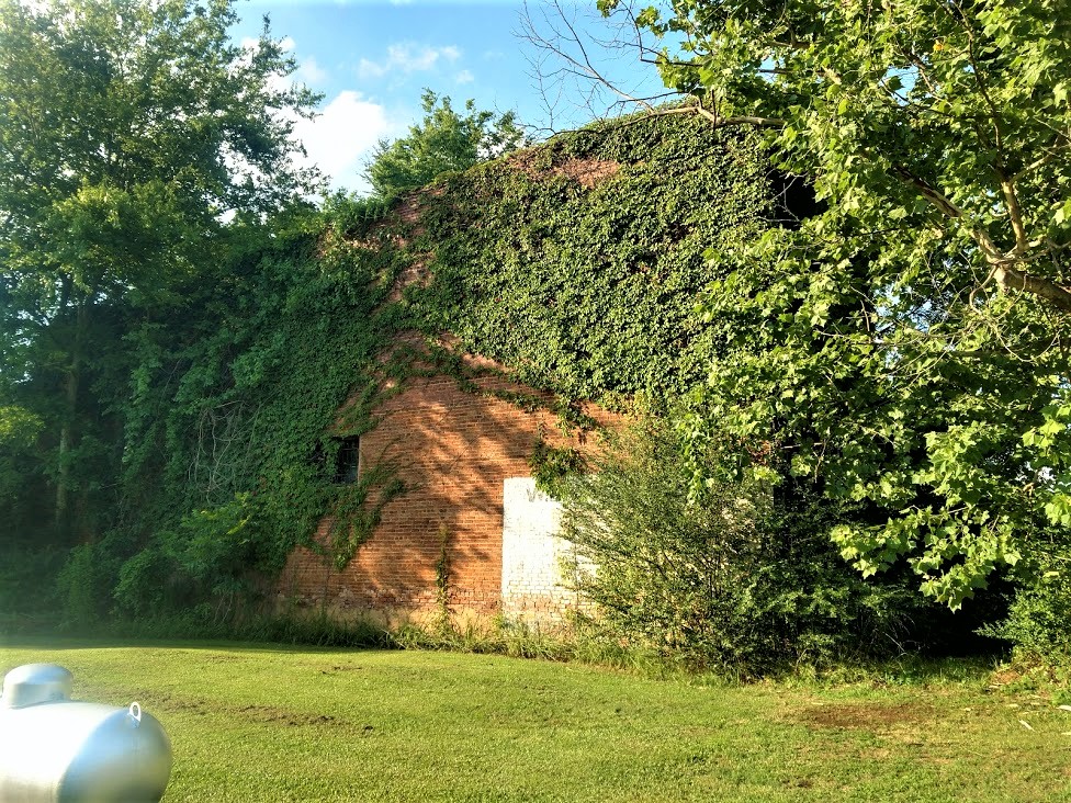
Continuing westbound on US-278 and still in Quitman County but on the way to the next, I caught a glimpse of an old abandoned church with a graveyard out the corner of my eye just calling out to me causing me to make a u-turn and explore further. After I parked I checked my phone and there just happened to be a geocache hidden there also! (GC3NGGM) But as luck would have it, there were some DNF's and I didn't have any success in finding it either. But I did walk away happy still because I love finding these old abandoned places.


After spending a couple of hours researching for this blog post, all I was able to come up with is that it was called the Pawpaw Church and Cemetery. There is also a Pawpaw Cemetery to the west in Clarksdale. These were predominately black cemeteries and reading many old newspaper articles, they had fallen into neglect. While the church itself has long been abandoned, it appears as though the graveyard has been taken care of recently.

Sadly I regret now only taking a photo of one headstone. The findagrave website only shows a few listings for this cemetery and no photos at all. The one headstone I did photograph wasn't even listed. So I added the name, dates, and the pic. I think I'm gonna want to go back and take more pictures.


I also found out that the "pawpaw" refers to the pawpaw fruit tree in the area. Similar to an apple or pear, but it has a vanilla taste to it. Supposed to be delicious. You won't find it at your local produce stand because it doesn't stay ripe very long. Therefore it usually just grows in the wild and has to be eaten right off the tree in the fall.

Next up in Coahoma County was another of the Mississippi Blues Trail historical markers and a cache (GC2KDJ6). Rock ‘n’ roll and rhythm & blues pioneer Ike Turner began his career playing blues and boogie-woogie piano in Clarksdale. Turner was born less than a mile southwest of this site, at 304 Washington Avenue in the Riverton neighborhood, on November 5, 1931. In his pre-teen years he got a job here at the Hotel Alcazar, where he operated the elevator and did janitorial work. Turner later rose to fame as a deejay, producer, and leader of the Kings of Rhythm band and the Ike & Tina Turner Revue.

What caught my eye was the old building and the Paramount Theater sign across the street. The original sign above it carved in stone says Theatre Marion. A December 1918 newspaper stated that the "Marion Theatre is one of the largest and most handsome in the state, having only recently been completed." The theater featured vaudeville shows and traveling productions. "Glorious Betsy" was the first talking picture shown there in November 22, 1928. The Paramount Theater, as it became known by then, had closed in the mid-70's. The facade with the sign actually leads to the theater entrance in the alley to either the building on the left or out of frame to the right, which is the actual theater / auditorium and dressing rooms.


Now somebody done left the water running and there's this big river flowing by in my way going westbound. Looks like I'm gonna have to drive south to find a bridge to cross this Mighty Mississippi!

Still following US-278, I enter into Bolivar County and a tiny town called Alligator, MS. A quick roadside guardrail cache (GC4FAC3) for the county and I keep moving. Then I jump over to the backroad of MS Hwy-1 which runs parallel and closer to the river. I spot another old church north of Rosedale and it also has a geocache hidden nearby. The old country church (GC32W1N) is called Saint Paul's Church Complete. And that is about all the information I can find on it!


Down and to the east of Rosedale I go to check out this old cemetery and find another cache (GC34HYD). At New Hope Cemetery there are just over 100 interments dating as far back as 4-year old Willie Johnson in 1903.

From there I continued south on MS-1 for quick roadside park and grab caches in Washington County (GC2VYC1), Issaquena County (GC2TT6V), and Sharkey County (GC3936F) for the last in Mississippi. By now the sun has set but I continue on down to a hotel in Vicksburg for the night. That was it for this Day 3 Thursday.

I'm gonna go ahead and include Day 4 Friday here as the last paragraph. I drove nearly 500 miles in 9 hours through Louisiana all the way to Killeen, Texas. Aside for gas and food, I only made 2 geocaching stops. The first was at the Clear Creek Chapel and Cemetery for Red River Parrish (GC1Z8N1). The other was at the Prude Cemetery for De Soto County (GC2JFKA).

Thank you for joining me. I really do appreciate the company on these long roadtrips. Please feel free to share these stories with your family and friends. You can follow and share me through these links to the various social media platforms:  Facebook,  MeWe,  Parler,  Gab,  Twitter,  Instagram,  MAGAbook,  and  Reddit. Follow us through any or all of these platforms and whichever you choose, please leave your comments. We'd love to hear from you and it encourages us to continue sharing our adventures.

Saturday, April 24, 2021

2019-06-19: Roadtrip Back to Texas Day 2 in SC, GA, and AL Finding History, Old Cars, Trains, Ghost Town and a Tragic Story

WOW, Busy day today! I woke up bright and early this morning ready to go on Day 2 of this Geocaching roadtrip from North Carolina back to Texas. I didn't get off work yesterday until just after noon, so it was a late start getting going. I only made it down into South Carolina. It's Wednesday morning and there are lots of counties and caches on the agenda. I gotta start the new project in Texas on Monday morning. So hop on in the passenger seat and let's hit the road!


After checking out of the hotel in Spartanburg, I drove down I-85 to Greer and my first geocache for Spartanburg County. "Easy Wood's"  is a virtual geocache (GCG9YP) for Woods Chapel Methodist Church and Graveyard across the highway from the BMW plant. Fun fact for the next time you're on Jeopardy or something... what's the difference between a graveyard and a cemetery? A graveyard is next to a church whereas a cemetery is by itself. The Rev. Henry Wood, for whom the church is named, was a Revolutionary War soldier who lived from 1756 to 1843.

Over in Greenville County was a quick and easy little multi-cache (GC2370V) that I had not seen before. A multi-cache consists of at least a stage one or multiple stages to get clues for the final location. This stage one was a travel bug dog tag attached to a tree behind a shopping center. The travel bug code had two numerical digits which you use to substitute into a new set of coordinates which take you to the final location for the real cache. The bonus for this one was that not only do you get a cache find but also get to log a travel bug discovery.

Then a quick park and grab cache for Pickens County (GC4W54R). Also located in Pickens County is Clemson University. There I made a stop for a virtual cache called "Death Valley" (GC1989). There were several different geocaches on campus. However I only made time for just this one. Clemson's Memorial Stadium has the nickname Death Valley because it's view of the cemetery on the hill before the upper decks were constructed.


Driving on down US-123 into Oconee County, there was another quick parking lot cache find to claim that county (GC3C0ZD) and my last for South Carolina.

Crossing the Tugaloo River into Stephens County, Georgia, I stopped soon thereafter for my next geocache at a historical marker. The "Old Tugaloo Town" (GC7TCX9) historical marker reads: "North of this marker, in the center of the lake, once stood and important Indian town. The area now marked by a small island was settled around 500 A.D. and occupied by Cherokee Indians around 1450. Traders were coming to the town by 1690.

"In 1716, while Col. Maurice Moore treated with Charity Hague, Cherokee Conjuror, a group of Creek ambassadors arrived. The Creek Indians, supported by Spain and France, wished to drive the British from the Carolinas, in the Yamassee War. The Cherokees killed the Creek ambassadors and joined the British. By 1717, Col. Tehophilus Hastings operated a trading center at Tugaloo where gunsmith, John Milbourne cared for Cherokee firearms. Indian agent, Col George Chicken visited Tugaloo in 1725 and described it as "...the most ancient town in these parts.

"Tugaloo remained a principal Cherokee town until destroyed by American patriots fighting these allies of the British in 1776."

Slowly making my way westbound, the next county was Habersham County. I stopped in the town of Cornelia for my next geocache at the historic train museum (GC3QGWC). The historic Cornelia Train Depot was first built by the Southern Railway Company in the late 1880's, soon after the town was founded. The railroad depot was originally called Blaine Station for the Republican presidential candidate James Gillespie Blaine. When the first charter of the town was secured by the attorney representing the railroad, Pope Barrow, the name was changed to Cornelia in honor of his wife. The official date of incorporation was October 22, 1887.

The original terminal was damaged in 1910 in a fire, and rebuilt in 1914 to its current appearance. This large passenger and freight station was once the home to two rail lines The Blue Ridge & Atlantic Railroad (also known as the Tallulah Falls Railway) and The Georgia Air Line Railroad, now known as Norfolk Southern. This depot is the symbolic and historic heart of Cornelia and in fact the town's first boundaries were set at one half mile increments in all directions from the depot. Today this depot serves as a railroad museum filled with relics from the days when the railroad ruled, it is also a great place to sit and enjoy the passing trains roll by.


Standing outside the train depot is the 7ft tall Big Red Apple monument. The pedestal it rests on is 8ft tall. The monument was constructed in 1925 and donated by Southern Railway to celebrate the annual festival of the many apples grown in the region.


Driving south on US-441, I crossed over into Banks County and a geocache right at the historical marker at the county line (GC7ED1F). The marker reads: "This line, sometimes called “The Four Mile Purchase Line,” was the boundary between Georgia and the Cherokee Nation from 1804 to 1818. It was established when Georgia bought a four mile strip from the Indians so as to take in Wofford’s Settlement on Nancytown Creek. James Blair was agent for the government, James Vann and Katahahee for the Cherokees. It formed the boundary between Jackson Co. and the Cherokees; later Franklin Co. and the Cherokees, and is now the line between Habersham and Banks Counties."

Back up into White County, I get the "Train of Thought" geocache (GC5PBVQ) for another county at the Mt Yonah Book Exchange. There you'll also find this old railroad train narrow gauge engine.


And then a quick stop for the cache and scenic views at the Popcorn Overlook (GC1F76H) in Rabun County in the Blue Ridge Mountains.


Driving westbound on US-76, I make a quick park and grab stop for Kelly's Bridge (GC34MR8) to pick up Towns County. Followed by two more quick roadside park and grabs in Union County (GC6E5W2, GC72R98), another in Fanin County (GC7YT9F) and one more in Gilmer County (GC3R4BH).

Down in Pickens County, I stop for a virtual geocache (GC7442) at the Zell Miller Mountain Parkway monument. Dedicated in 1986 to the "strong character, integrity, and moral fiber of the people of Appalachia are exemplified in this native son of Georgia's mountains, Zell Miller has dedicated his life to aiding his fellow man. Scholar, author, businessman, teacher, champion of developmental highways, legislator, serving as Lieutenant Governor longer than anyone in Georgia history."


And then there was the "Bomb's Away" geocache in Bartow County (GC50RGA). Not sure why someone would have this setup in their front yard, but when you think you've seen it all... expect the unexpected!


Just down the road from the bomb, is "Old Car City USA, the World's Largest Old Car Junkyard" that has been here since 1931. (GC46W33) I couldn't find the cache that was hidden. And since it was closed, I couldn't go exploring the 6 miles of trails through the woods full of old cars. Not that I had time to do so anyway! But it would be fun to get back here one day to do so. But just what they had out front and peaking through the fence and windows inside was worth the stop.


Quick park and grab caches in Floyd (GC65626) and Polk Counties (GC27Z53) and I was heading for the state line and into Alabama.

My first stops in Alabama were for Cherokee County where I found two geocaches. Driving west on US-278, I took a side road and arrived in the town of Spring Garden for my first cache (GC2583K). Spring Garden was originally named Ambersonville after one of the early families that settled the community. A post office was established in 1842 as Liberty and changed to Spring Garden in 1844. The Selma, Rome, and Dalton Railroad began rail service through the town in 1870. The line later became part of the Southern Railway and was abandoned in the 1970's.

This building here was last known as the W.L. Westbrook General Merchandise Store. Constructed in 1878, it was first known as the P.H. Savage General Merchandise Store, then T.F. Stewart General Merchandise Store. William Lester Westbrook died in October of 1981 and can assume that the store closed around that time period. The second photo I found in the Library of Congress database looks to be from the late 1980's or early 1990's and the store is already abandoned. (The photo I took is from the post office side. The street view is completely covered in vines!)


(photo:  Library of Congress)

The other geocache in this county was a few miles away. The Goshen United Methodist Memorial Park (GC49R24) was established by members, relatives, and friends after a tornado destroyed the church on Palm Sunday, March 27, 1994.

On this Sunday morning, 20 children had begun the service by marching around the sanctuary waving palm branches while the congregation sang the hymn: "Tell me the stories of Jesus." The worship service began with Jesus' triumphal entry into Jerusalem, and was to end with remembering His tragic death on the cross. At approximately 11:30, a tornado with winds up to 250 mph, and moving at a speed of 55 mph descended upon the church. The edge of the half mile wide storm caused a window to break, and within four seconds the building exploded propelling the congregation into literally living the Holy Week story of joy, suffering, death, and resurrection.

Jehovah Jireh, the Lord will provide, had just been sung when the winds blew the roof and the south wall to the north, trapping, injuring, and killing many worshippers. For two hours, persons assisted in the rescue efforts freeing those trapped underneath the debris and treating the injured. By 1:00, four hundred volunteers had arrived to help. Due to the heroic work of many rescue and medical workers, as well as unexpected helpers, 126 people survived. Of the twenty killed, six were children. Those surviving gave remarkable stories of experiencing God's presence and sustaining power in the rescue efforts and through the hard days that followed.


Driving up into Dekalb County, I stopped at the Lebanon Courthouse for a virtual geocache (GCB0CE). The historic courthouse was constructed during the 1840's when Lebanon, the county seat of Dekalb County, was a thriving community with inns, taverns, and government offices. This building remained in use as a courthouse until 1876, when the stagecoaches serving Lebanon gave way to progress. The county seat was then moved to Fort Payne, where railway service was available.

By the time I got here the sun was already setting behind the building making it hard to get a decent photo.


Finally it's getting to be 9:00 pm by the time I get to Scottsboro, Alabama in Jackson County. I grab one last geocache (GC6F458) in a Walmart parking lot to claim the county. Those are about the only caches I want to find in the dark, under a street light!

Well after 15 hours of driving and caching, I'm ready for the hotel! That's it for today. Let's get some sleep and start again early tomorrow morning. I hope you come back again and ride along with me. I'm out... ZZzzzz....

Saturday, April 17, 2021

2019-06-18: Roadtrip Back to Texas Day 1 in NC and SC, Finding an Abandoned Racetrack, Farmville, a Historic Survey Marker and a 9-11 Memorial

Well it's that time again. My work on this project in North Carolina is done. Time for a roadtrip back to Texas. Only this time it's in North Central Texas, about an hour north of Abilene. So that means I'll be hitting the backroads westbound again looking for geocaches in new counties, finding historical places and stopping for roadside attractions. The passenger seat in the GeoJeep is open. Hop on in and let's go for a ride...


I get out of work a little early today, run by the house to pack everything into the GeoJeep, and head west on US-264. Driving around Greenville to the other side a few miles, I see this huge water tower for the town of Farmville, NC. I stopped to take a photo and send it to my wife. She used to play Farmville a lot. I told her that the town really does exist but it's in shambles! She needs to get playing the game again, plant and harvest the crops, feed the animals, and get this place back growing again. She got a good chuckle out of it!


Arriving at my first new county down in South Carolina in a town called Cheraw. The cache was a quick parking lot LPC find for Chesterfield County (GC6807X). This wasn't my first choice to find, but a plan B find for the county credit.

My original geocache, and one of the reasons I like geocaching, brought me to this long abandoned racetrack just down the road by the airport. Like several others before me, I could not find the geocache. (it has since been archived) But I did get to find this piece of NASCAR history. Built by NASCAR legend Jimmy Ingram, the race track was in operation from 1955 through 1968. It started out as a quarter-mile dirt track. Sometime in the 1960's, it was paved and expanded to 3/8 of a mile. Now the only passing and overtaking happening is by time and nature. I did get a quick shot with the GeoJeep at the top of the page.


Next up was a virtual geocache called "Run For The Border" (GCE55). As a surveyor myself, I like finding these old survey stone markers. This one was placed in 1813 to mark the line between North and South Carolina. Originally surveyed in 1764, this stone was placed because of the uncertainty of the location of the Salisbury Road which had served as the north-south boundary from the western terminus of the state line. It was resurveyed again in 1934, found to be accurate, and the round Geodetic Survey Disc was attached to the stone. Not too far away is a traditional geocache called "North Corner" (GC333HN) and I make a stop and found that one also.


The next county on my list was Chester County, South Carolina. There I made two quick park and grab cache finds (GC5MD92, GC5VGFZ). On the way to my next county and geocache, I passed through this small town called Lockhart. I grew up in a small town called Lockhart in Florida. Back in Texas, I also encountered another Lockhart which they're famous for their BBQ. So I found a place that would make a good selfie by the town square and Liberty Bell replica.


My next cache over in Union County was at this highway 9-11 memorial made of painted rocks (GC1410J). A quick find for the county and a nice GeoJeep photo opp too!


A short adventure for today, but had to work until 3:00. Now it's almost 10PM and I find a hotel for the night in Spartanburg, SC. Tomorrow I can get started out bright and early. There's more counties to pick up, more geocaches to be found, and lots of history and cool sites to see. I hope you'll be back too. The passenger seat is always open. See you soon...

Sunday, March 21, 2021

2019-06-02: Geocaching Through Love, History, and Chainsaw Art Along the Backroads of Virginia and North Carolina.

Who's up for a surprise road trip? Well one of my co-workers on this project here in North Carolina got transferred to another project up in Virginia. And he doesn't have a car to drive there himself. So I offered to drive him up there myself. That's also another roadtrip opportunity to go Geocaching in a new area, to see new things, and maybe get some new caching county or two out of it. So off we go...

His new project was just outside the town of Blackstone, Virginia. Doing some research online, we found a place for him to rent while he's there. So a quick stop at Hardee's in Washington, NC for breakfast and we hit the road. We drove straight up into Virginia and arrived at the rental house, but the person renting out the room wasn't home at this time. Instead of just waiting there for an unknown amount of time, I drove him up to Enterprise over in Colonial Heights so he could rent a car until arranging a ride with another co-worker.

Now that his transportation is set and he's heading back to Blackstone, I'm going south back to North Carolina. But not before finding a geocache (GC6J8B2) right there in the parking lot next door. Now one thing a little different with Virginia is that they have 95 counties to find caches in. But then there's also 38 independent cities separated from the county borders for a total of 133 regions to complete on the "county" map. This cache gave me credit for the city of Colonial Heights.

Then I drove over to the "Welcome to Hopewell" cache (GC3X2VT) to get credit for the City of Hopewell region. There along with the normal "Welcome to" sign, they have a huge "LOVE" sign.


A quick roadside stop in the City of Petersburg (GC2JQCN), and another in Nottoway County (GC27HQ8). Then over in Prince Edward County at the Gallion Game Sanctuary, I picked up a couple of caches down some Jeep trails (GC4MNAM, GC4MN9X). In Charlotte County I realized I skipped right over lunch when my stomach started growling. I hit the drive through at a Burger King then parked next door in the parking lot of the Food Lion right next to the LPC cache (GC5XD7R). The last geocache today in Virginia was for Mecklenburg County (GC2W7HB).

On the way out of Virginia, I passed this place called Chainsaw Art. Seeing some of the work on display I knew I just had to pull over at this roadside attraction and get a close-up look. If this is the stuff left outside on a Sunday afternoon when nobody's around, the artwork on the inside must be amazing. I don't usually include this many photos for one place. However I thought this place deserved it.


Stopping for gas in the tiny town of Wise, North Carolina, I spot this old abandoned red brick two-story building. I asked this guy sitting on a chair outside the Pay Jay's Corner Store if he knew anything about it. He just said it was the old school building. Now doing further research, I find that this old abandoned school building was built in 1904 and was placed on the National Register of Historic Places in 2006. I'm not sure when it was last used. There is an effort underway to raise funds to restore this old historic school building.


My last stop of the day was a virtual geocache (GCH16M) in Littleton, NC. Here you'll find a replica of the home of Nathanial Macon and the gravesite of he and his wife. The original house burned down in 1977. From the headstone: "Nathanial Macon, born December 17, 1758, was a soldier of the American Revolution, a state senator in 1782 and 1784, a Representative in Congress 1791-1815, Speaker of the House 1801-1807, United States Senator from 1815-1828, President of the Constitutional Convention of 1835, the strictest of our models of Republicanism." Notice they did NOT use the word democracy which is so misused today. The founders despised democracy and mob rule, forming a Constitutional Republic.


Nathanial Macon was one of the most powerful men in the nation and exercised great influence until his death June 29, 1837. Thomas Jefferson referred to Macon as "The Last of the Romans."


Nearly 500 miles later, I finally returned back to Blounts Creek, NC. It was one of those unexpected but pleasant geocaching trips, picking up some new counties and seeing history. Now time to get some rest and prepare for work tomorrow. Thanks for stopping by and look forward to having you ride along again soon.

Saturday, March 20, 2021

2019-05-27: Roadtrip Day3! The North Carolina County Challenge: Finding an Old School, Civil War History, BBQ, and Railroad Museums

So today is Day 3 and the last day of my holiday weekend roadtrip geocaching around North Carolina to try and complete my caching county map. Unfortunately though, like I said in Day 2's blog, I had to turn the corner and start heading east before I was able to get all the counties. But I still have more to get to today as I travel east along the south-central part of North Carolina. 

Let's hit the backroads and drive through North Carolina history. The passenger seat is open on the GeoJeep. Climb in and see what we can find... 


After checking out of the hotel bright and early this morning, I drove up to Burke County for my first geocache (GC6GJMA). This one was hidden by a geocacher outside her own house. Problem was that she moved away and it doesn't look like the house has been occupied in a while. Probably won't last much longer.

Moving right along into Alexander County for a quick parking lot cache at a grocery store (GC7MF94). Going east on I-40 into Davie County, I exit on US-64 to the town of Mocksville. I find the quick cache (GC467NN) near the fire station and keep going.

Entering the town of Lexington in Davidson County, I stop in the town square for a look back into history. The name Lexington was given to a crossroads settlement that consisted of a store, a tavern, and a few houses in 1775 shortly after the first skirmish of the Revolutionary War in Lexington, Massachusetts. The town was officially incorporated in 1828. The first Davidson County court house was completed in 1858, and was the only masonry building in the county at that time. The courthouse was used as barracks for Yankee soldiers in the civil war during which was damaged by fire in 1865, and rebuilt in 1867.


Lexington is also known for its BBQ (GC6C85). North Carolina has a long history regarding barbecue. The Spanish brought hogs to the Americas in the 1600's. As the pigs took over, pork became the meat of choice. Over time, the barbecue methods from around North Carolina converged into the style that’s known today as Eastern-style barbecue, a thin tangy sauce made with vinegar and red pepper flakes. Once the meat is smoky and tender, it’s chopped up and mixed with more of the vinegar sauce. Eastern-style barbecue is served by the plate or on a bun, usually accompanied by white cabbage and mayonnaise slaw. This is the original style of North Carolina bbq.

Sometime around World War I, an East-West split started to happen in the towns and cities of the Piedmont region west of Raleigh. There, pitmasters started using only the shoulder of the pig and vendors started adding ketchup or tomato paste to the traditional vinegar sauce. The style grew in popularity throughout the Piedmont region. It especially took hold in Lexington, which became the center point for Western-style barbecue. Barbecue is big in Lexington. The town of just under 20,000 hosts an annual barbecue festival that draws upwards of 175,000 attendees.


One more quick roadside geocache (GC46YJ8) in Davidson County at a historical marker for the Yadkin College which opened in 1856. It began as the Yadkin Institute, a high school for young men by the Methodist Church. It was re-chartered by North Carolina as Yadkin College in 1861.

Then followed by a quick roadside geocache (GC1V14A) in Rowan County.

Moving south into Stanly County was another historic old school building (GC15ENE), pictured at the top of this page and the next two. Pfeiffer University is a private university located in Misenheimer, North Carolina, established in 1885. The school first began its operation on the edge of Hudson, NC and was called Oberlin School, and was later endowed by Mrs. Mary P. Mitchell and was named in her honor as the Mitchell School. A fire destroyed the original school in 1907, and it was then moved to Lenoir. The new location proved to be inadequate and was relocated in 1910, to Misenheimer.


The Mitchell School began awarding high school diplomas in 1913, and began offering junior college classes in 1928. In 1934, the Pfeiffer family of New York City, gave several generous financial gifts to the school. The school changed its name to Pfeiffer Junior College, after it was accredited the same year. In the 1950's, the school began offering senior level college courses, and was then accredited as a four-year college in 1960. In 1996, the college received university status, as Pfeiffer University.


On the way to my next set of geocaches I passed through Albemarle, NC. One of those always interesting roadside attractions was spotted outside Jerry's Automotive. A shortened VW Bus with the monster head and arm sticking out that reminded me of the old Ed Roth or Rat Fink CARtoon drawings. I had to stop for a photo.


My next two geocaches were also quick roadside stops, one in Montgomery County (GC1M50J) and the other in Union County (GC82RBK).

Driving down to my next geocache, I passed by this old abandoned house. It looked like it was once a nice home. I wonder who once lived here and why they abandoned such a nice house. It's a shame it's just falling apart.


The next geocache (GC4JA4H) and county comes with a ghost story. The Ghosts of Indian Rock In Anson County, about 3 miles northeast of Wadesboro there's a small bridge crossing a creek. Most people drive across the bridge without a thought of what lurks nearby, but the locals know. They know it as Indian Rock. Near the creek known as Gould's Fork Creek there is a cave that was carved by Catawba Indians long before the white man settled in Anson County. But it's what happens here that has the locals spooked. That's all I'll share with you. You can read "the rest of the story..." over on the geocache page.

Moving over into Richmond County, I had two virtual geocaches on my to-do list. "Justice Rolls Down" (GCG67R) was the virtual located in the town of Rockingham. Outside the county courthouse were three historical markers and a monument. The historical markers were for a Brigadier General, a Governor, and a U.S. Congressman. The monument honors the county's veterans who served.


The next virtual geocache (GCG67V) was located in the town of Hamlet, NC. The first building constructed on Main Street by E. A. Lackey in 1901. It once was Carsons Drugs, Hamlet Pharmacy, and then Birmingham Drug which remained in business for over 50 years until 2019. During WWII, soldiers stayed in the rooms upstairs while waiting to board their trains. In 1990 the movie Billy Bathgate was filmed here and this was used as the hotel and restaurant in the movie.


Across the street from the historic train depot was the Tornado Building. I thought it had something to do with the weather. After some research for this blog, I discovered it to be a railroad museum.

The Tornado was the first steam engine locomotive in North Carolina. Originally built in 1839 by D.J. Burr & Co. of Richmond, Virginia, the Tornado was classified as a 4-2-0 steam engine locomotive. The numbers stood for four leading wheels, two driving wheels and no trailing wheels and a total length of 50 feet including tender and box car. It was one of four locomotives delivered to the Raleigh & Gaston Railroad, the others being the Tempest, Volcano and Whirlwind.

Weighing in at six and a half tons, the Tornado was on the light side by most locomotive standards; however she pulled thirty loaded cars and routinely hauled up to 160 tons of freight on 50-mile runs between the towns of Henderson and Gaston, North Carolina. In 1840, the Tornado became the first steam locomotive to reach the state capital of North Carolina on the Raleigh & Gaston Railroad, where she arrived to gawking crowds of residents.

In the spring of 1865, the Union Army captured the Tornado when they took the North Carolina Railroad between Goldsborough and Raleigh. After much use and a gradual phase out of this model in favor of the newer 4-4-0 models, this Tornado replica was originally rebuilt in 1892 for the Raleigh Centennial Exposition. It was featured in the Great Centennial Celebration parade in October of that same year. It arrived in the Town of Hamlet in 1950 and was again fully-restored with North Carolina DOT funds between the years of 2007-2009.

The building in which it is now housed was specially-created to accommodate the Tornado. The structure also houses a 1927 Model-T, a 1930 Model-A Ford and a 1949 fire engine. Now I wish I would have checked to see if it was open so I could go inside.


In the late 1800's, John Shortridge established a woolen and saw mill along Marks Creek in the sand hills of North Carolina. In 1879, a railroad running from Wilmington passed through the area that would become Hamlet to the Pee Dee River, where it connected to a line running to Charlotte. Another railroad was being built from Raleigh through to Augusta; it was through the influence of early residents that these tracks also crossed through Hamlet. 

The Hamlet depot, the only Victorian Queen Anne style station in North Carolina, was built in 1900 for the Seaboard Air Line Railroad as both a passenger station and division headquarters. This two-story station was originally constructed at the crossing of the Raleigh and Augusta Air Line and Central Carolina Railways. Hamlet grew with the railroad, as it provided hospitality for travelers passing from New York to Florida. By 1936, Hamlet was dubbed the “Hub of the Seaboard,” with five Seaboard Air Line Railroad lines leading out from the city and about 30 passenger train departures each day. Freight trains still come to Hamlet for maintenance at the CSX Transportation Maintenance Shops.


Running out of time, I start making my way back as quickly as possible. In Moore County I find a quick roadside geocache along US-1 (GC1WYKK), one in Scotland County (GC1W6AA), another in Hoke County (GC3WBFA), Lee County (GC2QJFE), and finally Chatham County (GC7TCRR).

That is all the time I had for this weekend. Unfortunately, I couldn't make it as far west as I wanted too and had to leave those counties for another roadtrip. The other two counties in the middle, well I'm not exactly sure how I missed those. Still a good trip since just a few weeks ago when I first arrived in North Carolina I think I only had about 24-25 counties completed. And I still have some time left here. Maybe I can get those on the way back to Texas.